|
|
Post by Karl Welteke on Jul 12, 2012 20:24:30 GMT 8
Main Line of Resistance (MLR) at Korokan, Bataan, 2012-07-09 On the 9th July 2012 I checked out the area between Trail #2 and the Mt. Samat Shrine Road. In the process I discovered two new communities. Sitio (village) Korokan is now located at a place which certainly was an anchor in the MLR in 1942. This time I uploaded 67 images, including about 6 maps, into my Photobucket account with long descriptions. I came across some unique masonry structures on the Mt. Samat slopes, at about the 165 meter level, N by NE slopes. They been there a long time but I don’t know whether they are WWII related or not. Here is the album. s74.photobucket.com/albums/i265/PI-Sailor/Manila%20Bay%20Forts-Other/Bataan%20Defense/MLR%20Bataan%201942/MLR%20at%20Korokan%20Bataan/But I also uploaded the pictures in my Multiply account. Here are all168 pictures; they have only short titles but can be downloaded with a higher resolution: pisailor.multiply.com/photos/album/119/Main-Line-of-Resistance-MLR-at-Korokan-Bataan-2012-07-09Here are some sample images: This map is from the –Fall of the Philippines- and shows the knoll where the village Korokan sits on now. One can clearly see that the MLR runs around this knoll. 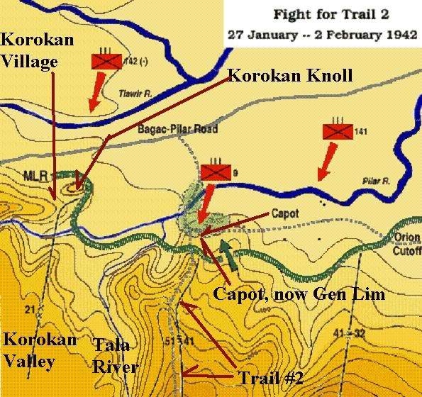 My GPS track on Google Earth, Mt Samat is marked for you reference.  The upper portion of the Sitio Hacienda Valley, I recognized it from an earlier walk. 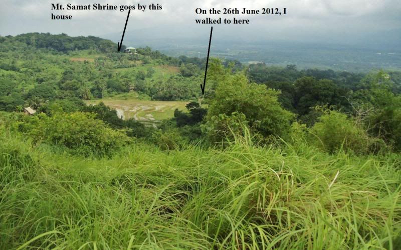 Last look down the Sitio Hacienda Valley before entering the Mt. Samat woods. 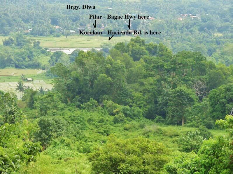 But here is something, this picture is from the 1st structure I seen. What, who when what for? 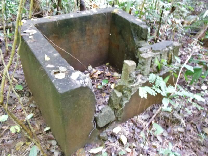 The 2nd structure 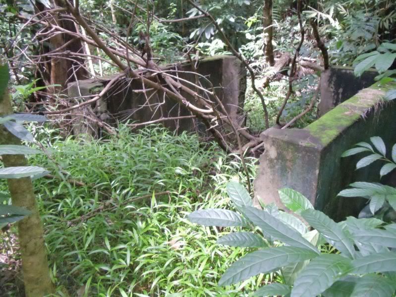 The 3rd structure, there are 4 sides but I only pictured 2 sides here in this album. 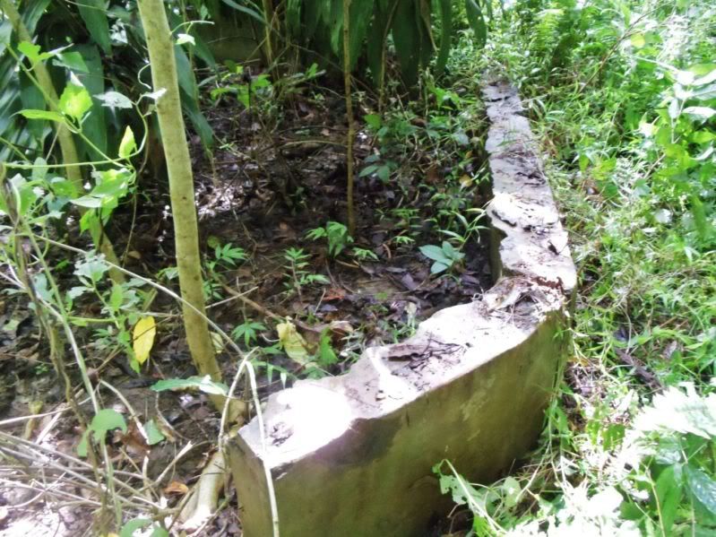 The Tala River Valley, my markings explain it all. 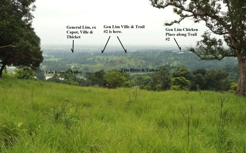 Looking east at Korokan 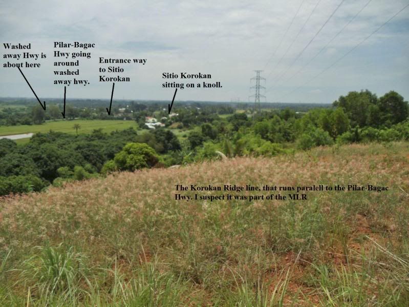 |
|
|
|
Post by okla on Jul 13, 2012 1:38:02 GMT 8
Hey Karl....The good stuff continues. A couple of comments....I still think your first impression pertaining to the "cross or partial cross" that appears on the boulder, is legit. I gotta think it appears to have possibly been "man made".. Those cement structures are, indeed, intriguing. I can't see them as being fortifications,etc, but what are they doing in what was once a MLR area??? Really interesting stuff. Keep it coming. I, and I am sure, other state siders "eat it up". Cheers.
|
|
|
|
Post by chadhill on Jul 13, 2012 6:50:09 GMT 8
Great post, Karl. Please keep 'em coming. Here's how the Final Battle marker looked in 1986:  Did you notice this one anywhere? Again, from a photo I took back in '86: 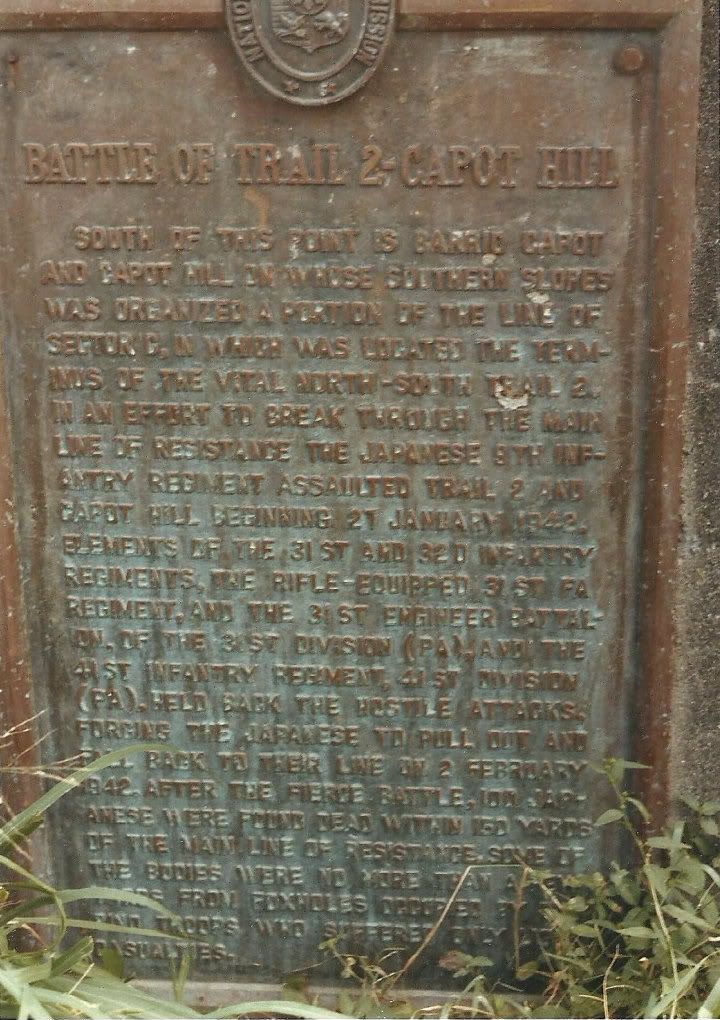 |
|
|
|
Post by sherwino on Jul 13, 2012 13:28:22 GMT 8
Great post, Karl. I grew up here in Bataan but you guys know more than I do with Bataan war history. Everytime I go in and out of, and through Bataan, I try to imagine how does every place look like during the war, and what went on in each place. I wish I have all the time to read all the stuff. But surely my imagination will run "wilder" this afternoon when I drive to Balanga.
The 1st cement structure looks like a water containment/well if only it's deeper on the inside. The 2nd looks similar to one of our old pigpens. It could have a trough and/or should have a small hole adjacent to the floor if it's a pigpen. But, like okla said, can't see it like a fortification. Seems small for an office.
If only carbon-dating technology is like a cellphone, portable and handy, then Karl would have easily identified when those structures were created.
|
|
|
|
Post by Karl Welteke on Jul 22, 2012 8:02:38 GMT 8
Final Battle, Diwa to Gen-Lim villages via Tala Rv. 2012-07-16 This album is intended only for people who like to know the geography of the Final Battle. Friends My main objective of this walk was to check the slopes, up from or behind Hacienda Village (Sitio), walk into the Tala River Valley and cross over the river and return to Gen. Lim Village, location of Trail 2. At Gen. Lim Village walk east a little on the Gen. Lim Road. Here are 71 images with long descriptions and include at least 6 maps: s74.photobucket.com/albums/i265/PI-Sailor/Manila%20Bay%20Forts-Other/Bataan%20Defense/MLR%20Bataan%201942/MLR%20Diwa%20to%20Gen-Lim%202012-07-16/ PS: If you like to look at all 156 pictures of this walk, they are here, have only short titles but can be downloaded with a higher resolution: pisailor.multiply.com/photos/album/120/Final-Battle-Diwa-to-Gen.-Lim-via-Tala-Rv.-2012-07-16Karl Here are some sample images: I like this pic, shot from the P-B Hwy. looking up into the Tala River Valley. Left is ex Capot, now Gen. Lim on Trail 2, right is Mt. Samat. 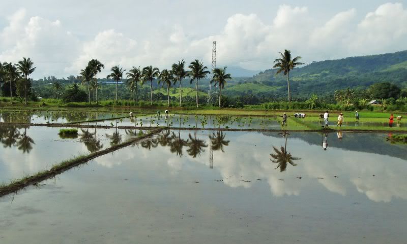 This is an important place, I call it the Korokan Ridge. The MLR runs along it or on top of it on a east west axis. 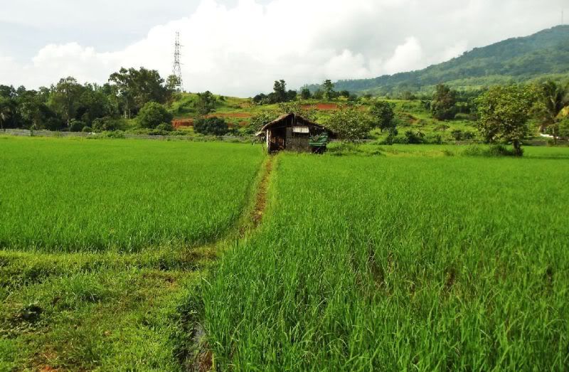 The important Korokan Ridge, which was the MLR. That was my purpose to look at from the rear. 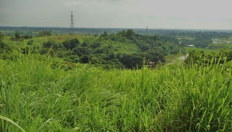 This is what I call the Korokan valley, we are looking east, left is Korokan Ridge and right it is bounded by the Duck Way, Duck Creek and Duck Place. 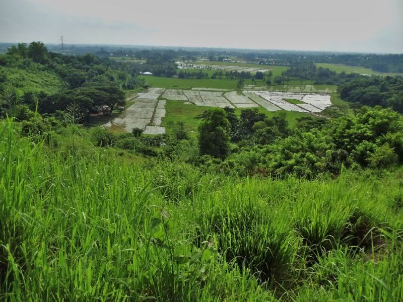 After the farmer got me on the way I seen this road split and decided to explore it first for some views. So I went up a little and got this nice view of Mt Samat. 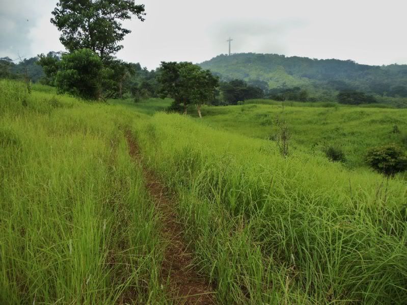 The now broken bridge across the Tala River leading from the Gen. Lim side, the east side, across the river and up the Mt. Samat slopes. 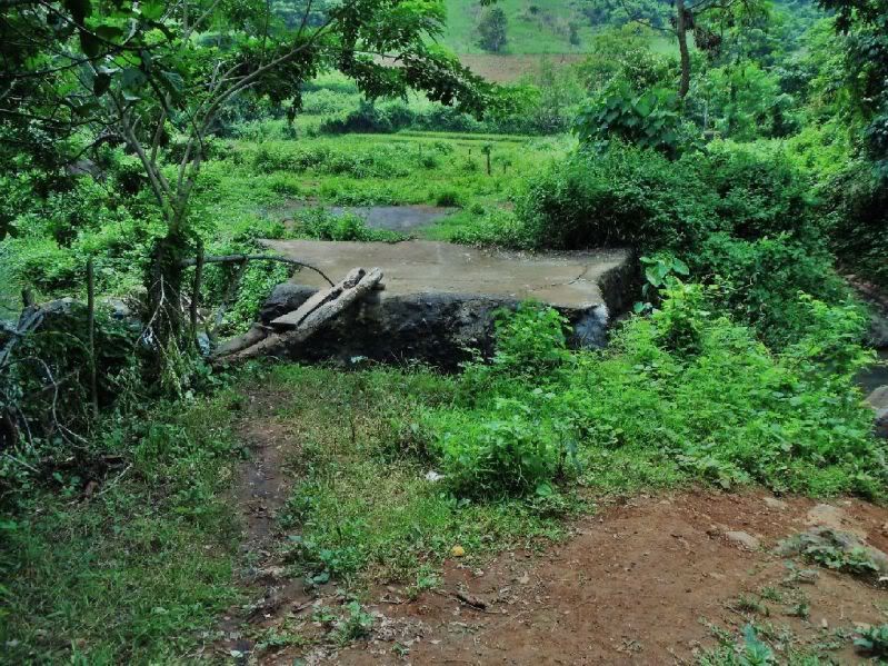 Looking across the Tala River Valley, looking up the NE slopes of Mt. Samat. 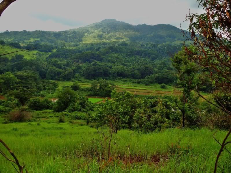 A view from the Gen. Lim road, three mountains, left to right, Mt. Limay,- Mariveles,- Samat. 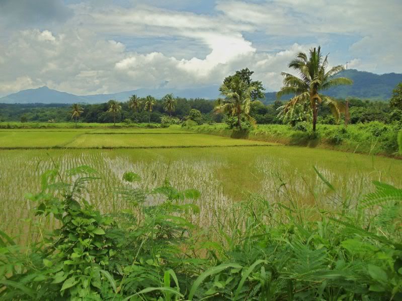 |
|
|
|
Post by okla on Jul 22, 2012 10:01:42 GMT 8
Hey Karl....Super good stuff. Tomorrow I will go over each pic a second time since the whole day is free. Thanks for posting. I gotta say....You are right down on the ground where it all happened. I can almost hear the gunfire. Bad things are about to happen for our side.
|
|
|
|
Post by Karl Welteke on Sept 29, 2012 18:04:37 GMT 8
|
|
|
|
Post by pdh54 on Sept 30, 2012 0:32:32 GMT 8
Great links Karl
Thanks!
Patty
|
|
|
|
Post by okla on Sept 30, 2012 2:28:52 GMT 8
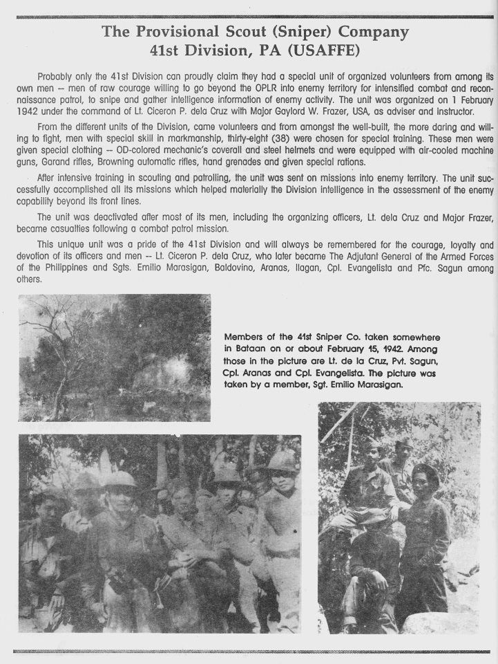
Hey Karl....In viewing the names on the plaque, Major Wade Cothran's, rang a bell. As it turns out he was at General King's side when the latter went to meet with General Homma to discuss surrender of the Bataan force. Cheers. Postscript...Those guys of the Sniper Platoon was tough looking hombres, indeed.  |
|
|
|
Post by Karl Welteke on Oct 1, 2012 13:09:33 GMT 8
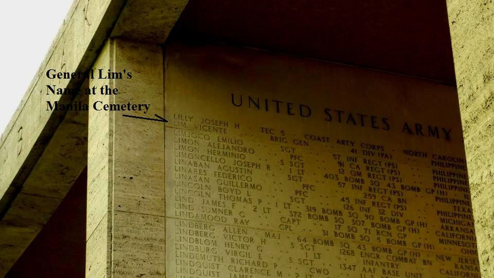
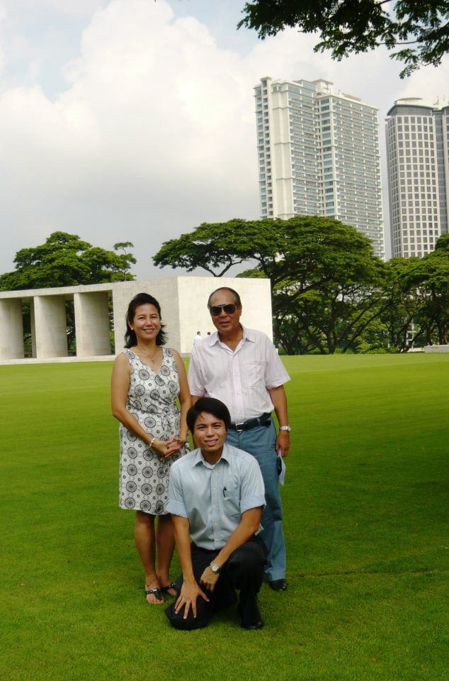
Battlefields of Bataan with Great Grandson of Gen. Vicente Lim 2012-09-16 Got to know the great grandson of Brigadier General Vicente Lim and we agreed to look at some of the areas where the 41st Div. Philippine Army under the Command of the General fought. It was a rainy day but we were not going to do much walking and headed for many landmarks that define the Abucay Defense line and the Bagac-Orion Final Battle Line. Here is my album with 30 images, the images have descriptions: s74.photobucket.com/albums/i265/PI-Sailor/Manila%20Bay%20Forts-Other/Bataan%20Defense/MLR%20Bataan%201942/With%20Vicente%20Lim%20IV%20to%20Bataan%2012-09-16/PS: If you like to look at all 43 images, they are here with only short titles but can be downloaded with a higher resolution when using the slideshow: pisailor.multiply.com/photos/album/133/Battlefields-of-Bataan-with-Grand-Grand-son-of-Gen.-Vicente-Lim-2012-09-16 Here are some sample images: We rendezvoused on the new section of elevated Bataan Highway, immediately west of the Colo River Bridge which is the area of the First Line of Defense of Bataan. From here we had the view of the Cabusilan Mountain Range that runs from here Layac, Dinalupihan to and including Mt. Pinatubo. I thought this is a nice image on a rainy day. 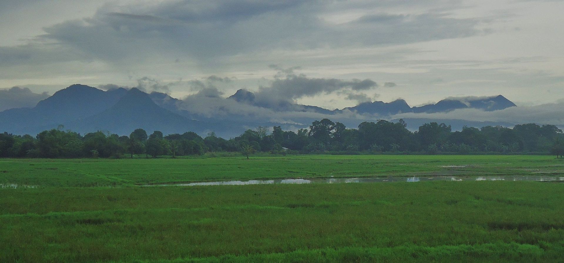 First we checked out the Abucay Line, here we are descending from the Abucay Hacienda area and had this view, from left to right are Mt. Limay, Mt. Samat and Mariveles Mt. 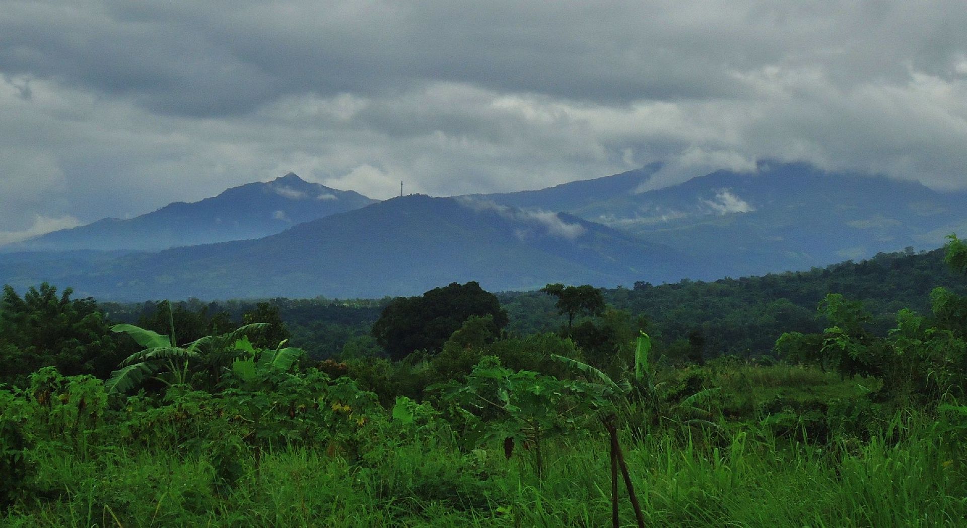 The Google Earth map of some of the landmarks of this exploration in my album. 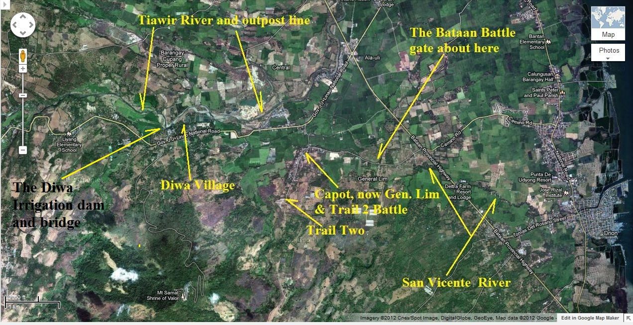 Here is t a section of the Bagac-Orion MLR that we tried to cover during our exploration. s74.photobucket.com/albums/i265/PI-Sailor/Z%20Direct%20Image%20Links/?action=view¤t=bBataan27Jan42Orion-BagacLinesingle_map.jpgWe stopped at the -Trail Two Battle- marker on the Bagac to Pilar Road. 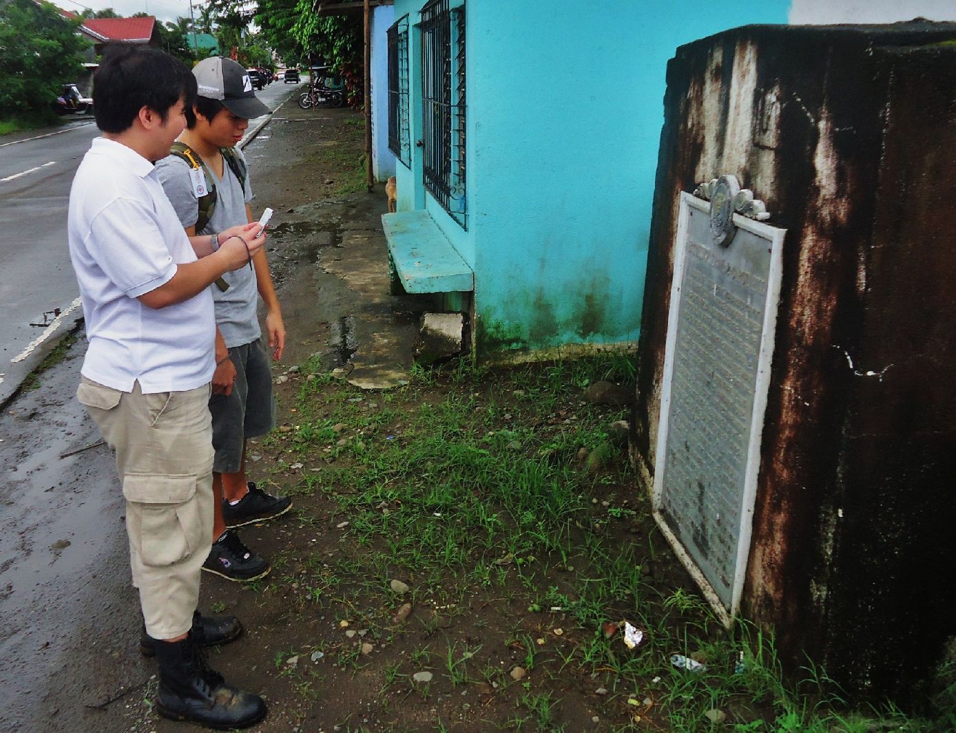 We went to the Diwa (Barangay) irrigation dam on the Tiawir River. I will use this bridge in the future to explore the north side where the Japanese attacked from. From here we got a good view that this river was the Out-Post Line- during the Bataan Defense. 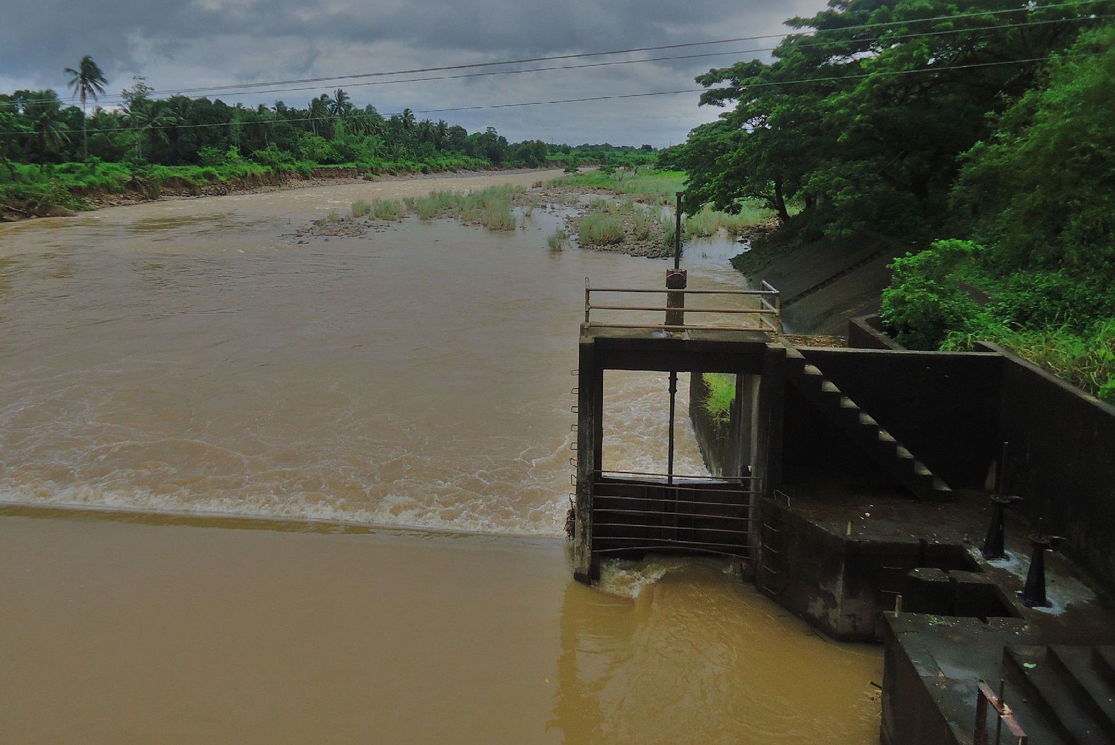 This village was called Capot on the WWII maps but in honor of the great grandfather of Vicente Lim IV who is standing there, it was renamed -Gen. Lim-Village. 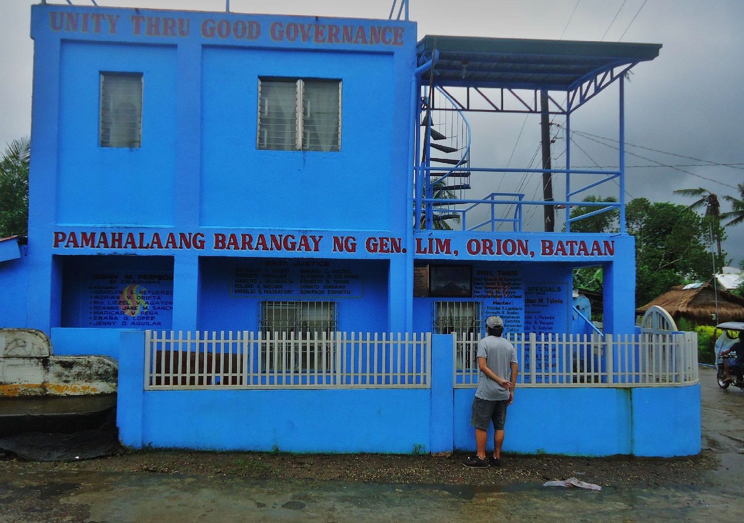 On the Gen. Lim Barangay Hall wall is a plaque mounted honoring another Philippine Hero. 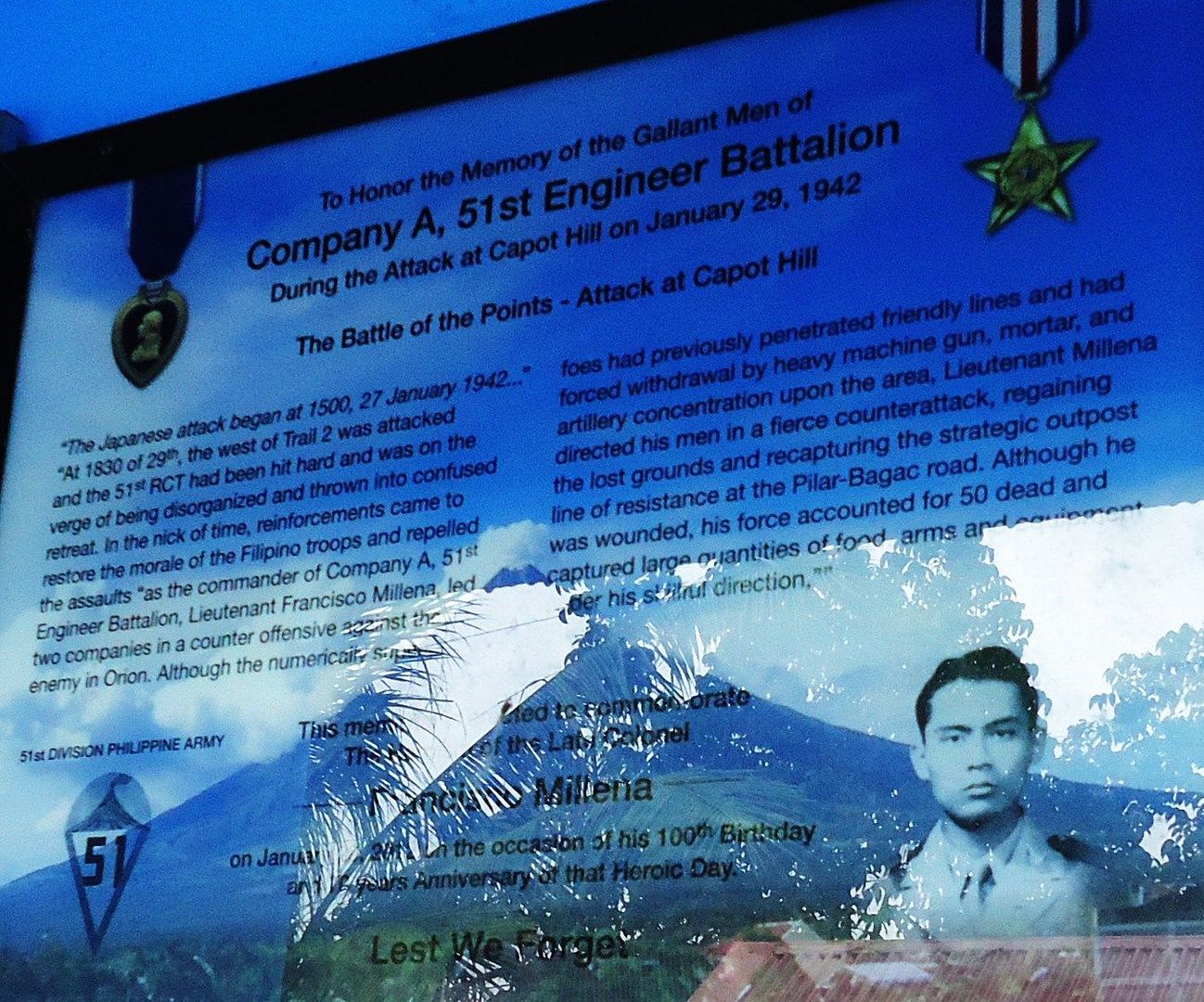 A big surprise, this gate, located east of Gen. Lim Village on the Gen. Lim Road I never had seen before. 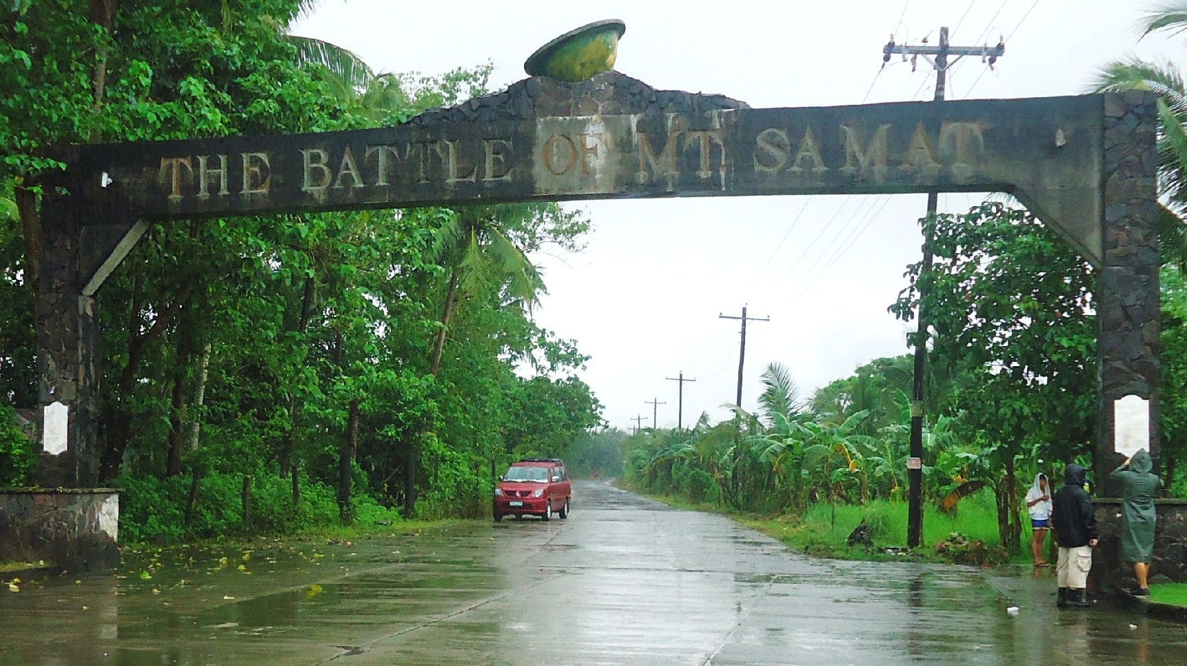 On each side of the two gate posts are plaques, 4 total. They are hard to read now but we deciphered them and they are posted in the album. This one is, looking from the east, on the left post, plaque facing east, -The Battle of Samat-. 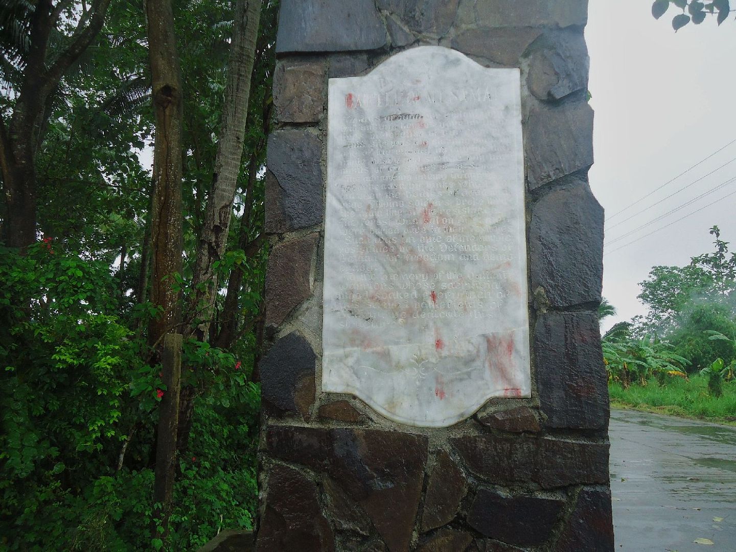 The wording on this plaque of the Battle of Mt. Samat. s74.photobucket.com/albums/i265/PI-Sailor/Z%20Direct%20Image%20Links/?action=view¤t=eBataanBattleGateGenLimRdPlaqueatleftlookingfromtheeast.jpgAt this intersection in front of the Pilar Town Hall, this -Memorial Sword Marker in honor of the Bataan Defenders-, was erected. At this point the Death March from Mariveles and from Bagac intersected. 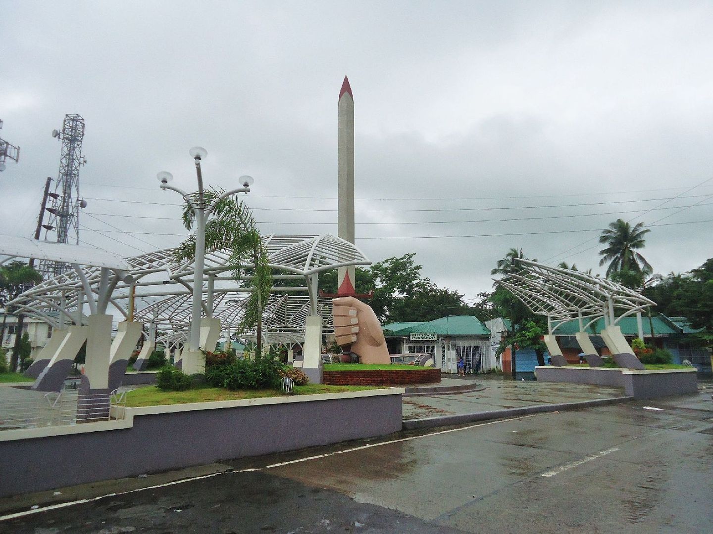 This time I was able to post 10 out 12 images, but the two are URLs only, thanks, an improvement! |
|