Post by fots2 on Dec 2, 2012 0:30:28 GMT 8
(venturing beyond Corregidor and Bataan)
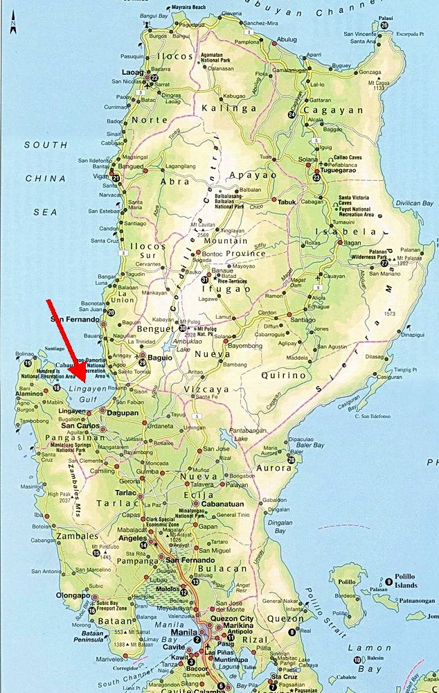
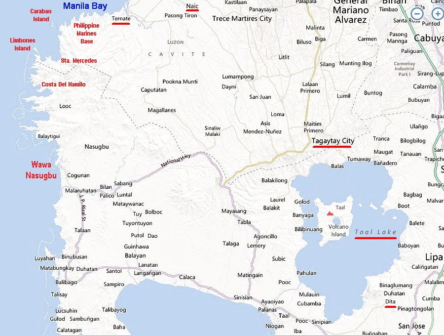
It is great to read different accounts of events and battles but I have always felt that at some point I really need to get out and stand on the ground that was fought over. Fortunately I am able to do that at times. In October and November Karl and I made two trips of three days duration each to do exactly that. The area covered was from the south western coastline of Manila Bay down to the Tagatay ridge. It was the first time for both of us to cover this territory and even the scenery was memorable. Not all WWII related locations were visited but it was a good start.
Many people are happy with seeing the views and war memorials but I guess that I am a bit more fussy. I prefer searching out remnants of war such as bunkers, trenches and tunnels. Guns and other artifacts would be great to discover but I know they are mostly long gone. When not at Fort Frank or trying to get on Limbones Island, here are some photos taken elsewhere during those two trips.
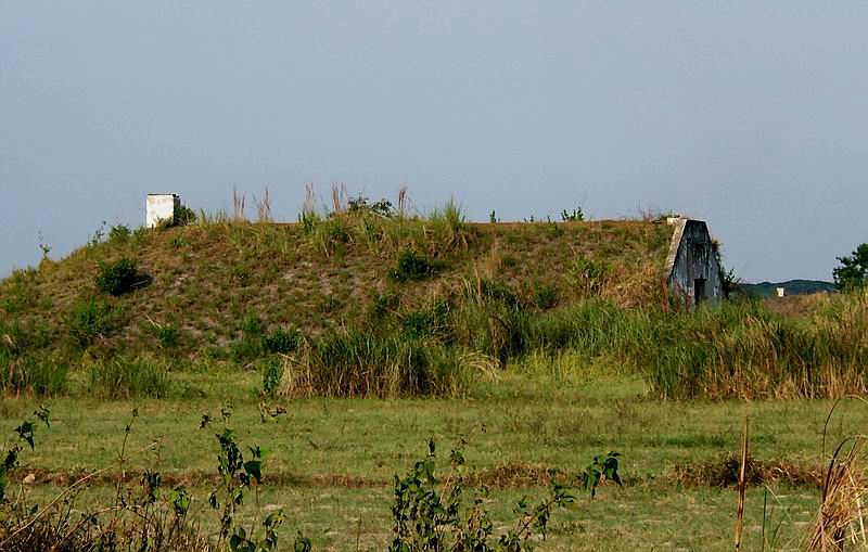
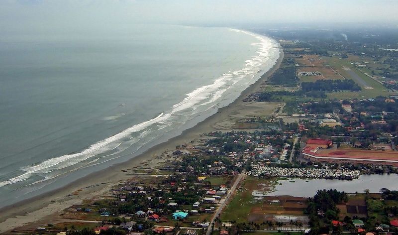
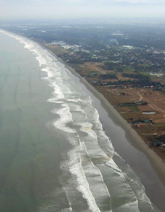
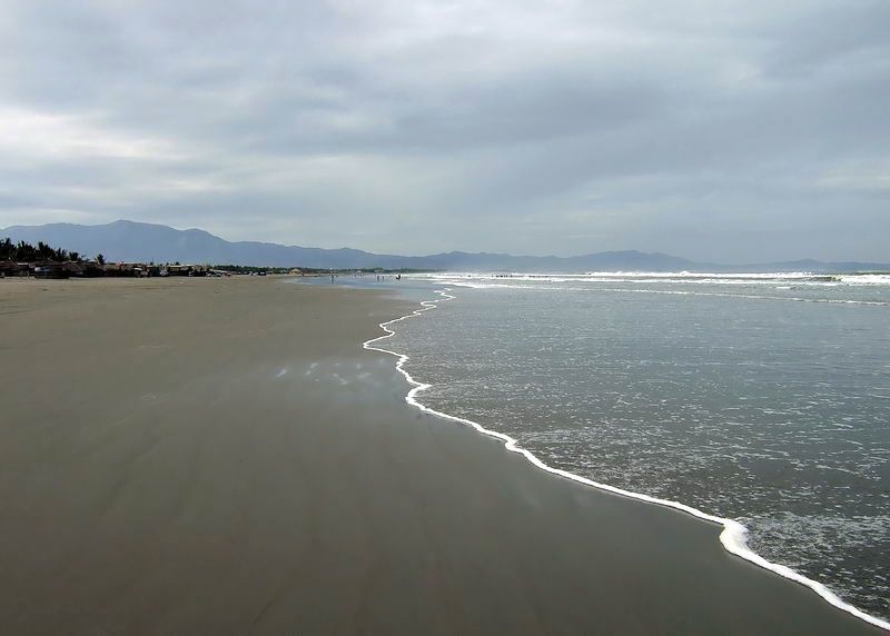
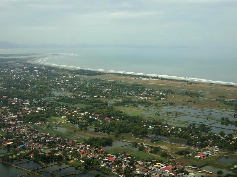
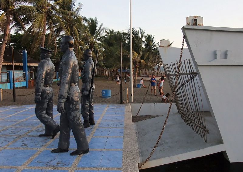
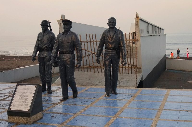
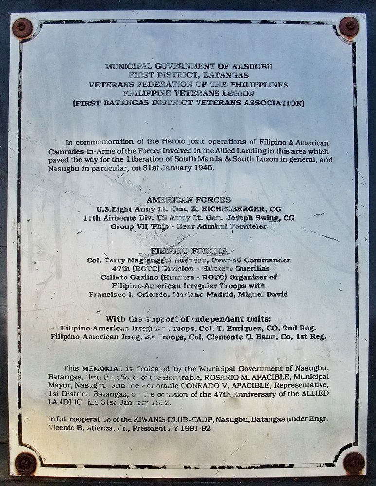
Nasugbu, Batangas was the location of an amphibious landing on January 31st, 1945. The 11th Airborne Division landed here and joined up with other units for the drive to liberate Manila. A memorial to this landing in the shape of a landing craft has been built on the beach.
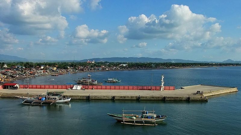
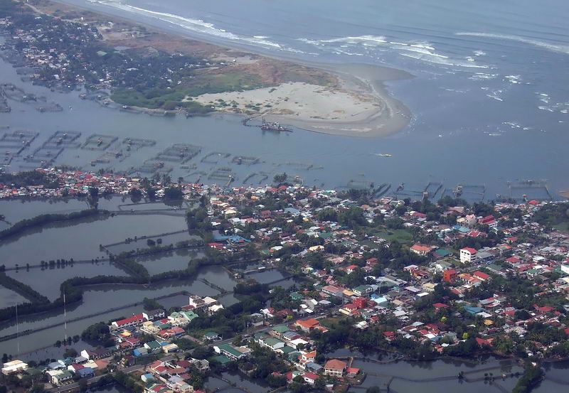
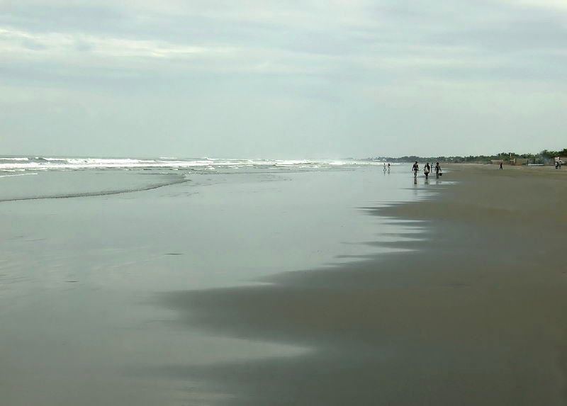
The Nasugbu landing beach (seen in the distance) is quite developed these days.
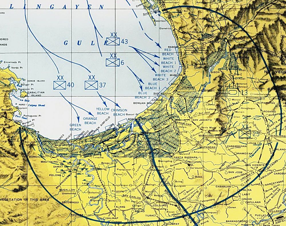
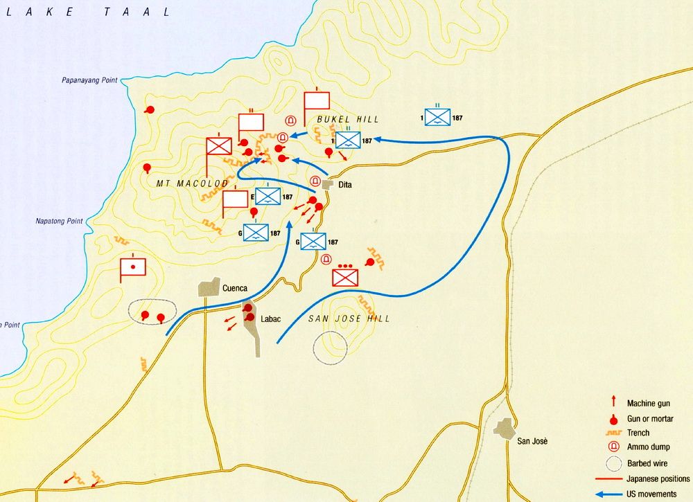
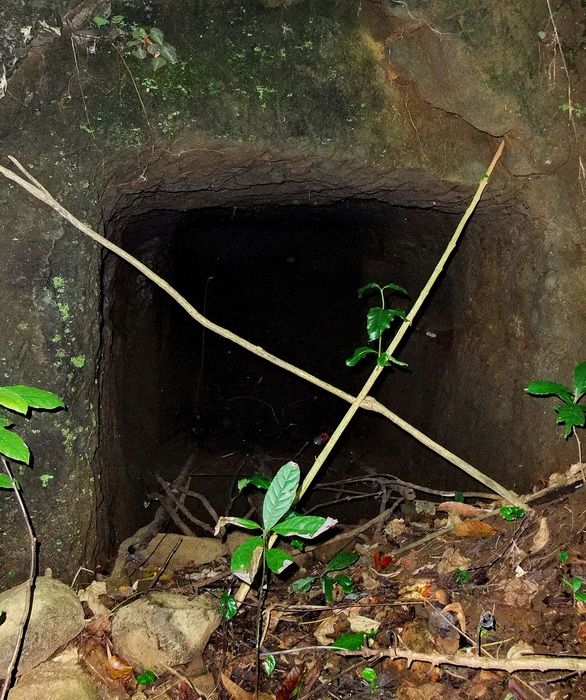
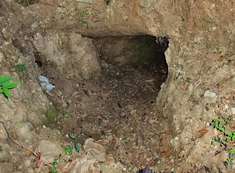
I found this 1945 map of Japanese positions in the Taal Lake area. I sent it to Karl and we added it to our list of things to see for our trip. We only scratched the surface of what may remain here but with local help, we did have good luck in visiting some tunnels. About 15 tunnels exist in the Dita area and we got into half of them that day.
(Map from the book “US Airborne Units In The Pacific Theater 1942-45”)
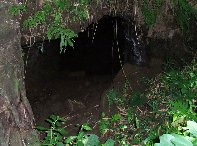
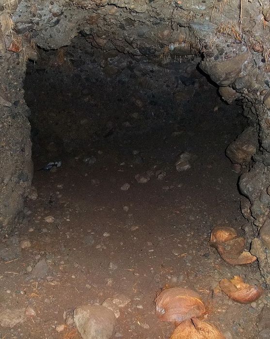
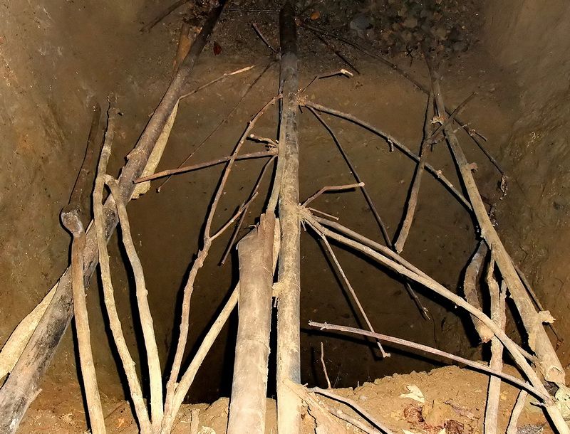
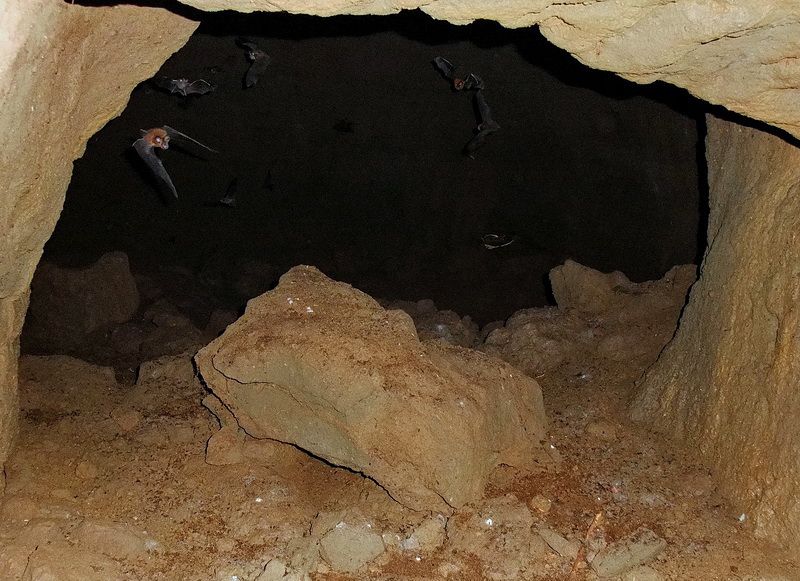
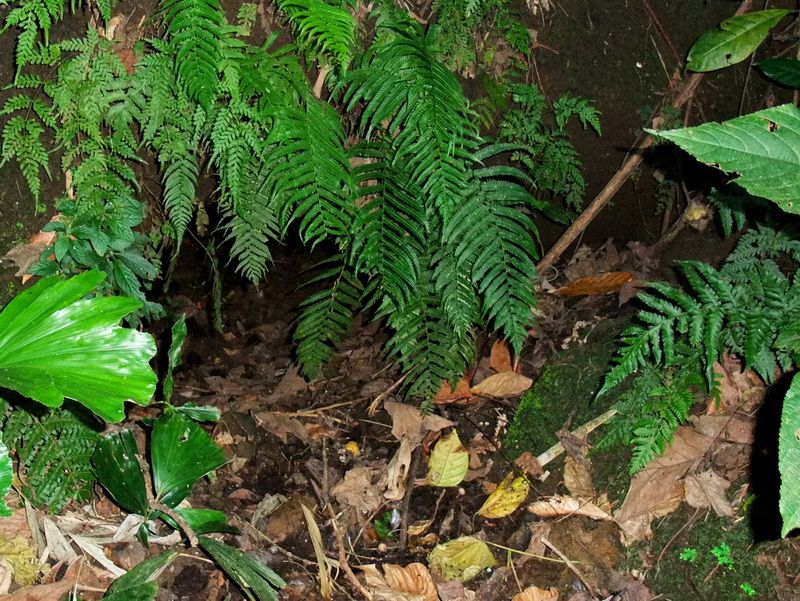
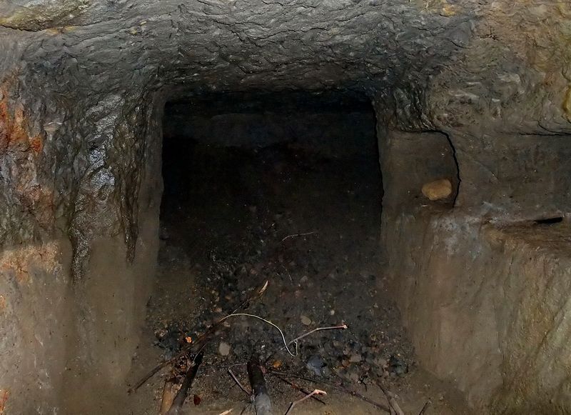
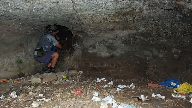
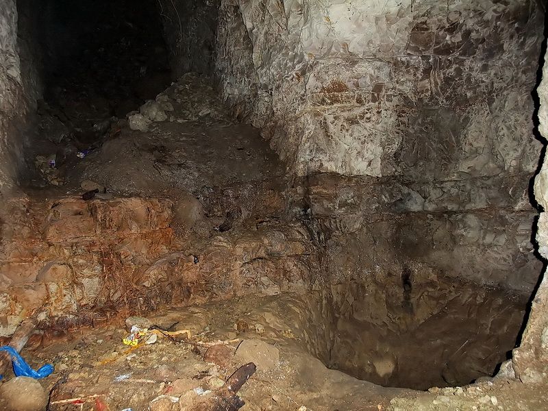
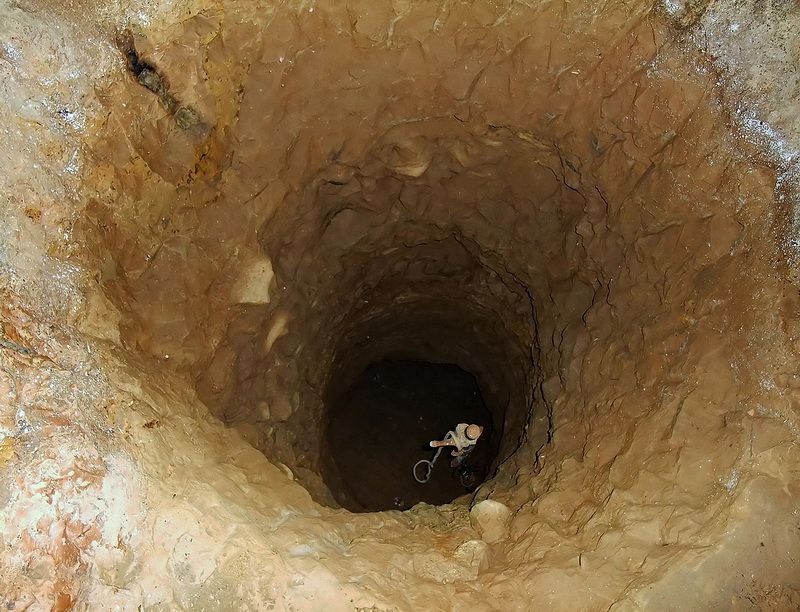
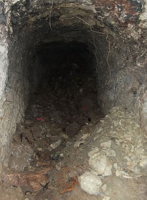
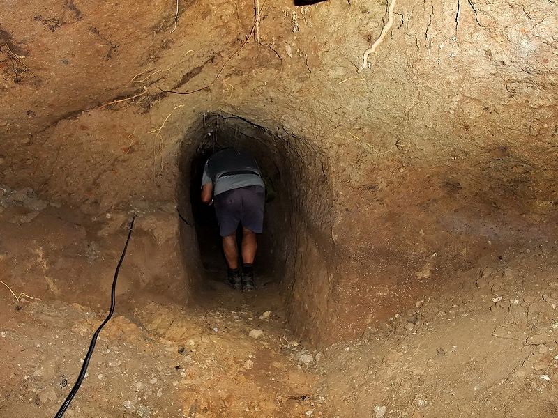
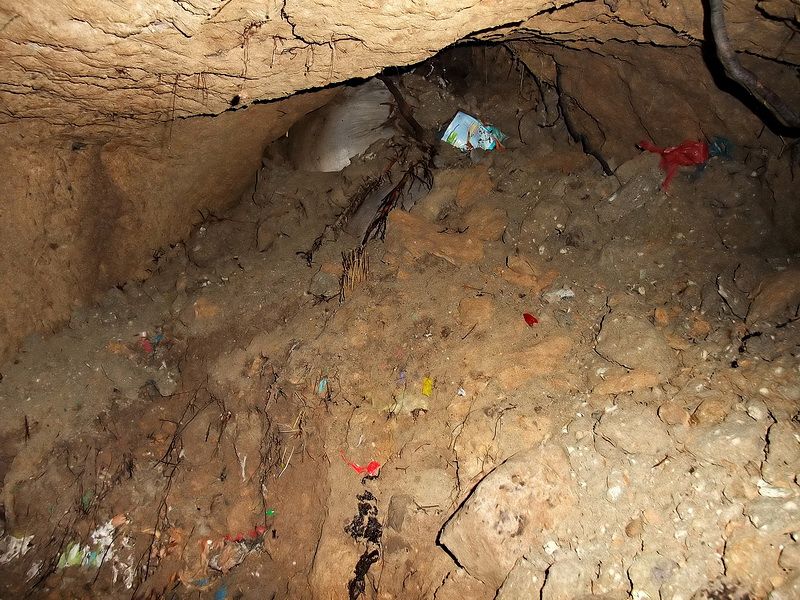
Here is a sample of photos showing Japanese tunnels in the area west of Dita.
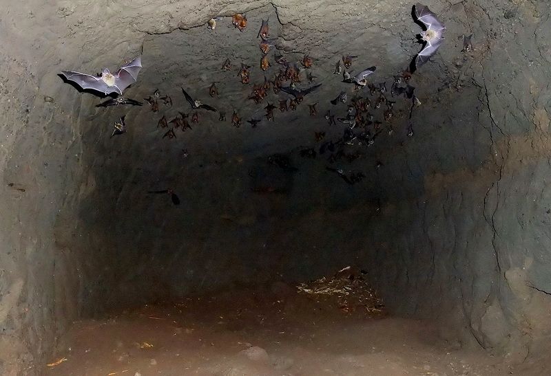
The 10% of bats that stayed inside to have their picture taken.
A local guy said that this hole was 20 metres deep. Sounds excessive but all I can say is that I would not want to fall into it.
A ‘T’ intersection is ahead.
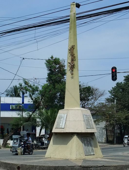
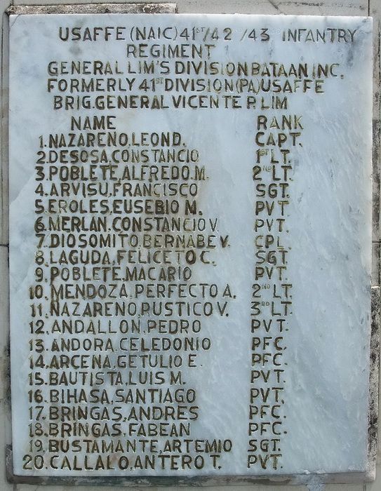
At a road intersection near Naic, Cavite is a Philippine Army memorial. Here is a view of it and one of the many plaques at this location.
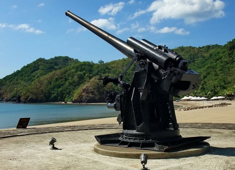
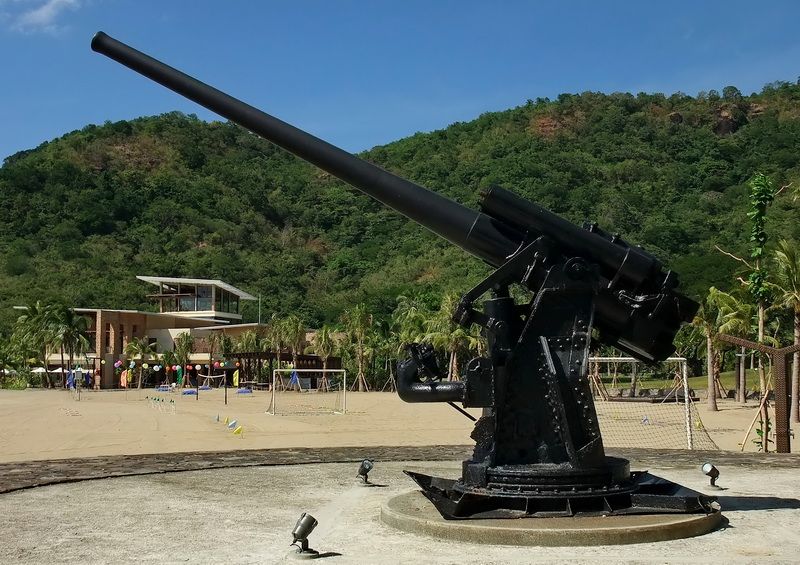
Karl had told me during the first trip that he had found a photo online of a Japanese gun located at the Costa Del Hamilo resort. Security personnel at the gate didn’t seem to have a clue about it. A marketing lady said it existed so we ended up at the Beach Club where it was said to be located. Inside we asked the two reception girls about a gun on display…Japanese gun?…WWII gun? Their “deer in the headlights” stare quickly led us to believe that talking to them was a waste of time. We thanked them for their ‘assistance’ and departed.
I was going to suggest to Karl that we just look around on our own but he was already on the move heading out the door toward the beach. At the end of the building was a grounds keeper sweeping some leaves. Karl said “let’s ask this guy”. Without hesitation the grounds keeper turned around and pointed further down the beach. There it was, sitting on a concrete pad with its long black barrel raised to the sky.
It appears to be a 120mm Dual Purpose (AA and coastal defense) gun. Some numbers and Japanese characters are stamped on the breech but the coat of paint is so thick that I cannot read anything. No one we spoke to had any idea of its history.
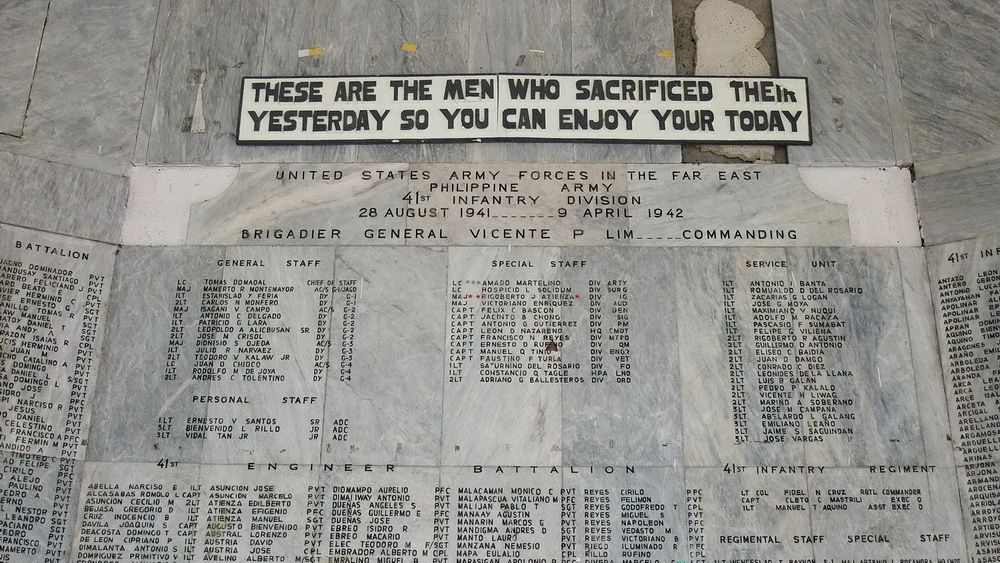
In Tagaytay is a memorial to the 41st Infantry Division, Philippine Army. This photo is just a very small portion of the plaques and murals that can be seen there.
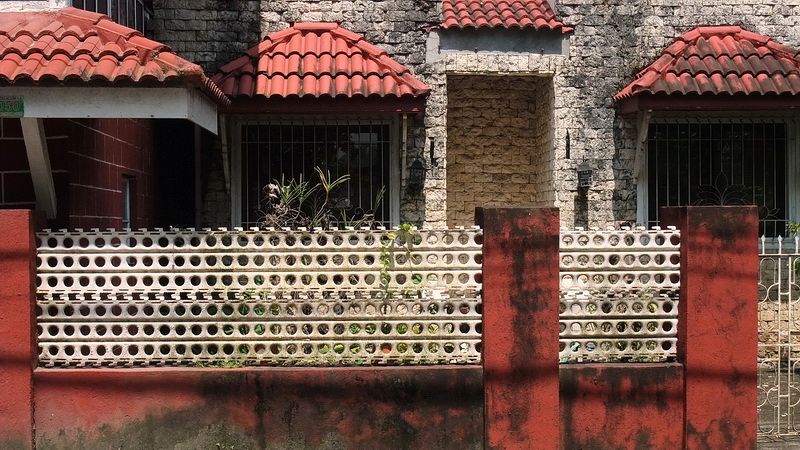
A visitor to the Philippines may notice a specific type of metal plating which is commonly used here for fencing. This interlocking metal is called ‘Marsden Matting’ which was used during preliminary construction of wartime airfields. It provided a stable surface for aircraft when operating on soft or muddy ground.
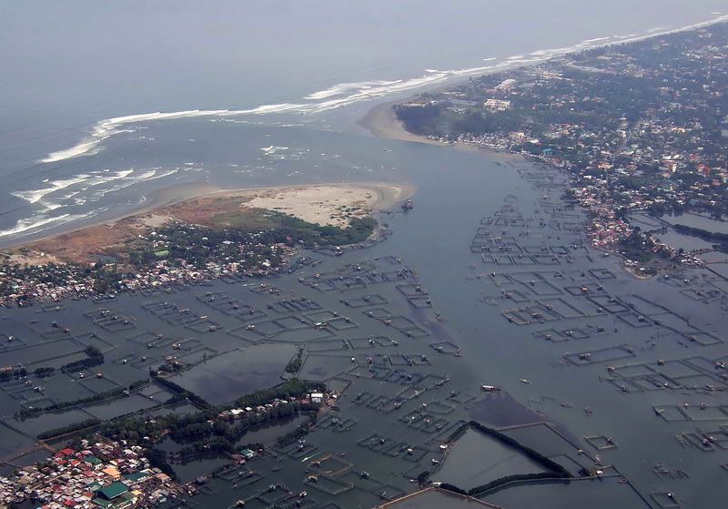
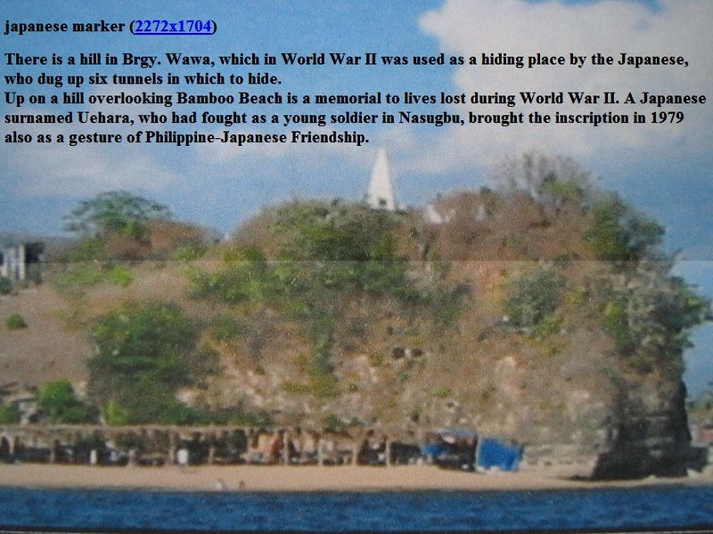
Adjacent to Nasugbu is a fishing community called Wawa. It has a small harbor with a ridge along its northern side in which the Japanese dug six tunnels. American forces had to neutralize the tunnel inhabitants in 1945 because they fired on them during the amphibious landing. Thanks to local guides, we got into some of these tunnels.
In 1979, a former Japanese soldier who fought in the area had a memorial built on top of this ridge but it is destroyed now. We also found that.
Karl found this photo of the Japanese memorial when it still existed.
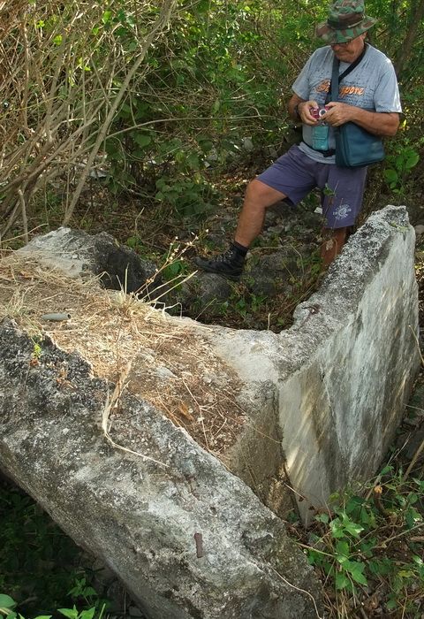
Today the memorial is lying on its side in pieces; Karl is standing near the base of it.
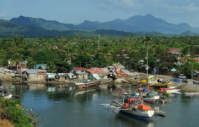
Wawa Harbour
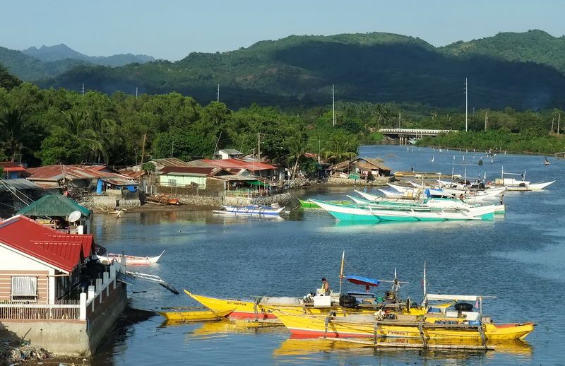
Wawa Harbour. The ridge is just out of sight to the left.
This tunnel entrance overlooking the harbor was quite wide and could easily have had a heavy machine gun placed in it. At the rear a tunnel continued into the ridge.
After climbing a short set a set of steps cut into the rock you come to a horizontal area. The tunnel continues straight ahead but note the hole to the right.
Looking down the hole. It may have been a well but I cannot say for sure.
The tunnel continues.
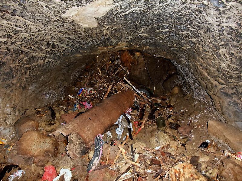
Soon the tunnel ends in a complete blockage of garbage. A local guy says the tunnel opens to the top of the ridge but people have thrown so much garbage into the hole that it is sealed now.
Here is a sample of some other Wawa tunnels. One has a large room inside where several Japanese could have hidden. A second entrance is now collapsed.
Near Ternate, Cavite is the General Gregorio Lim Marine Base. The main gate has a 3-inch naval gun and a few shells on display.
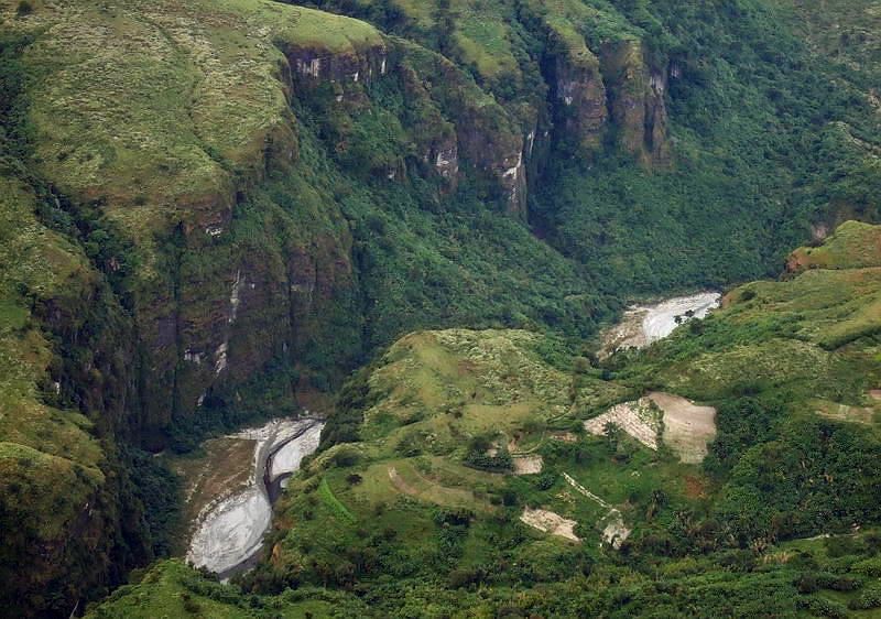
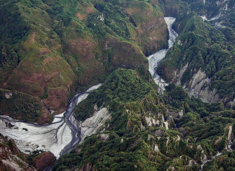
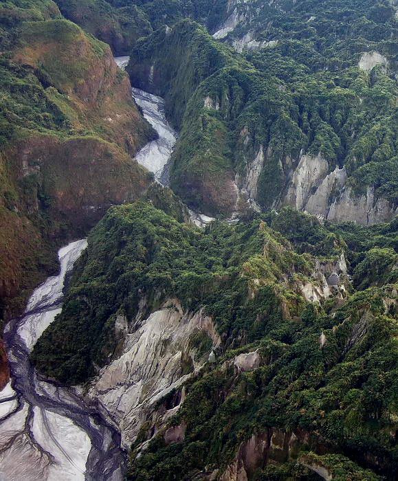
I’ll leave you with an ‘after sunset’ view of Lake Taal near Tagatay City which is a huge water filled caldera. Within this caldera are active volcanoes such as the one in the foreground. History is one thing but it is impossible to ignore the natural beauty that can be found throughout the Philippines. (This photos was not taken in the past couple months but earlier during a family outing).
If anyone wants to add their own WWII related explorations to this thread, please do.
It is great to read different accounts of events and battles but I have always felt that at some point I really need to get out and stand on the ground that was fought over. Fortunately I am able to do that at times. In October and November Karl and I made two trips of three days duration each to do exactly that. The area covered was from the south western coastline of Manila Bay down to the Tagatay ridge. It was the first time for both of us to cover this territory and even the scenery was memorable. Not all WWII related locations were visited but it was a good start.
Many people are happy with seeing the views and war memorials but I guess that I am a bit more fussy. I prefer searching out remnants of war such as bunkers, trenches and tunnels. Guns and other artifacts would be great to discover but I know they are mostly long gone. When not at Fort Frank or trying to get on Limbones Island, here are some photos taken elsewhere during those two trips.
Nasugbu, Batangas was the location of an amphibious landing on January 31st, 1945. The 11th Airborne Division landed here and joined up with other units for the drive to liberate Manila. A memorial to this landing in the shape of a landing craft has been built on the beach.
The Nasugbu landing beach (seen in the distance) is quite developed these days.
I found this 1945 map of Japanese positions in the Taal Lake area. I sent it to Karl and we added it to our list of things to see for our trip. We only scratched the surface of what may remain here but with local help, we did have good luck in visiting some tunnels. About 15 tunnels exist in the Dita area and we got into half of them that day.
(Map from the book “US Airborne Units In The Pacific Theater 1942-45”)
Here is a sample of photos showing Japanese tunnels in the area west of Dita.
The 10% of bats that stayed inside to have their picture taken.
A local guy said that this hole was 20 metres deep. Sounds excessive but all I can say is that I would not want to fall into it.
A ‘T’ intersection is ahead.
At a road intersection near Naic, Cavite is a Philippine Army memorial. Here is a view of it and one of the many plaques at this location.
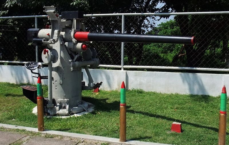
Karl had told me during the first trip that he had found a photo online of a Japanese gun located at the Costa Del Hamilo resort. Security personnel at the gate didn’t seem to have a clue about it. A marketing lady said it existed so we ended up at the Beach Club where it was said to be located. Inside we asked the two reception girls about a gun on display…Japanese gun?…WWII gun? Their “deer in the headlights” stare quickly led us to believe that talking to them was a waste of time. We thanked them for their ‘assistance’ and departed.
I was going to suggest to Karl that we just look around on our own but he was already on the move heading out the door toward the beach. At the end of the building was a grounds keeper sweeping some leaves. Karl said “let’s ask this guy”. Without hesitation the grounds keeper turned around and pointed further down the beach. There it was, sitting on a concrete pad with its long black barrel raised to the sky.
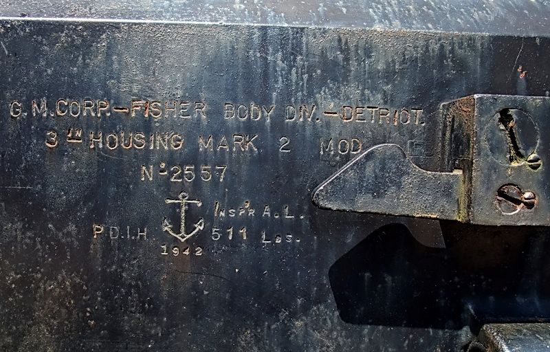
It appears to be a 120mm Dual Purpose (AA and coastal defense) gun. Some numbers and Japanese characters are stamped on the breech but the coat of paint is so thick that I cannot read anything. No one we spoke to had any idea of its history.
In Tagaytay is a memorial to the 41st Infantry Division, Philippine Army. This photo is just a very small portion of the plaques and murals that can be seen there.
A visitor to the Philippines may notice a specific type of metal plating which is commonly used here for fencing. This interlocking metal is called ‘Marsden Matting’ which was used during preliminary construction of wartime airfields. It provided a stable surface for aircraft when operating on soft or muddy ground.
Adjacent to Nasugbu is a fishing community called Wawa. It has a small harbor with a ridge along its northern side in which the Japanese dug six tunnels. American forces had to neutralize the tunnel inhabitants in 1945 because they fired on them during the amphibious landing. Thanks to local guides, we got into some of these tunnels.
In 1979, a former Japanese soldier who fought in the area had a memorial built on top of this ridge but it is destroyed now. We also found that.
Karl found this photo of the Japanese memorial when it still existed.
Today the memorial is lying on its side in pieces; Karl is standing near the base of it.
Wawa Harbour
Wawa Harbour. The ridge is just out of sight to the left.
This tunnel entrance overlooking the harbor was quite wide and could easily have had a heavy machine gun placed in it. At the rear a tunnel continued into the ridge.
After climbing a short set a set of steps cut into the rock you come to a horizontal area. The tunnel continues straight ahead but note the hole to the right.
Looking down the hole. It may have been a well but I cannot say for sure.
The tunnel continues.
Soon the tunnel ends in a complete blockage of garbage. A local guy says the tunnel opens to the top of the ridge but people have thrown so much garbage into the hole that it is sealed now.
Here is a sample of some other Wawa tunnels. One has a large room inside where several Japanese could have hidden. A second entrance is now collapsed.
Near Ternate, Cavite is the General Gregorio Lim Marine Base. The main gate has a 3-inch naval gun and a few shells on display.
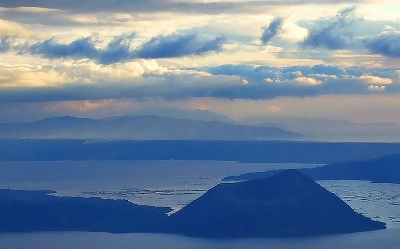
I’ll leave you with an ‘after sunset’ view of Lake Taal near Tagatay City which is a huge water filled caldera. Within this caldera are active volcanoes such as the one in the foreground. History is one thing but it is impossible to ignore the natural beauty that can be found throughout the Philippines. (This photos was not taken in the past couple months but earlier during a family outing).
If anyone wants to add their own WWII related explorations to this thread, please do.