|
|
Post by Karl Welteke on Jan 27, 2013 14:05:04 GMT 8
This is an attempt to put in one place all the Ft. Mills Defense Positions on Corregidor Island. They are numerous, some have disappeared, some are too hard to get to now but many can be visited today. Some of the defense positions are elaborate. They are designated like this sample: VI-F-2 VI = stands for sixth sector and they seem to number from east to west. F = stands for Field Artillery Gun. Then there is M = Machine Gun and S = Siege Gun. 2 = the numbered gun in this sector. As to from number 1 to the last number. VI-F-2 Defense Position at Geary Point This VI-F-2 Defense Position at Geary Point might be the biggest one. At each end it has enough room to place a 3 inch gun. It has a long trench and in the middle was a magazine with a roof that is collapsed now. It could cover the shore line in both directions. Here is the URL for the album I established for this defense position: s74.photobucket.com/albums/i265/PI-Sailor/Corregidor%20by%20subject/Defense%20Positions%20Ft-Mills/VI-F-2%20Def-Pos%20at%20Geary%20Point/Here are some sample images: 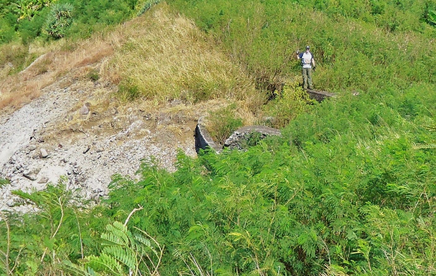 VI-F-2, DEF-Pos., Jan.17-2013, John is standing at the south end or at #2 gun position. I shot this picture from atop Search Light #7. 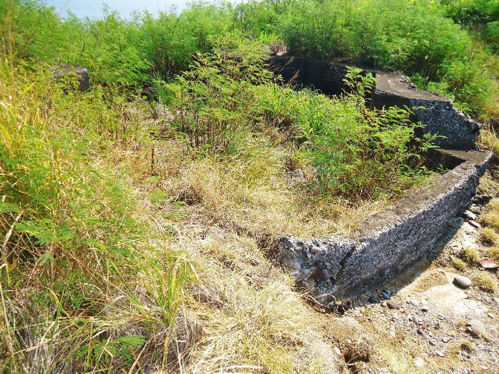 VI-F-2, DEF-Pos., Jan.17-2013, the south end or at #2 gun position. I shot this picture from near the cliff  VI-F-2, DEF-Pos., Jan.17-2013, Geary Point location on the CDSG 1936 Corregidor map. 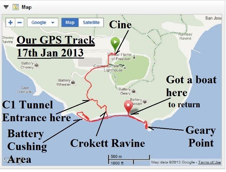 VI-F-2, DEF-Pos., Jan.17-2013, our GPS track to Geary Point on a terrain map 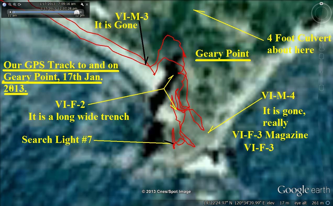 VI-F-2, DEF-Pos., Jan.17-2013, our GPS track on GE around Geary Point. 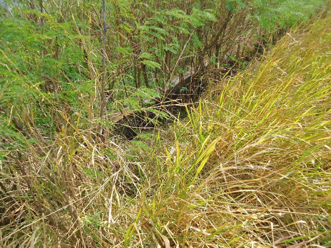 VI-F-2, DEF-Pos., Jan.17-2013, looking at the long trench between the south, #2, gun position and the magazine at my left. I’m looking from the cliff side. .  VI-F-2, DEF-Pos., Jan.17-2013, the south, #2, gun position. I’m looking SW from inside. On either east and west side the walls are low and I assume they would be able to shoot to either side. 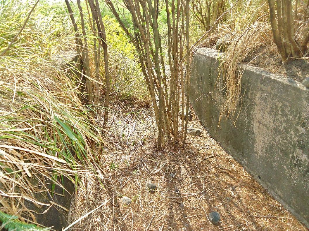 VI-F-2, DEF-Pos., Jan.17-2013, inside the trench, looking back at the south end or #2 gun position. 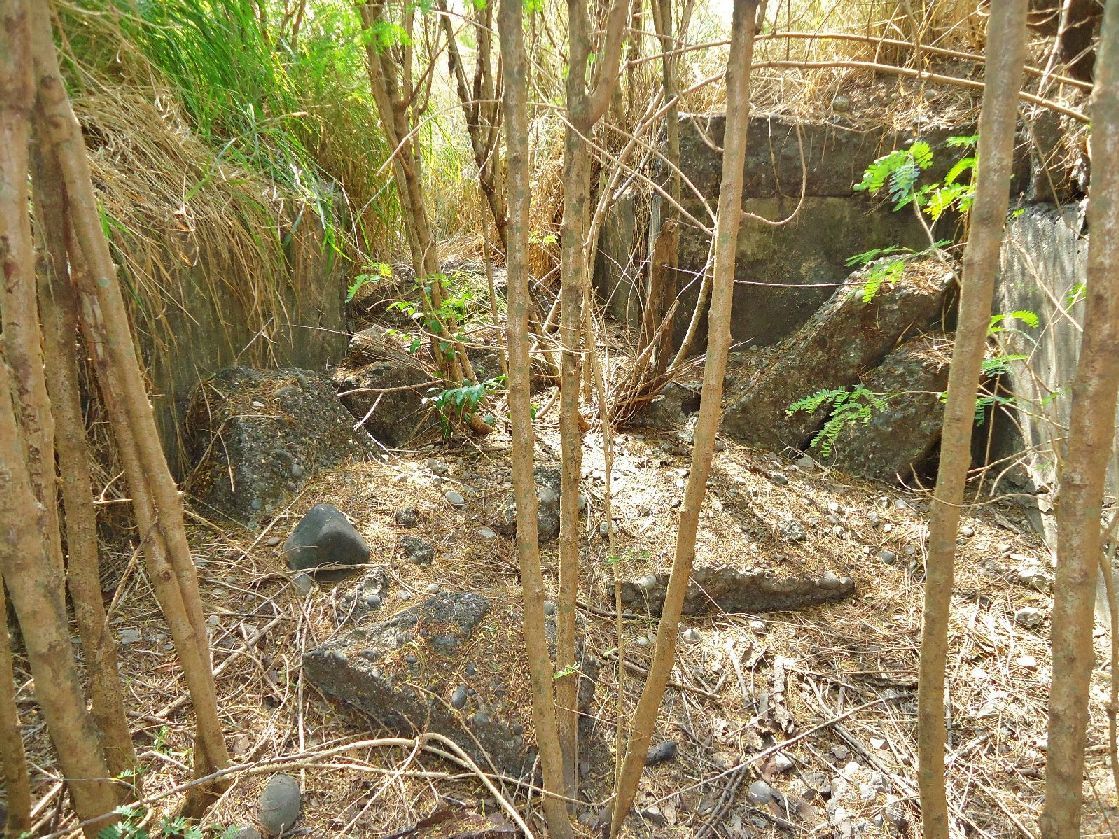 VI-F-2, DEF-Pos., Jan.17-2013, In the magazine, looking in the direction of the north or #1 gun position.  VI-F-2, DEF-Pos., Jan.17-2013, inside the north or #1 gun position looking at the east low wall 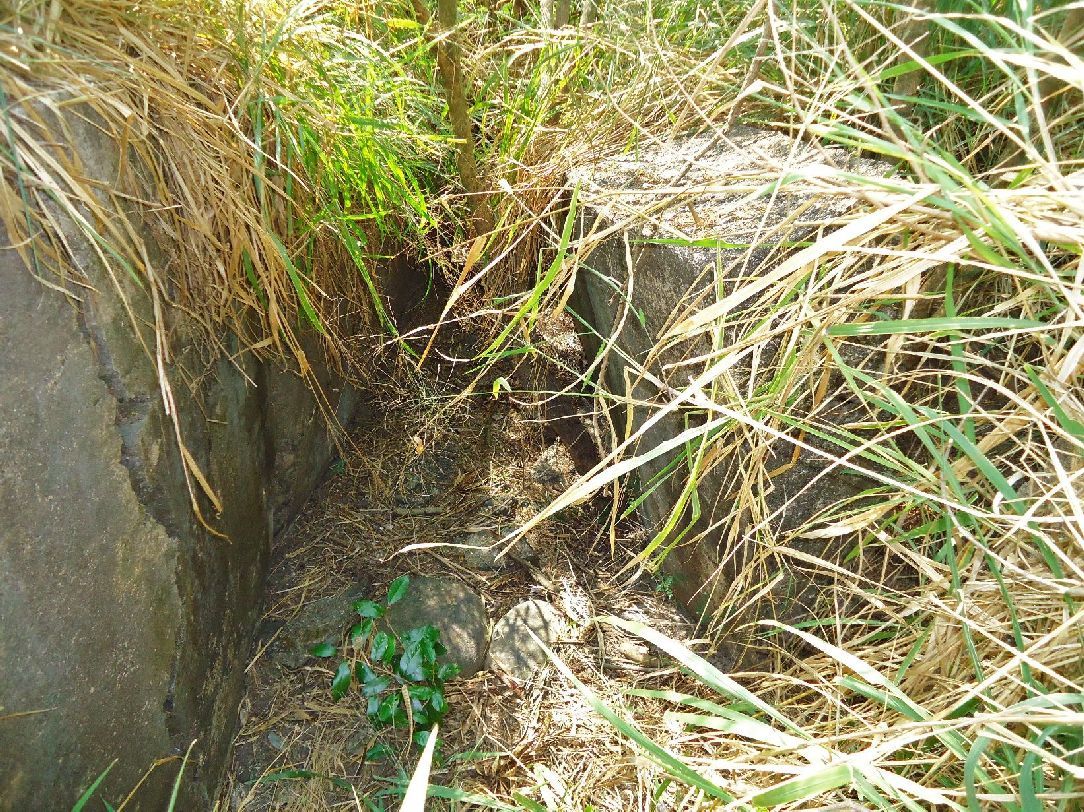 VI-F-2, DEF-Pos., Jan.17-2013, inside the north or #1 gun position looking at the trench, running back to the south and the magazine. The west side is leaning inside. |
|
|
|
Post by Karl Welteke on Jan 27, 2013 16:28:39 GMT 8
VI-F-3 Defense Position at Geary Point This VI-F-3 Defense Position at Geary Point seams to be a single gun. It is hard to get there. I was there in 2008 with the CDSG people and looked at it close. The last visit with John, 17th Jan. 2013 I only looked at it with some distance. Here is the URL for the album I established for this defense position, it has 18 pictures from both visits. The maps from the previous reply re VI-F-2 should cover this reply also. s74.photobucket.com/albums/i265/PI-Sailor/Corregidor%20by%20subject/Defense%20Positions%20Ft-Mills/VI-F-3%20Def-Pos%20at%20Geary%20Pt/Here are some sample images: 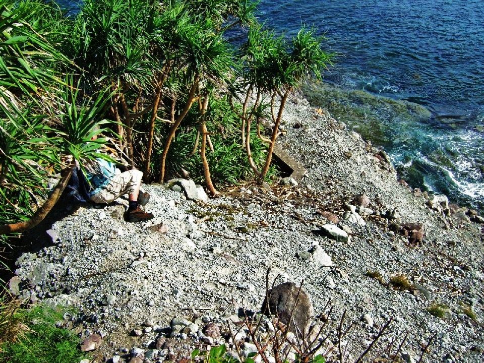 VI-F-3 Defense Position, 2008-01-17, the famous CDSG person -armyjunk- is sliding down into the gun position, carefully, on his backside.  VI-F-3 Defense Position, 2008-01-17, ok, we made it and we are in the gun position. These trees or whatever they are made it difficult plus the bark is rough and cant be gripped.  VI-F-3 Defense Position, 2008-01-17, you don’t want to slip and fall down here from this gun position, a nice picture of the South Channel and the Cavite coast line. 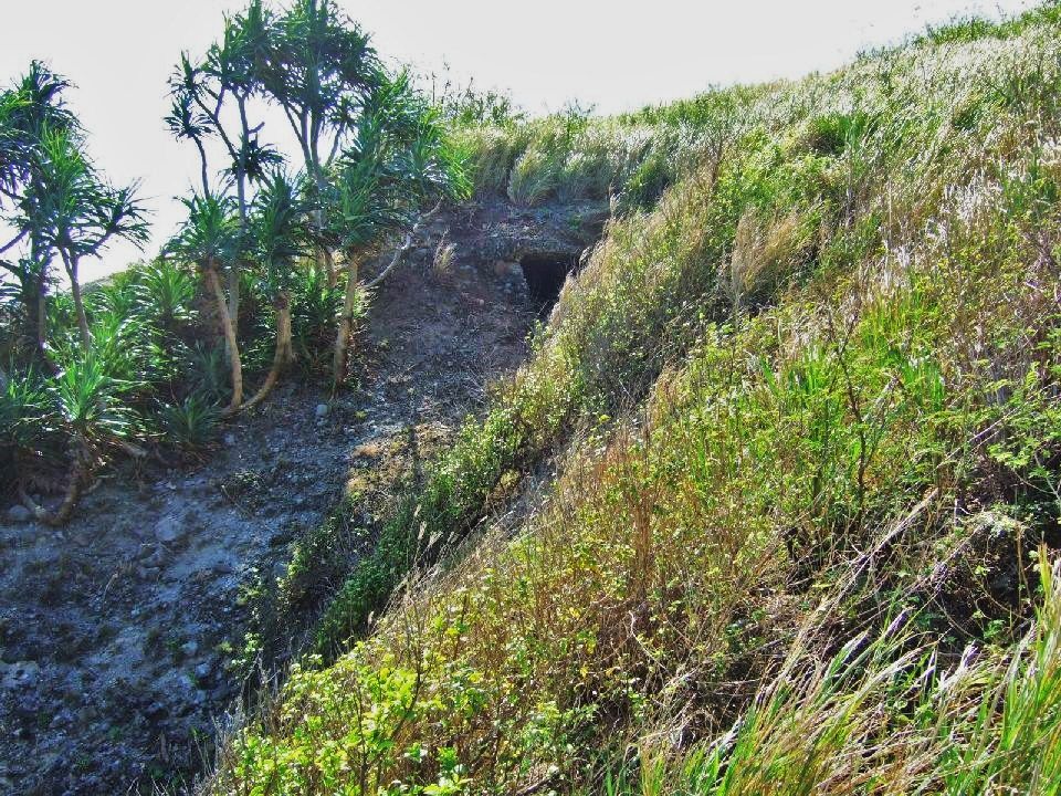 VI-F-3 Defense Position, 2008-01-17, This was shot some moments later from the VI-M-4 position, across a very eroded place towards the VI-F-3 position. Having turned to the right a little and we see the opening to the VI-F-3 magazine. 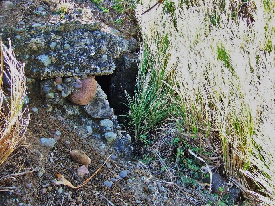 VI-F-3 Defense Position, 2008-01-17, now back on the VI-F-3 side and we are about to enter the magazine. 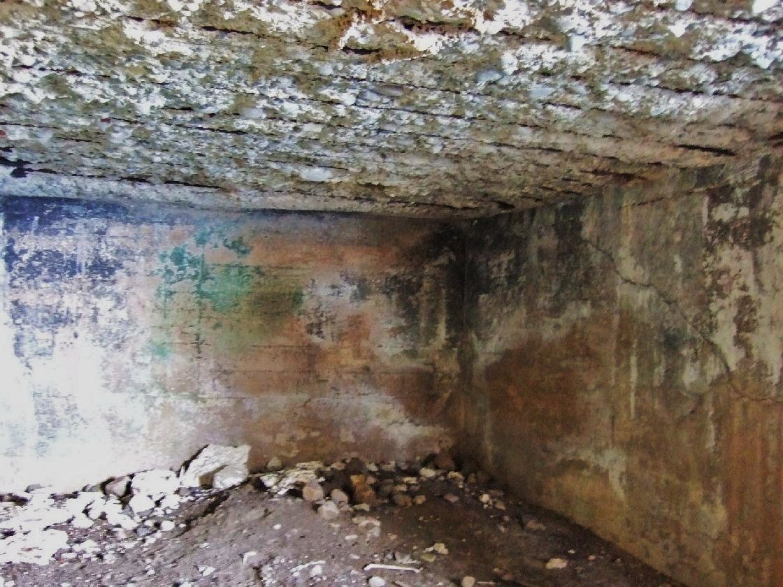 VI-F-3 Defense Position, 2008-01-17, I went inside the VI-F-3 magazine and shot pictures. 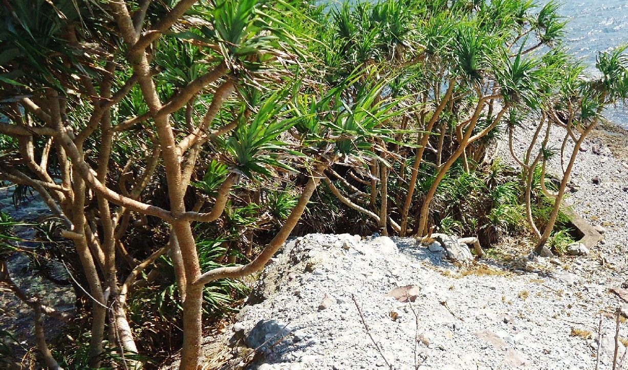 VI-F-3 Defense Position, 2013-01-17, this time it is as far as I went. 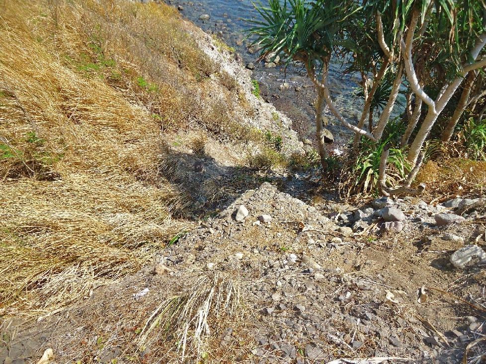 VI-F-3 Defense Position, 2013-01-17, the corner in the middle of the picture is the entrance to the magazine. 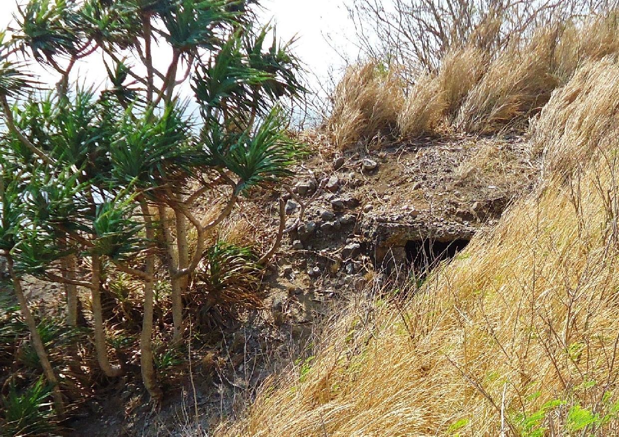 VI-F-3 Defense Position, 2013-01-17, the entrance to the VI-F-3 magazine and I’m shooting from just above the VI-M-4 position. 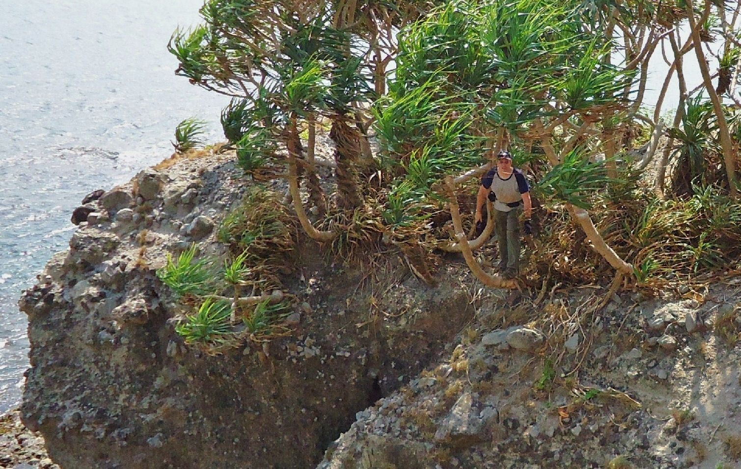 VI-F-3 Defense Position, 2013-01-17, shooting across the badly eroded area where much of VI-M-4 used to be. John is having a look towards me from the VI-F-3 gun position. |
|
|
|
Post by Karl Welteke on Jan 28, 2013 8:22:54 GMT 8
VI-M-3 at, near, next to and west of Geary Point This VI-M-3 defense position is next to and just west of Geary Point, pretty much at the shore line. As of Jan. 2013 it is gone; in 2005 it was still recognizable. Here are images from both visits. This is a good example of the erosion of time and by the elements. 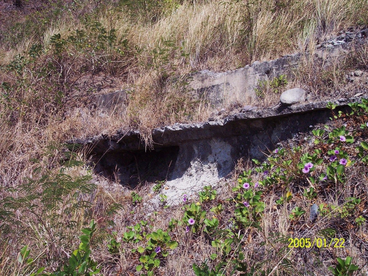 VI-M-3, 2005-01-22. The defense position is still recognizable.  VI-M-3, 2005-01-22. A bad, poor Google Earth image of Geary Point, my GPS track on the 17th Jan. 2013 and all the landmarks are indicted. 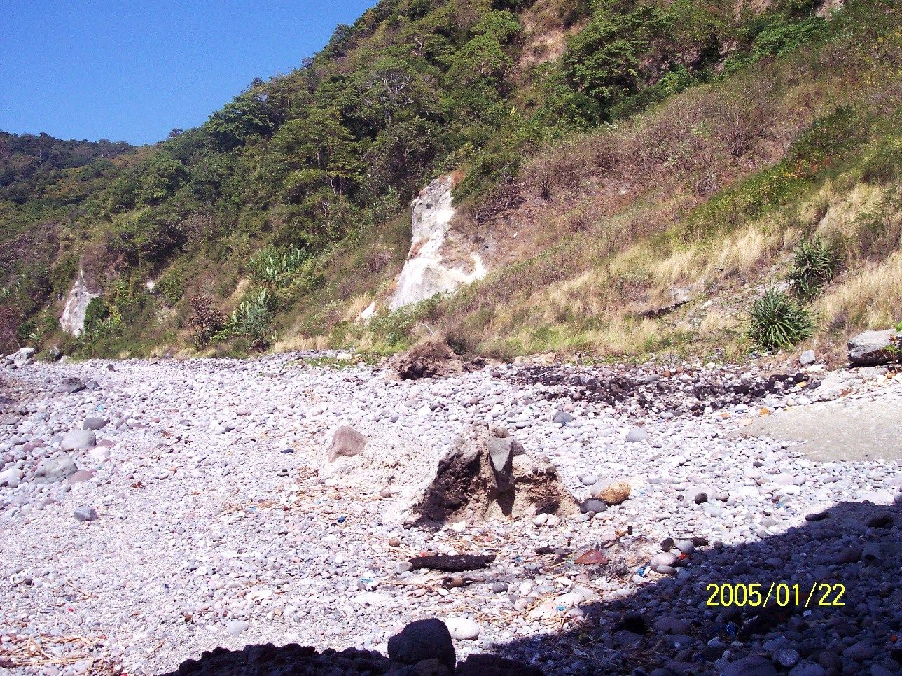 VI-M-3, 2005-01-22. At right, below center is a large piece of concrete. 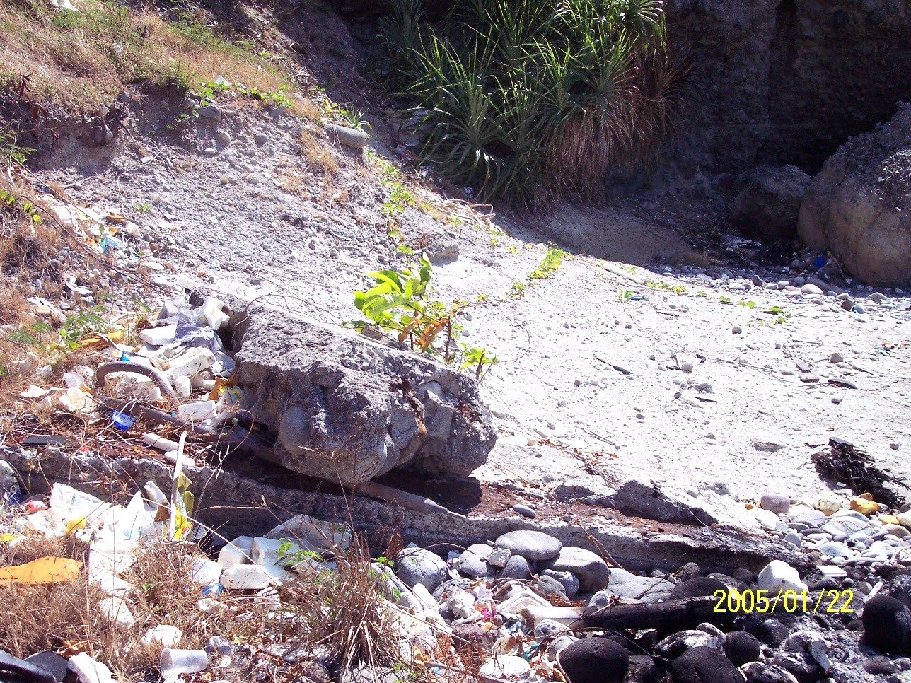 VI-M-3, 2005-01-22. Here are several pieces of concrete and in back is the base of the near Geary Point.  VI-M-3, 2013-01-17. This is about the same shot as the 3rd image above. A very tiny piece of concrete is at right just down and left of that plant. 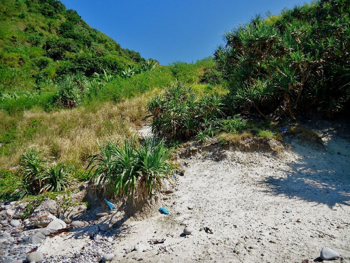 VI-M-3, 2013-01-17. That piece of concrete and now the only piece of concrete that is left now 8 years later. By the way this is were we went up onto Geary Point, which is at right, this Jan 2013. 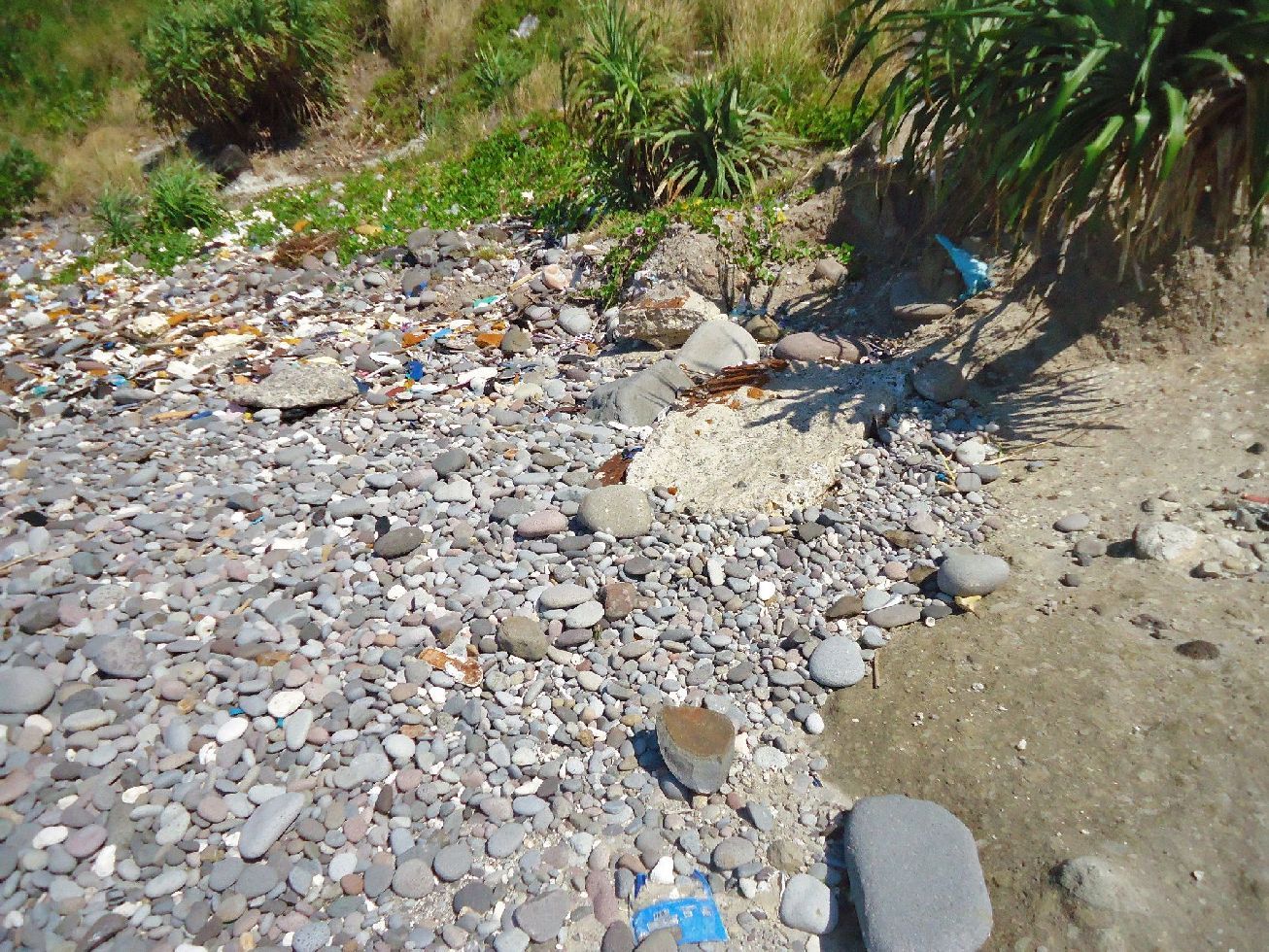 VI-M-3, 2013-01-17. A close-up of the only and small remaining piece of concrete from the defense position VI-M-3 and it’s history. THAT IS THE EROSION OF TIME AND ELEMENTS! Note: As you can see, I have established a new group of albums dedicated to the Corregidor Defense Positions. Here is the master URL for that group of albums and so far it only has Three: s74.photobucket.com/albums/i265/PI-Sailor/Corregidor%20by%20subject/Defense%20Positions%20Ft-Mills/ |
|
|
|
Post by okla on Jan 28, 2013 10:26:56 GMT 8
Hey Karl...Thanks for posting this detailed info. This took some real digging, no pun intended, but with you and Fots, we all know that it is labor of love. Cheers.
|
|
|
|
Post by Karl Welteke on Jan 28, 2013 15:42:20 GMT 8
VI-M-4 on Geary Point This VI-M-4 defense position was on the east side of Geary Point and just inland from VI-F-3. I visited this position twice, in 2008 and in 2013. It is almost completely gone only one piece of concrete is left. Noteworthy is that in this case the situation did not change from 2008 to 2013. Here are images from both visits. This is a good example of the erosion of time and by the elements. 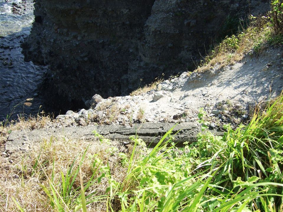 VI-M-4, 2008-01-17. In 2008, this was the only thing left of the defense position. 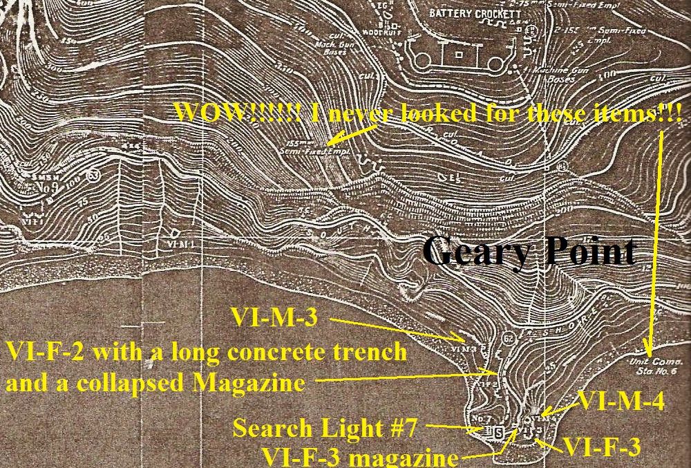 VI-M-4, 2013-01-17. The 1936 Corregidor map (from CDSG) of Geary Point all marked with the landmarks here. 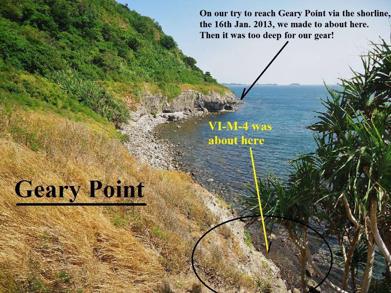 VI-M-4, 2013-01-17. A look down on the position where it was. 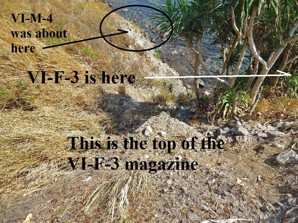 VI-M-4, 2013-01-17. Again looking down onto the gone position VI-M-4 from above the VI-F-3 magazine. 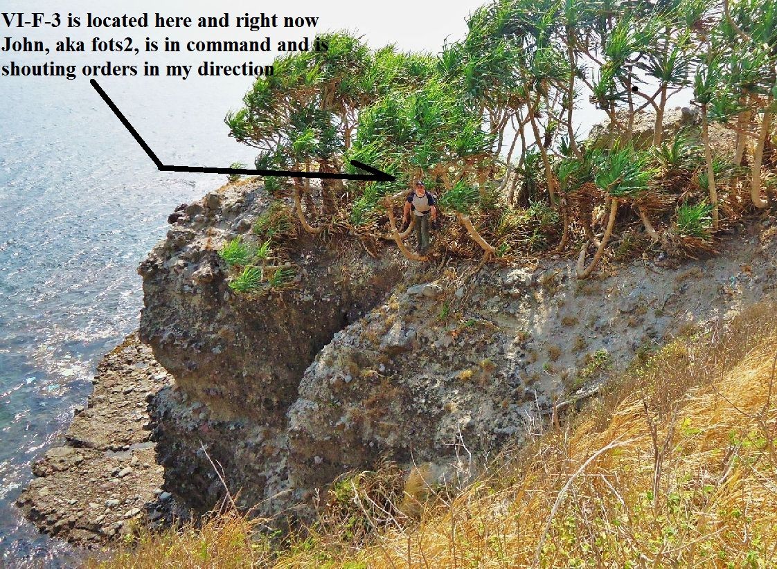 VI-M-4, 2013-01-17. Much of VI-M-4 position was here but erosion took it away. Across the ravine is position VI-F-3 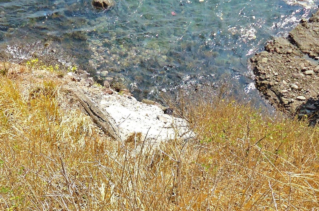 VI-M-4, 2013-01-17. This is all that is left. The situation, the condition of this last piece didn’t change from 2008. Note: As you can see, I have established a new group of albums dedicated to the Corregidor Defense Positions. Here is the master URL for that group of albums and so far it only has Four: s74.photobucket.com/albums/i265/PI-Sailor/Corregidor%20by%20subject/Defense%20Positions%20Ft-Mills/ |
|
|
|
Post by Karl Welteke on Jan 28, 2013 19:09:22 GMT 8
VIII-F-2 between Battery Cushing and Search Light 6 This VIII-F-2 defense position is located between Battery Cushing and Search Light #6 outboard of the South Shore Road. I was on the beach under it in 2005, visited it 2008 and 2013. My pictures show that the position eroded considerable more and only the steps down to gun position #1 and #2 remain today, 2013. The concrete pieces on the beach tell the story of its erosion. This is another place very few people have the opportunity to visit. One got to rent a boat and they are very expensive. I was able to walk here now 3 times, down to Crockett Ravine and it is not easy to get down to the ravine creek. I established this album with 28 images for this VIII-F-2 Defense Position: s74.photobucket.com/albums/i265/PI-Sailor/Corregidor%20by%20subject/Defense%20Positions%20Ft-Mills/VIII-F-2%20Def-Pos%20east%20of%20SL%20Pt/Here are some sample pictures: 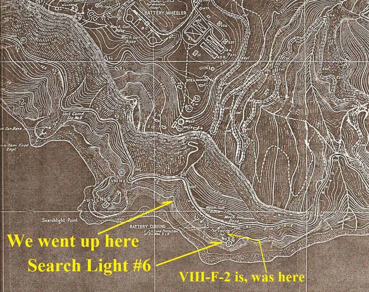 VIII-F-2 CDSG map and landmarks. 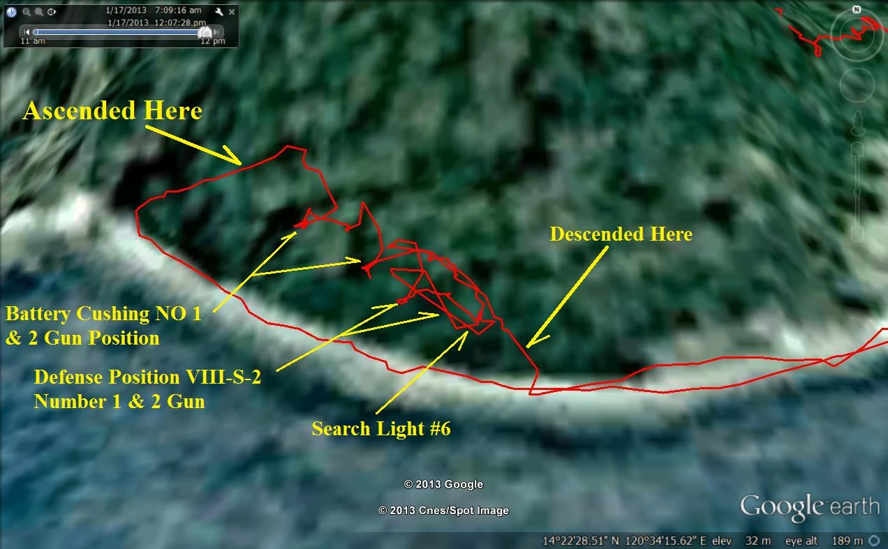 VIII-F-2 Jan.-17-2013 Our GPS track and landmarks. The South Shore Road is still here and it is not hard to walk around or behind these landmarks. 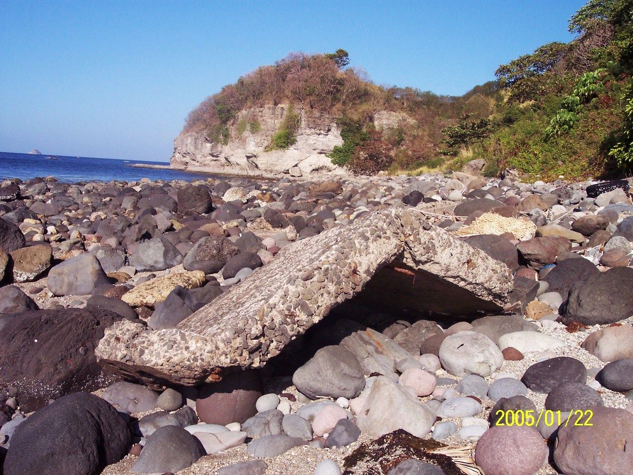 VIII-F-2 Jan.-22-2005. Eroded concrete position pieces on the beach, Search Light Point is in back. It must be low tide. 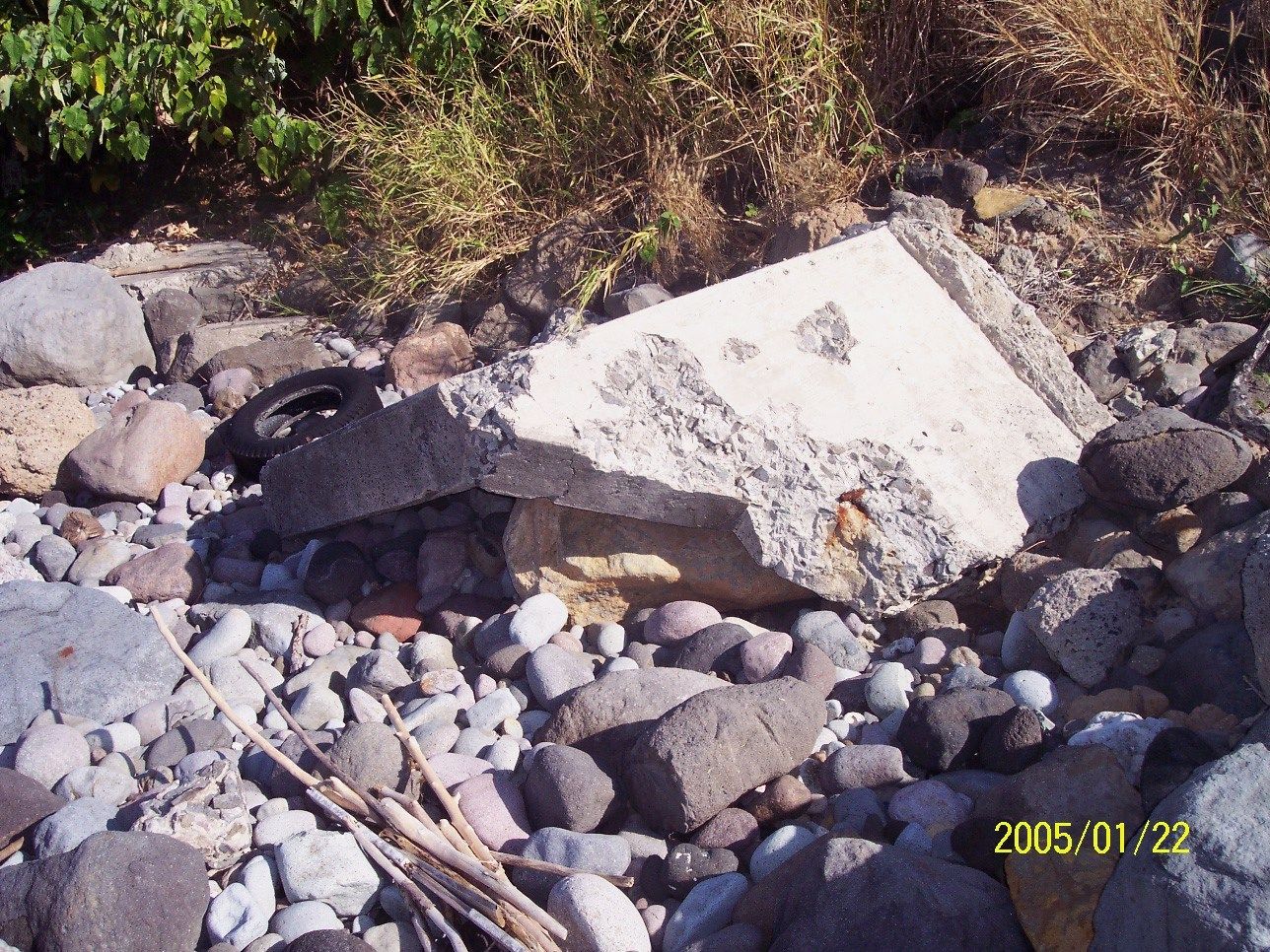 VIII-F-2 Jan.-22-2005. Eroded concrete position pieces on the beach  VIII-F-2 Jan.-22-2005. This piece and others were still here in 2008 and 2013. In the distance is Geary Point and even Caballo Island, ex Fort Hughes.  VIII-F-2 Aug.-19-2008, wow, I got here early, the morning shade is still here. This is August, see how green Search Light Point is. 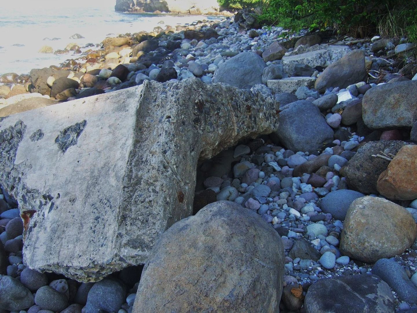 VIII-F-2 Aug.-19-2008, a large defense position piece on the beach, I remember it from 2005. 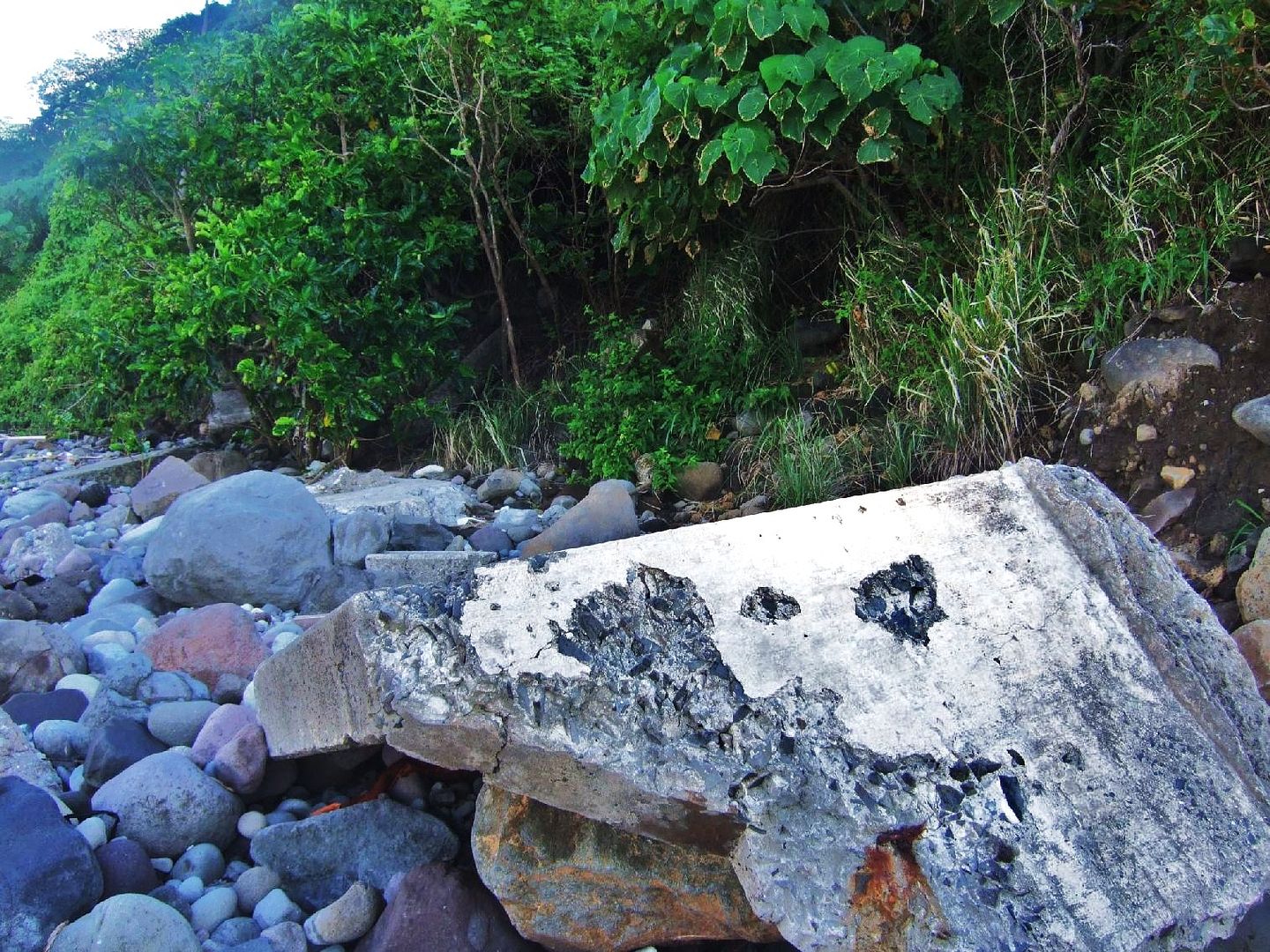 VIII-F-2 Aug.-19-2008, same piece from a different angle. 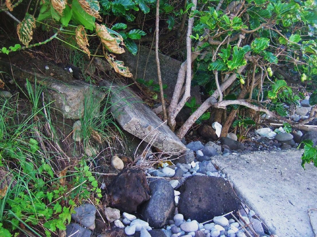 VIII-F-2 Aug.-19-2008, concrete pieces in the tree line. 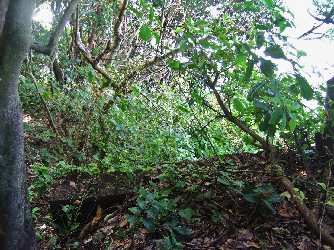 VIII-F-2 Aug.-19-2008, I’m up in the defense position, in 2013 we were not able to do this or see this.  VIII-F-2 Aug.-19-2008, these steps and walls are part of #2 gun and were still here in 2013. 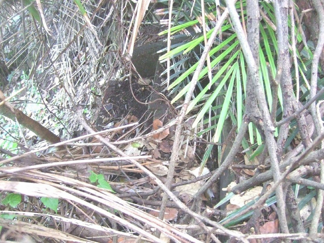 VIII-F-2 Aug.-19-2008, and these are the steps down to #1 gun position. 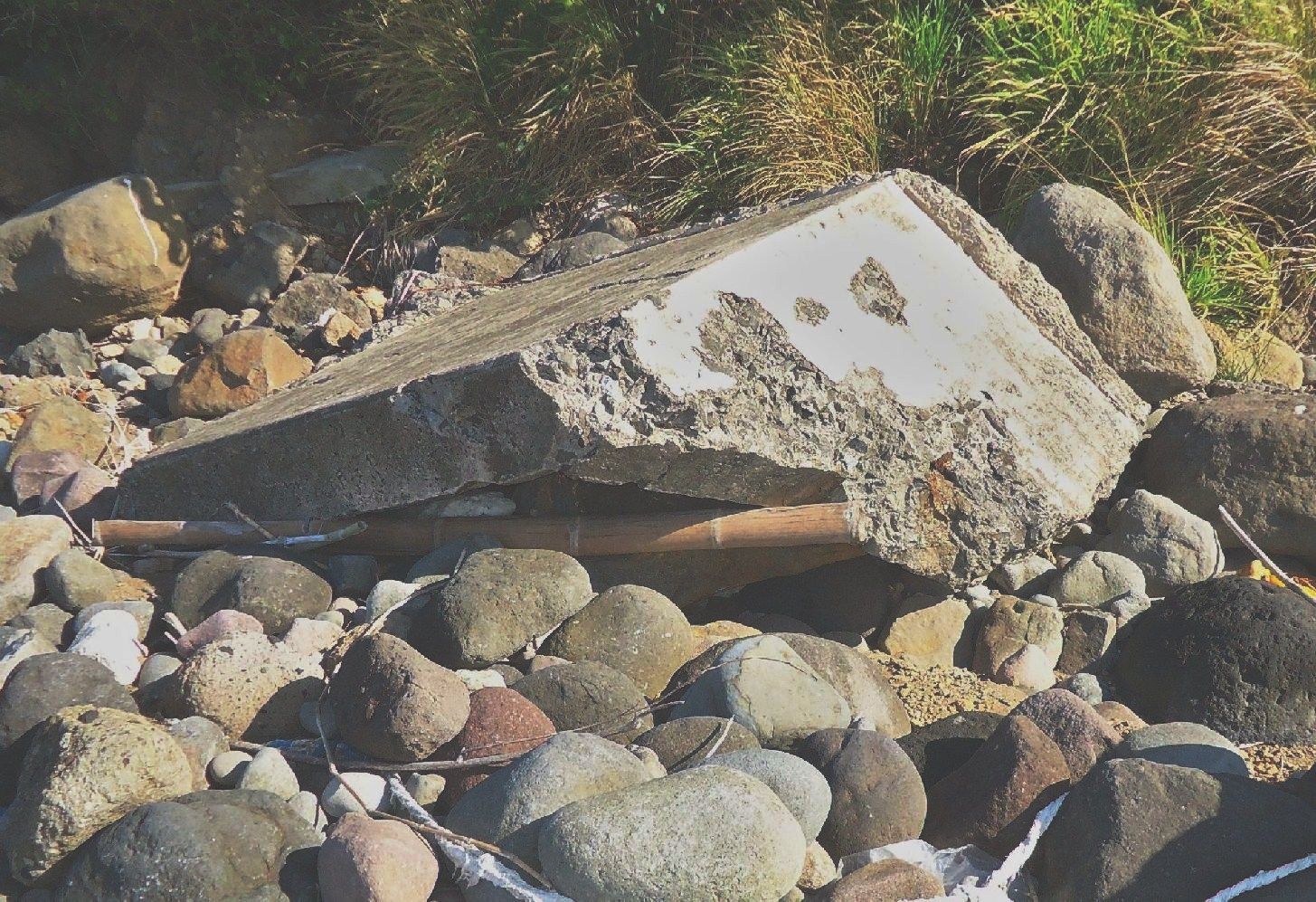 VIII-F-2 Jan.-17-2013, another angled piece that was here also in 2005. 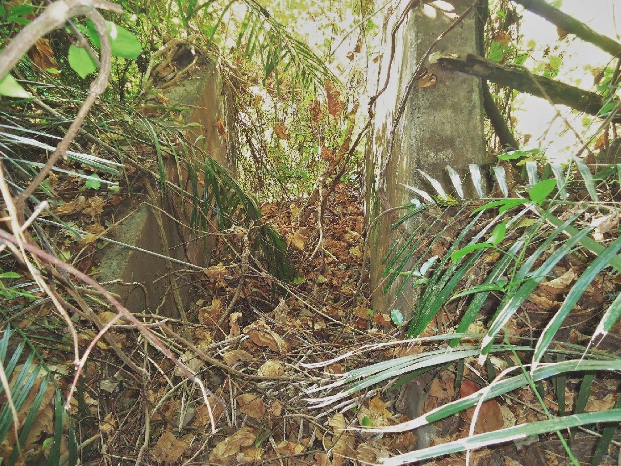 VIII-F-2 Jan.-17-2013, the stair way or steps down to #2 gun position, remember them from 2008, some of those jungle vines are gone this year. 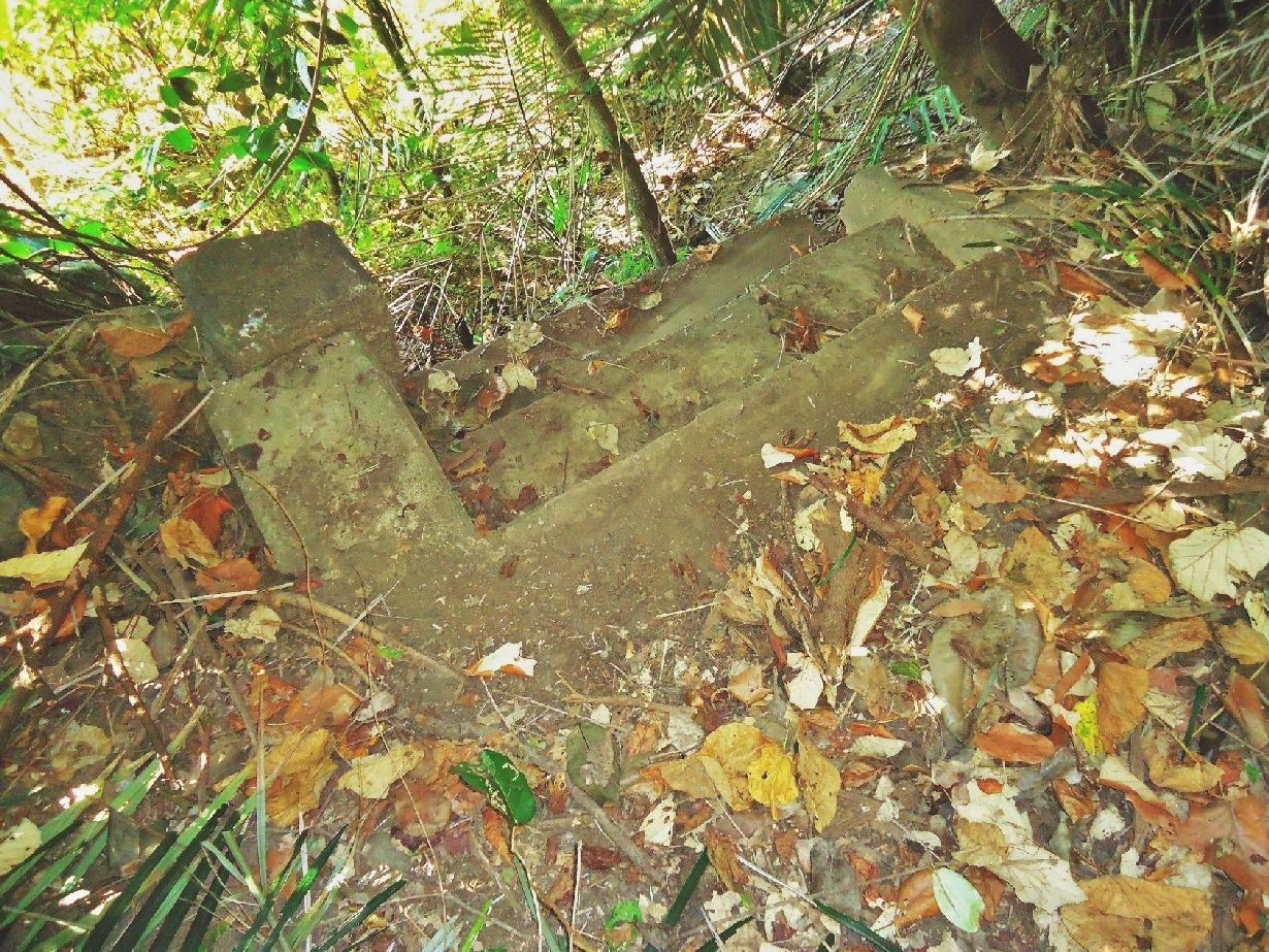 VIII-F-2 Jan.-17-2013, the steps down to #1 gun position, all cleaned up, courtesy of fots2. Note: As you can see, I have established a new group of albums dedicated to the Corregidor Defense Positions. Here is the master URL for that group of albums and so far it only has Four: s74.photobucket.com/albums/i265/PI-Sailor/Corregidor%20by%20subject/Defense%20Positions%20Ft-Mills/ |
|
|
|
Post by Karl Welteke on Jan 29, 2013 17:41:20 GMT 8
VI-M-3 next, west of Geary Point 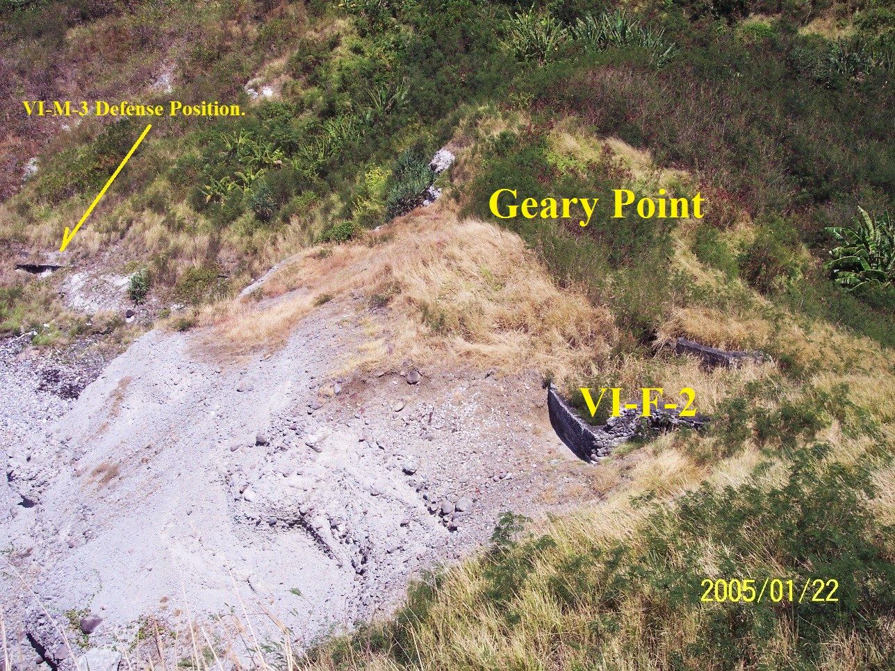 I added this picture of VI-M-3, 2005-01-22. I only rediscovered it today. The defense position is still recognizable. And you can see clearly the location in relation to Geary Point. In 2013 it was completely gone. |
|
|
|
Post by Karl Welteke on Oct 5, 2014 11:02:45 GMT 8
DEFENSE POSITION X-M-4 NEAR SEARCH LIGHT #3 AT CHENEY RAVINE On my 2nd day on Corregidor 2014-09-26 I made defense positions X-M-4 and Search Light #3 my main objective because I never seen them. It turned out to be a difficult walk because trails are over gown or difficult because of fallen trees or tree branches. I started early from my quarters, MacArthur Café, 6am, and was thinking about catching a ride from Corregidor workers heading in that direction to topside. But I did not see any vehicles or people heading that way. Good, that made it a challenging walk. Right now there are no breezes and even Manila Bay is very calm, so it made it a hot walk, everything on me ended up wringing wet! 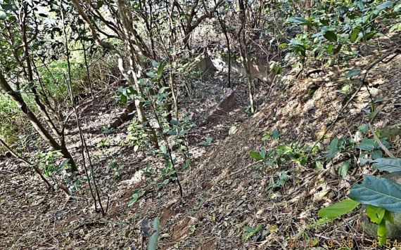 Y170. I am on a little rise or ridge between X-M-4 down there and Search Light #3 which is to the right and then down. I made it; I found both places. 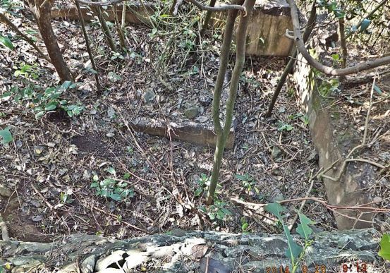 Y171. Looking down to X-M-4 from a rise, at right is the cliff to the water edge and straight ahead is the mouth of Cheney Ravine. 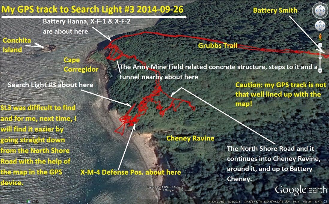 Y159. My GPS track and location of X-M-4 and it includes all the near and important landmarks. 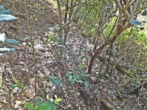 Y172. From above X-M-4 I am looking in the direction of Cheney Ravine, some people have come to here from there but I failed and I ended up coming straight down from the North Shore Road. I will use the from-above-approach again next time. 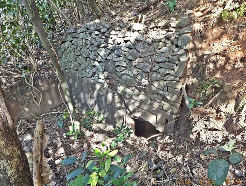 Y173. Looking at X-M-4 from the Cheney Ravine direction, it does have a magazine 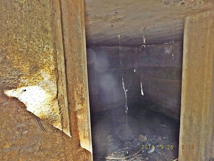 Y174. Not a good shot of the X-M-4 magazine but it is good enough to get an idea of the size of the magazine. 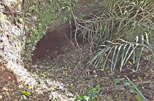 Y175. This is a digging not far above X-M-4 and SL3, it is not a tunnel; it just looks like digging under an overhang to get better cover from incoming ordinance. All these pictures are also in this album but are in a bigger size in this URL: tinyurl.com/nkgujyd |
|
|
|
Post by fots2 on Oct 6, 2014 2:45:53 GMT 8
Hi Karl,
You have visited one of my favorite places, Cheney Ravine. I agree with you that coming directly down from the North Shore Road is the easiest way to get to Searchlight #3 plus many other interesting spots. On the way down only one location was a bit steep so I had to slide on my butt for 10 feet or so. From the beach up to them is not easy. The good thing is that you do not have to be concerned with returning the same way you got there as going back up via the stream to the road is not too difficult. That is my usual path.
If you are really energetic, you can walk along the beach from Cheney Ravine to James Ravine then return to Bottomside via the old road. High tide is probably not the best time to try this route. I only did this once a few years ago but I don’t remember the tide being a factor in getting there or not.
Thanks for the photos.
|
|
|
|
Post by fortman on Oct 6, 2014 17:31:21 GMT 8
Hi Karl and Fots,
Thanks for another fascinating series.
What I find amazing and shocking is the effort that scrappers put into removing rebar from the reinforced concrete structures. The effort to get at the structures and then chipping away to get a few dollars worth of steel. One can almost admire them.
Fortman
|
|


