|
|
Post by Karl Welteke on Oct 28, 2013 14:54:45 GMT 8
IMAGES OF MY 22nd OCT. 2013 WALK IN THE MAUBAN DEFENSE LINE AREA. ALONG THE BAYAN-DATI RIVER Here are the images from that walk starting at the entrance road to Barangay (village) Nagbalayong from the Bataan West Road but in the opposite direction, inland to the slopes of Mt. Silanganan. Basically I walked up-stream in the Bayan-Dati River Valley. What was a surprise and after studying the map it should not have been, was, that the Bayan-Dati River, below the higher slopes, comes from way to the east. So it is actually a natural way, ready made for the Imperial Japanese Army, to hook around the Mauban Line. It is certain that the OPLR was in this valley and the Phil-Am Forces lost it for good in the night of the 19th Jan. 1942. I don’t think the Japanese started marching inland per this route but most likely used the route of my 8th Oct walk. And I seen possible trails from there that would have connected to the Bayan-Dati River valley a lot further inland, and connected to the trail, I used, further up river, the Bayan-Dati Rv. Once I entered the forest up-river of the Bayan-Dati River it was hard to tell where one was. The sun, close to noon and because of the trees, was no help. Only once did I get a vista view, it was a high ridge north of me and that gave me assurance that I was going east. I also could see, back, towards the west the Sitio Crossing Ridge where I walked on the 8th of Oct. It was a substantial trail, all the way, and that gives me confidence in the believe that plenty of trails also existed here in 1942. I had my Garmin GPS devise with me and I could see clearly that I was hooking around the Mauban Phi-Am Defense Line. My devise does not have a topographic map and has only a street map and so I could see my relative position to the Bataan West Road on my device. My walk started about 0730 and at about 1010 hours I entered a clearance and I lost the trail. I tried to find the continuation but decided to turn around. I choose another trail which I had come across earlier and gave me a little hope that it maybe went towards the West Road. It became clear early that was not to be and that the this new trail took my back where I came from. One thought was constantly on my mind, how in the heck do you establish a defense lines in this forest wilderness? There is no trails to connect a line there is only wilderness all around you. An enemy who does not have to worry about defense, is bent on attack and when he does will do or die is hard to defend against in this wilderness environment. All 77 pictures from this walk are in this album with only brief descriptions. I established “View-Points” where I shot rounds of pictures and gave them titles with those view point names: s74.photobucket.com/user/PI-Sailor/library/Manila%20Bay%20Forts-Other/Mauban%20Line%20Bataan/Bayan-Dati%20Rv%202013-10-22?sort=9&page=1Here are sample images: 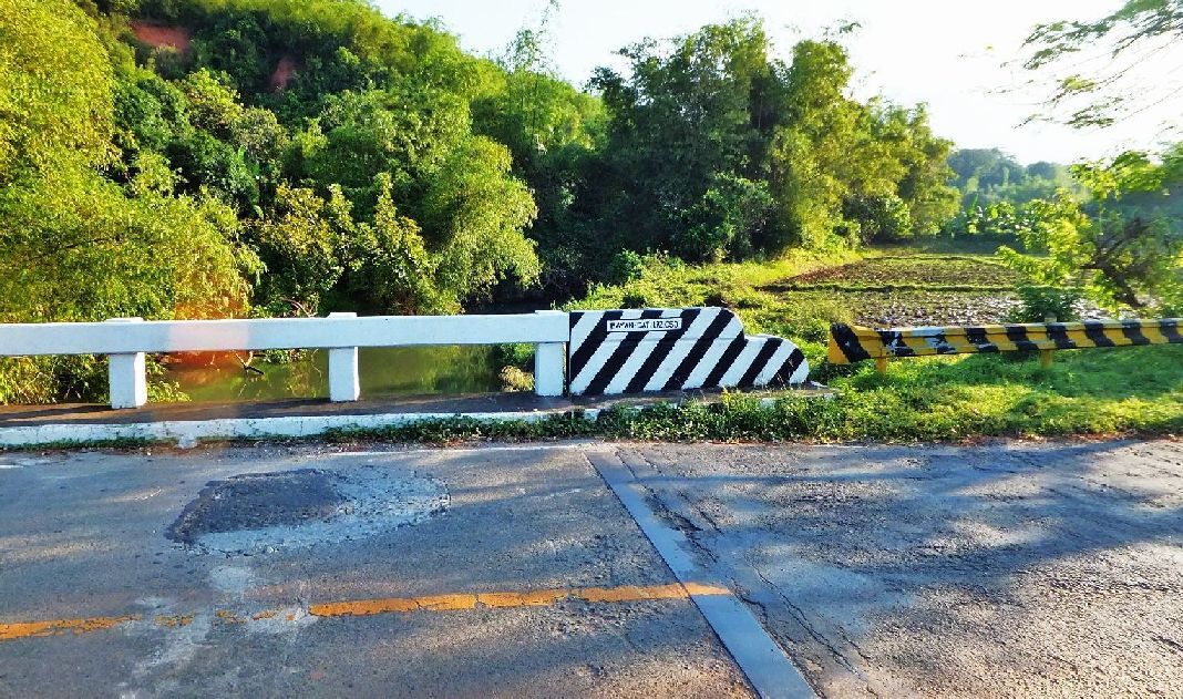 Z960- First I checked out the landmark Bayan-Dati River (spelling on the bridge) because that is on the WWII maps. I took a round of pictures here. 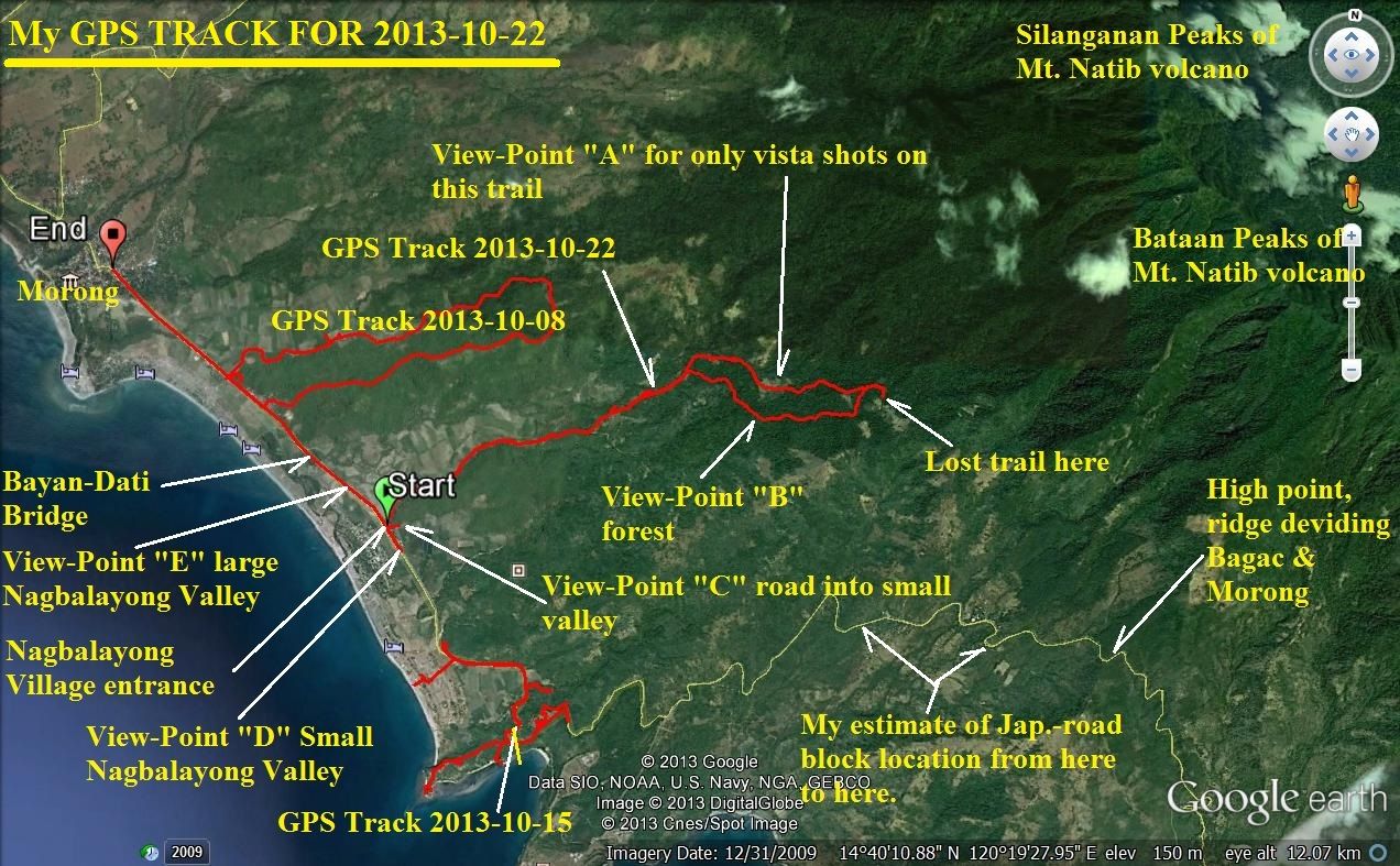 Z961- My GPS track shows that I hooked around the Mauban line and am ready to descend down on the Bataan West Road. It also indicates “View-Points” where I shot rounds of pictures. My next move next week will be to start from the location of the Japanese road block and connect to this track.  Z961- a little bigger version 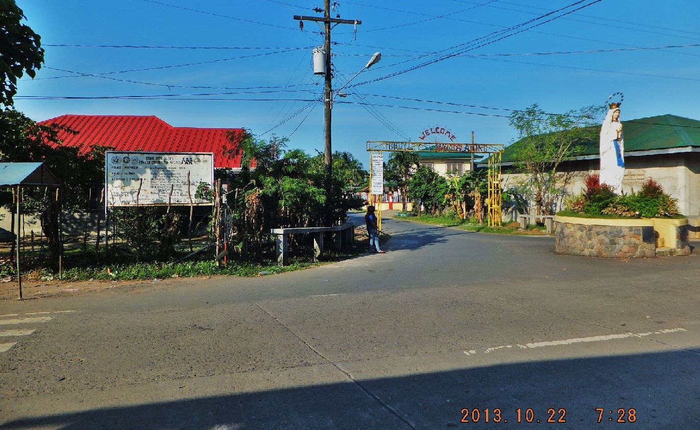 Z962- I drove on to the entrance road to Barangay (Village) Nagbalayong, parked there and started in the opposite direction, inland. This present name differs from the WWII maps which use Bayandati or Balayon. 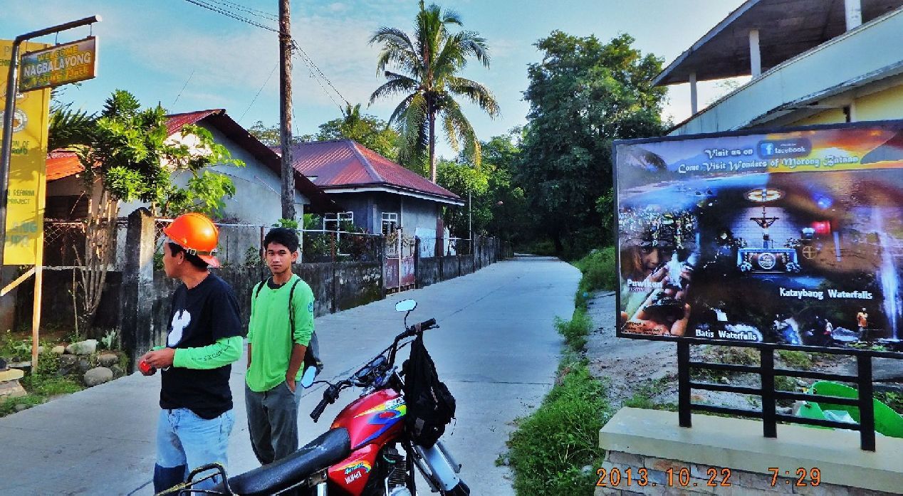 Z963- This is the substantial road into the Bayan-Dati River Valley which I followed. On the present Google Earth image one see clearly that it is a substantial road and goes deep into the valley. 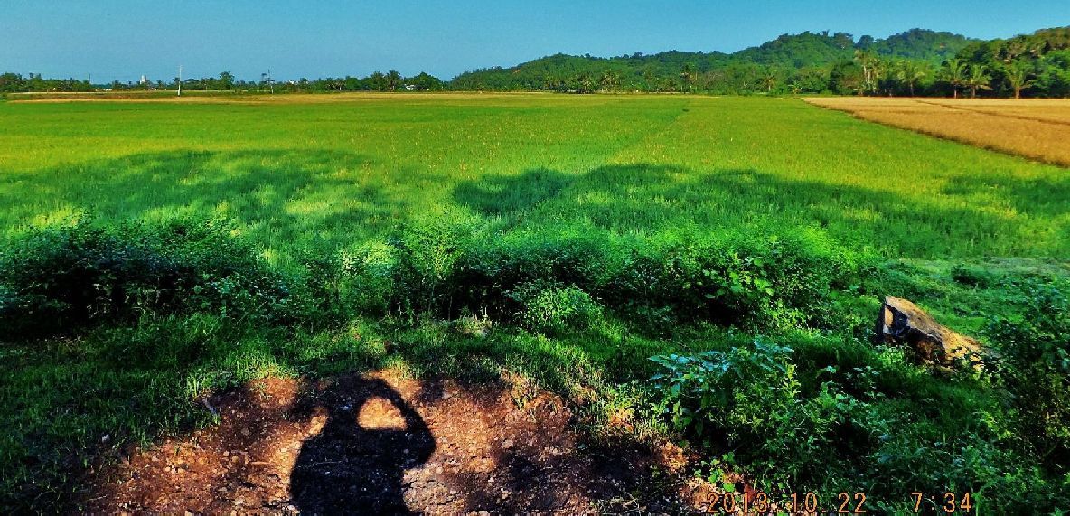 Z964- After a view hundred meters on the road I looked back. Left is the Bataan West Road and across the rice fields is the Sitio Crossing Ridge Line I used descending on my 8th Oct 2013 walk. 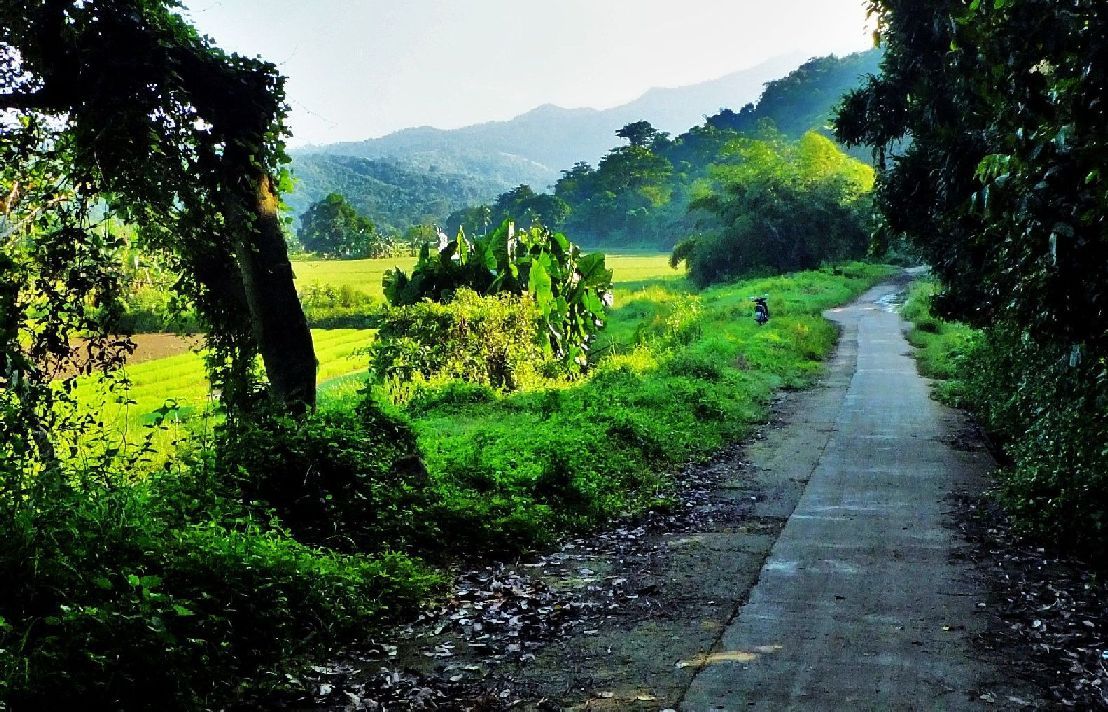 Z965- Continuing into the Bayan-Dati River Valley. In my album I call this valley the big Nagbalayong Valley. 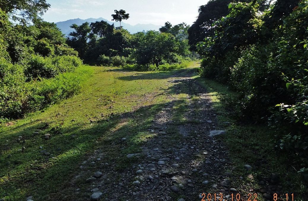 Z966- The road splits and you can see it clearly on the GE map image. I chose the left one because the right one would have been to close to Phil-Am line. I wanted to hook around the Phil-Am Defense Line as deep as possible. 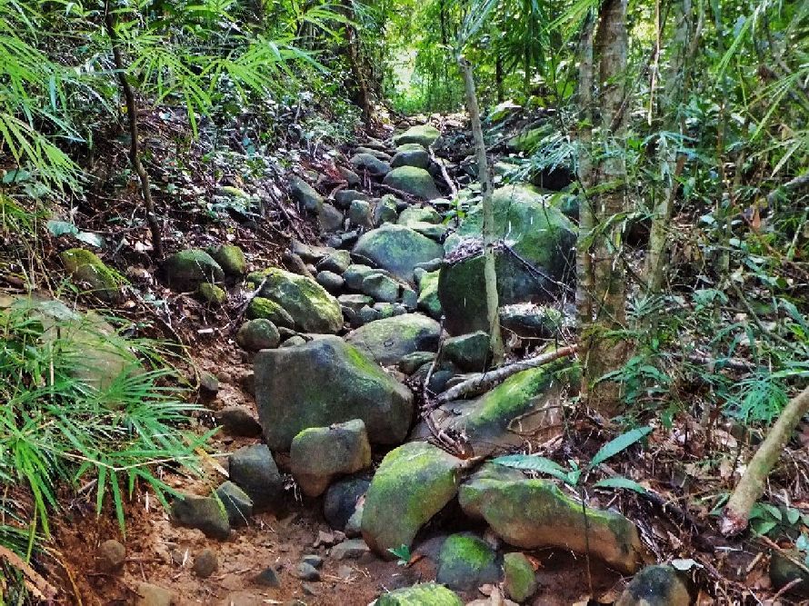 Z967- Maybe after another half hour the road turned into a mountain trail, only a few time was it rocky like this. It was a substantial trail! 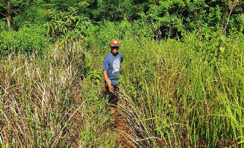 Z968- This was a large clearance and offered the only vista shots after I entered the forest trail. This person and another assured me that in this direction (my direction to the east) one could descend down to the Bataan West Road. In my opinion the Japanese could have easily found guides either for money or otherwise.  Z969- This peak is north of me and I am heading east. Here I realized that the Bayan-Dati River is not coming from, north from the slopes and rather from the east and so formed a great pathway to hook around the Phil-Am Line. 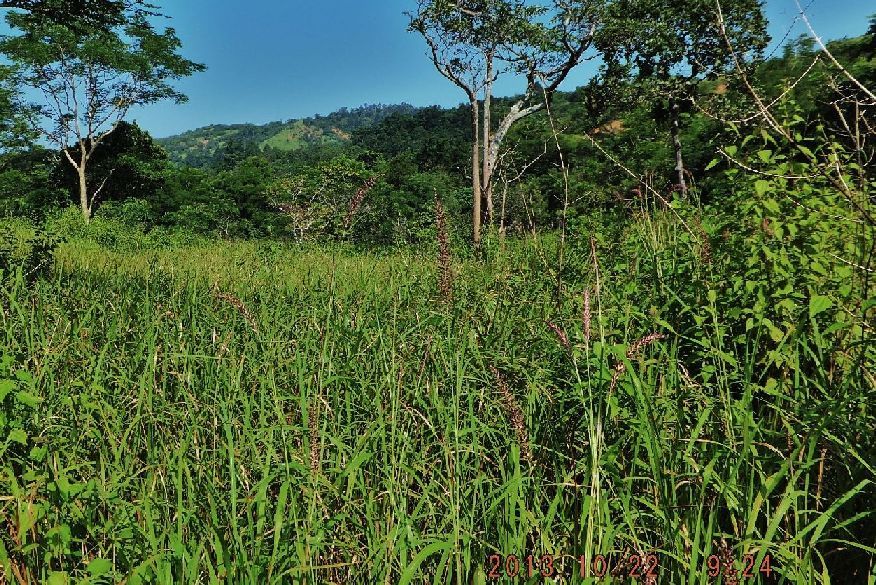 Z970- I’m looking back, west, and that is the ridge I was on my walk on the 8th of Oct 2013. I’m sure there are trails that connect from there to here. I came from the left up the Bayan-Dati River. 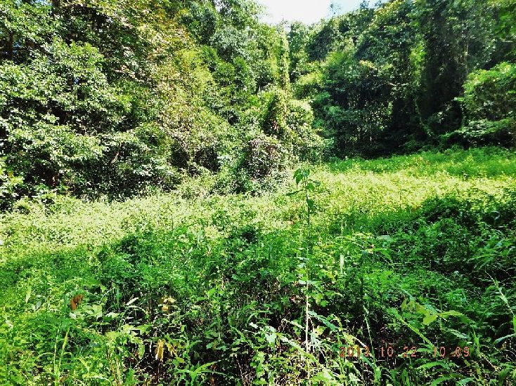 Z971- At about 1010 hours I came to this clearance and I lost the trail, I did not see a clear continuation. I’m sure one can continue further east from here to an ever better position the descent to the Bataan West Road and block it. From the GPS track one can see I was very close. My next move is to start from where the Japanese blocked and connect to here. With my GPS devise that can be done. I view of the time of the day and my unwillingness to search on and in view that I had seen another trail that looked promising I started my return march. 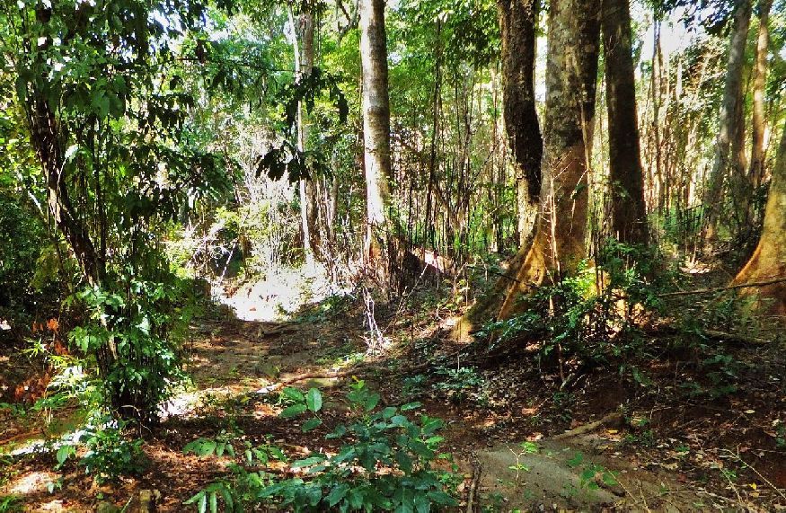 Z972- This is a typical section of the forest I walked thru, I’m on the new trail but I realized soon, on my GPS device, that this trail took me back where I came from. 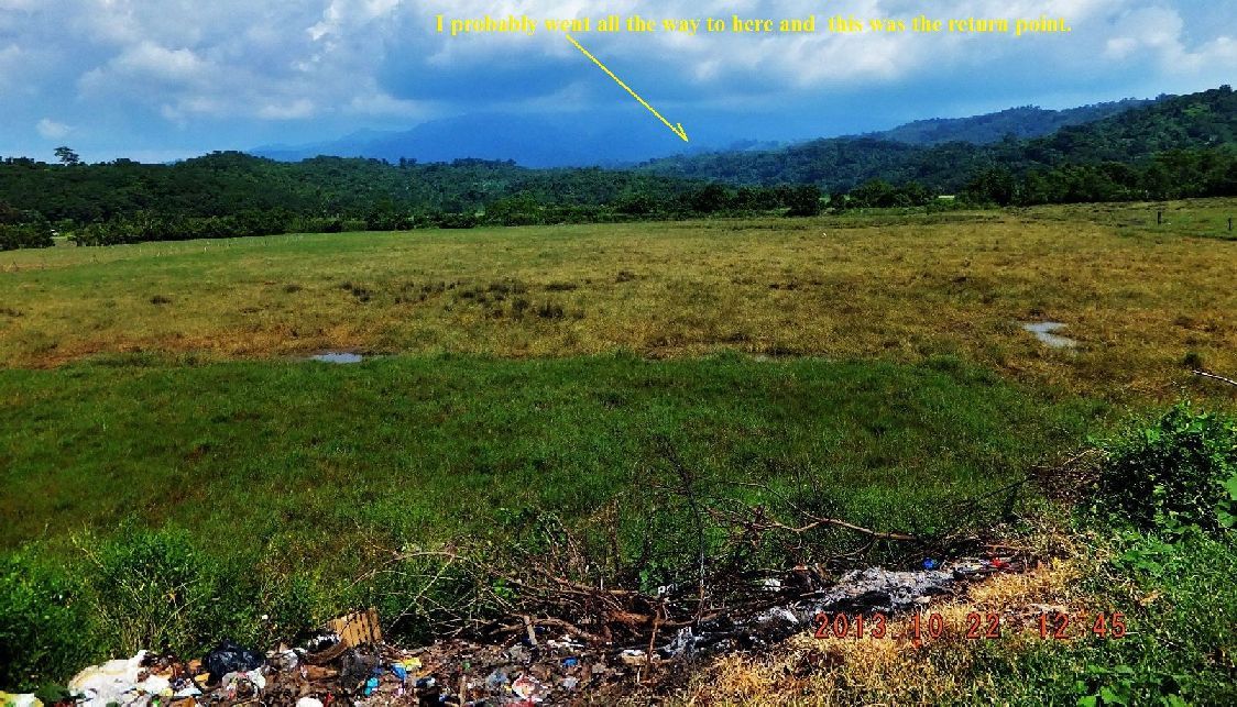 Z973- I completed my walk and drove here with my car and took a round of shots in front of what I call “the small Nagbalayong Valley”. 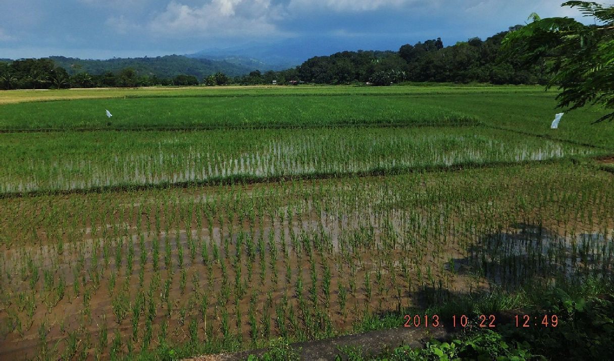 Z974- Then I stopped in front what I call the big Nagbalayong Valley and shot the last round of images. This is the Bayan-Dati Valley which I walked into and before the 19th Jan 1942 held the Phil-Am OPLR. 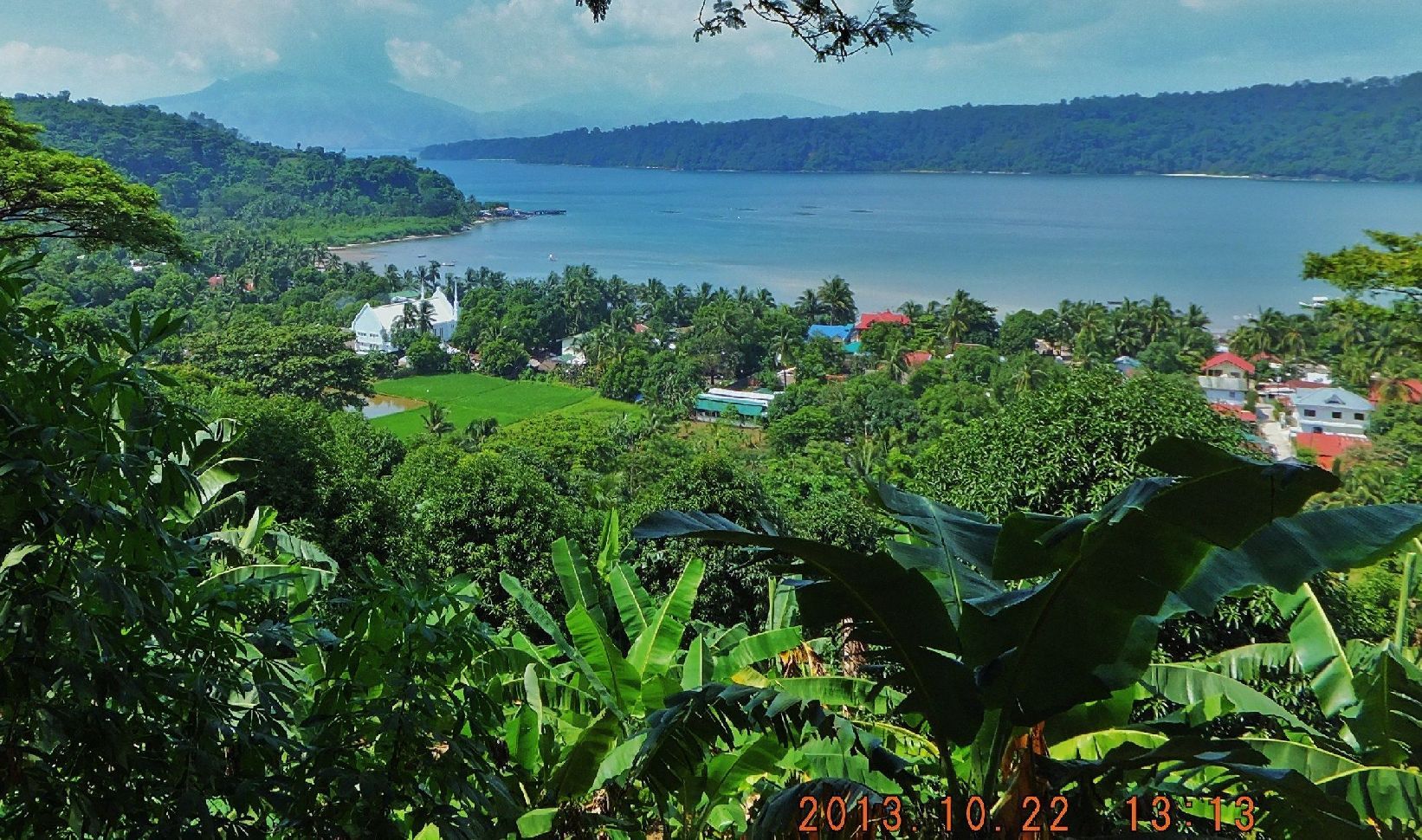 Z975- This is the lovely Binanga Bay and I believe this is where some of the Japanese forces landed coming from Subic Bay. The far side of this bay in later years, the 1950s, became the Subic Bay Naval Base Magazine area. I read, the village below was used by the US Alamo Scouts as training camp and base in 1945. I drive by here many times and enjoy this view. |
|
|
|
Post by Karl Welteke on Oct 30, 2013 14:28:16 GMT 8
FIFTH OFFICIAL WALK IN THE MAUBAN DEFENSE LINE AREA 2013-10-22 FROM AND TO THE SUSPECTED JAPANESE ROAD BLOCK POSITIONS The plan was to start the walk from the closest ravine and ridge to the point where I ended my 22nd Oct. 2013 walk along the Bayan-Dati River. The starting point could have been part of the Japanese Road Block. We were advised by locals to start into the Alupag River Valley, the trail split and we choose to go up to the West Ridge, it was a marginal trail. On top we found a highway (a well used trail) and continued. Per my GPS we found the spot I had reached on the 22nd Oct 2013 and returned back up to the West Alupag River Ridge. There were plenty of trails and we choose to round the head waters of the Alupag River to reach the East Alupag River ridge. Again there plenty of trails and I choose the one that lead to the closest point of the Bataan West Road per my GPS devise. I only have a road map in the device. I could have come down further east onto the Bataan Road if that is what the Japanese did. My experience of this project is that it seemed real easy to have hooked around the 1942 Mauban Line. I’m a 71 year sailor and beer drinker. If I had been a young conditioned soldier it would have been a piece of cake. Even in 1942 there must have been trails up there, I can’t believe the locals didn’t go up in the hills then and form trails! And what if the Japanese got a guide, then it would have been super easy, I didn’t use a guide. As a sailor, it baffles me how one can establish effective defense line in this mountain terrain and rain forest environment. It seems to me it could be impossible at that time with those recourses against an enemy like the Japanese Army. They were an aggressive force, not worried about defense, superior in training and material (air forces etc) and bend on to succeed or die trying! Bonus: At that bend and just before the bridge I parked and a resident there gave me several bullets that he had found around his house. More surprising one of my companions bend down and picked up a cartridge which was laying by his feet. That resident said that here down the road a little Japanese had built a marker (after the war) but that it did not exist anymore. I didn’t follow up but will in the future. It was a beautiful day for a walk, any day without rain is a good day for walking for me! It seems the rainy season is over. This walk I had four young men as partners, that is bad, because that seems to tell my buddy I got to keep up with them and I get exhausted. But they were helpful in staying on the trails while I was occupied in keeping up. Here is the data of my 5th official walk in the Mauban Defense Line area: 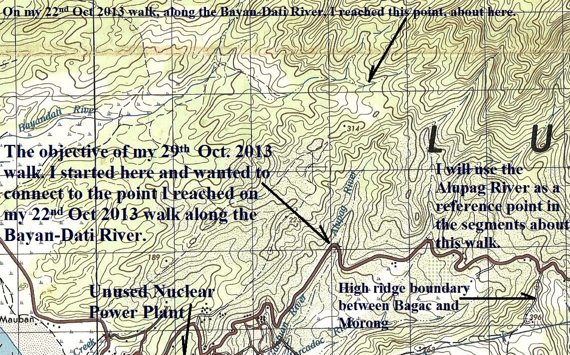 Z981- This map shows my goal and purpose of this walk and gives some landmarks. The Alupag River I used as landmark reference point in my picture album. 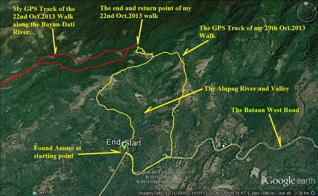 Z982- The yellow track is from today’s hike and the goal was to find my turn around point of my 22nd Oct. 2013 walk. The whole purpose now is to show that it is easy to come down onto the Bataan West Road coming from the Bayan-Dati River valley and then block it. 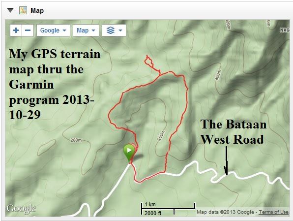 Z983- A small terrain map of this walk These are the actual numbers of this walk: Mauban #5 Japanese Road Block Tue, 2013 Oct 29 7:50 China Standard Time Activity Type: Casual Walking Event Type: Special Event This time we started from possible Japanese road blocks and indeed connected to my walk from the 22 Oct 2013, coming up the Bayan-Dati River. Then we were able to come down another trail. Found bullets. Summary Distance: 7.41 km Time: 3:06:44 Avg Pace: 25:11 min/km Avg Speed: 2.4 km/h Elevation Gain: 346 m Timing Time: 3:06:44 Moving Time: 2:10:41 Elapsed Time: 3:06:44 Elevation Elevation Gain: 346 m Elevation Loss: 348 m Min Elevation: 90 m Max Elevation: 341 m 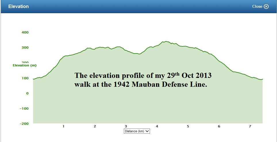 Z984- The elevation profile of my 29th Oct 2013 walk at the 1942 Mauban Defense Line. 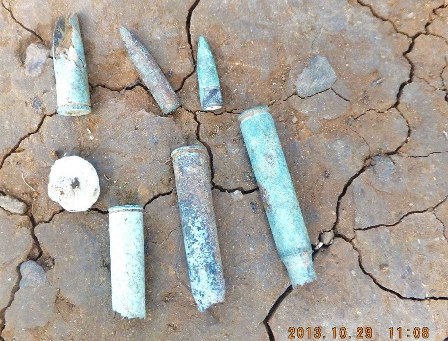 Z985- The stuff (cartridges and bullets) that was given to us by the resident there. The longest and cleanest one was found right there at our starting point by one of my partners. The pictures of this walk will be posted later. My next move will be to explore the retreat passage along the coast line. |
|
|
|
Post by Karl Welteke on Nov 4, 2013 14:08:09 GMT 8
IMAGES OF MY 29th OCT. 2013 WALK IN THE MAUBAN DEFENSE LINE AREA. STARTING AT THE POSSIBLE JAPANESE ROAD BLOCK. Here are the 45 images from that walk in this album: s74.photobucket.com/user/PI-Sailor/library/Manila%20Bay%20Forts-Other/Mauban%20Line%20Bataan/From%20Jap-Road-Block%20to%20Bayan-Dati%20River?sort=9&page=1Fourteen sample images are posted here, remember the pictures in the above album are much larger, refer to the maps and data in the last and previous segments: 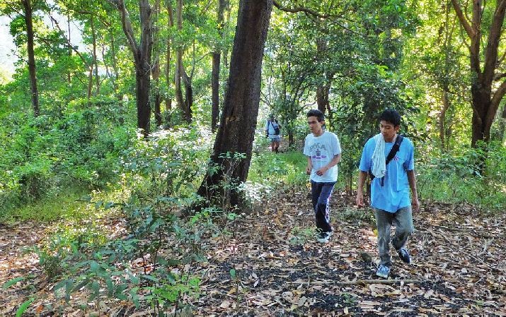 Z987- Walking up to the Alupag River West-Ridge. The plan was to start the walk from the closest ravine and ridge to the point where I ended my 22nd Oct. 2013 walk along the Bayan-Dati River. This starting point could have been part of the Japanese Road Block. We were advised by locals to start into the Alupag River Valley, the trail split and we choose to go up to the West Ridge, it was a marginal trail. There was a substantial trail, at the starting point that went straight up but we followed their advise. 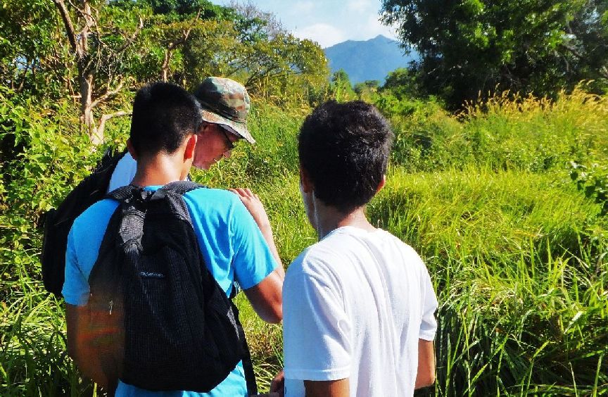 Z988- On top of the Alupag River West-Ridge we found a highway (a well used trail) and continued. Here I checked my GPS device for the first time. 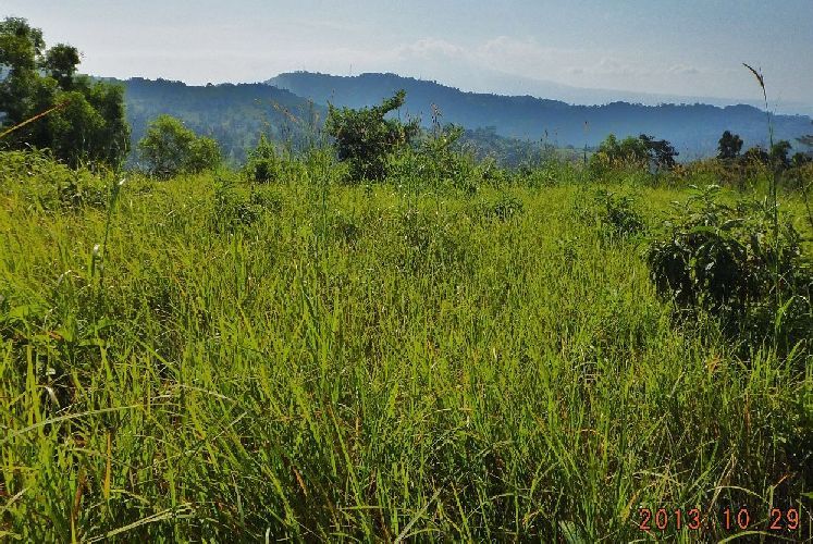 Z989- The first vista view of our walk from on top of the West Alupag River Ridge, we are looking east. In the distance is the high boundary ridge between the Morong and Bagac Municipalities areas. On the close ridge we will descend on our return march. 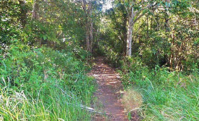 Z990- On top of the West Alupag River Ridge is this substantial (well used) trail going up hill and we followed it up. It may have started where we started to walk but we walked into the Alupag River valley per the local people’s advice. 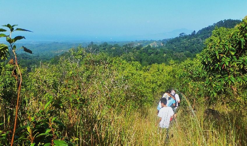 Z991- Now we have a west vista shot from the West Alupag River Ridge. Although not a clear shot in the distance is the entrance to the bay of Subic Bay with 2 ships anchored way out. 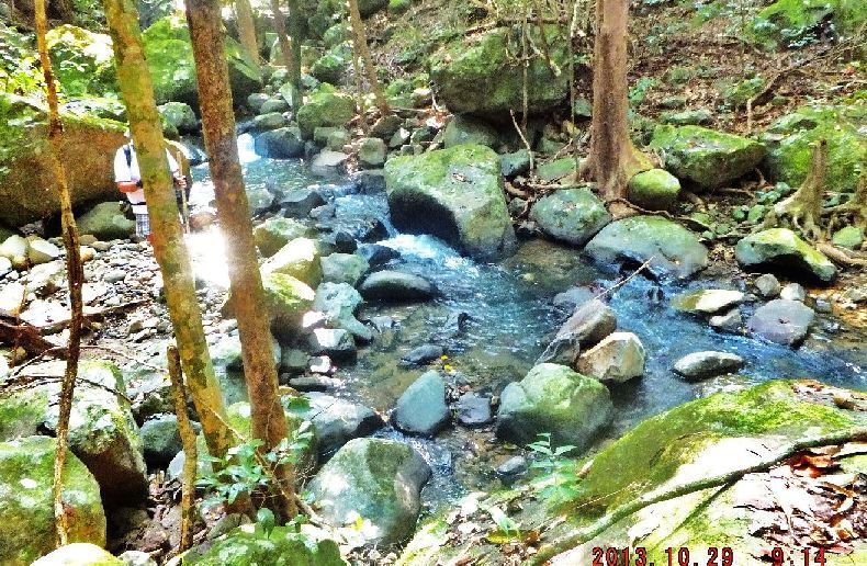 Z992- From the West Alupag River Ridge we descended to the Bayan-Dati River which starts from all the way east, here! My GPS device steered us to the turn-around-point of my of my 22nd Oct. 2013 walk to here when I followed trails along the Bayan-Dati River. 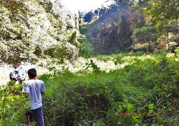 Z993- The river in the last picture and this clearance were my turn-around-point of my of my 22nd Oct. 2013 walk to here when I followed trails along the Bayan-Dati River. That was the goal of this walk, to prove that it was relative easy to walk from the Morong area, around the Mauban Defense Line and descend down to the West Bataan Road and block it behind the Phil-Am Mauban Defense line. True, I done it in stages but it turned out to be easy!  Z994- After that we walked back up to the West Alupag River Ridge, then looked for a trail, found it, that lead us around the head water of the Alupag River Valley. We followed it and are now on the East Alupag River Ridge. In the distance is the finished but unused Bataan Nuclear Power Plant. 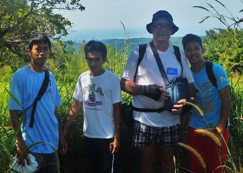 Z995- Four of us five Filipino Scouts at our task following the possible Japanese March in blocking the Bataan West Road behind the Phil-Am Mauban 1942 Defense line.  Z996- We are looking back, that is the head water area of the Alupag River Valley. So we marched thru that, around that, from the left ridge to here. 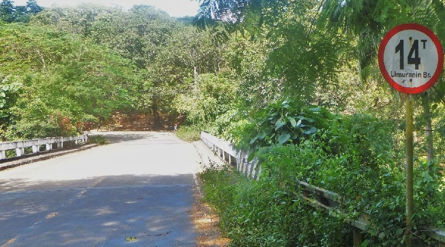 Z997- This bridge over the Alupag River (name is from my US Army map) was our starting point. I’m parked just behind those trees at left. The name of the sign, is it just for the bridge or is it the locale name for the river? We came down onto the West Bataan Road a few hundred meter up road, behind us and followed the road back to here. 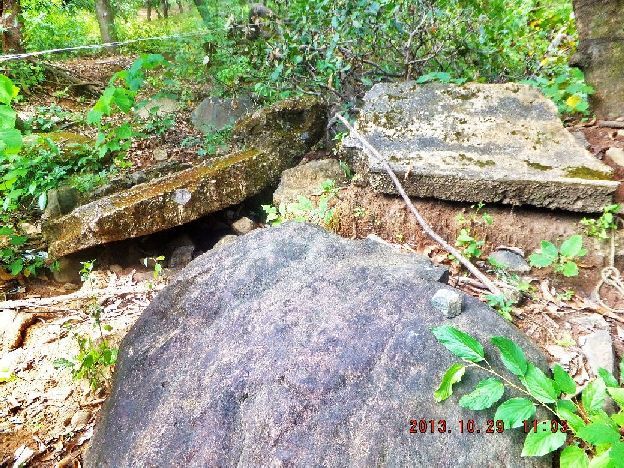 Z998- The local resident near the bridge called this a fox hole. I doubt that even the Phil-Am defenders had the time to have concrete structures here. Perhaps they are connected with previous bridge work. It was located near the bridge. But we were told by several people, that near this river and bridge were several “Fox Holes”. 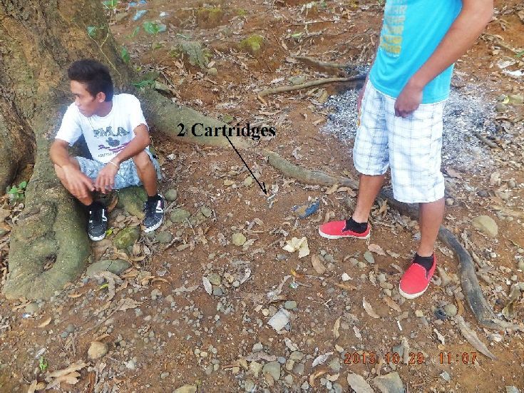 Z999- The two cartridges were laid there by my partner, he misunderstood me. I wanted him to hold up the cartridge he had found here near by and I wanted to shoot the picture of him holding up his prize. 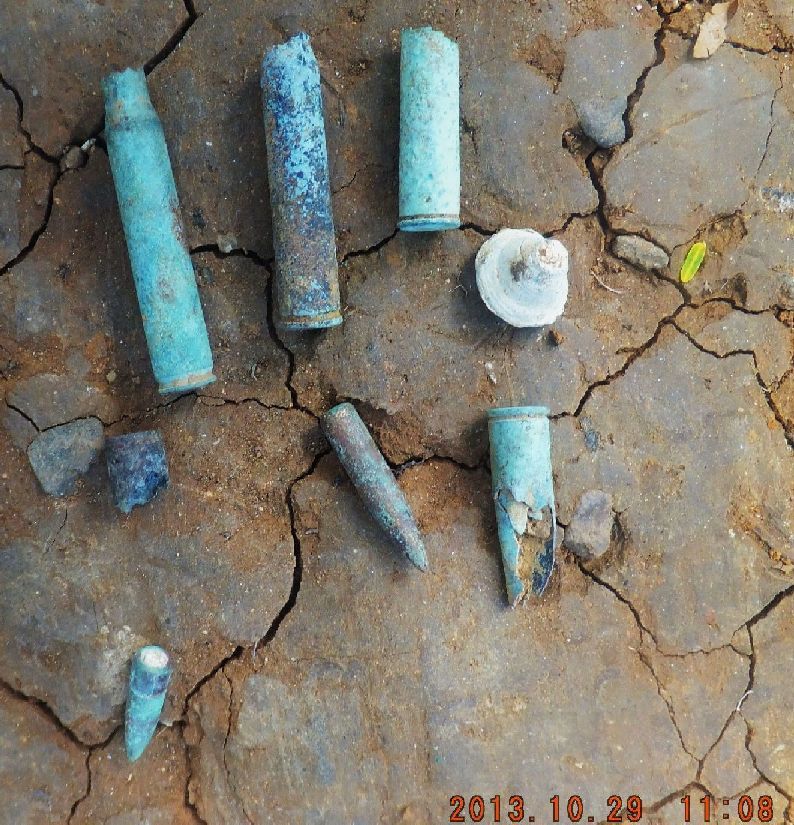 Z1000- Except for the long cartridge, all the items in this picture, were given to us by the local resident by the bridge. He said they were found near by. What was more important is that he said, down this road a little used to be a Japanese Marker (maybe a small stature) and I did not follow this up, my mistake. But indeed, if it was true, that is significant to me, that could mean that the fighting was here and the Japanese returnees placed their marker here because of it. I will follow up. My next goal will be to look at the route the Phil-Am Forces had to use to retreat. |
|
|
|
Post by Karl Welteke on Nov 5, 2013 21:07:49 GMT 8
HERE IS MY 5TH SEGMENT OF THE ARMY PUBLICATION:
-The Fall of the Philippines- section: Action against I Corps: The Mauban Line.
The initial Japanese block had been established by only a portion of the 3d Battalion, 20th Infantry. During the day the rest of the battalion picked its way along circuitous routes around blocked trails and down the steep slopes of Mt. Silanganan to join in the defense of the roadblock. Meanwhile, the build-up on the American side continued as additional forces from the 91st Division were released for the impending battle. Scouts of the 26th Cavalry and Company C, 194th Tank Battalion, were also ordered to the threatened area in an all-out effort to clear the road. Colonel Rodman, 92d Infantry commander, was placed in command of the entire force.
The attack opened on the morning of the 22d with an attempt by a platoon of tanks to break through the block and establish contact with the 1st Division to the north. By this time the Japanese had constructed antitank obstacles and laid mines, which, with the fire from their 37-mm. antitank guns, effectively held up the tankers. When the two lead tanks of the 194th 2343 disabled by mines, the remaining tanks of the platoon were held up and the attack stalled.
Next, Rodman sent an under strength motorized squadron of the 26th Cavalry and the 3d Battalion, 72d Infantry, against the roadblock. This attack was initially successful and the Filipinos reached a ridge near the roadblock. But all efforts to eliminate the block met with failure. Meanwhile, the 122d Infantry continued t engage Colonel Berry's 1st Division troops along the main line of resistance.
During the next few days Rodman attempted again and again to drive out the Japanese, first by frontal assaults and then by flanking attacks. A general attack by all units in contact with the enemy was delivered at daylight of the 23d but failed to gain any ground. Later in the day the 1st Battalion, 2d Constabulary, in an effort to outflank the enemy and establish contact with 1st Division units, slipped through the jungle south of the roadblock and at nightfall emerged in the vicinity of KP 172, from where it could attack the enemy from the west. Without explanation, however, the Constabulary withdrew during the night to its former position. The next morning, 24 January, the 1st Battalion, 91st Infantry, and the 3d Battalion of the 72d attacked the roadblock from the east. Despite support from the Constabulary, which delivered a limited attack from the south, this effort to penetrate the block also proved unsuccessful.
Rodman's inability to make progress against the roadblock could not have been due to a shortage of troops. By 24 January he had under his command the 2d Battalion, 92d Infantry; 1st Battalion, 91st Infantry; 3d Battalion, 72d Infantry; the 2d Squadron, 26th Cavalry; two battalions and a howitzer company from the 2d Constabulary, attached to I Corps on 22 January; as well as other mixed detachments. All of these units, it must be added, were under strength, tired, poorly fed, and, except for the 26th Cavalry squadron and the howitzer company, had no automatic weapons at all.
|
|
|
|
Post by Karl Welteke on Nov 9, 2013 14:43:32 GMT 8
HERE IS MY 6TH AND LAST SEGMENT OF THE ARMY PUBLICATION:
-The Fall of the Philippines- section: Action against I Corps: The Mauban Line.
Against this array of units Colonel Nakanishi had only a single battalion, less one company. Moreover, the Japanese probably suffered greater hardships than their opponents. It is extremely doubtful that Kimura was ever able to establish a supply route over the mountains and through the I Corps line to the men at the roadblock. Nor is there any definite evidence of enemy air drops to Nakanishi's troops. His men probably had no supplies
--283--
other than those they had carried across the mountain. Their staunch defense of the roadblock in the face of such strong opposition was therefore the more remarkable, explainable only by the difficulty of the terrain, which favored the defender, by training, and by determination.
While the fight for the roadblock was being fought to a standstill, the Japanese continued to push against the main line of resistance. Their advance was contested by Colonel Berry's 3d Infantry and elements of the 1st Infantry, but by evening of the 24th the "situation was desperate and rapidly growing worse."[42] The line was under attack from the north, ammunition was short, and the supply route had been cut. The 1st Division troops, whose food stocks were low when the roadblock was established, were suffering from a real shortage of rations. Under the circumstances there was little for Colonel Berry, who for all practical purposes was now commanding the 1st Division, to do except to abandon the main line of resistance. His position was untenable, his supplies gone, his men exhausted and hungry. He could not even rely on continued artillery support since Colonel Fowler's ammunition was exhausted. On his own responsibility, after consultation with Colonel Fowler and Maj. A.L. Fitch and without permission from General Wainwright, Berry made the "inevitable" decision to withdraw.[43]
Having made his decision, Berry still had a difficult problem to face. By what route would his men withdraw and what equipment could he save? On his front was the 122d Infantry; to his rear was the 3d Battalion, 20th Infantry, firmly in position along the roadblock. With the West Road blocked, Colonel Berry had only one route southward, the narrow beaches paralleling the South China Sea coast line. If he used this route, he would have to abandon his vehicles, Colonel Fowler's artillery, and all heavy equipment. Moreover, he would be without cover from air attack while he was on the exposed beaches. Knowing all this, Berry had no choice but to withdraw along this route.
On the morning of the 25th the order to withdraw was issued. All guns, trucks, and equipment which could not be moved along the beaches were to be destroyed. "My officers and myself," wrote Colonel Fowler, the artillery commander, "destroyed the guns with tears in our eyes."[44] At 1030 the withdrawal began, with men bearing the wounded on improvised litters leading the way. Covering the withdrawal was the 1st Battalion, 3d Infantry, blocking the West Road along the slopes of Mauban Ridge. Colonel Rodman's men kept the beaches clear of Nakanishi's patrols by pressing in against the roadblock from the west.
The withdrawal of the 1st Division from the main line of resistance was made by battalion, from east to west. The route of withdrawal ran westward through the battalion support area to me West Road and then along it to the 3d Infantry command post. From here the troops scrambled down trails to the water's edge, where a station was established to direct the men on their way toward Bagac. By noon of the 25th an estimated
--284--
1,000 men had "infiltrated south"; of this number about one fourth were clad only in underwear, carried no arms, and passed as civilians.[45] By nightfall the main force had reached the beach from where the men made their way south as best they could. The withdrawal continued during the night, the covering troops pulling back under cover of darkness to join their comrades in the flight to safety.
The difficult task of disengaging the enemy and moving a large number of men to the rear along a dangerously exposed and inadequate route of withdrawal was accomplished with a minimum of loss and confusion. The maneuver had been well planned and executed. Only one tragic fact marred the success of the withdrawal--the loss of the artillery. Altogether, twenty-five pieces, of which fifteen were 2.95-inch mountain guns and the rest 75s, had to be left behind. These had been emplaced just behind the infantry when the line was set up. Their destruction by the retreating artillerymen left I Corps with but two 155s and four 75-m. guns (SPM).[46] At least the destruction was accomplished with the greatest efficiency for the Japanese failed to report the capture of any large number of guns.
Presumably when the 1st Division elements and the artillery withdrew from the Mauban line, the other units to its right, the 31st Field Artillery and Company K of the 1st Infantry, also pulled back. There is no record of their movement beyond scattered references to Filipino troops infiltrating to the south.[47]
By evening of the 25th the Mauban line had been evacuated. That night MacArthur reported to the War Department that enemy pressure on the left had forced him "to give ground with some loss including guns of the obsolete 2.95 type."[48] The situation, he asserted, had been stabilized and "for the present the immediate danger is over." At the time he sent these reassurances to Washington, the enemy had already scored a great victory against II Corps and the withdrawal of both corps was in progress.
|
|
|
|
Post by Karl Welteke on Nov 10, 2013 13:13:33 GMT 8
SIXTH OFFICIAL WALK IN THE MAUBAN DEFENSE LINE AREA 2013-11-07 THE RETREAT ALONG THE COASTLINE. The purpose of this walk is to get a feel of how the Phil-Am Forces had to retreat along the coast line. First I stopped at the PNP Outpost in the area and ask for information. They gave me instructions how to get down to the Gatuan Beach via Sitio Tatlong Poste. But they did not know anything about the Post War Japanese activities here. It was an easy walk to the beach. Locals advised me to go over the ridge and that was a good trail and not hard. The next cove was also a sandy beach. Here again I choose to use a trail to go up the next ridge and over. In my 20 year experience of walking here at Philippine Coast lines it has many times more easy to walk over the ridge lines instead around the rocky points. The Phil-Am troops may have done that too. On the 2nd ridge I lost the trail because the forest here was really easy too walk and the trail became indistinctive. It would have been easy to continue with a compass but that is against my personal safety rules. So I turned around and one day in the future I will start from the opposite end and connect those trails. I learned that walking around the points here is difficult and the Phil-Am Forces very well may have chosen walking across the ridge lines where it was beneficial. At Sitio Tatlong Poste I talked to the residents and asked about the Japanese Marker. They said yes and took me to a location. The trouble with my limited Tagalog and their limited English is that I don’t know what they are trying to tell me. What I gather is that Japanese have come here after the war and did some searching and the residents became aware of rocks that are perceived as markers. The pictures of this walk and my observations of this trail will be presented in another segment. Here is the walk image data from my 6th walk: 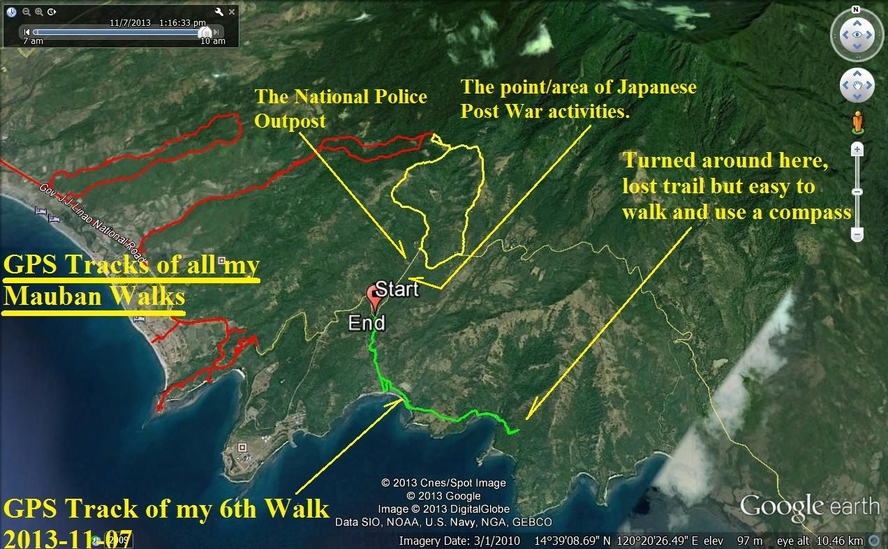 Z1015- The big picture of my sixth walk in the Mauban Defense line. It has all of the 5 recorded GPS tracks and I indicated where the Police Check point is and where a person from Sitio Tatlong Poaste showed me where they believe, the Japanese searched and left a marker or markers. 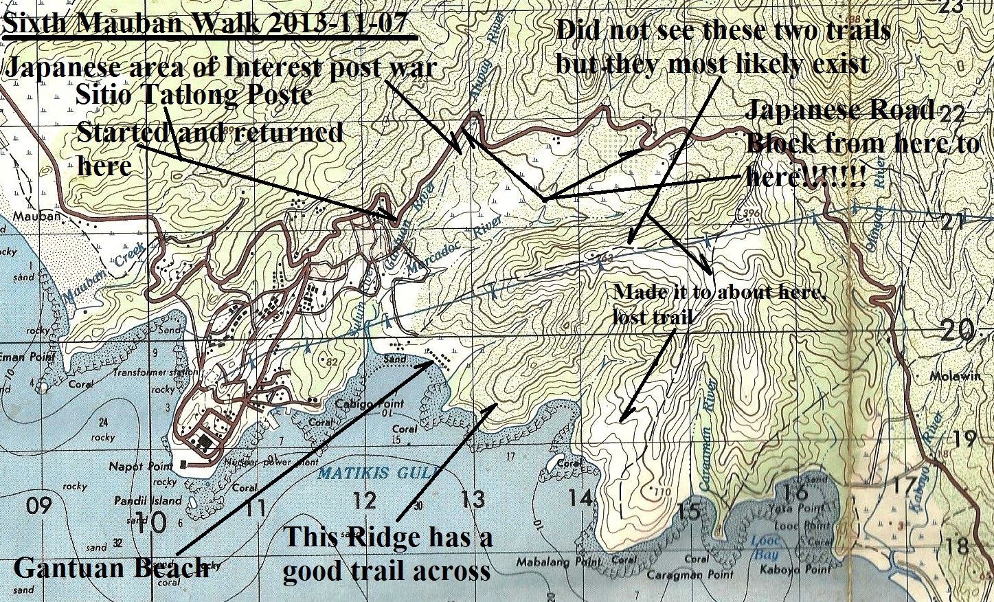 Z1016- A section of a 1:50000 map of the area, marked up by me with the landmarks of this walk.  Z1016- A section of a 1:50000 map of the area, marked up by me with the landmarks of this walk. A bigger copy! 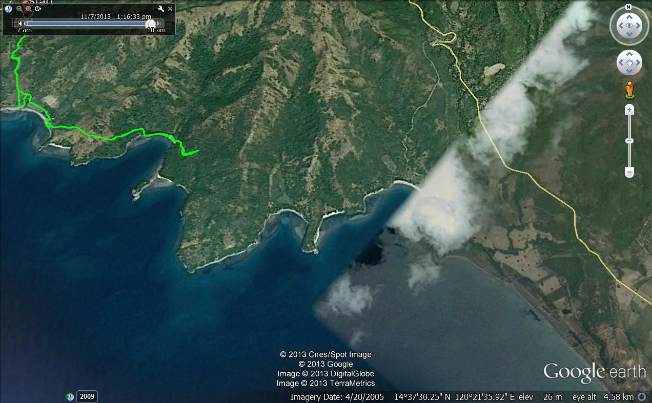 Z1017- An unmarked GE image of the area the Phil-Am troops had to cover on their retreat. It has my GPS Track and the end where I turned around. 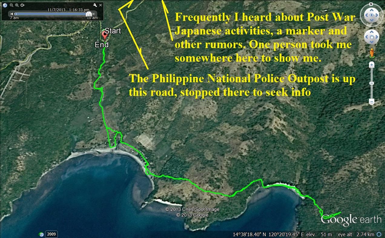 Z1018- My GPS Track of my 7th Nov 2013 walk zoomed in with GE. 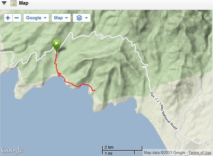 Z1019- A simplified terrain image of the Mauban Line retreat route. The actual numbers of the walk data: Mauban Phil-Am Retreat Route, Walk No 6 Thu, 2013 Nov 7 8:57 China Standard Time Activity Type: Walking Event Type: Recreation Started at Tatlong Poste, went down to Gantuan, over one ridge and up another, lost trail and returned. Summery: Distance: 7.86 km Time: 4:19:19 Avg Pace: 32:58 min/km Avg Speed: 1.8 km/h Elevation Gain: 270 m Timing Time: 4:19:19 Moving Time: 2:30:30 Elapsed Time: 4:19:19 Elevation Elevation Gain: 270 m Elevation Loss: 273 m Min Elevation: 7 m Max Elevation: 87 m 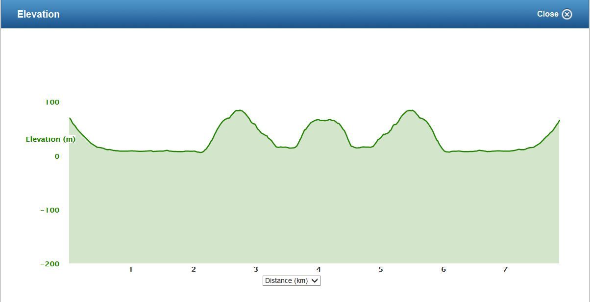 Z1020- The elevation profile of the walk. |
|
|
|
Post by Karl Welteke on Nov 11, 2013 14:54:55 GMT 8
IMAGES OF MY 7th NOV. 2013 WALK IN THE MAUBAN DEFENSE LINE AREA. THE COASTAL RETREAT ROUTE BECAUSE OF THE JAPANESE ROAD BLOCK. Here are the 83 images from that walk in this album: s74.photobucket.com/user/PI-Sailor/library/Manila%20Bay%20Forts-Other/Mauban%20Line%20Bataan/Retreat%20along%20Coast%202013-11-07?sort=6&page=1The purpose of this walk was to get a feel of how the Phil-Am Forces had to retreat along the coast line. It was an easy walk to the beach. Locals advised me to go over the ridge and that was a good trail and not hard. The next cove was also a sandy beach. Here again I choose to use a trail to go up the next ridge and over. On the 2nd ridge I lost the trail because the forest here was really easy too walk and the trail became indistinctive. It would have been easy to continue with a compass but that is against my personal safety rules. So I turned around and one day in the future I will start from the opposite end and connect those trails. I learned that walking around the points here is difficult and the Phil-Am Forces very well may have chosen walking across the ridge lines where it was beneficial. Eleven sample images are posted here, remember the pictures in the above album are much larger, refer to the maps and data in the last and previous segments: 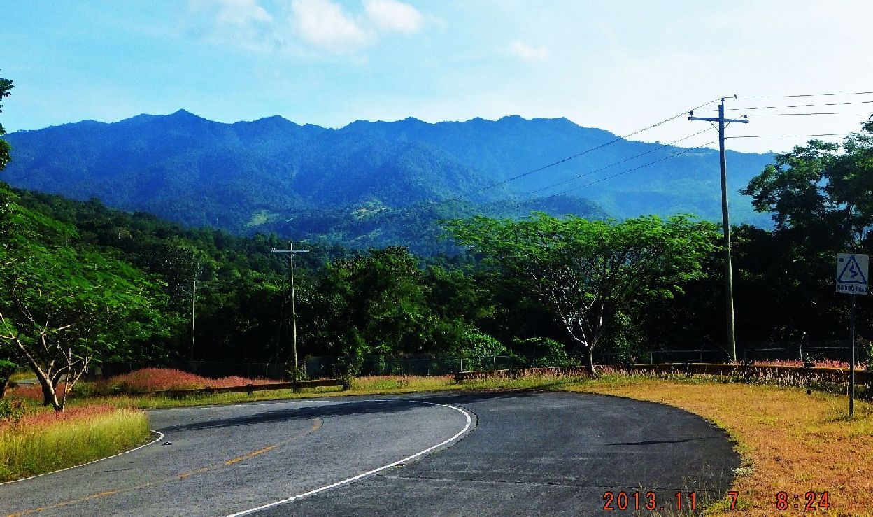 Z1025- This view is from in front of the gate to the unused Bataan Nuclear Corporation power plant (NPC). All those slopes of Mt. Silanganan (all are peaks of the west side rim from the Mt. Natib huge caldera) drain into the Gantuan Beach which is where the Phil-Am Forces descended to and started their retreat along the coast. Those grass patches in the middle of the images is where my partners and I descended on our 29th Oct. 2013 walk. 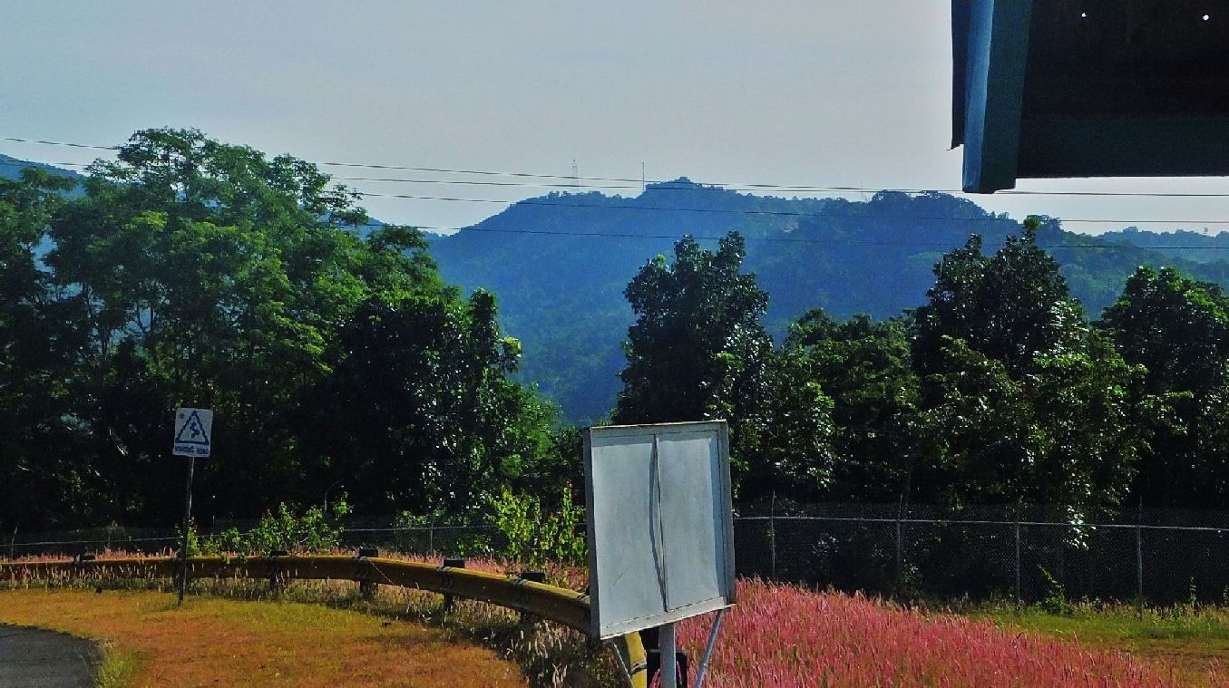 Z1026- Again this is an image from in front of the gate to the unused Bataan Nuclear Corporation power plant (NPC). That tower in the middle of the image is an important landmark for me, navigating around these hills. It is just above the pass where the Bataan West Road crosses a high ridge that separates the Morong and Bagac watershed areas. The high voltage power line towers from the unused Bataan Nuclear Corporation power plant also pass there. 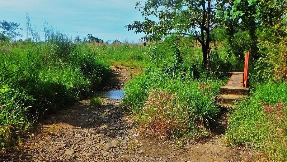 Z1027- After I checked with and National Police checkpoint further down the road, I proceeded to Sitio Tatlong Postes, back this direction a little, and descended from there to the Gantuan Beach area which is also a community. I crossed across 4 bridges like this one. This area must have been part or still is part of the NPC because the trail went thru a hole in the fence. Check it out in the album above! 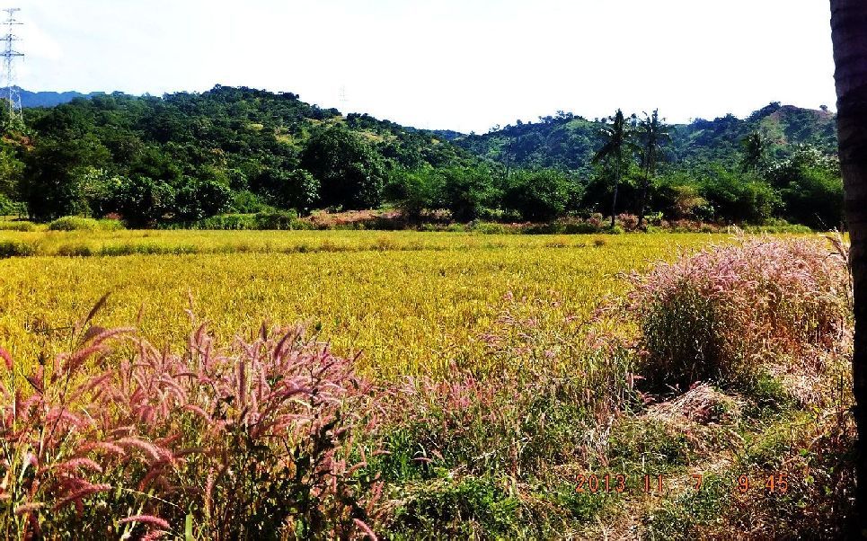 Z1028- I am proceeding SE between the beach and these ridges. On the left ridge the power lines of the unused Bataan Nuclear Corporation power plant (NPC) run up and cross the high ridge ahead where we seen that communication tower in the previous picture. 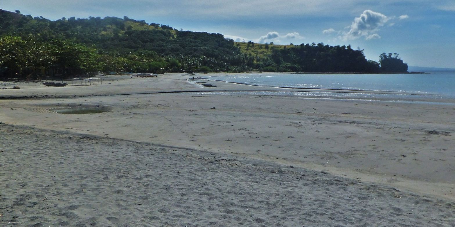 Z1029- This is the SE end of the Gantuan Beach area and I choose, after asking the people how best to get around or over that ridge ahead, to use the trail that runs up and thru that thick grove of trees in the middle of the picture. That was a good trail and based on my walking experience was a better choice than navigating along the coasts on foot. 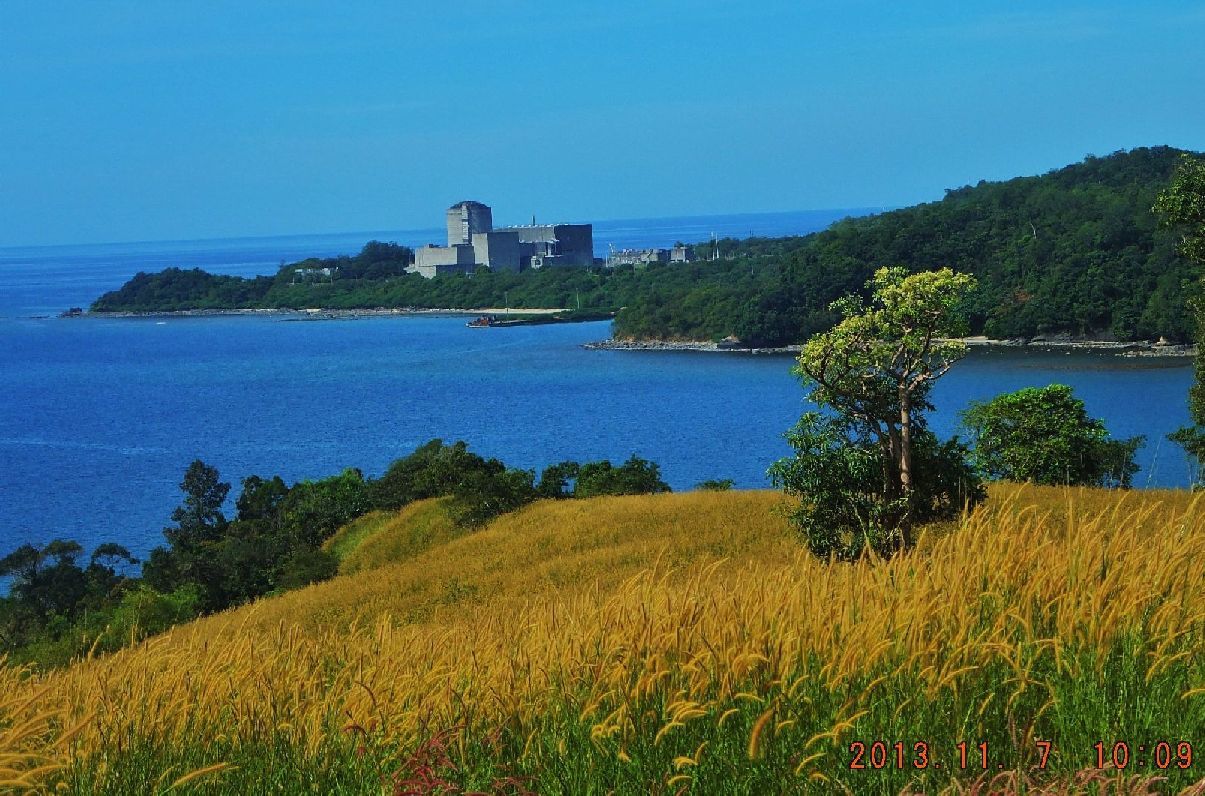 Z1030- Much of the ridge I crossed was grassy and so I got a good view of the unused Bataan Nuclear Corporation power plant (NPC). 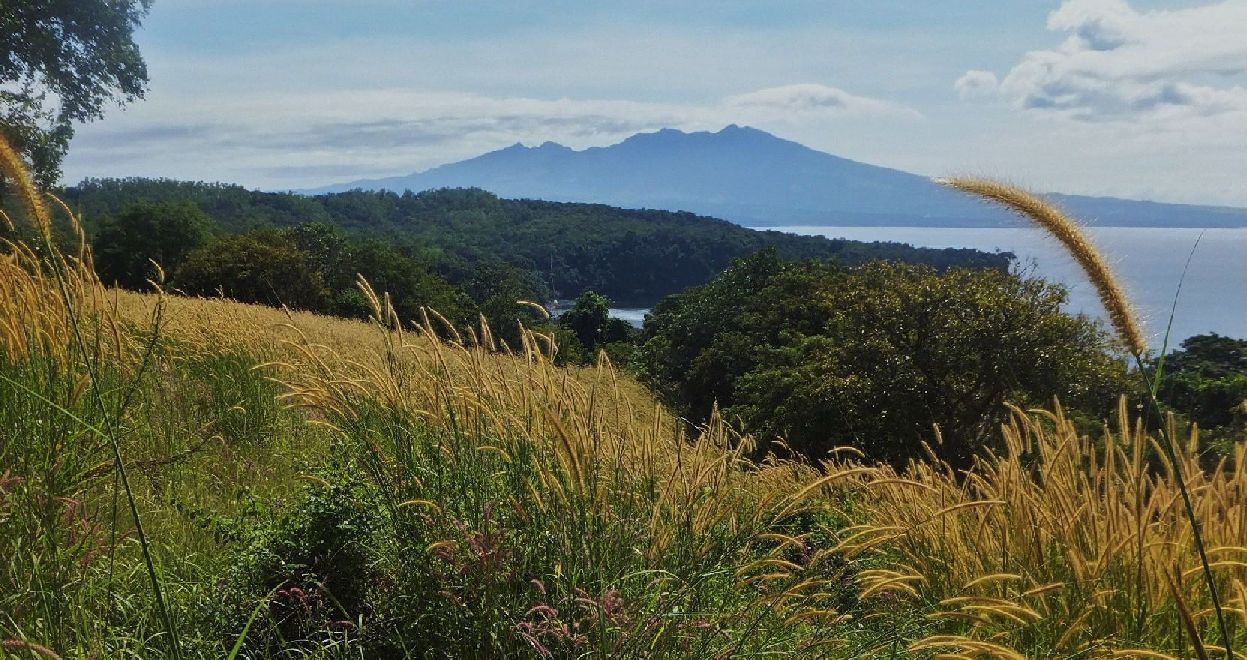 Z1031- Then the next cove/bay and the next ridge line came in view. In the distance is Mt. Mariveles volcano. 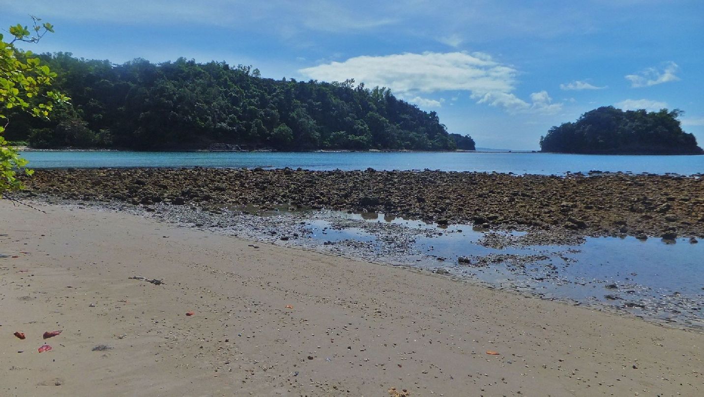 Z1032- I descended to the next beach and after I looked at that shore I was convinced to go over the next ridge is a better way. Some Bagac fishermen there showed me the way. On top of the ridge the trees were so spaced and the ground was pretty much level that it was a piece of cake to walk thru this forest. But the trail became indistinctive because of the easy walking condition and so I lost the trail. At this particular situation I decided against continuing by compass only and turned around and went back. After studying the GPS track and maps later, I think I proved my point and got a feel, as to how the retreating Phil-Am Forces may have executed their retreat. On an other day I will start a walk from the other side, SE side, and connect the track. I should have shot pictures of that forest but I failed to do it, to show you how easy it was to walk thru this tropical forest. 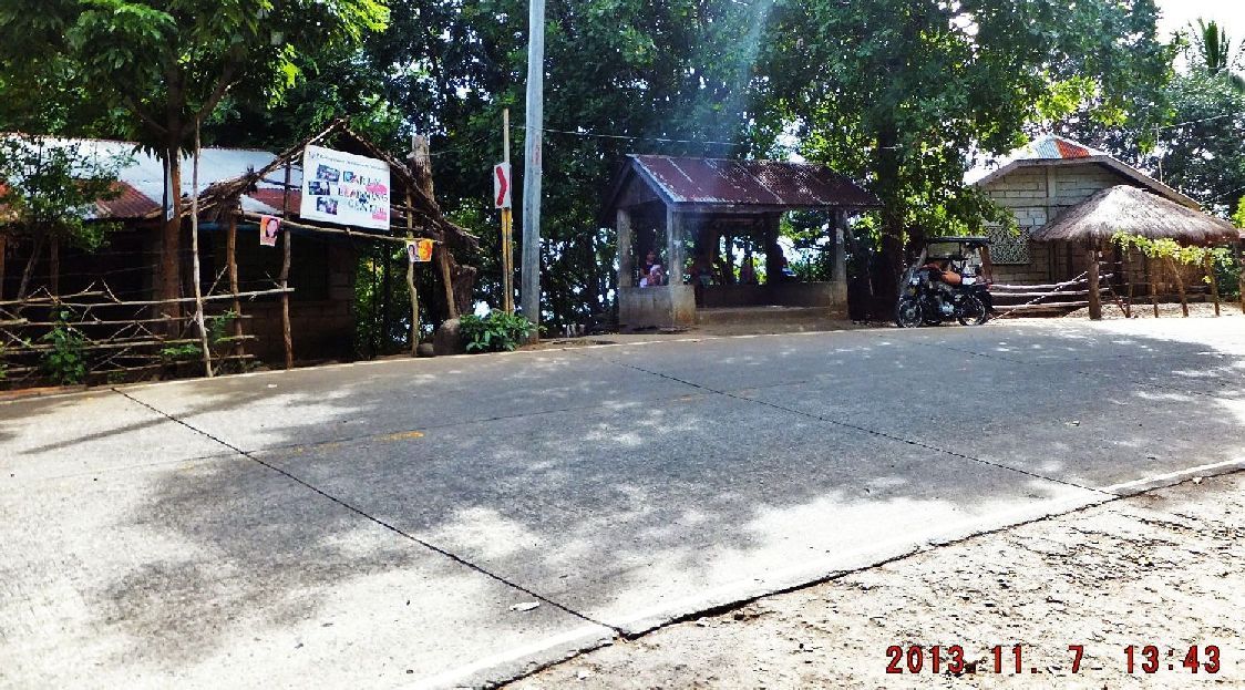 Z1033- This is Sitio Tatlong Poste and just left of that waiting shed is a concrete walkway that leads down to Gantuan Beach. Here again I asked about the Japanese marker and a person was willing to show me. It is towards the area where we started the Japanese Road Block walk on the 29th Oct 2013, maybe only 200 meters from the start of that 29th Oct. walk. And the National Police Check point and camp was only about 50 meters away. 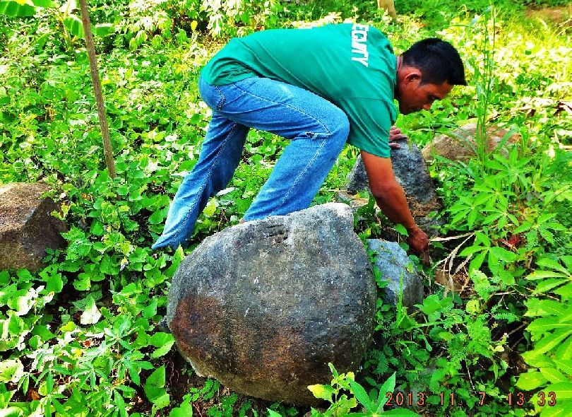 Z1034- This fellow volunteered to show me and he said he was looking for a rock with a 5 finger marking (a hand) on it but could not find it. In the next picture, on that rock, it seems some markers existed but are now unreadable. 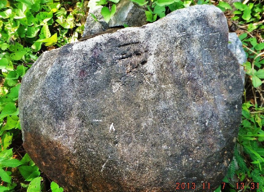 Z1035- This is the rock, my guide took me to and it seems that some markers existed but are now unreadable. Well I can’t tell what was here in the past but one thing I’m sure of that at one time in the past (Post WWII) Japanese were interested in this area. Is that another indicator that this area was part of the Japanese Road Block? |
|
|
|
Post by okla on Nov 14, 2013 9:18:15 GMT 8
Hey Karl...I just wanted to send along another "well done" to you on presenting to us "Geeks" the fruits of your retracing the Mauban Line actions. This, is as per usual, good stuff. I have long felt that this sector has been largely, if not overlooked, neglected in the story of the Bataan Campaign. I suppose this is due to the fact that most of the heavier fighting took place further East in Parker's II Corps, i.e., Abucay, the Mt Samat breakthru, etc. although the "Pockets" fighting took place, largely, astride the I Corps, II Corps boundary. Of course, we all know that the "Points" struggle was in the Reserve Area. Anyhow, thanks again for posting this very interesting material. Postscript....So glad you and yours were spared the wrath of the horrendous Typhoon.
|
|
|
|
Post by Karl Welteke on Nov 18, 2013 16:03:03 GMT 8
SEVENTH OFFICIAL WALK IN THE MAUBAN DEFENSE LINE AREA 2013-11-16 THE RETREAT ALONG THE COASTLINE CONTINUED. The purpose of this walk is to finish exploring the Phil-Am Retreat Route. The last walk, the 6th on 2013-11-07 one, was only half successful. On Mabalang Point Ridge I lost the trail, although it was easy to walk thru the forest, I decided to call it quits . This time I started from the Bagac end of the retreat route. The Google Earth image of this area showed a road going to the beach. It was a good concrete road and it lead me to Sitio Look, Pinaitan and La Salle; all are part of Barangay Banawang of Bagac Municipality. The road is not recorded yet on the old map I provided here, I drew it in! I talked to the locals and asked for a guide to help me. A caretaker of a resort beach was willing to walk with me and he brought a companion who lived on a beach, 2 coves up the coast on our route. I was able to drive all the way to the resort in Sitio Pinaitan, park there and we proceeded. We walked on a trail around the first valley/beach/cove (Yasa Beach) and descended down to the Karagman beach/bay/cove and at the far end was a trail that ascended to the Mabalang Point Ridge. Then we descended down to the Lalamin Cove. The 2nd companion had his house in Karagman Beach and I met part of the family. We followed the coast line to the Matikis Beach, the care taker there remembered me and received me with a big welcoming grin when he saw me. After shooting the breeze I decided I wanted to return up to the Mabalang Point Ridge on the trail I used last time. Up there the trail disappeared again and we just walked thru the forest which was easy to do. I had my GPS which told what direction to go but we had to walk inland some distance to walk around the head-water of the Lalamin Creek. Eventual we got back on the trail we used to get here and returned to Sitio Pinaitan and drove to Sitio Look. My guide treated me to lunch and I showed my appreciation for all his help. In my 20 year experience of walking here at Philippine Coast lines it has been many times more easy to walk over the ridge lines instead around the rocky points. The Phil-Am troops may have done that too. I’m sure they didn’t have any problem getting trail information from the locals. I finally came to an other conclusion about walking in Bataan, I don’t remember seeing any charcoal burning going on. It seems in Bataan they are taking care of their forests now!!!!!! In my greater Subic Bay area there is a lot of charcoal burning going on!!!!!!!! The pictures of this walk and my observations on this trail will be presented in another segment. Here is the walk image data from this 7th walk:  Y56- A section from a 1:50000 size old US Military map of the area of today’s walk, the road I used to drive to Sitio (village) Look and Pinaitan is not on the map and I drew it in by hand. My Guide told me about all the landmark names and I wrote them onto this map.  A little bigger version: 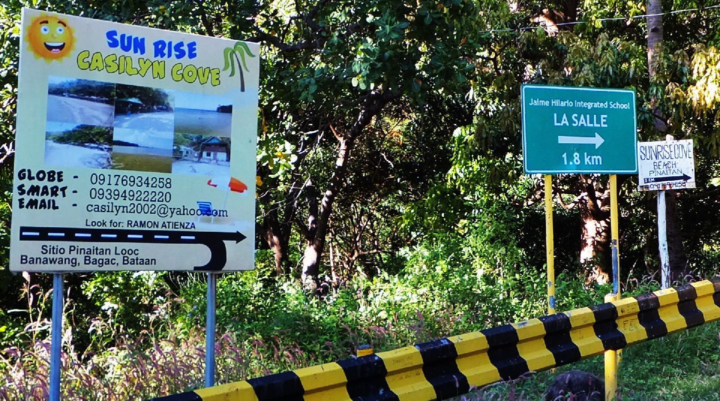 Y57- Direction signs at the start of the road to Sitio Look and Pinaitan, I shoot signs because they help remind me as where I have been. 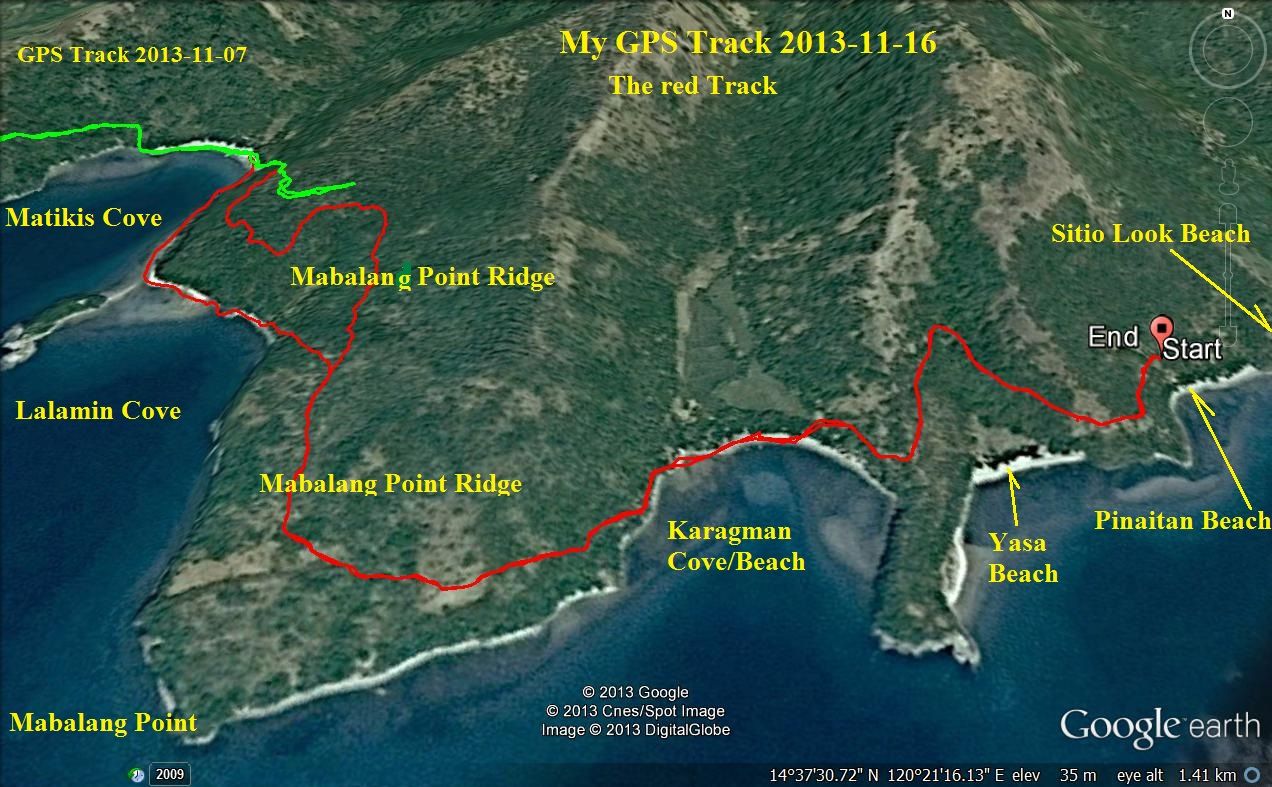 Y58- My GPS Track from this 7th Mauban Line Walk, it is the red one. This image also shows the end of the 6th Walk which is green in color. 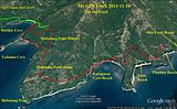 A little bigger version. 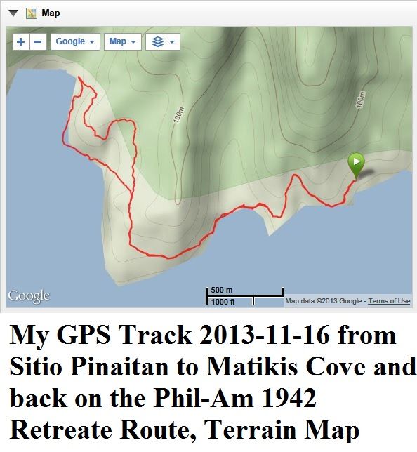 Y59- My Terrain map of this walk. 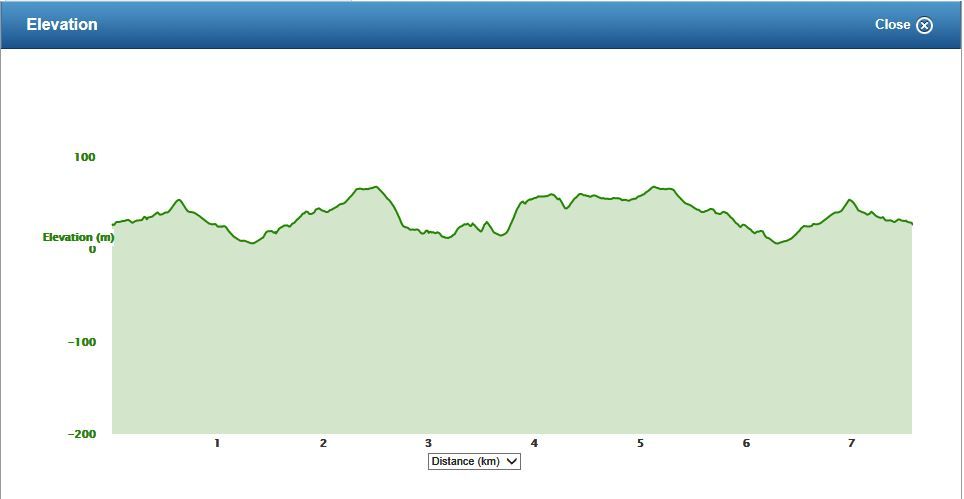 Y60- My elevation profile for this walk. Here is the actual walk data from my GPS devise. Mauban 7th Trip, Retreat 2nd Part Sat, 2013 Nov 16 8:37 China Standard Time Activity Type: Casual Walking Event Type: Special Event This time started on the Bagac end and with guides connected to the turn around point of my 6th Mauban trip. Summary Distance: 7.57 km Time: 3:20:02 Avg Pace: 26:25 min/km Avg Speed: 2.3 km/h Elevation Gain: 277 m Timing Time: 3:20:02 Moving Time: 2:13:24 Elapsed Time: 3:20:02 Elevation Elevation Gain: 277 m Elevation Loss: 277 m Min Elevation: 7 m Max Elevation: 69 m |
|
|
|
Post by Karl Welteke on Nov 19, 2013 9:43:43 GMT 8
IMAGES OF MY 16th NOV. 2013 WALK, THE 7TH WALK, IN THE MAUBAN DEFENSE LINE AREA. THE RETREAT ALONG THE COASTLINE CONTINUED. Here are the 41 images from that walk in this album: s74.photobucket.com/user/PI-Sailor/library/Manila%20Bay%20Forts-Other/Mauban%20Line%20Bataan/Retreat%20Two%202013-11-16%20from%20south?sort=9&page=1The purpose of this walk is to finish exploring the Phil-Am Retreat Route. The last walk, the 6th on 2013-11-07 one, was only half successful. On Mabalang Point Ridge I lost the trail, although it was easy to walk thru the forest, I decided to call it quits . This time I started from the Bagac end of the retreat route. The Google Earth image of this area showed a road going to the beach. It was a good concrete road and it lead me to Sitio Look, Pinaitan and La Salle; all are part of Barangay Banawang of Bagac Municipality. The road is not recorded yet on the old map I provided here, I drew it in! See map in the previous segment! Eleven sample images are posted here, remember the pictures in the above album are much larger, refer to the maps and data in the last and previous segments: 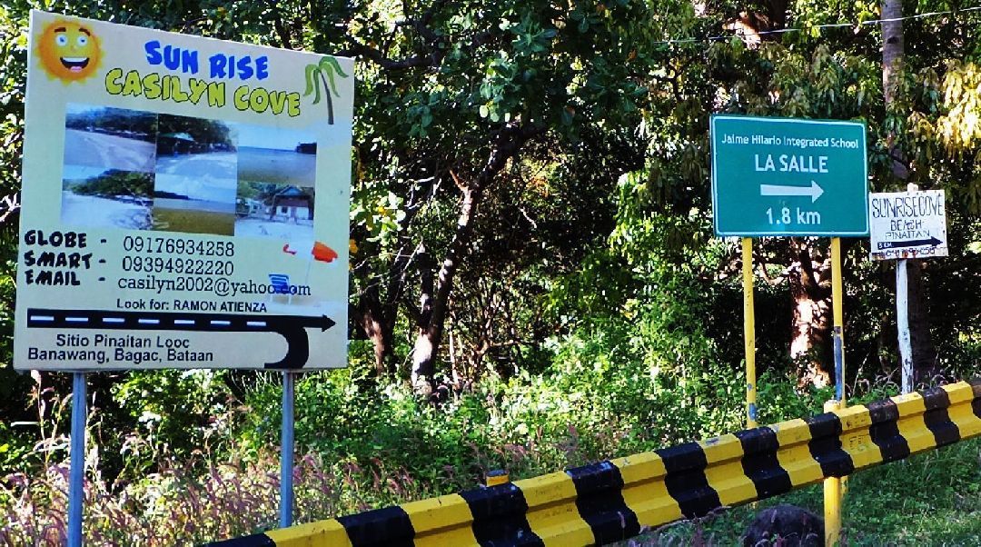 Y80- The entrance of the road to Sitio Look,-La Salle,-Pinaitan at the Bataan West Coast in Brgy. Banawang, Bagac. 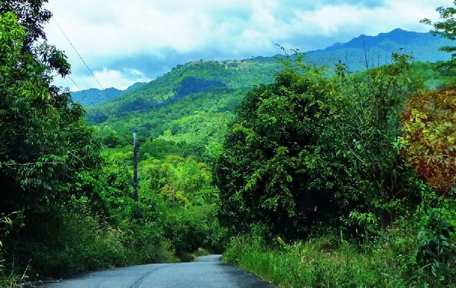 Y81- The road to Sitio Look,-La Salle,-Pinaitan at the Bataan West Coast in Brgy. Banawang, Bagac, looking back at the western peaks of the Mt. Natib caldera. 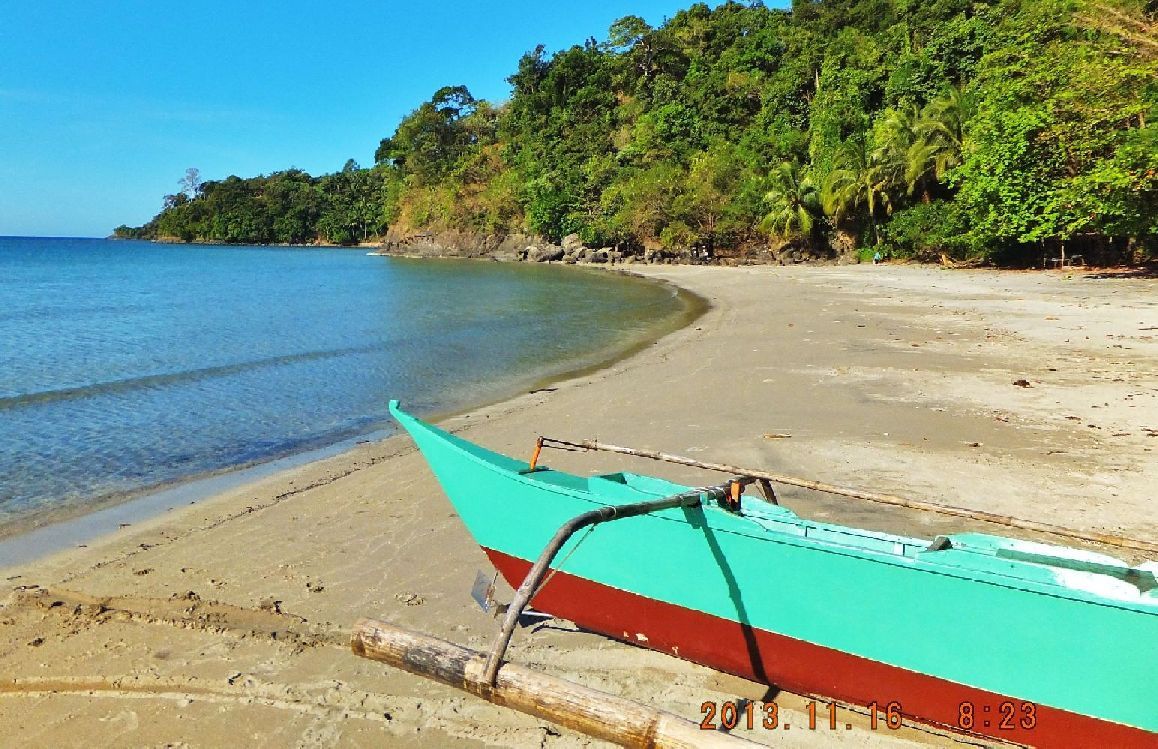 Y82- On the beach of Sitio Look and I am looking west, direction of Morong, and see Yasa Point and Caragman Point. 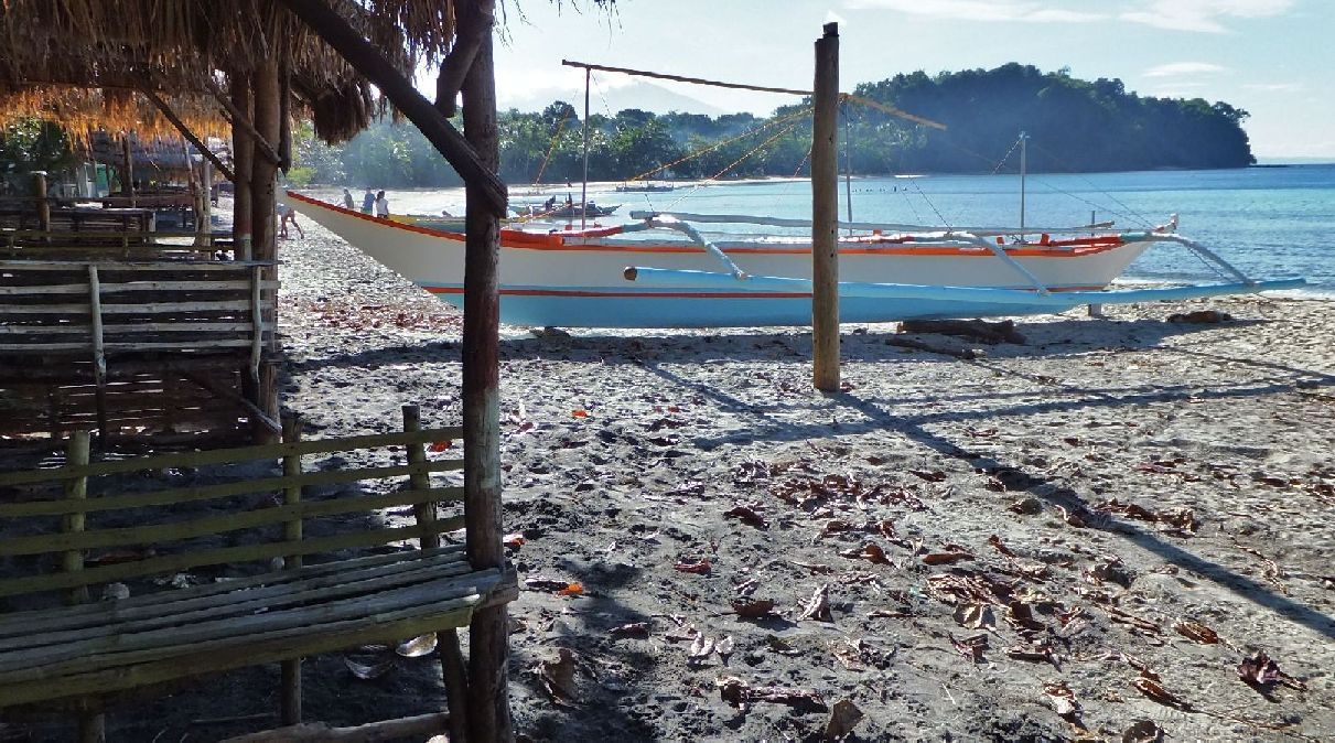 Y83- On the beach of Sitio Look and I am looking east in the Bagac direction. In 1942 that would have been one more ridge, the last point and ridge to cross or go around. It is the Kaboyo Point and ridge. I did not walk it. It would have been a piece of cake in 1942 and my old map in the previous segment shows a road went across at ancient times! 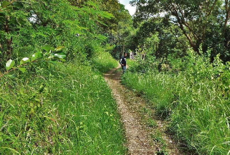 Y84- The first section of the trail was like this. My guide told me in the 1950s this was a logging road. 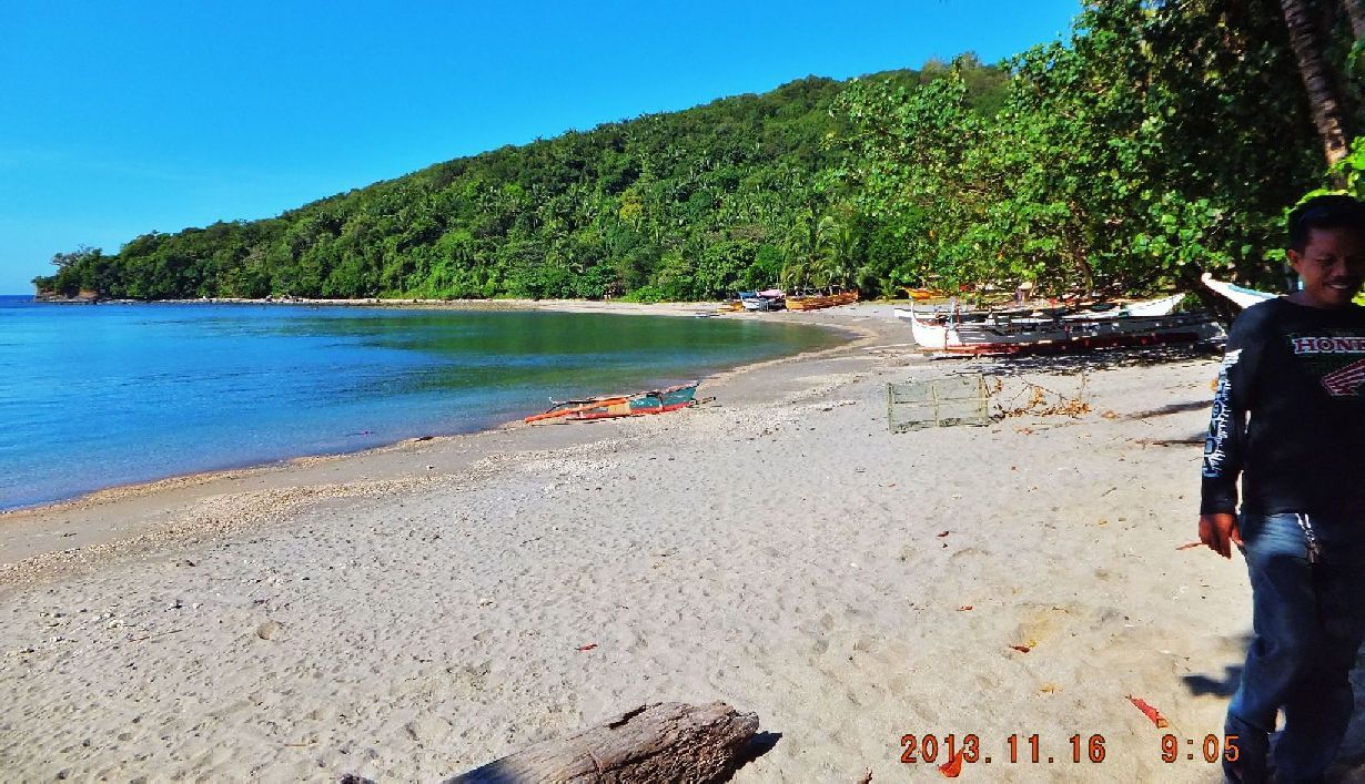 Y85- After we walked around the Yasa Bay/Valley we descended to the Karagman Beach/cove we are looking west, towards the Morong direction. In the distance is Mabalang Point. The trail ascends there and will go across the Mabalang Point Ridge.  Y86- At Karagman Beach/cove. One of my guide was living at this beach with his family and his daughter was happy to see her father. 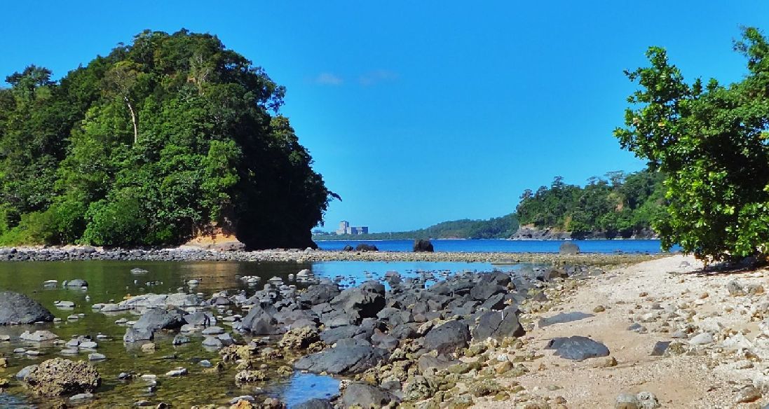 Y87- After a long march we have crossed the Mabalang Point Ridge line and we have descended to the Lalamin Cove. At the Lalamin Cove we will proceed along this rocky shore and go thru that gap ahead, between that island and the shoreline at right. It was difficult at places not getting your shoes wet. The idle Bataan Nuclear Power Plant (NPC) is in view. 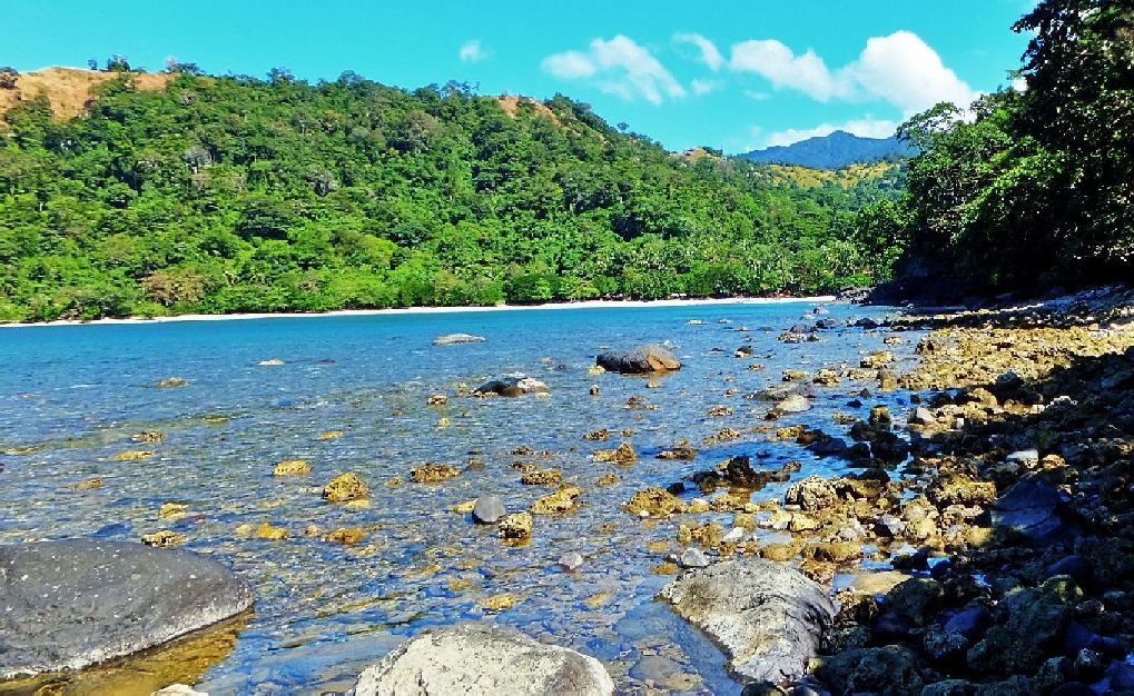 Y88- Matikis Beach/Cove is in view, our goal for today. On the 7th Nov. I reached it also from the Morong direction. We followed the coast line here to the Matikis Beach, the care taker there remembered me and received me with a big welcoming grin when he saw me (thinking “The Crazy Cano“). 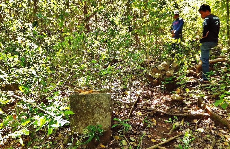 Y89- After shooting the breeze I decided I wanted to return up to the Mabalang Point Ridge on the trail I used last time. Up there the trail disappeared again and we just walked thru the forest which was easy to do. On top of the Mabalang Point Ridge we came across these 4 bases, for a tower, built by who, for who, for what purpose. In my 20 year experience of walking here at Philippine Coast lines it has been many times more easy to walk over the ridge lines instead around the rocky points. The Phil-Am troops may have done that too. I’m sure they didn’t have any problem getting trail information from the locals.  90- On top of the Mabalang Point Ridge, crossing it, and in the distance we can see Mt. Samat. All this is an adventure to me. I am happy to be alive and am able to retrace the tracks of history. |
|


