|
|
Post by Karl Welteke on May 30, 2015 14:53:32 GMT 8
This new thread is being started to show the many Battery Position Finder Stations of the Harbor Defense Command of Manila Bay and Subic Bay. Many of us who have visited the former Fort Mills on Corregidor Island and the other former forts on the other islands in Manila Bay and Subic Bay were intrigued by these many concrete bunker looking places. We have tried to find them all. But before we start presenting the 1st Station we should learn the symbols used to indicate these battery finder stations on the maps. Well, my first step was to ask fots2 and batteryboy for help and they responded promptly. Fots2 send me several things and I present the most important items as they pertain to this thread. 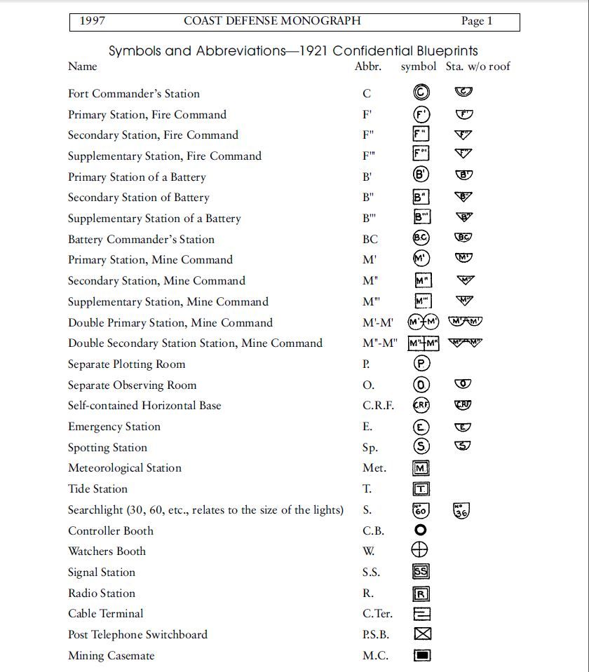 X464.Symbols and Abbreviations—1921 Confidential Blueprints 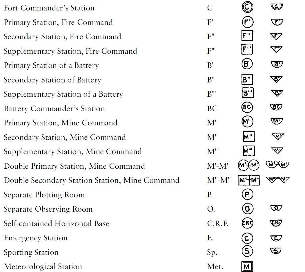 X465.Symbols and Abbreviations—1921 Confidential Blueprints, for clarity this section is zoomed in. 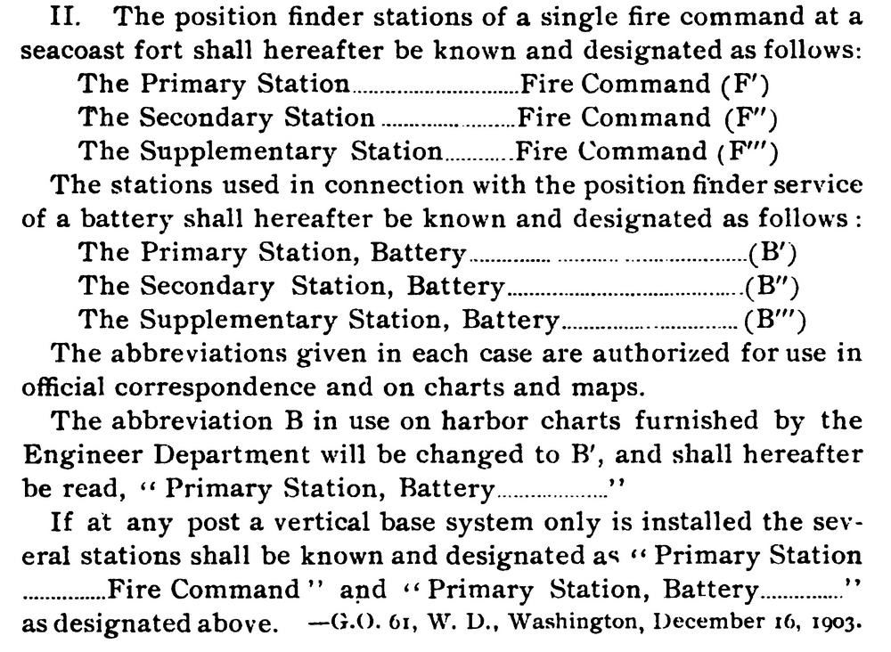 X466.Read the instructions page 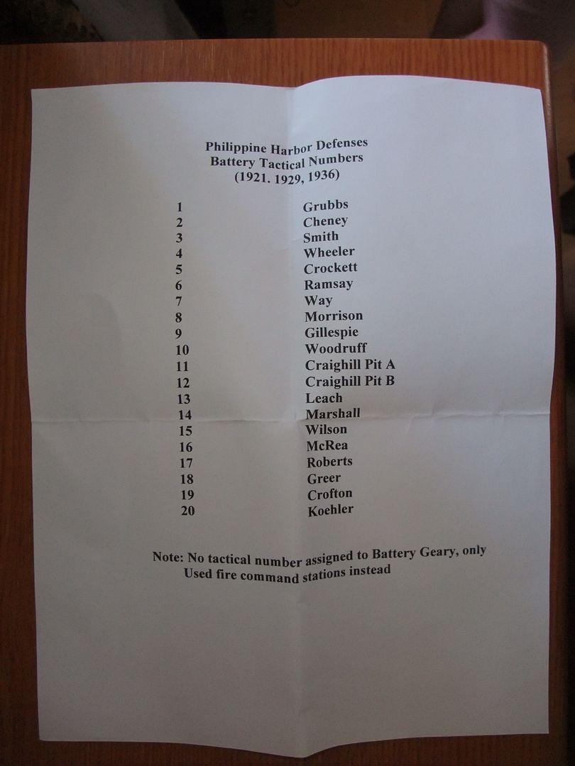 X467.Tactical numbers for the batteries. For example on the map you could see this (B’’’14) and it should mean (Supplementary Battery Station for Battery MarshaL) After fots2 and batteryboy responded to my call for help and I learned what to look for I found this in the internet from the Coastal Defense Study Group blueprints, Exhibits, and Site Plans Period Maps of US Army Coast/Harbor Defense Installations, 1900-45 Mark Berhow cdsg.org/old/reprint%20PDFs/symbols.pdf
|
|
|
|
Post by Karl Welteke on May 31, 2015 12:33:00 GMT 8
BATTERY POSITION FINDER STATION (B-III-14) or (B’’’14) This battery position finder station is located above and next to Geary Trail. It is not too far from Battery Geary, look for the map provided. This Supplementary Battery Station B-III-14 or (B’’’14) is for Battery Crofton perhaps. I saw the name written by it on one map only, a 1935 graph. A tactical battery list indicates that the number 14 is for Battery Marshall and the number 19 is for Battery Crofton. On 14th Jan. 2011 did I have the first close look at it. 503d Paratrooper Dick Adams was looking for his 1945 landing site, because he had drifted passed the landing zone, the golf course. Recently my CDSG friend Glen and I looked at it again. Some of the pictures from those two visits were put into this album with 22 images: s74.photobucket.com/user/PI-Sailor/library/Corregidor%20by%20subject/Battery%20Controls/B-III-14%20Crofton?sort=9&page=1or tinyurl.com/pd49vlnAs usual I present 6 sample images here and they are much smaller than in the above album: 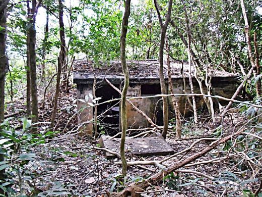 X468. View of (B-III-14) or (B’’’14) battery position finder station as one approaches it from the rear. This is a 15th Jan. 2011 image. 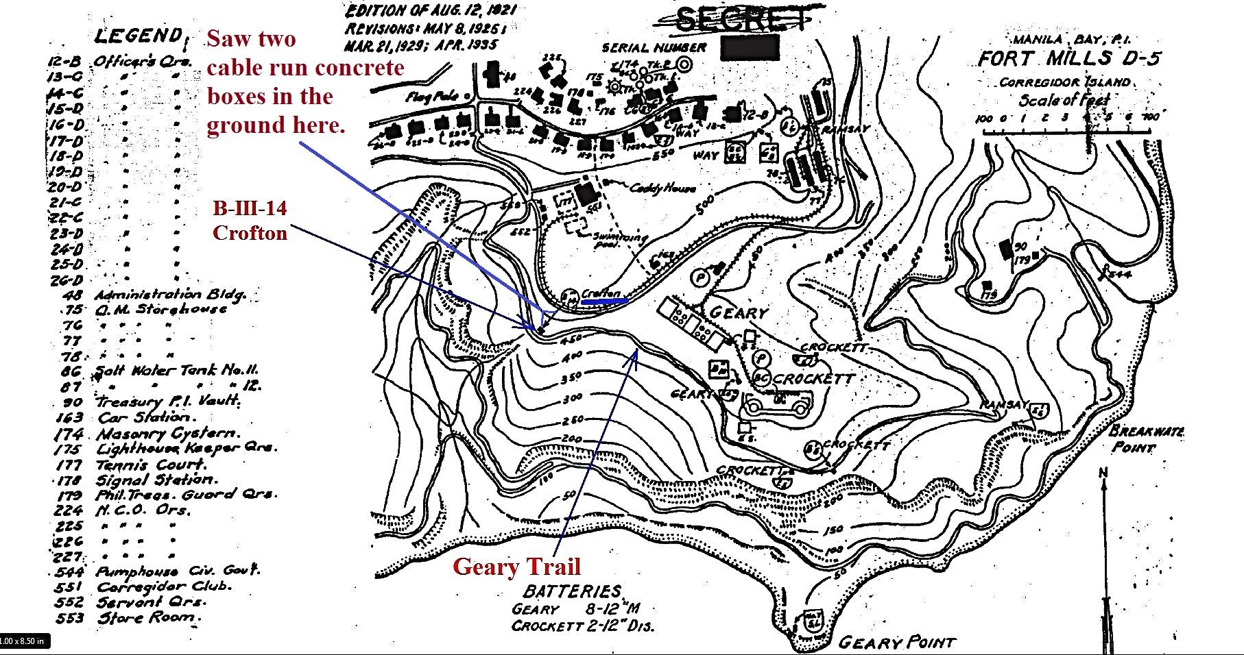 X469. Of all the maps I have only this one shows the name Crofton, the other maps show no name. The Battery Tactical Numbers list (in the first segment of this thread) indicates Battery Marshall (Ft. Drum), and the number 19 is for Battery Crofton; which one is it? 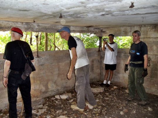 X470. The 88 year young 503d Paratrooper Richard (Dick) Adams, Steve Kwiecinski, Peter Parsons and John Moffitt (aka fots2) at the battery position finder (B-III-14) or (B’’’14) on Jan. 11th 2011. NOW YOU SEE IT: THE METAL BRACKET HANGING DOWN OUTSIDE BETWEEN Trooper Adams and Mr. Kwiecinski !!!! 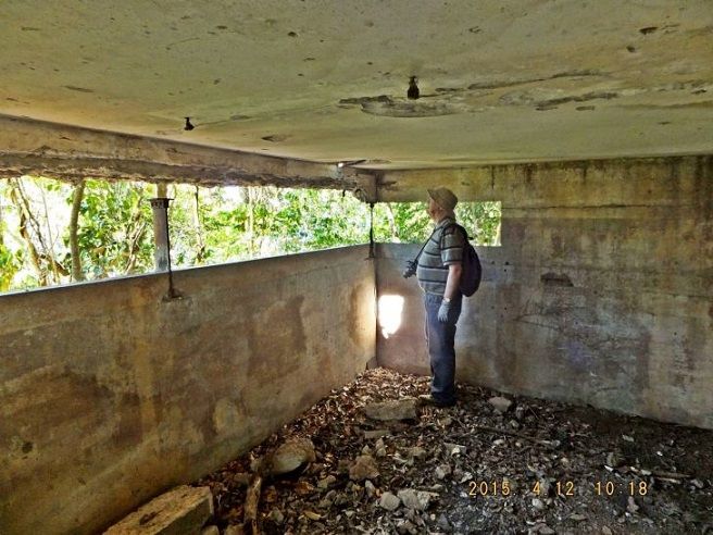 X471. Inside and this is the right side of the (B-III-14) or (B’’’14) battery position finder. This is Glen Williford of CDSG Fame on the 12th April 2015. NOW YOU DON’T SEE IT!!! If you compare this image with the last one, X470, you will notice that a metal bracket that was hanging down in front has disappeared. 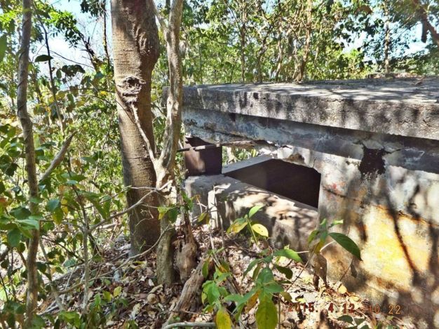 X472. This is the left outside corner of (B-III-14) or (B’’’14) battery position finder. This is a 12th April 2015 image. 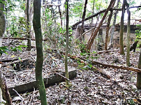 X473. Not far in the rear of (B-III-14) or (B’’’14) battery position finder is a cable run man hole. This is a 15th Jan. 2011 image. 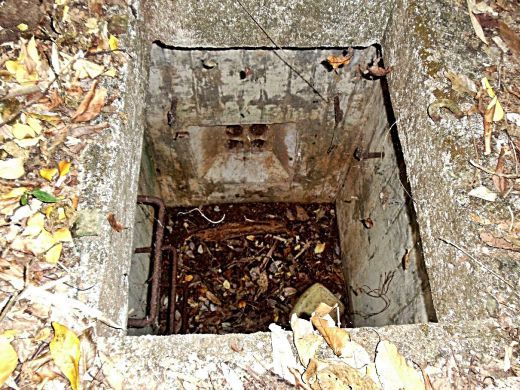 X474. We saw a 2nd cable run man hole of B-III-14) or (B’’’14) battery position finder. It is located near the road. A look inside the 2nd cable run man hole and these two images are from the 12th April 2015 |
|
|
|
Post by fortman on May 31, 2015 13:29:20 GMT 8
Hi K-W,
This is going to be a fascinating thread. Many thanks.
Fortman
|
|
|
|
Post by rickthelibrarian on May 31, 2015 20:30:46 GMT 8
I was thinking some of them were base end stations (observation points), but it looks like you have them all laid out!
|
|
|
|
Post by Karl Welteke on Jun 8, 2015 14:54:21 GMT 8
(E’’5) or (E-II-5) and (A-B-14) or (^B14) Crockett This Emergency station is located on the berm behind Battery Crocket #2 Gun. It has 2 tic marks that make it a secondary station; it is an uncovered station which we visitors call a bathtub. A map and the #5 identify it for Battery Crockett. Another symbol (^B14) or (A-B-14) could mean it also was a Battery Marshall observation station. On the 12th of April 2015 I walked by this station again and that motivated me to present the images of a visit on the 15th of Jan. 2011 when fots2 and I wanted to find it and have a good look at it. We did and I posted my pictures in this new album with 14 images: s74.photobucket.com/user/PI-Sailor/library/Corregidor%20by%20subject/Battery%20Controls/E-II-5%20and%20A-B-14%20Crockett?sort=9&page=1or tinyurl.com/potxxe2Here are some sample images but they are smaller than in the album above! 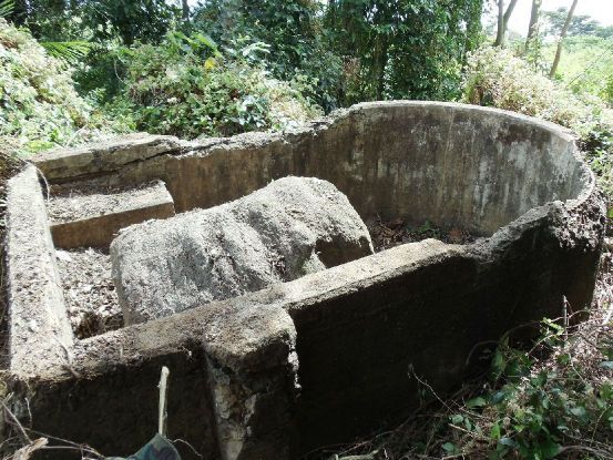 X509 on the 15th Jan. 2011 this Emergency station got cleaned up by fots2 and me. How did that big rock or big piece of concrete get inside there, from the Battery Geary explosion? 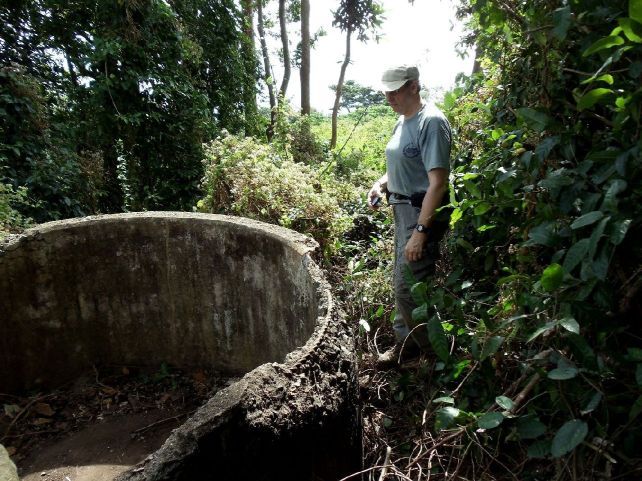 X510 we came here from that green, grassy spot behind fots2 and that is next to Battery Crocket #2 Gun. A map, I got, says it is for Battery Crockett and I use the symbol on the map like this (E’’5) or (E-II-5). 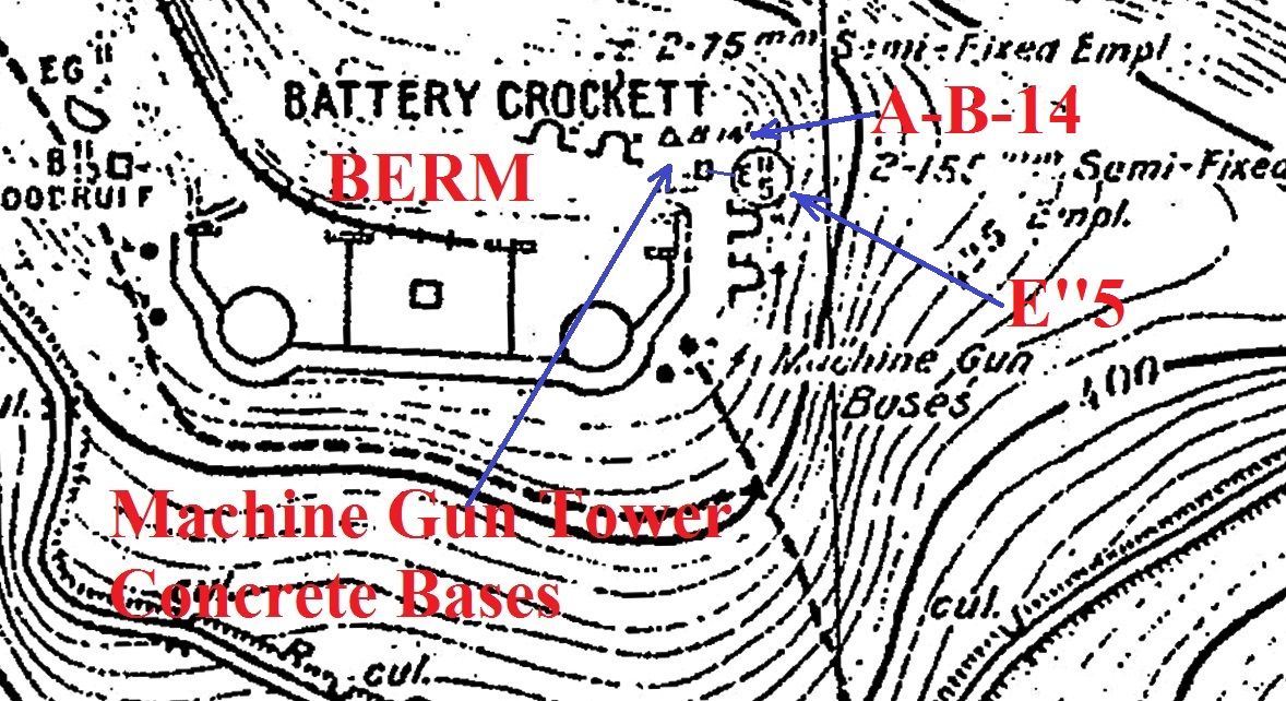 X511 on all the maps we got, they also show another designation (A-B-14) or(^B14). That is my interpretation of the symbol and I believe it means Battery Observation Station for Battery Marshall as per battery tactical number list we have (List is shown in first segment of this thread). 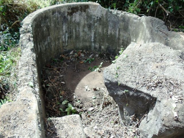 X512 a look to the forward end of (E’’5) where the observation instrument was bolted down. 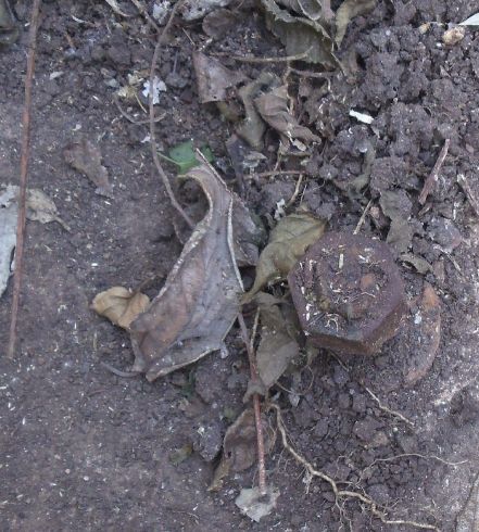 X513 a stud and nut to secure the observation instrument inside (E’’5) Station; that is a pretty good size. 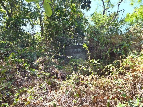 X514 this is how (E’’5) Station looked like on the 12th of April 2015 when I walked passed it. This is the forward end where the observation instrument was placed to search in my direction. I came to look for the machine gun tower. |
|
|
|
Post by Karl Welteke on Jun 28, 2015 15:34:58 GMT 8
G1 GROUP GUN CONTROL BETWEEN BATTERY SMITH AND BATTERY HEARN This was the goal of Glen today, the 13th April 2015, I been there but never took any pictures, off we went. Because of the thick undergrowth it is a little hard to get there that may be that not many people get there. An album was established with 21 images in my Photobucket account; this is the URL: s74.photobucket.com/user/PI-Sailor/library/Corregidor%20by%20subject/Battery%20Controls/G1%20B-Smith%20B-Hearn%20between?sort=9&page=1or tinyurl.com/ncsy8rrHere are 12 sample image but they are MUCH smaller than in the album above: 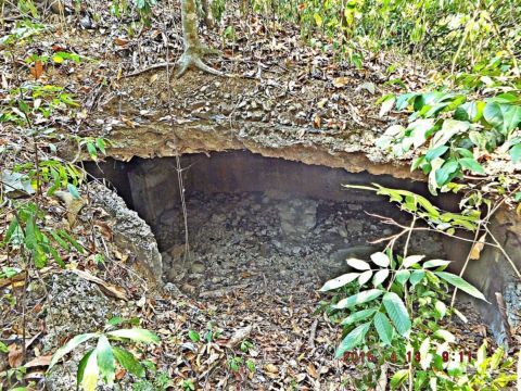 X649 this is the right side of the observation deck; the main view to the ocean is to the right. We approached G1 this way and entered it here. It is obviously damaged, US bombs is my speculation. 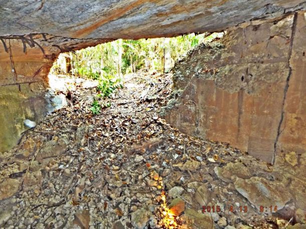 X650 after we entered G1, we looked back to the right side of the observation deck; the main view to the ocean is to the left. We entered thru that battle damaged opening of the observation deck. 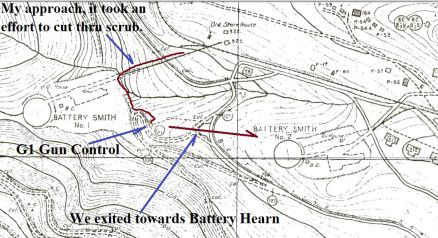 X651 where is G1, a section of a Corregidor 1936 map clears that matter up. Because of the thick jungle undergrowth it is a little hard to get there. 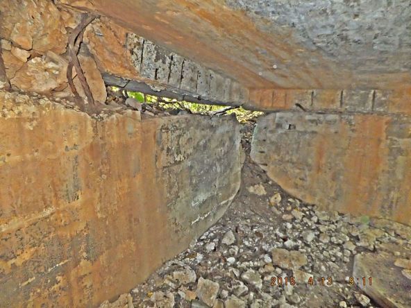 X652 this is the left side of the observation deck; the main view to the ocean is straight ahead and it is completely closed, must have been a US bomb, my speculation. 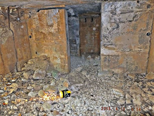 X653 in the rear of the G1 observation deck are the telephone booths. At that wall in the rear, immediately to the left is a long flight of steps going down to the plotting room. 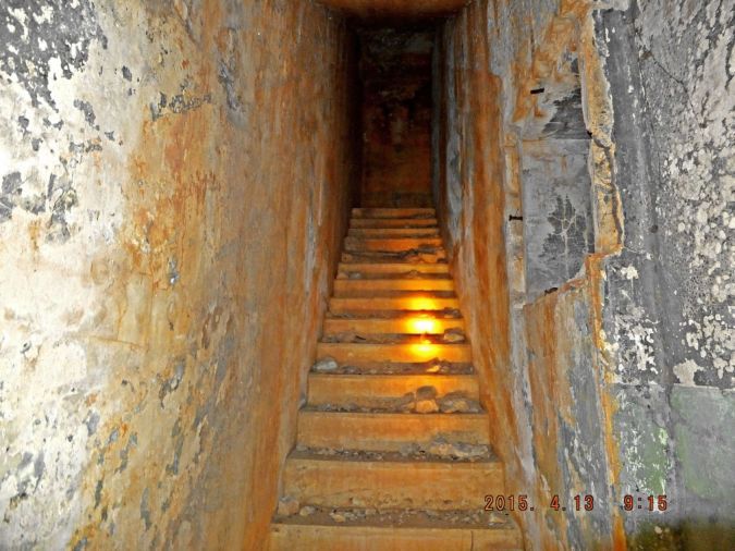 X654 the steps at the rear of the G1 observation deck area coming down to the north, to the G1 plotting room. Notice a window or opening to the right, into the G1 plotting room. 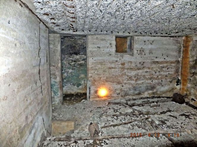 X655 we are in the G1 plotting room, behind that wall in the rear are the step coming down from the observation deck. The door opening at left leads to a passage and step going up and out of G1. 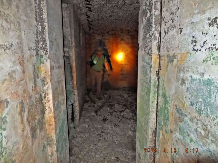 X656 I am standing in the passage going to steps up and out of G1 behind and left of me. This view is into the plotting room and the door opening at left is from steps coming down from the G1 observation deck. 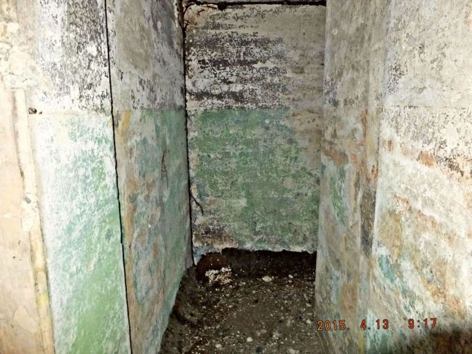 X657 I am standing in the G1 plotting room and look into the short passage way leading to the steps up and out of G1. At the rear wall the steps start up and out to the right 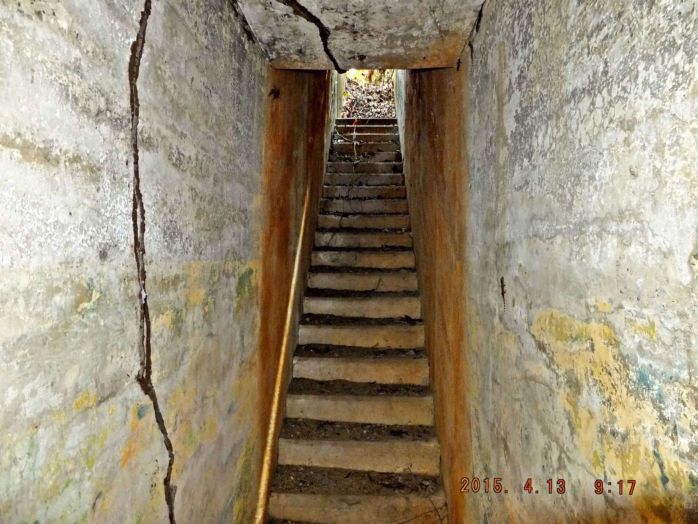 X658 these are the steps in and out of G1 from the rear. 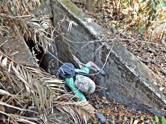 X659 Glen is coming out of G1 Gun Control. There is so much debris on the steps, using the hands coming up, is helpful.  X660 it is a long way down to G1 Gun Control. |
|
|
|
Post by Karl Welteke on Sept 13, 2015 11:57:49 GMT 8
COASTAL ARTILLERY OBSERVATION POST, COURTESY OF THE MACARTHUR MEMORIAL Sometime the MacArthur Memorial, hosted by the City of Norfolk in Virginia sends me a snippet as a personal favor because of my great interest in our Philippine-US historical relationship. This image shows Philippine Scouts, US Army, manning a Coastal Artillery Observation Post. This post seems to be for Battery Morrison based on the geographical names and the cardinal directions, north and east, written above the view slits. I uploaded 3 images of the observation post into this album with the numbers O1 to O3: s74.photobucket.com/user/PI-Sailor/library/Corregidor%20by%20subject/Historical%20Corregidor/MacArthur%20Memorial%20images?sort=9&page=1The same three pictures are presented here but are much smaller: 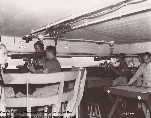 W108 (O1) Coastal Artillery Observation Post, manned by Philippine Scouts, my guess, it is for Battery Morrison based on the geographical names and the cardinal directions, north and east. This image is from the MacArthur Memorial. 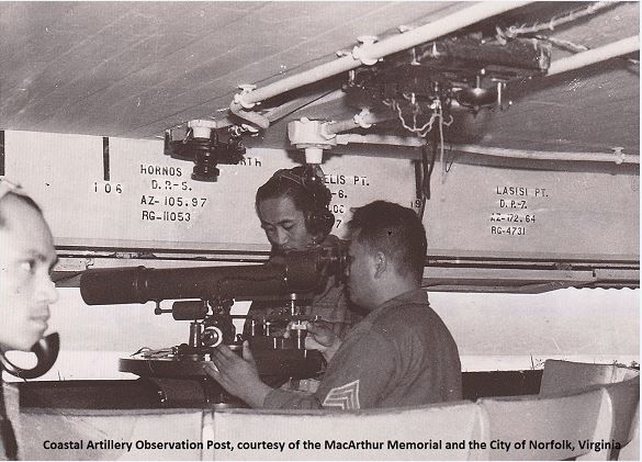 W109 (O2) Coastal Artillery Observation Post, manned by Philippine Scouts, my guess, it is for Battery Morrison in Fort Mills on Corregidor Island. This is a close-up image of W108 (O1). This image is from the MacArthur Memorial. 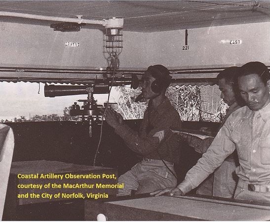 W110 (O3) Coastal Artillery Observation Post, manned by Philippine Scouts, my guess it for Battery Morrison in Fort Mills on Corregidor Island. This is a close-up image of W108 (O1). This image is from the MacArthur Memorial. |
|
|
|
Post by fortman on Sept 14, 2015 4:21:20 GMT 8
In the Osprey book "American Defences of Corregidor and Manila Bay" the OP is given as that of Battery Grubbs. Any views Batteryboy?
fortman
|
|
|
|
Post by Karl Welteke on Oct 16, 2015 18:21:22 GMT 8
YES, I AGREE, IT MUST BE THE BATTERY GRUBBS BATTERY CONTROL AND TARGET POSITION FINDER STATION. That is a message to fortman! Batteryboy did not respond but I have come to a conclusion. On the 17th Sep. 2015 I visited both batteries, Grubbs and Morrison. Both batteries control station are pretty much destroyed. The Battery Grubbs station was a larger and more sophisticated station. One thing I am sure of, the centerline of the battery and control station points just about north and exactly towards Sisiman Bay on Bataan. In the picture W110 the written direction to Mt. Arayat threw me off; I thought that their field of vision was very far to the east. But on this visit I reached the conclusion that all the landmark directions in the previous pictures jive. I present here two Google Earth images to give you a feel for the directions and pictures of the gun control/target position finder stations of both Battery Grubbs and Morrison. 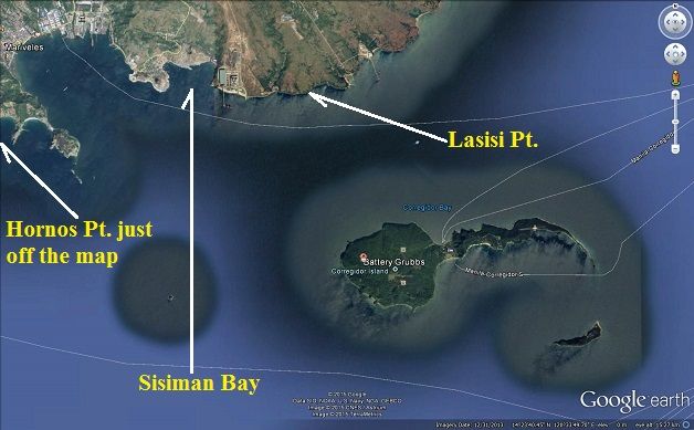 W201 a Google Earth image to show you the area that Battery Grubbs covered and I marked in a few landmarks. A reminder the Corregidor Hotel brings people here to observe the sunset and the sun goes down in the general direction of Monja Island and that is in a direction to the left from the centerline direction of the battery. 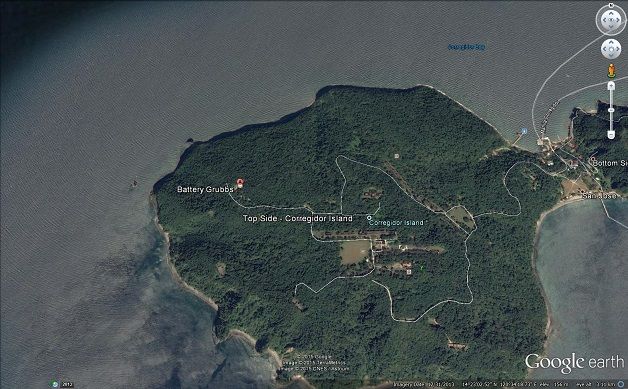 W202 a Google Earth image of the location of Battery Grubbs on the former Fort Mills on Corregidor Island. 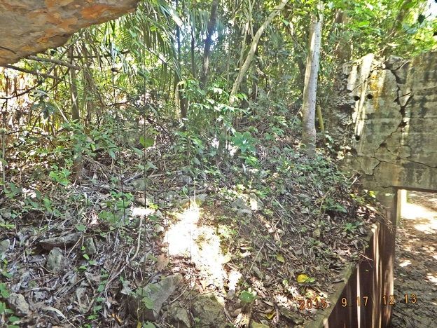 W203 the Battery Grubbs, gun control/target position finder station, it is completely destroyed, only the left wall is still standing 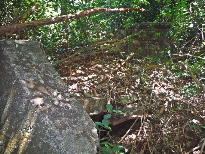 W204 the Battery Morrison gun control/ target position finder station is also wiped out. It was smaller than the Battery Grubbs one. Note: the pictures I took of the Battery Grubbs gun control/target position finder station have been uploaded already to the forum: corregidor.proboards.com/thread/624/guns-battery-grubbs-jump-afterand to my album: s74.photobucket.com/user/PI-Sailor/library/Corregidor%20by%20subject/Batteries-Coastal%20Artillery/Battery%20Grubbs?sort=9&page=1 |
|
|
|
Post by fortman on Oct 16, 2015 21:58:52 GMT 8
Great thread Karl.
Where do Base End Stations fit into the scheme of things?
fortman
|
|


