


Lesser Known Gun Batteries of Corregidor Island
Jun 6, 2015 9:51:42 GMT 8
Karl Welteke, chadhill, and 2 more like this
Post by fots2 on Jun 6, 2015 9:51:42 GMT 8
Corregidor is known for its big guns and most of them are well documented. What is not well known are numerous smaller batteries scattered all over the island. Unfortunately none of these smaller calibre guns still remain. By smaller calibre I am referring to 3-inch and 155mm guns. They were on pedestal mounts, Panama Mounts or on semi-fixed emplacements.
Due to their smaller size, these guns may have been easy prey to Japanese wartime scrapping and to later post war clean-up. If we are lucky, we will find gun mounts, magazines and perhaps even Fire Control Stations. If it were not for maps and some US Army Corps of Engineer documents, we might not know exactly where some of them were located as little remains there today.
One thing about the lesser known batteries is that simply; not much is known about some of them. Few battery histories exist for these little guys. This results in speculation and inaccuracy that eventually ends up as quoted history. Much of what I will show you here is not a surprise to the regulars on these forums however you will certainly hear different stories elsewhere depending on who you talk to.
The first four batteries we will have a look at are: Battery Concepcion, Battery Stockade, Battery Martin and Battery Kysor. These 155mm GPF gun batteries are not visible from the day tour route and are never mentioned.
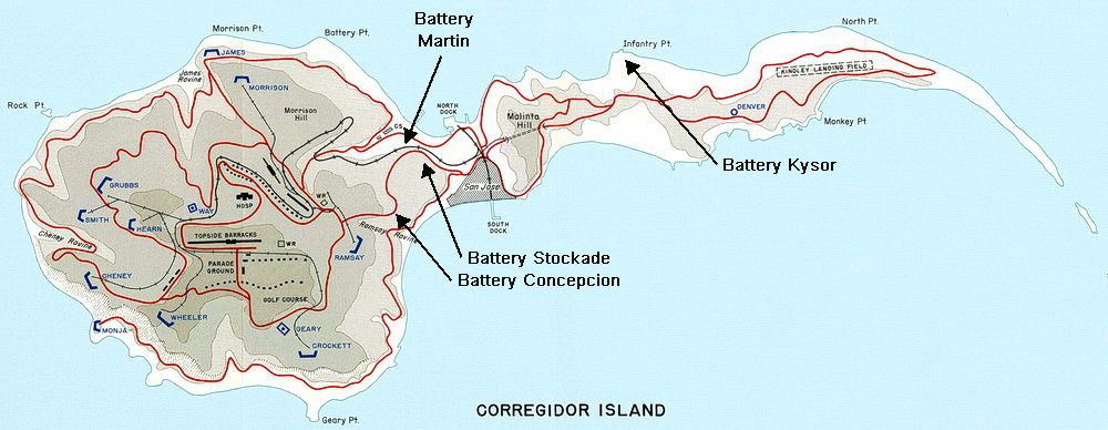
Battery locations map
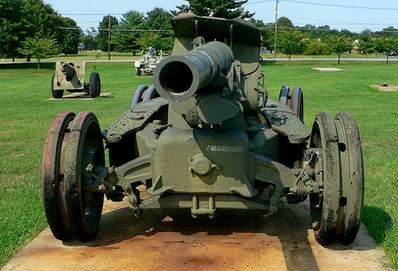
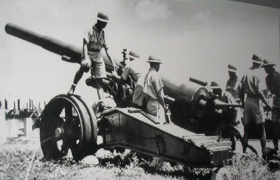
The gun itself, the 155mm GPF (Grande Puissance Filloux) was a French design that went into service in 1917. It was later adopted by the US and manufactured there as the model M1917 and model M1918.
Some basic gun specs are: calibre 155mm (6.10 inch), barrel 20 ft long, length 38.2 ft long, 95lb shell, elevation 0 to +35 degrees, rate of fire 2 rounds/minute and a range of 21,325 yards.
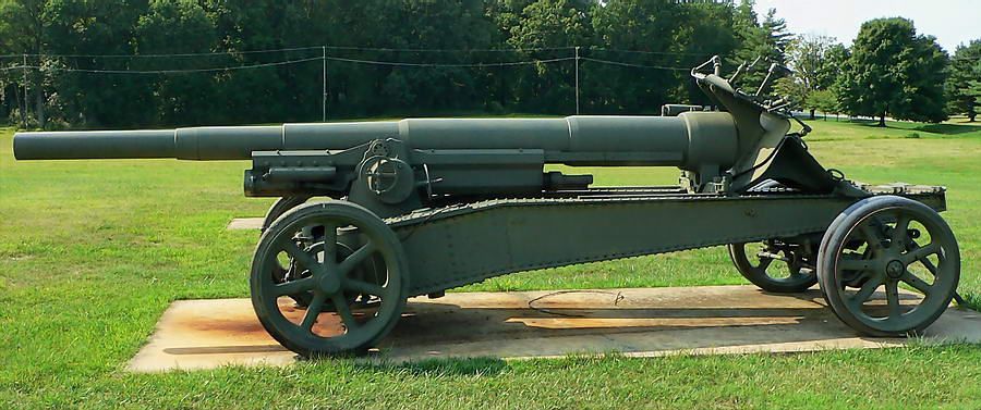
155mm GPF gun (ready for transport)
155mm GPF gun
155mm GPF gun
A commonly used platform for these guns was known as the “Panama Mount”. This structure was basically a concrete outer ring (with an embedded steel rail) surrounding a centre concrete pivot. The gun rested on the pivot and the rail assisted to traverse the gun towards its direction of fire. Many circular Panama Mounts were constructed at less than the maximum of 360 degrees depending upon the requirement at the location where it was located.
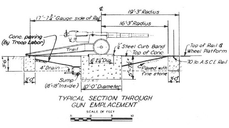
Drawing of a Panama Mount.
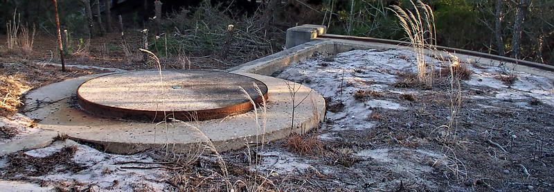
Note the steel rails in the outer rings of the following photos.
180 degree Panama Mount
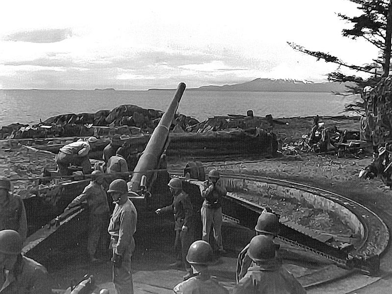
Panama Mount in Alaska
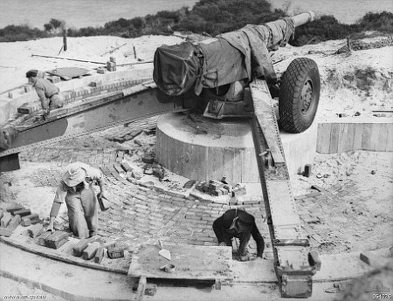
Panama Mount at Garden Island, Western Australia
Battery Concepcion
This battery consisted of three 155mm GPF guns. It was located above Barrio Concepcion and adjacent to the road between Bottomside and Middleside. Some text mentions these guns as being on Panama Mounts but the Corps of Engineer’s 1936 map shows Semi-Fixed Emplacements. Since I cannot find even a trace of the three concrete mounts then I tend to believe the map. If it were not for the maps then I would not even know exactly where this battery was, nothing remains of it today.
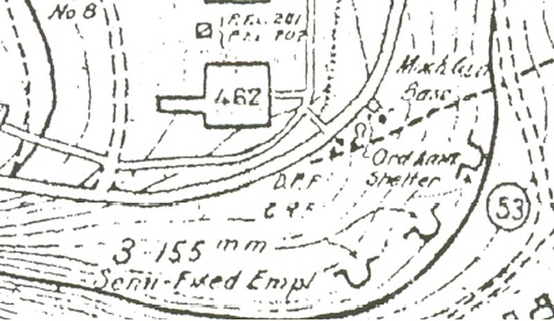
Map of the 3 Semi-Fixed Emplacements adjacent to the road between Bottomside and Middleside.
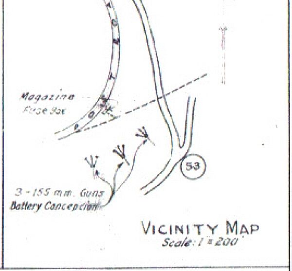
A sketch in a Corps of Engineer’s “Report of Completed Works” document proves that these guns were Battery Concepcion.
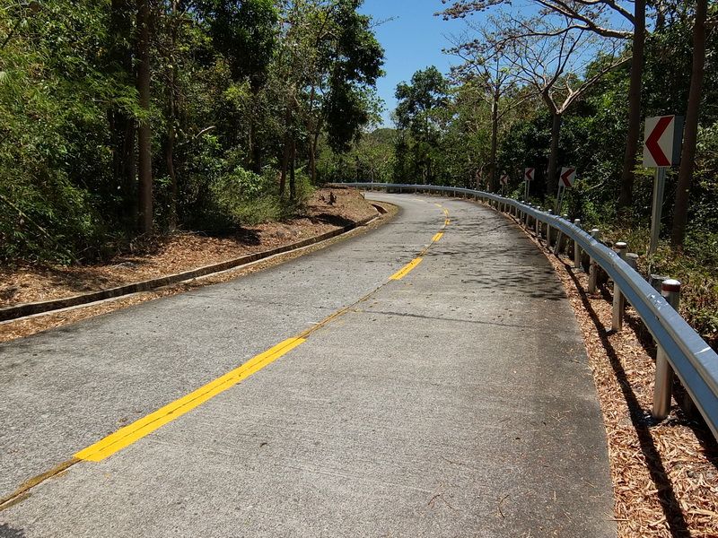
The curved road above Battery Concepcion.
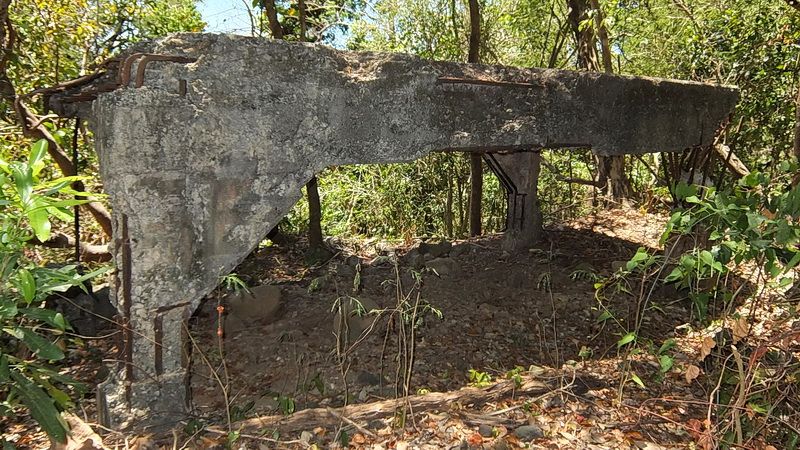
A covered 75m gun position between the road and the battery.
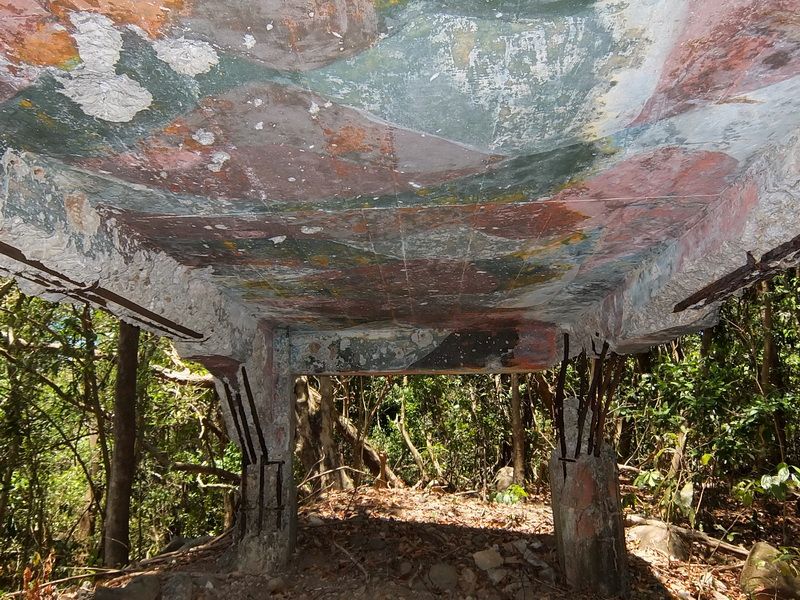
Original camouflage paint on the ceiling.
A narrow strip across the hillside above Road Junction 53 is nearly horizontal. According to the map, the three guns were placed here. No evidence remains of this battery.
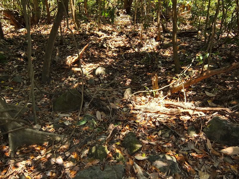
Where the guns would have been placed.
Where the guns would have been placed.
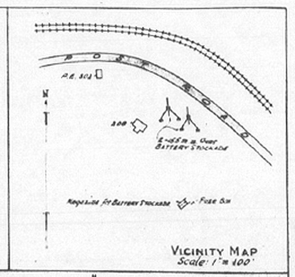
Battery Stockade
This battery consisted of two 155mm GPF guns. It was located just below the Stockade and adjacent to the road between Bottomside and Middleside. Again, text mentions these guns as being on Panama Mounts but the Corps of Engineer’s 1936 map shows Semi-Fixed Emplacements. Since I cannot find even a trace of the two concrete mounts then I tend to believe the map. If it were not for the maps then I would not even know exactly where this battery was, nothing remains of it today.
Map showing Battery Stockade at the bottom.
A sketch in a Corps of Engineer’s “Report of Completed Works” document confirming that these guns were Battery Stockade.
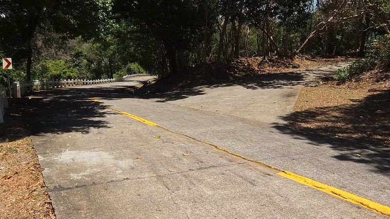
The view looking towards Bottomside. Going right takes you to the Stockade.
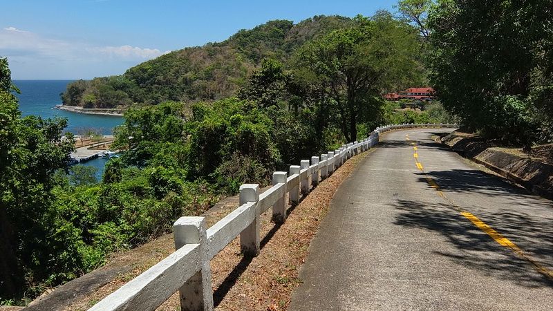
Further down the road towards Bottomside, note the corner in the distance. Battery Stockade is on the right.
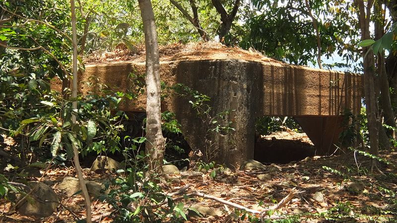
Just off the road is another covered 75mm gun position; this one half buried.
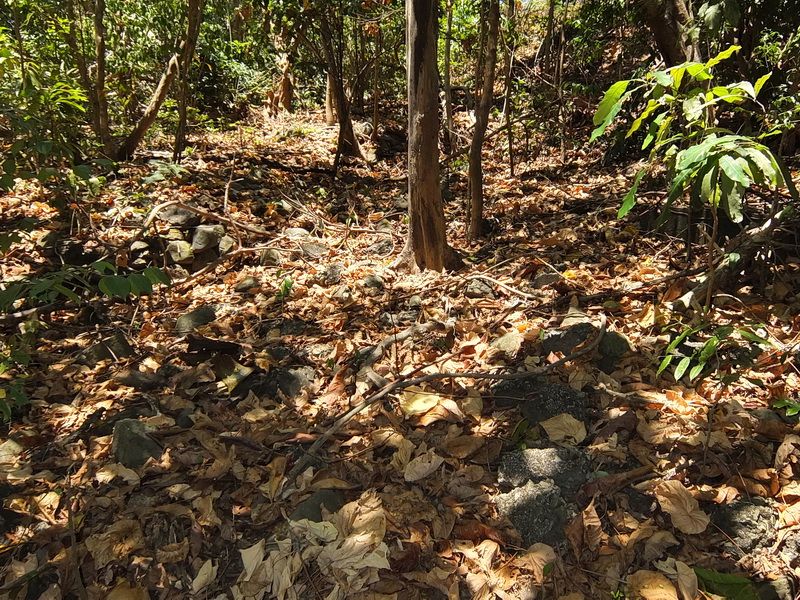
The sloping hillside here also has a near horizontal section where the guns would have been placed. There is no trace of this battery either.
Where the guns would have been placed.
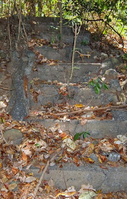
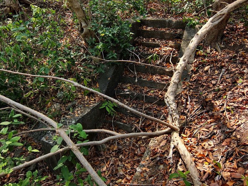
At the rear of the horizontal section, steps go up the hillside towards the Stockade.
OK, boring so far! More interesting things are coming.
Battery Martin
This battery consisted of two 155mm GPF guns. It was located in an old land defense position called VII-S-2 below the road between Bottomside and Middleside. The two siege gun positions were modified to support the 155mm GPFs and the centre concrete magazine was also reused.

Map showing Battery Martin at the top just below the road going from Bottomside to Middleside. The dual trolley line passed between the road and the battery.
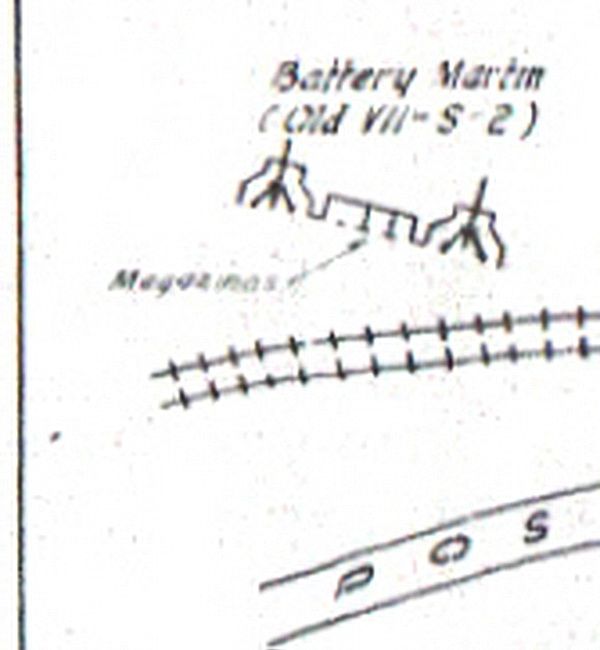
A sketch in a Corps of Engineer’s “Report of Completed Works” document confirming that these guns and magazine were Battery Martin.

Lets walk roughly halfway down the road towards Bottomside and look left.
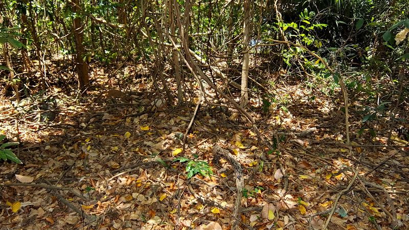
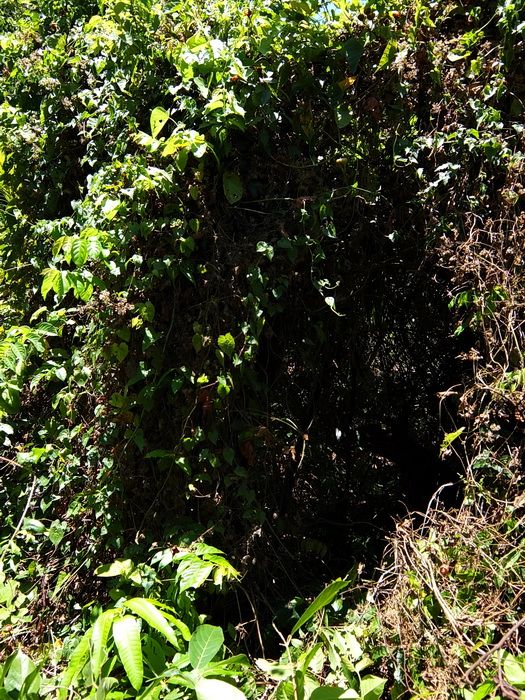
Looking over the white concrete guard-rail is a thick mess of vegetation down below. This is the location of Battery Martin. (At top centre in the distance is the Engineer Dock on Bottomside).
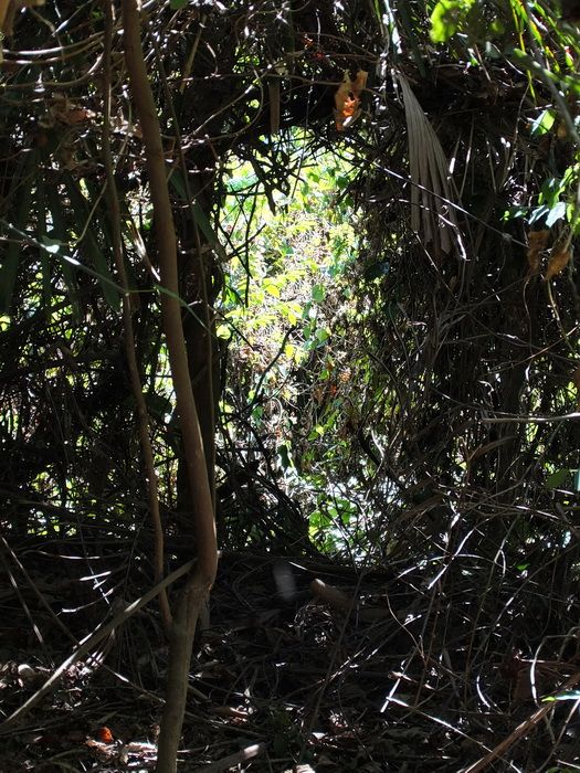
Here is a look at a wall of vines after I cut a “doorway” to pass through. The battery is only 20 feet or so away.
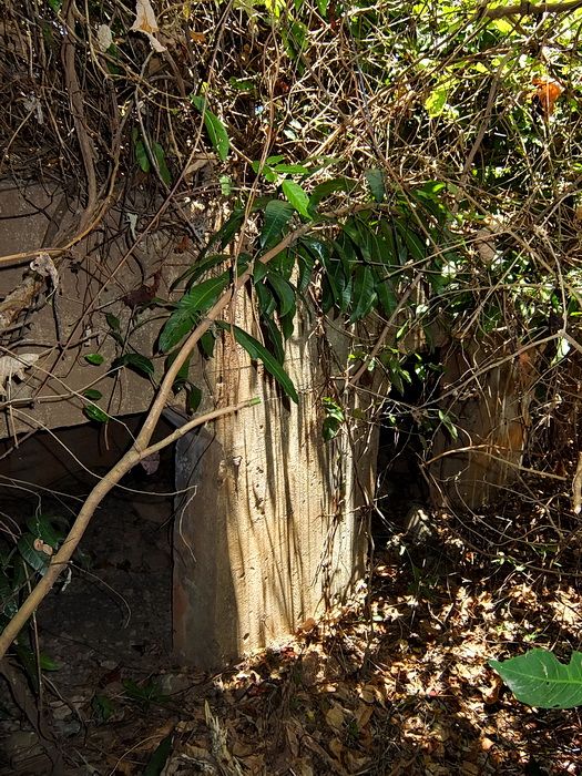
Looking back towards my “doorway”.
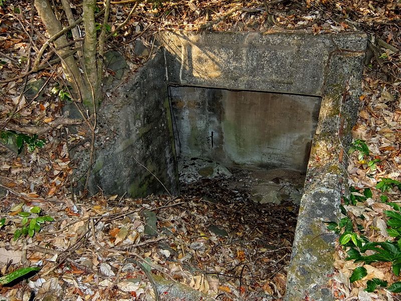
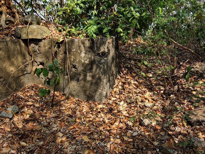
Approaching the centre magazine. This battery has collected a lot of typhoon debris over the past few years. It used to be much clearer at the magazine and both gun positions.
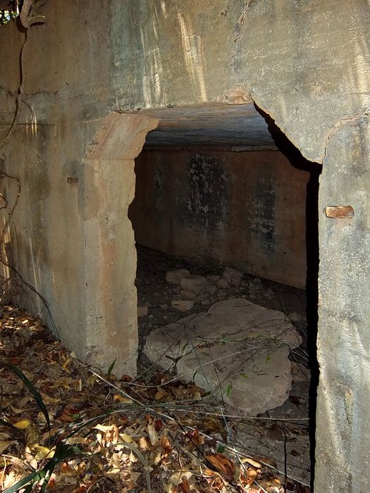
One of the four doors to the magazine.
Interior of the magazine.
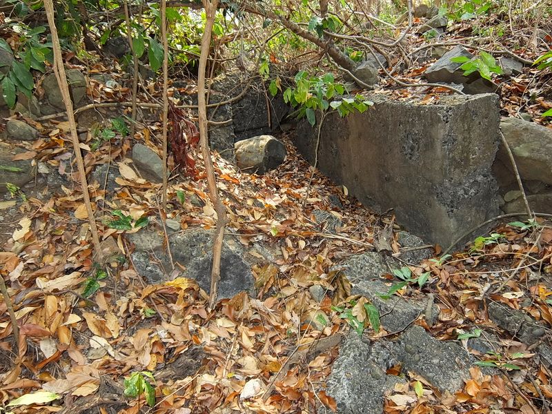
Along the outside rear wall of the magazine you can get an idea of how thick vegetation can make getting around difficult.
Looking out Gun position #2.
Behind the gun positions are angled concrete blocks positioned to brace the legs of the 155mm guns.
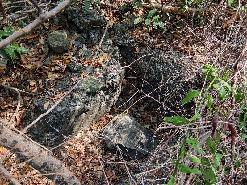
On top of the blocks are pieces of steel embedded in the concrete. Don’t know why.
Another concrete block. This one is at the rear of Gun Position #1. Both gun positions would have had two concrete blocks but the others are buried now.
The left-hand wall of the magazine.
The right-hand side of the magazine.
Battery Kysor
Here is one battery that has more than its share of Corregidor folklore. We know it was equipped with 155mm GPF guns but did it have 1, 2 or 3 of them? Were they mounted on Semi-Fixed Emplacements or 1 or 2 Panama Mounts? I was even told that since no one had found any Panama Mounts then perhaps they were never constructed.
As for the location of the battery, locals will guide you to the nearby old land defense position IV-F-1. We know for sure that is wrong.
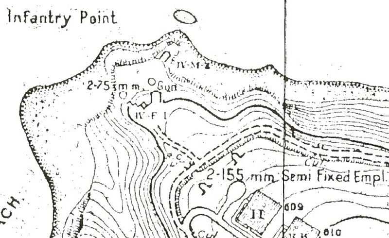
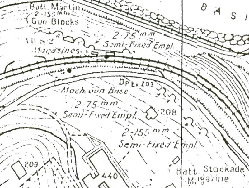
Map of the Infantry Point area on Tailside which was the location of Battery Kysor.
What got me interested in this battery again was that I found a sketch in a Corps of Engineer’s “Report of Completed Works” document. It shows that Battery North (which later became Battery Kysor) had one gun and where it was located. This would be worth a look during my next trip to the island.
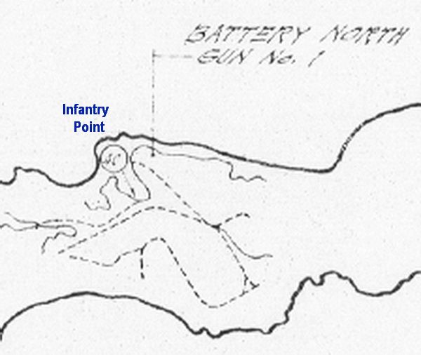
RCW showing the location of Battery North.
That “next trip” came a few weeks ago. I left the Corregidor Inn around 6am and walked through Malinta Tunnel on my way to Infantry Point. From the Semi-Fixed Emplacements, I walked east a couple minutes until I came to the first entrance of the 3 entrance magazine.
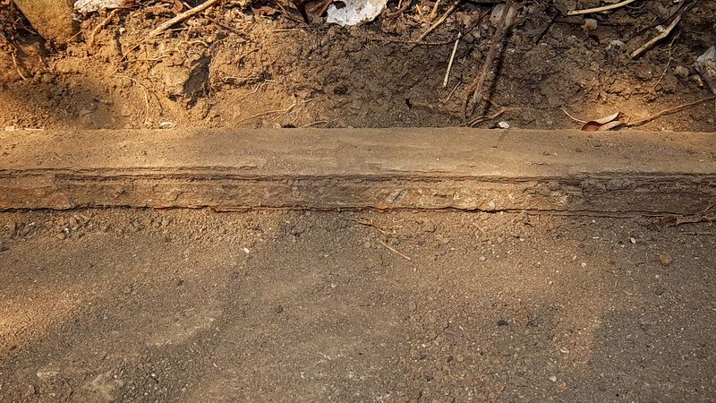
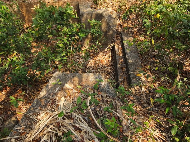
I had gone too far but now knew my search boundary. It is such a small area here that if that gun position existed, it must be very close. I back-tracked checking out each crater/depression. In the side of one of them was a little piece of vertical concrete just barely sticking out. I cleared away dirt and roots but was not sure what was until I uncovered the embedded rail. Here is a Panama Mount.
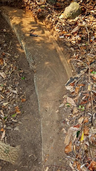
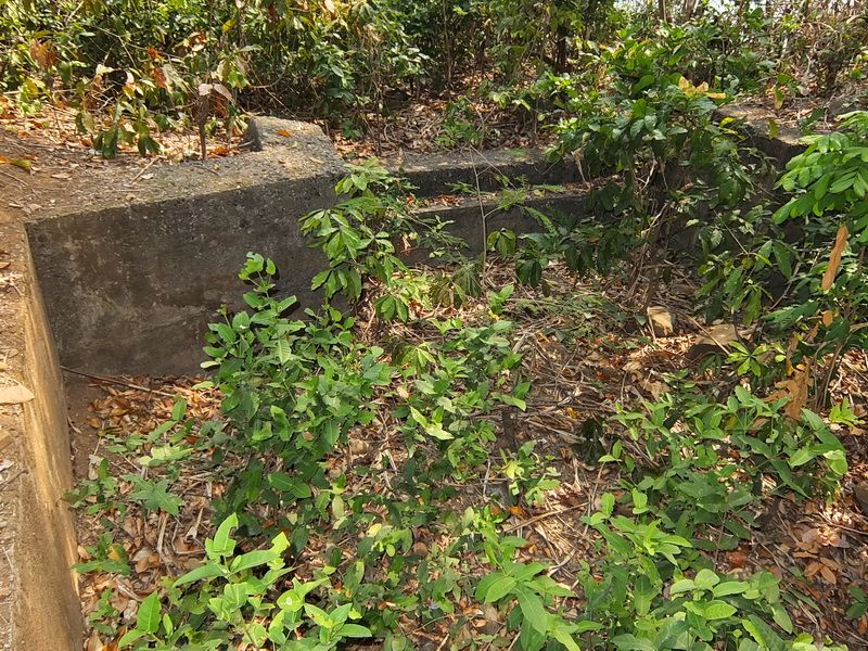
This gun position faces NW towards the cliff and I would estimate that it is a 180 degree mount judging from the surrounding terrain. On the right side of the mount is a very defined trench cut into the ground going down to the road north of the position. It took over an hour to clear off a 10 to 12 foot section of the outer ring. Even now, 95% of the Panama Mount is still buried. For those who know the area, it is located between the two Semi-Fixed Emplacements and the 3 entrance magazine.
I forgot to take a photo of the Panama Mount before I cleared the bushes, branches and small trees away. This view is before I started digging.
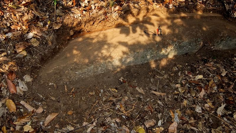
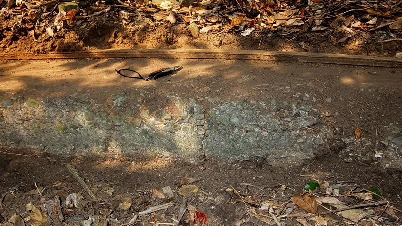
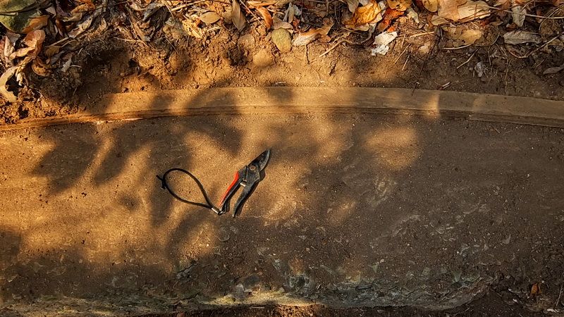
Here are some photos of the outer ring of the Panama Mount after clearing a small section of it. The garden shears are there for a size comparison.
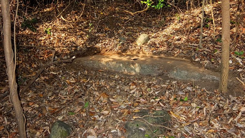
I can say that I found a Panama Mount and I believe it is part of Battery Kysor however we still do not know how many guns or mounts were there. At least now we know one exists.
Before we leave, here is a look at some other structures at Infantry Point.
The western entrance to the 3 entrance underground magazine.
Gun Position #1 of IV-F-1 .
Another view of the Gun Position #1.
Part of the Gun Position #2.
Looking towards the destroyed centre magazine.
More of the destroyed centre magazine.
Steps coming down into the rear of IV-F-1.
This 75mm gun position on the east side is almost completely buried.
This is the west side 75mm gun position.
Looking over the cliff down to the shoreline. Note the large chunks of rock that have eroded away from Infantry Point. The nearby machine gun position IV-M-2 which was above the cliff is completely gone now.
A final view along the coast looking west from Infantry Point. Artillery and Engineer Points are toward the right. The top peak and ridge to the left of it is Malinta Hill. In the cliff along the shoreline are Shinyo suicide boat caves.
For those of you that do not know, I am temporarily AWOL from the Philippines but will be back permanently next year. I actually miss wandering around the island. Even after 50 trips to Corregidor, there are still things to be learned.
Due to their smaller size, these guns may have been easy prey to Japanese wartime scrapping and to later post war clean-up. If we are lucky, we will find gun mounts, magazines and perhaps even Fire Control Stations. If it were not for maps and some US Army Corps of Engineer documents, we might not know exactly where some of them were located as little remains there today.
One thing about the lesser known batteries is that simply; not much is known about some of them. Few battery histories exist for these little guys. This results in speculation and inaccuracy that eventually ends up as quoted history. Much of what I will show you here is not a surprise to the regulars on these forums however you will certainly hear different stories elsewhere depending on who you talk to.
The first four batteries we will have a look at are: Battery Concepcion, Battery Stockade, Battery Martin and Battery Kysor. These 155mm GPF gun batteries are not visible from the day tour route and are never mentioned.

Battery locations map
The gun itself, the 155mm GPF (Grande Puissance Filloux) was a French design that went into service in 1917. It was later adopted by the US and manufactured there as the model M1917 and model M1918.
Some basic gun specs are: calibre 155mm (6.10 inch), barrel 20 ft long, length 38.2 ft long, 95lb shell, elevation 0 to +35 degrees, rate of fire 2 rounds/minute and a range of 21,325 yards.

155mm GPF gun (ready for transport)

155mm GPF gun

155mm GPF gun
A commonly used platform for these guns was known as the “Panama Mount”. This structure was basically a concrete outer ring (with an embedded steel rail) surrounding a centre concrete pivot. The gun rested on the pivot and the rail assisted to traverse the gun towards its direction of fire. Many circular Panama Mounts were constructed at less than the maximum of 360 degrees depending upon the requirement at the location where it was located.

Drawing of a Panama Mount.
Note the steel rails in the outer rings of the following photos.

180 degree Panama Mount

Panama Mount in Alaska

Panama Mount at Garden Island, Western Australia
Battery Concepcion
This battery consisted of three 155mm GPF guns. It was located above Barrio Concepcion and adjacent to the road between Bottomside and Middleside. Some text mentions these guns as being on Panama Mounts but the Corps of Engineer’s 1936 map shows Semi-Fixed Emplacements. Since I cannot find even a trace of the three concrete mounts then I tend to believe the map. If it were not for the maps then I would not even know exactly where this battery was, nothing remains of it today.

Map of the 3 Semi-Fixed Emplacements adjacent to the road between Bottomside and Middleside.

A sketch in a Corps of Engineer’s “Report of Completed Works” document proves that these guns were Battery Concepcion.

The curved road above Battery Concepcion.

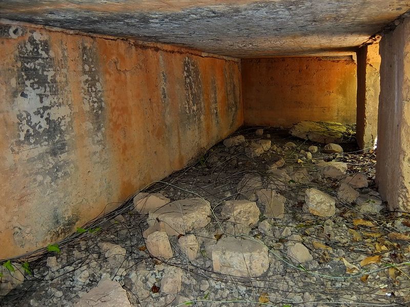
A covered 75m gun position between the road and the battery.

Original camouflage paint on the ceiling.
A narrow strip across the hillside above Road Junction 53 is nearly horizontal. According to the map, the three guns were placed here. No evidence remains of this battery.

Where the guns would have been placed.

Where the guns would have been placed.
Battery Stockade
This battery consisted of two 155mm GPF guns. It was located just below the Stockade and adjacent to the road between Bottomside and Middleside. Again, text mentions these guns as being on Panama Mounts but the Corps of Engineer’s 1936 map shows Semi-Fixed Emplacements. Since I cannot find even a trace of the two concrete mounts then I tend to believe the map. If it were not for the maps then I would not even know exactly where this battery was, nothing remains of it today.

Map showing Battery Stockade at the bottom.

A sketch in a Corps of Engineer’s “Report of Completed Works” document confirming that these guns were Battery Stockade.

The view looking towards Bottomside. Going right takes you to the Stockade.

Further down the road towards Bottomside, note the corner in the distance. Battery Stockade is on the right.

Just off the road is another covered 75mm gun position; this one half buried.
The sloping hillside here also has a near horizontal section where the guns would have been placed. There is no trace of this battery either.

Where the guns would have been placed.

At the rear of the horizontal section, steps go up the hillside towards the Stockade.
OK, boring so far! More interesting things are coming.

Battery Martin
This battery consisted of two 155mm GPF guns. It was located in an old land defense position called VII-S-2 below the road between Bottomside and Middleside. The two siege gun positions were modified to support the 155mm GPFs and the centre concrete magazine was also reused.

Map showing Battery Martin at the top just below the road going from Bottomside to Middleside. The dual trolley line passed between the road and the battery.

A sketch in a Corps of Engineer’s “Report of Completed Works” document confirming that these guns and magazine were Battery Martin.

Lets walk roughly halfway down the road towards Bottomside and look left.

Looking over the white concrete guard-rail is a thick mess of vegetation down below. This is the location of Battery Martin. (At top centre in the distance is the Engineer Dock on Bottomside).

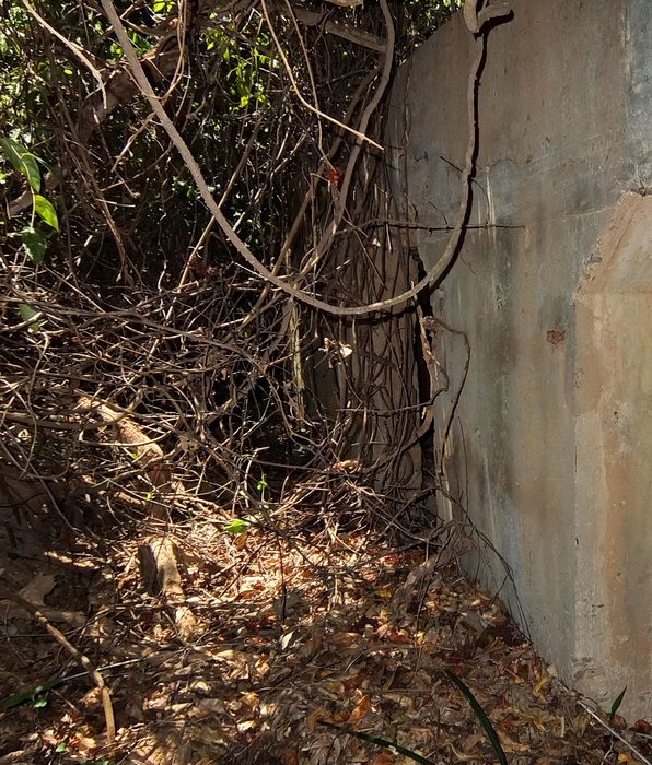
Here is a look at a wall of vines after I cut a “doorway” to pass through. The battery is only 20 feet or so away.

Looking back towards my “doorway”.

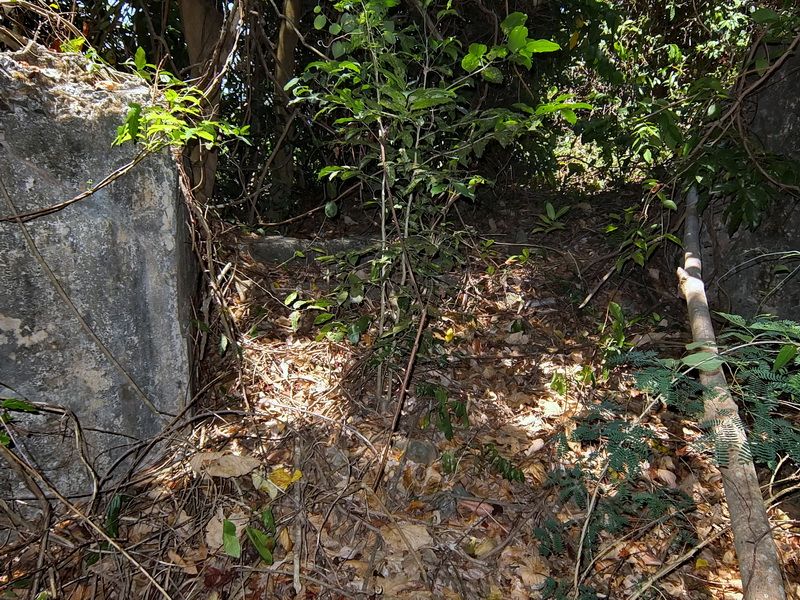
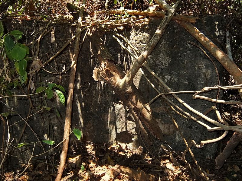
Approaching the centre magazine. This battery has collected a lot of typhoon debris over the past few years. It used to be much clearer at the magazine and both gun positions.

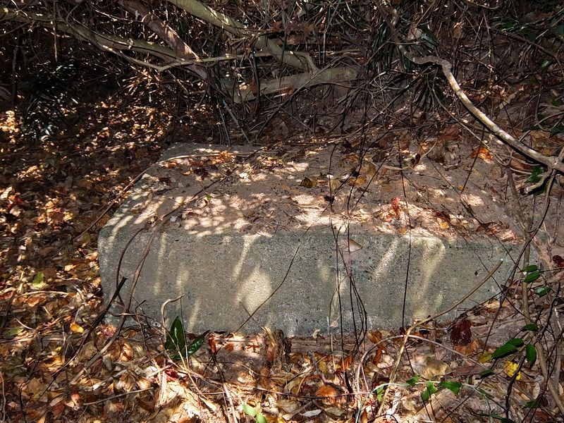
One of the four doors to the magazine.

Interior of the magazine.

Along the outside rear wall of the magazine you can get an idea of how thick vegetation can make getting around difficult.

Looking out Gun position #2.

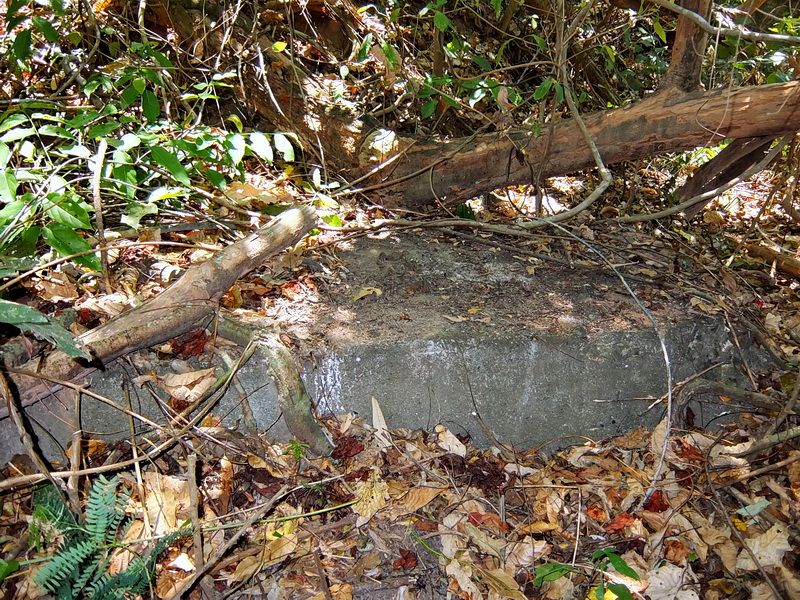
Behind the gun positions are angled concrete blocks positioned to brace the legs of the 155mm guns.

On top of the blocks are pieces of steel embedded in the concrete. Don’t know why.

Another concrete block. This one is at the rear of Gun Position #1. Both gun positions would have had two concrete blocks but the others are buried now.

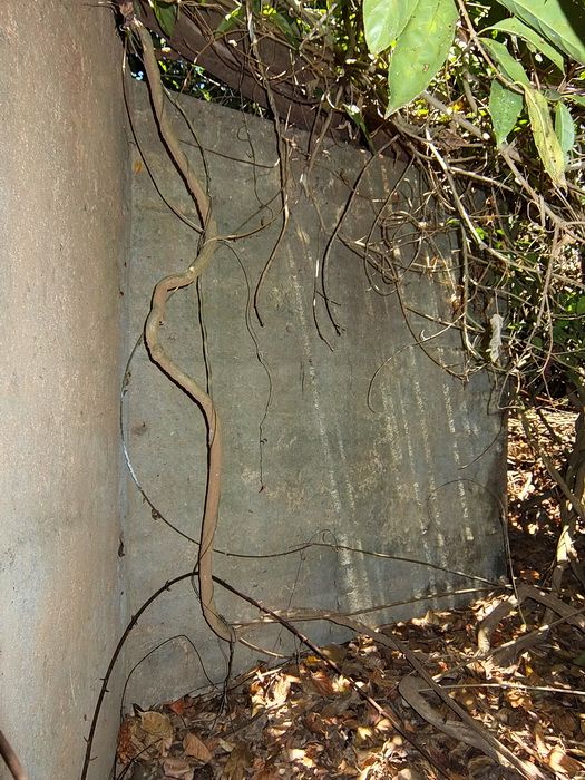
The left-hand wall of the magazine.

The right-hand side of the magazine.
Battery Kysor
Here is one battery that has more than its share of Corregidor folklore. We know it was equipped with 155mm GPF guns but did it have 1, 2 or 3 of them? Were they mounted on Semi-Fixed Emplacements or 1 or 2 Panama Mounts? I was even told that since no one had found any Panama Mounts then perhaps they were never constructed.
As for the location of the battery, locals will guide you to the nearby old land defense position IV-F-1. We know for sure that is wrong.

Map of the Infantry Point area on Tailside which was the location of Battery Kysor.
What got me interested in this battery again was that I found a sketch in a Corps of Engineer’s “Report of Completed Works” document. It shows that Battery North (which later became Battery Kysor) had one gun and where it was located. This would be worth a look during my next trip to the island.

RCW showing the location of Battery North.
That “next trip” came a few weeks ago. I left the Corregidor Inn around 6am and walked through Malinta Tunnel on my way to Infantry Point. From the Semi-Fixed Emplacements, I walked east a couple minutes until I came to the first entrance of the 3 entrance magazine.
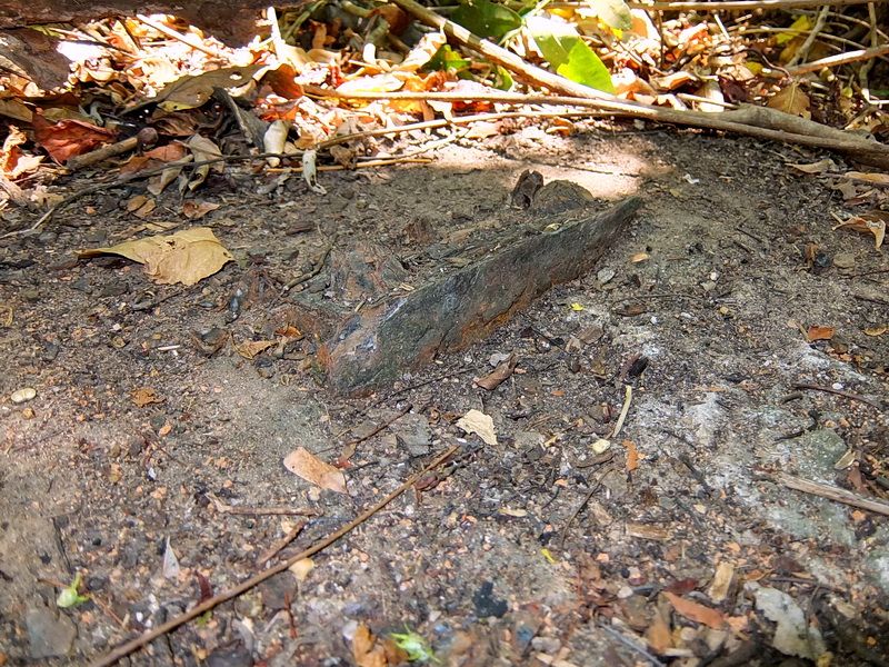
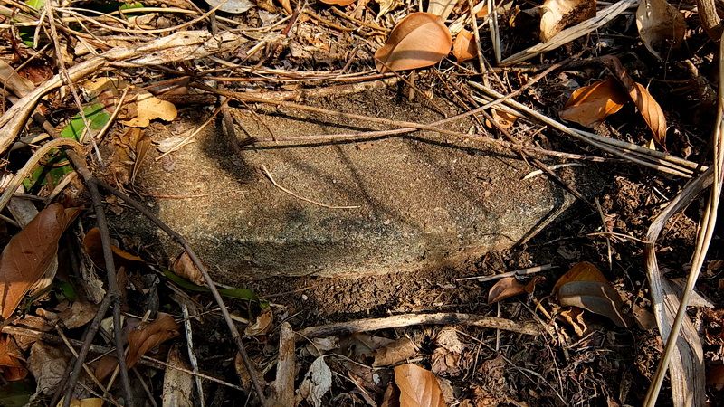
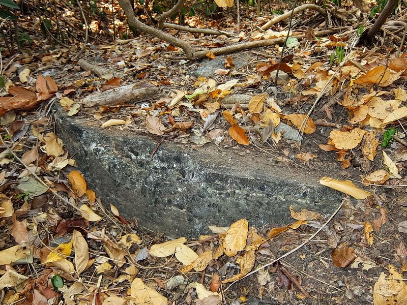
I had gone too far but now knew my search boundary. It is such a small area here that if that gun position existed, it must be very close. I back-tracked checking out each crater/depression. In the side of one of them was a little piece of vertical concrete just barely sticking out. I cleared away dirt and roots but was not sure what was until I uncovered the embedded rail. Here is a Panama Mount.
This gun position faces NW towards the cliff and I would estimate that it is a 180 degree mount judging from the surrounding terrain. On the right side of the mount is a very defined trench cut into the ground going down to the road north of the position. It took over an hour to clear off a 10 to 12 foot section of the outer ring. Even now, 95% of the Panama Mount is still buried. For those who know the area, it is located between the two Semi-Fixed Emplacements and the 3 entrance magazine.

I forgot to take a photo of the Panama Mount before I cleared the bushes, branches and small trees away. This view is before I started digging.
Here are some photos of the outer ring of the Panama Mount after clearing a small section of it. The garden shears are there for a size comparison.


I can say that I found a Panama Mount and I believe it is part of Battery Kysor however we still do not know how many guns or mounts were there. At least now we know one exists.
Before we leave, here is a look at some other structures at Infantry Point.

The western entrance to the 3 entrance underground magazine.

Gun Position #1 of IV-F-1 .

Another view of the Gun Position #1.

Part of the Gun Position #2.

Looking towards the destroyed centre magazine.

More of the destroyed centre magazine.

Steps coming down into the rear of IV-F-1.

This 75mm gun position on the east side is almost completely buried.

This is the west side 75mm gun position.

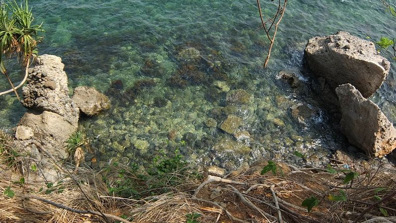
Looking over the cliff down to the shoreline. Note the large chunks of rock that have eroded away from Infantry Point. The nearby machine gun position IV-M-2 which was above the cliff is completely gone now.

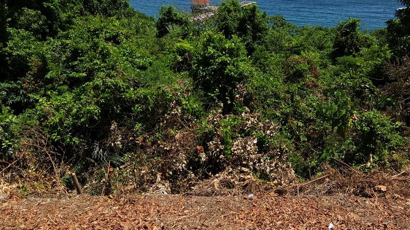
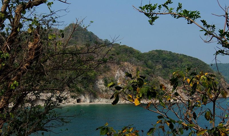
A final view along the coast looking west from Infantry Point. Artillery and Engineer Points are toward the right. The top peak and ridge to the left of it is Malinta Hill. In the cliff along the shoreline are Shinyo suicide boat caves.
For those of you that do not know, I am temporarily AWOL from the Philippines but will be back permanently next year. I actually miss wandering around the island. Even after 50 trips to Corregidor, there are still things to be learned.


