|
|
Post by T2 on Nov 27, 2016 23:52:37 GMT 8
Thank you very much for the SITREP Karl it looks like a camping trip is in order for me and this suites me just fine as I can plunge directly into historical Bottomside. Upon some good reconnaissance I will be camping near the SW corner of Barrio San Jose at the end of "Calle Bocana"  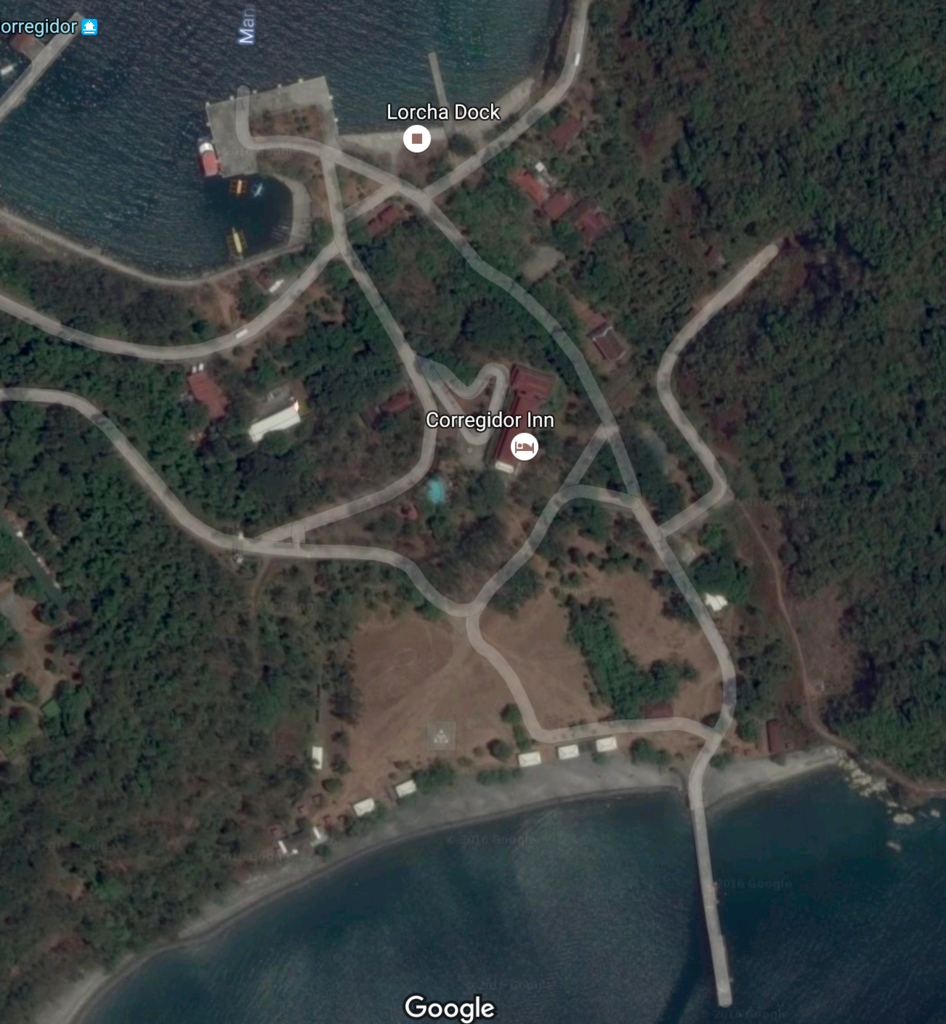 |
|
|
|
Post by T2 on Nov 28, 2016 0:04:18 GMT 8
What I find extraordinary is to look closely in the map of today, you will see the faint trails and roads of yesteryear...omg they are still in the same footprint, so therefore you can pinpoint historical places like road intersections, old building slabs, and the like. An example would be just to the East of the Stockade Battery is a faint V shaped trail intersection which I believe to be the "502" number in the '36 map making the showers of today right at the "52" number in the '36 map and the white rooftop in the map of today. Its tidbits like this which I will use to find many more historical facts from our past here, in favorite place of all time.
|
|
|
|
Post by T2 on Nov 28, 2016 0:11:20 GMT 8
 Calle Bocana looking towards the excavation marks on Malinta Hill 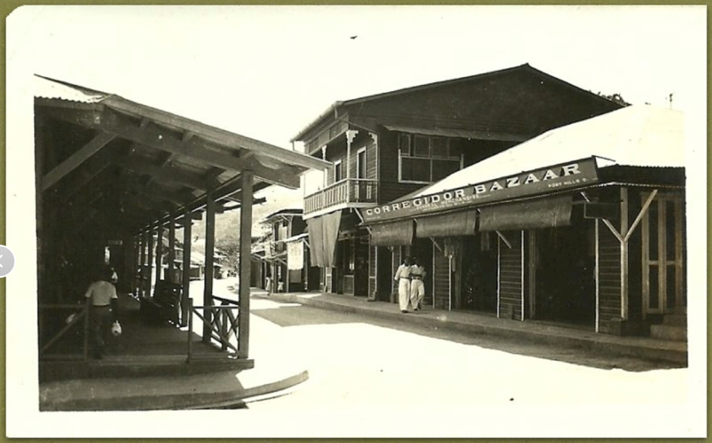 Calle Bocana again, I believe near the cinema and building 479 looking West |
|
|
|
Post by T2 on Nov 28, 2016 0:16:25 GMT 8
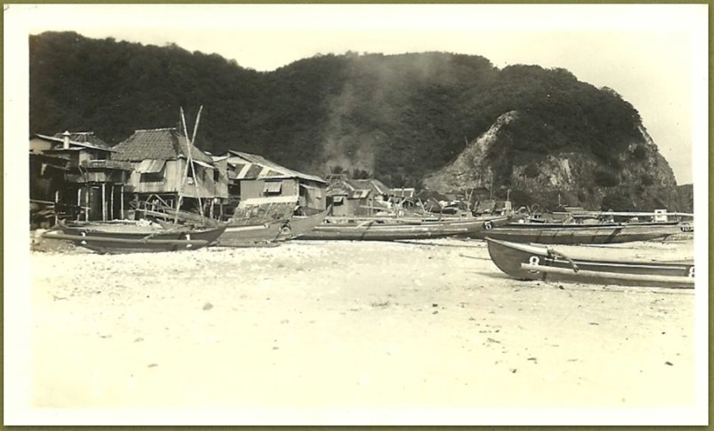 Barrio San Jose at the beach! Camping is near this area and is also the site of the major amphibious landing for WW11. Many thanks to Paul as always for this great material. |
|
|
|
Post by T2 on Nov 29, 2016 7:39:15 GMT 8
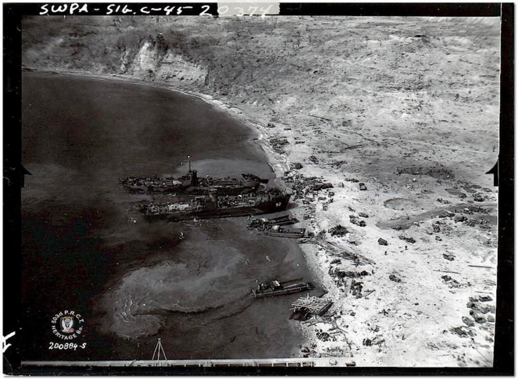 Mighty big difference from the San Jose days and even bigger in todays world |
|
|
|
Post by T2 on Nov 29, 2016 7:45:30 GMT 8
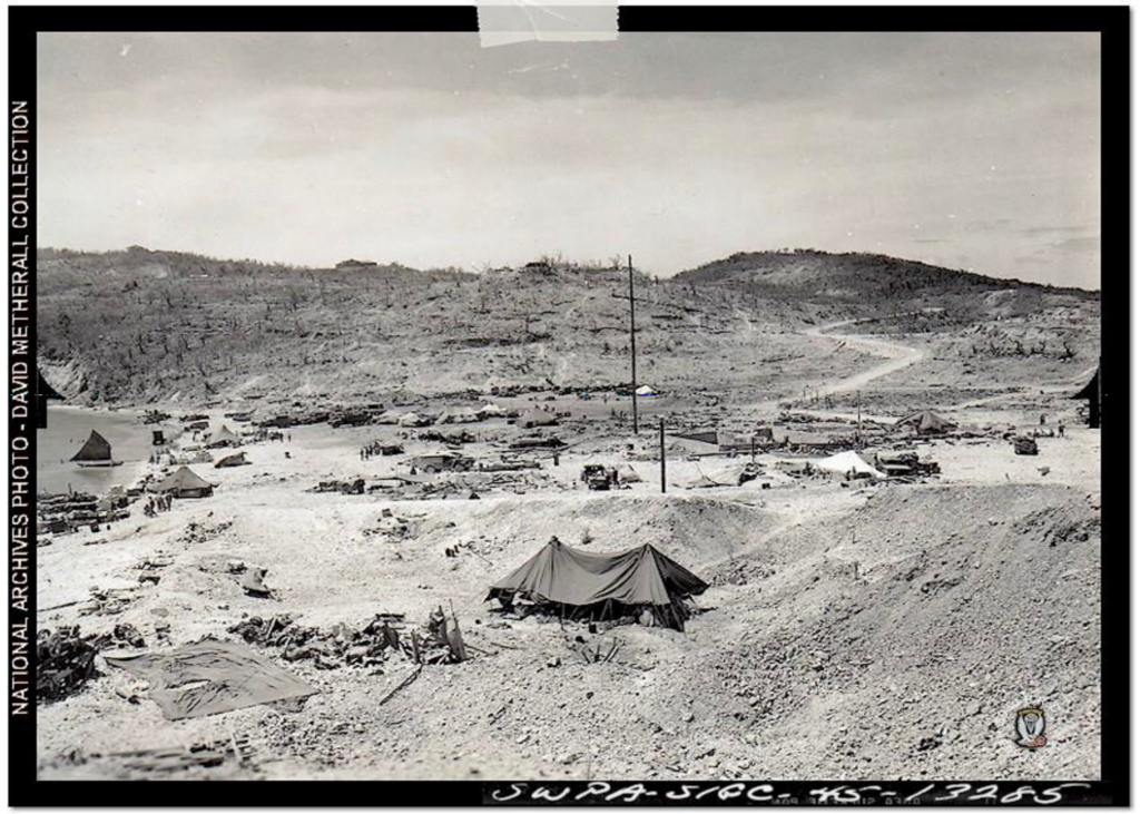 Just noticing two "cellars" in the center and a smidge to the right in this picture...recon has begun! |
|
|
|
Post by T2 on Nov 29, 2016 7:52:05 GMT 8
I would love to have anyone share some details of these two photos...thank you in advance
|
|
|
|
Post by cbuehler on Nov 29, 2016 23:59:56 GMT 8
Those are some fantastic photos! It graphically illustrates the virtual desertification of Corregidor in 1945. These photos would be sometime shortly after the battle to retake the island, with the bottom photo showing tents and supplies and vehicles. I would think that the 503rd may have been gone by this time, or at least in the process of leaving and being replaced by other troops.
An absolute mess with no trace of the former appearance of the area.
CB
|
|
|
|
Post by T2 on Nov 30, 2016 7:59:16 GMT 8
Thank you CB I would agree with you 100% in the first picture all the landing craft appear to be starting the process on the beach head while pic #2 has alot more troops in position, tents up and getting settled. I would add that MacArthur returned on March 2nd 1945, one day before they called Philippines secure, to the South Dock in PT373 with 3 PT escorts. In the first picture you can see the South Dock and I do have a snap shot of MacArthur just leaving the edge of the dock and stepping on land. In this snapshot I am talking about, there is an AA gun emplacement, lots of sandbags around it and a slightly more organized entrance than what is being shown in this first picture. I wonder how long it would take to set this entrance way once being notified VIP's are coming to Corregidor! This time frame to organize might lead to the exact date of the first picture. I say this because the complete annihilation of Corregidor was very much there on March 2nd 1945 but with a more organized entry point. I believe the 503rd started the Corregidor jump Feb 16th 1945.
|
|
|
|
Post by T2 on Nov 30, 2016 8:16:59 GMT 8
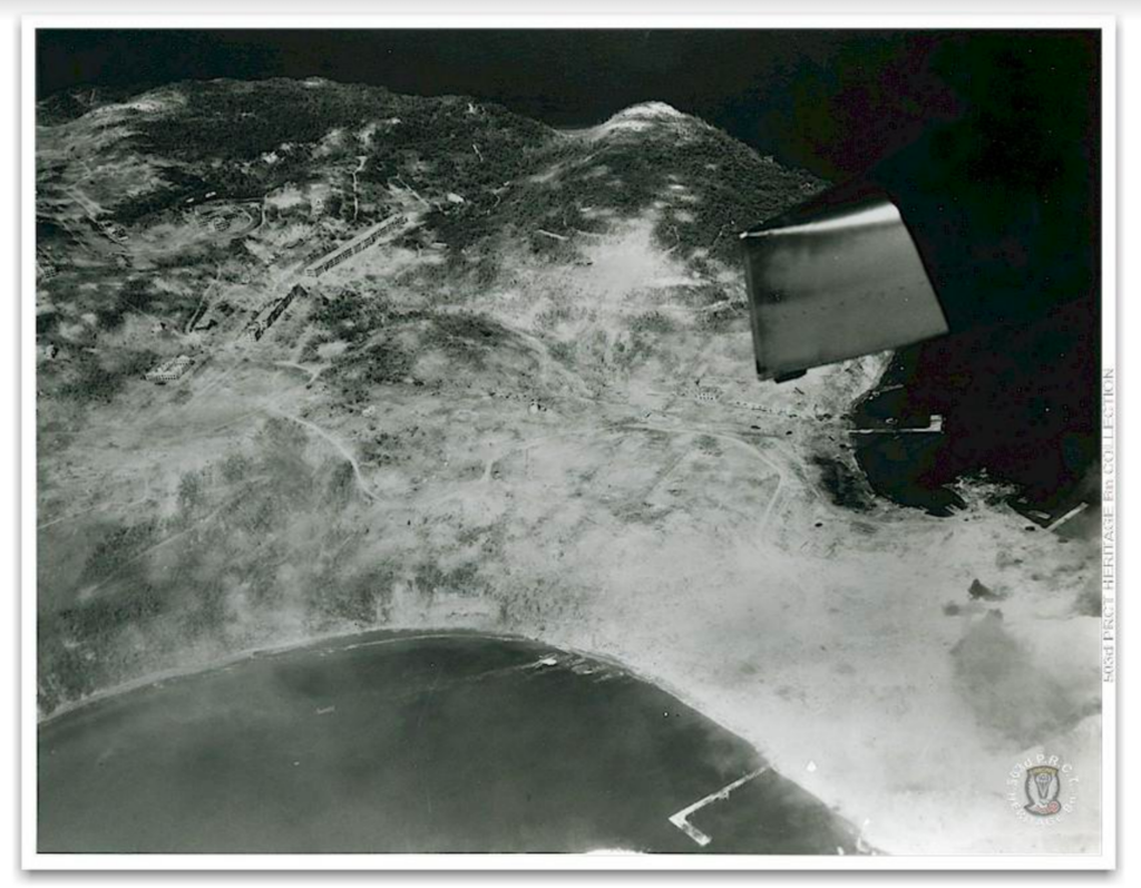 Reconnaissance flight with landing craft at the beach head. Corregidor very sadly annihilated. |
|


