Battle of the Zig-Zag Pass and Mabel's Tit
This entry is about my walking in the Luzon Mountains, and particular this entry is about Subic Bay.
Joe Sherrill was a Sailor (3rd Class Petty Officer, Radio Man) on the famous LSM-51 that took the Army to Fort Drum, the Concrete Battleship, in Manila Bay in 1945. We communicate with each other. Here is an answer from him about Mabel’s Tit. For your information, Mabel’s Tit is what the GIs called a peak in Subic Bay which on the map is called Suso ng Dalaga (Maiden’s Tit).
To: Karl-Welteke Welteke
Subject: Re: One of my note-worthy hikes
Hi Karl,
Great pictures and I really enjoy them. I wonder if you are familiar with a peak that the GI's
referred to as Mabel's Tit? From out in the bay it certainly had a resemblance of that. I was surprised at the number of soldiers who made mention of it when we had them in that area. We operated in the area on several occasions during 1945.
Thanks again for sending the pictures.
Joe
I answered Joe with the below email and this picture:
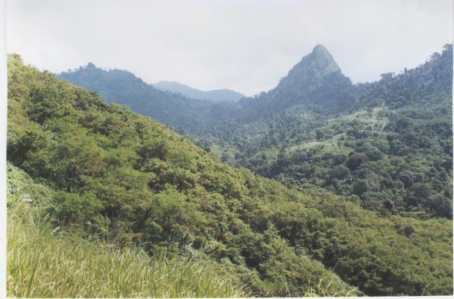
V537. Mabel’s Tit, Maiden Tit, Suso ng Dalaga. This picture of Suso ng Dalaga is from our walk 2002-08-24 and is provide by Jos, my Belgian Lady walking partner in Subic Bay.
From: Karl-Welteke Welteke
Sent: Tuesday, March 30, 2010 3:09 PM
To: 'Joe Sherrill'
Subject: RE: One of my note-worthy hikes
Joe
You only could be talking about the one on the attachment. That peak has the name Suso ng Dalaga on the map and knowledgably locals call it that also. Suso ng Dalaga means “Maiden’s Tit”. That picture is from hiking friend Jos. Yes, you can see it also from the bay in front of the Subic Base and Olongapo.
That is a nice piece of news from the war, from Subic Bay in 1945; thanks Joe
Karl
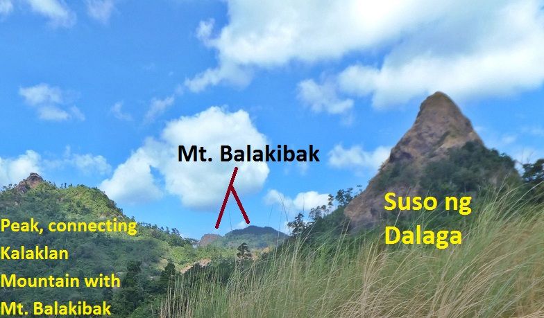
V538. Here is a closer picture of Suso ng Dalaga. It is from our walk 2017-01-06.
During the Battle of the Zig-Zag Pass, 1945, one whole regiment, the 149th of the 38th Div marched thru these mountains. THAT IS AN AMAZING ACCOMPLISHMENT and hardly anyone mention it. I know the route and I have to express my greatest Bravo Zulu for these GIs who done it. I am sure they not only carried their full combat equipment and most likely had to carry more. See the map and order from the 38th Inf. Div. Report, the Avengers of Bataan.
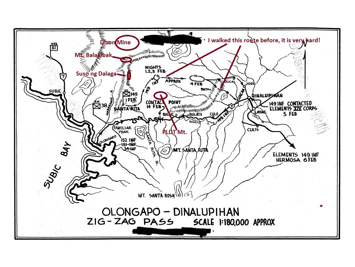
V539. The Plan of Attack, 38th Inf. Div. to advance two regiments parallel with each other to Dinalupihan.
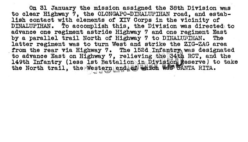
V.540.The paragraph ordering the two regiments to advance parallel with each other to Dinalupihan.
If you are interested in our walk to the peak of Suso ng Dalaga we present 37 images in this album:
s74.photobucket.com/user/PI-Sailor/library/Walk%20in%20the%20Philippines/No%201%20Walk%20PI%20Group/PLDT%20Mt%20-%20Sta%20Rita%20Mt/Susu%20Dalaga%202017-01-06?sort=9&page=1From the above album of our walk to Mt. Suso ng Dalaga I present 3 images here but they are much smaller:
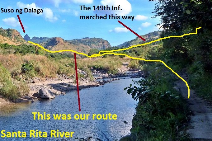
V541. We have started our walk, Suso ng Dalaga is in sight.
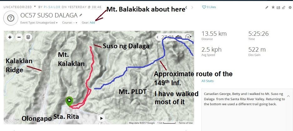
V542. The terrain and data of our walk to Suso ng Dalaga on the 6th of Jan 2017.
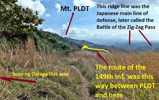
V543. A look back from our walk to the peak of Suso ng Dalaga, we are near it. From this vantage point we can see the route of the 149th Inf. around PLDT Mt. and we can see much of the Japanese Main Line of Defense. It stretches further to the east.
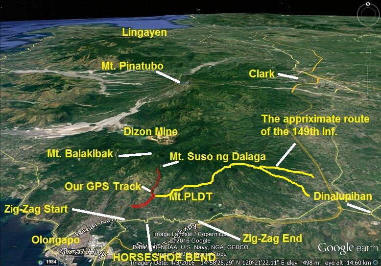
V544. Here is a bigger Google Earth picture for your orientation.
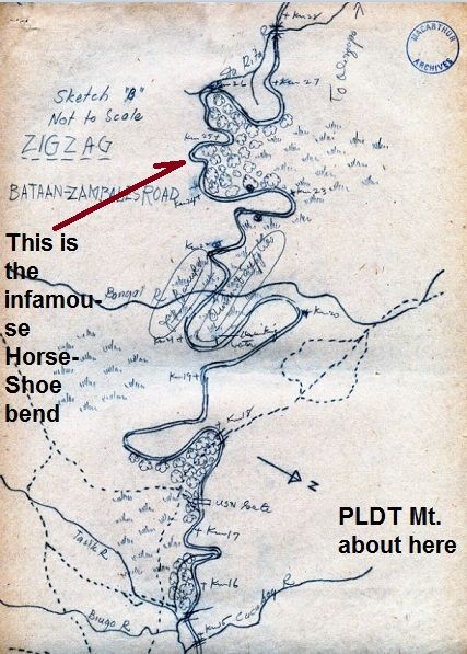
V545. This is a story of many unsung heroes, this is a story of Corporal John Boone, a soldier of the famous 31st Inf. Regiment. He did not surrender and helped in establishing a guerrilla unit, right in our back yard, at Dinalupihan Town. Near Dinalupihan is a monolith peak, called Mt. Malasimbo, nearby there was his Head Quarter. He provided this map and much more to Gen. MacArthur’s Intelligence Service. This map, reduced in size here, was send to me by the Gen. MacArthur Memorial Archivist James Zobel. I bet you any kind of money that the 149th Inf. would not been able to walk thru these mountains without the troops of John Boone’s Guerrillas to guide them. This was John Boone’s backyard.


