|
|
Post by fots2 on Sept 9, 2009 15:48:40 GMT 8
Here are some photos I promised for okla and for anyone else who is interested. Most are not labeled as to their exact location because I did not think it was worth the effort. I walked through the three levels of all the remaining buildings so you will get a good sample of the whole complex. The barracks are mostly free of rubble and garbage, only recently fallen pieces of concrete litter the floors. Day tourists are allowed to wander all around the barracks during their stop at the adjacent Pacific War Memorial and museum but few seem to wander over here. Some areas are definitely dangerous so I assume management hopes tourists display a little common sense. The first two photos are pre war views of the Mile Long Barracks to use as references when viewing what you see today. 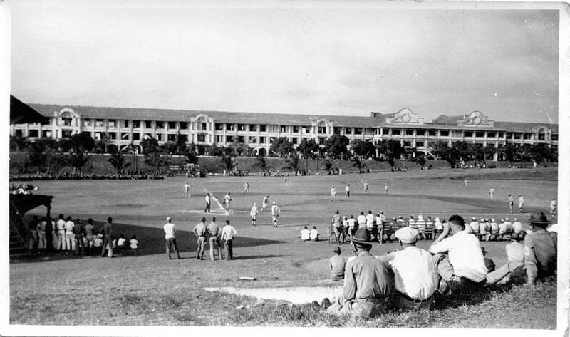 Z1fots001 “Mile Long Barracks” image on Corregidor Island. 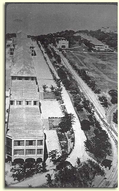 Z1fots002 “Mile Long Barracks” image on Corregidor Island. 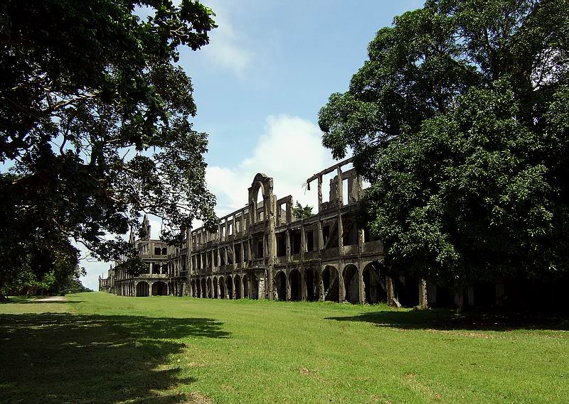 Z1fots003 “Mile Long Barracks” image on Corregidor Island. 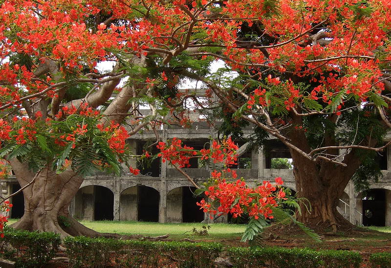 Z1fots004 “Mile Long Barracks” image on Corregidor Island.  Z1fots005 “Mile Long Barracks” image on Corregidor Island. 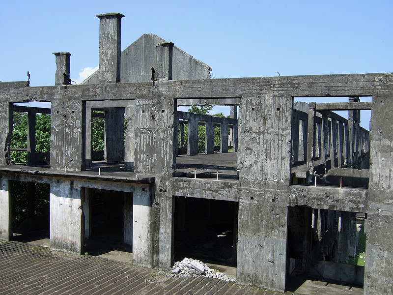 Z1fots006 “Mile Long Barracks” image on Corregidor Island. 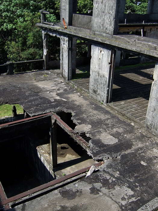 Z1fots007 “Mile Long Barracks” image on Corregidor Island. 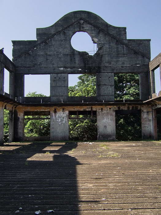 Z1fots008 “Mile Long Barracks” image on Corregidor Island. 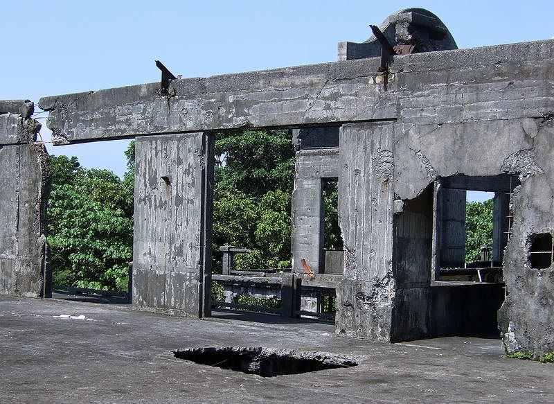 Z1fots009 “Mile Long Barracks” image on Corregidor Island. 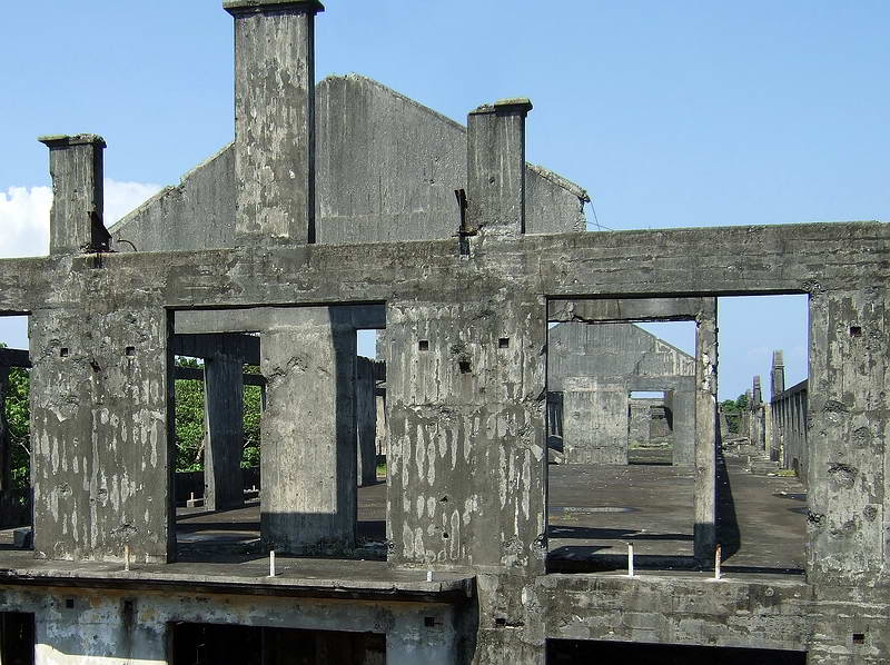 Z1fots010 “Mile Long Barracks” image on Corregidor Island. 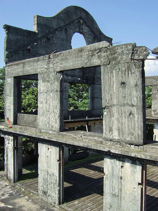 Z1fots011 “Mile Long Barracks” image on Corregidor Island. 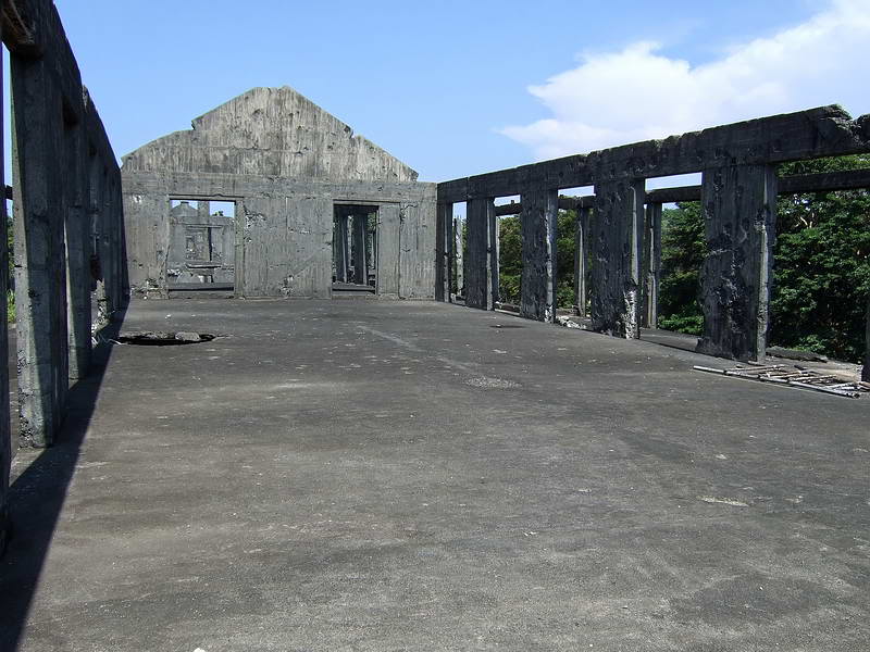 Z1fots012 “Mile Long Barracks” image on Corregidor Island. 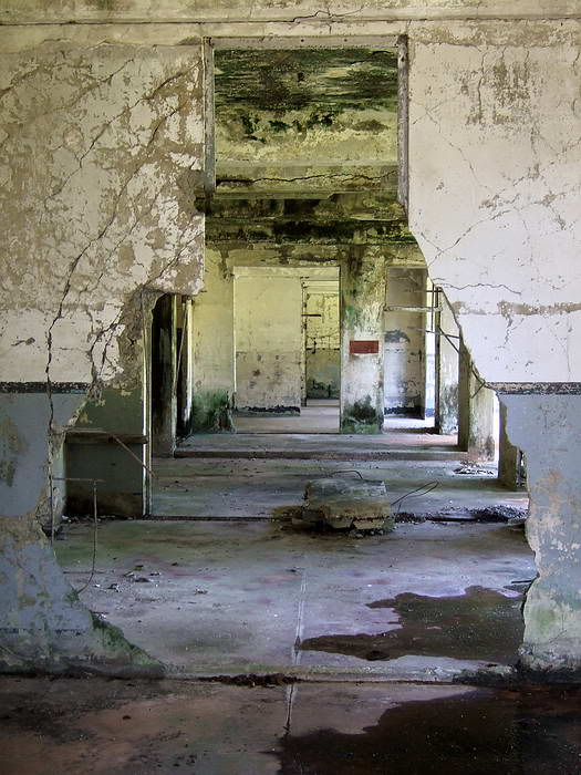 Z1fots013 “Mile Long Barracks” image on Corregidor Island. 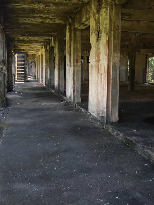 Z1fots014 “Mile Long Barracks” image on Corregidor Island. 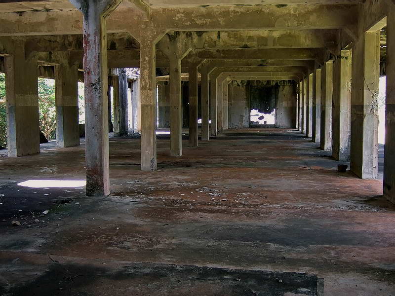 Z1fots015 “Mile Long Barracks” image on Corregidor Island.  Z1fots016 “Mile Long Barracks” image on Corregidor Island. 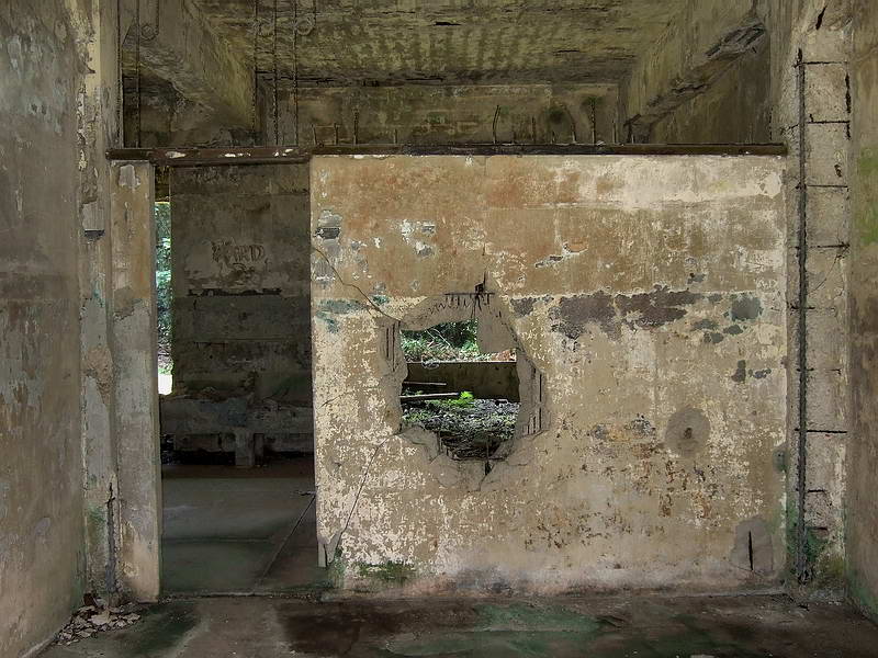 Z1fots017 “Mile Long Barracks” image on Corregidor Island. 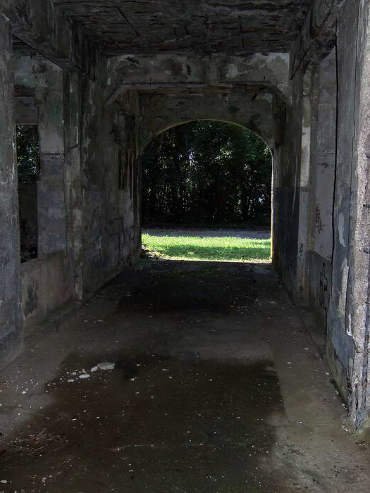 Z1fots018 “Mile Long Barracks” image on Corregidor Island.  Z1fots019 “Mile Long Barracks” image on Corregidor Island. 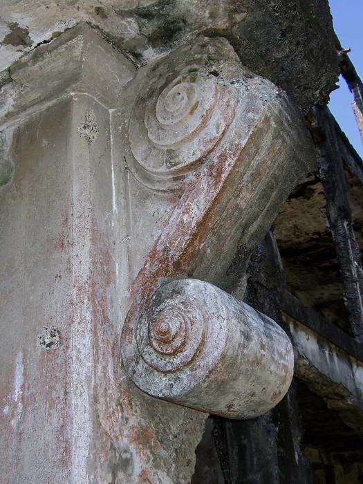 Z1fots020 “Mile Long Barracks” image on Corregidor Island. 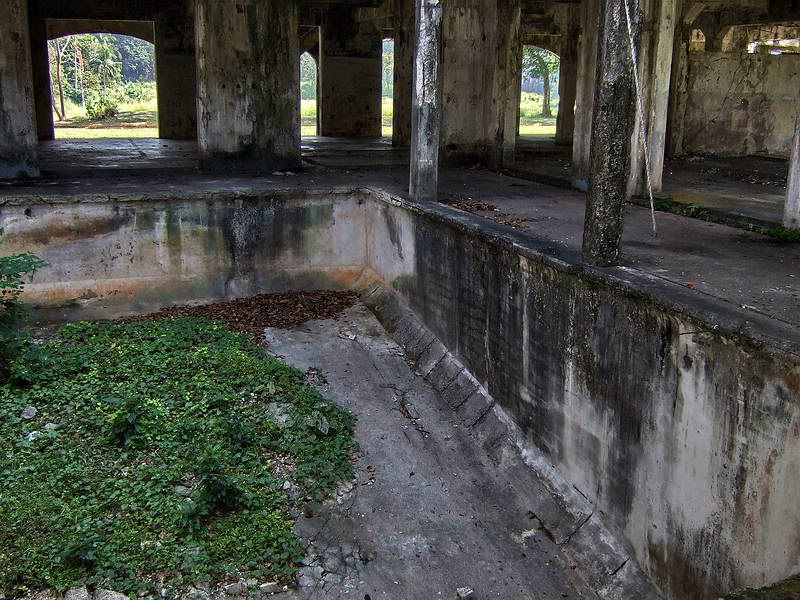 Z1fots021 “Mile Long Barracks” image on Corregidor Island. Swimming pool. 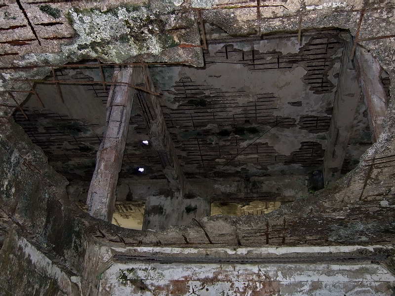 Z1fots022 “Mile Long Barracks” image on Corregidor Island. 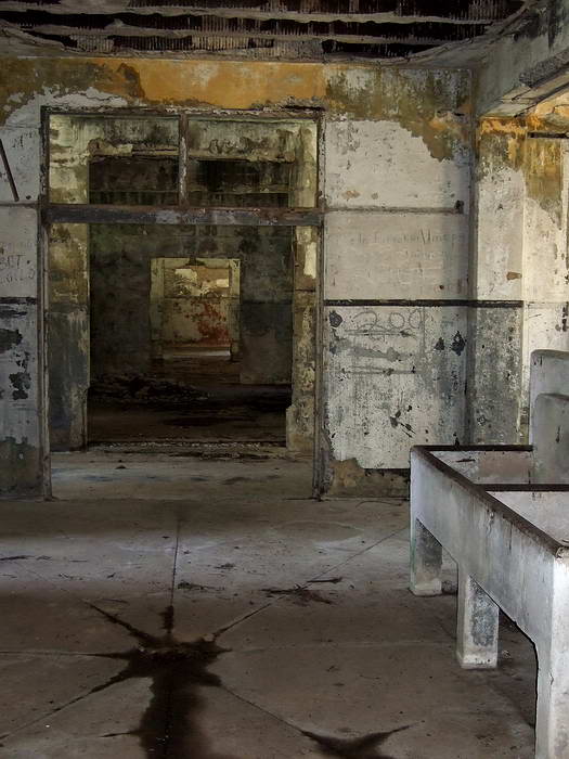 Z1fots023 “Mile Long Barracks” image on Corregidor Island. 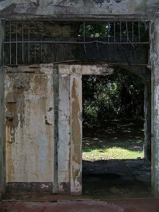 Z1fots024 “Mile Long Barracks” image on Corregidor Island. 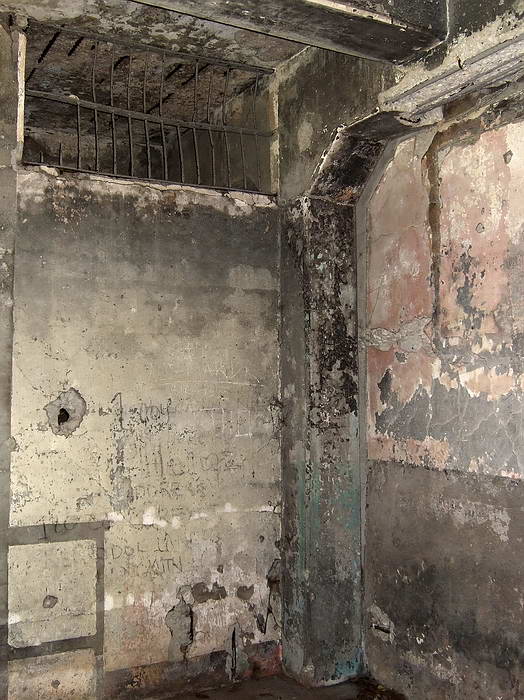 Z1fots025 “Mile Long Barracks” image on Corregidor Island. Rear wall of the Guard House. 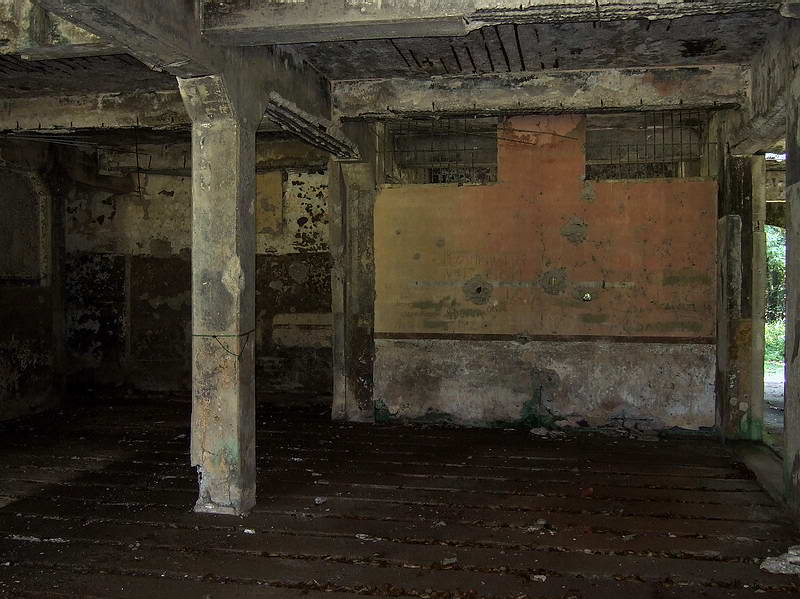 Z1fots026 “Mile Long Barracks” image on Corregidor Island. 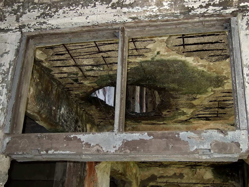 Z1fots027 “Mile Long Barracks” image on Corregidor Island. 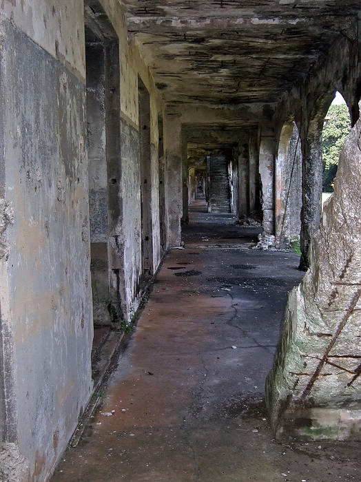 Z1fots028 “Mile Long Barracks” image on Corregidor Island. |
|
|
|
Post by okla on Sept 10, 2009 0:10:16 GMT 8
hey fots...many thanks for the shots of the mile long barracks. an absolutely great addition to fots' fabulous foto tours. this group of pics, to me at least, rates right up there with the malinta tunnels collection. some folks might not see much in these views, but i, with my vivid imagination, can almost hear those old, cranky, peacetime, 30 years sergeants making the troops drop their @#$%^ and grab their socks. the pics of the guard house puts me in mind of how many poor, hungover dog faces, faced the cruel daylight after having lost their cool and wrecked some manila bar before being loaded on the barge back to the "rock" and probably some pretty harsh, "peace time army" punishment. i will say again, i wouldn't blame any poor southern share cropper youth or pennsylvania/ west virginia coal field kid for fleeing the drudgery and poverty of his situation and enlisting in the army (or navy) and volunteering for foreign duty. in those days the only places, other than usmc embassy duty, overseas would be hawaii, panama, puerto rico, alaska, and the PI.. i can certainly see why, even buck privates, would think they were in a much better place being assigned to the "mile long barracks". the $18.75 that privates drew monthly went a long way in the 1920s and 30s. i never lived in accommodations as good as those barracks and i am talkin' 1950s for myself. i wont go into the scenery and those south china seas sunsets. these, alone, would be enough for me. in short, i would have done it in a mili-second. a two or three year hitch on corregidor would have been time well spent in my humble. i believe i mentioned to you or at least posted on this board, that back when i was in junior high school, i had a neighbor who served "the big guns" (as he described it) on corregidor back in the 1920s. he was one of those young men who had escaped the cotton fields of his native tennessee. fots, thanks again for your efforts to keep me absorbed in the philippines. the only drawback to the fots tours is that i start regretting missing out on my attempt to extend my far east USAF hitch by being reassigned from korea to clark field way back in 1953.
|
|
Deleted
Deleted Member
Posts: 0
|
Post by Deleted on Sept 10, 2009 6:02:12 GMT 8
Yes, once again, you've given us a wonderful look with this latest series.
Your photography lets us get personal with these buildings.
Thank You again,
Alan
|
|
|
|
Post by fots2 on Sept 11, 2009 14:26:03 GMT 8
You are welcome for the photos gents.
okla, that is good info on the lives of the grunts at the bottom. I expect a posting to Asia and the Philippines in particular was a unique place to be in those days.
When the war reached Corregidor, it must have been quite a shock to have most surface buildings reduced to rubble and their routine lives changed forever.
|
|
|
|
Post by okla on Sept 11, 2009 23:54:12 GMT 8
hey fots....i have never given it too much thought over the years, but after viewing the excellent shots of the mile long barracks i got to thinking about just how many bazillion cubic yards of concrete went into the construction of the mile long and middleside barracks, the officers quarters, cine theatre, headquarters buildings, gun emplacements, and, of course, the massive malinta tunnel complex. i am forgetting other facilities, but just the thought of what it took to complete all the corregidor establishment blows my mind. where was all the rock quarried for use in the production of concrete??? where were the concrete plants located, on luzon or on the "rock" itself. how much convict labor was involved?  ? so much went into this endeavor. it truly was a tremendous undertaking from start to finish (and i guess it wasnt finished when december 8, 1941 dawned--manila time). postscript....my wife was very impressed with the photo of the ruined barracks pictured behind the gorgeous red blossomed trees. i told her that the same guy shot that picture that took the finest photo ever taken, that being the sunset over bataan that i display in my den and use as my screen background on my PC. |
|
|
|
Post by fots2 on Sept 12, 2009 14:53:42 GMT 8
Yes there is an amazing amount of concrete on that island. A quarry and rock crusher was at the location which later became the Malinta Tunnel west entrance, there may have been more of them. I do not know where the concrete was mixed. Concrete to start building the Malinta Tunnel came from Japan. These three photos give you a good idea of the length of the barracks. The actual length is close to 1/3 of a mile but that is still a long building. In the upper right of the last photo, you can see the hospital. ![]() 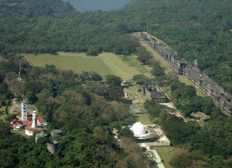 Z1fots029 “Mile Long Barracks” aerial from John Moffitt 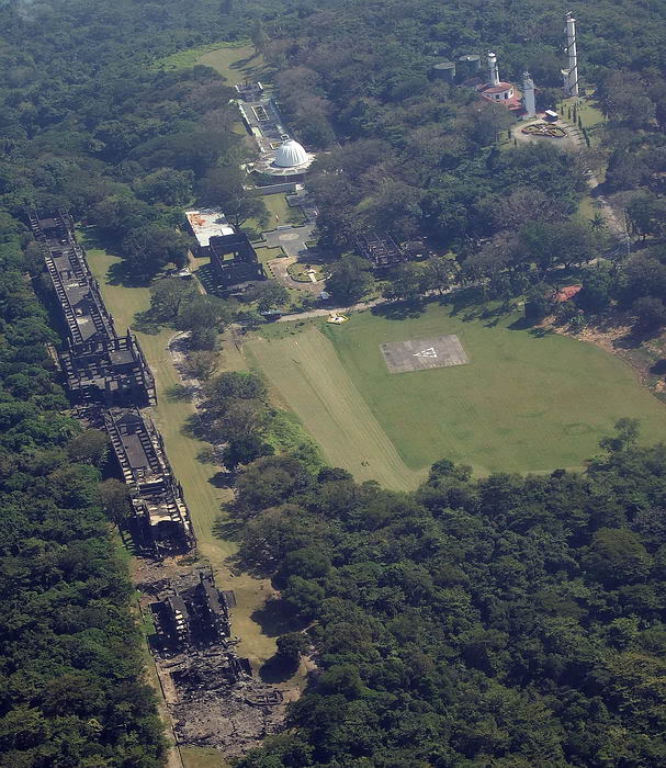 Z1fots030 “Mile Long Barracks” aerial from John Moffitt 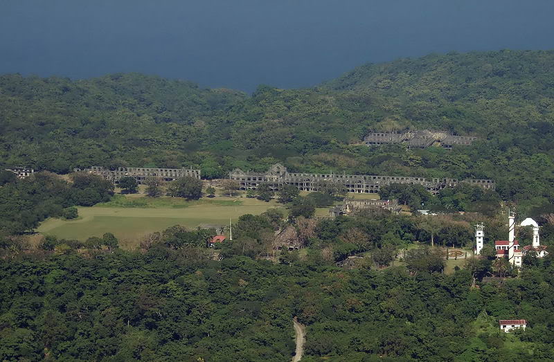 Z1fots031 “Mile Long Barracks” aerial from John Moffitt |
|
|
|
Post by okla on Sept 13, 2009 8:56:29 GMT 8
hey fots....you say the concrete for malinta was from japan? how ironic. i think i will retire for the evening on learning that little tidbit. somewhere, either on this board or maybe vic's philippine scout board, there is a photo posted by someone inquiring of what type vine seems to be taking over portions of the "rock". i answered that it appeared to be what we in the southern part of the USA call japanese kudsu. it was brought to the southern parts of the country during the 1930s drouth and economic depression by the US dept of agriculture in an attempt to halt or at least control soil erosion. it was too effective, as it started climbing over barns, sheds, fencing, telephone and telegraph poles. killing or controlling it is very difficult. you can almost see it growing (being facetious here) if one watched closely. my point being, it is rather ironic that the japanese are re-taking the "rock" with a fast growing vine if this weed, is indeed, japanese kudsu. |
|
|
|
Post by fots2 on Sept 13, 2009 10:25:28 GMT 8
Hi okla,
I have no idea what that climbing vine is but it just hangs and drapes itself over even the highest trees. It looks like a green wall at the road sides and any open areas where it seems to thrive. Even the dry season does not slow it down. Certain areas are infested with the vine and it is spreading.
I hear that it covers then smothers out the other vegetation, even trees. Trying to walk through it is a bit of a challenge, it is so thick that you can’t even see your feet on the ground. God knows how many hundreds of snakes are hiding in there!!!
ExO suggested that goats might eat it. Have they tried that in Okla?
I wonder what it will take for management to take action on this real threat to the island? As far as I know they are not even looking at it.
|
|
|
|
Post by okla on Sept 13, 2009 22:52:56 GMT 8
hey fots...EXO might be on to something as per turning goats loose on this clinging stuff. they are supposed to eat anything. it does seem to me that i have heard that story about the goats from friends in alabama. the deep south is where this stuff is so prevalent. ala, miss, louisiana,etc. i am not to sure that we have the problem here in oklahoma, except maybe in the far southeast corner of the state in what we here in tulsa call "little dixie". i dont believe any real, dependable solution has ever been devised to actually kill the plant out. its just a continual battle to contain according to my friends who live in "kudsu country". kudsu is a prime example of "unintended consequences" or to put it another way, "the cure is worse than the ailment". not to make light of the situation, but kudsu is a real problem in "old dixie".
|
|
|
|
Post by okla on Sept 14, 2009 9:42:09 GMT 8
hey fots....again, those are great shots of the mile long barracks. before we move on i have three more questions about these phenomenal ruins. first...could you tell me where (approximately) the swimming pool was/is located???western, central, or eastern portion of that vast structure. inside or outside? ?. it appears to be inside, but maybe there is just a canopy type covering? second...what is the significance, if any, of some areas of the floors being smooth concrete (or course, concrete lol) and some areas seeming to have small, shallow grooves? kinda like mini-speed bumps as found on some streets/roads/etc. third....are those shower stalls or semi-private latrine stalls. if latrine stalls, those mile long barracks were way ahead of their time. during my four years in the military any latrine i had available had no privacy at all. urinals and commodes were lined up like ducks in a shooting gallery where any participant, performing his bodily functions or grabbing a shower, was in full view of his fellow GIs. only the last year i served, after returning from korea, did i have access to private showers and commodes and that was only because the powers that be turned a brand new bachelor officer's quarters over to the "enlisted swine" because the officers were given something even better. these queries are of no consequence, but even inconsequential tidbits like this are of interest to me if it pertains to corregidor (or bataan). many thanks if you can shed a little light on these, admittedly, minute items. those aerial shots are great also. man, if those old, shattered walls could talk. they are impressive, even in their sad condition. |
|


 ? so much went into this endeavor. it truly was a tremendous undertaking from start to finish (and i guess it wasnt finished when december 8, 1941 dawned--manila time). postscript....my wife was very impressed with the photo of the ruined barracks pictured behind the gorgeous red blossomed trees. i told her that the same guy shot that picture that took the finest photo ever taken, that being the sunset over bataan that i display in my den and use as my screen background on my PC.