


Post by fots2 on Dec 1, 2009 10:47:28 GMT 8
Due to decades of fishermen stealing head stones for use as weights and anchors, little remains today of the two civilian cemeteries.
Although now is at the end of the rainy season, Karl and I decided to head towards the east end of Corregidor. We had to do some cutting but it was not near as bad walking as I expected. After getting a ride to Kindley Field, we entered the jungle from there and made our way down to the old road on the north side. At the road, we turned east.
The first cemetery just east of Kindley Field is the larger of the two. A rough stone wall still surrounds it but in most paces the stones are displaced and a line of stones is what you will see. The section I examined had layers of stone with no concrete to hold them together.
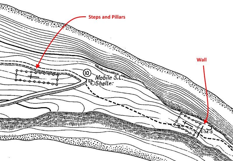
Halfway along the northern wall is the entrance. Here is a set of four or five concrete steps up from the road with two short pillars, one on each side.
I was disappointed to not find even a single head stone. There may be some hidden under the vegetation but everything obvious is gone. Several concrete head stone bases are there.
The second cemetery is much smaller and located further east where the island narrows significantly. There is no surrounding wall evident on any side. Here only two head stone bases were found, one broken into pieces.
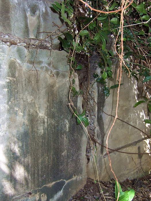
A few metres to the east of the headstones here is a structure not found on any map that I have. It is a concrete wall perpendicular to the coastline and runs almost completely from one side of the island to the other.
The ground on the western side of the wall is higher and a soldier could easily stand and shoot over the wall (at least most of it). The eastern side of the wall is quite high and well above a soldier's head.
The map shows a 'Mobile Searchlight Shelter' and the 'I-M-3' machine gun position in the area. We never found any trace of either of them.
We also did not find any of the Philippine Cobras that are supposed to infest the east end of the island. It was a good day.
The cemeteries portion of today's hike was a request from okla. I have never been to them before so it was good to see what remains of them, thanks for the suggestion. Past the wall, Karl and I continued our trek east and rounded the island walking via the beach.
Kindley Field airstrip with Mount Mariveles, Bataan in the distance.
Standing on the east end of the airstrip looking west.
The first thing you notice on approaching the first cemetery are the steps and short pillars.
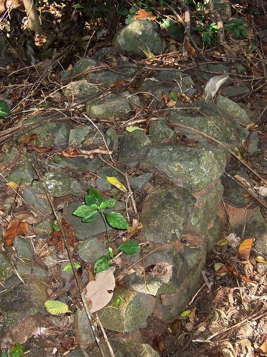
Sections of the outside wall are still intact. It is made up of layers of stones one to two feet wide and a foot or two high. Different sections seem to be wider or higher than others
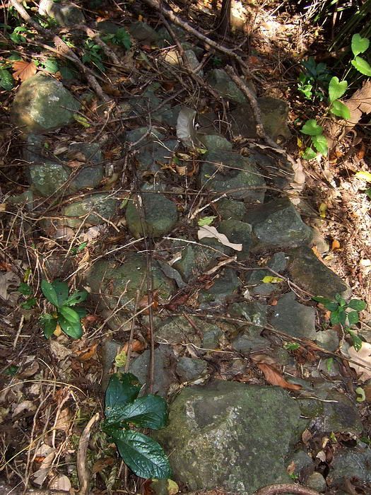
A narrower section of wall.
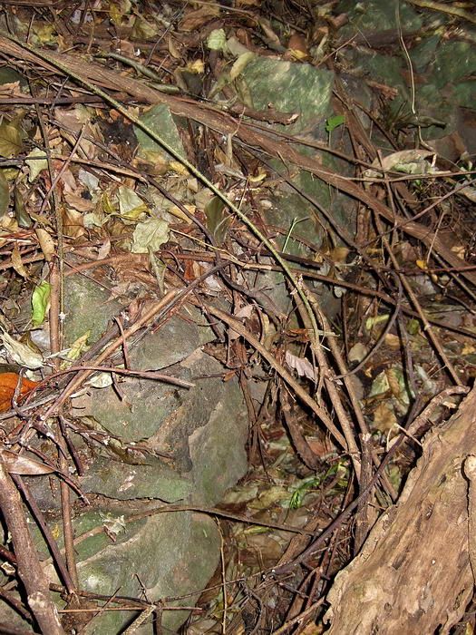
Most of the wall is just a long line of loose rocks like this view.
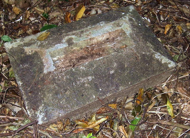
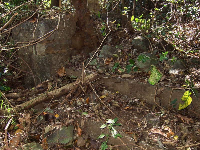
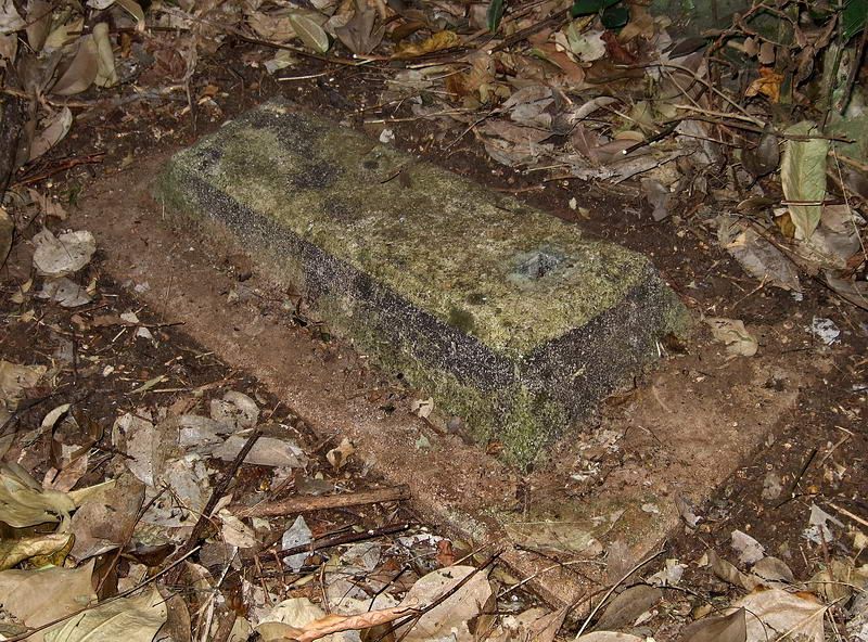
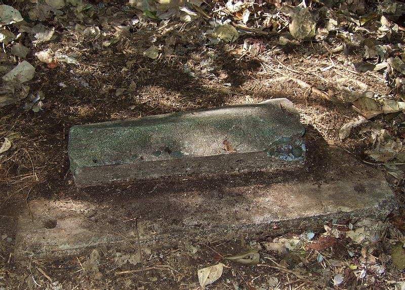
This is the best example of a head stone base that I saw. These bases are probably too heavy to carry away.
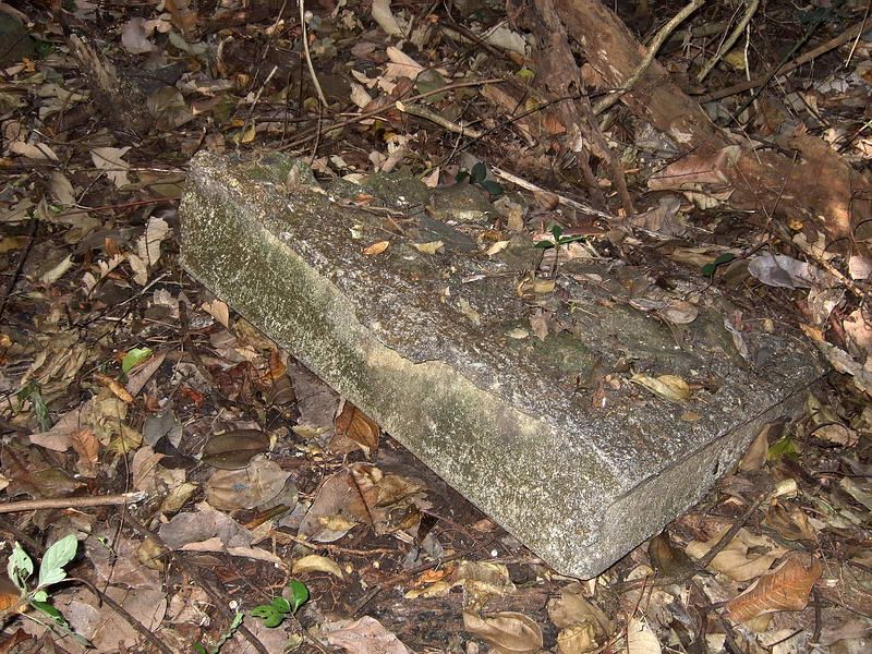
The notch in the top of this one may have been for a cross.
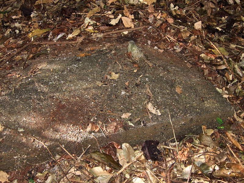
This one appears to have been turned upside down. It is rough concrete on the top now with the sides and bottom smooth.
Another one with a broken vertical concrete part.
I am not sure what this was but there are a few of them lying around, some intact, some broken.
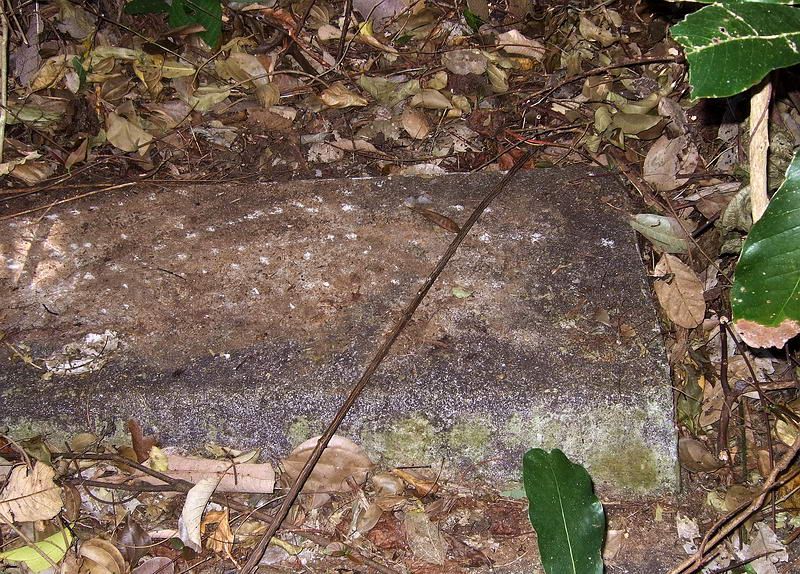
This is the only intact head stone base I found in the smaller second cemetery. Another broken lies nearby. This cemetery has no outer wall.
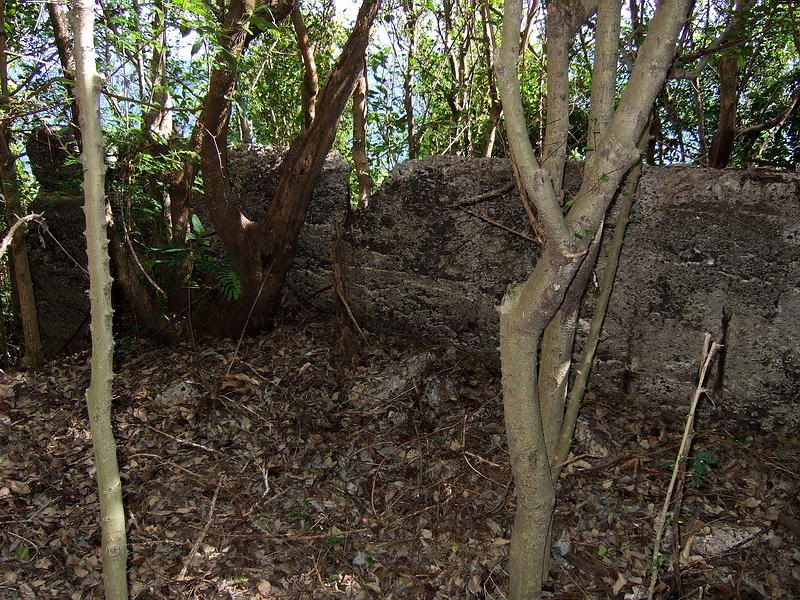
This wall (west side view) is just east of the second cemetery. The island is very narrow here. You can walk around the north side of the wall but it stretches almost all the way across the island.
Another west side view of the wall.
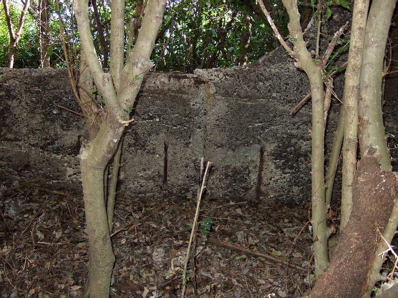
East side view of the wall.
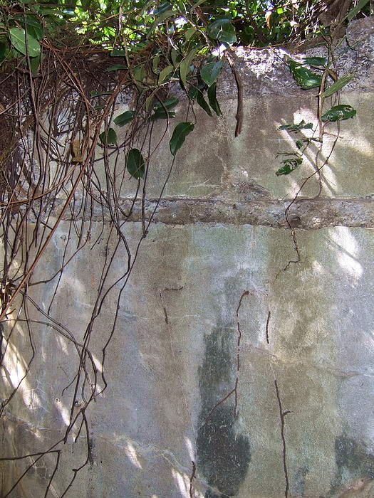
Another east side view of the wall.
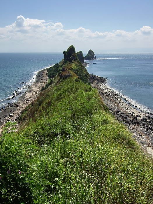
Just past the wall, the island narrows further, the scrub trees fade away and the ridge is covered with grasses taller than me - snake territory.
Nice view though, Hooker Point is in the distance. I will post more of these photos in the 'east coastline' thread.
Although now is at the end of the rainy season, Karl and I decided to head towards the east end of Corregidor. We had to do some cutting but it was not near as bad walking as I expected. After getting a ride to Kindley Field, we entered the jungle from there and made our way down to the old road on the north side. At the road, we turned east.
The first cemetery just east of Kindley Field is the larger of the two. A rough stone wall still surrounds it but in most paces the stones are displaced and a line of stones is what you will see. The section I examined had layers of stone with no concrete to hold them together.
Halfway along the northern wall is the entrance. Here is a set of four or five concrete steps up from the road with two short pillars, one on each side.
I was disappointed to not find even a single head stone. There may be some hidden under the vegetation but everything obvious is gone. Several concrete head stone bases are there.
The second cemetery is much smaller and located further east where the island narrows significantly. There is no surrounding wall evident on any side. Here only two head stone bases were found, one broken into pieces.
A few metres to the east of the headstones here is a structure not found on any map that I have. It is a concrete wall perpendicular to the coastline and runs almost completely from one side of the island to the other.
The ground on the western side of the wall is higher and a soldier could easily stand and shoot over the wall (at least most of it). The eastern side of the wall is quite high and well above a soldier's head.
The map shows a 'Mobile Searchlight Shelter' and the 'I-M-3' machine gun position in the area. We never found any trace of either of them.
We also did not find any of the Philippine Cobras that are supposed to infest the east end of the island. It was a good day.
The cemeteries portion of today's hike was a request from okla. I have never been to them before so it was good to see what remains of them, thanks for the suggestion. Past the wall, Karl and I continued our trek east and rounded the island walking via the beach.

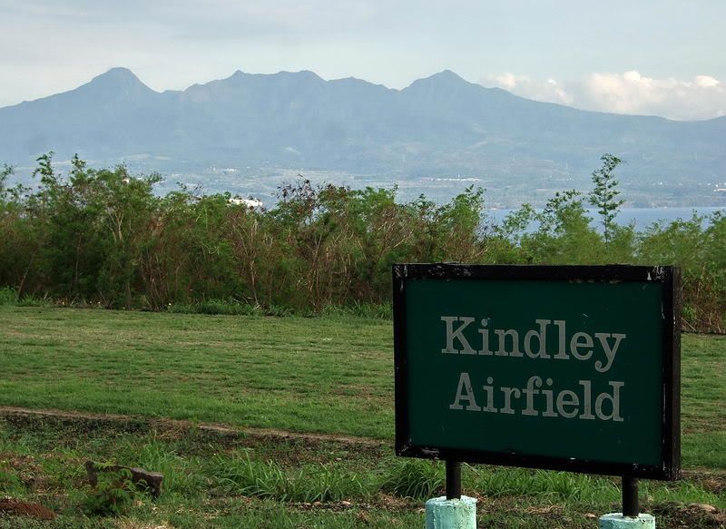
Kindley Field airstrip with Mount Mariveles, Bataan in the distance.
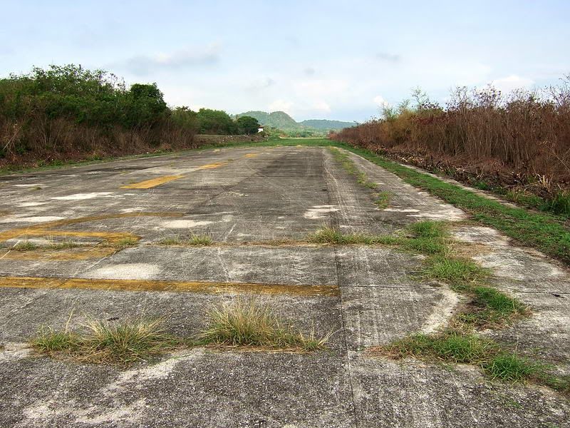
Standing on the east end of the airstrip looking west.
The first thing you notice on approaching the first cemetery are the steps and short pillars.
Sections of the outside wall are still intact. It is made up of layers of stones one to two feet wide and a foot or two high. Different sections seem to be wider or higher than others
A narrower section of wall.
Most of the wall is just a long line of loose rocks like this view.
This is the best example of a head stone base that I saw. These bases are probably too heavy to carry away.
The notch in the top of this one may have been for a cross.
This one appears to have been turned upside down. It is rough concrete on the top now with the sides and bottom smooth.
Another one with a broken vertical concrete part.
I am not sure what this was but there are a few of them lying around, some intact, some broken.
This is the only intact head stone base I found in the smaller second cemetery. Another broken lies nearby. This cemetery has no outer wall.
This wall (west side view) is just east of the second cemetery. The island is very narrow here. You can walk around the north side of the wall but it stretches almost all the way across the island.
Another west side view of the wall.
East side view of the wall.
Another east side view of the wall.
Just past the wall, the island narrows further, the scrub trees fade away and the ridge is covered with grasses taller than me - snake territory.

Nice view though, Hooker Point is in the distance. I will post more of these photos in the 'east coastline' thread.


 ?. I reply, "me, thats who. So leave me be, woman". Maybe I should dial up the excellent photos of the San Jose chapel to shut her up. She couldnt get enough of those. Thanks again for scoping out those haunting cemeteries. Postscript...Fots, on looking at the shots of the wall again, do I see where there is a bit of rebar visible and where there might have been some rebar removed. If so, wouldnt this indicate that this wall was probably built by American military?


