|
|
Post by Karl Welteke on Aug 21, 2006 6:25:36 GMT 8
Two WWII Pilots died here in a dogfight! A good friend, (Kevin Hamdorf-look him up on the www) is working on a story that 2 WWII planes crashed here in 1942. We don't know our way around here. Since I have more time than Kevin I did a preliminary exploring trip to find our way. The pictures tell the rest of the story. The dates on the pictures are not correct. This link is active again as 2011-07-31 app.photobucket.com/u/PI-Sailor/a/3d2ad397-3caa-4ae5-a912-8fa43edc9dfe?field=TITLE&desc=asc |
|
|
|
Post by okla on Nov 23, 2006 9:28:18 GMT 8
is the view of little baguio the same location as us army hospital number 1 during the bataan campaign of 1942. hospital number 1 was originally located closer to the front line and was moved to another location closer to mariveles during the early months of 1942.
|
|
|
|
Post by Karl Welteke on Dec 1, 2006 7:21:58 GMT 8
Hello Friend from Oklahoma.
Yes, I believe that is correct.
When, I first seen that sign I didn't know the significance of it.
I been there again since and I was told that the hospital was there.
|
|
|
|
Post by Karl Welteke on Jul 31, 2011 9:20:26 GMT 8
This sign is at the road that leads to the Tarak Ridge. It is along the Hwy. in Alasasin Village. The 'feet' on the sign should read meters! 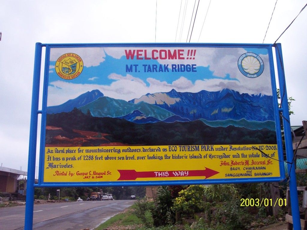 |
|
|
|
Post by Karl Welteke on Jul 31, 2011 9:28:03 GMT 8
Little Baguio!!! That got my attention. This is indeed the area where the hospital was relocated to and the area was called then “Little Baguio” This must be the area! 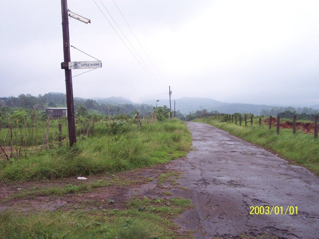 |
|
|
|
Post by Karl Welteke on Jul 31, 2011 9:30:41 GMT 8
There is a 2nd building near by where personal required me to sign in into a log. 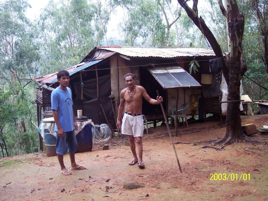 |
|
|
|
Post by Karl Welteke on Jul 31, 2011 9:35:27 GMT 8
To the right, east, of the Tarak Ridge Trail is the Real River Valley, that river runs all the way to Cabcaben Village. 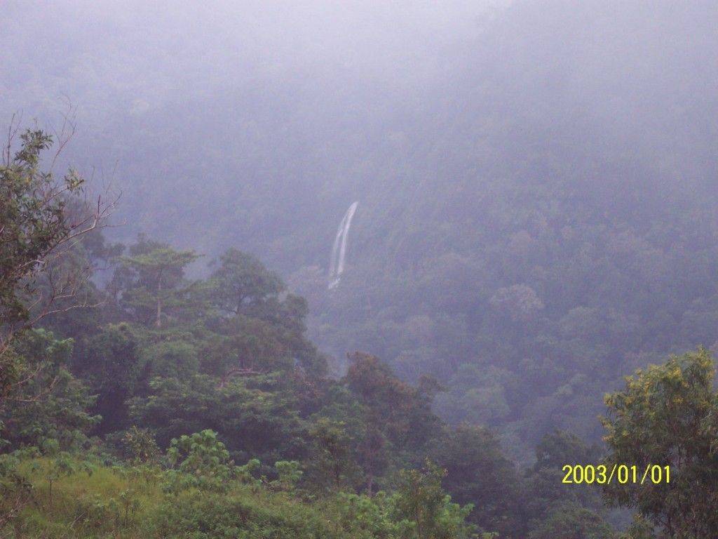 |
|
|
|
Post by okla on Aug 1, 2011 2:10:15 GMT 8
Hey Karl....How time, it does fly. I can't believe that it was way back in 2006 when I asked you if the "Little Baguio" sign, that is visible in your photo, might indicate that we were looking at the location of US Army Hosp No. 1. Did you ever learn if any of the locals, presently, have any info on the Hospital,etc.  ? That is quite a gorge that the Real River runs thru on it's way to Cabcaben and Manila Bay. It is my understanding that US Army Hospital No 2 was located near it's banks just north of Cabcaben. The nurses supposedly "skinny dipped" in the Real during periods when they might get a "break" from their long, grueling, duty hours. MPs were posted to give them some degree of privacy. |
|
|
|
Post by Karl Welteke on Aug 5, 2011 5:40:07 GMT 8
Hi Okla
Sorry to say: “No, I don’t have any real word or other confirmation as to the exact locations of the two Hospitals”. The location with the present sign ‘Little Baguio’ seems to match the general descriptions in many books as to where Hospital #1 was relocated to. This area is more than a ridge, it is more like a plateau and it is the dividing line of the watersheds to Mariveles and Cabcaben. On the Mariveles side is a equal deep valley and now has the water dam reservoir for Mariveles. As far as meeting and asking locals- very seldom would you meet one on the street who is either old enough or knowledgeable about the local history.
|
|
|
|
Post by dmether on Aug 5, 2011 17:55:31 GMT 8
This is part of a report "The official history of General Hospital Number 1" by Col. Duckworth, Commanding Officer Attachments:
|
|


 ? That is quite a gorge that the Real River runs thru on it's way to Cabcaben and Manila Bay. It is my understanding that US Army Hospital No 2 was located near it's banks just north of Cabcaben. The nurses supposedly "skinny dipped" in the Real during periods when they might get a "break" from their long, grueling, duty hours. MPs were posted to give them some degree of privacy.
