|
|
Post by Karl Welteke on Feb 22, 2024 15:12:47 GMT 8
|
|
|
|
Post by Karl Welteke on Feb 21, 2024 16:24:54 GMT 8
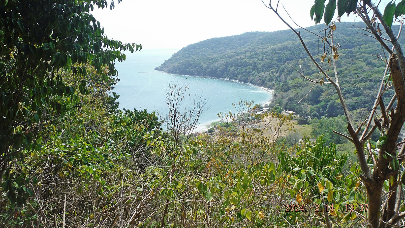
Corregidor Visit, First Flag 79th Anniversary, 1st Album Perhaps our 20th commemorations visit to Corregidor to celebrate the liberation of Corregidor in 1945. This is the 79th Anniversary on the 16 FEBRUARY, 1945 "...at about 1100, two men from the regimental headquarters company, T/5 Frank Agrrigo and Pfc. Clyde I. Bates, climbed up one of the few still-erect telephone poles near the parade ground and attached to its top a U.S. flag that flew there day and night for the rest of the campaign." - Corregidor The Rock Force Assault by Lt. Gen E.M. Flanagan, Jr. Corregidor Forum Flag Raising Ceremony: corregidor.proboards.com/thread/2509/2024-flag-raising-ceremonyThis is the 1st of 2 Albums We arranged it with the Corregidor Foundation Inc. (CFI), they gave us there full hearted support as in all the years before. They provided the Flag, serviced the Flagpole and Monument, gave us transportation and commemorated the Anniversary with us, Thank You Very Much CFI. This is the official Corregidor Foundation Inc. (CFI) office, who I deal with when I go with friends or myself. Call her, email her and ask. I heard that they have now scheduled Sunday visits. Melody Bondoc Corregidor Island Philippines [info@corregidorisland.com.ph] Sales & Marketing Officer Corregidor Foundation Inc. Rm. 10 Bay Terminal, CCP Complex, Roxas Blvd Malate Manila Tel # +63 2 8823.3281 Mob # +63 977.643.4819 website: www.corregidorisland.com.phwww.facebook.com/corregidor.island.adventure.tourI believe this is a former tour guide who is running this; he perhaps could organize a group of your people. I heard good things about him! -------------------------------------------- This is our Corregidor Forum Current Affairs INFO page: corregidor.proboards.com/board/8/corregidor-current-affairsFirst 10 Pictures Number 00 to #06 Pictures #00 and 01 show us checking in at the Villa Carmen Gate. We are told that the procedure has ---changed and we have to catch the boat at the MAAP Pier. We continued to there!   --------------------------------------------- Pictures #00a, #00b and #00c feature maps that will help you find the locations of this visit to Corregidor. 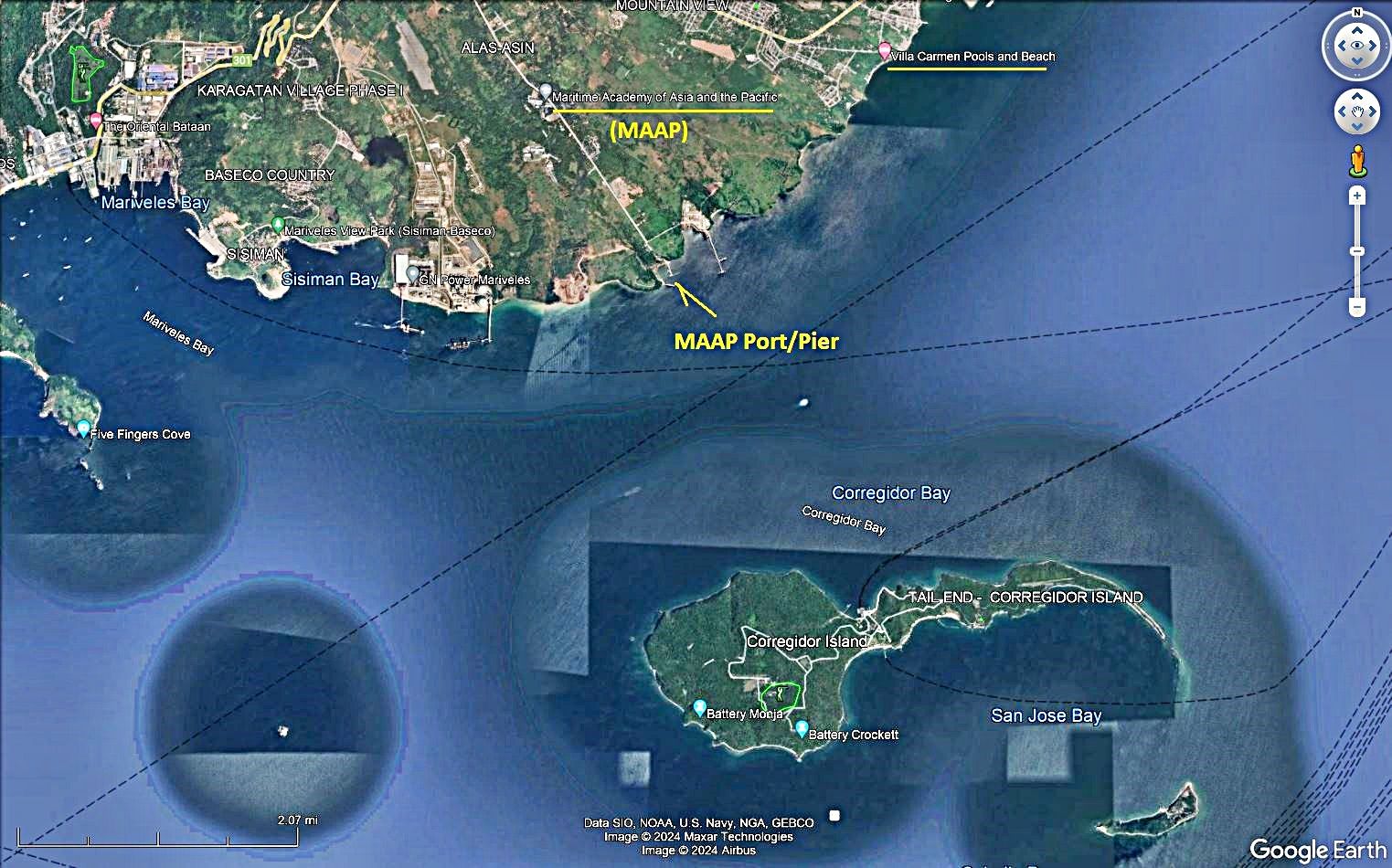   ---------------------------------------------- Pictures #02, #03 and #04 show us stopping at the Main Gate to the Marine Academy of Asia and the Pacific (MAAP). Just inside the gate at about 30 meters from it, is an Australian Memorial dedicated to the loss of a Black Cat Catalina. No.76 Wing RAAF, Black Cat Catalinas On 14 December, No. 43 Squadron, augmented by Catalinas from No. 11 Squadron based at Rathmines, New South Wales, mined Manila Bay to keep Japanese shipping "bottled up", thus supporting the Allied landing at Mindoro taking place the next day. Flying from Leyte, the 24 Catalinas successfully dropped 60 mines in the heavily defended target area for the loss of one of their number, and returned to base at the limit of their fuel reserves. The Corregidor Forum has this dedicated thread to this missing aircraft and crew: Australian WWII Memorial on Bataan corregidor.proboards.com/thread/2310/australian-wwii-memorial-on-bataan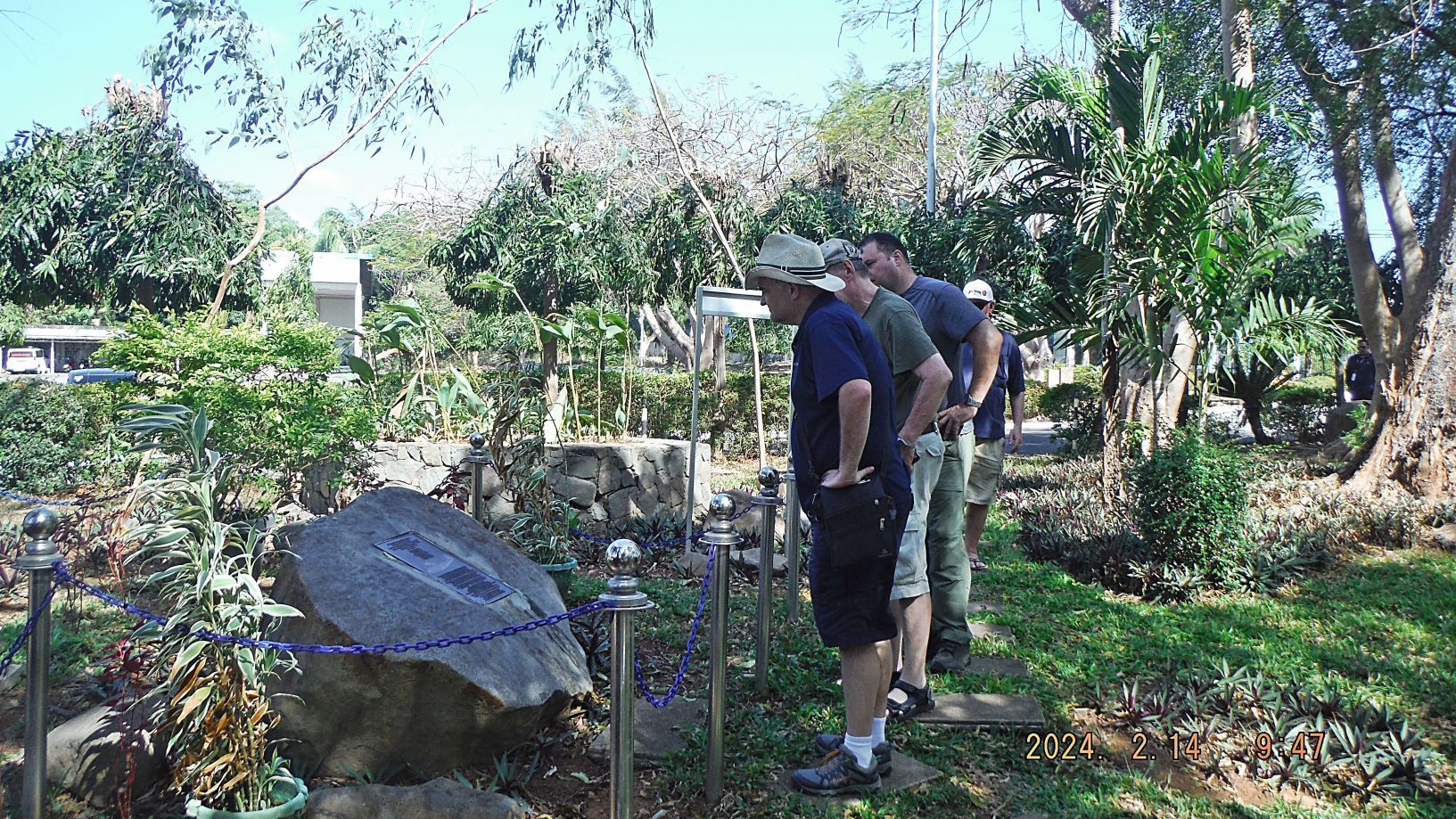 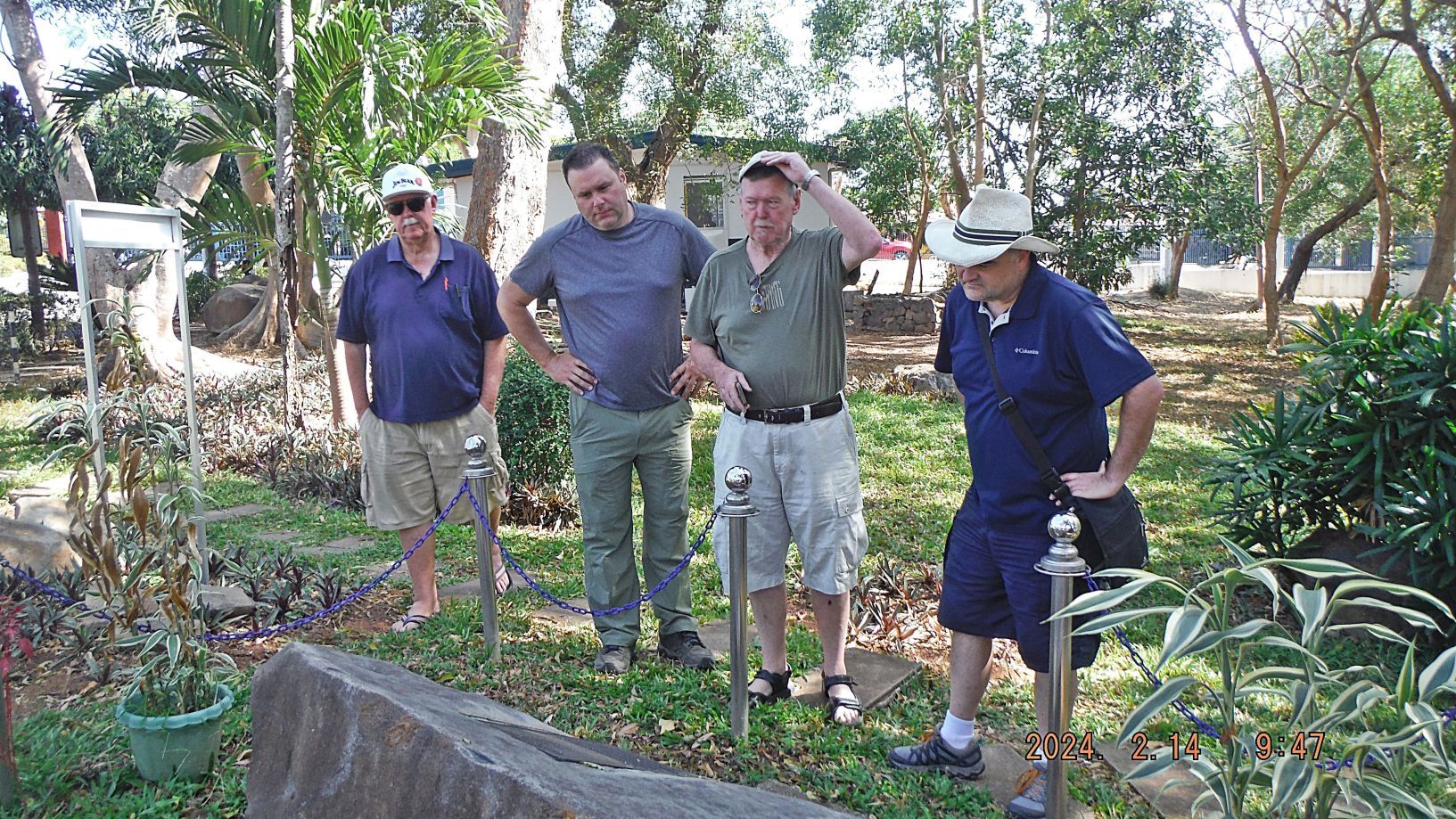 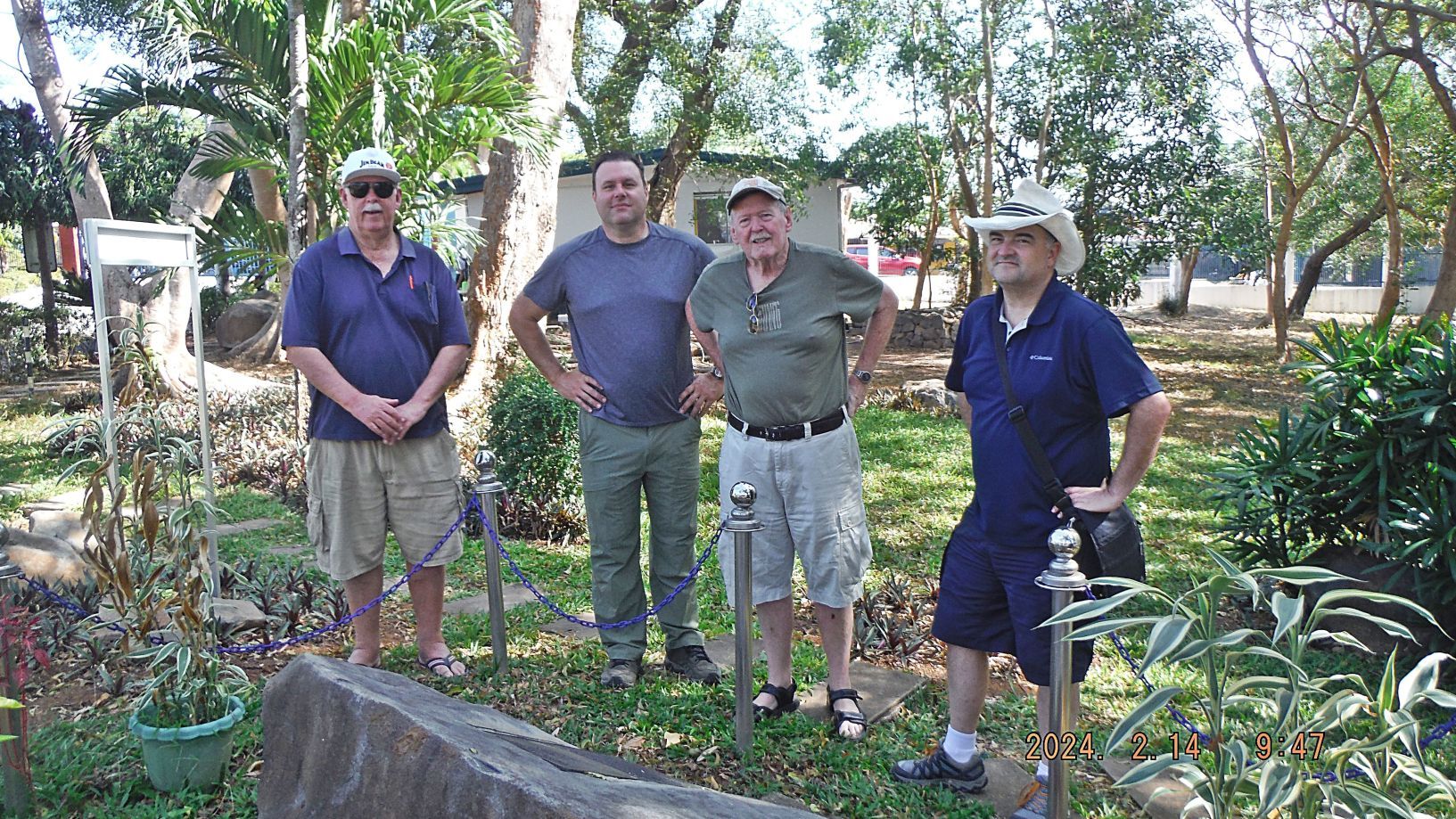 ---------------------------------------------- Pictures #05 and #06 show us loading on a Villa Carmen Boat at the MAAP Pier and go to Corregidor. 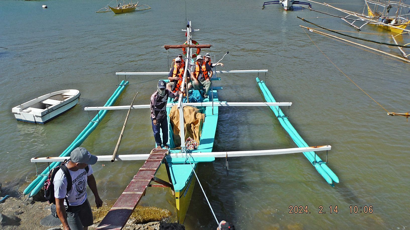 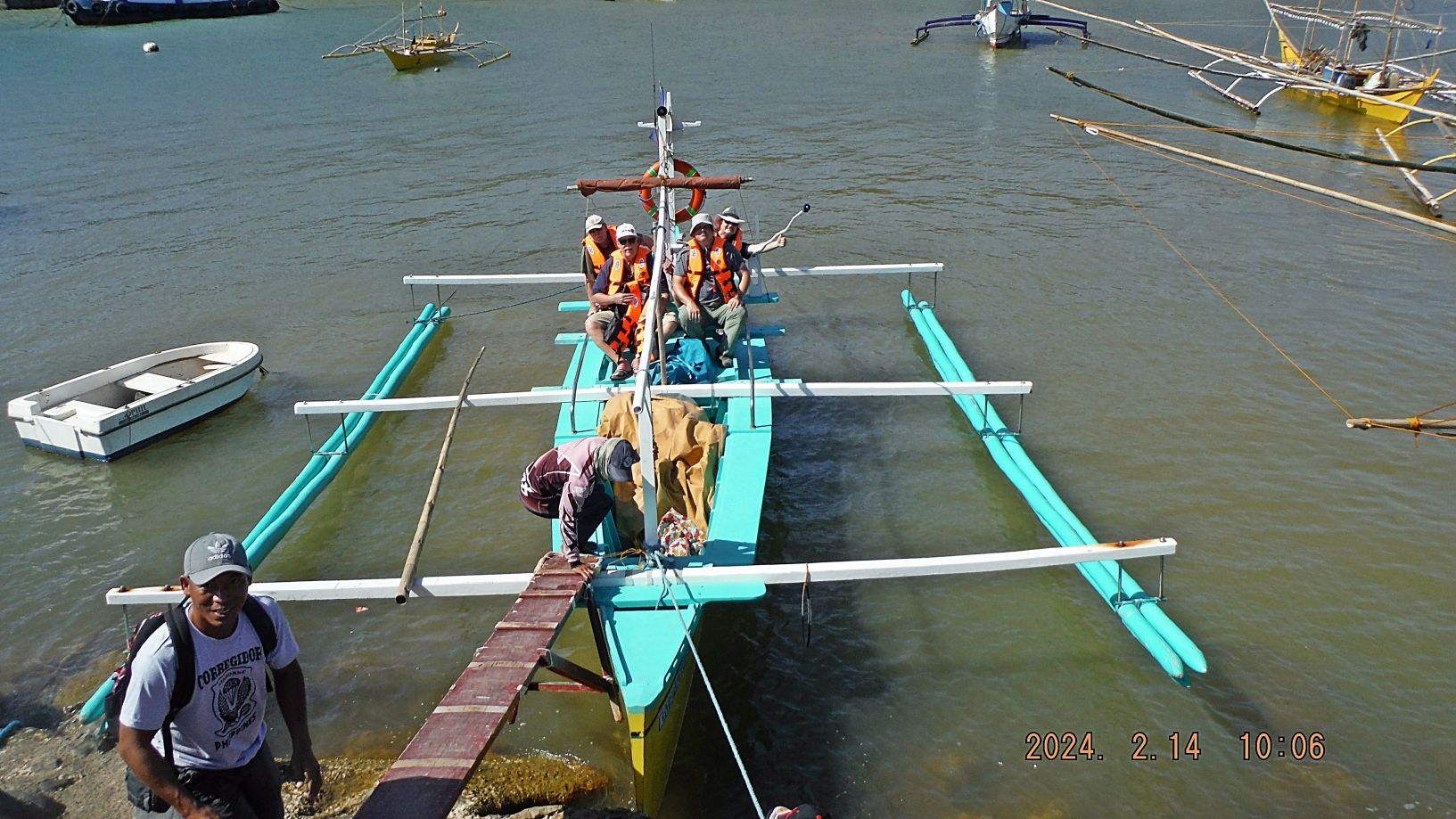 |
|
|
|
Post by Karl Welteke on Feb 20, 2024 13:18:14 GMT 8
Hi Kevin, you do great work, thanks!
Do you have any more pictures of us raising the 48 Star Flag on the 503d PIR First Flag Monument and Fladstaff from our 79th Anniversary Commemoration a few days back on the 16th Feb.?
|
|
|
|
Post by Karl Welteke on Feb 11, 2024 20:03:25 GMT 8
Sixth and Last Segment of the Carabao Island Visit on the 15th Nov. 2009 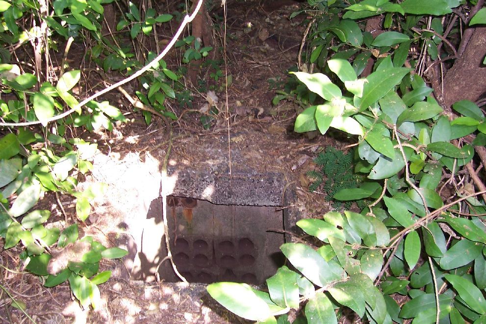 091115eFtFrholeinpath. A communication cable hole on the trail to Battery Greer.  091115fFtFrB-Greer-Entr1. South Entrance to Battery Greer; a tree has fallen in front of it. 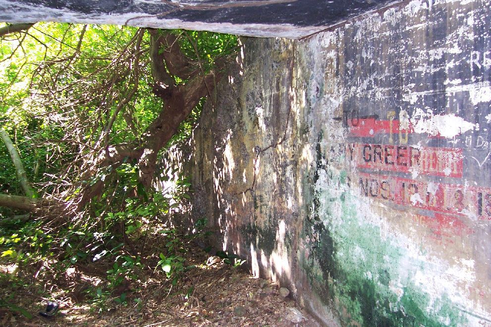 091115fFtFrB-Greer-Entr2. South Entrance to Battery Greer; a tree has fallen in front of it. Looking out. 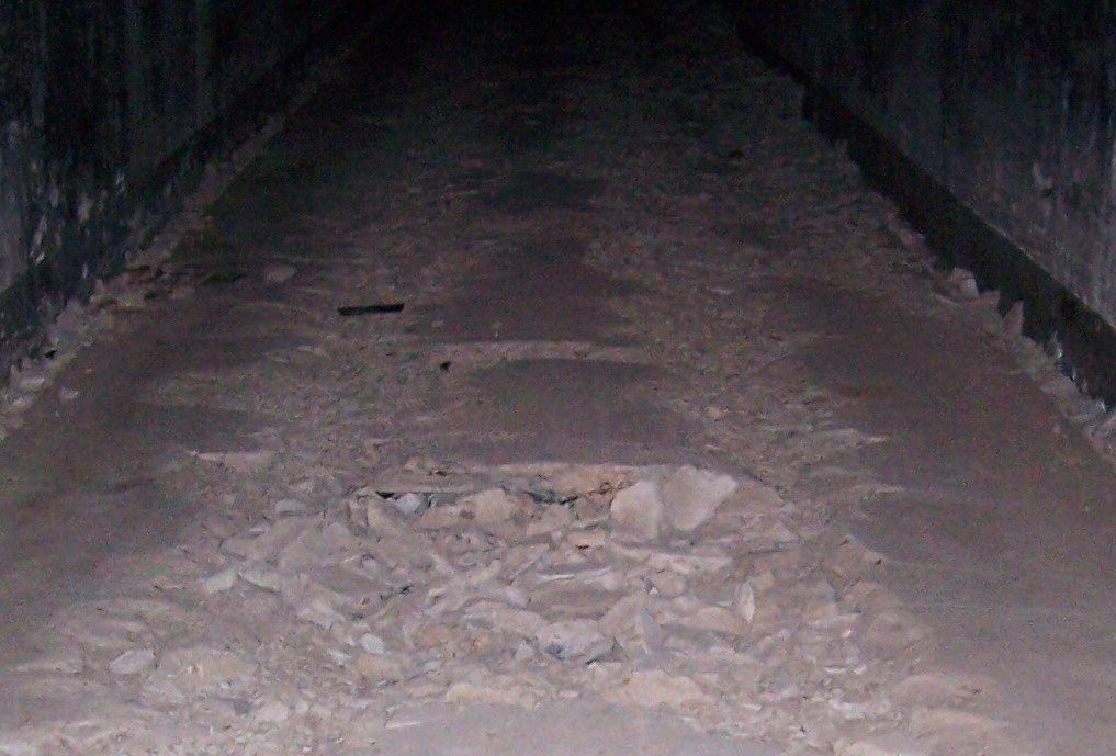 091115gFtFrB-Greer2. I only noticed this on this visit, apparently there lay ties and tracks in the tunnel to Battery Greer.  091115gFtFrB-Greer3. The short side tunnel to the west. looking back to the main tunnel where I entered it. 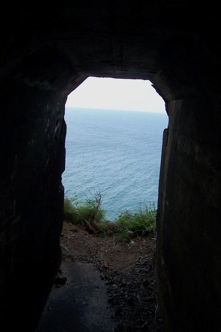 091115gFtFrB-Greer4. The short side tunnel from the Battery Greer tunnel, looking out.  091115gFtFrB-Greer5. The short side tunnel from the Battery Greer tunnel, looking out. The boat is left, near the wall, out of view. 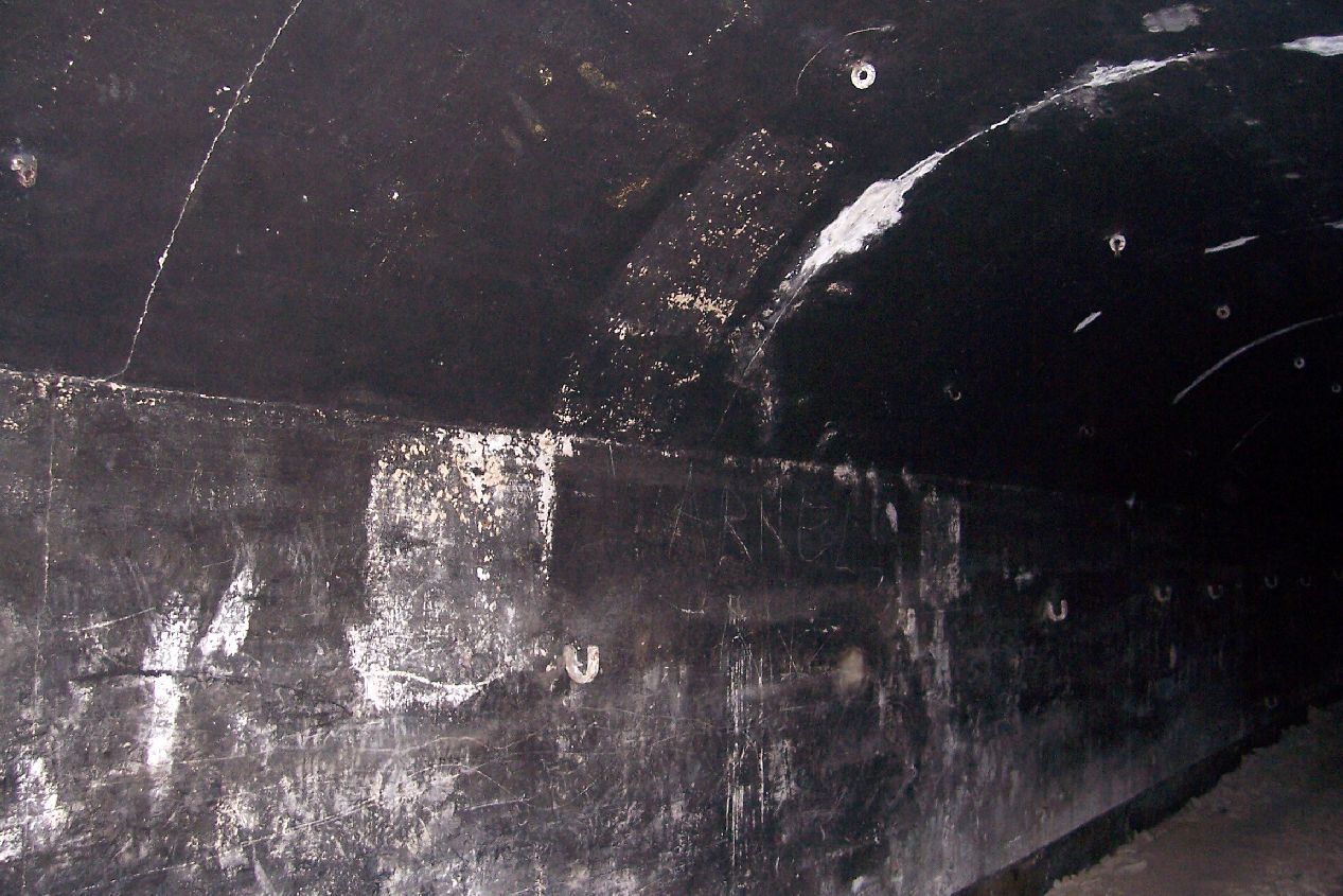 091115gFtFrB-Greer7eastside. The east side of the Battery Greer tunnel; I thought there were no hooks for the bunks but there are! |
|
|
|
Post by Karl Welteke on Feb 11, 2024 19:46:24 GMT 8
Fifth Segment of the Carabao Island Visit on the 15th Nov. 2009  091115dFtFrB-Koehler-Entr2. Then I entered the Battery Keohler entrance. Right is where I came from, the bridge. More digging has been done here.  091115dFtFrB-Koehler-Entr3. The Battery Koehler entrance.  091115dFtFrB-Koehler-Entr4. Where the entrance from the bridge meets this tunnel there is renewed digging. (For the Yamashita Gold- he,he,he). They never learn. 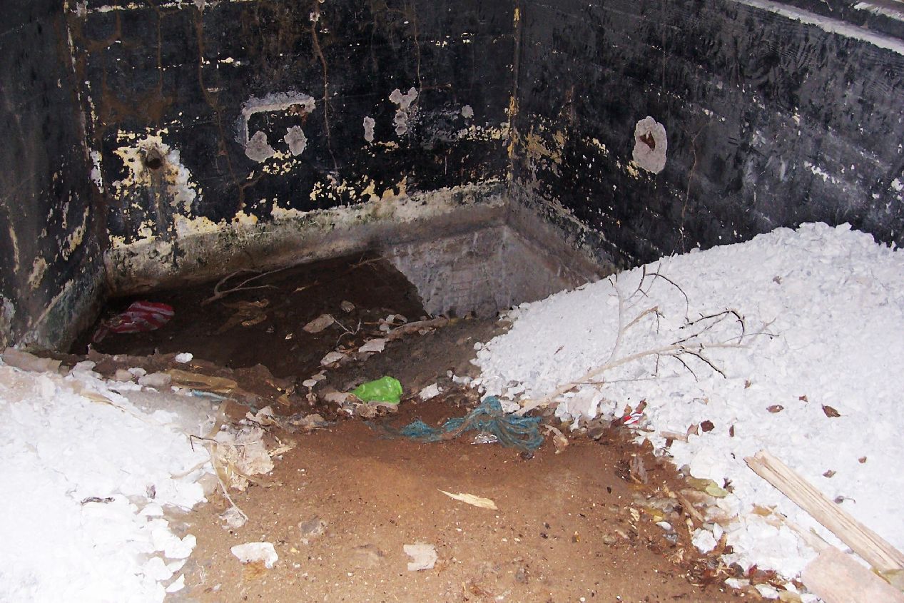 091115dFtFrB-Koehler-Entr6. The left room diggings.; I think they were trying to connect to the tunnel. 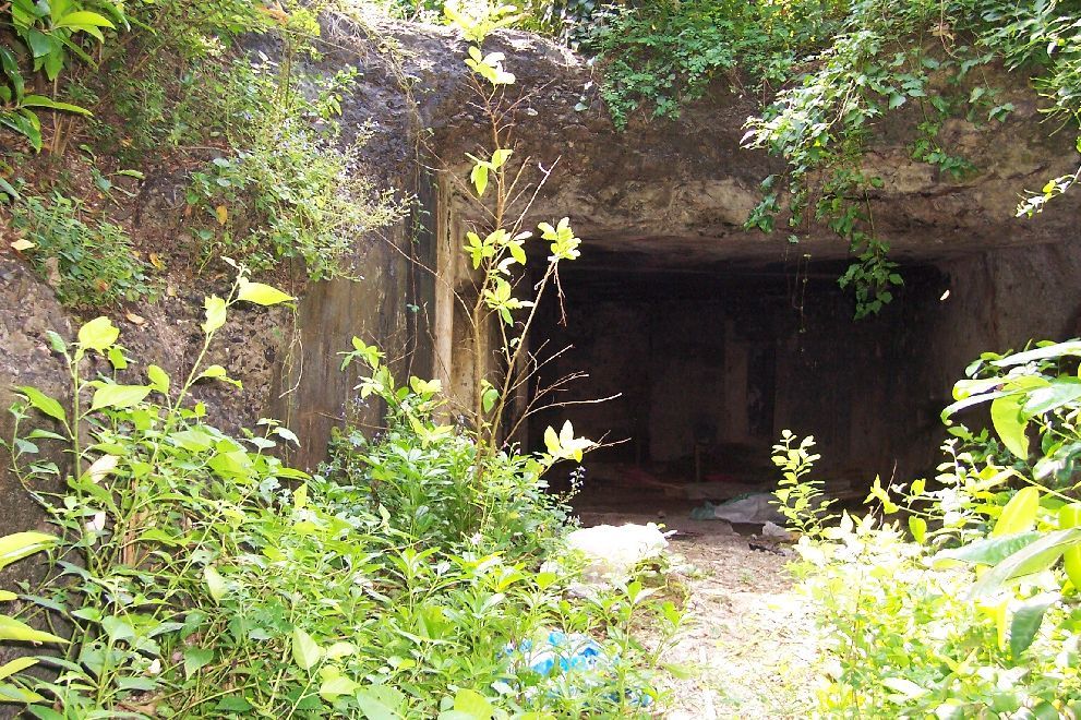 091115dFtFrB-Koehler-Entr7. The entrance to Battery Koehler from the north; it shows war damge. The last 5 images I took from that entrance.  091115dFtFrB-Koehler-Entr8. More war damage at the Battery Koehler North Entrance; is this where the Japanese. Artillery shell killed many scouts while they were waiting for shots? |
|
|
|
Post by Karl Welteke on Feb 11, 2024 19:30:27 GMT 8
Fourth Segment of the Carabao Island Visit on the 15th Nov. 2009  091114Ski3Karlreturningtobanca. My friends decided not to go, enter Carabao Isl., ex Fort Frank because of the swells. I was a Navy diver and did not have any concerns, so I went. I walked under the wall about 6 times , separate trips, to cary my cameras and stuff not to get wet. I made the mistake to walk with sandals, the rocks under the water are round, big and slippery, The last walk, returning to the boat, the sandals broke, slid up my legs and I lost my footings. A boat crew member came to help with the gear. 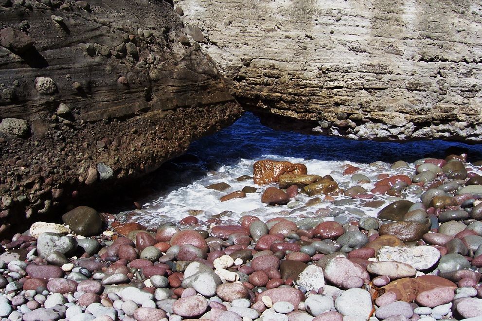 091115iFtFrtheWall. Desalination Plant -The Wall- look at the wet rocks where the swell hit. I went under the wall about 6 times this day. 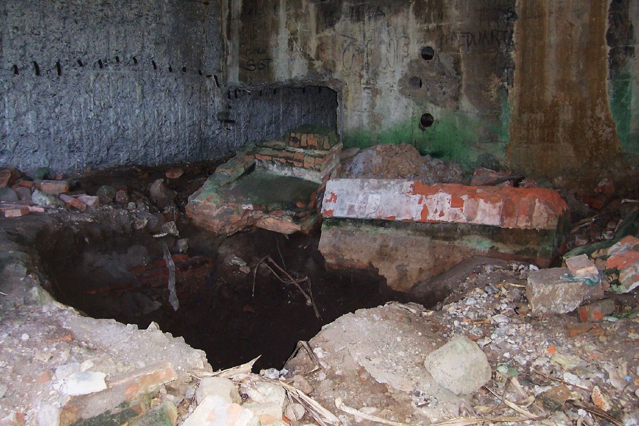 091115hFtFrDesalinationRm1. Down at the Desalination Plant more diggings also occurred.  091115hFtFrDesalinationRm2. Desalination Room NE corner.  091115hFtFrDesalinationRm3. Desalination Plant, looking from the entrance to the SE corner. 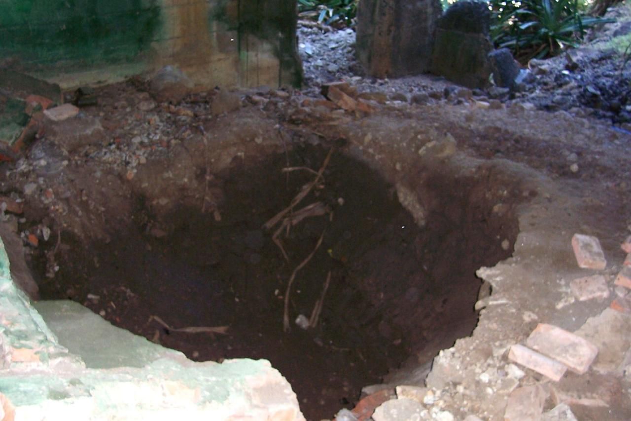 091115hFtFrDesalinationRm4. Desalination Plant, the dug hole, looking at the entrance and the NW corner. 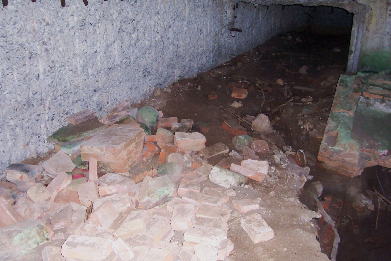 091115hFtFrDesalinationRm5. Desalination Plant, the SE corner; more diggings there. 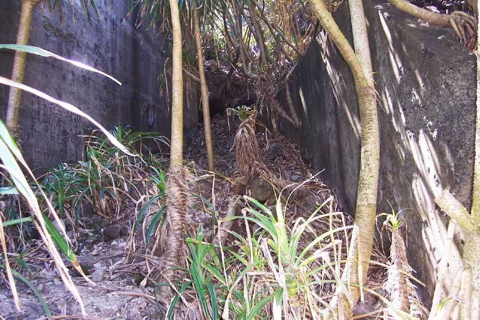 091115iFtFrthewayup. Desalination Plant is the wall left. This is the passage up from -The Wall- which a little further up becomes a set of concrete steps. |
|
|
|
Post by Karl Welteke on Feb 11, 2024 19:13:01 GMT 8
Third Segment of the Carabao Island Visit on the 15th Nov. 2009 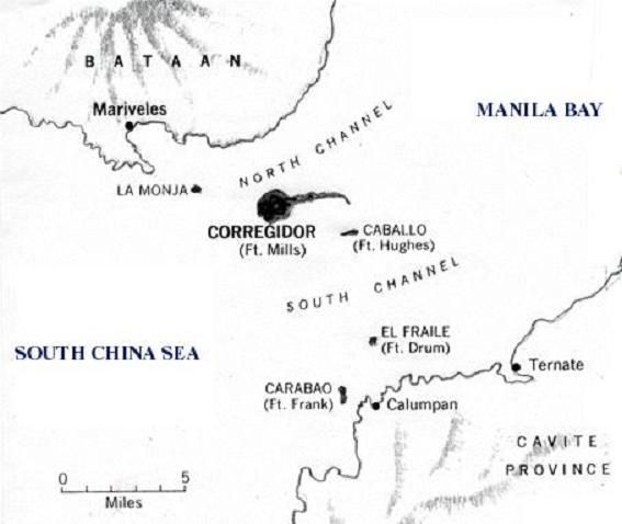 091113ManilaBayislands. Where is Carabao Island, ex Fort Frank? This image came from 'corregidor.org'. 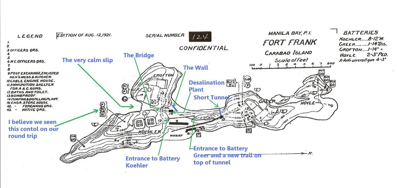 091114aFortFrankmapfromCDSG. Carabao Island, Fort Frank map from the Coastal Defense Study Group (CDSG). I marked it up with the points that are covered in this album. Friends, Steve and Marcia Kwiecinski, John Moffitt and I took a boat to Fort Frank on the 15th Nov 2009. Strong NE end were prevailing and we went for the Wall on the west side. Here, NW ocean swell were also strong and my partners did not deem it safe to go this way. I had to try it and went, stayed maybe almost two hours and then we all decided to go back. 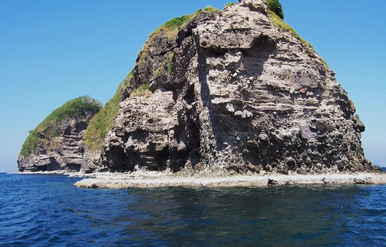 091115lFtFrNorthPt1. Carabao Island, the ex Fort Frank, the south point! 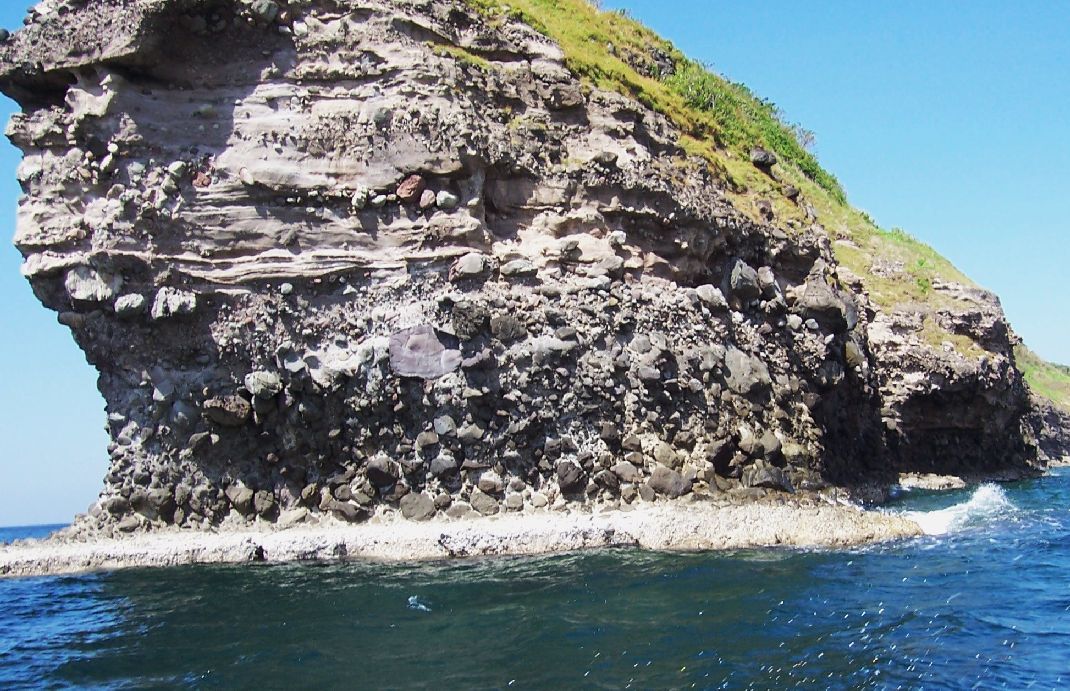 091115lFtFrNorthPt2. Close-up of last pic. Fort Frank South Point. 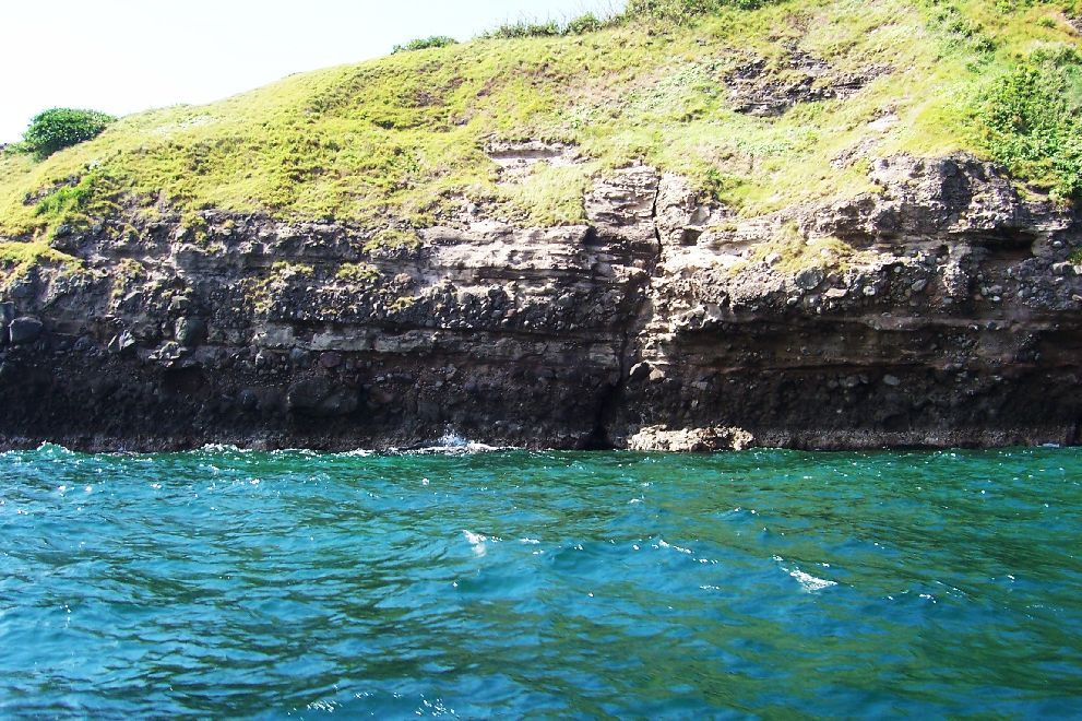 091115lFtFrNorthPt3. Carabao Island, ex Fort Frank, going along the east side from the south point.  091115lFtFrNorthPt4. Carabao Island, ex Fort Frank, the east-side wharf.  091115lFtFrNorthPt5. Close up of last pic. |
|
|
|
Post by Karl Welteke on Feb 11, 2024 18:53:51 GMT 8
Second Segment of the Carabao Island Visit on the 15th Nov. 2009  091115jFtFrCalmEntr. That is what I call the -Calm Slip- where I need to go to see whether we can get there with a boat to offload and enter Fort Frank.  091115jFtFrCalmEntra. Close up of the last pic.  091115cFtFrCalmEntrance1a. Now looking down the calm slip, opposite of the 'Wall' and Desalination Plant ravine.  091115cFtFrCalmEntrance3. I was able to walk down some, even with my unreliable sandals. One could see, this path has been used by others. 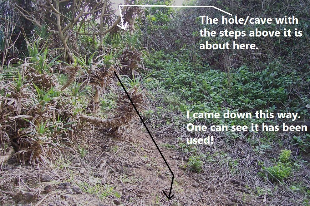 091115cFtFrCalmEntrance3a. Looking back where I came from. 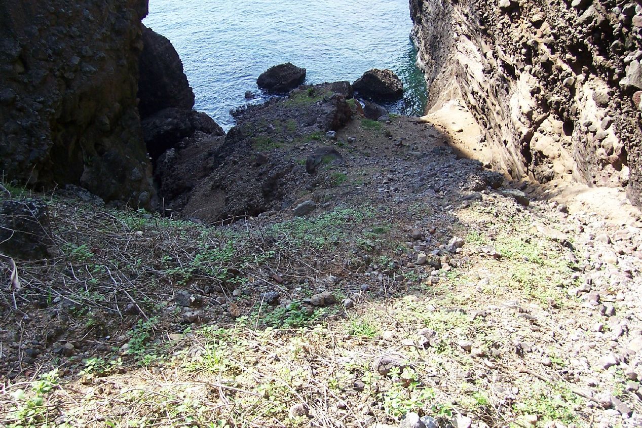 091115cFtFrCalmEntrance4. Looking down the calm slip which is opposite of the ravine with the 'Wall' entrance. 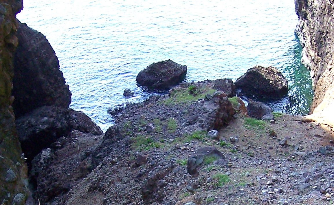 091115cFtFrCalmEntrance4a. Close - up of the last pic. One should be able to walk this. 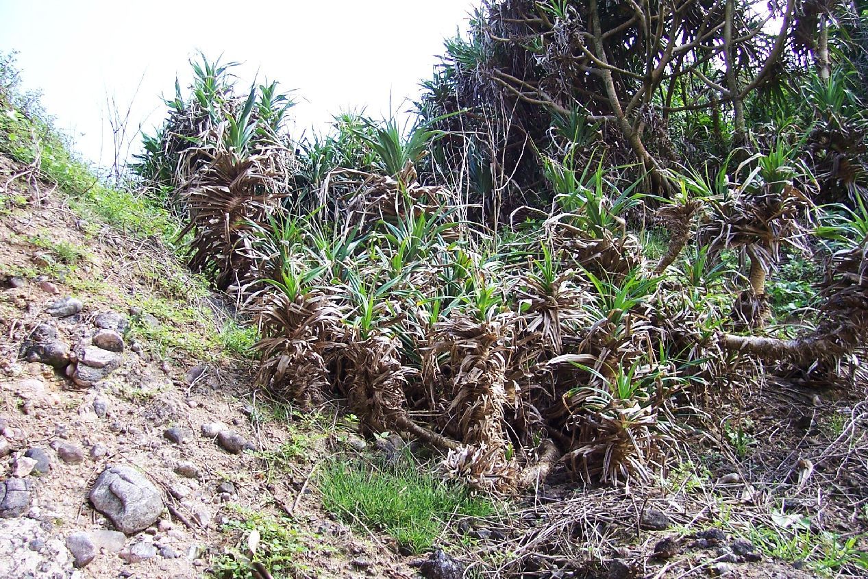 091115cFtFrCalmEntrance5. Looking back up where I came from. |
|
|
|
Post by Karl Welteke on Feb 11, 2024 18:34:39 GMT 8
Friends and I visited Carabao Island the 15th Nov. 2009. I made an album with 43 images and the album URL is linked in this webpage but I never posted the pictures here. So, it is better late than never. I’ll do it in segments. Here is the dairy entry for this day: Corregidor Dairy 2009 Nov. 14th to 16th Day 2, Sunday, 15th Nov. 2009. Based on the experience yesterday (no sea swells, light NE wind and a low tide) we ordered a boat from Villa Carmen in Cabcaben to take us to Fort Frank, Carabao Island at 0830. We were planning to go under the wall at the desalination plant, west side of the island. They wanted and we paid 3500 Peso. After a little over an hour ride we arrived at Fort Frank. The wind was much stronger then yesterday and worse there were ocean swells, they came from the NW. Maybe yesterday, at the west end Corregidor, we didn’t have any swells because the land points at Mariveles were protecting us from NW swells. My 3 partners, John, Steve and Marcia, didn’t think it was safe and didn’t go. I went in with three walks to get one piece of gear at a time under the wall. I thought it was passable. I walked up the steps which were wet at places and immediately went higher over the connecting land bridge which connects Battery Crofton. One of my goals was to check the feasibility to climb up on the opposite gulch of the one with the wall where I came up. I got the impression it could be done and I let you judge by the images. Still I don’t know whether a boat can come close enough to offload people safely. And still the first climber would have to be agile coming up; much of the slope is fine gravel and need to be brushed away. If the first climber was to rig a line it should be easy to get up there. I would like to try it next time. The reason for all this is, that gulch or slip is the most calmest water around the island and one wouldn’t have to worry about the risky boarding of the island either on the west side under the wall or east side, onto the wharf because of wind, swells or tides. These are the only places one can enter Fort Frank and with Philippine Banca boats it is always difficult and risky. While I was on the island I noticed renewed digging at the desalination plant and the tunnel entrance to Battery Koehler. The trail between the Battery Koehler and Battery Greer sure needs maintenance, I constantly had to bend down under vegetation. Because of our situation I didn’t bother yet to put on boots and bolo. The trails from the upper end rail track (from the east side wharf) and it’s shortcut from there were ok. Where this trail meets the trail between the batteries I noticed another trail and followed it a little. It seems well used and it seems to run on top of the tunnel to Battery Greer. I communicated (texting) with my partners as to what to do and we didn’t come to a decision. So I saddled my gear and returned down to the wall. Down there it was obvious the swells had picked up and sometime they even looked like Waikiki breakers. Ok, we agreed to hang it up. Between the boat crew member and me swimming we got my gear and I back on the boat. I had a little trouble standing up going thru the surf because my sandals broke and slipped up my legs. We asked the boat crew to go around the island slowly so we could take pictures. The ride back took a little longer because of the NE wind generating local Manila Bay swells. They dropped us off at the Corregidor south shore at our request that saved time and water coming over the bow. We set down at the south beach watering hole and agreed to go our separate ways tomorrow. I was pooped and called it a day. We noticed the hotel rigged a sliding wire from the hotel to a solid frame near the beach but it was not yet in operation. The next day Steve and Marcia hosted a retired Lt Col of the US Army and who also is the son of a Philippine scout, who resides in the USA. His father served on Fort Frank during the war and was part of Battery ‘North’, the four 155mm guns. I told him I been at the battery once and we seen only 1 Panama mount. He then said with certainty that his father had told him there was only one, the others were in position the old field way. END 091114Ski3Karlreturningtobanca. My friends decided not to go, enter Carabao Isl., ex Fort Frank because of the swells. I was a Navy diver and did not have any concerns, so I went. I walked under the wall about 6 times , separate trips, to cary my cameras and stuff not to get wet. I made the mistake to walk with snadals, the rocks under the water are round, big and slippery, The last walk, returning to the boat, the sandals broke, slid up my legs and I lost my footings. A boat crew member came to help with the gear. 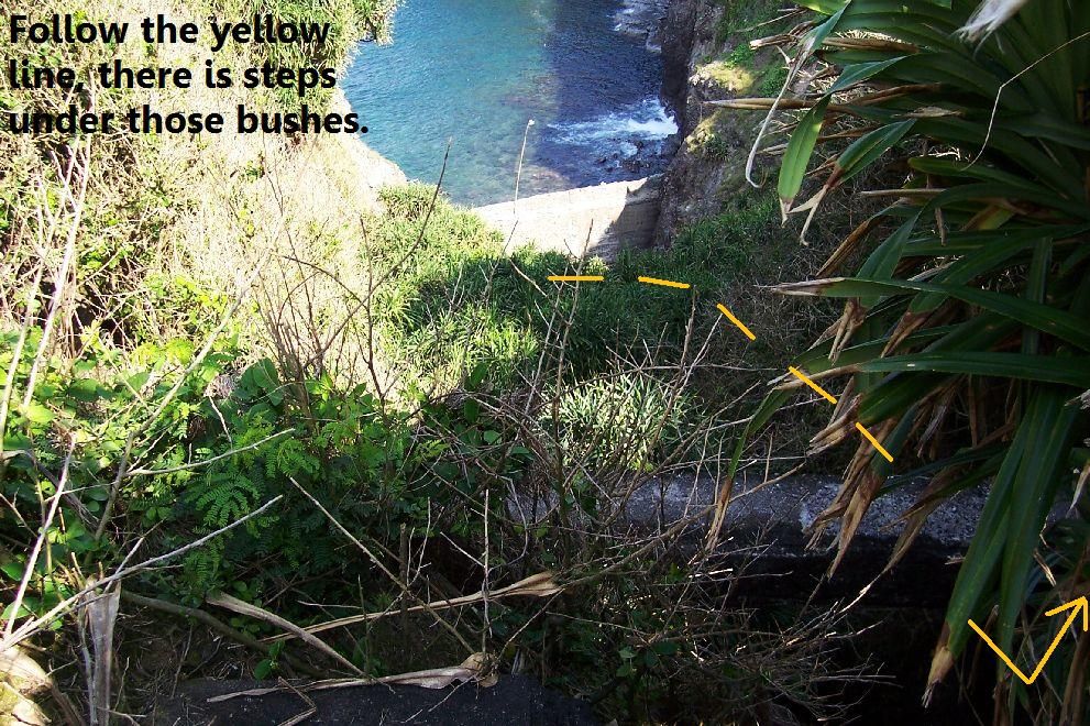 091115aFtFrBridge1. I am standing in the saddle connecting Battery Crofton to the island, the wall is at the bottom. The foot bridge to Battery Crofton is just below me. 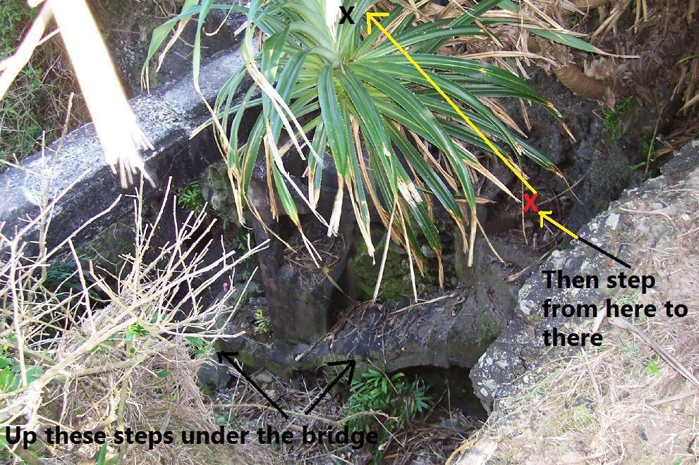 091115aFtFrBridge3. One comes up these steps, under that foot bridge and then steps into the entrance to Battery Koehler. 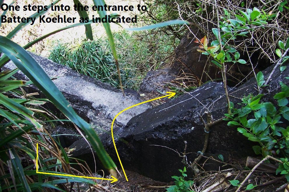 091115aFtFrBridge3a. Right is the entrance to Battery Koehler and left is the foot bridge to Battery Crofton. One comes up that ravine under that foot bridge. 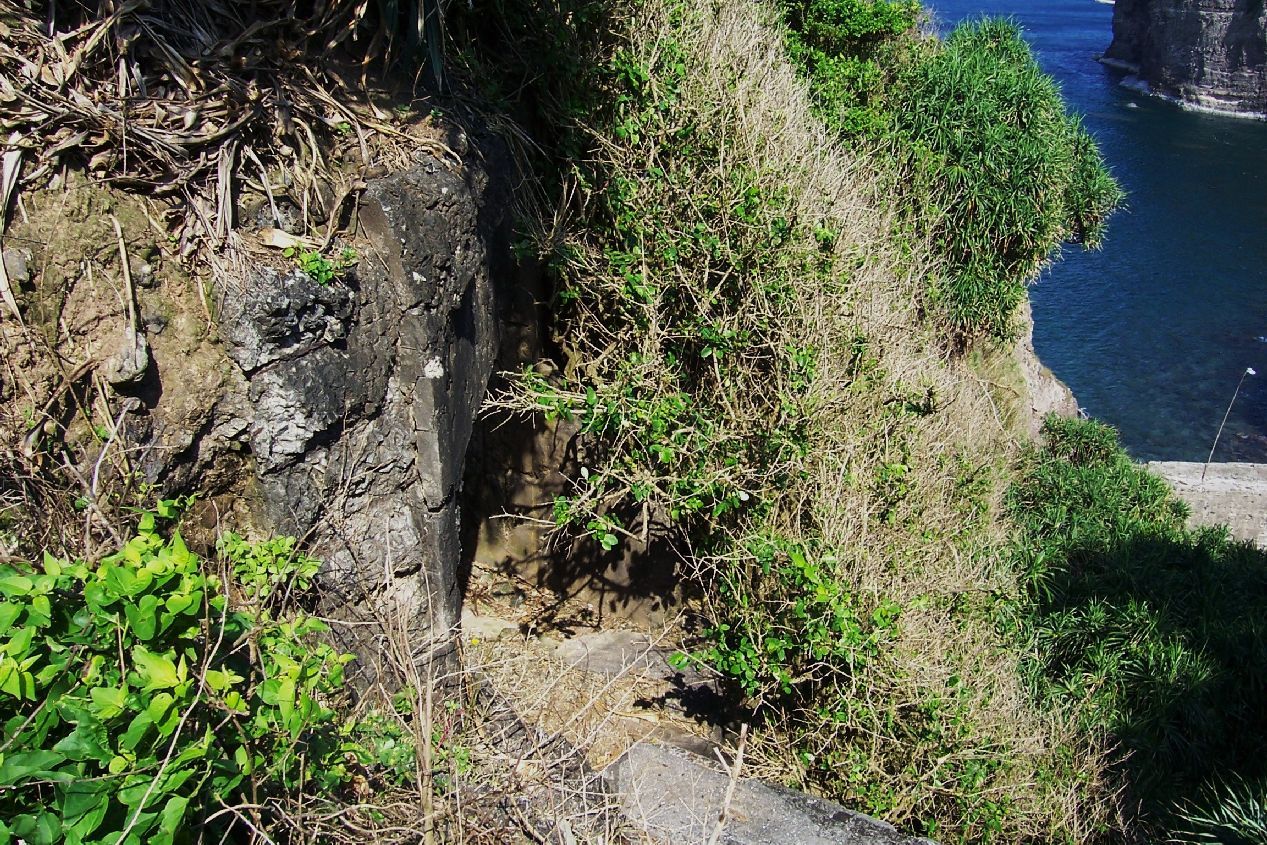 091115aFtFrBridge6. The entrance to Battery Crofton from the foot bridge. The wall is right at bottom. 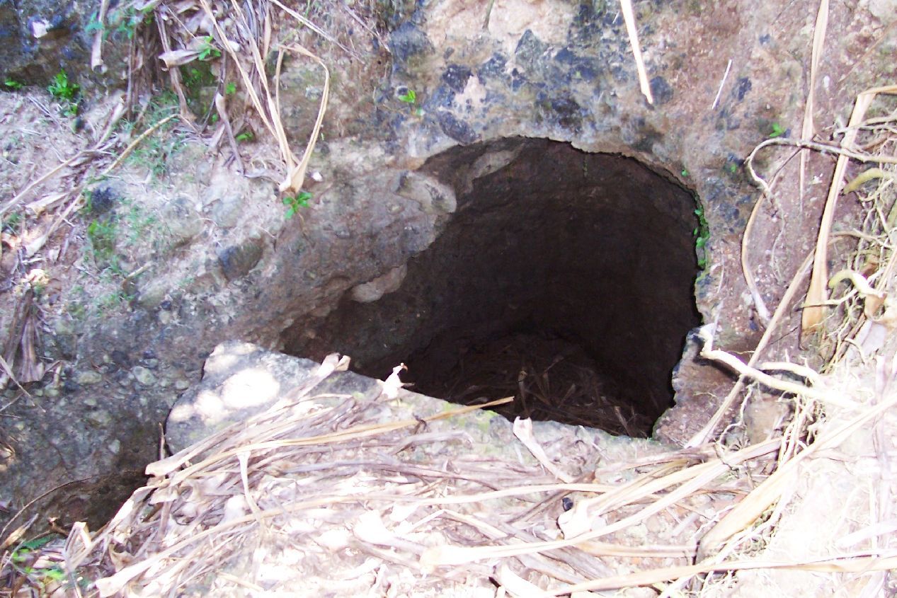 091115bFtFrBridgehole1. As I climbed onto the saddle between Battery Crofton and the main part of the island I noticed this hole; it is just a few feet from where one enters Battery Koehler coming up from the wall. 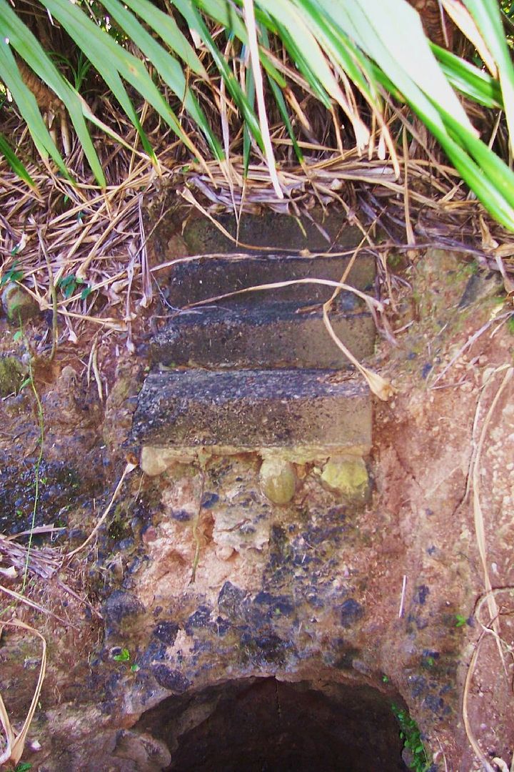 091115bFtFrBridgehole2. Apparently steps went over this hole onto the top of Battery Koehler tunnel. |
|
|
|
Post by Karl Welteke on Feb 10, 2024 14:30:42 GMT 8
--------------------------------------------------- Start of correction notification: ----------------------------------------------------- About 14 images were replaced in this URL because they were watermarked by Photobucket. Here are 4 sample pictures. Links in this URL were updated and an updated list of related links was added! 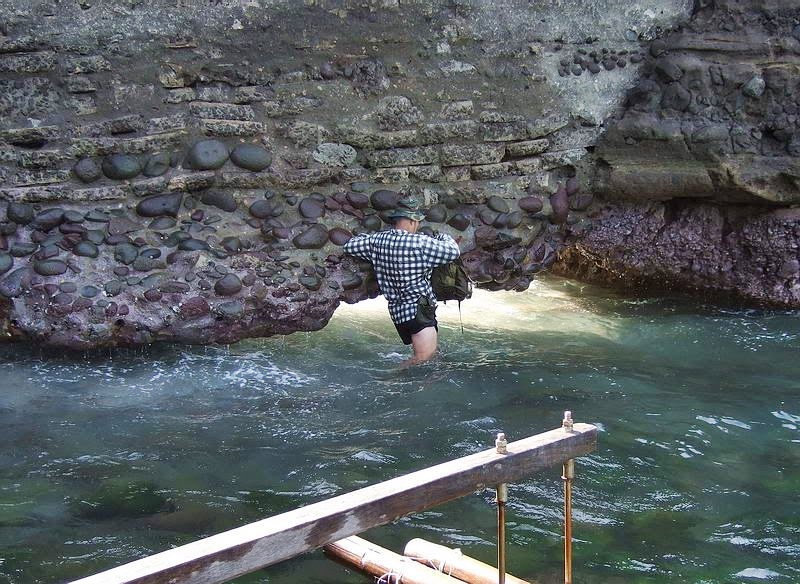 Zg673. Nov. the 15th 2009.This is how one enters Carabao Island, the ex Fort Frank, under the wall! This is a John Moffitt image. 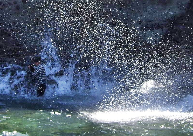 Zg680. Karl is coming and going several times under the wall, to get all my gear under the wall in a relative dry condition, camera etc. This is a John Moffitt image. 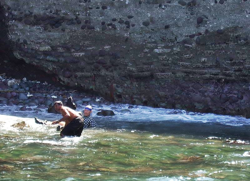 Zg682. It is not easy to walk here, because of the slippery big rocks and I made the mistake to walk with slippers. They broke and slid up my legs and I lost footage. A boat crew member came to me to get my gear. I WAS NOT WORRIED, I KNOW HOW TO SWIM GOOD, I was a Navy Diver. This is a John Moffitt image. 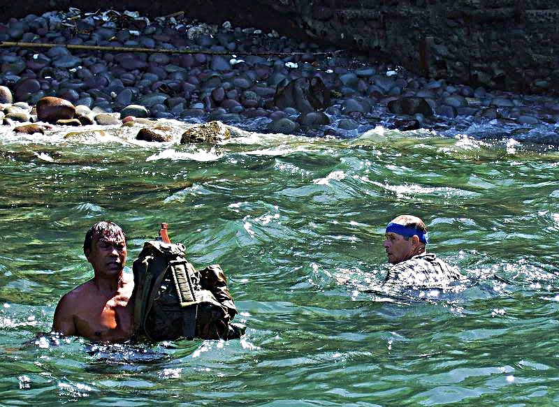 Zg687. It is not easy to walk here, because of the slippery big rocks and I made the mistake to walk with slippers. They broke and slid up my legs and I lost footage. A boat crew member came to me to get my gear. This is a John Moffitt image. URLs for Fort Frank, Carabao Island-Fort Frank on Carabao Island under construction Karl’s Flickr Album This album shows construction of Fort Frank on Carabao Island in Manila Bay. Fort Frank was part of the Manila and Subic Bay Harbor Defense Command. These images were given to me by Karl Schmidt from the Coastal Defense Study Group (CDSG.org) who got the images from National Archives and Records Administration (NARA). Thank you Karl and all members of the CDSG. The pictures were uploaded at a high resolution. www.flickr.com/photos/44567569@N00/albums/72157673964028162--------------------------------------------------------------------------------------------- If you interested about the Fort Frank history, here is a short one Charles M. Bogart at Corregidor.org: corregidor.org/chs_bogart/bogart2.htm-------------------- -ex Fort Frank, Carabao Island, Karl’s thread in Corregidor Proboard.com, 7 pages now. corregidor.proboards.com/thread/121/ex-fort-frank-carabao-island-Carabao Island-Fort Frank-No Trespassing, EXO thread in Corregidor Proboard.com corregidor.proboards.com/thread/1618/carabao-island-fort-frank-trespassing-Roster of Enlisted Men on Ft. Frank 1942, from Bob Hudson. corregidor.proboards.com/thread/1813/roster-enlisted-fort-frank-1942-Trip to Points, the Tailend and ex Fort Frank from Karl in the Corregidor Proboard.com. My Canadian Friend AJM and I met on Corregidor 14th Nov 2009 and we took 3 trips. We went to the points, the Tailend and ex Fort Frank. (KARL GOING UNDER THE WALL, VERY WET) Here is the 1st of 3 installments with 50 images about going to Wheeler Point, Search Light Point and noticing a new land slide that affected Search Light # 2: corregidor.proboards.com/thread/581/trips-points-ft-frank-tailendQuestions-getting to Forts Drum and Frank, forum thread: corregidor.proboards.com/thread/294/question-forts-drum-frank- This is a group of 10 albums of Ft. Frank from Karl via Photobucket. Fort Frank is another unique fort in the defense of Manila Bay. It is hard to get there. All the guns and other metal have been removed by scrappers. And the scrappers are working hard to get at the rebar in the concrete. It is a most interesting place to visit. These Albums are from this ex fort, Carabao Island, I visited there 2004, 2006 and 2009 at least. app.photobucket.com/u/PI-Sailor/a/698227f9-0b3d-4c48-88c5-5210316b1856?field=TITLE&desc=asc-Aerial Views from NARA via CDSG. On Karl’s Flick account: Manila - Subic Bay Forts! These pictures were given to me by Karl Schmidt, a leader in the Coastal Defense Study Group (cdsg.org) who got these images from the National Archives and Records Administration (NARA). This album contains aerial images of the Manila and Subic Bay Harbor Defense Forts. www.flickr.com/photos/44567569@N00/albums/72157658661455655-Fort Frank on Carabao Island under construction, forum thread from Karl Construction of Fort Frank on Carabao Island in Manila Bay. Fort Frank was part of the Manila and Subic Bay Harbor Defense Command. These images were given to me by Karl Schmidt from the Coastal Defense Study Group (CDSG.org) who got the images from National Archives and Records Administration (NARA). Thank you Karl and all members of the CDSG corregidor.proboards.com/thread/1975/fort-frank-carabao-island-constructionFort Frank, Carabao Island, 2012-02-16 with CDSG 37 pics app.photobucket.com/u/PI-Sailor/a/8f91c41b-4d8a-46ae-b515-b77edea640c0?field=TITLE&desc=ascMost of my albums about the other than Ft. Mills Harbor Defense Islands and installations are in this group of albums: If it doesn't work, try copy and paste it into a browser! app.photobucket.com/u/PI-Sailor/a/e9cef160-42c3-47e0-acd1-9fceeeffacf9?field=TITLE&desc=ascThese groups of albums cover all the Harbor Defense Forts of Manila Bay including Fort Wint in Subic Bay. But I also included some Hawaiian Forts and areas of defense battles defending the backdoor to Manila Bay. That includes Mariveles WWII history and the Battle of Bataan and the Points. For good measure I also added Fort Santiago in Manila. app.photobucket.com/u/PI-Sailor/a/e9cef160-42c3-47e0-acd1-9fceeeffacf9?field=TITLE&desc=ascCarabao Island, ex Fort Frank, Dec. 2023 and Jan. 2024 This was an exploration Trip on the 10th to 12th Dec 2023. I will establish several albums and put them here. And then we visited it on the 8th and 9th of Jan. (7 albums now). app.photobucket.com/u/PI-Sailor/a/3d68fb11-20cc-40d9-9620-701f5c855414?field=TITLE&desc=asc----------------------------------------------------------------------------------------- TRANSCRIPT OF INTERVIEW Major John Perkowski O-1688424, U.S. Army (Ret'd.) As conducted by his Grandson, John William Perkowski He served on Fort Frank: corregidor.org/chs_army/perkowski.htm |
|