|
|
Post by Karl Welteke on Jul 1, 2013 19:55:07 GMT 8
Seelow Heights Battle, 16th April 1945. Displays The Red Army had to go thru here to get Berlin. It was going to be costly! We are starting our 5th day into the history of the Third Reich in North and East Germany. Seelow Heights is our goal, we are operating east of Berlin today. A bitter battle was fought here. The Soviets built an Memorial here in 1945, then East Germany adopted it and now Germany maintains it in memory of all soldiers and the civilians who suffered here because of a terrible war. Again this one is personal, we heard last from my father on the 17th April 1945 when he got a letter off. He may have died here or near here in the battle for Berlin. 18 images have been uploaded into this album: www.flickr.com/photos/44567569@N00/sets/72157634420753997/Here are some sample images: 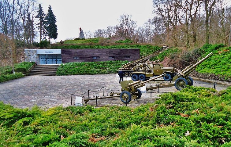 01-This is the first view of the Memorial, Museum and Commemoration Place at the Seelow Heights, Seelower Hoehen in German. This plaza was built by East Germany in 1972 and loved to use it to strut their communist stuff 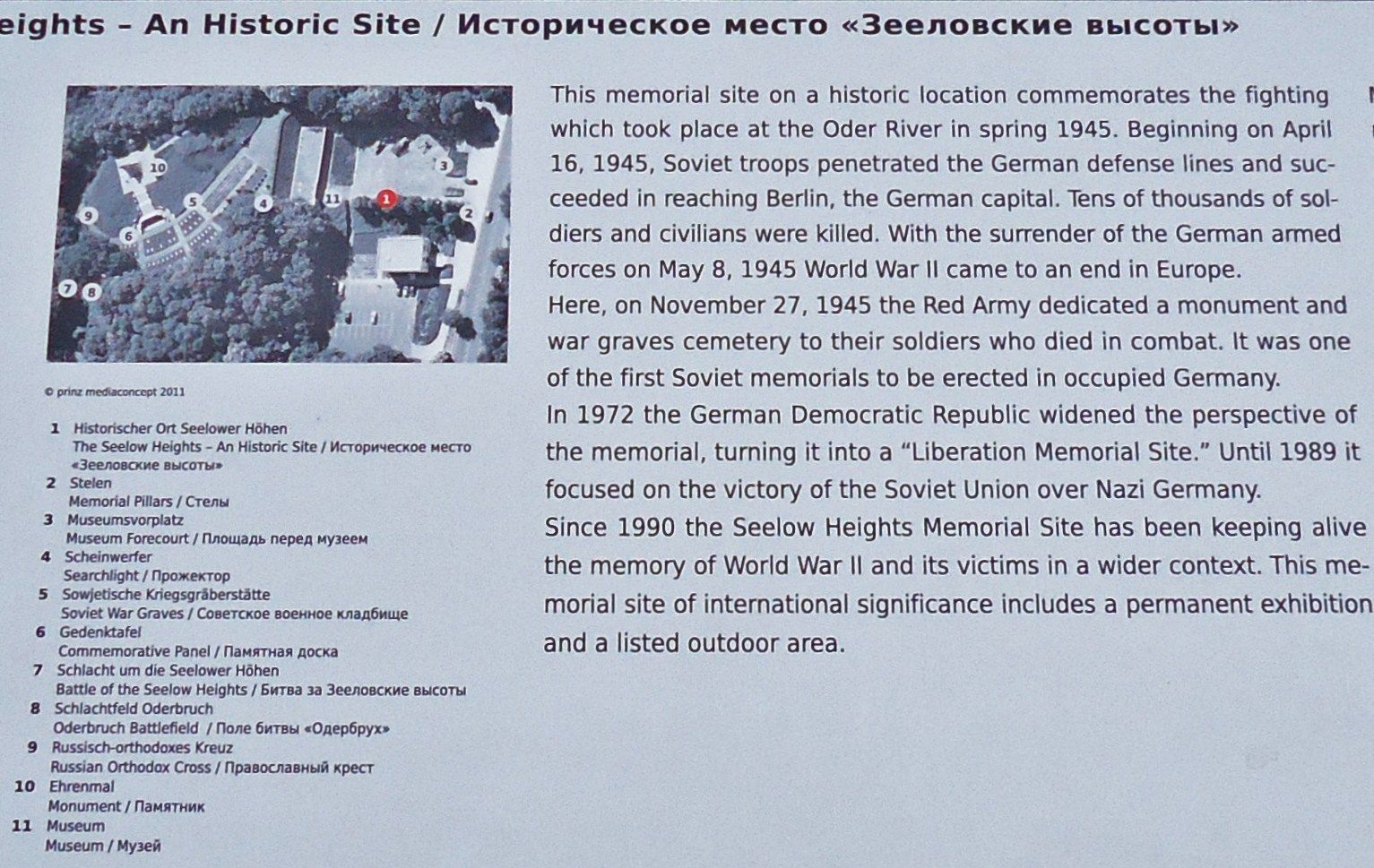 02-The official view of the status of this Memorial, Museum and Commemoration Place at the Seelow Heights now. In 1945 the Red Army already erected to memorial marker columns below this height. When this spot became a Memorial in 1972, the East German Government moved the left column to this location. 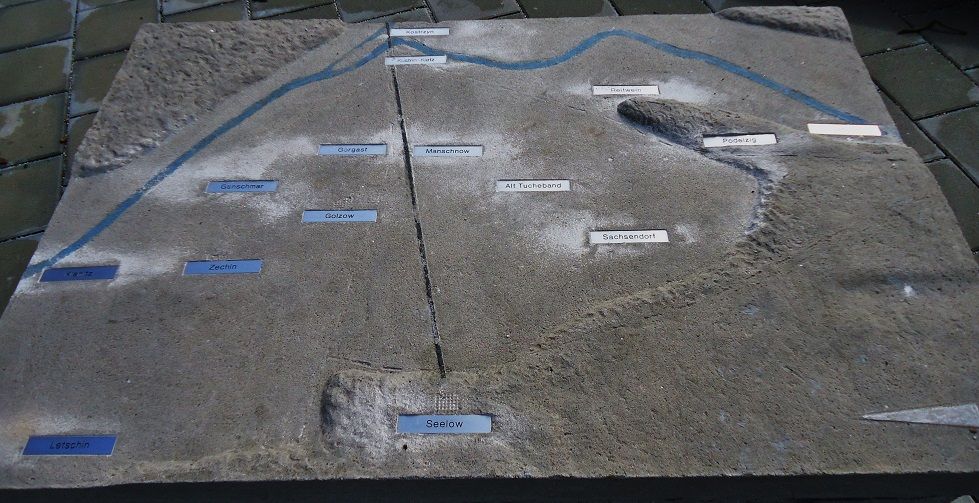 03-The topography of the Seelower Hoehen or Seelow Heights Battle, the north points towards left. Kuestrin which we will visit is dead ahead, Reitwein is where Zhukov had his Command Post. 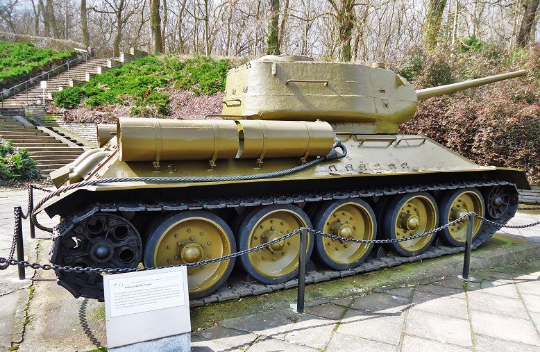 04-T-34/85 Soviet tank, the very famous one, displayed at the Seelow Heights Commemoration Place. The Red Army had excellent weapons, Adolf Hitler had a hard time believing it. 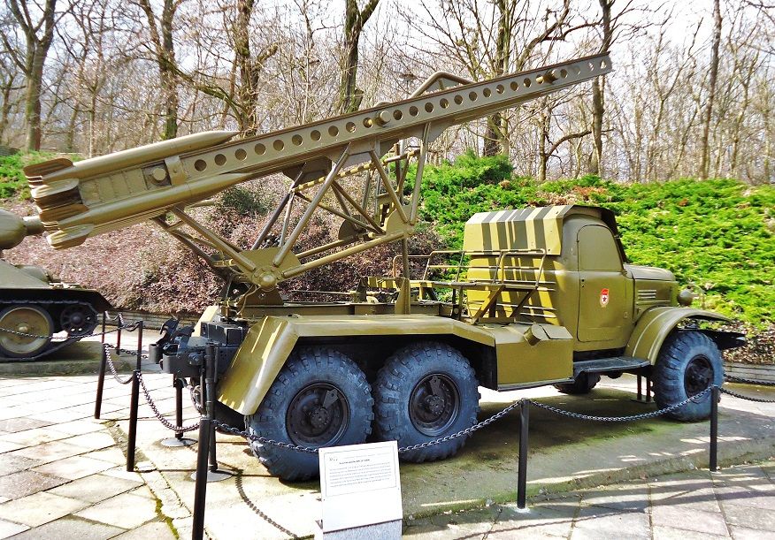 05-Soviet mobile rocket launchers, model BM-13-16NM on a Soviet truck, model SIL-157. The Germans feared it greatly and called it the Stalin Organ. During the war many were mounted on US trucks. Note -chadhill, your comments are very much appreciated -There is much in the www about the Seelow Heights Battle.
|
|
|
|
Post by Karl Welteke on Jul 3, 2013 5:23:03 GMT 8
Seelow Heights Battle, Russian Memorial,16th April 1945 The Red Army started building this Memorial and Cemetery in 1945. East Germany adopted it and now Germany maintains it. The Memorial, Cemetery, the Museum and the outside displays are all in the same place. This is the 2nd album out of three about the Seelow Commemoration Place. 22 images have been uploaded into this album: www.flickr.com/photos/44567569@N00/sets/72157634437667651/Here are some sample pictures: 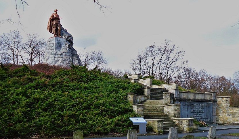 01-This is the highlight of the memorial, the stature of Russian Soldier resting on a destroyed German tank, high above everything visible from afar at the Seelow Heights Memorial. 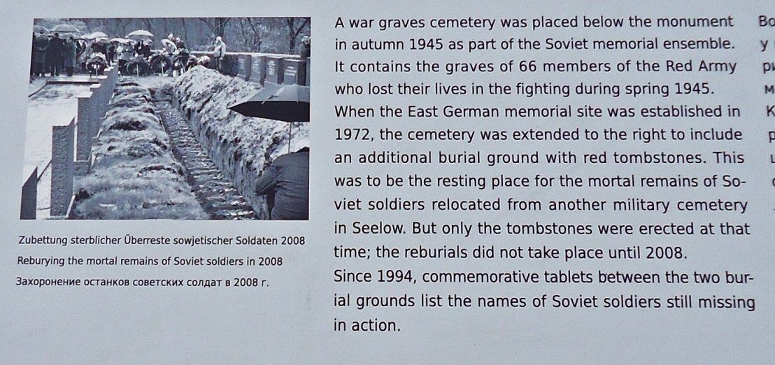 02-Some of the Red Army cemetery history under the Seelow Heights Memorial stature 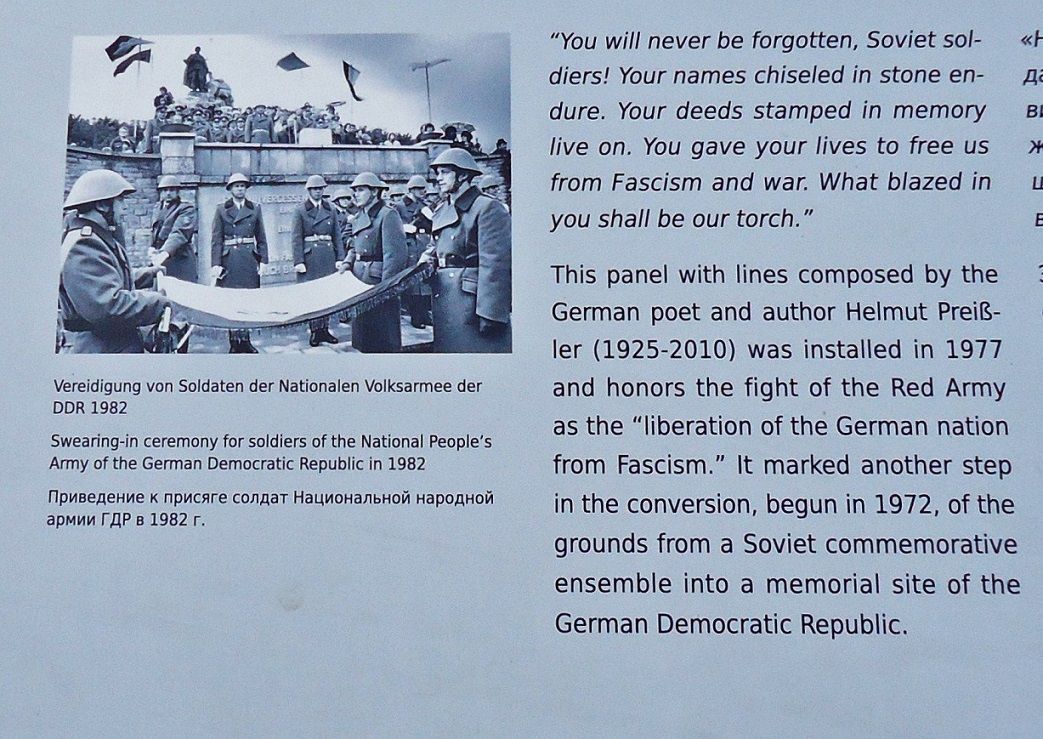 03-Swearing in of East German Army soldiers at this Seelow Heights Soviet Memorial site in 1982. The inscription of the engraving under the stature is completely translated. 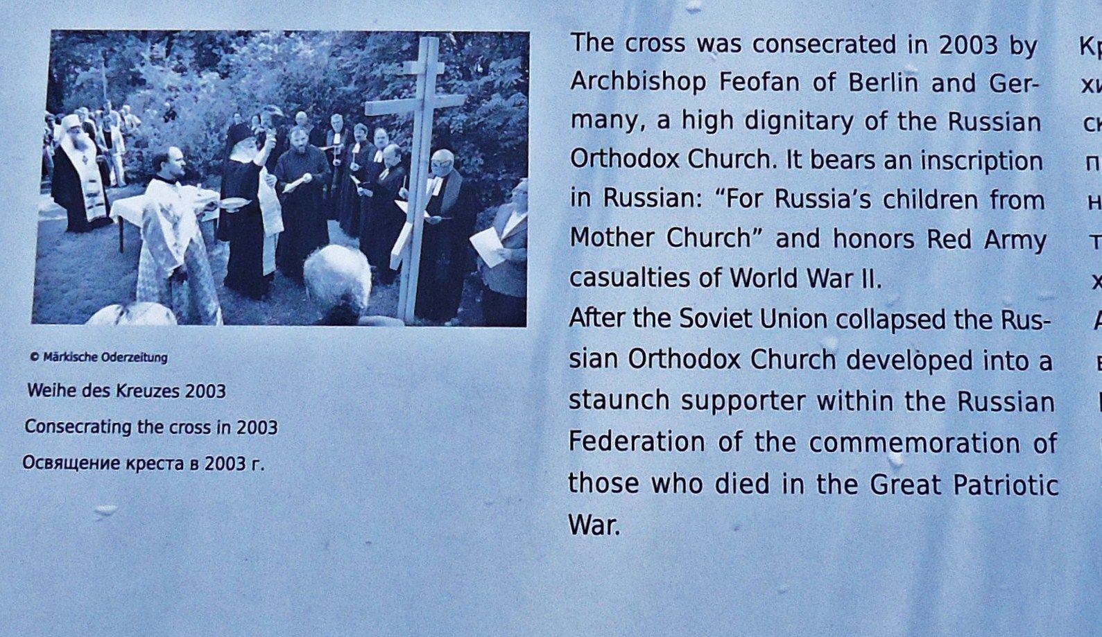 04-Consecrating the cross at the Seelow Heights Memorial by high dignitaries of the Russian Orthodox Church in 2003. Now I don’t remember seeing the cross. Yea, when one is too busy taking pictures. 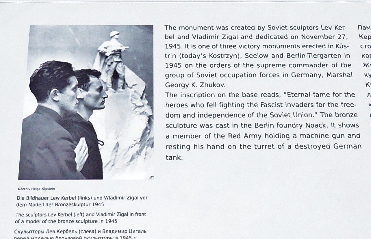 05-The sculptors of the Soviet Seelow Victory Memorial. 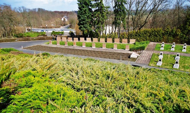 06-The Seelow Heights Soviet cemetery, just above the museum. One can barely see the search light in a tree shadow just left of center. Note: This is a web page about the memorial in English. www.memorialmuseums.org/eng/staettens/view/12/Seelow-Heights-Memorial |
|
|
|
Post by Karl Welteke on Jul 4, 2013 12:51:18 GMT 8
Seelow Heights Battle Museum,16th April 1945 The Seelow Heights Battle Museum was built by East Germany in 1972. Some of the material presented then, had to be changed from only glorifying the Red Army and the Soviet Union. The Red Army started building this Memorial and Cemetery in 1945. East Germany adopted it and now Germany maintains it. The Memorial, Cemetery, the Museum and the outside displays are all in the same place. This is the 3rd album out of three about the Seelow Commemoration Place. 23 images have been uploaded into this album: www.flickr.com/photos/44567569@N00/sets/72157634463757950/Here are some sample pictures: 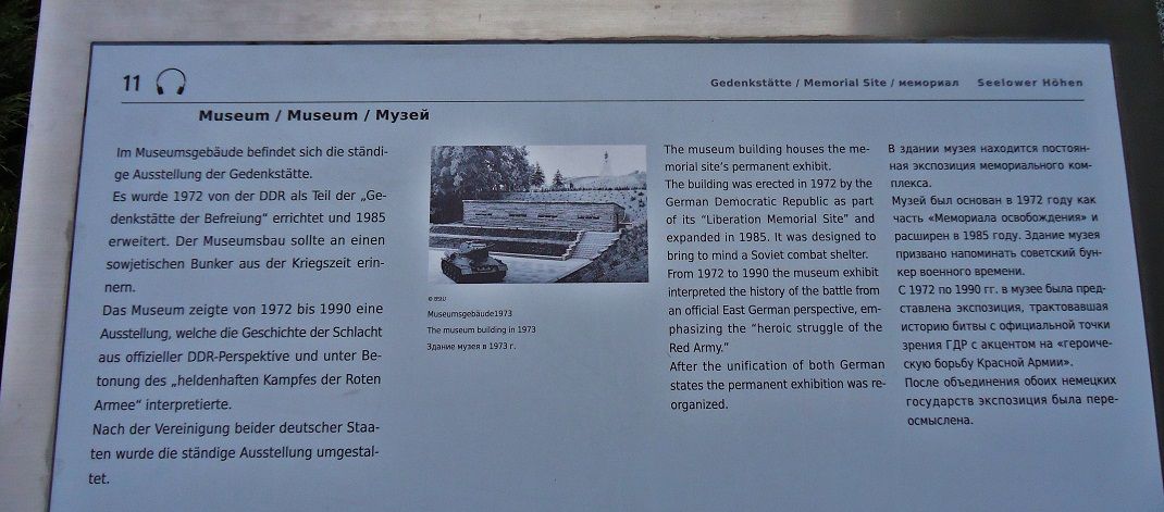 01-The history of the Museum, it was built by East Germany in 1972 and after reunification it was reorganized. 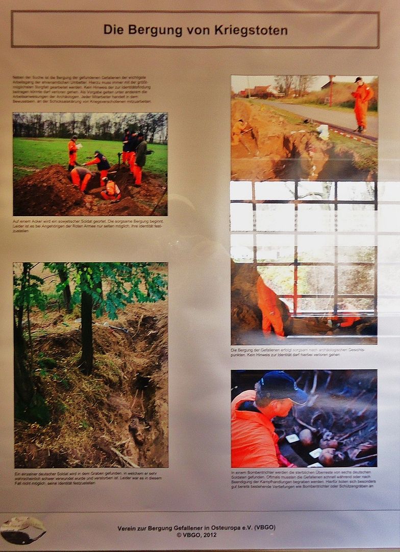 02-Shooting these information signs has not been successful most of the time from me by just free holding the camera. But I had to show this picture. Basically it tells the story that with the downfall of Communism one can now search for German Soldiers, really all soldiers on the Eastern Front. Under the Commie Regime they were only fascists aggressors and unworthy to look for. Will they find my father and 2 uncles? 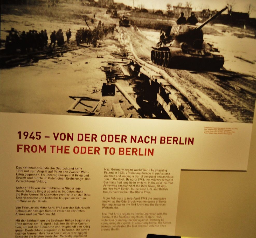 03-The march from the Oder to Berlin. Are those tanks just driving on ice of the frozen river Oder? That picture was shot in Feb. 1945. In the museum were many pictures like that. The Red Army crossed the Oder on the 31st of Jan. 1945. 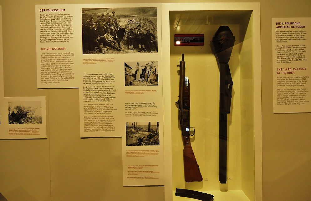 04-The Volkssturm, my father was in the Volkssturm since late 1944. Did he fight here and die here? He sent a letter dated the 17th April 1945 from somewhere around Berlin. 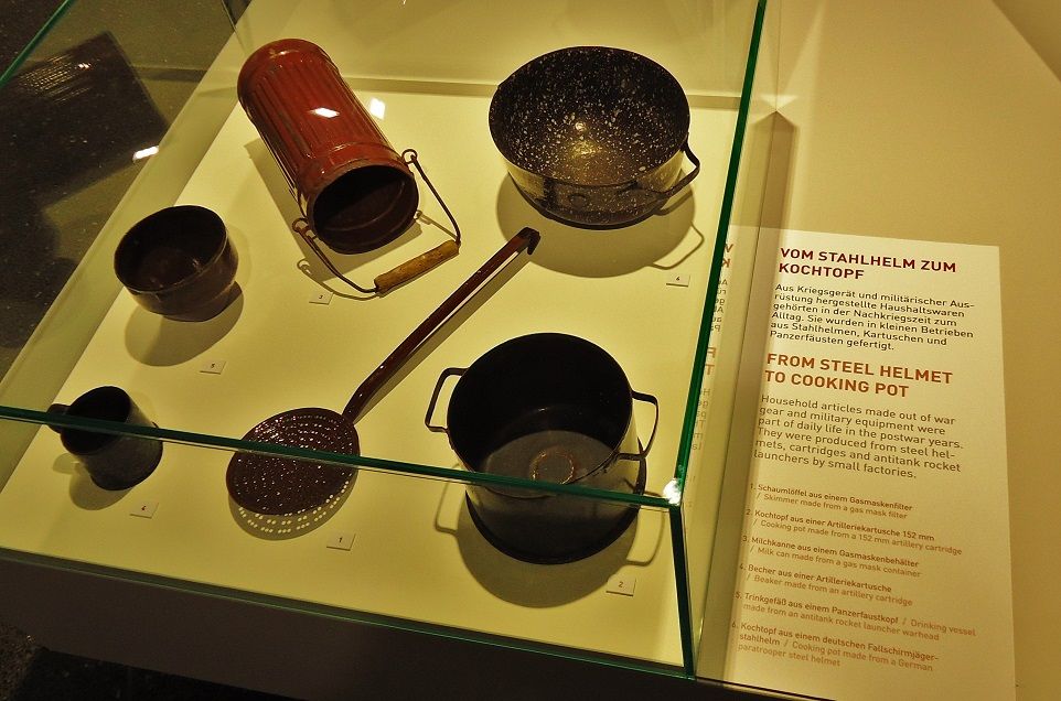 05-The Sears catalog was not available, from steel helmet to cook pot. 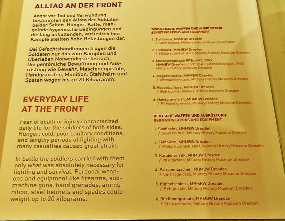 06-The daily living conditions of the soldiers and their personal equipment. 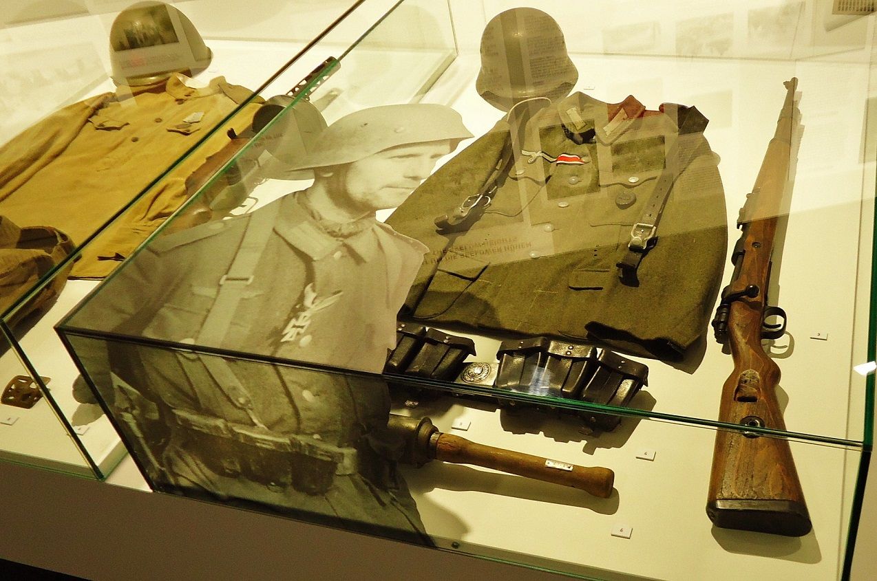 07-The German soldier and his equipment. Note: There is plenty on the www and here is the page from Wikipedia: en.wikipedia.org/wiki/Battle_of_the_Seelow_Heights
|
|
|
|
Post by Karl Welteke on Jul 6, 2013 17:40:26 GMT 8
Marshall Zhukov’s Command Post, 16th April 1945, at Reitwein, From the Seelow Heights runs a spur towards the east (a ridge line), all the way to the village Reitwein near the river Oder and the Commander of the 1st Belarusian Front, Marshal Zhukov) choose to use it as his Command Post because he would be able to overlook the whole Seelow Heights Battle Field. It was an ideal position and that was our next goal on this 5th Day into the Third Reich History. This is the 4th album about the Seelow Commemoration Place and the Battle Field.. 25 images have been uploaded into this album: www.flickr.com/photos/44567569@N00/sets/72157634497686480/Here are some sample images: 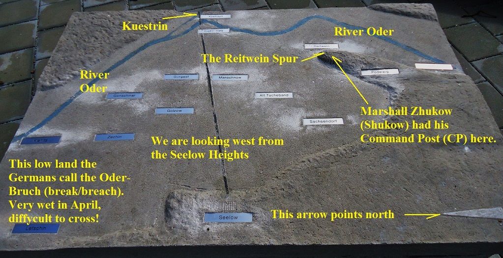 01-This map relief was at the Red Army Memorial and Cemetery. It shows clearly why Marshall Zhukov chose this place as his Command Post (CP) the command the Seelow Heights Battle. 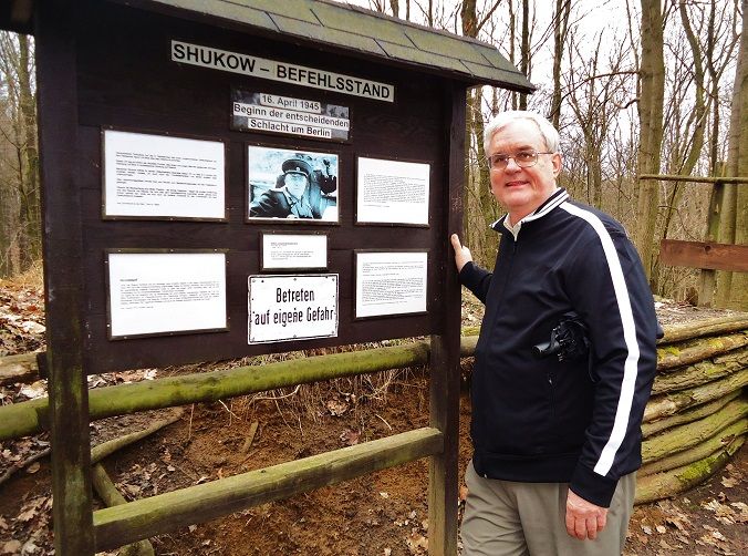 02-From the Reitwein village edge we followed a dirt track on the north side of the Reitwein Spur and saw several signs guiding us to this sign at Marshall Zhukov Command Post (CP). This 2nd big sign board says, this is the Marshall Zhukov’s CP (Command Post). Remember Germans spell the marshal’s name as Shukow. I have to show us two travelers at least sometimes. Here is Steve, my partner, who made this trip possible, thank you Steve. 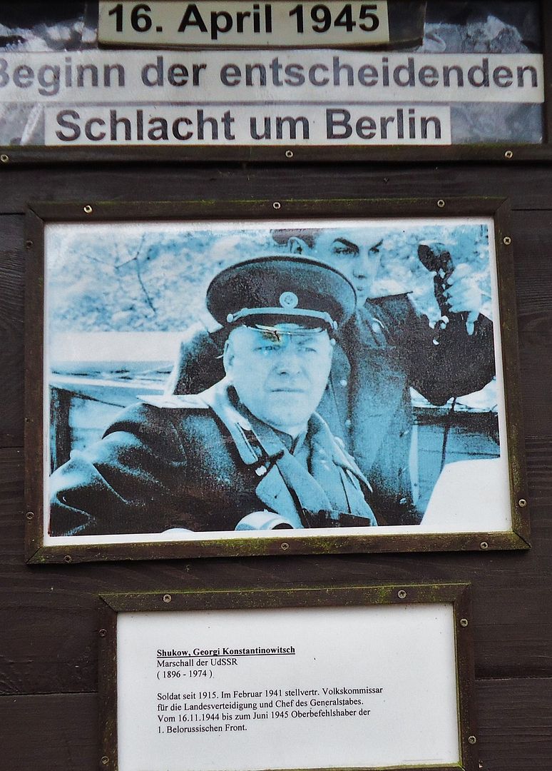 03-A short career description of Marshall Zhukov. 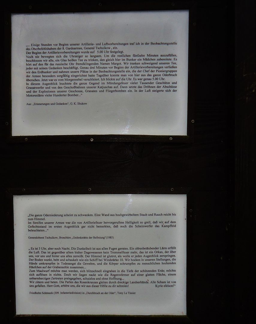 04-The top excerpt is from Marshall Zhukov himself. Notice that he says 5 am, he was on Moscow time, the local German time was 3 am. The other two paragraphs are from an Army commander and an author about the battle. I translated some of these information signs in the album above. 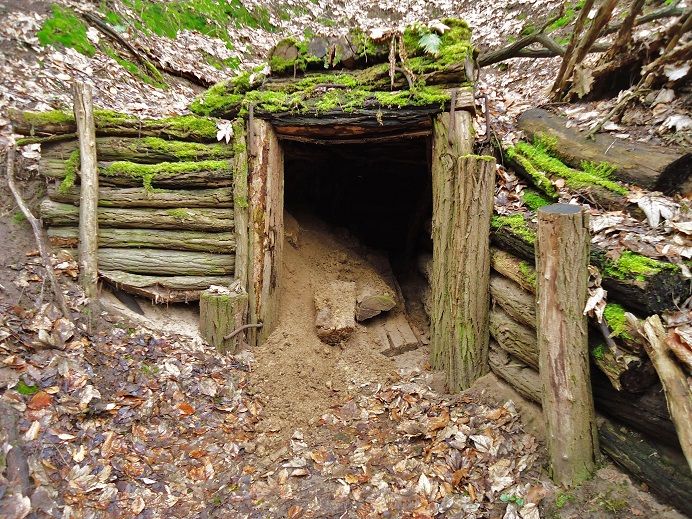 05-The entrance to the Marshall Zhukov bunker but I wonder whether the NVA reconstructed it? I can’t believe that a 1945 bunker out of wood is still in that good shape, especially in this wet Central Europe weather. More information from the 1st sign board. It says that the East German Army (NVA) in Oct. 1989 did some digging and cleared the entrance of the bunker, took exact measurements and made a photo documentation of this Marshal Zhukov’s CP. I couldn’t help thinking, that the NVA also did this job 5 minutes before 12 (in the last minutes) because in Nov 1989 East Germany disappeared from the map including the NVA. 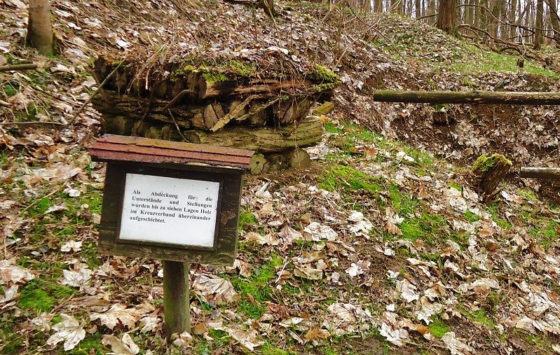 06-Here the NVA built a sample bunker ceiling thickness of 7 layers of tree trunks that’s what the sign says. I assume that the NVA engineering troops did this. In the German Army they are called Pioneers. 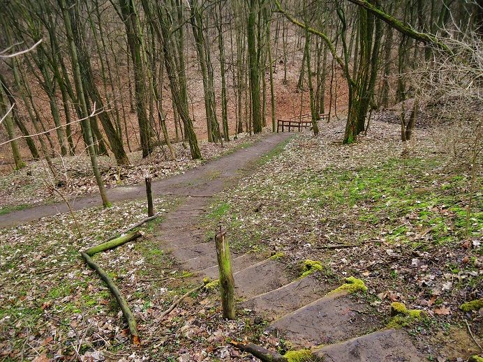 07-The Reitwein Spur does have considerable height and this is the valley where we cut in from the north side dirt road and then climbed up here . North is to the left. All along the dirt road from the Reitwein village to the Marshall CP we seen a lot of dugouts. I assume many if not all were covered and were used just about for everything, weapons, munitions, vehicle and personnel. 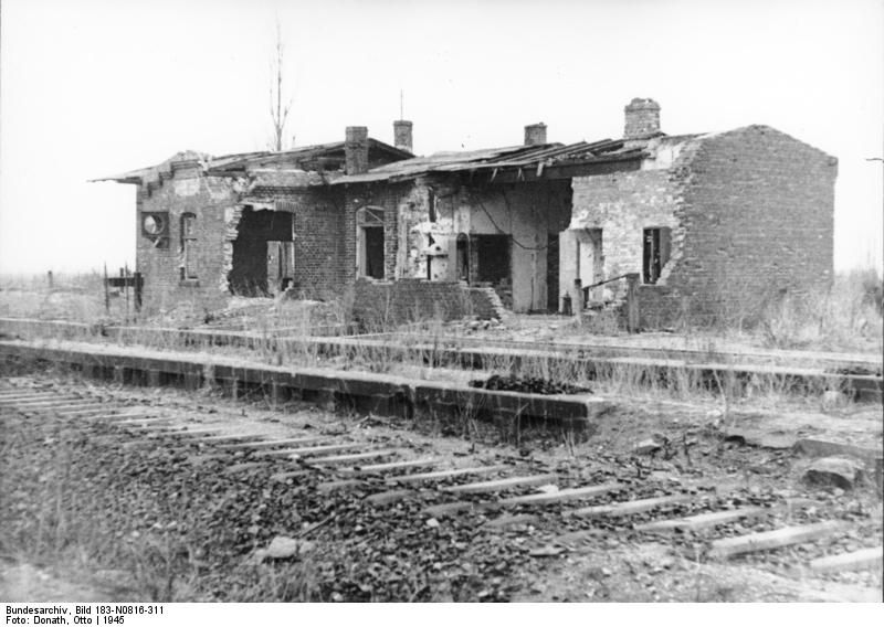 08-The Reitwein Railway Station at 1945, it had become a casualty. This image was attained from Wikipedia and on the bottom it says where it came from original. 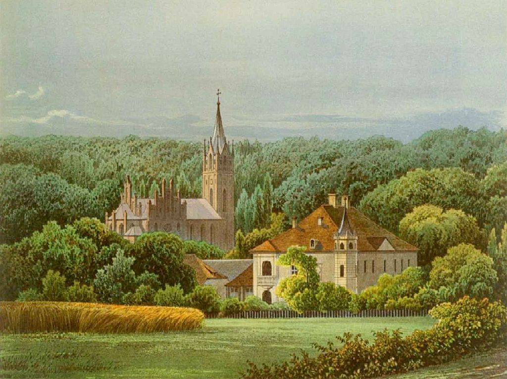 09-This Reitwein Church was also destroyed in 1945. It is near where we parked and started the walk to Marshall Zhukov’s CP. In the album above, in the 2nd last picture, we got a glimpse of the church tower thru the trees from the spot where started the walk. The church was not rebuilt but the tower was and the church grounds are sometime used for public events. Note: This Wikipedia link is in German but has pictures of the town: de.wikipedia.org/wiki/Reitwein
|
|
|
|
Post by Karl Welteke on Jul 16, 2013 17:39:10 GMT 8
Kuestrin Fortress on the Oder River 2013-04-13 On our 5th day we crossed the Oder River and entered Poland at Kuestrin. Kuestrin was completely destroyed in the defense battle from the 31st of Jan. to the 30th of March in 1945 against the Red Army. One thousand Germans were able to break out at the end. This fortress city played an important part in the history of the land where I come from. It is about 80 km distance from my village and was the seat of Regional Government most the centuries since the 12th Century. I put my 39 pictures of this fortress in this Album: www.flickr.com/photos/44567569@N00/sets/72157634664610604/Here are some sample images: 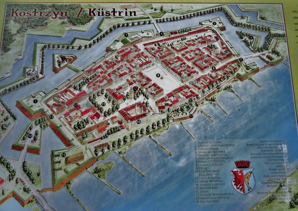 01-Map Drawing of the Kuestrin Fortress on one of the information plaques. That is the way it looked before the war. 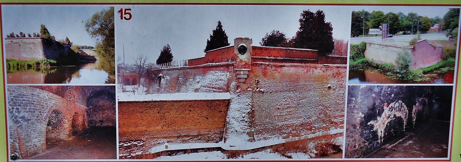 02-These pictures were on an information sign and are about the bastion Koenig (King) #15 on the map drawing. 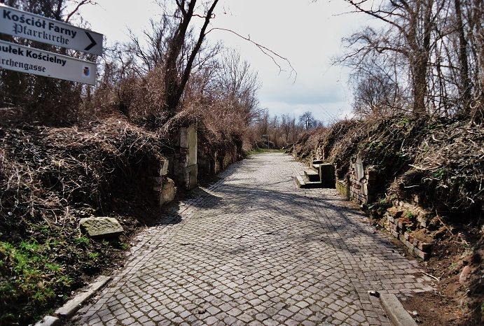 03-The Church Alley in the Kuestrin Fortress. This is a good example of how the whole fortress was destroyed in the 1945 defense struggle against the Red Army. The battle lasted from the 31st of Jan. to the 30th of March 1945, 1000 men were able to break out then. Compare this with the next picture, this place was more destroyed that Manila! 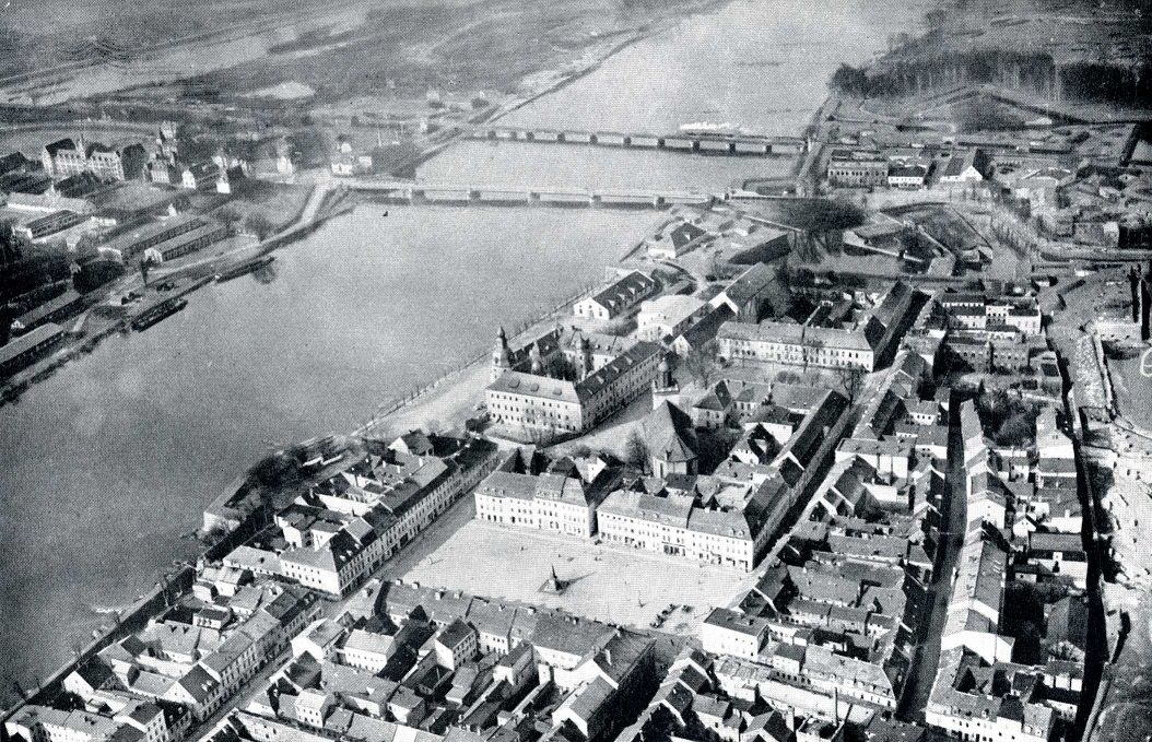 03a-Fortress Kuestrin before the war, what a city! It is gone now thanks to my Fuehrer Adolf Hitler. 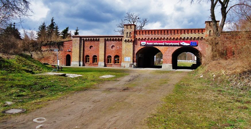 04-The Berliner Gate, it houses now a Museum. 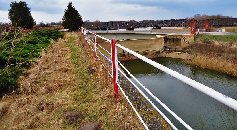 05-View from Bastion Koenig onto the Oder River bridges. The vehicle bridge is real close and the far one is the rail bridge. 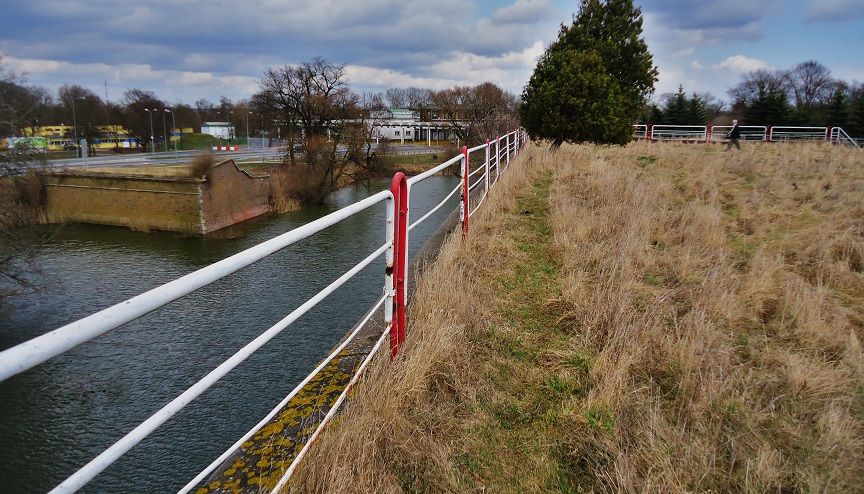 06-View from Bastion Koenig, Kuestrin Fortress, towards the Polish-German border check point which is no longer manned. The Polish and German Government gave up on these border check points after the collapse of Communism 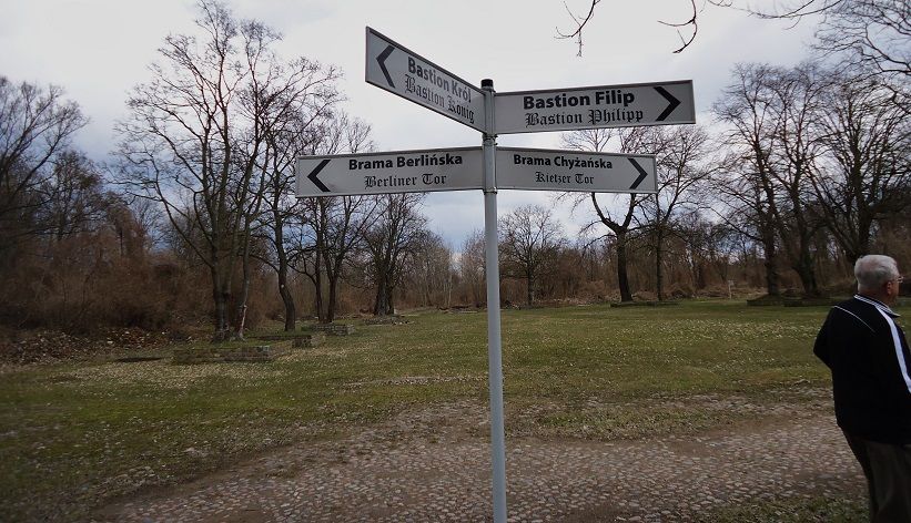 07-This was the Renneplatz (Platz = plaza) in the Kuestrin Fortress but I do not know what it was used for. 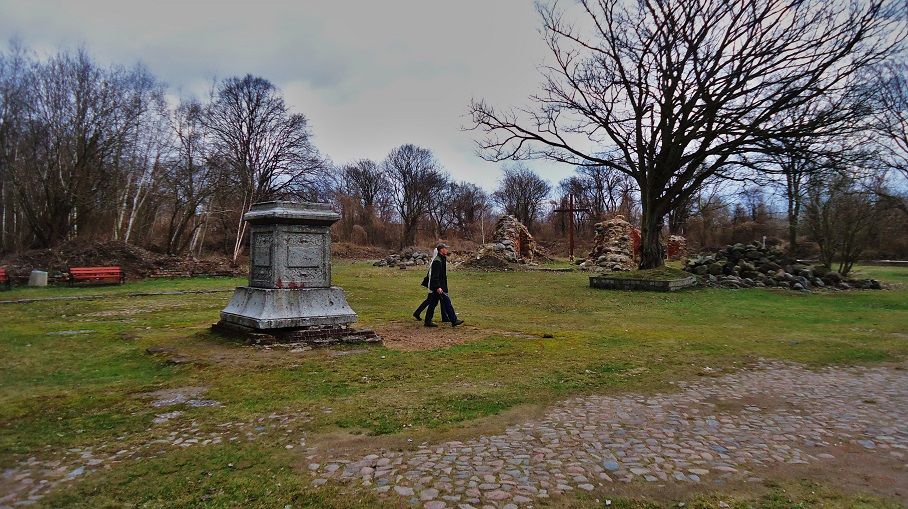 08-In back was the church in the Kustrin Fortress, #10 on the map; in the front is the base of one of the Royal Statures. 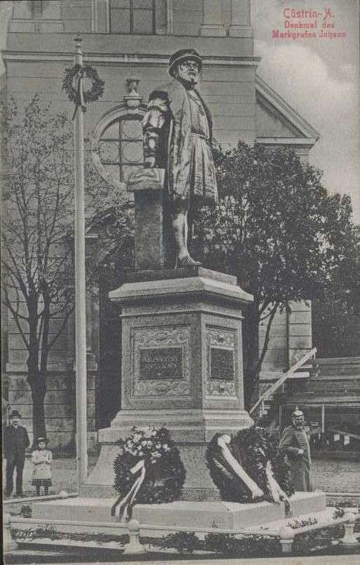 08a-Kuestrin Marker for Markgraf Johann (Graf=Count of a Border State or province =Mark) from Wiki-Commons 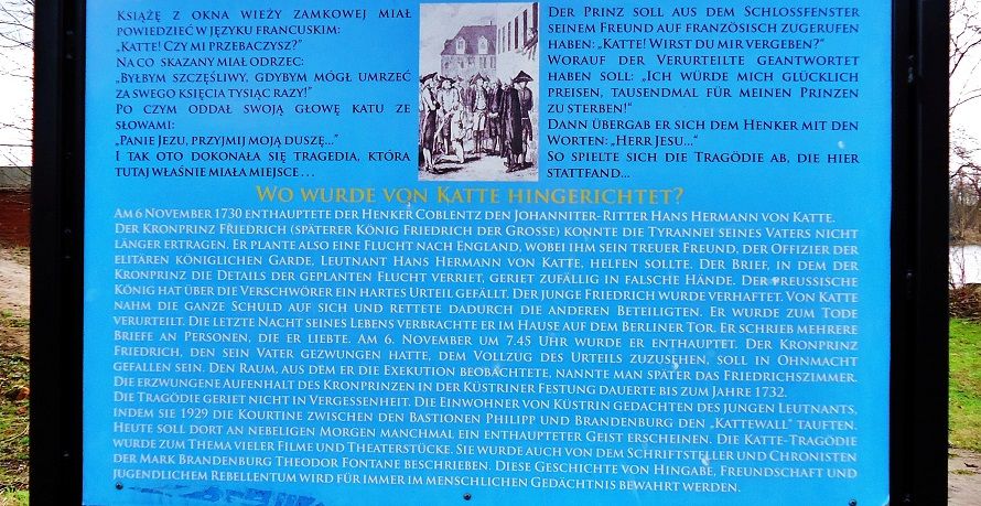 09-We have moved to the Katte Wall, #18 on the map. Here played out one of the well know dramas in Brandenburg, Prussia, German history. The Brandenburg, Prussian Crown prince tried to escape to England from his Army Post with an army officer friends but they were caught. His father the king wanted to execute both but relented and had his son watch the execution of the officer friend Katte in 1730 here in this fortress. Both were famous kings, the father was known as the Soldier King and the son became to be known Fredrick the Great. Sorry, this sign is in German but I posted it because it is one of my memorable historic stories that was engrained in my mind, early in life. 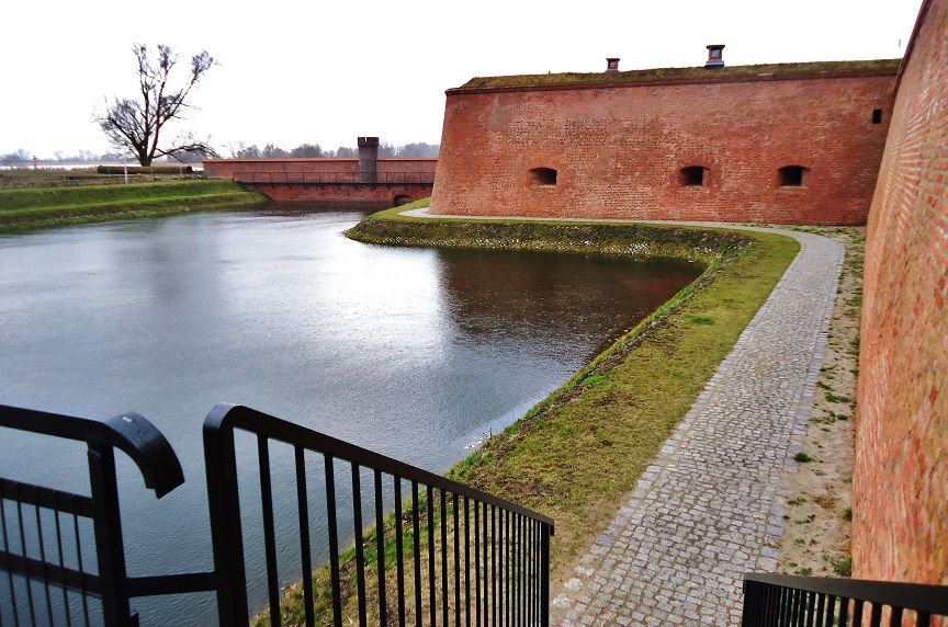 10-Bastion Philipp one of the corner strong points of the Kuestrin Fortress, it obviously has been rebuilt since the war. 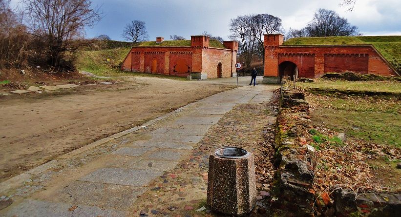 11-The Kietzer Gate, it also seems to have been rebuilt. Note: Here is a URL for that fortress: Kuestrin from Wikipedia www.flickr.com/photos/44567569@N00/sets/72157634664610604/ |
|
|
|
Post by Karl Welteke on Jul 19, 2013 19:24:32 GMT 8
Sonnenburg, Slonsk, Knights of St. John On our 5th day and still in Poland we visited the Sonnenburg Castle near Kuestrin. This was my request. Sonnenburg is now called Slonsk in Polish. This castle was built by the Knights of St. John. These Knights and the Templar Knights before them developed this region since the 1200s. The Templar Knights operated first out of Lagow and near my village and that is the reason my village received the name Tempel (Temple in English, Templewo now in Polish). After the Templar Knights were dissolved by the Pope The Knights of St. John took over and established their new seat of Government in Sonnenburg. They also built the church and a hospital. So for me this visit was retracing my heritage. Sixteen pictures have been uploaded into this album and many images are at high resolutions: www.flickr.com/photos/44567569@N00/sets/72157634698155661/Here are some sample images: 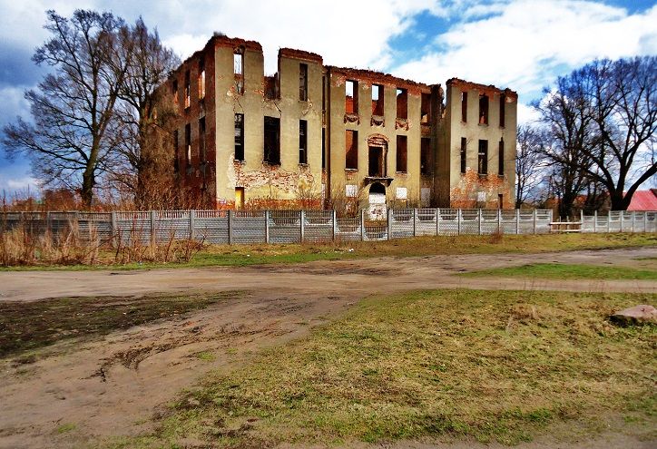 Z121. The Sonnenburg (Slonsk) castle of the Knights of St. John. It survived the war and burned mysteriously in 1975. All the Crusader Knight Orders after about 1400-1500 only survived as humanitarian organizations and had control only over little land. Most land had been taking over by the new state organization; here it was Brandenburg and later Prussia. 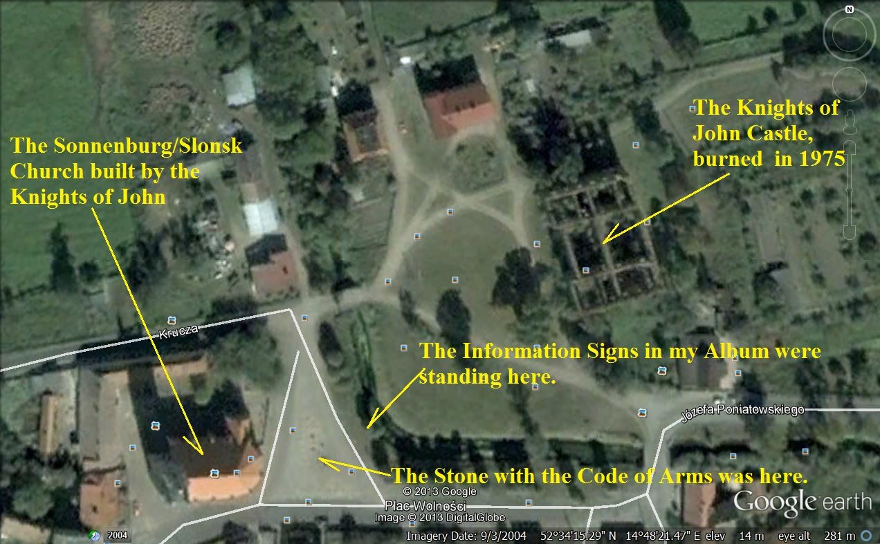 Z122. The Google Earth map as to where the Knights of St. John castle and the church are. Looking for the hospital was not on our schedule. 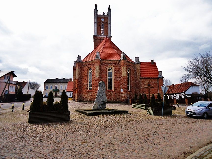 Z123. The Knights of St. John Church in the former City of Sonnenburg, it is now a village and is called Slonsk in Polish. 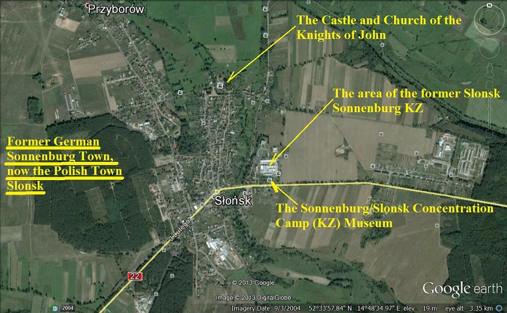 Z124. Google Earth map of Slonsk, the ex Sonnenburg City. 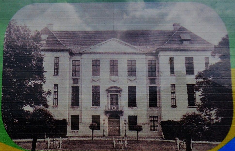 Z125. This picture is from the information sign and shows how the Knights of St. John Castle used to look like. Do you notice the US Civil War type artillery pieces in front as decoration? 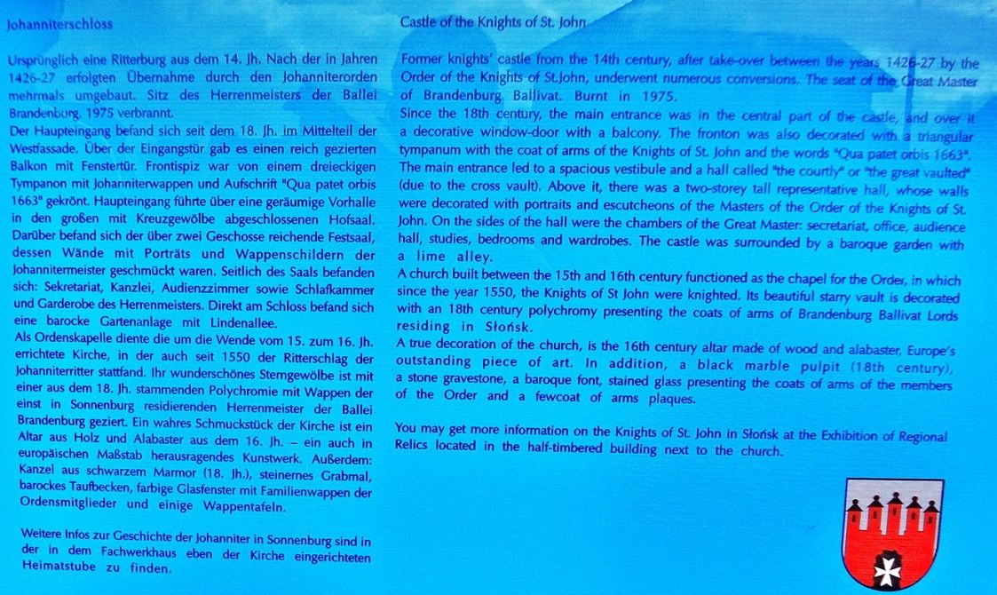 Z126. The description on that sign about the Knights of St. John Castle. It is also in English. 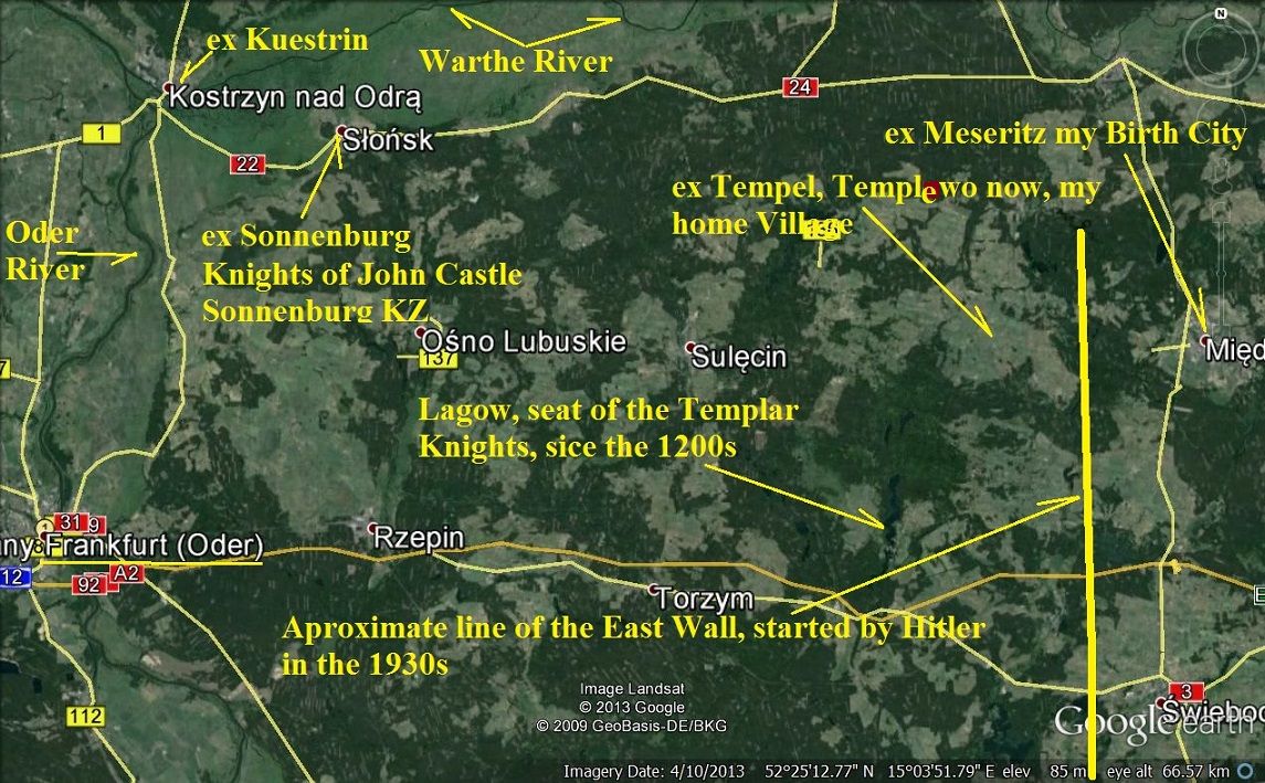 Z127. This Google map shows a bigger picture of this area and how it relates to my home village and birth city. 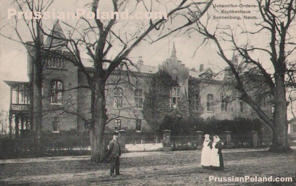 Z128. This is the Knights of St. John Hospital but we didn’t look for it. It comes from the PrussianPoland.com web pages. Note: This is the Wikipedia link to Sonnenburg, Slonsk: en.wikipedia.org/wiki/Slonsk |
|
|
|
Post by okla on Jul 20, 2013 10:18:20 GMT 8
Hey Karl....Here I am again, tossing out another"thank you", but I believe all of us viewing your Eastern Front material would be in full agreement with me, that this is excellent stuff. I, certainly am no expert on Military History, especially the War in Eastern Europe/Russia/etc and especially the final Campaign on the Oder River sector. I remember those days from viewing Newsreels, reading the papers and, of course, listening to the latest War news on the radio. Saying all this, I would venture that most Americans were focused on getting across the Rhine and our attention was glued to that situation. Due to this factor, my knowledge of the fighting at the Oder River is very limited. Thanks to you, I feel that I am a bit better prepared to even discuss it with any other folks interested in a neglected area of that conflict. I also am very mindful for the fact that your trip was very meaningful to you since this is your "home ground", plus the fact that your Father and Uncles could have fought over the very ground you stood on. Gotta be quite a moving experience for you to return to this place at this point in your very eventful life. Thanks again.
|
|
|
|
Post by Karl Welteke on Jul 20, 2013 20:53:22 GMT 8
Sonnenburg Concentration Camp (KZ). Our last stop in Poland on the 13th April 2013 was the museum for the Sonnenburg Concentration Camp (KZ in German for short) which is now called Slonsk, Poland. I didn’t know about this KZ and only after I got back home to the Philippines did I learn about the terrible act that was carried out here. It was on the night of 30th to 31 Jan. 1945, the same night half of my village fled from our village. A GESTAPO Detail from Frankfurt/Oder arrived and executed about 800 prisoners. Many of the prisoners were resistance people against the Nazi Regime or Occupation and so were from all over Europe. In this album are 15 images: www.flickr.com/photos/44567569@N00/sets/7215763471244979/6Here are some sample pictures: (For maps of this area refer back to the last segment on this page) 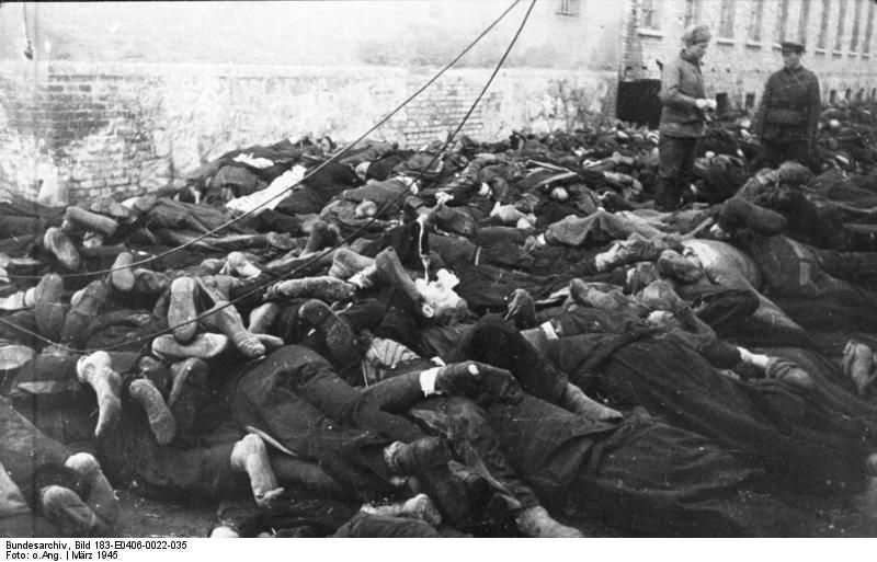 z129-This was from the Wikipedia pages and most likely was a Soviet picture, that is what the Red Army soldiers saw on the 31st of Jan. in Sonnenburg. This picture got to be the 1st one to be shown here to document the travesty carried out here by the Third Reich National Socialist Regime. 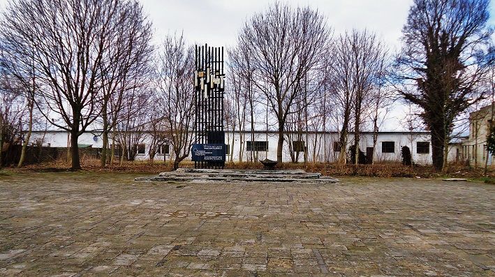 z130-We are approaching the Sonnenburg KZ Museum, at right is the museum building. The structure dead ahead must be a commemoration Marker. The buildings in back are now commercial buildings but that was the area of the KZ camp. 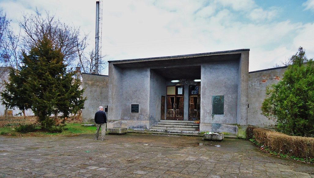 z131-The entrance to the museum, it looks like not too many visitors come here and one has to make an appointment to visit. We hadn’t done that so we could not go inside. The right plaque must represent the Red Army or Communist Allied Soldier who liberated East Europe from the German aggressor. 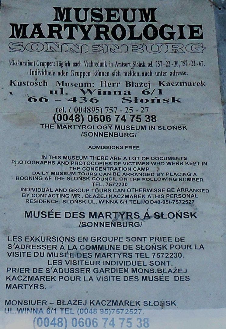 z132-This is the visiting contact information in German, English and French. It was located above the door, good that I took a picture! 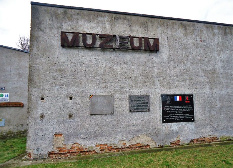 z133-Outside on the wall are several plaques praising the resistance against fascism. Some in German are from the DDR (East Germany). The next wall also has three plaques and the were placed to commemorate Dutch, French and Belgian (in the French and Flemish language) Resistance people 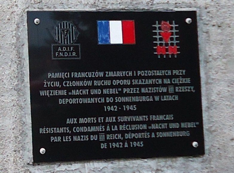 z134-This one is for the French resistance fighters who were held and died here. 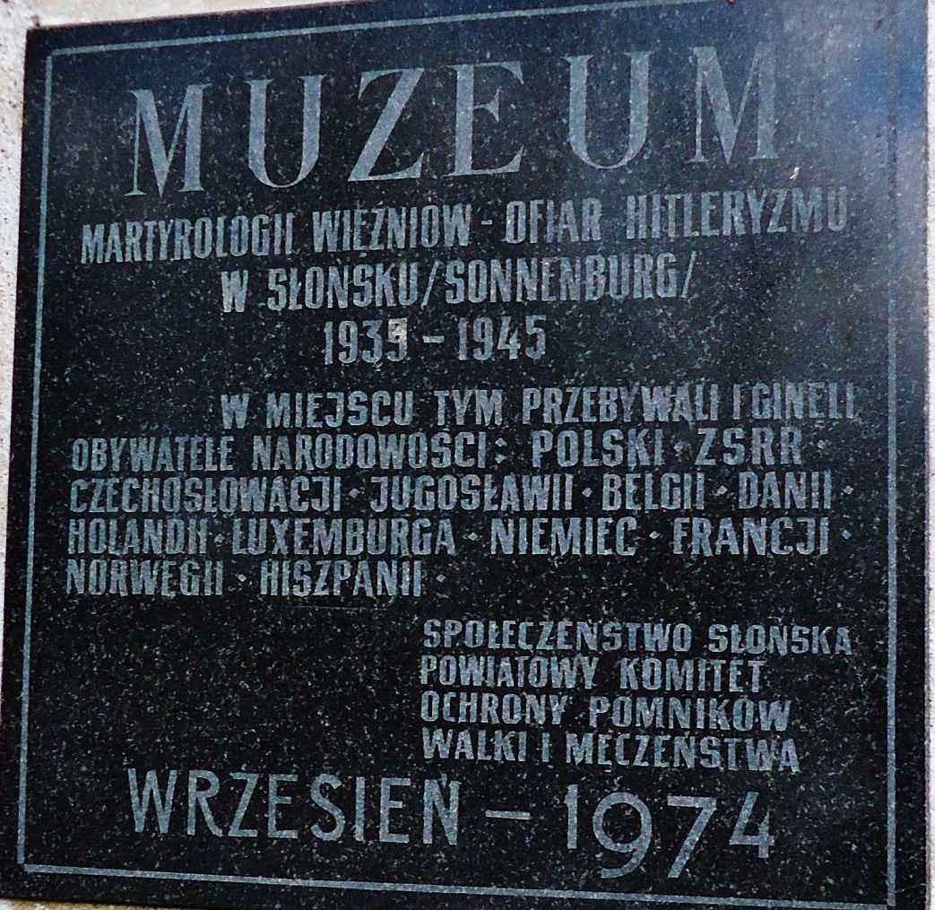 z135-This plaque is special and is located separate, it commemorates all the other countries that are not listed separately, in Polish though. Note: Okla and All, it’s just that I like to do this. Retired now, just like to study history and I love to share pictures. Thank you for your comments. |
|
|
|
Post by Karl Welteke on Jul 26, 2013 15:20:36 GMT 8
Karlshorst Surrender Site, VE-Day, 2013-April-13 Our last stop on our 5th day into the Third Reich History, Karlshorst, the WWII surrender site in Berlin, the 8th of May 1945. On this day we had covered all our goals , east of Berlin. This was the last day, VE, it was finally over. Bad luck, it was closed for renovations but we could walk around the building and were able to look at some of the Red Army hard ware. The Russian Army occupied this building until 1994 but it had become a joint Russian-East German Museum before that and it continues as such after the German reunification. I have seen the picture of Gen. Keitel signing the Document countless times but know I know where it was, I have been on this historical spot! 18 picture are uploaded into this album: www.flickr.com/photos/44567569@N00/sets/72157634793499963/And here are some sample images but 4 of these are from the www: 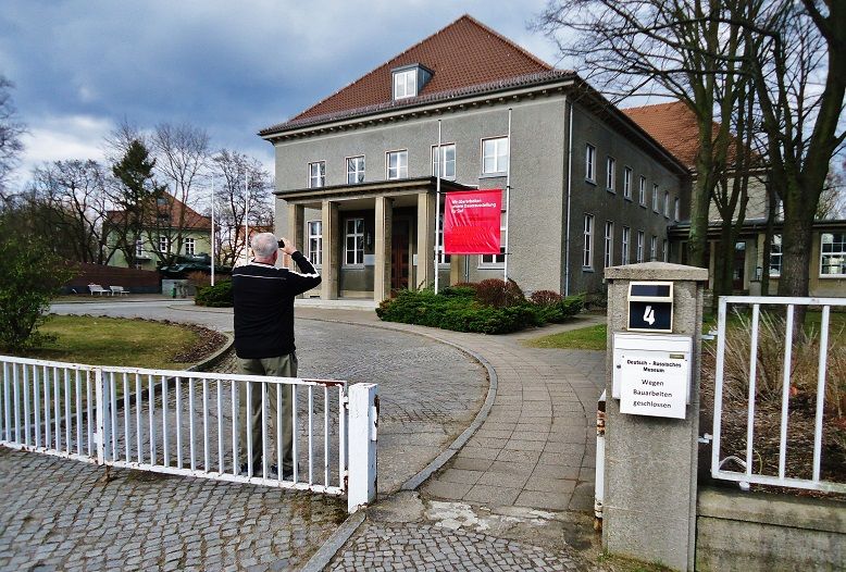 Z210-This is the front of the Karlshorst Berlin May 8th 1945 Surrender building. The sign at the gate says that the Russian-German Museum is closed due to renovations. Notice the T-34 tank at the left side of the building. 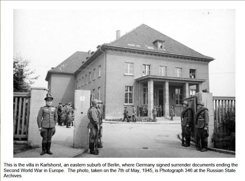 Z211-This picture shows the building on the 7th of May 1945. It cam from the www. 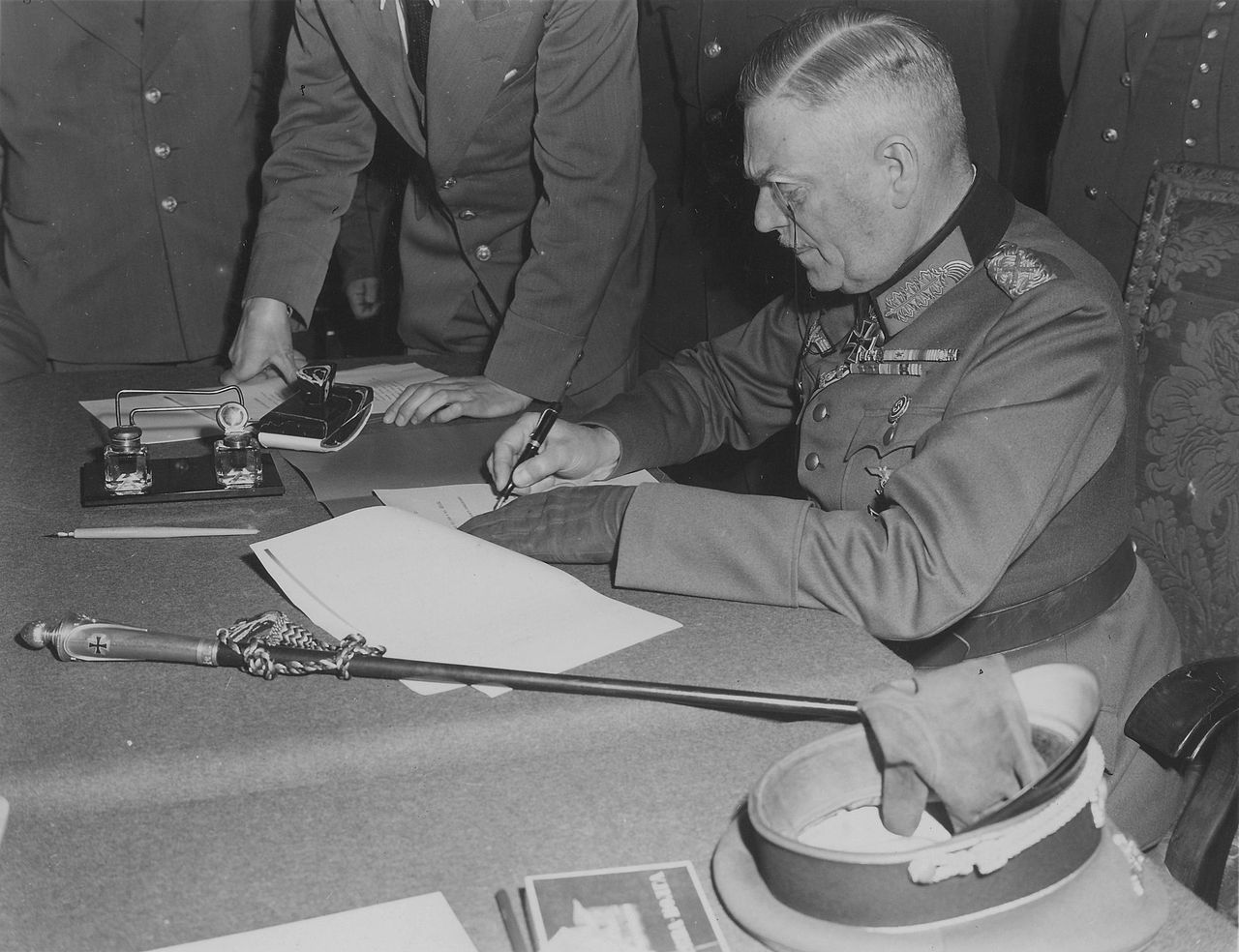 Z212-I have seen this famous picture countless times but now I have in my mind the geographic point where it happened and I have been there. This image is Wikipedia Commons. 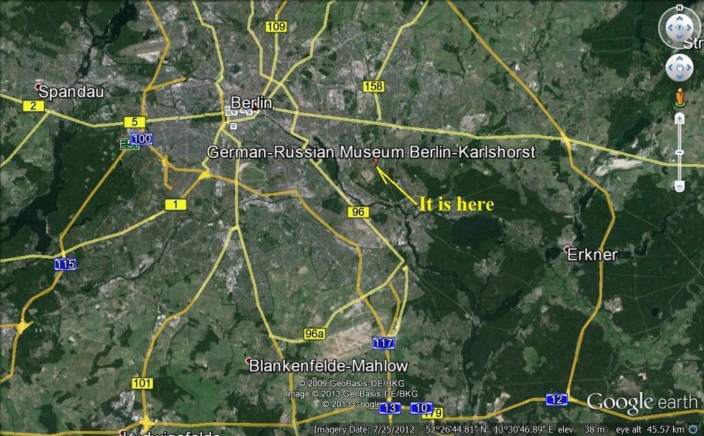 Z213-The location of the Russian-German Museum on a Google Earth map. 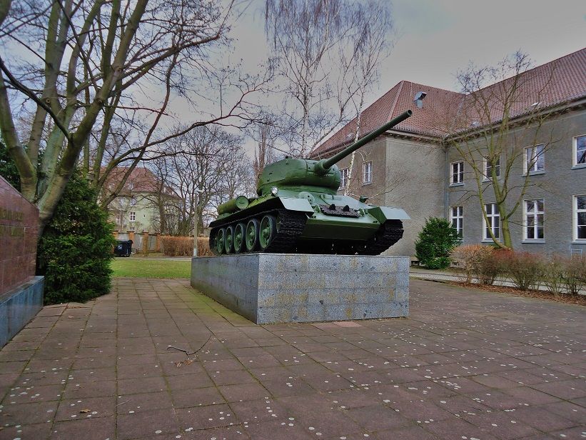 Z214-On the left side of the building stands this T-34 tank ( I assume that it this famous tank model). 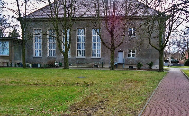 Z215-This is the back of the Karlshorst Berlin May 8th 1945 Surrender building. Notice the T-34 tank at the right, we were walking around the building counter clock wise and we just walked passed that tank. 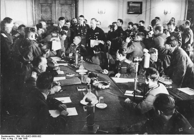 Z216-I never seen this picture before, it seems a lot of people wanted to witness this monumental moment in history. Gen Keitel signing the surrender instrument at Berlin-Karlshorst, the building we just walked around. This image is Wikipedia Commons. 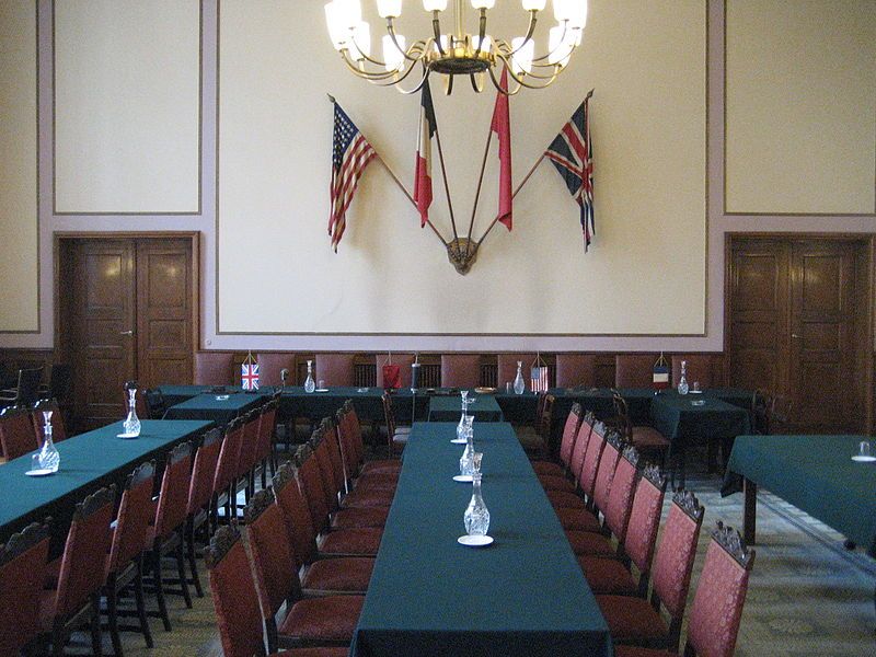 Z217-The same room of the last image. We were not able to go inside because the museum is closed for renovations. This image is Wikipedia Commons. 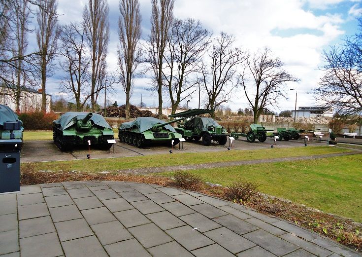 Z219-At one corner of the museum are all these samples of the Red Army hard ware. 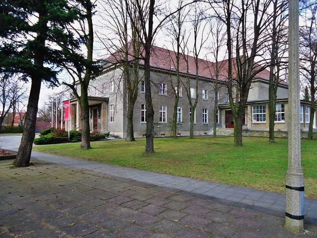 Z218-We finished our counter clockwise stroll around the Karlshorst surrender building and are almost back in the front of it. Note: There is plenty material in the www, just search for -Karlshorst Surrender Site. |
|
|
|
Post by Karl Welteke on Jul 30, 2013 15:44:35 GMT 8
Sachsenhausen-Oranienburg Concentration Camp (KZ). The 6th day of our trip into the history of the Third Reich started at the Sachsenhausen concentration camp (KZ). The KZ is about 22 miles north of Berlin. I took about 150 images but only 31 are posted here. This camp was big and the Commemoration Foundation prepared many things to see and study. Wikipedia says this about this KZ: Sachsenhausen-Oranienburg was a Nazi concentration camp in Oranienburg, Germany, used primarily for political prisoners from 1936 to the end of the Third Reich in May 1945. After World War II, when Oranienburg was in the Soviet Occupation Zone, the structure was used as an NKVD special camp until 1950 (Google: NKVD special camp Nr. 7). The remaining buildings and grounds are now open to the public as a museum. In this album I posted 31 images: www.flickr.com/photos/44567569@N00/sets/72157634844866094/But here are some sample images from the album and from the www: 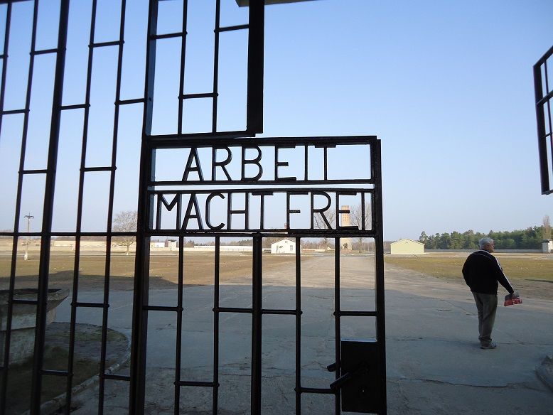 Z229-That infamous slogan-Arbeit macht frei- (Work makes one free) is still at this infamous gate. One can see how big this place it. The open area in front was the -roll-call- area for the prisoners. 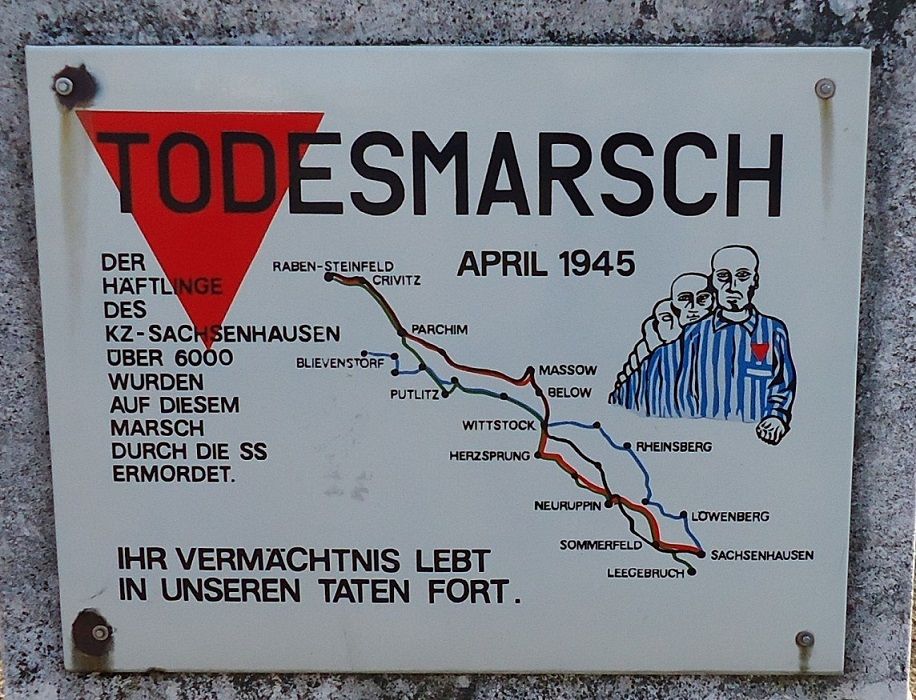 Z230-This sign says that more than 6000 prisoners died between 21 April and 7th May 1945 on a Death March. About 35000 prisoners were marched out to prevent liberation by the Red Army. Anyone who could not keep up or fell was shot immediately and the prisoners had to keep stepping over their fellow prisoners. 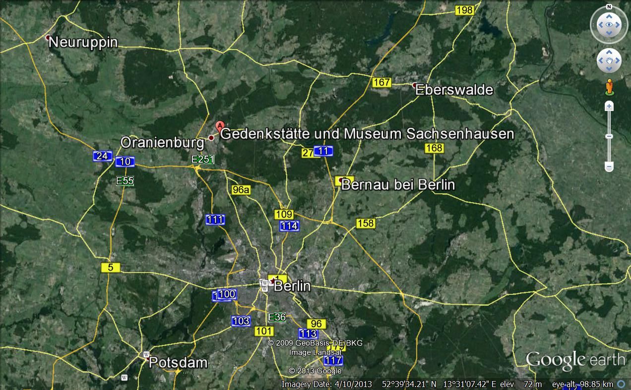 Z231-Sachsenhausen-Oranienburg KZ is about 22 miles north of Berlin. 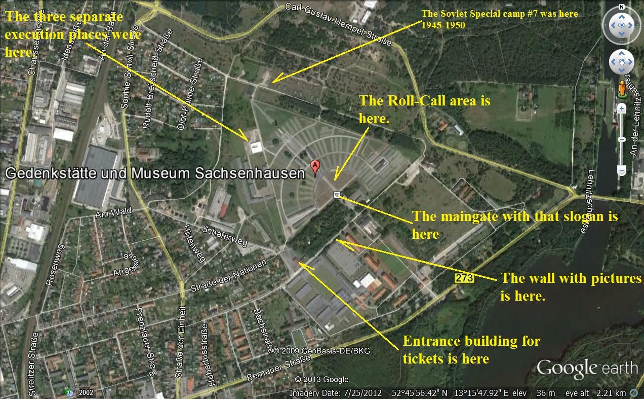 Z232-Close-up of the Sachsenhausen KZ on a Google map 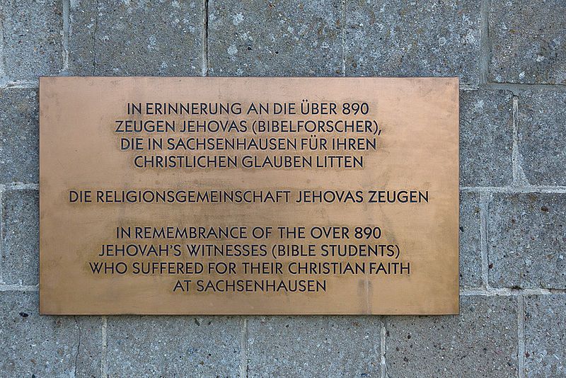 Z233-This KZ was mainly for anyone or organization who did not want to follow the Nazi line. This plaque commemorates 890 members of the Jehovah witness organization who suffered or died here. 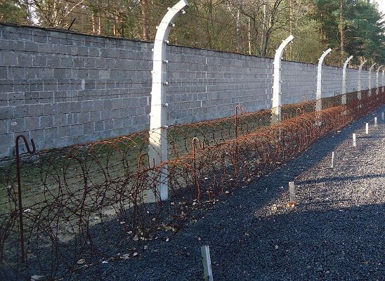 Z234-09-The Sachsenhausen KZ wall/fence, mason wall, 3 meters high, death strip, electrical wire and barbed wire. If got on that gravel near those short sticks the guards opened fire without warning. 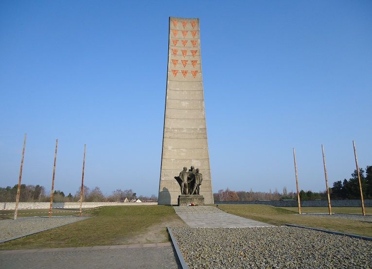 Z235-After the soviets gave up this camp in 1950 the East German Government made this site a place of Commemoration and they built this tall monolith marker. This memorial monolith was erected by East Germany, those symbols on top represent the different patches the prisoners had to wear on their cloth for identification, the pink color was for homosexuals for example. 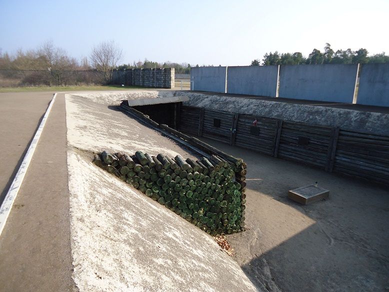 Z236-One of the early execution sites, it is a trench. 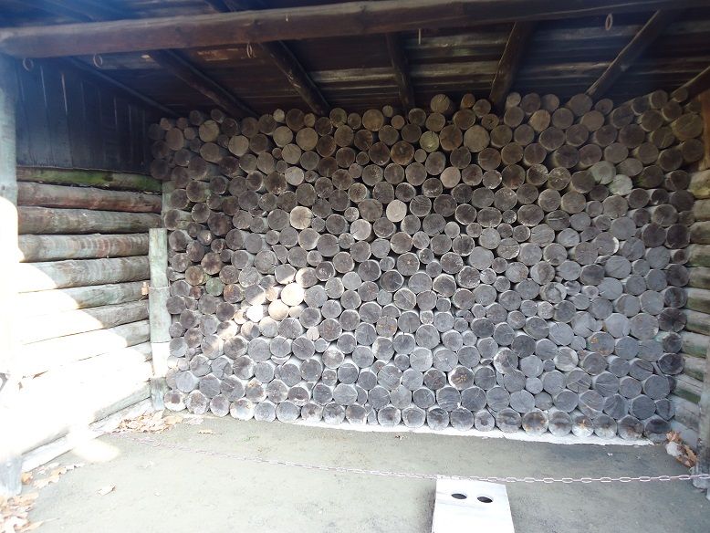 Z237-Close-up of the execution wall, notice the metal eyes above for hanging. 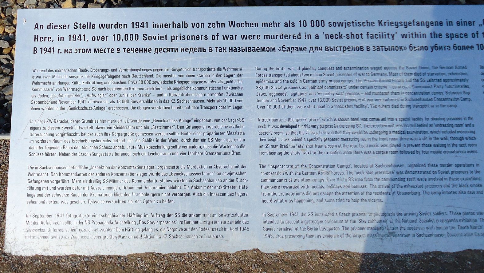 Z238-Here in 1941 over 10000 Russian prisoners were executed, 13000 were sent here but about 3000 died of starvation or sickness. If you try hard you could read the English right side of this sign. 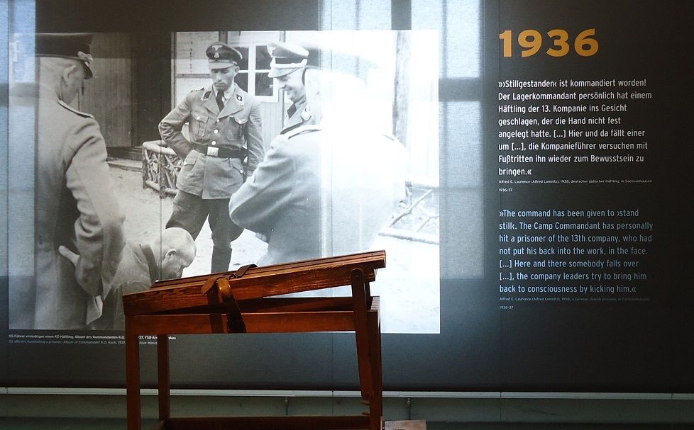 Z239-Everywhere is documentation displayed, this is a sample of the guards cruelty. 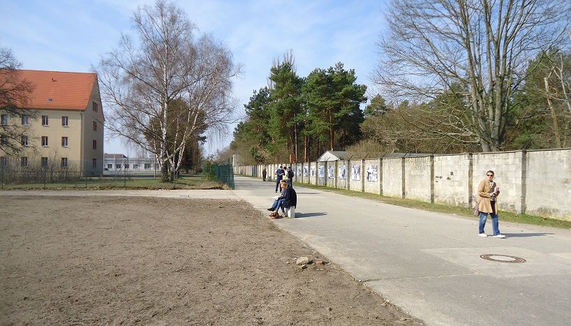 Z241-From the reception building to the Arbeit Macht Frei gate is this wall which displays many graphs of what terrible things that have happened here. 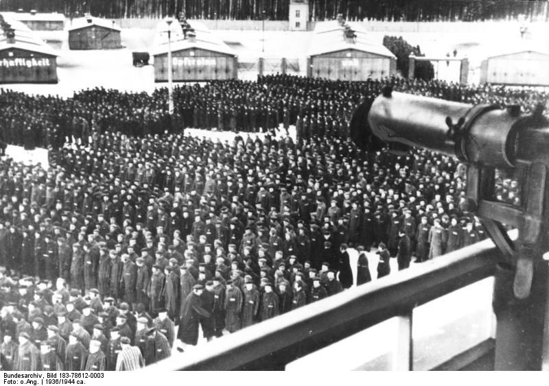 Z242-This picture is from Wikipedia Commons and shows the daily roll call from the Tower-A building which had the gate with the slogan Arbeit Macht Frei. 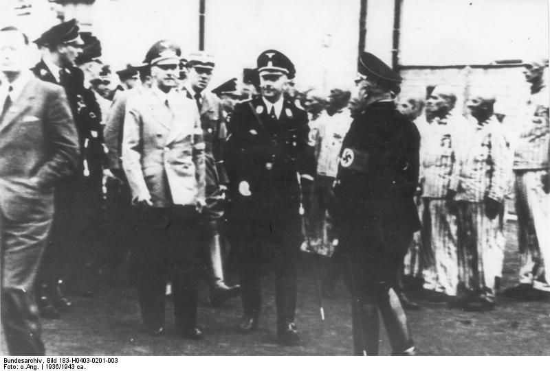 Z243-Himmler and Wilhelm Frick at Sachsenhausen KZ. This image is from Wikipedia-Commons 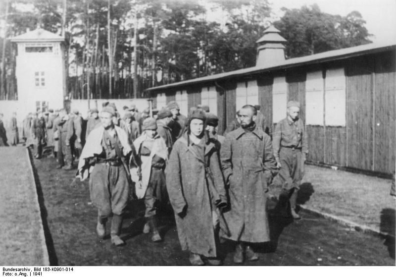 Z244-Russian POWs arrive in 1941 to be executed here and soon. They were selected as Political Commissars and other reasons the Nazis thought are cause to eliminate them. This image is from Wikipedia-Commons. 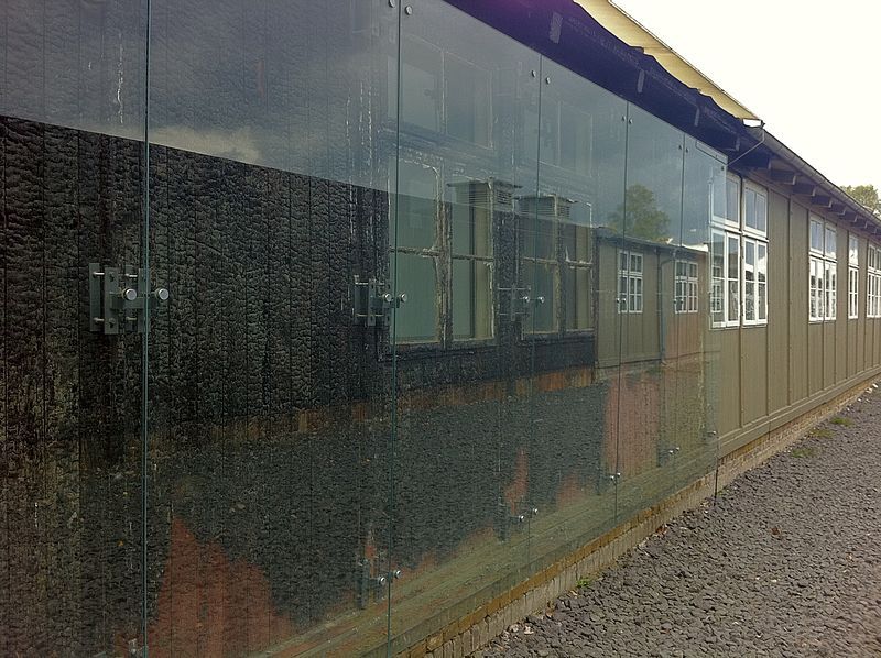 Z246-This barracks suffered fire damage by neo Nazis who tried to burn the barracks down. The damage is now covered with glass or Plexiglas to preserve this shameful act as reminder that the Nazi believers are still amongst us. This image is from Wikipedia-Commons. There is much to be found in the www, just Google: Sachsenhausen-Oranienburg Concentration Camp (KZ) or some of these words. |
|


