|
|
Post by Karl Welteke on Jun 9, 2019 14:28:06 GMT 8
Subic Bay Naval Base early 1980s 6th set and last one with the last 3 original images. These are mostly aerial shots of the Naval Station Subic Bay and a few other shots from the greater Naval Base from about 1981 to 1983. They are all from U.S. National Archives. I downloaded these images many years ago and it is about time I do something with them. I think they are very interesting for people with interest to Subic Bay. I added comparable images from Google Earth for you to compare the changes that have occurred under the new management of the former base, which is now the Subic Bay Freeport Zone. These pictures are available at high resolution in this Flickr album: www.flickr.com/photos/44567569@N00/albums/72157671843428567There were 19 shots and here is the 6th set with the last 3 images: 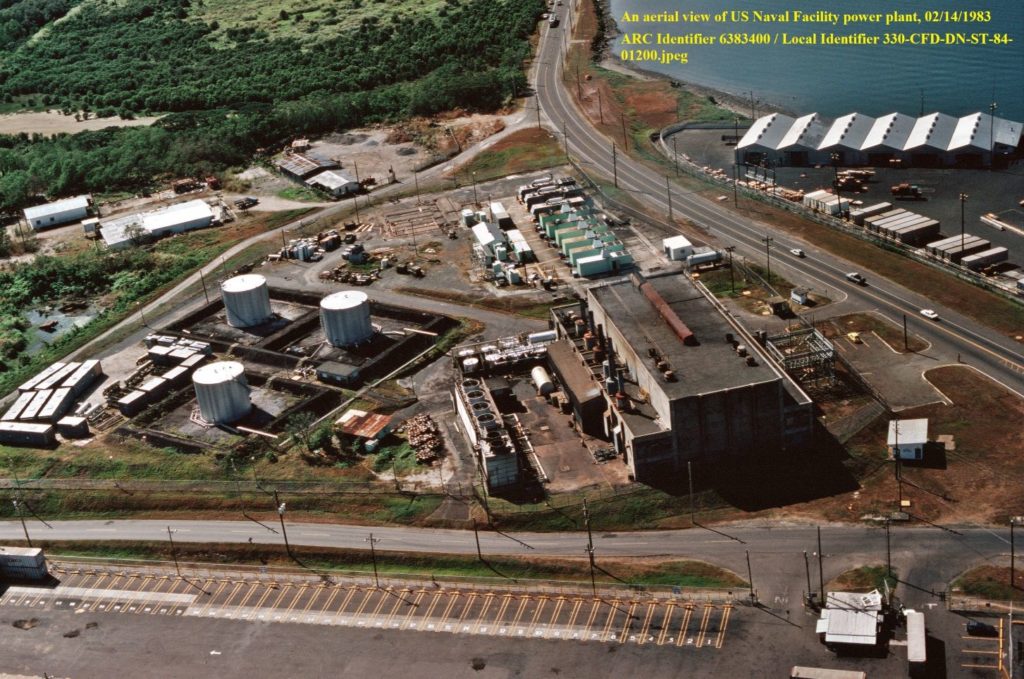 Ze352. The Subic Bay Naval Base power plant in 1983, as far as I know it is not being operated now, a new one has been built. 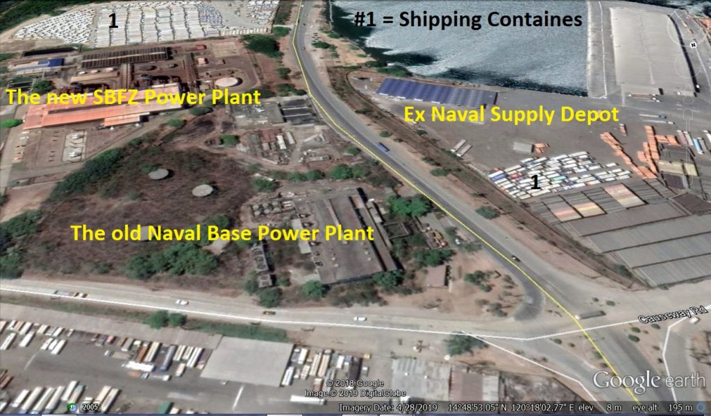 Ze353. The Subic Bay Naval Base power plant in 2019, as far as I know it is not being operated now, a new one has been built. It seems most equipment is still there. 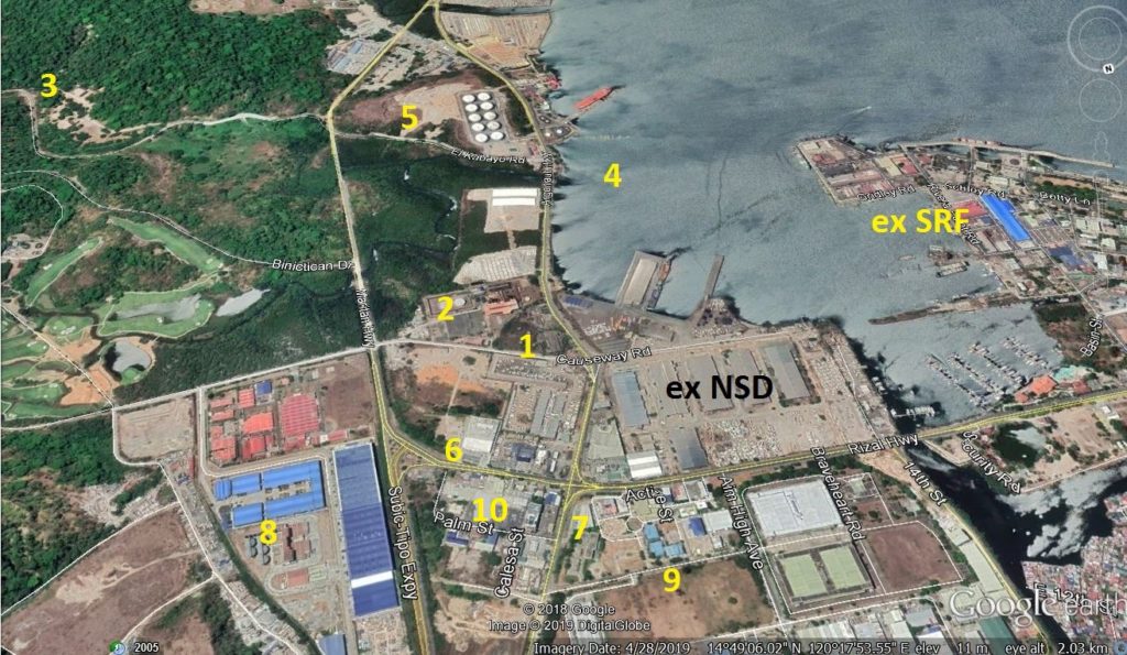 Ze354. The Subic Bay Naval Base power plant in 2019 and the greater area around it with descriptions by the numbers: 1= the old Naval Base Power Plant (not being used); 2= the new SBFZ Power Plant; 3= the horse stables (they were completely rebuilt); 4= an additional smaller fuel pier was built; 5= this was a hill and was used to build the new container port as fill and these new huge fuel tanks were built; 6= Toyota-the new car dealership (nearby, off camera, Ford and Chevrolet also have dealerships here; 7= the Mitsubishi car dealership; 8= New commercial development (just before the Base Negotiation the Navy started a new hospital and dropped it before the end of the negotiations); 9= a huge new commercial development (we only had wetland and a skeet shoot here); 10= our former Main NEX and Commissary building (it is a big Supermarket with a small department store section). 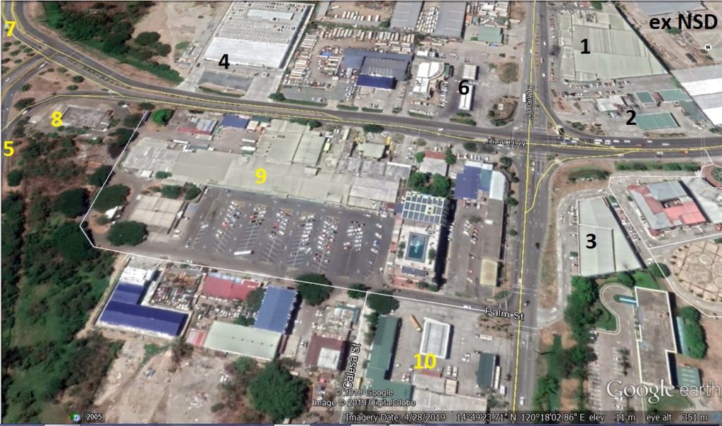 Ze355. The former Main NEX and Commissary building and area by the numbers: 1= is a huge supermarket called “Duty Free”-it is located next to the former NSD; 2- gas station, 7/11 store and a pizza place; 3= the Mitsubishi car dealership; 4= is the brand new Toyota car dealership (nearby, off camera, Ford and Chevrolet also have dealerships here; 5= is the new Subic Expressway (about 10 km long) off the former base and connects with other Luzon express ways (right now it is widened to 4 lanes); 6= is a full service Petron gas station; 7= is the road to Binictican Golf Course and housing, the road is also widened and lengthened to Cubi Point; 8= was our own McDonald and had just opened a few years before base closure and closed with the base closure ( don’t be sad we have now 2 McDonalds in the SBFZ); 9= was our former Main NEX and Commissary building (it is a big Supermarket with a small department store section, I go shopping here) ( many other commercial enterprises opened shop around and in this area); 10= was our own NEX gas station and car service shop (it is still a gas station and car wash, I use it all the time). 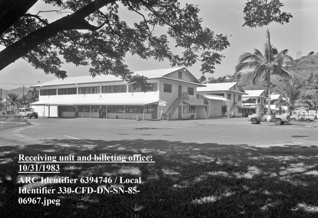 Ze356. The former Transient Personnel Unit (TPU) a friend of mine was the OIC at one time and told me, during his time he had 64 legal holds. 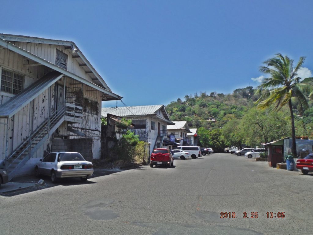 Ze357. The former Transient Personnel Unit (TPU), this picture shows only the last 4 buildings. The 2nd building is used by the Land Transportation Office and I register my car here every yew and renew my driver license. Other government offices use the other buildings. 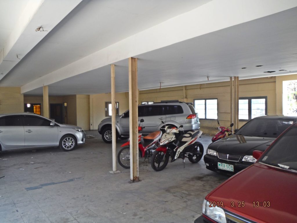 Ze358. This is the 1st building of the 5 former Transient Personnel Unit (TPU) buildings; it is used now as a parking place. 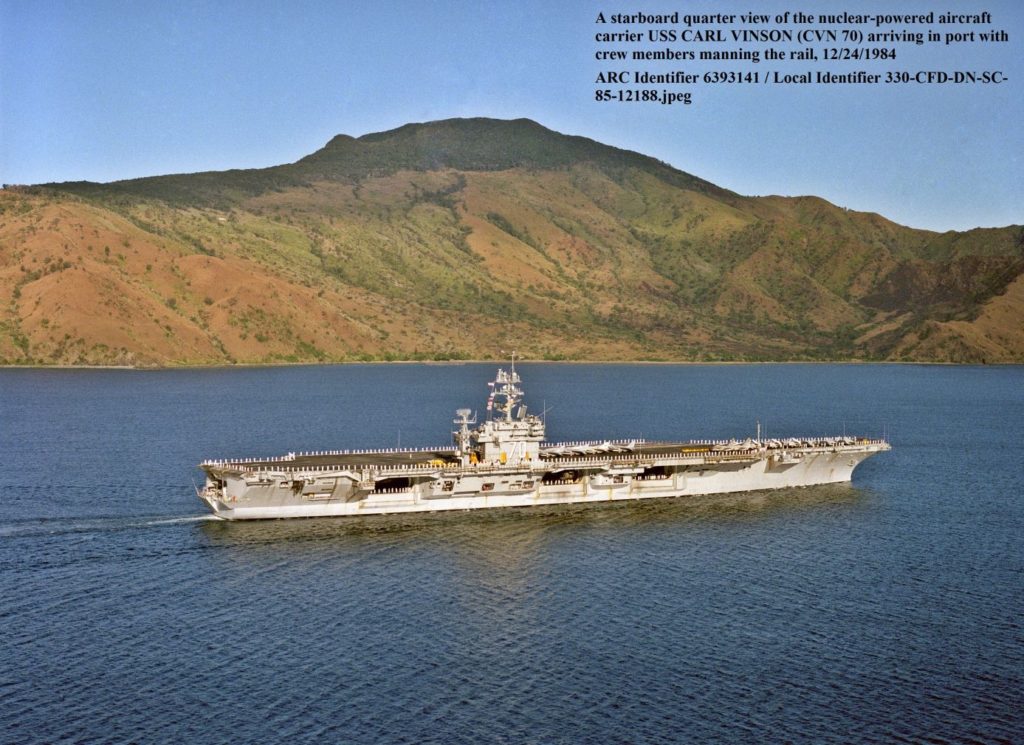 Ze359. USS Carl Vinson is arriving in Subic Bay 1984. 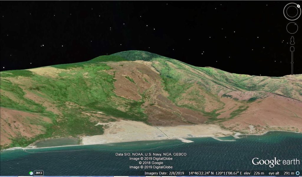 Ze360. I believe I captured the same area of the Redondo Peninsular as in the last picture of the USS Carl Vinson is arriving in Subic Bay 1984 (from Google Earth). In that area a new coal powered power plant was started but I understand it has been halted because it has been challenged in court. 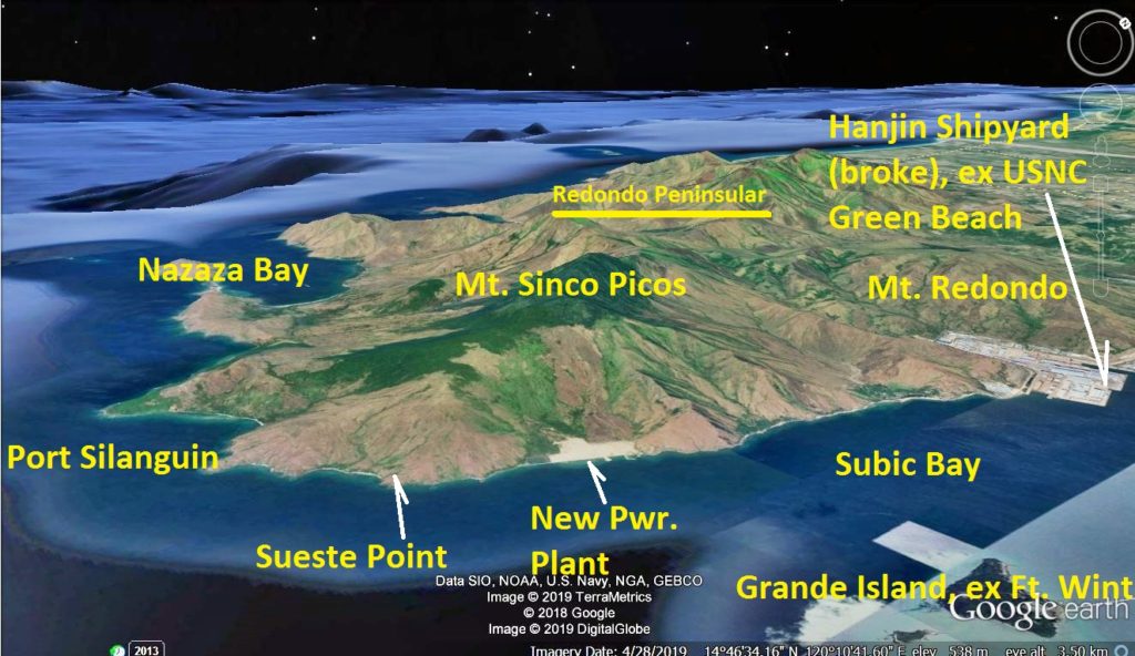 Ze361 This is a Google Earth image of Subic Bay and Redondo Peninsular captured the greater area of the last USS Carl Vinson image entering Subic Bay in 1984. |
|
|
|
Post by Karl Welteke on Jun 16, 2019 14:57:10 GMT 8
Visit Olongapo & Subic Bay 1945 with the 38th Inf. Div. A very good friend of mine, we met on Corregidor several times sent me three 1945 pictures and he said this: “Hi Karl, I found this 38th Division (Indiana National Guard) Yearbook at the local Library, have you seen any of these or are they new to us?” Roger From Karl: I saw a similar picture about the 38th Inf. Div. Bataan Welcome Sign. My friend Roger Davis is a very active member of the Coastal Defense Study Group (cdsg.org) and has contributed much in keeping alive the history of the US Army Coastal Defense.  Z099. Kalaklan Point in 1945 from the 38th Division (Indiana National Guard) Yearbook at a local Library via Roger Davis (cdsg.org). According to the inscription on this picture the Japanese did leave a few soldiers behind to die, before they retreated to the Zig-Zag Pass to defend that. A pillbox defense position at the foot of Kalaklan Point is new to me.  Z100. The 38th Inf. Div. marching along Dewey Ave. in Olongapo Town in 1945 from the 38th Division (Indiana National Guard) Yearbook at a local Library via Roger Davis (cdsg.org). I recognize the Kalaklan Ridge in back which is now populated with a lot more graves; even then it was the Olongapo cemetery already. The house at right seems to be intact, so not all houses got destroyed in the war. The soldiers look dry so the 38th Div must have thrown a bridge over the Kalaklan River between the soldiers and that ridge. The Kalaklan Point is at left on that ridge. This road is now one of the main roads of the Subic Bay Freeport Zone (SBFZ) that is managing the former US Naval Base Subic Bay (1945-1992) now.  Z101. The proud soldiers of the 38th Inf. Div. who liberated Olongapo and Bataan (they are now called the Avengers of Bataan) from the 38th Division (Indiana National Guard) Yearbook at a local Library via Roger Davis (cdsg.org). I believe I saw this picture in a little different setting before. |
|
|
|
Post by Karl Welteke on Jun 22, 2019 15:00:56 GMT 8
U.S. Marines Barracks 1912, Olongapo Naval Station.  U134. These were the U.S. Marines Barracks in 1912 at the Olongapo Naval Station. Maybe the Marines burned them down in 1941 when they were ordered to Mariveles. A dedicated retired U.S. Air Force Man, David Metherell, recently came across this picture and likes to share it. It is a rare find; there are not too many pictures of the U.S. Naval Station Olongapo before the war. |
|
|
|
Post by Karl Welteke on Jun 25, 2019 14:48:36 GMT 8
Naval Base Subic Bay was developed for Navy Ships These are three close-up shots of what the Naval Base Subic Bay was all about, a port for Navy ships. These pictures were shot in 1967 by my Navy Buddy Chuck (Charles) Thompson; we were fellow Navy divers in Viet Nam in 1971.  U160. This is one of 3 images of Navy and Naval ships at the Naval Station Subic Bay, part of the Naval Base Subic Bay. The pictures were shot in 1967 by my Navy Buddy Chuck (Charles) Thompson and show typical Navy ship scenes in Subic Bay. I see a Swaby (Sailor) sweeping the deck and that white research ship is airing life jackets.  U161. This is one of 3 images of Navy and Naval ships at the Naval Station Subic Bay, part of the Naval Base Subic Bay. The pictures were shot in 1967 by my Navy Buddy Chuck (Charles) Thompson and show typical Navy ship scenes in Subic Bay. This was a busy port (Viet Nam War), our ships were often nested, there was not enough pier space but that beats anchoring out and put up with boat rides. The Boton Shore area is in back.  U162. This is one of 3 images of Navy and Naval ships at the Naval Station Subic Bay, part of the Naval Base Subic Bay. The pictures were shot in 1967 by my Navy Buddy Chuck (Charles) Thompson and show typical Navy ship scenes in Subic Bay. The Gators (Amphibious Ships) are in port, my first two ships were Gators and we had 10 to 11 ships in our Gator Squadron. Now they have only one ship, it does everything including jet aircraft on board. In back is the Naval Base Subic Bay Naval Supply Depot (NSD). |
|
|
|
Post by Karl Welteke on Jul 1, 2019 11:06:46 GMT 8
U.S. Coast Guard cutter USCGC Campbell (WHEC-32) from Roger Davis. This is a correction, my friend Roger Davis; a US Coast Guard man, who wrote me this on June 28th: Hello Karl, I have a correction on your photos you posted of Subic in 1967, the “research ship” is either the US CoastGuard Cutter Campbell or the CGC Daune, hard to tell without a hull number. Over 8000 Coasties served in VN,26 82foot Patrol Boats, 32 Large Cutters and 5 Buoy Tenders. CGC Campbell clearing New York Harbor 1967 on her way to Vietnam……..Thanks for posting the 38th Division pics they look good. Roger  U177. U.S. Coast Guard cutter USCGC Campbell (WHEC-32) from Roger Davis. This was my answer: Roger I am a day late but I will make the correction in a few days. It is raining pretty good today (in Subic Bay) but tomorrow (29th of June) I will join a group of locals from Cavite who will come around by bus to Bataan and go to The Rock a few hours. I join them just for the hell of it. Yes, I know about all the Coasties; I operated with them when we had a diving job, with one of those patrol boats. They were seasoned sailors compared to the very young sailors we had on the swift boats |
|
|
|
Post by Karl Welteke on Jul 7, 2019 14:52:08 GMT 8
Subic-Tipo Expressway widening 2019 The Subic Tipo Expressway was built about 1996. It has mostly only two lanes and the heavy trucks creeping up the hill make the traffic frustrating some of the time. The project to widen it to 4 lanes has started this year. These pictures were shot by the driver thru the windshield of my car. 20 images were put into these two albums, take your pic: Uploaded to Facebook: www.facebook.com/karlwilhelm.welteke/media_set?set=a.10216575198646131&type=3Uploaded to Photobucket: s74.photobucket.com/user/PI-Sailor/library/SBFZ%20Ex%20Naval%20Base%20Subic%20Bay/SBFZ%202016%20to%202019/Subic-Tipo%20Expressway%20widening%202019For this forum presentation I chose these 9 images:  U210. 190701 Subic-Tipo EXWay. This is a Google Earth image of the Subic Tipo Express way and I marked in most the spot where I took pictures. Remember, I’m traveling towards the SBFZ, the former Naval Base.  U211. 190702 Subic EXWay. 03, Jad Jad Rv.Bridge. The Jad Jad Bridge is in sight, the widening is on the right side and a new additional bridge has to be build here also on the right side and the river is deep down. That odd thing in the picture is a reflection of my dashboard.  U212. 190702 Subic EXWay. 07,approaching tunnel. The tunnel on the Subic Tipo Expressway is in view; I understand they will dig another tunnel next to it.  U213. 190702 Subic EXWay. 10,from tunnel to Dewey Rd. Between the tunnel and the ex base are several places where parts of the hillside will have to be removed, here is such a place.  U214. 190702 Subic EXWay. 14.Dewey HSchool Rd. Right in front of the CAT equipment is part of the former road to the former George Dewey High School that came from the Kalayaan Housing Road. Widening will be easy here.  U215. 190702 Subic EXWay. 16,Binictican Rd. This is the Subic-Tipo Rizal Hwy intersection. Here the road already exists with 4 lanes. I think this section will be closed shortly per the traffic advisory.  U216. 190705 SBFZ Traffic Advisory 2. This is the traffic advisory I just noticed that will go into effect soon. I added to it to make it more understandable. Apparently the Subic-Tipo Rizal Hwy intersection will have to be modified.  U217. z1996 SBMA Express Way,bridge. This is a 1996 image of the construction of the Subic-Tipo Expressway. An Aussie engineer, married to an Indonesian lady invited us to walk there on a Sunday. That is me, at left, with less weight and more hair.  U218. z1996 SBMA Express Way,tunnel. This is a 1996 image of the construction of the Subic-Tipo Expressway. An Aussie engineer, married to an Indonesian lady invited us to walk there on a Sunday |
|
|
|
Post by Karl Welteke on Jul 10, 2019 19:49:43 GMT 8
|
|
|
|
Post by Karl Welteke on Jul 11, 2019 11:04:27 GMT 8
Remy Field gets an uplift! Recently I posted these two pictures in my Facebook page, noting that the old bleachers are being torn down. I wondered why?  U232. 190705 SBFZ Remy Field,stands came down a. The bleachers at Remy Field in the SBFZ, the ex Naval Base Subic Bay, have been taking down. The scrap metal is laying on the right side of the running track.  U231. 190705 SBFZ Remy Field,stands came down b. This is a 25th of March 2019 images of the bleachers at Remy Field in the SBFZ, the ex Naval Base Subic Bay. At this date the bleachers were still up; the track was built after we left in 1992. Here are two pictures for your orientation:  U232. This is a Google Earth image with the Remy Field in SBFZ, the former US Naval Base, at its center.  U233. This is 25th of March 2019 shot up the Aguinaldo St. from the Canal Road, left is the former Chief Petty Officer Club. Notice the two large buildings at right; they were built after the Navy left in 1992. The first one houses tennis courts. The second one is the Gym and I believe is the building that is going to be renovated for the SEA Games. Now I know why! The next two pictures and headline came from this URL: subicnewslink.blogspot.com/2019/07/subic-sea-games-venues-set-for-upgrades.html?utm_source=feedburner&utm_medium=email&utm_campaign=Feed%3A+SubicBayNewslink+%28SUBIC+BAY+NEWSLINK%29 U234. The upgraded track and bleachers at the Remy Field, SBFZ-the former Subic Bay Naval Base, will look this way for the upcoming SEA Games this year.  U235. The upgraded Gym Building at the Remy Field, SBFZ-the former Subic Bay Naval Base, will look this way for the upcoming SEA Games this year. Subic SEA Games venues set for upgrades Posted: 09 Jul 2019 05:38 AM PDT Facilities that will serve as venue for the upcoming Southeast Asian (SEA) Games 2019 will undergo upgrading and improvement in time for Subic’s co-hosting of the sporting event on Nov. 30 to Dec. 11. Subic Bay Metropolitan Authority (SBMA) Chairman and Administrator Wilma T. Eisma said massive repair work will be undertaken at sports facilities like Remy Field and Subic Gym here despite the onset of the rainy season. Click the URL above to read more! |
|
|
|
Post by Karl Welteke on Jul 28, 2019 16:31:24 GMT 8
Kalaklan Point & SBFZ Kalaklan Gate area 2019-03-14 On this walk, the 14th of March 2019 I first took some pictures of the Kalaklan Point area in Olongapo and the Subic Bay Freeport Zone (SBFZ) Kalaklan Gate area. It is a story about change and how the place looks now. In front are old maps or images so you can compare the changes right away. This presentation has 9 images. If you like to look at 58 images of this album and in high resolution, click here: www.flickr.com/photos/44567569@N00/albums/72157709826041332If you like to look at 83 images of this album and in low resolution, click here: s74.photobucket.com/user/PI-Sailor/library/SBFZ%20Ex%20Naval%20Base%20Subic%20Bay/SBFZ%202016%20to%202019/Kalaklan%20Pt-Gate%202019-03-14If you like to look at 36 images of this album in medium resolution, Karl’s web page, click here: philippine-sailor.net/2019/07/28/kalaklan-point-sbfz-kalaklan-gate-area-2019-03-14/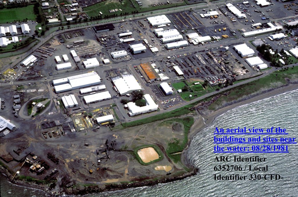 Ze421. (-05) I start this album with 5 maps or images; this is a 1981 Subic Bay Naval Station facility image of the Kalaklan Point area in Olongapo and the Subic Bay Naval Base Kalaklan Gate area. My nice Uncle Sam provided it. 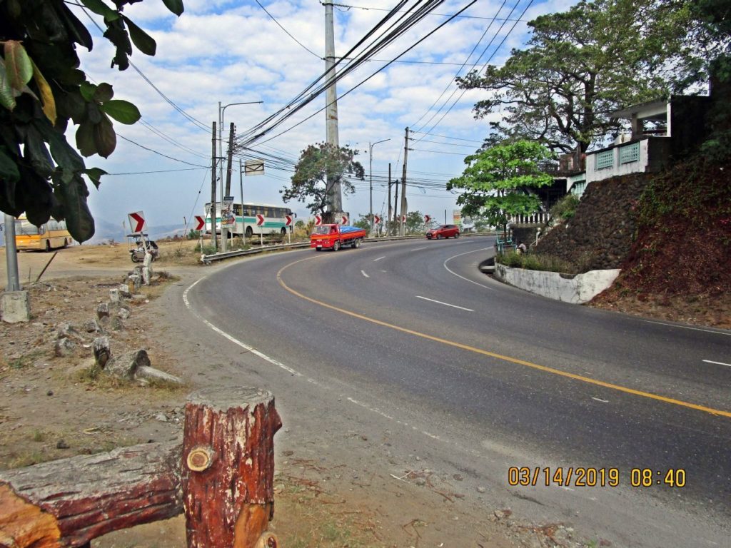 Ze425. (-12) this is the famous Kalaklan Point-Curve and Olongapo City Cemetery. This Kalaklan Point-Curve is a dangerous one; many a motorbike rider laid down his machine here! 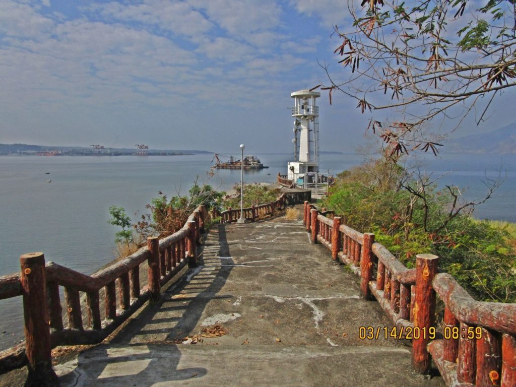 Ze431. (-18) Kalaklan Point in Olongapo City, Subic Bay, 2019-03-14. The point and navigational light have been renovated since the Subic Bay Naval Base closure. I believe that dredge is doing quarrying work. Left is the new SBFZ Container Port at the actual “Cubi Point”. 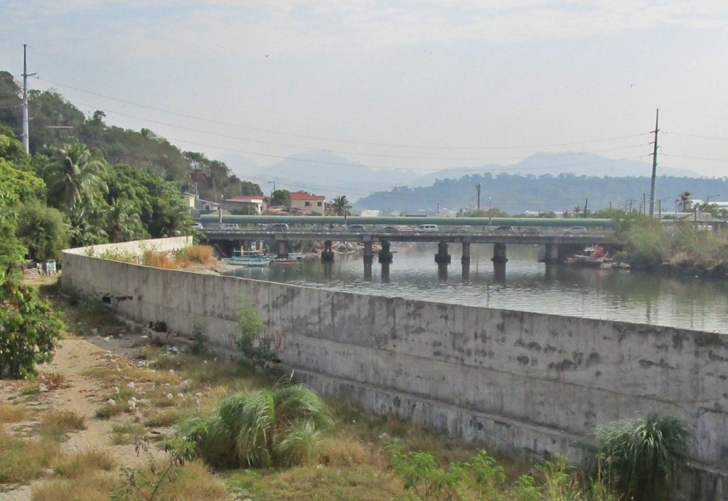 Ze437. (-24) this is a new Kalaklan River Bank Wall, new and old SBFZ Kalaklan Bridges to enter the famous and beloved former Subic Bay Naval Base. 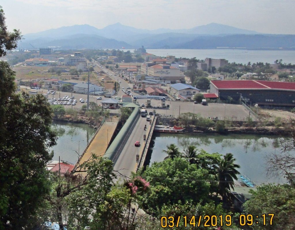 Ze441. (-29) This is the mouth of the Kalaklan River, looking across the river from Kalaklan Point in Olongapo City in Subic Bay. Since the Navy left a new bridge has been built to the SBFZ Kalaklan Gate. 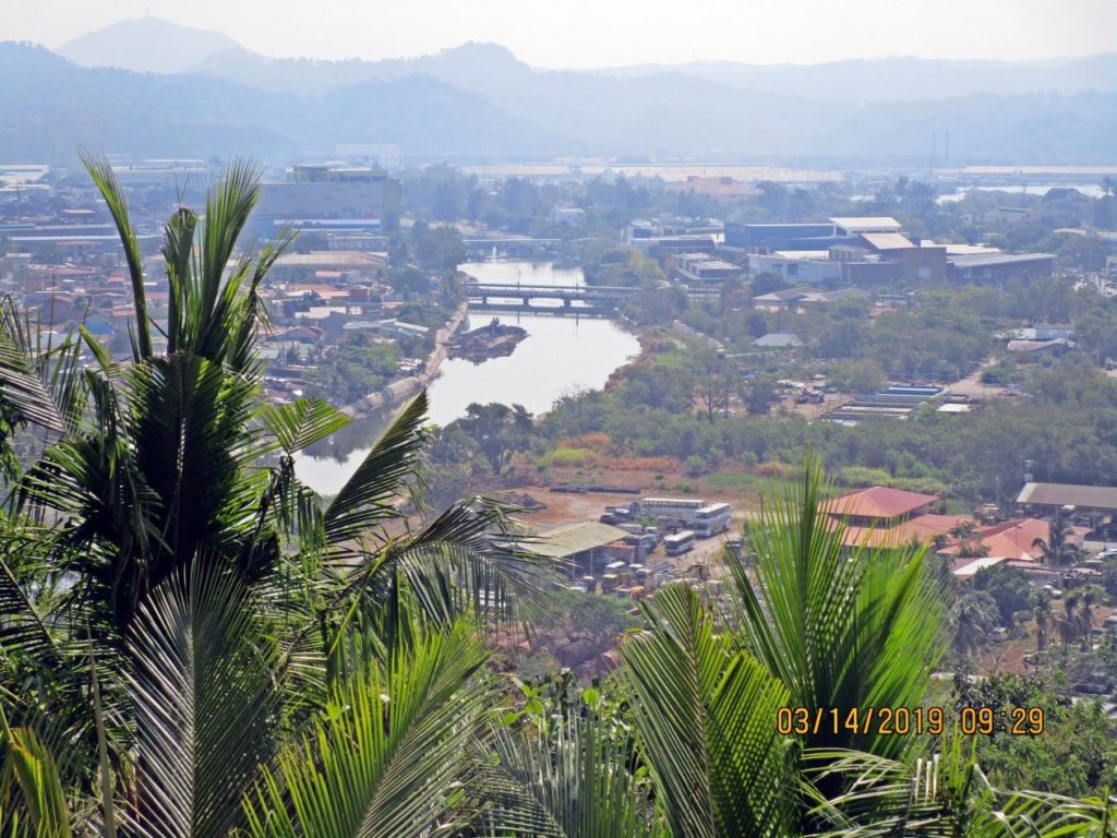 Ze445. (-33) this is a view of the drainage canal that separates SBFZ from Olongapo city. Notice, there are now two bridges crossing the canal. Right, between the two bridges is the new large Ayala Mall called Harbor Point. 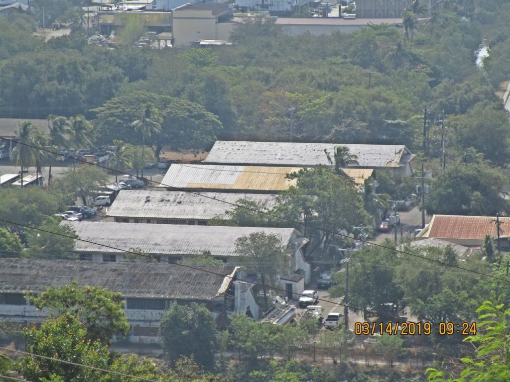 Ze451. (-40) this is a view of the former Subic Bay Naval Station Transient Personnel Unit (TPU), I remember at one time it held 64 sailors on legal hold. The building at right is where all the Filipino US Navy volunteers started their career. 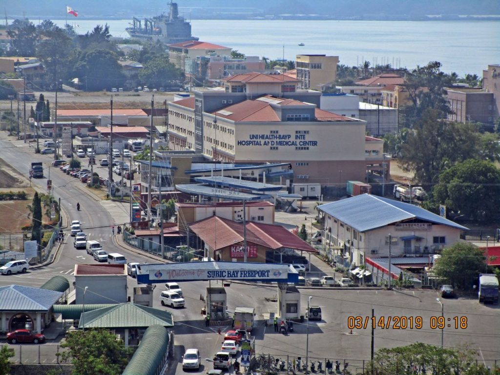 Ze452. (-42) this shot covers the area just inside the Kalaklan Gate in the SBFZ, the former Naval Station Subic Bay. This was shot from the Olongapo Cemetery 2019-03-14. Between the new hospital and the gate are two Korean businesses. 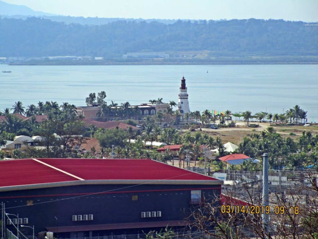 Ze454. (-44) Zoomed in. This shot covers the area just inside the Kalaklan Gate in the SBFZ, the former Naval Station Subic Bay. This was shot from the Olongapo Cemetery 2019-03-14. Everything near the shoreline is a hotel, restaurant or other entertainment business. The red roof is a brand new business, but I don’t know what. The lighthouse is the Lighthouse Hotel. Across the bay is the former Cubi Point Naval Air Station. |
|
|
|
Post by Karl Welteke on Aug 26, 2019 13:37:28 GMT 8
Subic Bay Metropolitan Authority (SBMA) distributed checks amounting to a total P203.14 million to adjacent local government units (LGUs) that benefit from the semi-annual revenue shares from the Subic agency.  U371. SBMA Chairman and Administrator Wilma T. Eisma (center), 2019-08-23 The picture and headline came from this URL: subicnewslink.blogspot.com/2019/08/sbma-releases-p20314-million-shares-to.html |
|


