|
|
Post by Karl Welteke on Oct 14, 2013 16:09:01 GMT 8
THIS HISTORY INTERESTS ME!!!! I live in the Subic Bay area and am in a unique position to visit the Bataan Battlefield. The West Road of Bataan, I have driven numerous times and every time I do, I think about this defense line. More specifically I think about how the Japanese troops turned the line by breaching the US-Philippine Mauban Line and set up a roadblock on the Bataan West Road (in the rear). After numerous times of trying to dislodge the Japanese roadblock unsuccessful, the allied had to retreat along the shore line and abandoned all their heavy equipment and weapons. The purpose of exploring this area by me is to acquaint myself with the geography and hopefully learn and understand the difficulty of operating in this rugged terrain and try to imaging how the troops on both sides had to deal with their challenges. One good reference of information is this US Army publication  Z794- www.ibiblio.org/hyperwar/USA/USA-P-PI/USA-P-PI-16.html I will paste relevant pages from this army publication into this Thread and here is the first segment: Attack Against I Corps: The Mauban Line The Mauban line along which Wainwright's I Corps was posted extended from the slopes of Mt. Silanganan on the east, westward along Mauban Ridge, to the small coastal village which gave the line its name. (Map 12) Along the steep and rugged sloped of the mountain was Company K of the 1st Infantry (PA) which had been ordered to establish contact with II Crops on the right. It was never successful in accomplishing its mission, an impossible one in the view of many officers. To its left was a battalion of the 31st Field Artillery, 31st Division (PA), organized and equipped as infantry. The rest of the line was held by the 3d Infantry of Brig. Gen. Fidel V. Segundo's 1st Division (PA). About three quarters of a mile in front of the main line of resistance, from Bayandati to a point about midway up the mountain, was the outpost line, manned by elements --278-- of the 3d Infantry .Defending Moron, two miles north of Bayandati, and the sandy stretch of beach between it and the outpost line was Company I, 1st Infantry, and Troop G, 26th Cavalry. In corps reserve was the 91st Division (PA), with combat elements of the 71st Division attached; the 26th Cavalry; and the 1st infantry (less detachments). 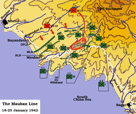 Z795-This map #12 is from the above URL: 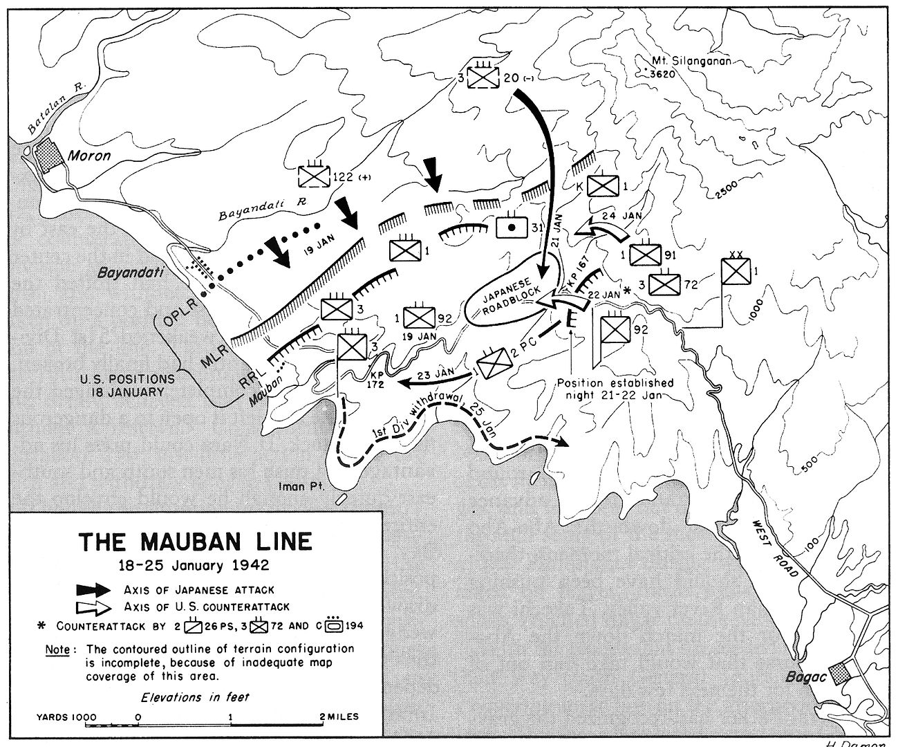 Z796-This map come from this URL: www.history.army.mil/books/wwii/5-2/5-2_16.htmFrom past observation I can state that the Kilometer Post Stone (KP) do not jive anymore and that KP 167 is located now about where KM 172 is indicated on the above map On the 8th of Oct 2013 I made my first official walk into the Mauban Line area. After studying the map, I think that the Japanese very well could have used the very same route as the one I used. It was an easy walk, a well used trail and even a half hour of rain did not slow me down. I turned around when I came across several trail intersections and choose a trail on top of the ridge to return to the Bataan West Road. The trails continued further up and to the east. I say, with a guide, I could have reached the roadblock area in less than a day march. I very seldom use guides, that’s makes the walks more challenging.  Z797-This is my GPS track with the relevant landmarks.  Z798-This is my GPS track with the relevant landmarks, full size 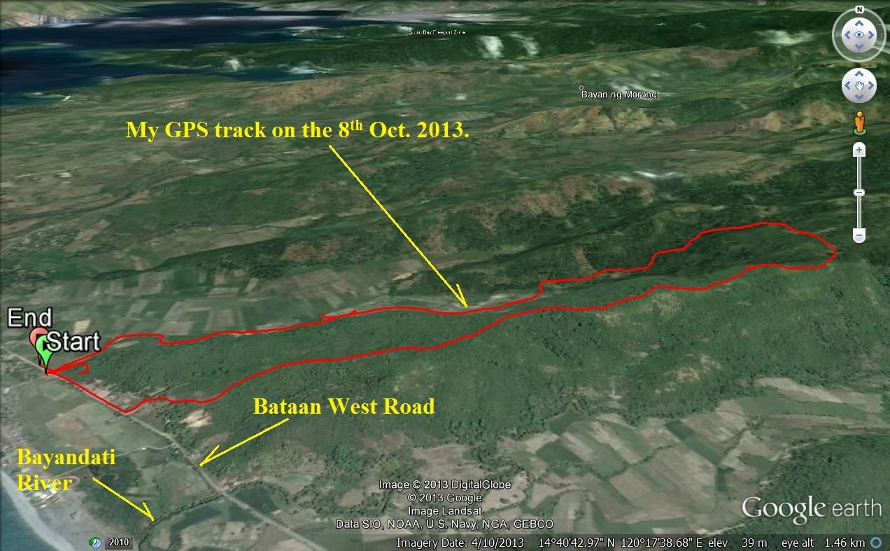 Z799-This is the GPS track only. 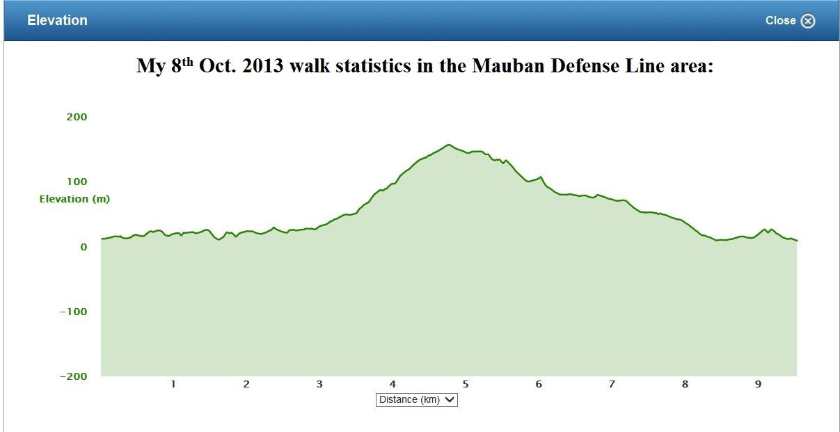 Z800-This is the elevation record of this walk. Below are the 8th Oct 2013 walk statistics in the Mauban Defense Line area: Mauban Line 2nd Try Tue, 2013 Oct 8 8:52 China Standard Time Activity Type: Casual Walking Event Type: Special Event Second time I walked in this area, 1st time keeping the Mauban Line in mind. The place where I turned around was a place of many tracks. Summary Distance: 9.54 km Time: 3:15:22 Avg Pace: 20:29 min/km Avg Speed: 2.9 km/h Elevation Gain: 243 m Timing Time: 3:15:22 Moving Time: 2:28:18 Elapsed Time: 3:15:22 Elevation Elevation Gain: 243 m Elevation Loss: 246 m Note: This will be a continuous project. The next entry will be some pictures from that 8th Oct.2013 walk. |
|
|
|
Post by okla on Oct 15, 2013 6:37:59 GMT 8
Hey Karl....Thanks for posting. Again you deliver the goods for us stateside bound folks. What has always blown my mind is the fact that the enemy turned Parker's II Corps left flank in the same fashion that I Corp's inland (right)flank was turned. If memory serves, General Sutherland, the most hated man on MacArthur's staff, in the PI, Australia and afterward, recommended that both inland flanks be extended a few more miles toward the heights of Mt Natib. This was not done and we suffered the consequences, i.e., both flanks were turned. The Greek Tragedy continued. Thanks again for this excellent stuff.
|
|
|
|
Post by Karl Welteke on Oct 16, 2013 9:45:30 GMT 8
IMAGES OF MY 8TH OCT. 2013 WALK IN THE MAUBAN DEFENSE LINE AREA. Here are some images from that walk towards Mt. Silanganan, using a trail, the Japanese Forces could have been using. Basically I walked into a valley and came down a ridge which must have been the Japanese line, opposite from the US-Philippine OPLR. According this old US army map the slopes are more in the area of the Bataan peak but I will stick with the name Silanganan which is used in the US army reports. These pictures represent a typical Philippine valley and ridge as they exist in the thousands in these mountainous islands. Here is the Bataan West Road running parallel to the sandy coast line, a small village sits mostly on the beach side, the name is Sitio Crossing, rice fields are between the highway and the beach and reach deep into the Sitio Crossing valley, there is a river coming out of the valley, the road into the valley turns into a trail and reaches the top of the Sitio Crossing ridge line, on top of the ridgeline exist another trail and I use it to return to my starting point. On top of the ridge the trail continued further up the slopes and other trails go east which would in the direction of intercepting the Bataan West Road. But I am sure the Japanese went higher to hook around or slip thru the US Philippine Lines. I think it is safe to assume that Filipinos lived here before the war, grew rice and had trails going into the mountains to harvest forest products. So it is only natural that the Japanese took advantage of that. 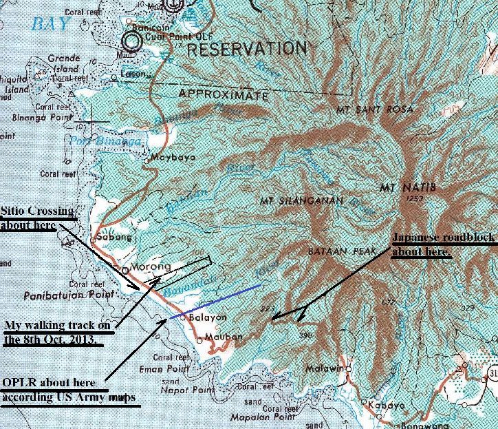 Z817-A section of an old US Army map 1:250000 covering the Mauban area. I marked in Sitio rossing (Sitio=an administrative subdivision of a Barangay), my track of the 8th Oct 2013 walk, the roadblock and the OPLR.  Z818-The above map in a larger size. 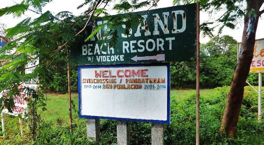 Z819-The Sitio Crossing sign at the entrance road to the sitio from the Bataan West Road. It is an elevated road going thru the rice fields towards the beach and sitio. 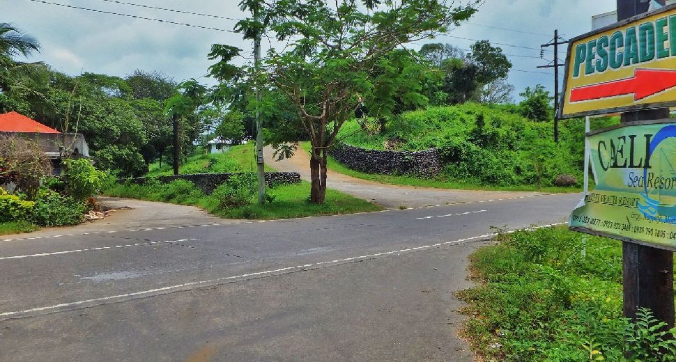 Z820-The road left goes in the Sitio Crossing valley with the rice fields, in WWII it would have been at least a trail. The road at right seems to go to an uncompleted project and I shot the last picture of Sitio Crossing from there. 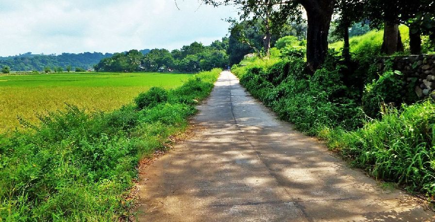 Z821-The present road into the Sitio Crossing valley, in WWII it must have existed at least as a trail. Remember this is the ridge, at right, and the valley opposite to the US-Phil OPLR. 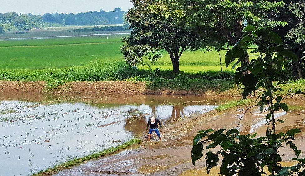 Z822-In my opinion this valley must have been used by the Filipino Farmers before WWII, here a farmer strengthening a rice paddy dam. 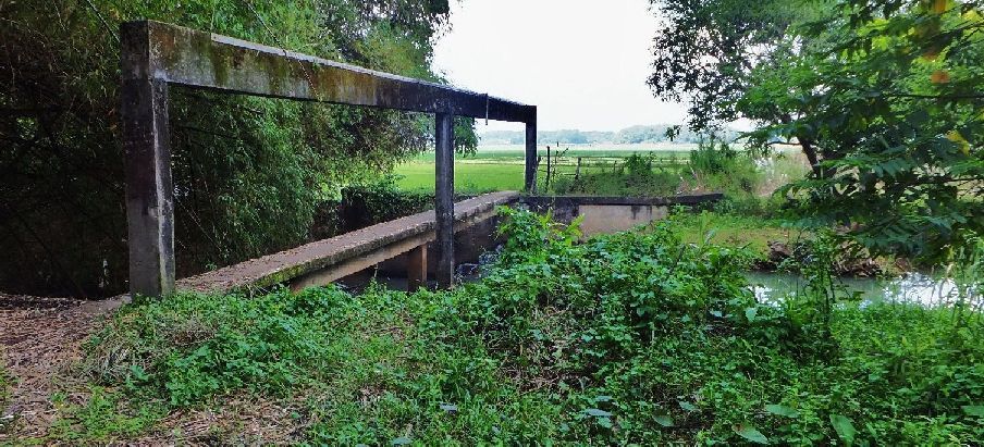 Z823-Like in most rice growing valleys there is an irrigation system. 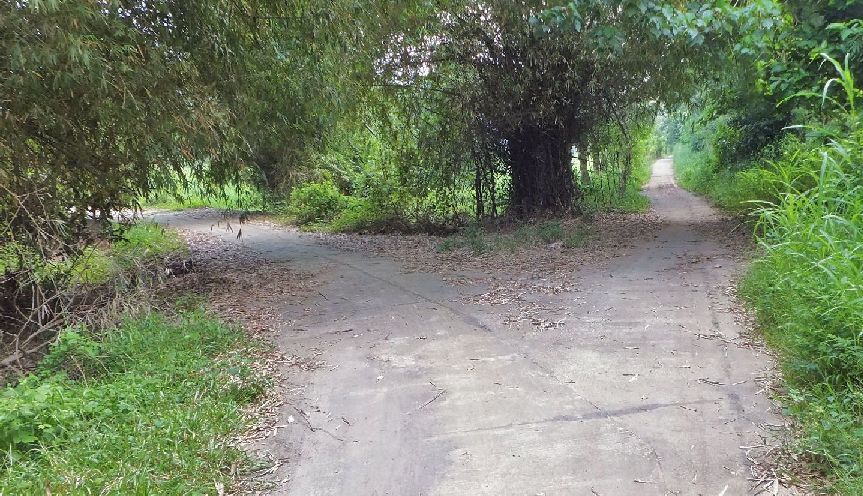 Z824-Just passed the irrigation dam in the Sitio Crossing Valley the road splits up. I choose the right one, after all I want to intercept the Bataan West Road some where to the right. 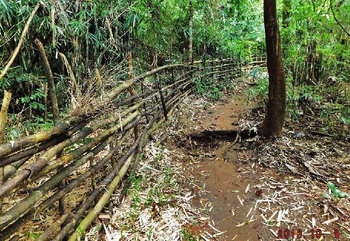 Z825-The road turned into a trail. It was a substantial trail all the way to the top of the Sitio Crossing Ridge. 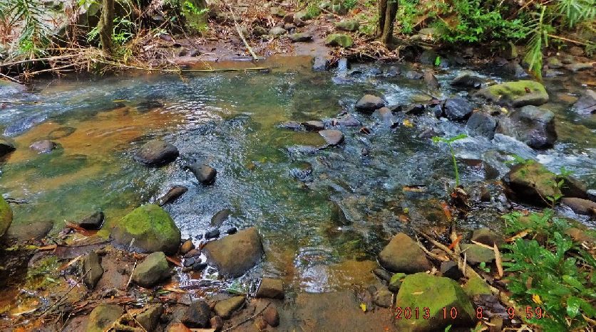 Z826-I had to cross this stream a few times, I will call it the Sitio Crossing stream. 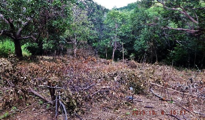 Z827-I am on top of the Sitio Crossing ridge, all along there plenty of signs of human activities. Also here was a major intersection of trails. I chose the one on the ridge to return to the Bataan West Road. Trails continued further up the ridge, slope of Mt. Silanganan and to the east which might reach the Bataan West Road further east. 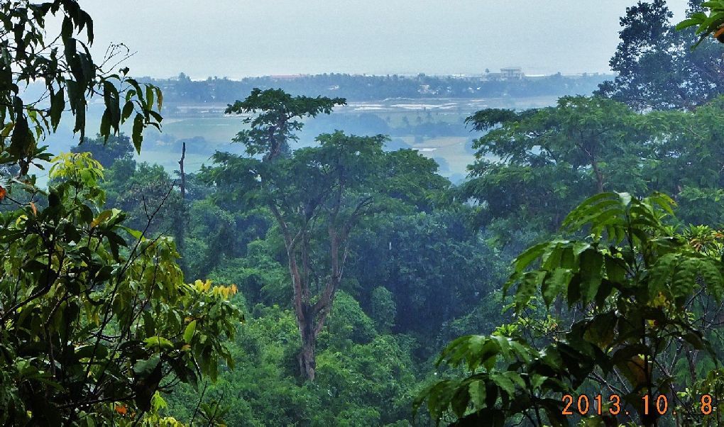 Z828-The trail down on the Sitio Crossing ridge was thru the woods and I only ones got a glimpse of Barangay Bayandati. It was raining so it is not much of a view. 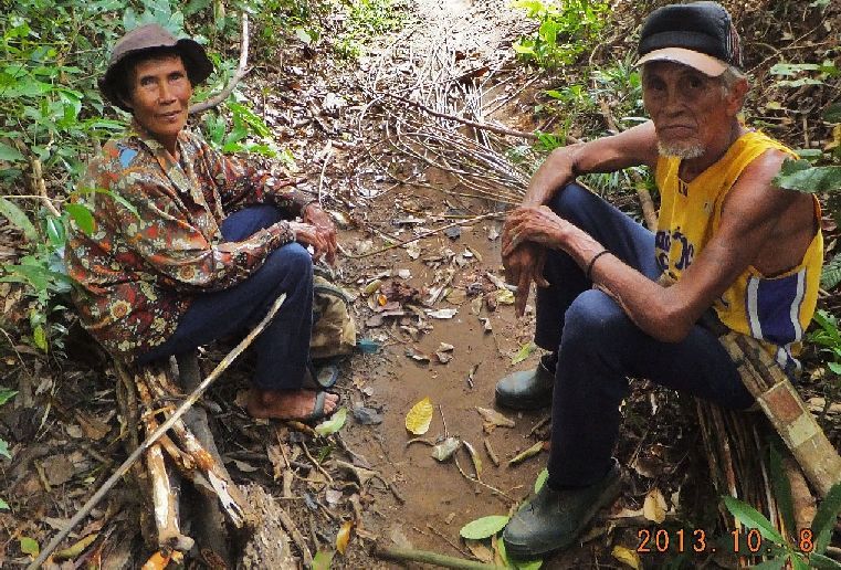 Z829-This couple was also returning to Sitio Crossing, the man was 75 years old (4 years older than I). And I wished I could ask him about the war but my lack of Tagalog prevented that. The material he got by his feet is for making baskets. 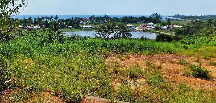 Z830-From an elevation I am looking down on Sitio Crossing. In the distance, to the right, is the beginning of the Morong shoreline. Remember Morong in WWII was still spelled as Moron. If you like to look at all the 89 images from this walk they are here in this album: s74.photobucket.com/user/PI-Sailor/library/Manila%20Bay%20Forts-Other/Mauban%20Line%20Bataan/Sitio%20Crossing%202013-10-08?sort=6&page=1 |
|
|
|
Post by Karl Welteke on Oct 17, 2013 21:21:33 GMT 8
Here is the 2nd segment from the Army publication: -The Fall of the Philippines- section: Attack Against I Corps: The Mauban Line
In drawing up his plans for the conquest of Bataan, General Nara had correctly estimated that decisive results could be obtained most quickly in the II Corps sector and had sent the bulk of his troops down the eastern side of Bataan. Against Wainwright's I Corps he had sent a relatively weak force, consisting of a combat team composed of the 122d Infantry (less two companies), a battalion of field artillery, a platoon of engineers, and a squad of signalmen. This force, led by Colonel Watanabe, was under orders to advance westward from Dinalupihan to Olongapo, then south through Moron toward Bagac.[33]
Leaving Dinalupihan at 1900 of the 9th, Colonel Watanabe led his men along Route 7 toward undefended Olongapo. Delayed only be destroyed bridges and demolitions planted earlier by the American engineers, he reached Olongapo at 1400 the next day. His field artillery was still at Dinalupihan where it was to remain until the road could be repaired. Two days later, on 12 January, under orders from 14th Army, the 122d Infantry embarked in native boats and quickly seized Grande Island, at the entrance to Subic Bay.
In occupying Grande Island the Japanese acquired possession of Fort Wint, the "little Corregidor" of Subic Bay. Strategically situated to guard the entrance to the bay and control the northwest shore of Bataan, this fort had been part of General Moore's Harbor Defenses and had been manned by coast artillery personnel under Col. Napoleon Boudreau. On 24 December Colonel Boudreau had been ordered to abandon the fort by the next day and join the troops then entering Bataan. He had completed the evacuation in time, but only at the expense of several thousand rounds of 155-ammunition, some mobile guns, and the fixed guns of larger caliber.[34]
While the support or retention of Fort Wint was probably impossible once the decision had been made to fall back on the Mabatang-Mauban line, its evacuation without a struggle gave the Japanese in important objective at no cost. An American garrison on Grande Island, even if it was ultimately lost, might well have paid substantial dividends and certainly would have given the Japanese many uncomfortable moments. From Fort Wint the Americans with their large guns could have disputed Japanese control of the bay and of Olongapo, which later became an important enemy supply base, and would have constituted a threat to the flank of any Japanese
--279--
force advancing down the west coast of Bataan.
|
|
|
|
Post by Karl Welteke on Oct 20, 2013 13:02:05 GMT 8
THIRD OFFICIAL WALK TO THE MAUBAN LINE 2013-10-15 I started and ended the walk at the area where Mauban Village is indicated on the WWII map. My walk followed the Bataan West Road into the Mauban Valley, across the Mauban River bridge. KM # 169 is located in Mauban now. From the Mauban bridge my walk took me to the Nuclear Power Corp. (NPC) Deep Well #13, this is along the Mauban stream into the Mauban valley. From the Mauban bridge I walked up the Eman Point ridge. This is where Sitio Baococ or KM # 168 Village is located. From this village is a trail down to the cove that separates the Eman Point Ridge from the NPC ridge line. Returning and going back up to the Eman Point ridge line was next. Following the trail all the way to the Eman Point I descended down to the beach on either side of the point. After returning to the KM 168 Village, I followed the Bataan West Road all the way to KM # 167. Then I entered a trail and a back road and entered the abandoned NPC residential area. There is a guard and we got along fine. I’m wondering how the Bataan West Road looked like in 1942, it is in good shape now. The US-Phil Forces must have used it on their retreat until they had to descend to the beach because of the Japanese roadblock. The Eman ridge line must have been an important part of the Mauban Defense Line. From here one has and unrestricted view and an unrestricted field of fire all the way to Morong. Here are the walk data images: 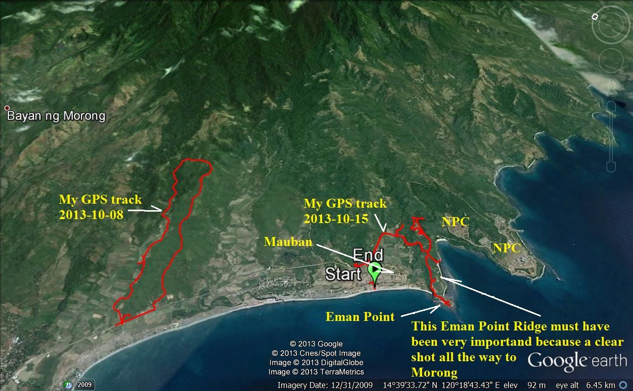 Z876- The big map of the Mauban Defense line with two of my tracks. 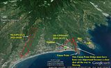 A larger version. 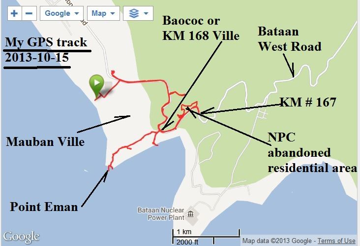 Z877- This is the image of my track I get from my Garmin device, using my Garmin account. 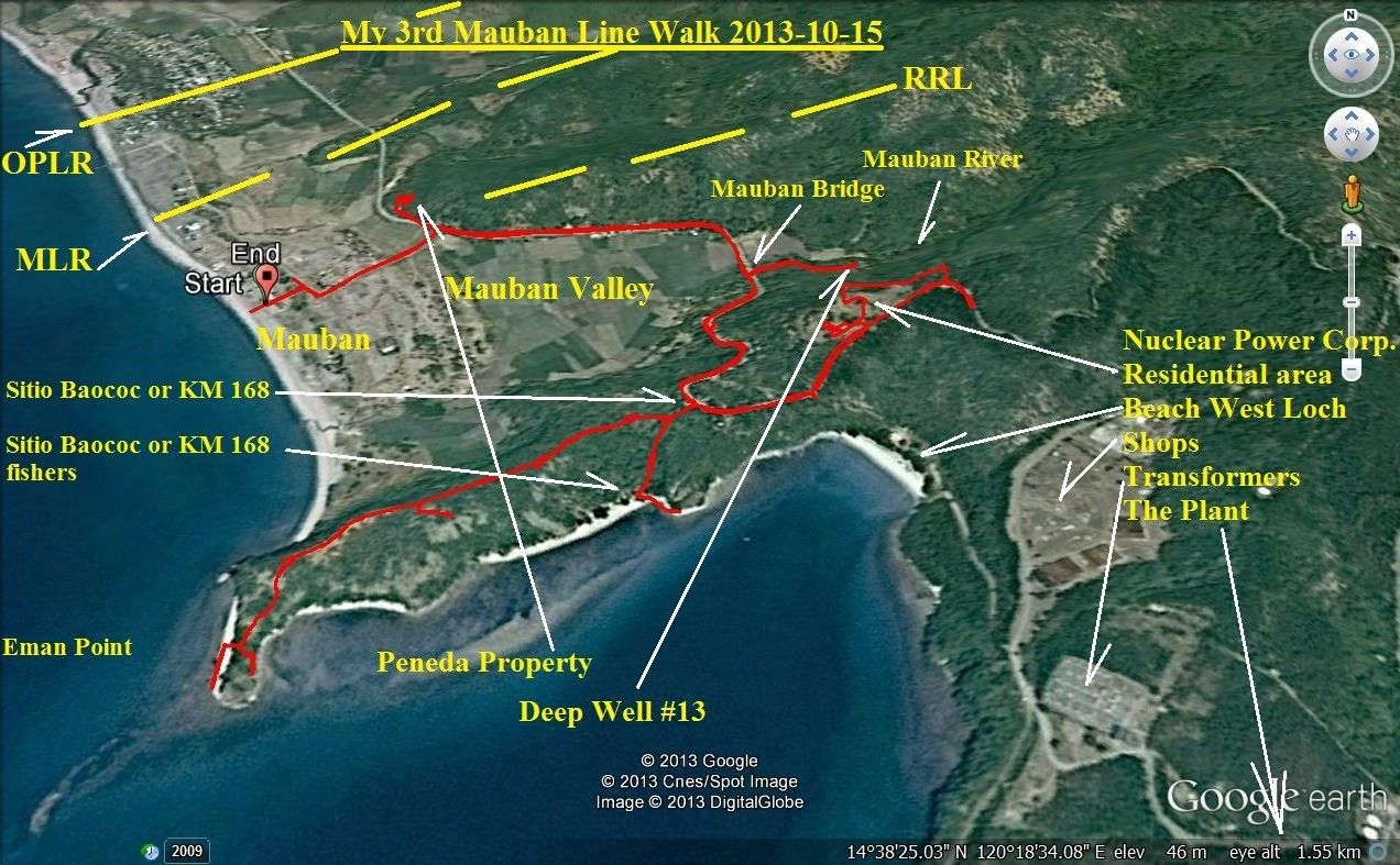 Z878-This is my GPS track with Google Earth, I marked in landmarks and where I think the actual defense Lines were, by studying the WWII maps.  This is a larger version. 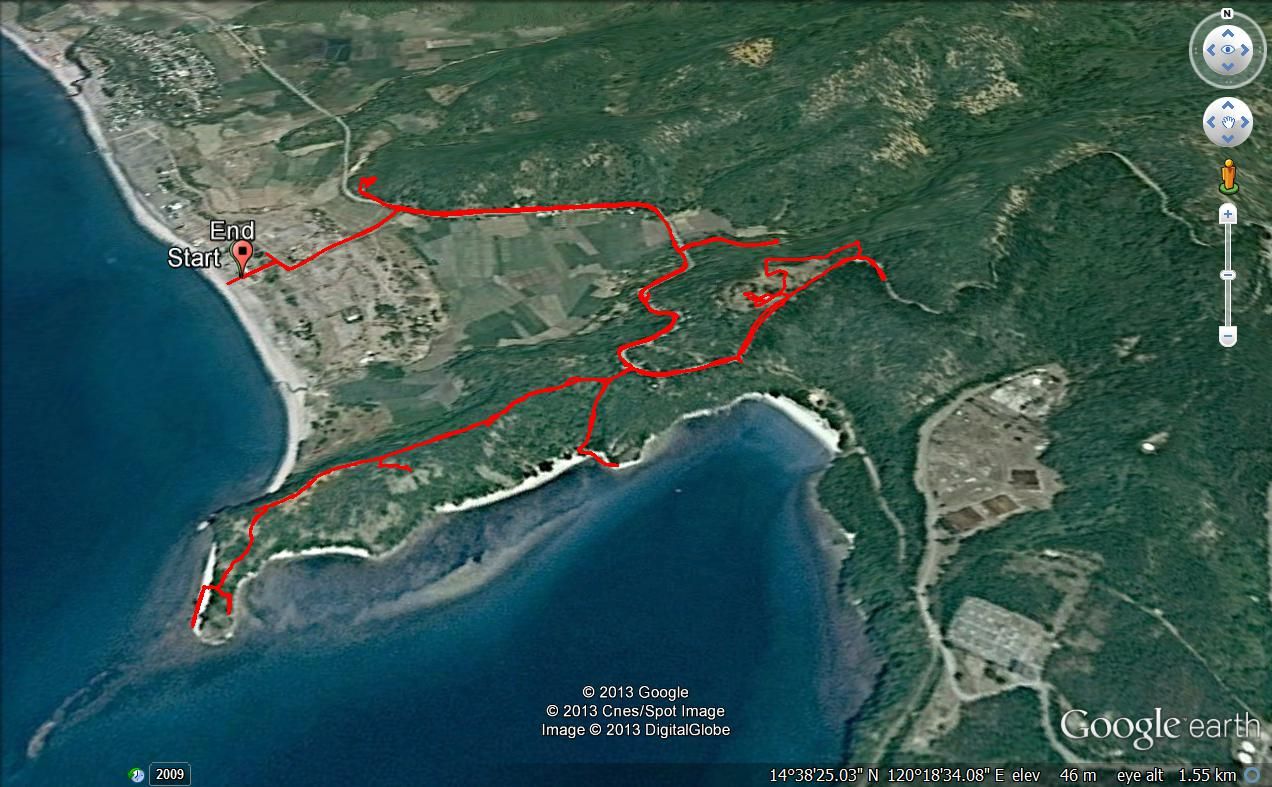 Z879-The same images as the last one but this time without markings. These are my walk statistics: Mauban Walk #3 at KM 168 and Eman Point Thu, 2013 Oct 15 8:53 China Standard Time Activity Type: Casual Walking Event Type: Special Event| The main goal was Eman Point, started at Mauban, went to Sitio Baococ, also called KM168, then the point and explored the area to KM #167.Also the Nuclear Power Corporation (NPC) Residential area Summary Distance: 11.57 km Time: 4:53:30 Avg Pace: 25:22 min/km Avg Speed: 2.4 km/h Elevation Gain: 288 m Timing Time: 4:53:30 Moving Time: 3:09:08 Elapsed Time: 4:53:30 Avg Speed: 2.4 km/h Avg Moving Speed: 3.7 km/h Elevation Elevation Gain: 288 m Elevation Loss: 288 m Min Elevation: 8 m Max Elevation: 85 m 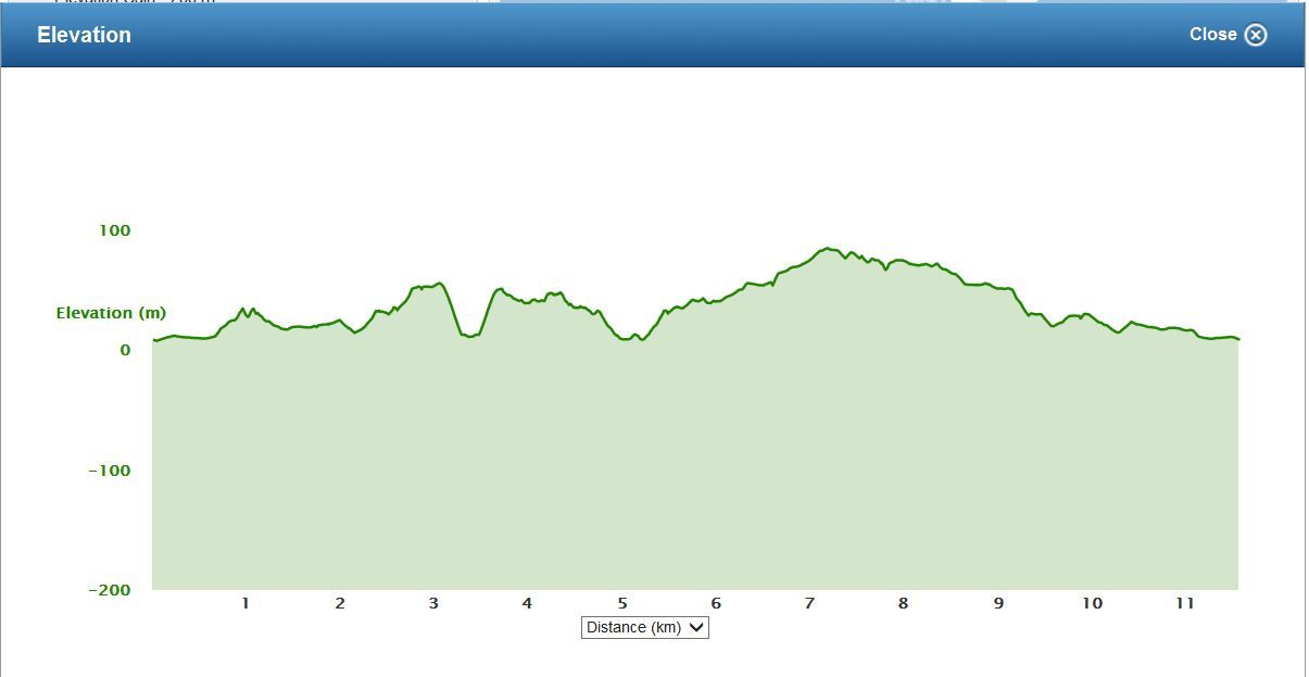 Z880-This was my elevation profile. Note: The pictures of this walk will follow. |
|
|
|
Post by Karl Welteke on Oct 20, 2013 21:05:14 GMT 8
Here is my 3rd segment from the Army publication: -The Fall of the Philippines- section: Attack Against I Corps: The Mauban Line.
It was not until 14 January that Watanabe began his advance southward along the west coast of the peninsula.[35] Wainwright had dispatched a battalion of the 1st Infantry to Moron at the first news of the occupation of Olongapo, but had withdrawn it two days later when the Japanese failed to advance. On the 14th, when the Japanese began to move toward Moron, the battalion was in corps reserve. Part of the 122d Infantry came down the narrow trail between Olongapo and Moron; the rest of the regiment embarked in boats for Moron where the West Road began. Watanabe hoped in this way to advance more rapidly down the west coast toward Bagac and avoid the delay inevitable if the entire regiment followed the winding trail north of Moron. Unfamiliar with the coast line and handicapped by poor maps, the water-borne elements of the 122d came ashore at a small barrio midway between Olangapo and Moron and prepared to march the rest of the distance on foot.
Wainwright received word of the Japanese advance almost as soon as the forward elements of the 122d Infantry landed. In an effort to contain the enemy he dispatched the entire 1st Infantry, as well as the 1st Engineer Battalion and two battalions of artillery, to Moron. He also relieved Troop G of the 25th Cavalry, which had been on patrol since the 10th, and replaced it with the composite Troop E-F of the same regiment. In command of these forces was General Segundo, commander of the 1st Division. Major McCullom,[36] commander of the 1st Infantry, exercised tactical control.
On 15 January the two elements of the 122d Infantry joined, and by the following morning the regiment was within a mile of Moron. When it crossed the Batalan River, just north of the village, opposed only by fire from an American patrol, Wainwright hastened to Moron where he organized and directed an attack by the 1st Infantry and Troop E-F of the 26th Cavalry. In this first engagement in I Corps the honors went to the Filipinos who forced the Japanese back to the river line. Unfortunately, the cavalrymen suffered heavily in men and animals and had to be withdrawn. During the course of the action Major McCullom was wounded in the head and Col. Kearie L. Berry, commander of the 3d Infantry, on the main line of resistance, was placed in command of the 1st Infantry as well.
The Japanese continued the attack against Moron during the 17th and by late afternoon penetrated the town in force. Wainwright's men thereupon withdrew to a ridge about a mile and a half to the south. It is possible that from this position they could have delayed the enemy advance but already strong Japanese reinforcements were moving against the Mauban line.
The decision to commit additional troops to he attack against I Corps had been made by General Homma, the Army commander,
--280--
not General Nara, who was responsible for the assault against the Abucay-Mauban line. Homma had made this decision on 13 January, by which time he had correctly estimated that Nara's attack against II Corps "was not progressing favorably" and that the advance of Watanabe's force was meeting no resistance.[37] By strengthening the force on the west coast Homma apparently hoped to overwhelm the two corps simultaneously. His revised plan called for a continuation of the drive against II Corps by the 65th Brigade and an increased effort on the west by a larger force than originally contemplated. This force would not only advance to Bagac but would also push east along the Pilar-Bagac road to take II Corps from the rear.
|
|
|
|
Post by victor on Oct 20, 2013 21:11:50 GMT 8
Karl, fantastic, fantastic photos and exploration info. Thank you.
|
|
|
|
Post by Karl Welteke on Oct 21, 2013 8:27:55 GMT 8
IMAGES OF MY 15TH OCT. 2013 WALK IN THE MAUBAN DEFENSE LINE AREA. Here are the images from that walk starting where Sitio (village) Mauban is, up to the Eman Point Ridge where Sitio Baococ (also called KM 168 Ville) is located, down to Eman Point and then the area of KM 167 and the Nuclear Power Corp. (NPC) abandoned managing team residential area. Refer to the maps in the previous segments! NOTE: I screwed up! All these pictures are small and not very sharp because I had shoot them with my cell phone. It was really dumb for several reasons. I had been in this area before, many years ago but I lost/misplaced those images. So this trip was to correct that and then I promptly forgot my camera! All 101 cell phone images have been uploaded into this albums with fair title/descriptions: s74.photobucket.com/user/PI-Sailor/library/Manila%20Bay%20Forts-Other/Mauban%20Line%20Bataan/Mauban%20and%20Eman-Pt%202013-10-15?sort=6&page=1Here are sample images: 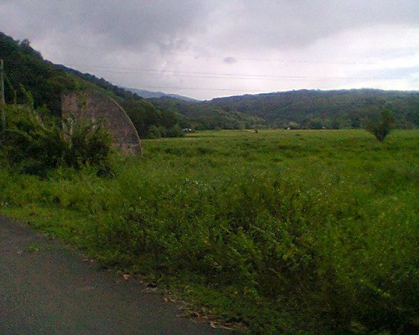 Z884- From the entrance road to the Mauban Beach looking into the Mauban Valley. On the ridge left most likely was the RRL. What did RRL stand for? I don’t know! This particular area in Mauban is called “The Strand” now. 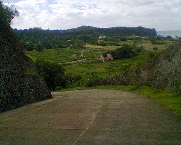 Z885- At the ocean end of the left ridge mentioned in the previous image is this road. It leads to a private house and I was told it belongs to a Peneda Family. This shot from this road shows the Eman Point ridge, the view is across the area that showed the Mauban Village on the WWII map in this area! It did not look like that a trail continued up this ridge passed the Peneda residence. 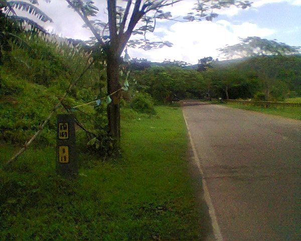 Z886- Not far from the road in the last picture is this KM #169, we are looking south and in the distance is the Mauban River bridge. Mauban Village is not really a compact village, rather houses/families are scattered about. One person said maybe 40 families are in Sitio Mauban. 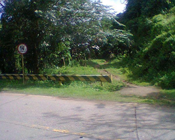 Z887- Next to the Mauban bridge, south side, is this trail going up-river into the Mauban River valley. That’s were I seen the Nuclear Power Corp (NPC) Deep Well #13 which was not functioning! 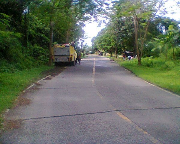 Z888- From the Mauban Bridge the road continuous south, up the hill and at the end of this section of road, at the bend is KM #168. There also is the center of Sitio (Village) Baococ which is also called “KM #168 Village”. This village is concentrated, not like Sitio Mauban. The fire truck ahead is from the NPC, that tells me that maybe in the NPC plant has no running water? 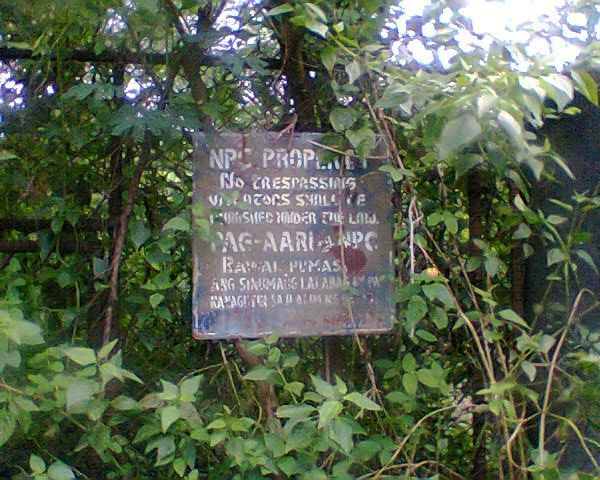 Z889- Up the slope from the truck in the last picture leads a grown over road to a locked gate and a high fence. This sign was attached to the fence next to the locked and overgrown fence and gate. Later I learned, from this walk, that the NPC residential camp stretches all the way to here. This camp is abandoned, not used, but is guarded but all facilities are run down, in bad shape! 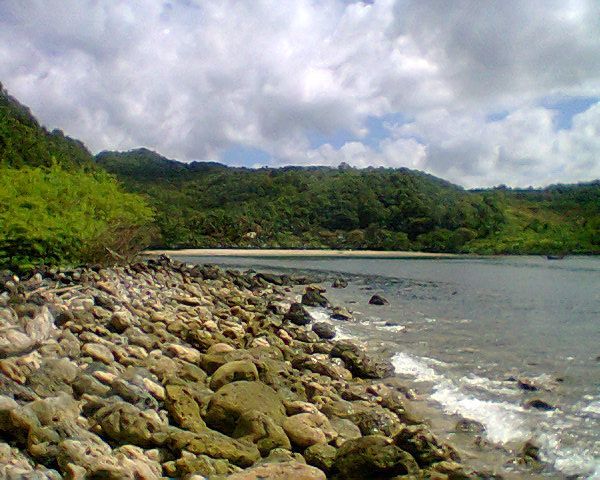 Z890- At the village I was encouraged to walk down to this spot, a few fisher families from this Baococ Village live here. We see a nice beach with facilities, it is located between the Eman Point ridge and the next south ridge which is the home of the NPC. I walked there one time in the past not realizing it belongs to the NPC and was courteously escorted off the NPC plant to the main gate. I was told, at an office in Bagac, one get permission to utilize this beach. 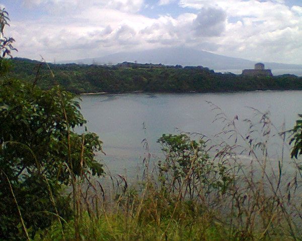 Z891- Back up on the Eman Ridge Line I got a good view of the Nuclear Power Corp. But with my cell phone I can not get good shots. 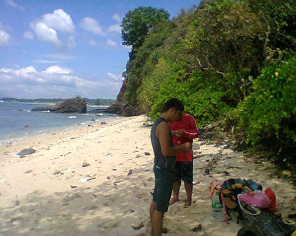 Z892- The trail to and down to the Eman Point was pretty good. A party was about to start, these people brought plenty of booth. We are looking north. 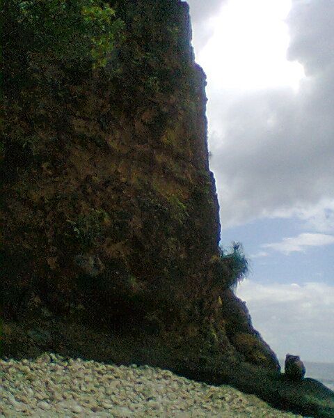 Z893- Looking south at the actual Eman Point 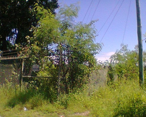 Z894- After I returned to the West Road I continued further up the road and this is the point where the NPC fence comes from below, from that nice beach, meets the Bataan West Road and then runs along it all the way the NPC main gate. 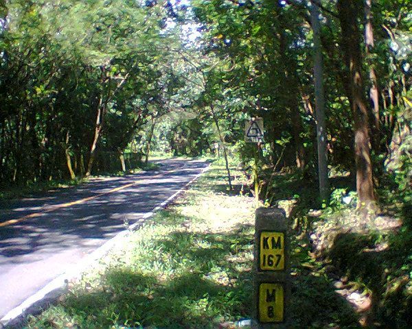 Z895- At the KM #167 I turned around. We are looking in the Morong direction. Reminder, I mentioned it before that the present KM stone locations don’t jive with the WWII maps. This would be the KM #172 location on the WWII map. Another note that the village name Bayandati on the WWII map is not so today. On the other Army map, in the first segment, it is called Balayon. But I was told on this walk that both Baococ and Mauban Villages belong to Nagbalayong, that seems to be the correct present name of Balayon and Bayandati. 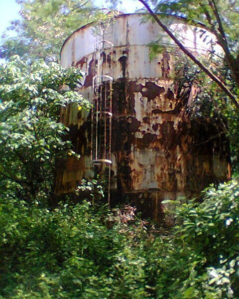 Z896- About 300 meters back from KM #167 I noticed a trail and followed it. It took me to a fence with a hole , went thru it and was on asphalt road which let me into the abandoned NPC residential camp. Dogs announced me and I explained to the guard how I got there. 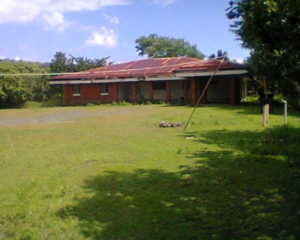 Z897- This is one of two NPC better houses, maybe built for the managers but one can tell that they were not used or were maintained. 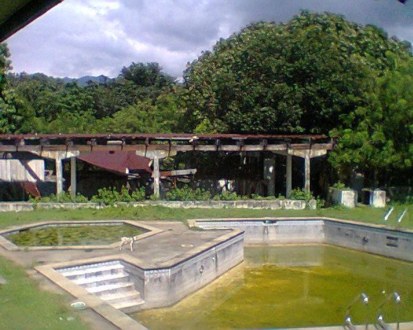 Z898- I shot this image from the NPC residential camp club house and we see the swimming pool and a ball court. It is all abandoned, not used! But it is guarded. 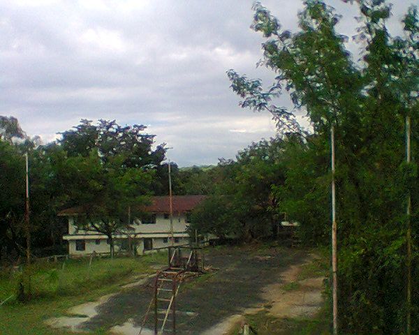 Z899- This seems to be some kind of barracks building in this NPC residential compound. 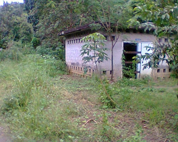 Z900- This NPC Deep Well #13 pump house is located in the Mauban Valley. It was not operating and this is as far as I went into the Mauban valley. Note to Vic: Thank you for your comment. |
|
|
|
Post by Karl Welteke on Oct 21, 2013 8:46:30 GMT 8
Here is my 4th segment from the Army publication: -The Fall of the Philippines- section: Attack Against I Corps: The Mauban Line.
To secure the troops for his revised plan of operations against I Corps, General Homma drew on the 16th Division. On the 13th he ordered the division commander to send to Bataan two infantry battalions and as many regimental guns of 75-m. caliber and rapid-fire 37-mm. guns as possible. This force, when finally organized, consisted of Headquarters, 16th Infantry Group, the 20th Infantry (less one battalion), an antitank battery, and half the regimental gun battery of the 33d Infantry. Led by Maj. Gen. Naoki Kimura, 16th Division infantry group commander, it left Manila for San Fernando on 15 January. Late that night General Homma created the Kimura Detachment and placed it directly under the control of 14th Army, thus relieving Nara of responsibility for operations against I Corps. In addition to the units he had brought with him, Kimura was also placed in command of the troops already operating along the west coast of Bataan. Altogether he had a force of about 5,000 men.[38]
On the morning of 18 January General Kimura reached Moron and assumed control over operations For the assault against Wainwright's line along the ridge south and southeast of the town he organized three forces. The 122d was to attack frontally down the West Road; the 3d Battalion, 20th Infantry was to swing east of Moron in an attempt to take the ridge position in the flank. The third force, one company of the 3d Battalion, was sent far up the mountain around the I Corps flank to cut the Pilar-Bagac road and did not participate in the ensuing action. The 2d Battalion, 20th Infantry, Kimura held in reserve.
In the belief that his force was not strong enough for a successful stand along the ridge, Wainwright on the 18th directed a withdrawal. The 1st Infantry and the 1st Engineers fell back through the outpost line to take up a position along the main line of resistance between the 3d Infantry and the battalion of the 31st Field Artillery on the slopes of Mt. Silanganan. The Japanese followed closely and that night drove in the corps outpost line "without much effort."[39] A counterattack the next morning restored the line but another Japanese assault on the night of the 19th gave the Japanese final and permanent possession of the outpost line.
As the 122d Infantry continued to push against the 1st Division troops on the left of the Mauban line, the 3d Battalion, 20th Infantry (less on company), which had been sent around the east flank of the ridge
--281--
--------------------------------------------------------------------------------
line on the 18th, swung back to the southwest into the I Corps area. Unopposed, the battalion, led by Lt. Col. Hiroshi Nakanishi, either infiltrated through the I Corps line along the slopes of Mt. Silanganan or advanced through a gap between the 1st Infantry and 31st Field Artillery. At about 1000 of the 21st it reached the West Road, three miles east of Mauban in the vicinity of Kilometer Post (KP) 167, and established a roadblock behind the 1st Division.[40] By this move the Japanese placed themselves squarely athwart the only major road suitable for transporting heavy equipment and supplies. Though the enemy force was a small one, less than a battalion ,the danger to Wainwright's position was a grave one.[41]
To meet the threat Wainwright was obliged to shift units in his sector. The transfer five days before of the 31st Division (less 31st Field Artillery) to II Corps had left Wainwright with no reserves, and the commitment of the Philippine Division made it impossible to secure reinforcements from USAFFE. He would have to fight the battle with what he had. most of the 91st Division, including the attached elements of the 71st, had replaced the 31st on beach defense when that division had gone to Parker. One battalion of the 92d Infantry had been attached to the 1st Division and was in place along the reserve line, north of the roadblock. When, on the 19th, word reached General Segundo, the 1st Division commander, that a Japanese force was infiltrating into the line from Mt. Silanganan, he sent three company-size patrols from the battalion of the 92d Infantry forward to block the trails. They quickly became involved in action along the slopes of Mt. Silanganan and were not available to meet the threat behind the line. The remainder of Wainwright's force, the 26th Cavalry and elements of the 71st Division, were already committed to the defense of the Pilar-Bagac road and could not be shifted without endangering the security of that vital highway.
When the Japanese roadblock was first discovered, therefore, the only unit available to throw against it from the north was a reinforced platoon of the 92d Infantry. Col. John H. Rodman, the regimental commander, ordered 1st Lt. Beverly N. Skardon to lead the platoon into action. After an advance of a few hundred yards it came under fire and was forced to halt. meanwhile, sought of the roadblock, a provisional platoon was being readied for action. This platoon was organized and led personally by General Wainwright who, on his way to the front that morning, had heard firing to the north and had hastily gathered about twenty men from the Headquarters Company, 92d Infantry, to meet this unexpected threat. With these men he attacked the block from the south, but after two hours, realizing he could make no progress with so few men, he left the platoon with another officer and continued forward by another route to organize a larger force.
--282--
|
|
|
|
Post by Karl Welteke on Oct 24, 2013 14:21:36 GMT 8
FOURTH OFFICIAL WALK IN THE MAUBAN DEFENSE LINE AREA 2013-10-22 ALONG THE BAYAN-DATI RIVER This time I started at the main entrance road to Nagbalayong Village (WWII spelling Bayandati or Balayon). Now there is a real road going into the Bayandati River Valley (present spelling Bayan-dati). The road and trail I followed and other trails were substantial trails which may have been used before the war. Barangay (village) Nagbalayong is the largest community between Morong and Bayac that makes me believe that plenty of people went to the slopes of Mt. Silanganan peaks to harvest forest materials before the war. I walked with relative ease to a point above and close of the Japanese road block on the Bataan West Road. The Japanese soldiers could have experienced this easy trail also and with a guide it could have been even easier. In this segment I will only present my walk data, GPS etc. And I also present 3 sections of the relevant topographic US Army 1:50000 map. Using the US Army battle graphs from their publications and which are presented here in the beginning of this thread it is hard or impossible to place the exact location of the OPLR, MLR and RRL (still trying to find out what RRL stands for -- rear line perhaps?). But it is possible to imaging that the OPLR was in the Bayandati River Valley which was lost for good in the night of the 19th Jan 1942. At the place where I turned around I had lost the trail because it went into a clearance with hip/chest high scrub. Per my hiking procedure I had to have a good trail to continue or at this time of the hike I would turn around to return safely. I did not have the time to search and explore as to where the trail continued. This hiker likes to be home for the 6pm news and a cold beer. I had come across another trail and was hoping it took me towards the West Road but I noticed right away I was going back in the direction where I came from. The pictures of this walk (this time I did have my camera) and my observations of this trail will be presented in another segment. Here is the walk image data from my 4th walk: 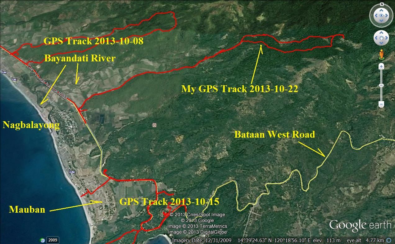 Z934-the GPS track of this walk 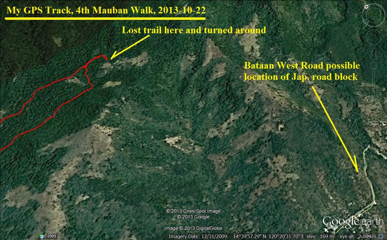 Z935-Relation ship of the end of the walk to the Bataan West Road. 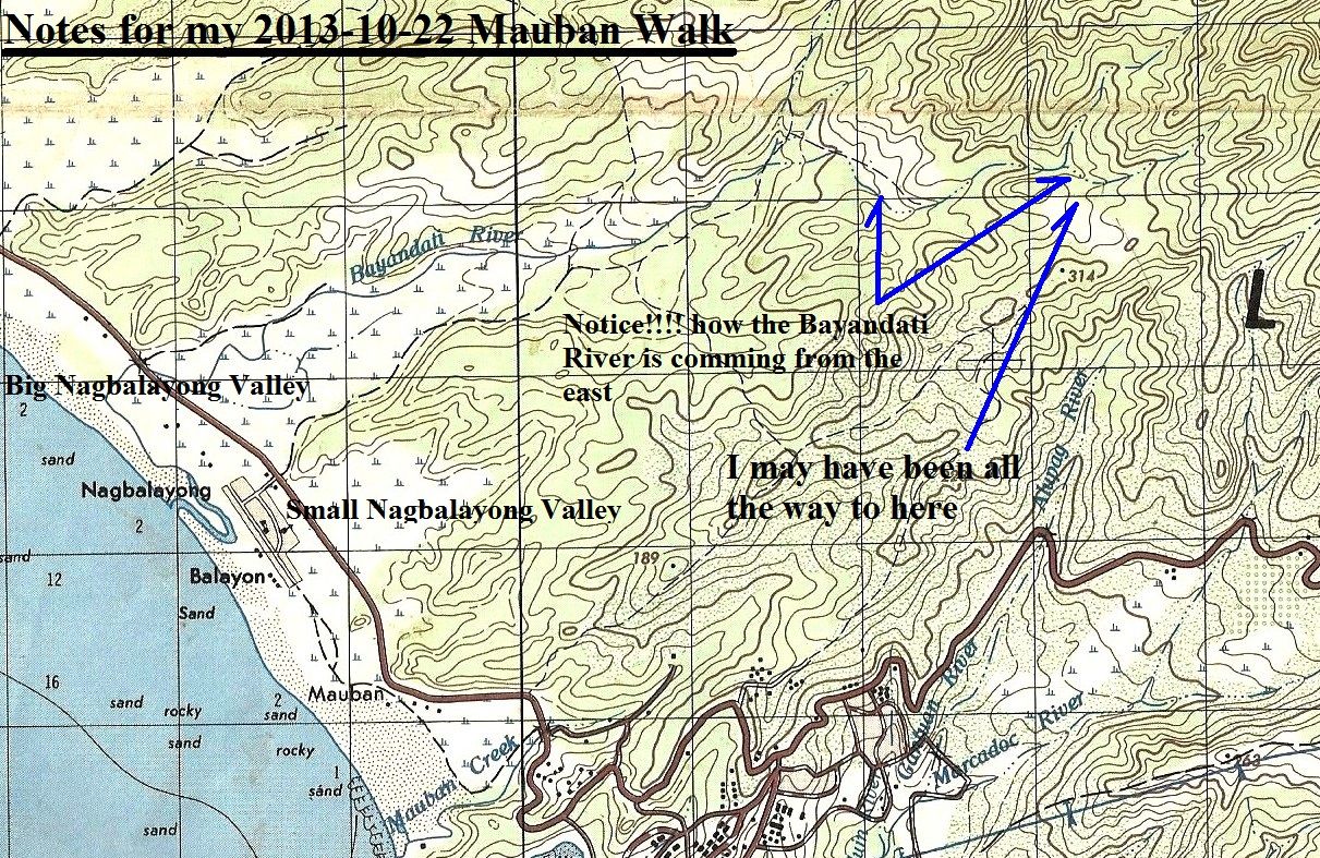 Z936-Notice that the run of the Bayandati River makes it easy to hook around and reach the Bataan West Road easy via the Mt. Silanganan slopes. The actual numbers of the walk data, subtract 5 km and 30 minutes because I did not turn off the device right away. BA Mauban #4 from/at Nagbayong Tue, 2013 Oct 22 7:19 China Standard Time Activity Type: Casual Walking Event Type: Special Event My 4th walk at the Mauban Defense Line area. Started and ended at the entrance road from the Bataan West Road to Barangay Nagbayong. I turned off the Garmin devise too late, subtract 5 km and 30 minutes. Summary Distance: 17.62 km Time: 5:34:33 Avg Pace: 18:59 min/km Avg Speed: 3.2 km/h Elevation Gain: 350 m Timing Time: 5:34:33 Moving Time: 3:46:33 Elapsed Time: 5:34:33 Elevation Elevation Gain: 350 m Elevation Loss: 344 m Min Elevation: 6 m Max Elevation: 262 m 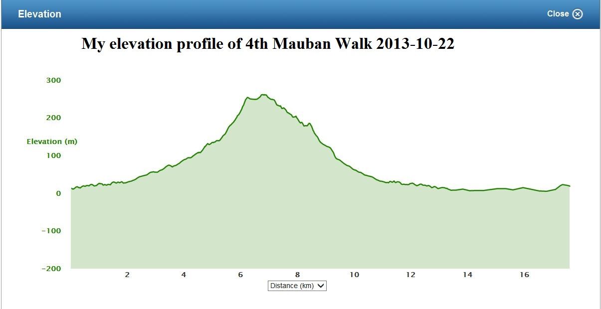 Z937-My elevation profile of the 4th Mauban walk The three sections of a map,1:50000 size, of the Mauban area in two sizes: 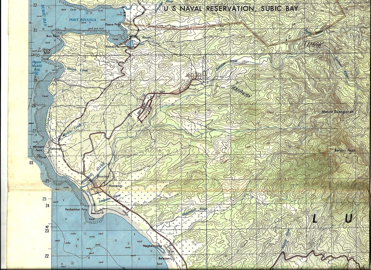 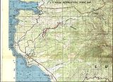 Z938-Morong area. 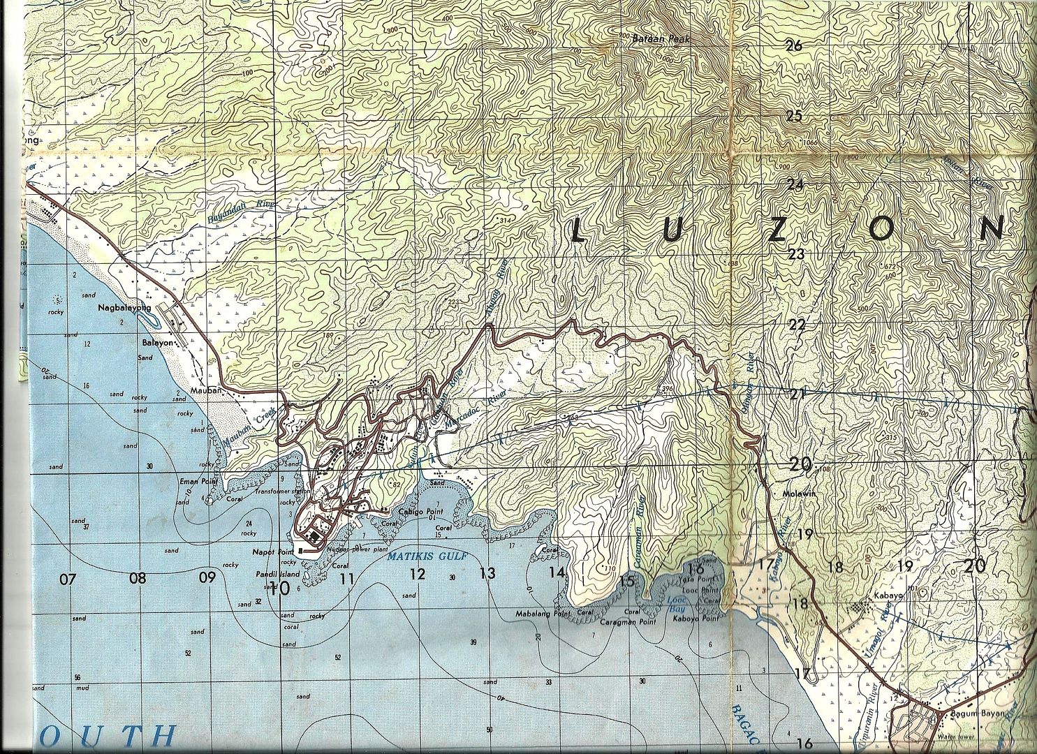 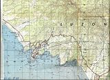 Z939-Mauban Line 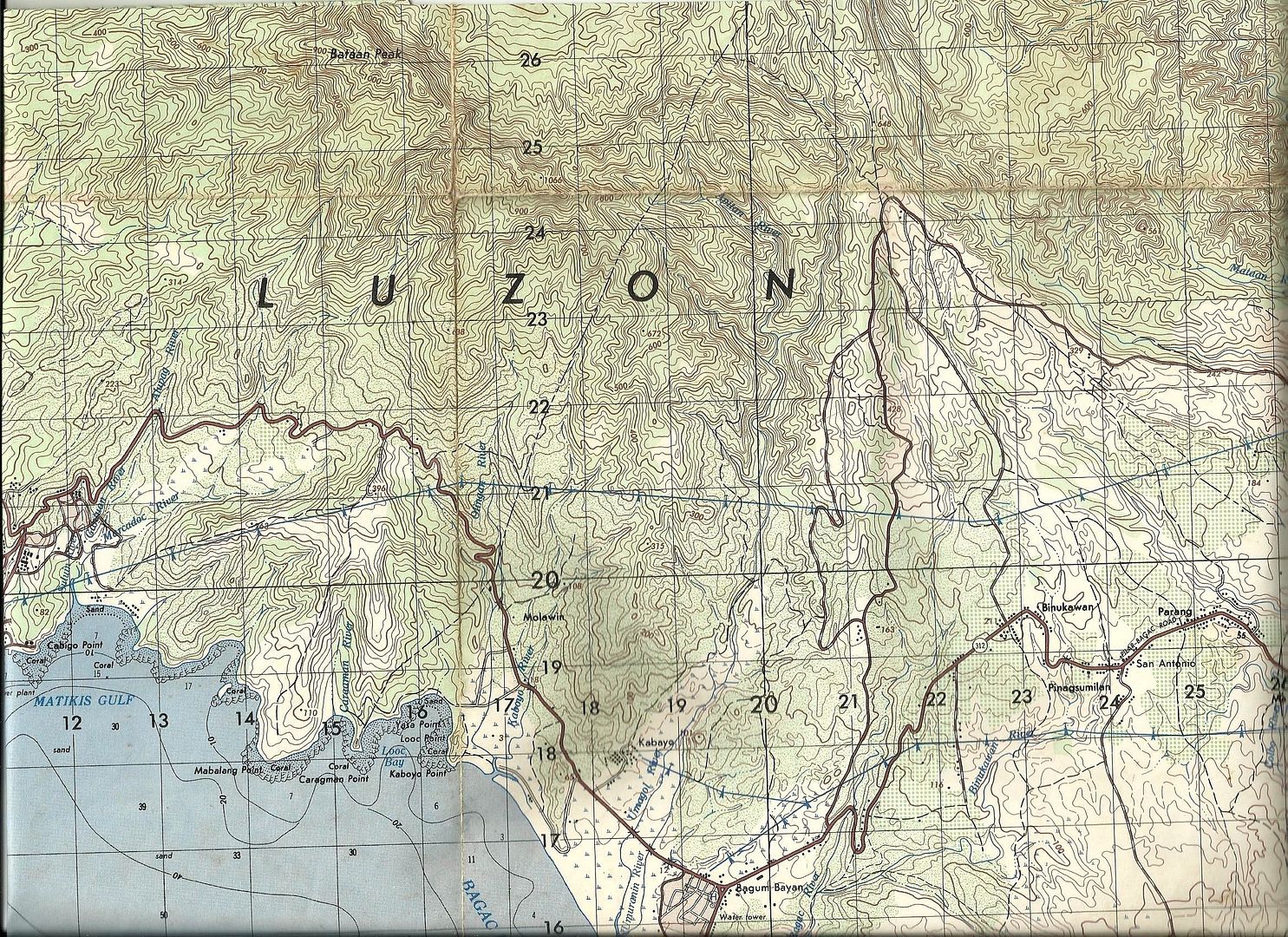 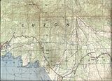 Z940-Japanese road-block on the Bataan West Road. |
|


