|
|
Post by victor on Jul 19, 2016 9:49:38 GMT 8
In a couple of weeks, I'm hoping to explore the Damortis (La Union) area in search of the 26th Cavalry's hasty defensive positions when they met the Japanese invasion coming from Agoo on Dec 22nd 1941. I'm posting some initial "online reconnaisance" info that I will hopefully be able to update with boots-on-the-ground photos later on. An excerpt from the book, Twilight Riders: 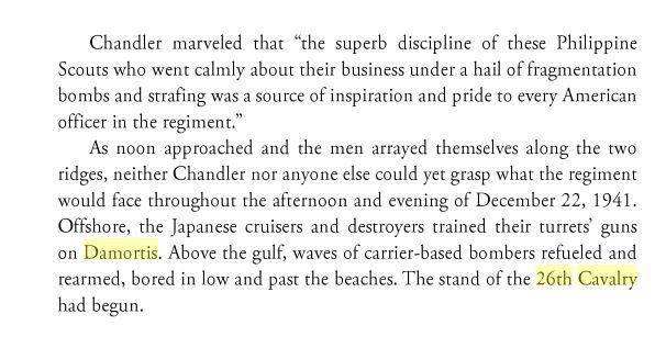 The big picture 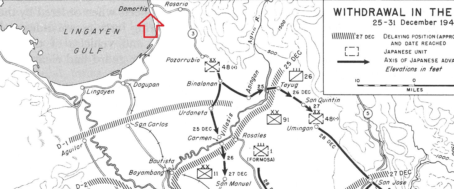  Based on several books and accounts, this is the best guess of disposition I could put together. I'm very iffy on the Troop F positions though. 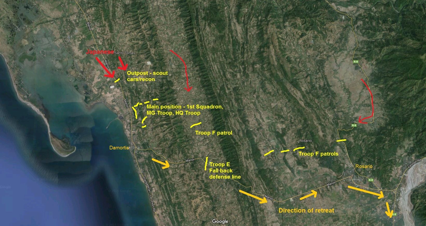 This is Lt. Arthur Whitehead's rough sketch and description. Of course the sketch was rough and drawn from memory - and of course not to scale. Lt. Whitehead got separated from the regiment later that night of the 22nd and was never able rejoin the unit. Over the course of a year and a half he was able to work his way down the archipelago and sailed to Australia in an incredible journey as detailed in his memoirs in the book, "Odyssey of a Philippine Scout" 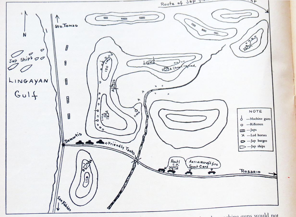 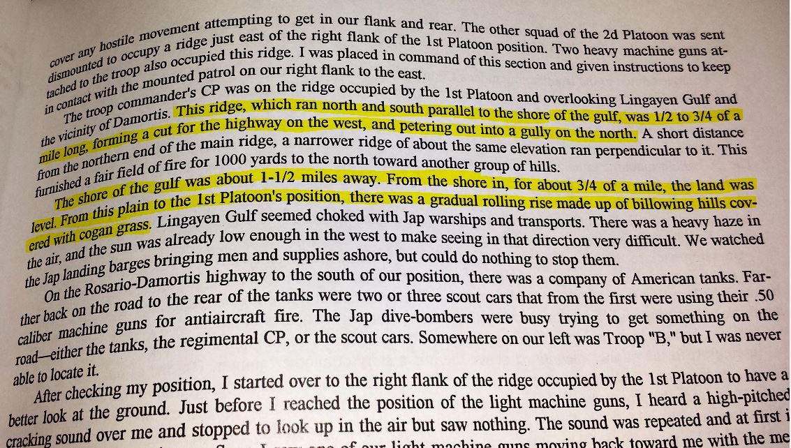 I found a group of hills that approximate the description by Whitehead and in the same rough distance north of Damortis that was described in accounts. 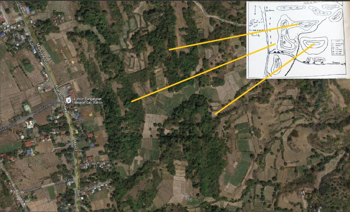 A slightly 3D angle via Google Earth 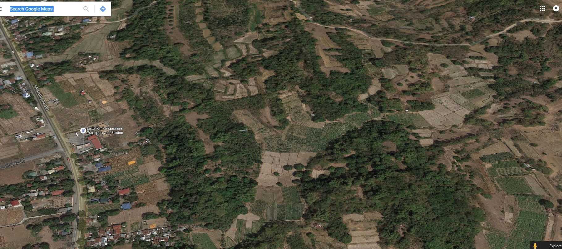 I found a random picture posted online by someone facing inland from a jetty directly across from the hill that I think the 26th Cavalry were.  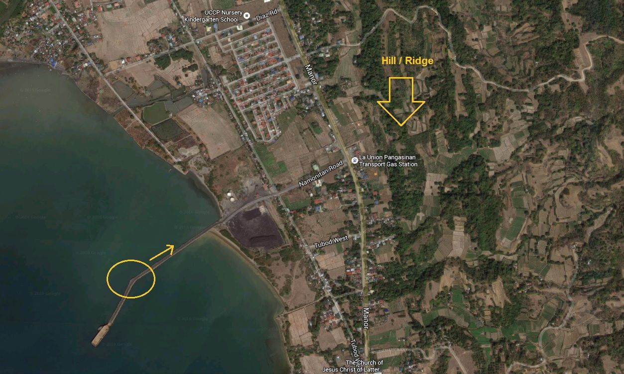 Lt. Whitehead also described a stream bed where they hid many of the horses. In zooming in, I found a possible stream bed in the valley behind the hills. 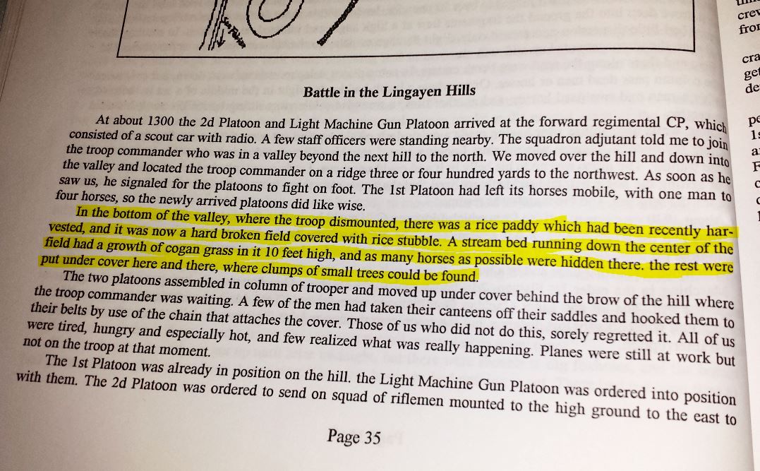 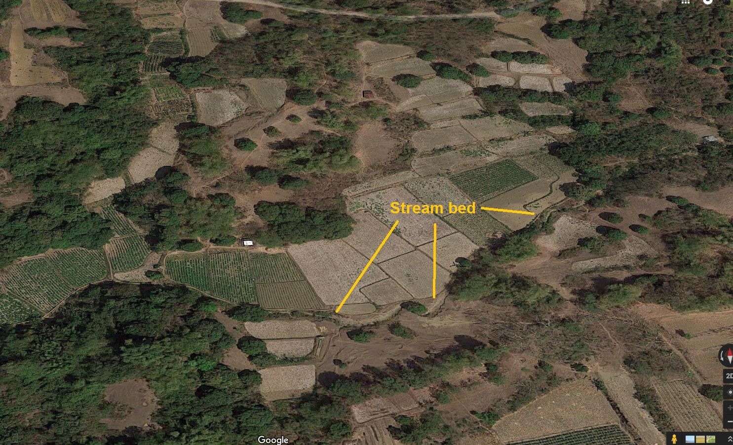 Another sketch of positions by Maj. Trapnell. This one looks quite different from Whitehead's. 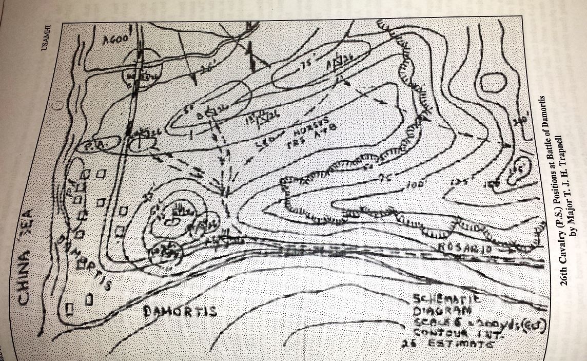 |
|
|
|
Post by victor on Jul 19, 2016 9:57:49 GMT 8
One of the things that happened in Damortis... 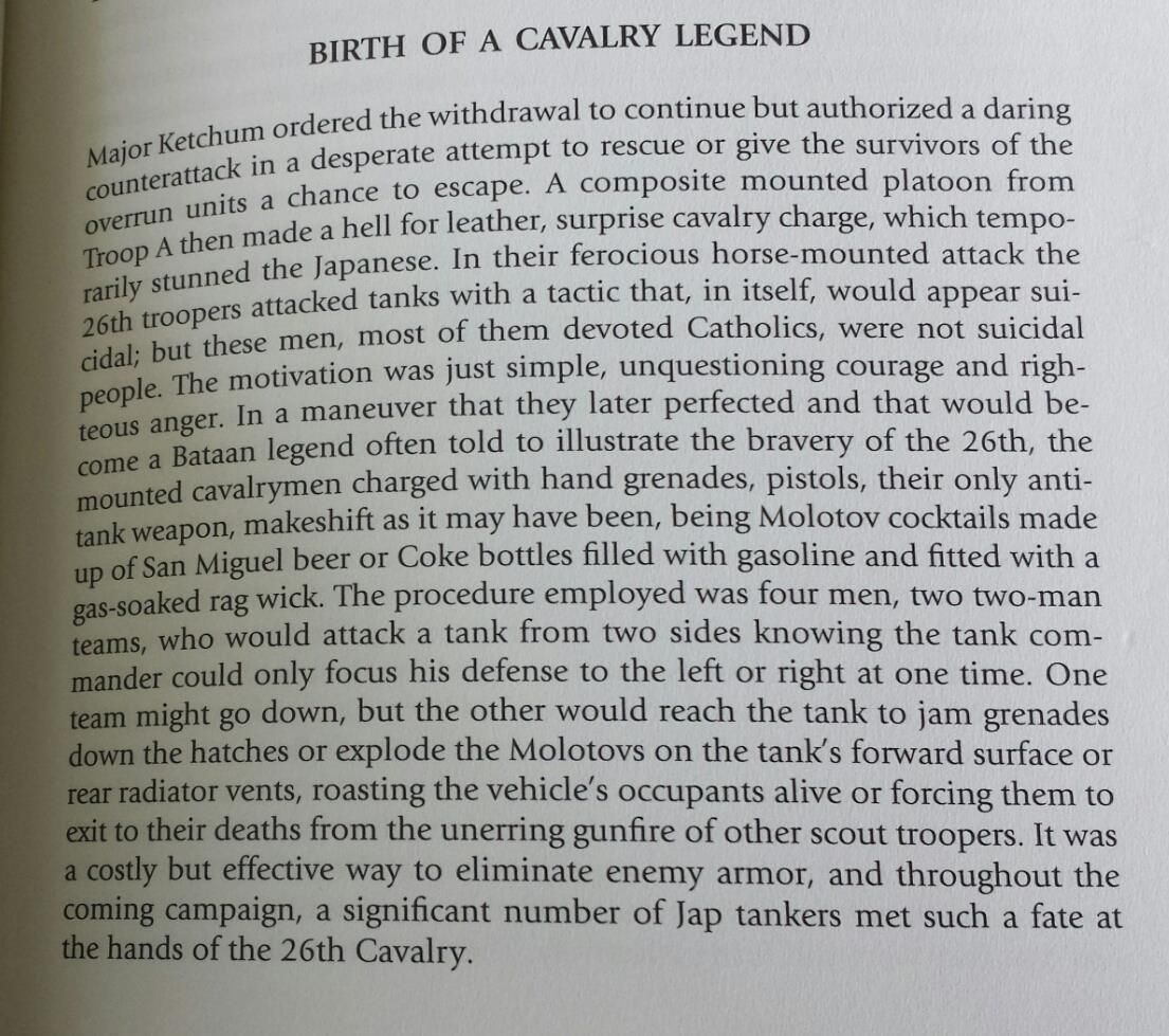 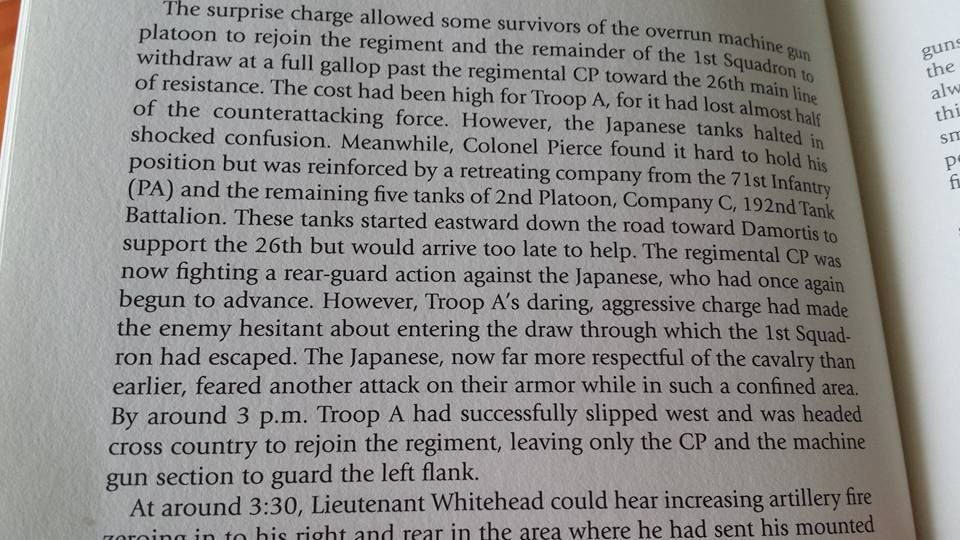 |
|
|
|
Post by chadhill on Jul 20, 2016 8:12:15 GMT 8
Good research, victor. Best wishes for your expedition and look forward to hearing about your findings.
|
|
|
|
Post by victor on Jul 20, 2016 9:55:09 GMT 8
|
|
|
|
Post by Karl Welteke on Jul 20, 2016 17:41:34 GMT 8
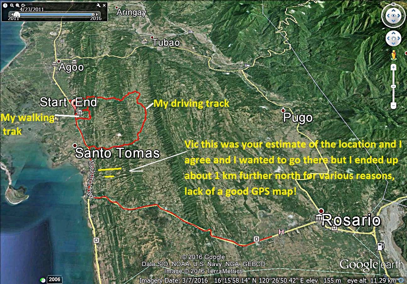
VIEWS OF THE DAMORTIS AREA Because of Vic’s interest in Damortis, 2015-05-25, I did stop there on a family excursion to Vigan, explored a little and took a walk. We are going to team up again shortly and head on up there again. As Vic and I said my walk was a little too far north of the area that Vic wants to explore. However the pictures, I did shoot, give us an idea what the area looks like. I present here a Google Earth image with the GPS track of my walk and marked with the view directions of 5 pictures of the area. The pictures are also marked with some points of interest. The pictures were shot from left to right. 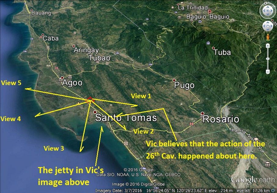 W964 is an Google Earth image of the Barangay (Village) Damortis in the Municipality of Santo Tomas in the province of La Union. 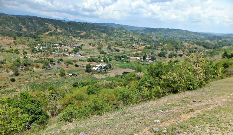 W965 is view roughly in the direction of Rosario from closest ridge line to Lingayen Gulf above the Municipality of Santo Tomas in the province of La Union. And we can see clearly the next long ridge line which run parallel to the Lingayen Gulf coast line. 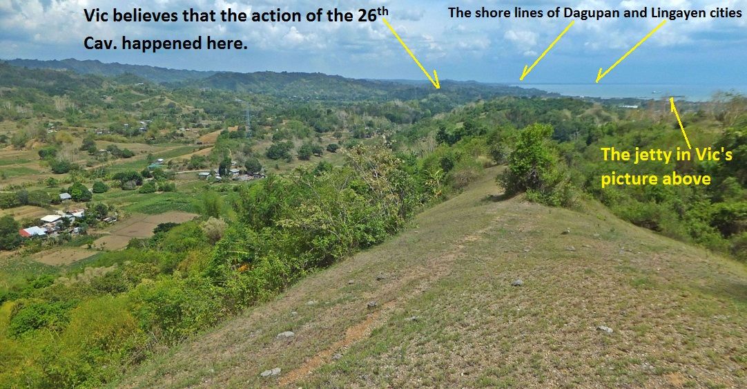 W966 is a view in the direction of Dagupan City and I marked the image with the location of the jetty in Vic’s presentation above and where Vic believes that the action of the 26th Cav. happened. 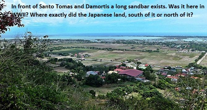 W967 there is a long sandbar (that is what it seems to me) in front of Barangay (Village) Damortis in the Municipality of Santo Tomas in the province of La Union or is it a breakwater? I wonder where did the Japanese actually land in 1941? 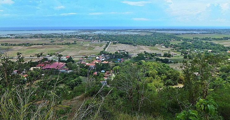 W968 is a view straight towards west from closest ridge line to Lingayen Gulf above the Municipality of Santo Tomas in the province of La Union. If the Japanese landed here in 1941 they had to cross a lot of wet areas! 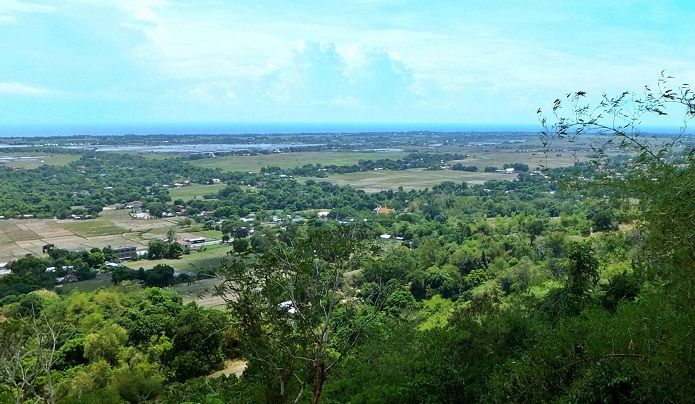 W969 we are now looking into the NW direction from closest ridge line to Lingayen Gulf above the Municipality of Santo Tomas in the province of La Union, a little further to the right would be the town of Agoo. The pictures above are small; if you want to look at them at a larger size and all the other images of that walk are in this album: s74.photobucket.com/user/PI-Sailor/library/X%20for%20HR%20Albums/Bataan%20HR%20images/Damortis%20walk%20160525?sort=9&page=1 |
|
|
|
Post by okla on Jul 21, 2016 5:46:47 GMT 8
Hey Vic....Good stuff. Thanks for posting. Your efforts make the activities/efforts of our "Horse Soldiers", way back in 1941, come to life for this old 1941-42 Philippine Campaign "Geek". It's great, actually, viewing the terrain, etc that they occupied/fought over. This, certainly, makes it so much easier to comprende, the whole operation, even if it did end up with the "good guys" on the short end of the stick as far as military success was concerned. Cheers.
|
|
|
|
Post by cbuehler on Jul 25, 2016 23:54:20 GMT 8
Once again an absolutely fantastic study presented here! This is getting into military archeology and I wish there were the funds and time to do more.
I too have always wanted to know more about this since passing through the area along the main highway going north back in 1988.
As is usual, the contemporary maps drawn of the area are difficult to use with accuracy when compared to what the layout is today. We dont know exactly how the land has been changed with man made development, or with regard to the shoreline, natural change. But I think Victor must be very close here.
I also think we can assume that the large sand bar etc. was likely not present during the Japanese landings in 1941. The photos in the Gakkei publication seem to indicate that the landing sites were clear and clean with no obstructions. We dont know the breadth landing area at the time, but I seem to recall reading that there were a series of landing sites along the coast in the area, not just concentrated in one location.
CB
|
|
|
|
Post by victor on Aug 16, 2016 1:40:37 GMT 8
I was able to make the trip to Damortis with my friend on August 8. Karl was not able to come along this time. On the way 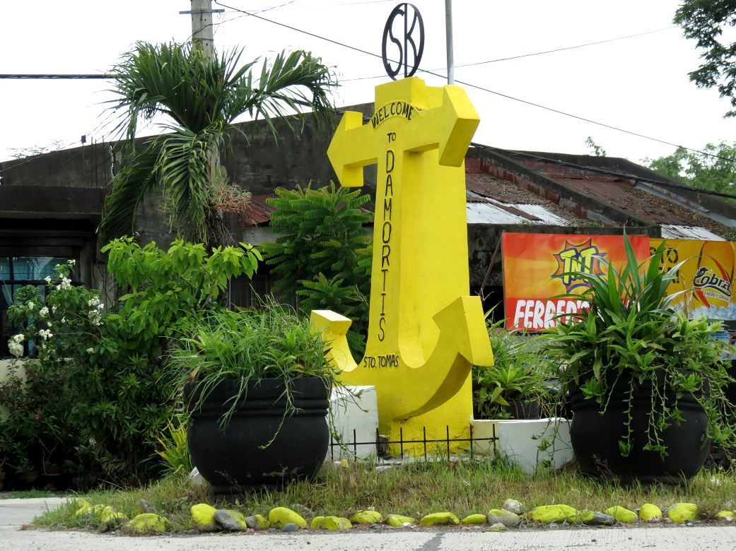 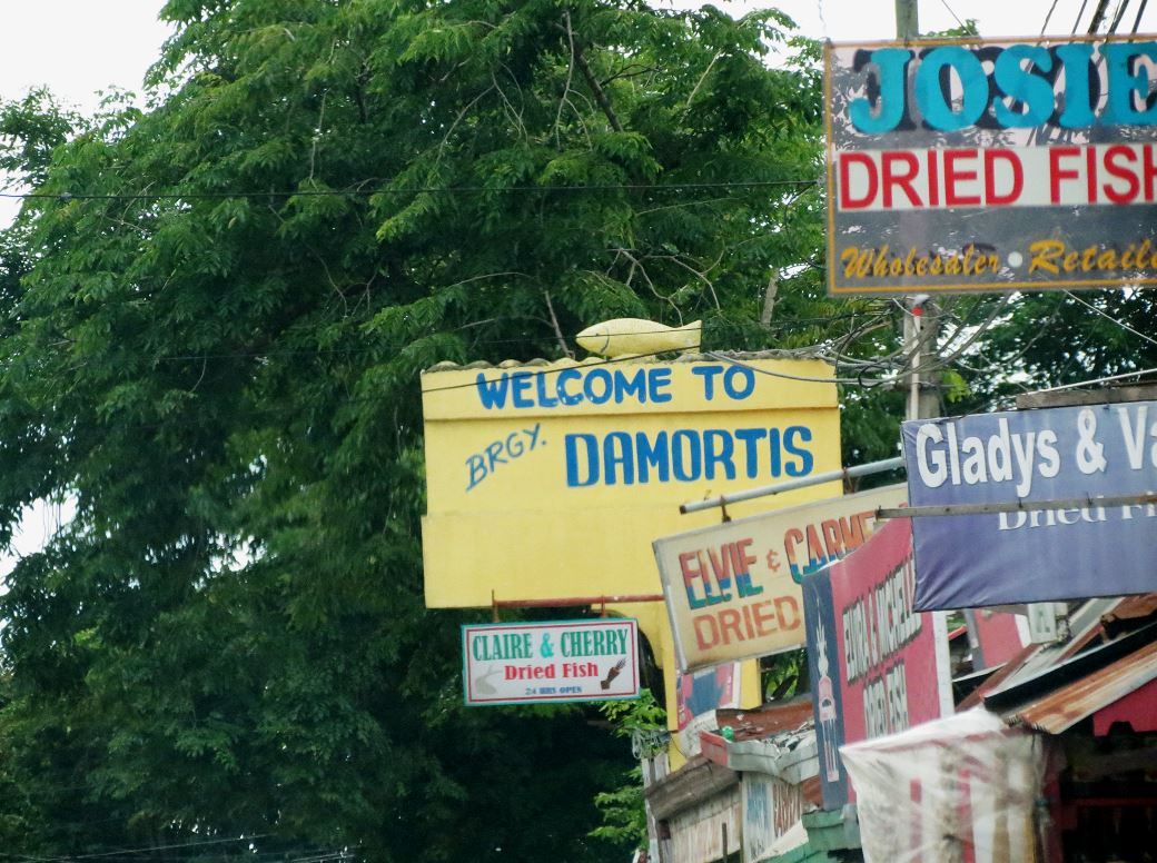 The main road as it turned north, within Damortis proper 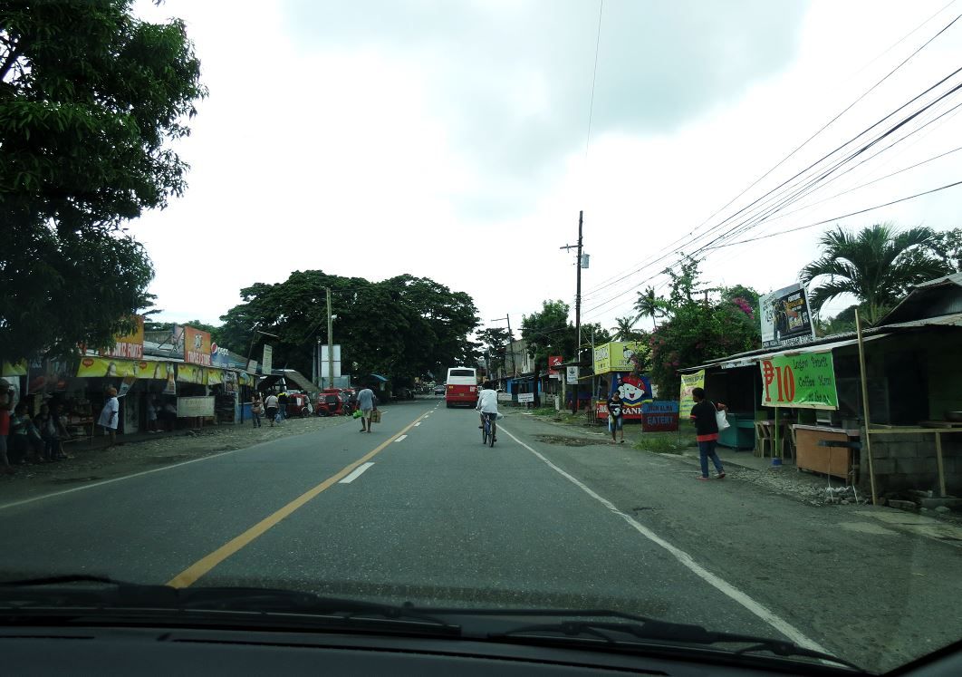 This is Mang Loretto, the farmer who tilled the land in front of the hill thought we were looking to purchase the land. He graciously accompanied us and acted as our guide. We were very thankful to him. His main concern was we would get ourselves muddy and wanted to steer us away from muddy parts  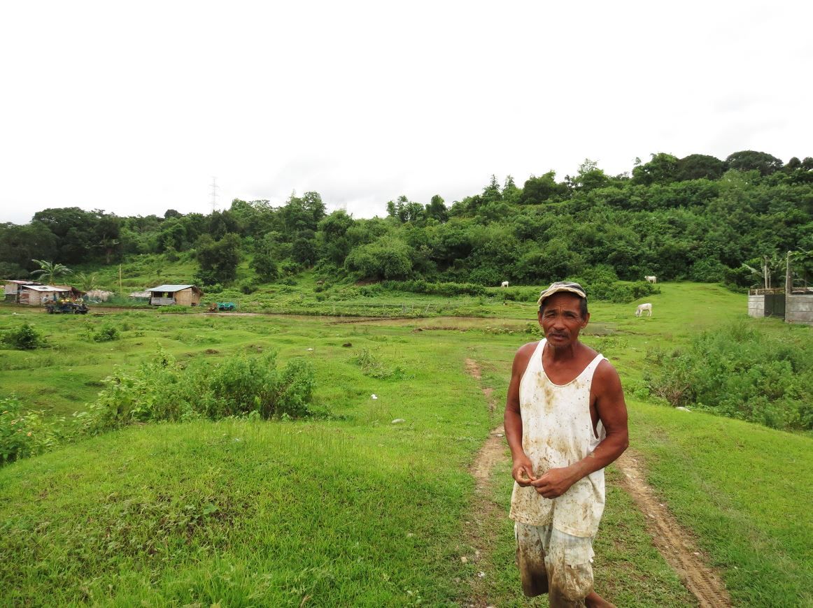 The hill that ran north-south parallel to the road that Lt. Whitehead described. We went up another hill to the north of it first because there was an easy paved road we could follow, but decided that wasn't the hill because it was too far away and obscured from the main road. However this one had a commanding view of the road and is approximately 600 yards north of Damortis town. 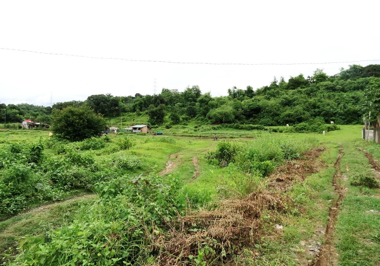 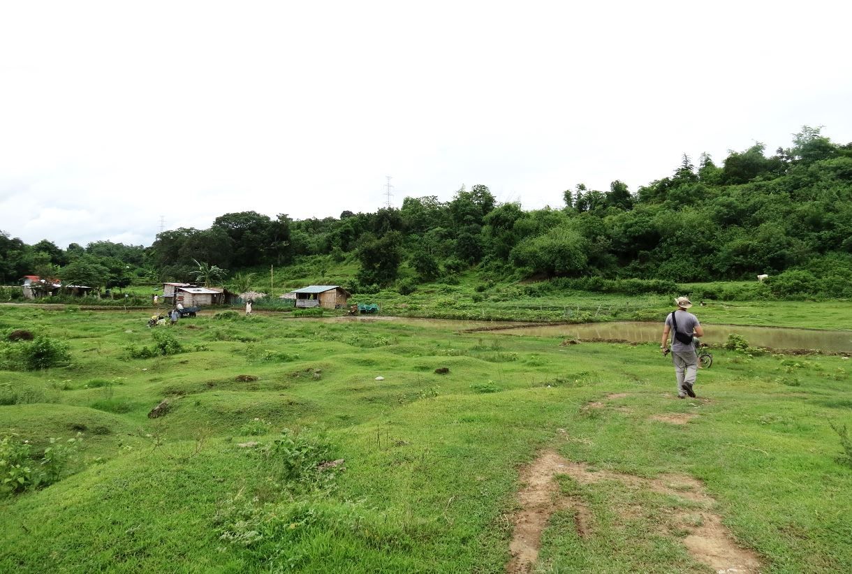 Going up the hill with Mang Loretto.   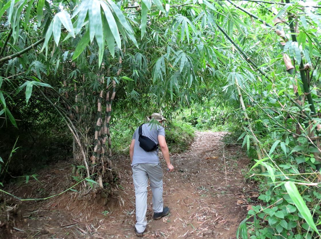 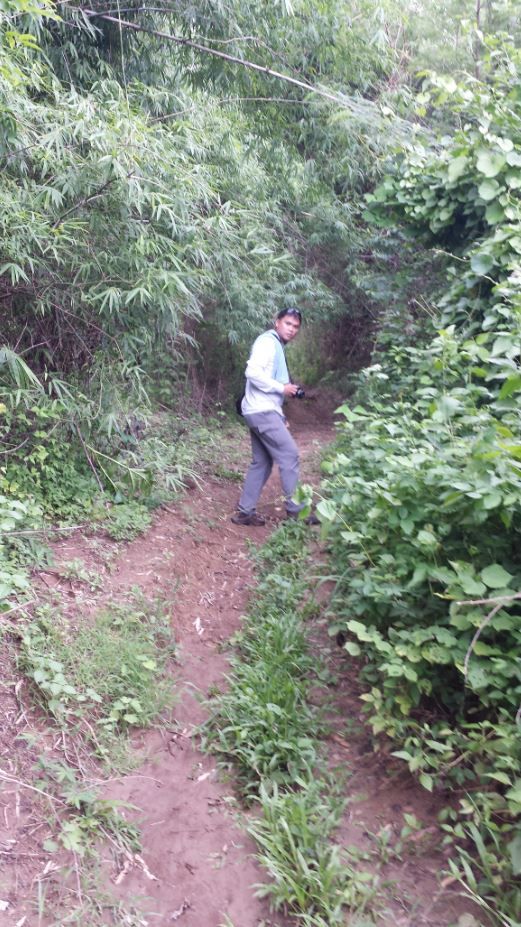 Halfway up the hill we came to a clearing/plateau. Even at a relatively low elevation, the view had dramatically gotten interesting. Goats grazed on the plateau. The view from halfway up was already giving credence to the veterans' accounts of having a vantage point seeing the Japanese fleet landing troops. 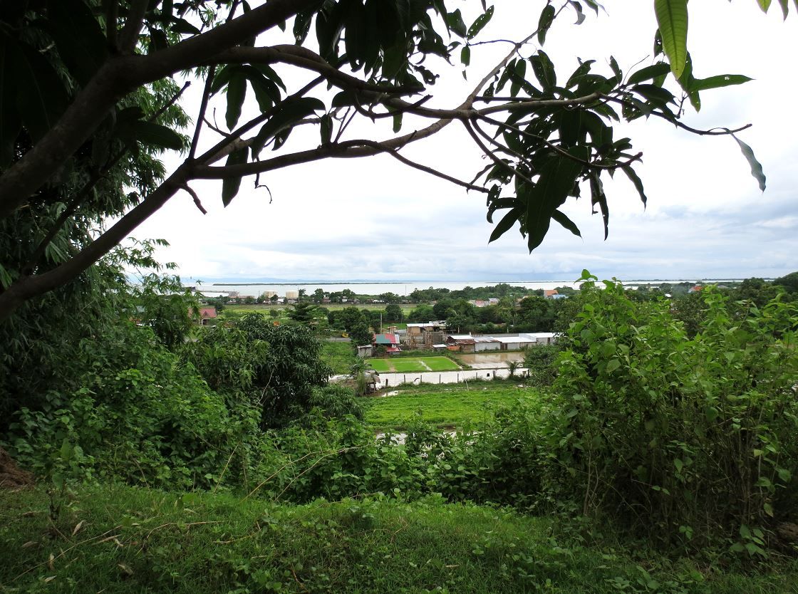 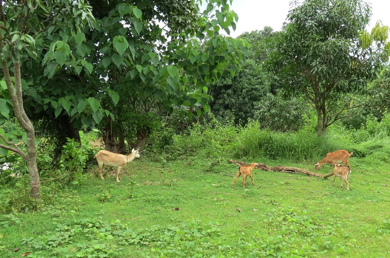 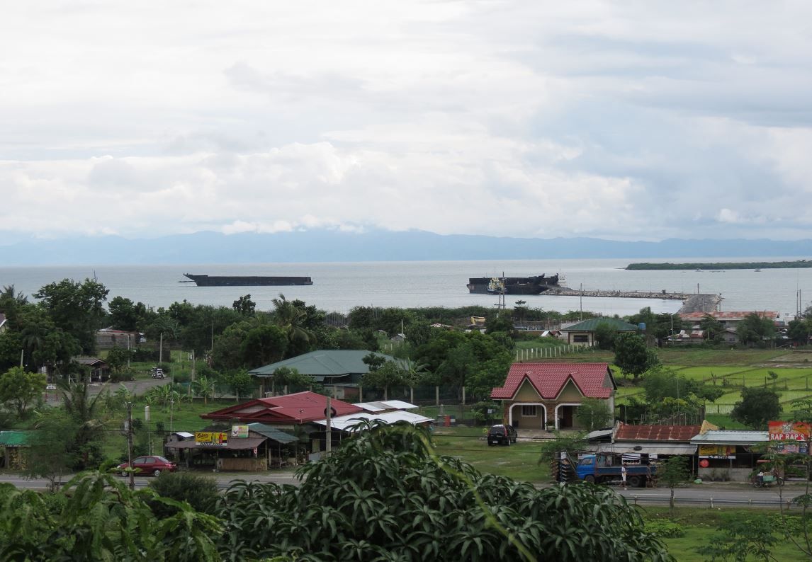 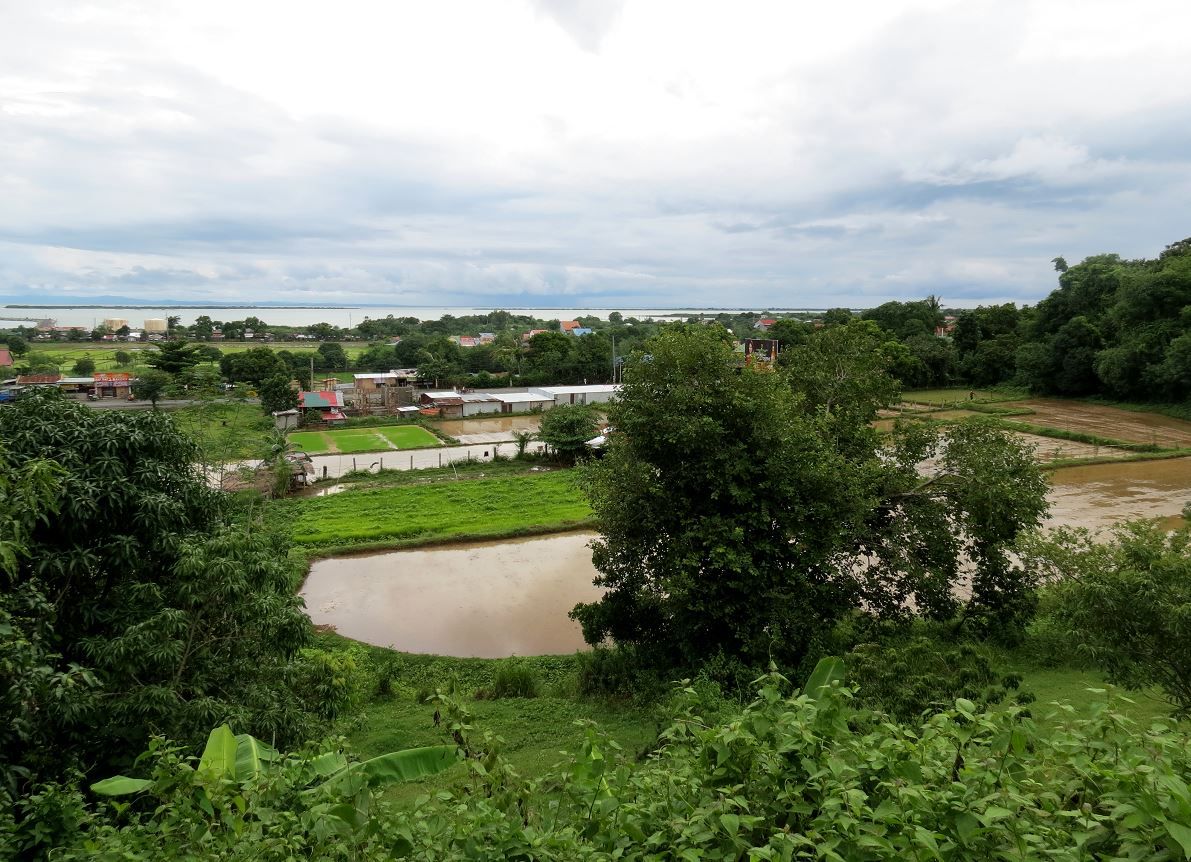 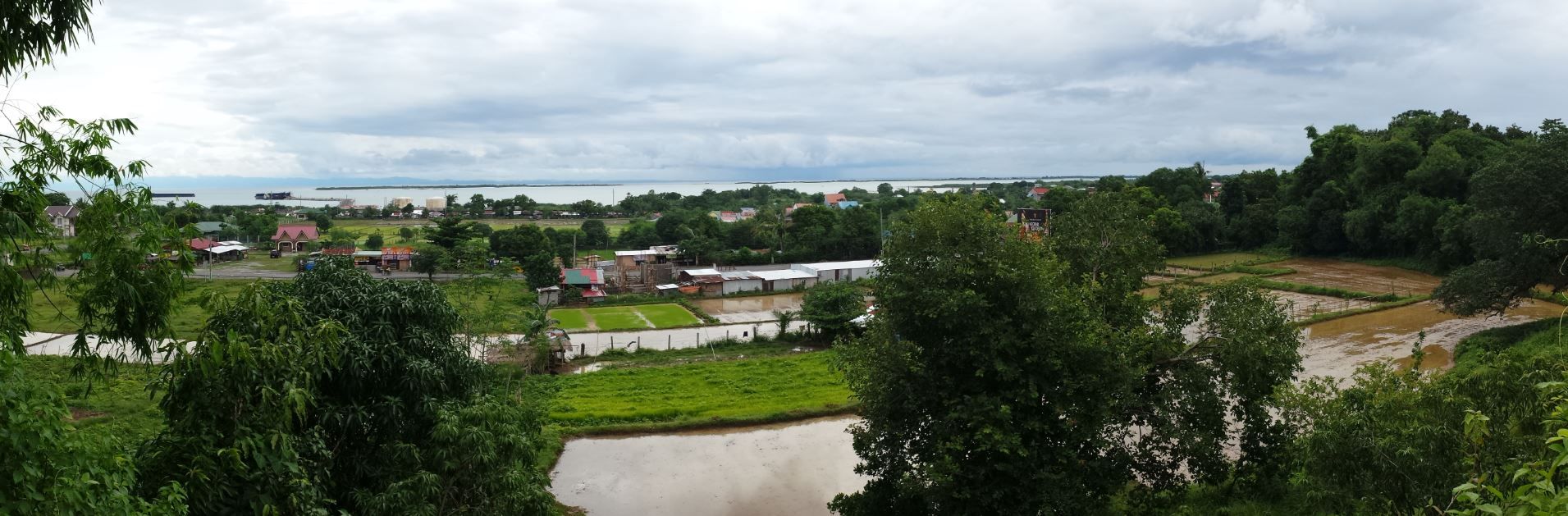 Mang Loretto told us that he had dug up an artillery round on that hill side. He showed us where he left it beside a tree right on that plateau. It's a big caliber one. It looked like it may have been a dud. I'm not familiar with identifying artillery shells but our guess was that it was from a naval gun. If so, it was possible that it came from a Japanese ship that could have shelled the position in support of their troops who were attaching south and trying to break through. And if so, then we were on the right hill. 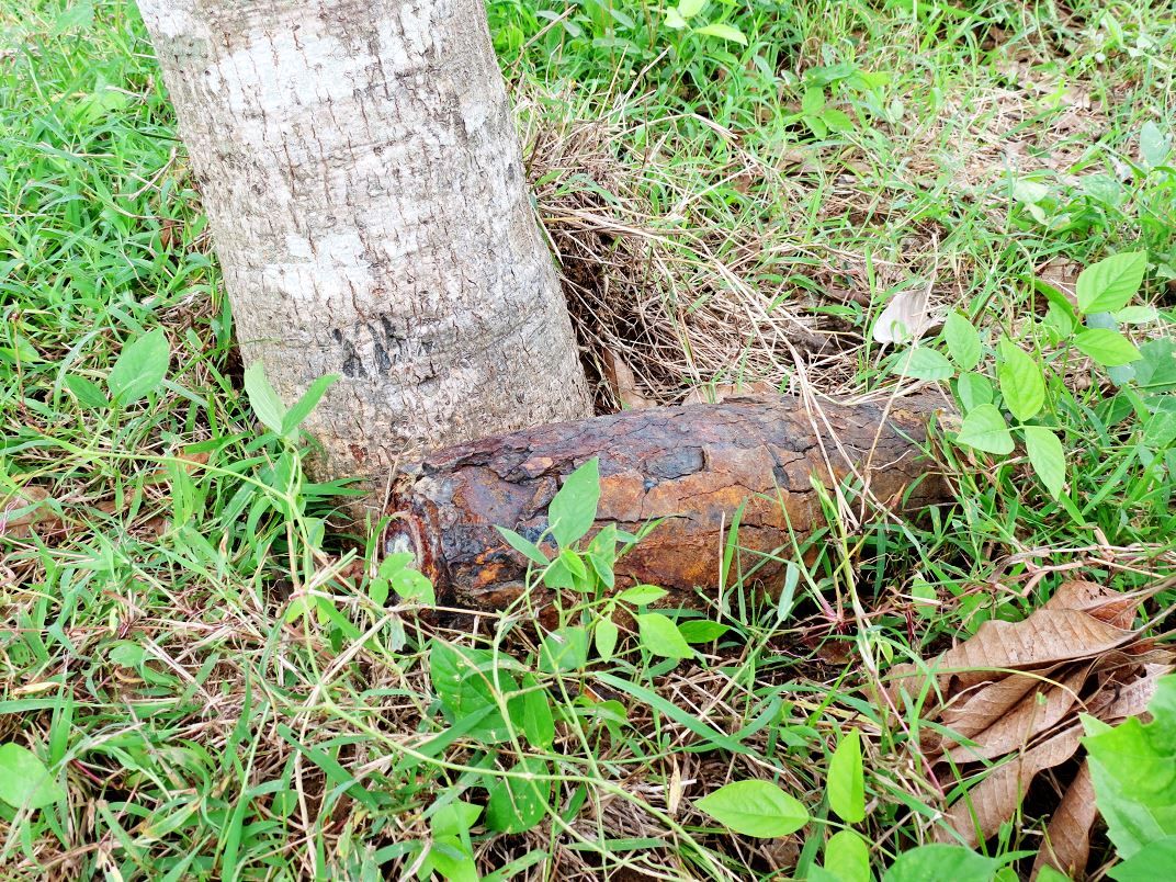 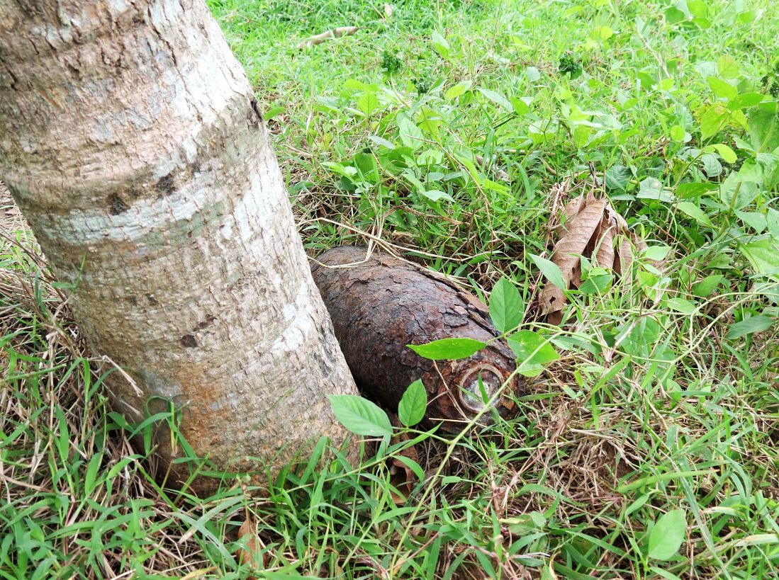 We had more climbing to do, we were only halfway up the hill. 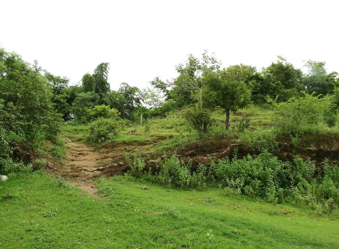 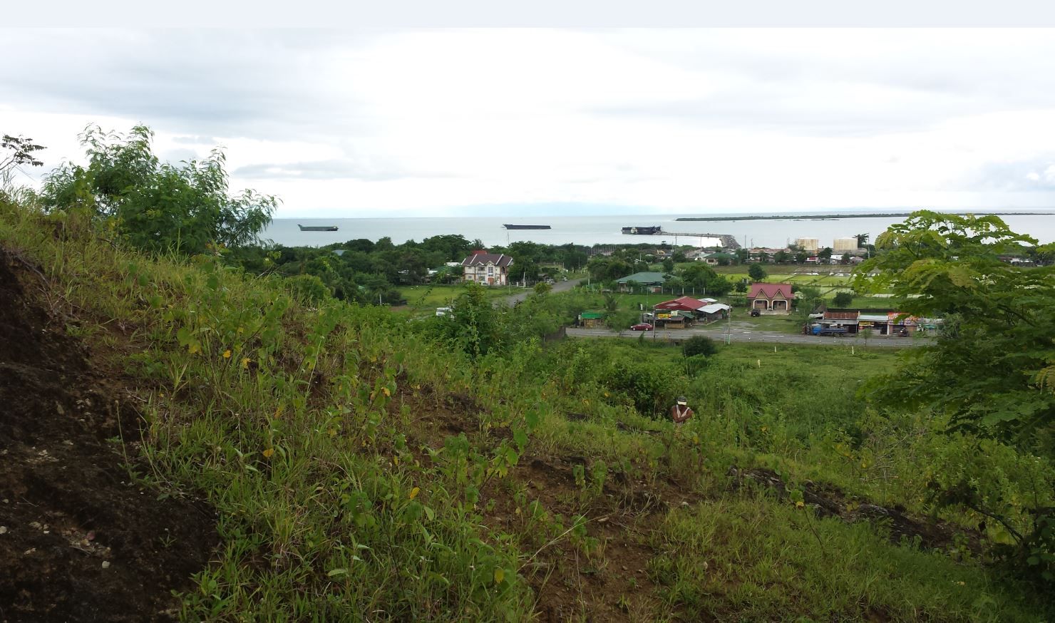 You can see how the hill had a commanding view of the road. Our car is the maroon one on the right, parked on the side of the road below. 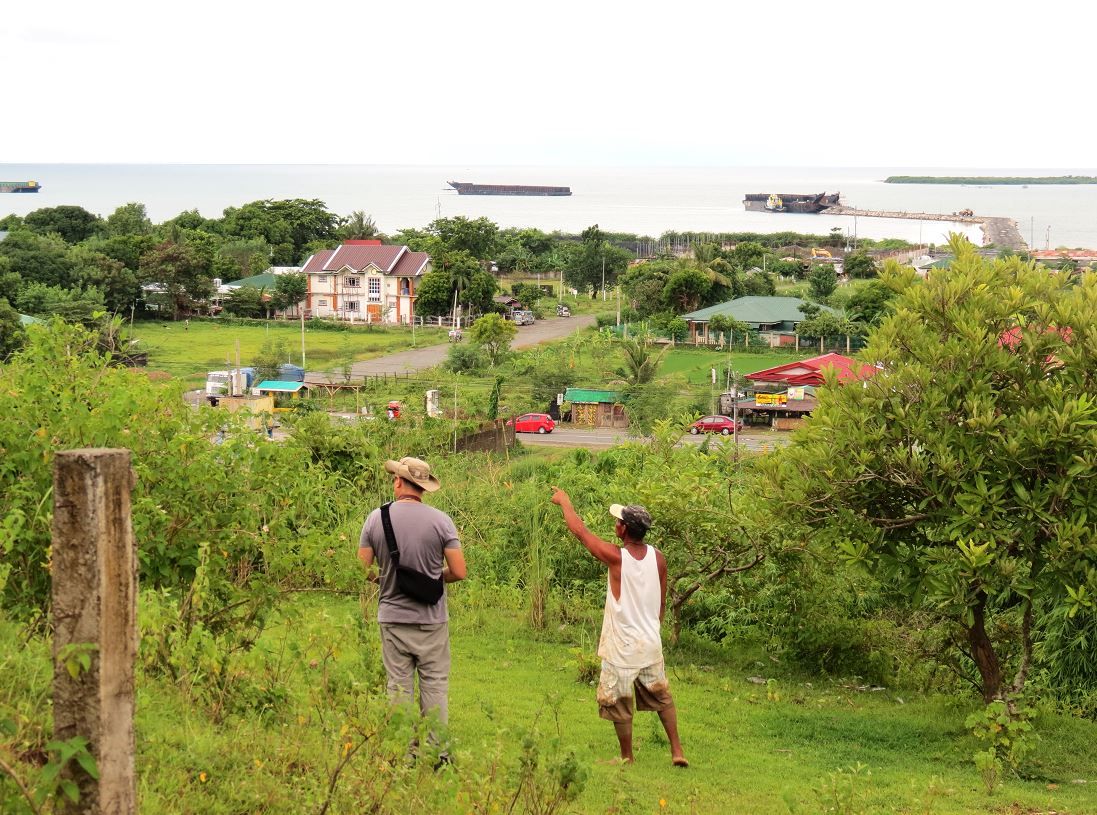 The trail that ran along the top of the ridge 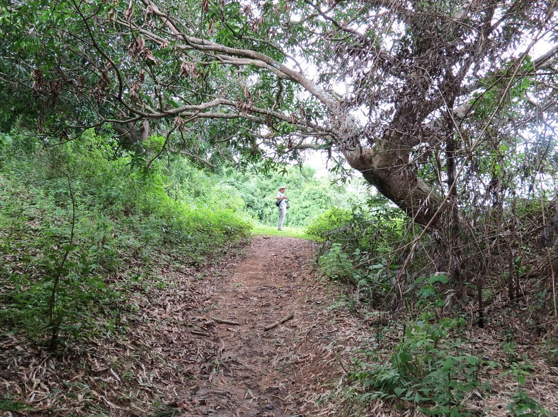 The view from the top. I was a bit concerned that we weren't on the correct hill. The foliage and trees didn't offer a clear view and fields of fire for defenders. Mang Loretto said that he lived in Damortis all his life. He's in my estimate in his 60's. He said that he remembers the area not very overgrown at all. He said they were mostly grassy and low shrubs with occasional trees, and the lowlands didn't have any buildings at all and were mostly agricultural fields. If so, then it offered clear fields of fires for defenders. 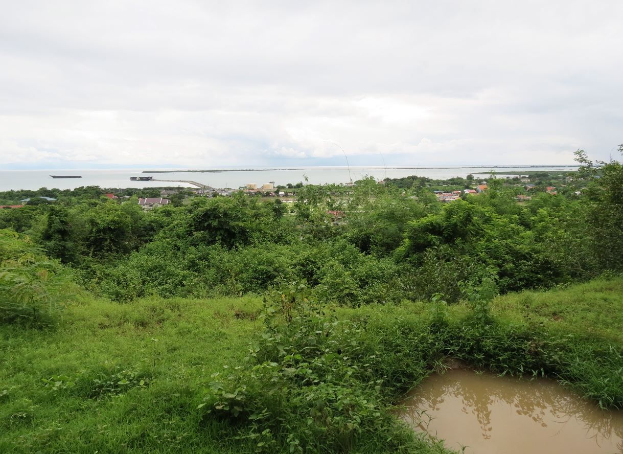 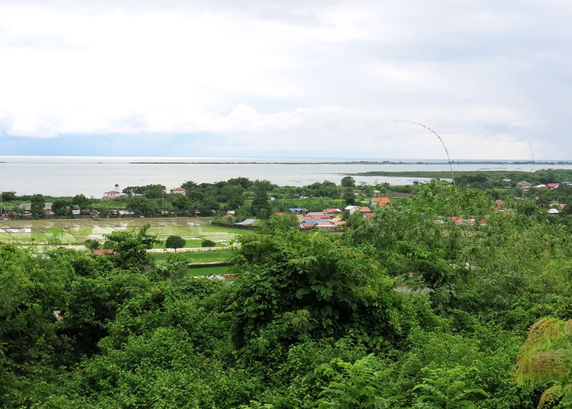 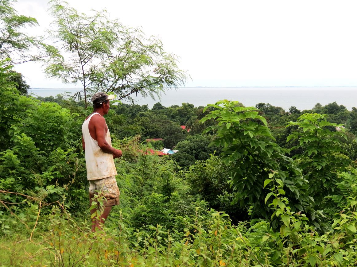 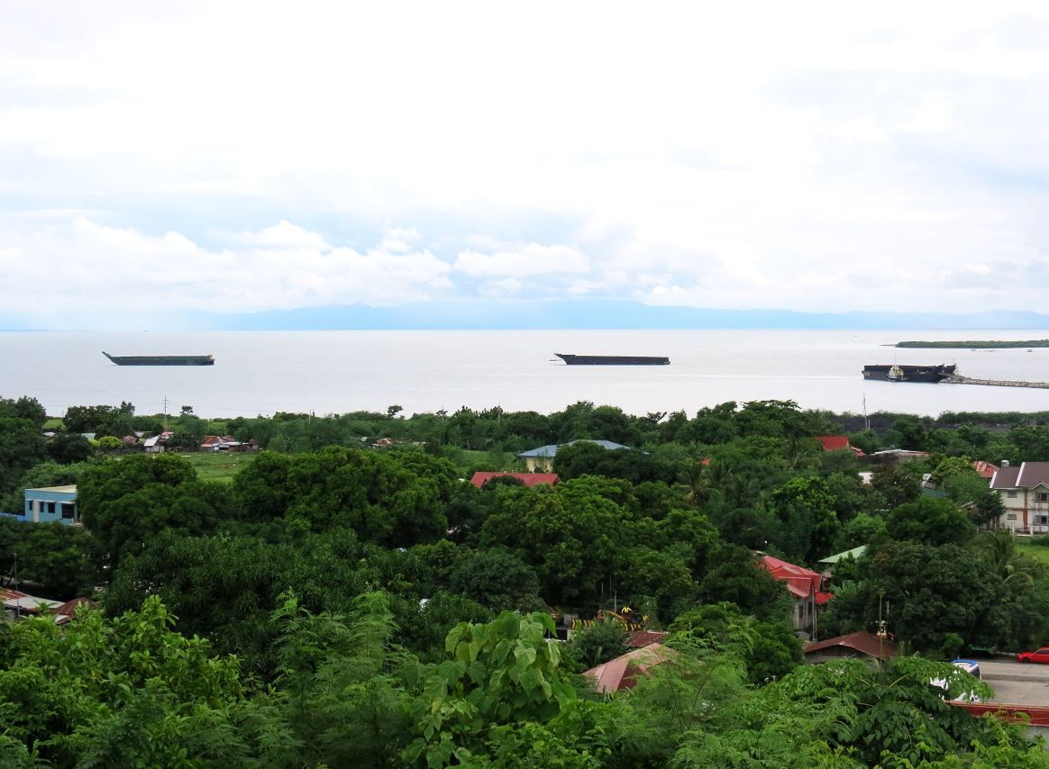 On the way down the hill. We gave Mang Loretto a little gift for his time and willingness to help us out. Along the way we told him what history we know of and the significance on that hill so he could pass it along to his family and friends. This little anonymous hill we stood on, men had made a stand on, on Dec 22nd, 1941. 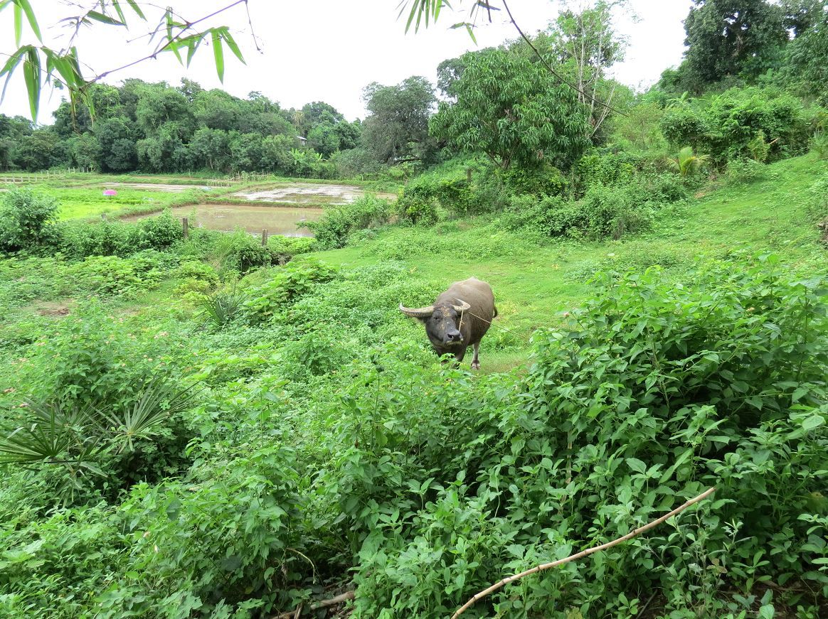 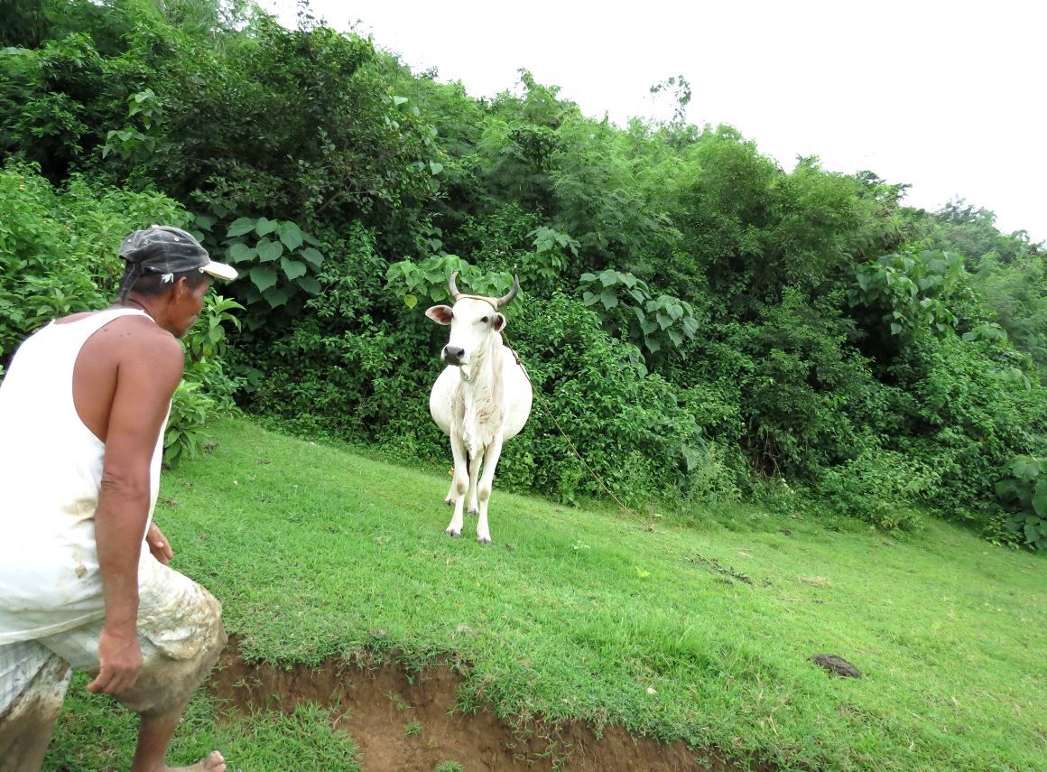 The clearing we were able to reach, as seen from below 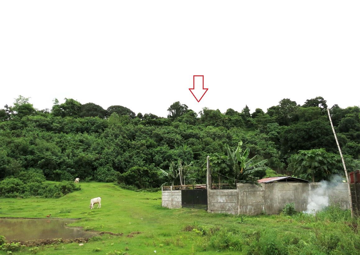 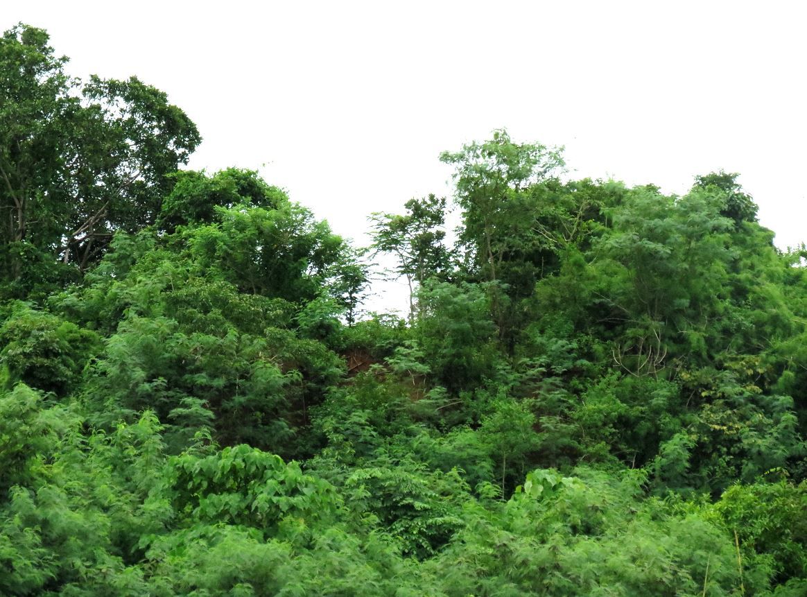 Some pictures on the way to Damortis. Crossing the Bued river approaching the town of Rosario. 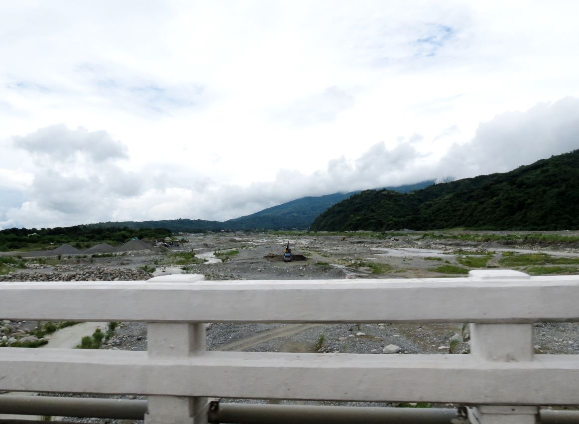 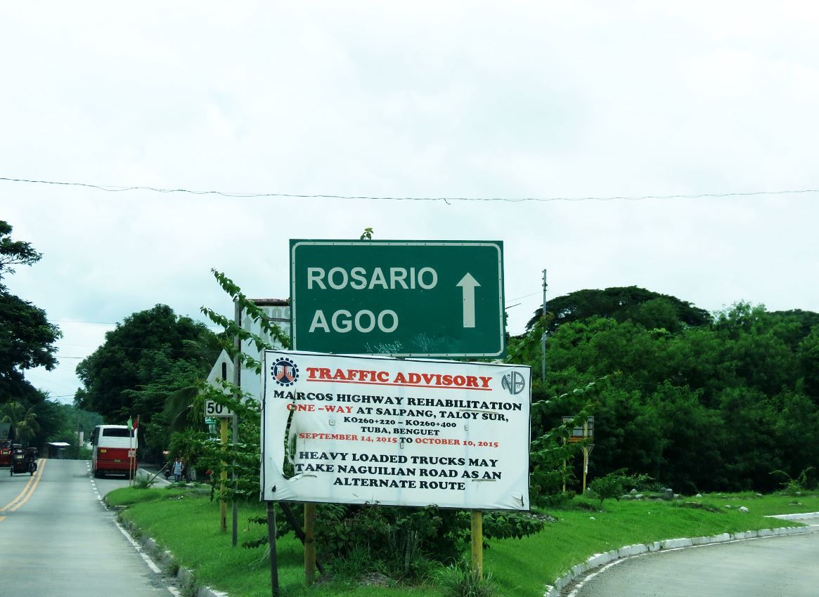 The Rosario town square. The huge ancient acacia tree would have been already there during the fighting. F Troop was pushed all the way back to the town square trying to hold off the Japanese so the rest of the regiment could fall back past behind them, along the road. 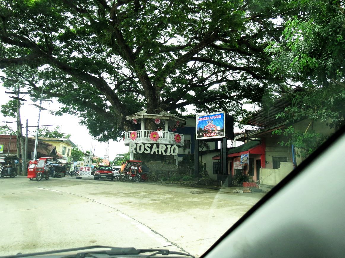 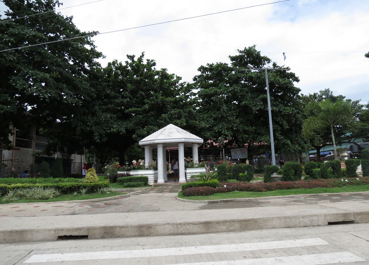 |
|
|
|
Post by Karl Welteke on Aug 16, 2016 8:06:41 GMT 8
Hello Vic. Congratulation to your successful exploring trip. I guess you were lucky and went up that hill between some rain showers. It has been very rainy in the last few days here on Luzon. A very great presentation, I enjoyed it very much! And finding that piece of armament was a good surprice.
|
|
|
|
Post by victor on Aug 17, 2016 0:09:11 GMT 8
Thank you Karl. We got lucky. We encountered heavy rains on the way up while in Tarlac, but it was dry and just cloudy when we got to Pangasinan and La Union. More photos and trip report on Binalonan, Trapnell's bridge, and Clark trail ride coming soon...
Does anyone have an idea if the artillery round (pictured above) is indeed a naval shell?
|
|


 If any of you are interested as well and have nothing better to do, come along