|
|
Post by cbuehler on Jun 13, 2019 0:18:06 GMT 8
Usual outstanding detective work here! All other matter aside, those were some pretty big explosions with an awful lot of earth going up, particularly the second one. Whatever caused them, the explosive was certainly not on the surface. If from aerial bombs, they would have had to penetrate down quite a bit.
CB
|
|
|
|
Post by beirutvet on Jun 14, 2019 6:59:34 GMT 8
Hey guys, I have some theories here.
#1 I agree it is Battery Ramsay but judging by the preponderance of vegetation I would guess it to be 1942 and the smoke is from Battery Geary. After that went up you would think the japs would try to get a closer look at "what did we just blow up?".
#2 This time judging by the LACK of vegetation I will go with 1945 and this being Battery Wheeler, not Cheney. I say this because look at your maps and note the juxtaposition of the explosion to Searchlight Point and Wheeler Point. I am going from memory here but wasn't Wheeler the one that Douglass M visited on his return and it was completely destroyed?
#3 And yes of course one of the 1911 model 12 " mortars from Geary holding up the roof.
Full disclosure is required here. These are just SWAGs on my part.
|
|
|
|
Post by fots2 on Jun 14, 2019 9:18:43 GMT 8
Hello beirutvet, #1 I grabbed a couple views from Google Earth to show us exactly where Batteries Ramsay and Geary are located. I placed markers on the batteries then adjusted the perspective to approximately what is seen in Chad’s photo. (excuse the poor quality, getting clear low angle views at a decent size is difficult with Google Earth). 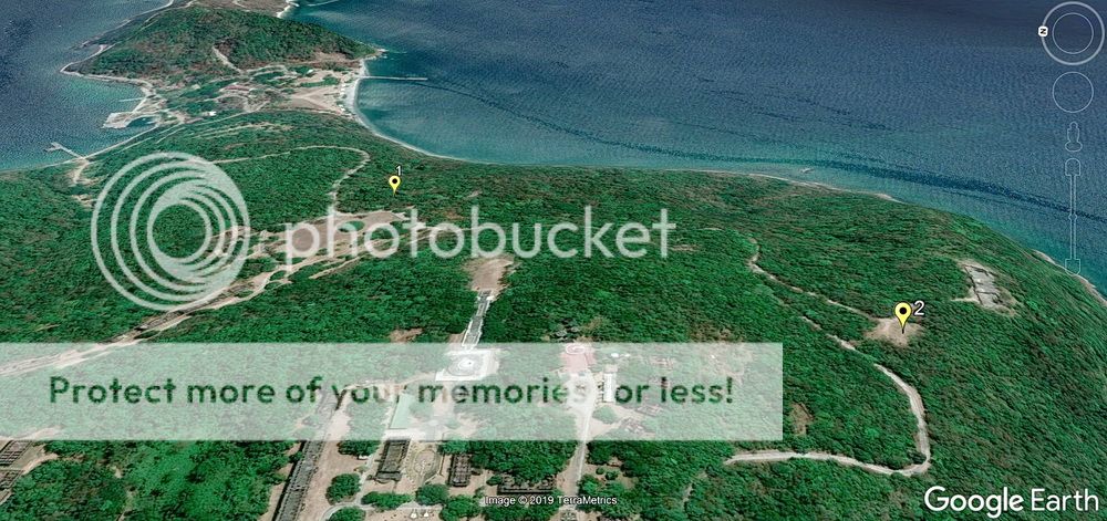 #1 is Battery Ramsay, #2 is Battery Geary 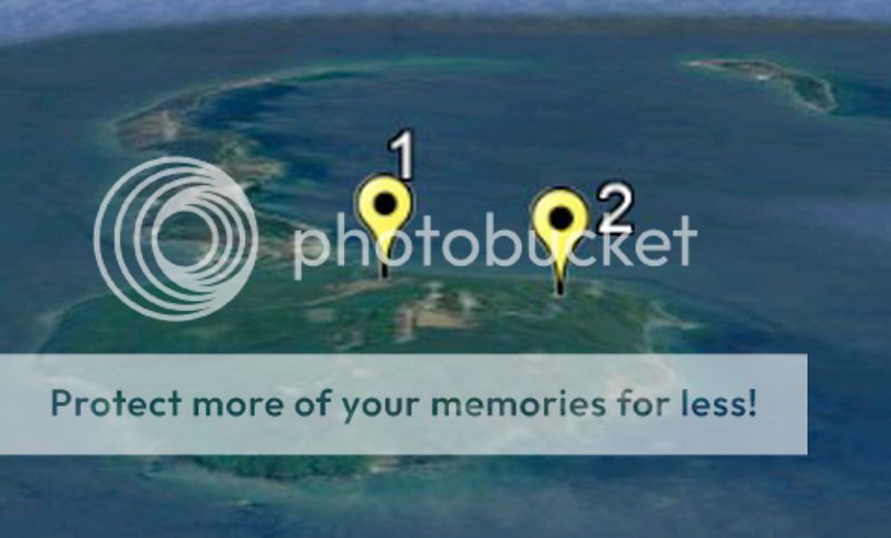
Also, ignore what you hear on the day tour that “Corregidor did not even have a blade of grass on it in 1945”. Other that parts of Topside and Bottomside, Corregidor had lots of trees, especially in the ravines. Note the aerial recon photo dated February 6, 1945. 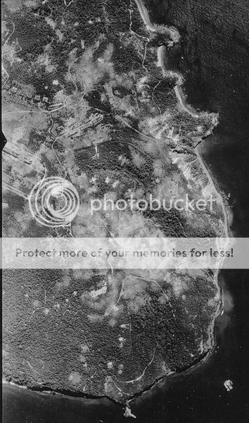 February 6, 1945 photo showing lots of trees on Corregidor. (credit to Dan's collection) #2 Here more Google Earth views. I agree that the explosion seems closer to Battery Wheeler than Battery Cheney. Battery Wheeler itself is intact today so it is not at that location. As a guess, perhaps we are seeing the northern entrance to Wheeler Tunnel being blown up. I really don’t know what such a large explosion in this area was. 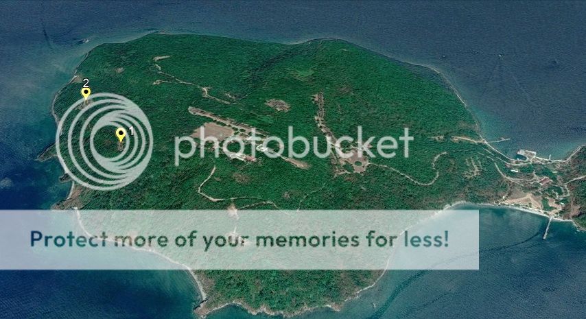 #1 is Battery Wheeler, #2 is Battery Cheney 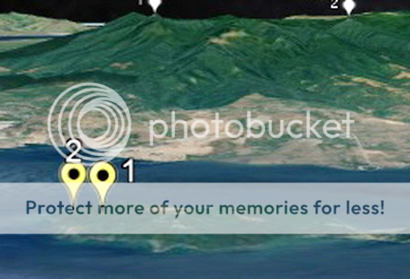 |
|
|
|
Post by chadhill on Jun 15, 2019 11:51:18 GMT 8
Hey guys, very good responses. As I mentioned earlier, EXO's wonderful book "Rock Force" had a much better, computer enhanced version of photo #2. I was not aware of the existence of this book photo when I made my original post, and came across it while writing my response to fots' first reply. EXO has graciously given me the ok to reproduce the photo here. I regret not having found it sooner; my apologies. First, for convenience here is a google satellite map snapshot of the area. For comparison purposes, I tried to get the camera level as close to sea level as possible, but this is the best that I could do. 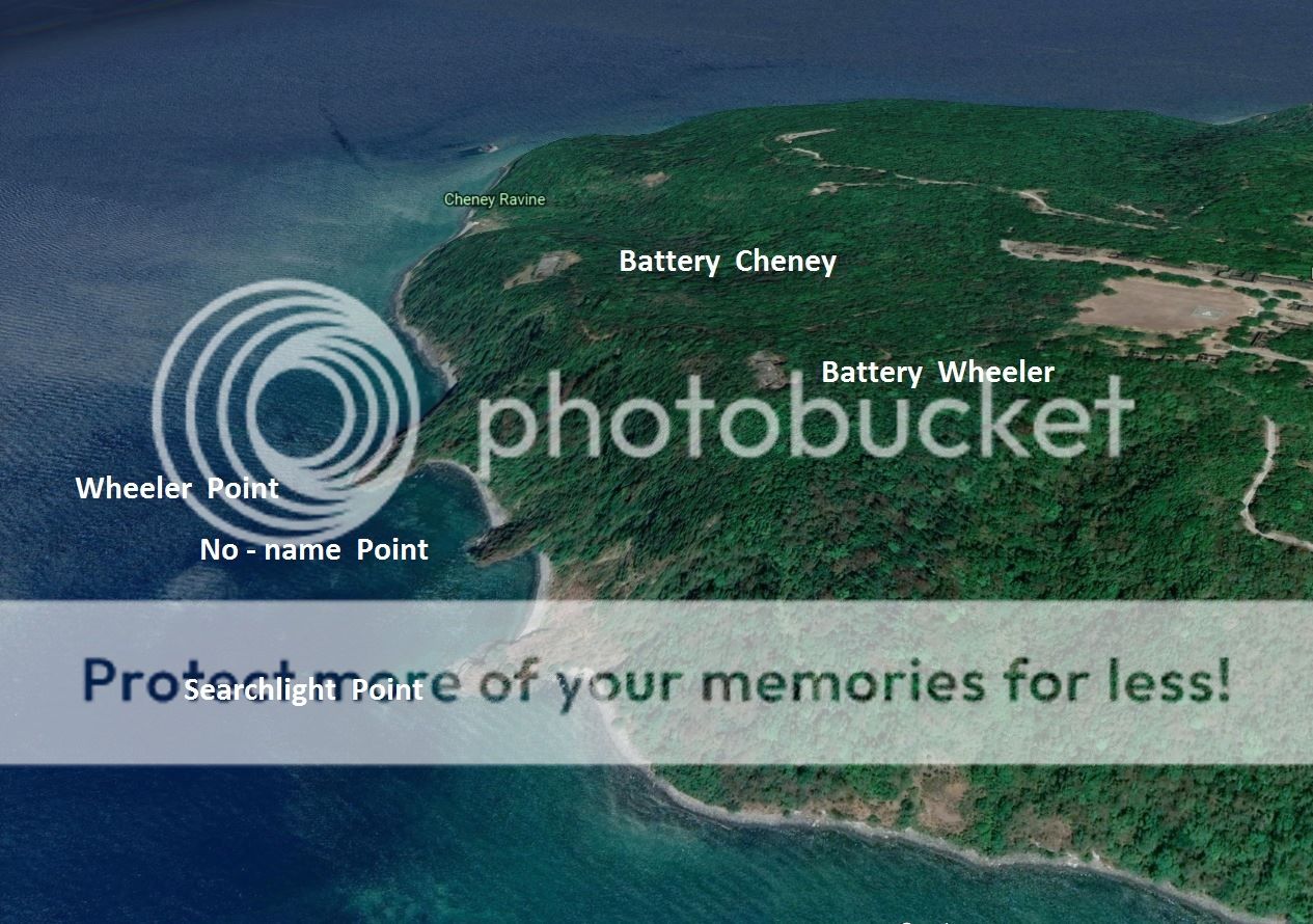 Next is a cropped section from the "Rock Force" photograph of the area. We can see all three of the points. In my opinion, the explosion appears to be on the far side of Wheeler Point, and probably nearer Battery Cheney than Battery Wheeler. It also seems to be straight out due west of Topside Barracks. This would have been easy for all of us to see beforehand if only I had found this version of the photo earlier. Again, my apologies. (courtesy of EXO) 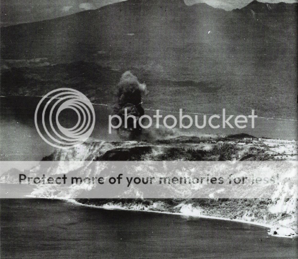 Finally, here is a coarse photo showing a cloud of smoke similarly dark and rising; maybe it would soon reach much higher and resemble the one we are discussing. At first I thought that the photo looked to the southeast and the location of this explosion might have been in the upper part of Cheney Ravine. But I noticed that the faintly visible distant shoreline in the background tapers downward to the right, and resembles Bataan more than, say, Ternate. If true, this could not be Cheney Ravine. 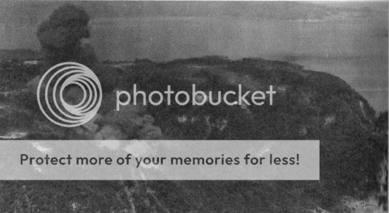 |
|
|
|
Post by fots2 on Jun 16, 2019 11:09:59 GMT 8
Hi Chad,
This photo is indeed much clearer, thank-you. The explosion does appear to be past Wheeler Point as you mention but I cannot accurately determine the location. There are many craters in the area so any of them could have been caused by this bomb (I assume).
The last photo is interesting. I will have a more detailed look at it when I get some time.
|
|
|
|
Post by cbuehler on Jun 16, 2019 23:25:24 GMT 8
These photos, especially the last one shown creating a landslide, are quite massive as I mentioned; as if they were purposely prepared. Unless they were initiated by aerial bombs. I have difficulty thinking these were accidently caught on film and the plane which took them was prepared and waiting to photograph the results.
CB
|
|
|
|
Post by beirutvet on Jun 18, 2019 0:05:03 GMT 8
Hello Fots2
You seem to be correct. With Chadhill's better photo the explosion does appear to be farther northwest of Wheeler but maybe not quite as far as Cheney. I see on my map a building numbered 126 and listed as a powder storehouse and 125 as an oil house. Do you think this explosion could be a direct hit on one of those?
|
|
|
|
Post by fots2 on Jun 18, 2019 15:20:01 GMT 8
Hi beirutvet,
The only map where buildings 125 and 126 are shown is the 1921 map. They do not appear on the 1932, 1935 or 1936 maps. It was not unusual for some buildings to be removed over the years. I doubt building 126 was the source of the explosion but good suggestion though.
|
|


