Post by fots2 on Apr 9, 2009 0:14:55 GMT 8
Today I took the morning boat to Corregidor so by the time I was ready to walk it was nearly 11am. Since only a half day, I wanted to take some current photos of the Tailside trenches for okla that were mentioned in a thread recently.
After walking around Malinta Hill via the South Shore Road, I turned east into the jungle. Later I was farther south between Malinta Hill and the 92nd Garage area.
The weather is very hot now but I have never had such good visibility on the ground due to baked dead grass. After only one minute I came across a concrete structure facing north-south. It is 38 meters long in three connected sections. The downhill side has a prominent gravel mound all along it and there is an old road below, perfect view and position.
Since this structure reminded me a one I had not seen for years, I walked a little north to the other one. It is above part of the North Shore Road and is a total of 25 meters long. The shape is irregular and the east end is partially destroyed.
Wandering around this area I saw lots of big craters and also a couple of semi-circular elongated shapes in the ground similar to crude defensive positions.
Continuing on I came to the water tank which is above the pump station. This station is beside the road heading to the Malinta Tunnel East entrance. Since I could see quite well through the undergrowth I walked west along the road even though it was not my intended direction. Beside the trail heading down to the 92nd Garage area is a long third structure. This one is slightly curved but roughly similar to the second one. It is 37 meters long. A small portion of one wall has collapsed.
I was ready to turn around when I noticed an old road going south that you would never see if the undergrowth was green and alive. I walked in here a short distance and guess what, a forth structure. The undergrowth here is thick with those bushes with needles that rip the flesh from your bones. This one is long, 58 meters and almost a �J� shape with much of it along the top of a ridge. The structure runs south and then east. It ends parallel to the coastal cliff between 92nd garage area and Malinta Hill south east corner. It took me almost forty-five minutes to cut my way to the end above the cliff�damn bushes!
There are a couple unusual features here including one fourteen meter section with a roof. There are openings in the wall facing north.
I must admit that exploring this area seemed pointless in the past as I did not think anything of interest would be here. Not so. None of these structures may be new to some of you but I had fun exploring them.
At the time I was guessing these were some of the old 1920s and 30s �X-X-X� positions you see all over the island. I was surprised to find out tonight that I cannot find any of these structures marked on the maps I have.
Now I am thinking they were part of an elaborate drainage system but there is no visible system feeding them plus the first one has the ends blocked. If even simple road crossings are recorded then why not these elaborate structures. Why the roof on top of a ridge? So the rain water does not get wet?
Does anyone know for sure? They would make good defensive positions.
I took GPS waypoints of the ends of all the structures and I will ask Mapmaster to place them on a map we can all see after I get back home. Someday when I have time I will create a post with photos, sketches of each structure and the map. Ignore the poor quality of many photos as it was mid day with harsh light. I am just trying to capture what I saw for you guys.
Today I never made it to even RJ-43. The next two days I have other plans but I will continue to the trenches for okla this trip.
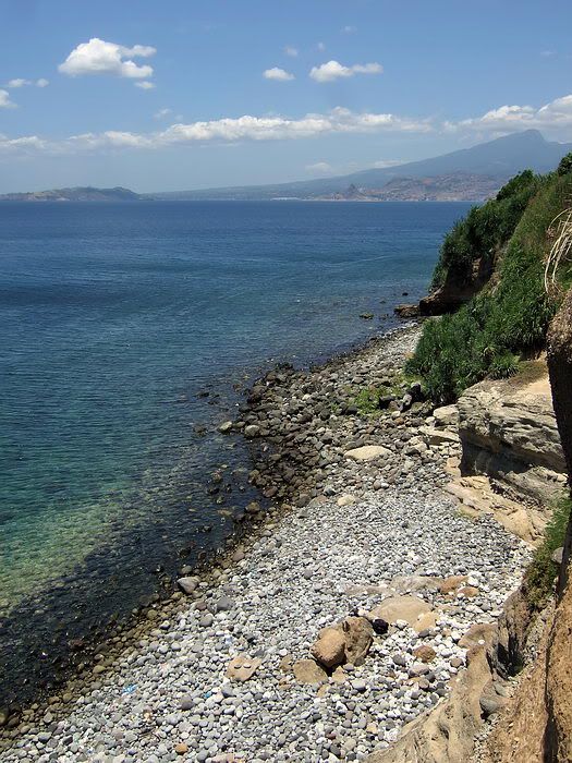
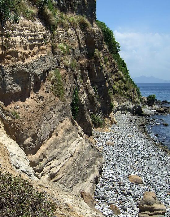
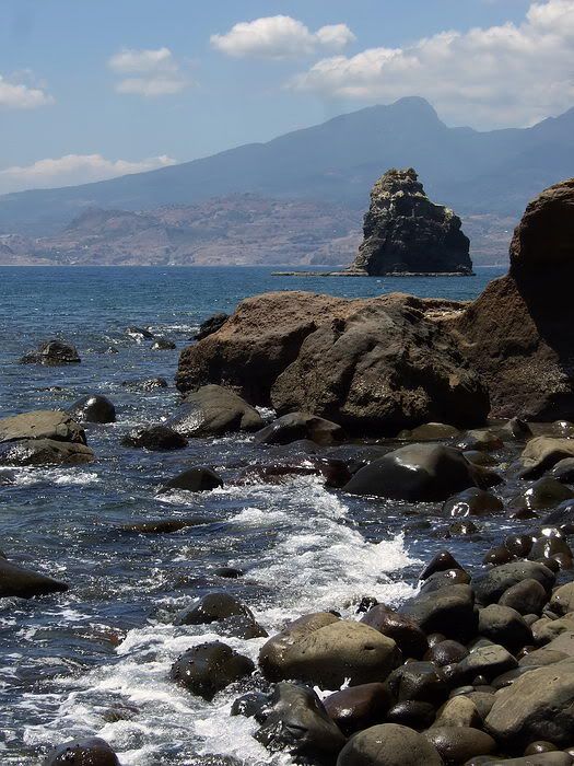
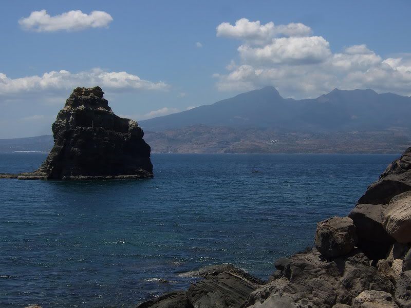
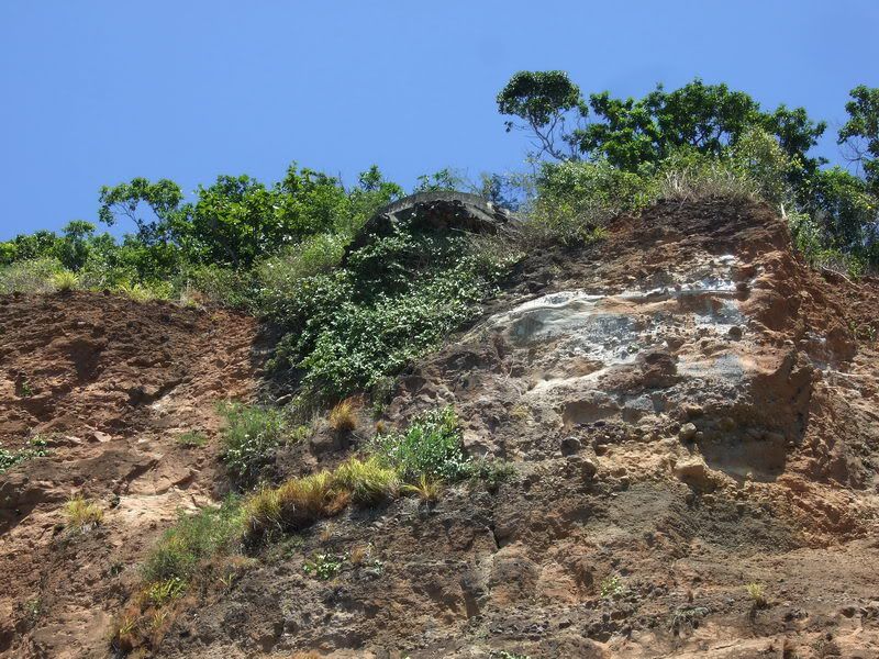
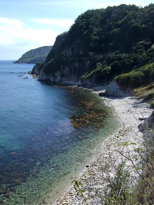
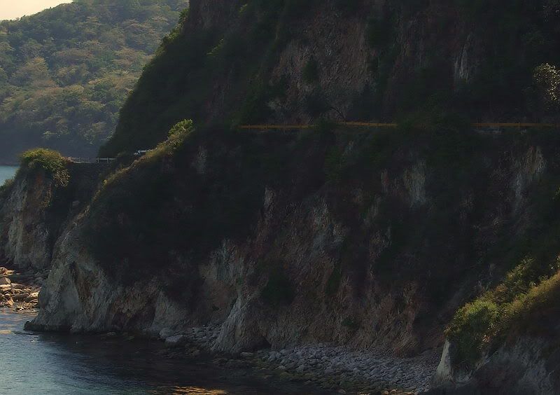
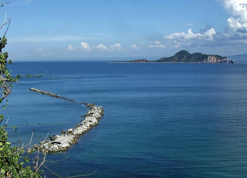
Here are a few coast views you don�t see very often.
NOTE: trench photos are located in the April 17th message below.
fots2
After walking around Malinta Hill via the South Shore Road, I turned east into the jungle. Later I was farther south between Malinta Hill and the 92nd Garage area.
The weather is very hot now but I have never had such good visibility on the ground due to baked dead grass. After only one minute I came across a concrete structure facing north-south. It is 38 meters long in three connected sections. The downhill side has a prominent gravel mound all along it and there is an old road below, perfect view and position.
Since this structure reminded me a one I had not seen for years, I walked a little north to the other one. It is above part of the North Shore Road and is a total of 25 meters long. The shape is irregular and the east end is partially destroyed.
Wandering around this area I saw lots of big craters and also a couple of semi-circular elongated shapes in the ground similar to crude defensive positions.
Continuing on I came to the water tank which is above the pump station. This station is beside the road heading to the Malinta Tunnel East entrance. Since I could see quite well through the undergrowth I walked west along the road even though it was not my intended direction. Beside the trail heading down to the 92nd Garage area is a long third structure. This one is slightly curved but roughly similar to the second one. It is 37 meters long. A small portion of one wall has collapsed.
I was ready to turn around when I noticed an old road going south that you would never see if the undergrowth was green and alive. I walked in here a short distance and guess what, a forth structure. The undergrowth here is thick with those bushes with needles that rip the flesh from your bones. This one is long, 58 meters and almost a �J� shape with much of it along the top of a ridge. The structure runs south and then east. It ends parallel to the coastal cliff between 92nd garage area and Malinta Hill south east corner. It took me almost forty-five minutes to cut my way to the end above the cliff�damn bushes!
There are a couple unusual features here including one fourteen meter section with a roof. There are openings in the wall facing north.
I must admit that exploring this area seemed pointless in the past as I did not think anything of interest would be here. Not so. None of these structures may be new to some of you but I had fun exploring them.
At the time I was guessing these were some of the old 1920s and 30s �X-X-X� positions you see all over the island. I was surprised to find out tonight that I cannot find any of these structures marked on the maps I have.
Now I am thinking they were part of an elaborate drainage system but there is no visible system feeding them plus the first one has the ends blocked. If even simple road crossings are recorded then why not these elaborate structures. Why the roof on top of a ridge? So the rain water does not get wet?

Does anyone know for sure? They would make good defensive positions.
I took GPS waypoints of the ends of all the structures and I will ask Mapmaster to place them on a map we can all see after I get back home. Someday when I have time I will create a post with photos, sketches of each structure and the map. Ignore the poor quality of many photos as it was mid day with harsh light. I am just trying to capture what I saw for you guys.
Today I never made it to even RJ-43. The next two days I have other plans but I will continue to the trenches for okla this trip.
Here are a few coast views you don�t see very often.
NOTE: trench photos are located in the April 17th message below.
fots2


 ?) about 20 years ago and it showed scuba divers being able to still scavenge a few of the coins with not too much effort. it didnt appear that they had found a bonanza, but still did manage to scrounge up a few pieces of the silver. might not have even been worth the effort monetary wise, but made for an interesting junket. i gotta believe that a few pesos remain. from accounts i have read, that toward the end of the "dumping" project that the crates were broken open and the silver was scattered, hoping to make recovery even harder for the japanese. i have also read that the enemy used US navy divers,etc to work in the recovery process after corregidor tossed in the towel. have also read, that even later, dredges were used by the japs and even still later after the war that the philippine government made extra ordinary efforts to find as much of their treasury as possible. aside from all that, it is still a striking photo. thanks much, for the additional trench information. as i have said before, i certainly envy you people who can hop on a boat and make runs out to corregidor and drive from san fernando down into bataan and prowl to your hearts content.