|
|
Post by chadhill on Jan 9, 2011 1:49:20 GMT 8
 (newsclip: Dana Ribble) First Lieutenant Stanley O. Friedline, O-389550 1919-1942 Van Zandt County, Texas KIA 29 April 1942, in Searchlight # 8 tunnel with five of his men from the pom-pom gun crew. The American Battle Monuments Commission states burial place is the Manila American Cemetery: Plot A, Row 2, Grave 90. Curiously, a website for Van Zandt County cemeteries lists Friedline at Woodside Cemetery, near the intersection of North FM Road 17 and US Highway 80 in Grand Saline, Texas. But I assume there must be only a memorial for him there. |
|
|
|
Post by EXO on Jan 9, 2011 12:16:42 GMT 8
|
|
|
|
Post by chadhill on Jan 9, 2011 12:41:57 GMT 8
You're welcome, EXO. That link you provided is another one of the many great reads at this website.
|
|
|
|
Post by fots2 on Jan 10, 2011 8:36:33 GMT 8
That is a good link EXO. It gives me a few ideas.  |
|
|
|
Post by chadhill on Feb 27, 2011 0:58:42 GMT 8
More 1945 photos:   |
|
|
|
Post by fots2 on Feb 27, 2011 1:39:28 GMT 8
Good photos Chad.
The first one must have been taken some time after the end of the fighting since Malinta's west entrance is cleaned up so well. The damaged concrete remained looking like that until the 1970s.
|
|
|
|
Post by chadhill on Feb 27, 2011 5:09:35 GMT 8
Thanks, Fots. The second photo struck me for several reasons. First, the structure on top in the center...one of the 75mm shelters?  Below this structure, along the North Shore Road, are two openings. Is this where the two hospital entrances were?  There also seem to be a number of openings along the shoreline. Thanks, Chad |
|
|
|
Post by fots2 on Feb 27, 2011 10:11:52 GMT 8
Hi Chad,
I think all three 75mm gun shelters are accounted for. They are all further north along the top of Malinta Hill. This rectangular thing is at the dip in the ridge where no concrete ruins are today. The II-S-1 position is at the top of the southern cliff so it is not that either. I do not know what this was.
Your second zoomed photo (SW corner of Malinta Hill) is in the exact location of two of the five Navy Tunnels. These are the two that we can still visit today. My best guess is that these are Roger and Queen. One of them is the original Malinta Storage System south entrance as shown on the 1934 plan.
The two Hospital entrances are on the north side of Malinta Hill. Both are mostly undamaged and still there today.
Along the shoreline is certainly a good location for finding caves. None appear to be in this photo’s view today but just around the corner to the east are two caves that may have been Shinyo boat caves.
I walked the South Shore road around Malinta Hill twice earlier this week. The 40 rifle grenades were found in this area last month. Lots of surprises are left on this island yet.
|
|
|
|
Post by chadhill on Feb 27, 2011 12:21:11 GMT 8
Thanks for the reply, Fots. I know that the hospital entrances are on the north side, but the photo, by a sergeant from the "673rd Replacement Company, 1945" was captioned: "Malinta Hill, from the north. The cut in hill is road. Note small caves on hill above road. These hold two inch rifles. To the left is the Japanese invasion beach". Some of the caption on the back of the photo can be seen bleeding through. I must admit that I was scratching my head while looking at my pictures from the 80s, trying to see how this one could be of the north side, but decided to trust the (mistaken) photographer. Thanks for setting me straight...  |
|
|
|
Post by fots2 on Feb 27, 2011 19:59:43 GMT 8
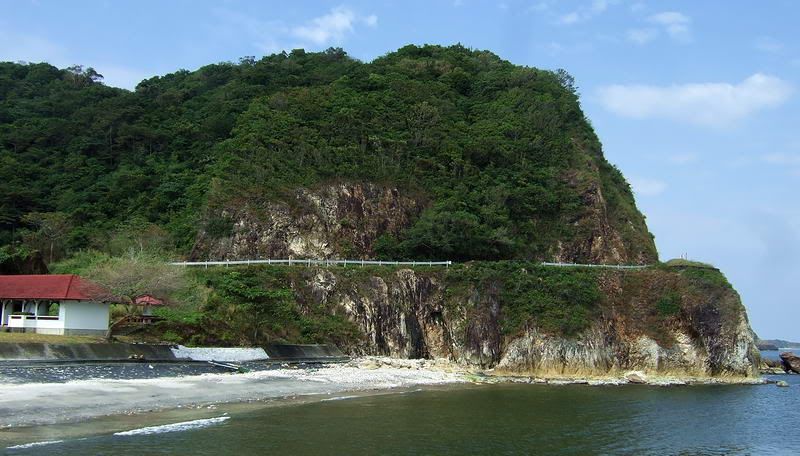
I do the same thing you do Chad. We assume the original photographer is correct and most of the time they probably are. Occasionally we know for sure that their label is wrong. Once coming from the left side (north), I climbed up there looking for those tunnels but found nothing. It was relatively easy so I continued up to the top along the south cliff. The old roads are still quite visible up there. Here is a look at this corner of Malinta Hill today.  |
|