Post by fots2 on Nov 5, 2009 18:17:26 GMT 8
During WWII, Battery Boston was manned by the 1st Battalion of the 60th Coast Artillery and consisted of four mobile 3-inch M3 Anti-aircraft guns on M2A2 Spider mounts. The battery was located on a ridge immediately to the south east of Battery Wheeler.
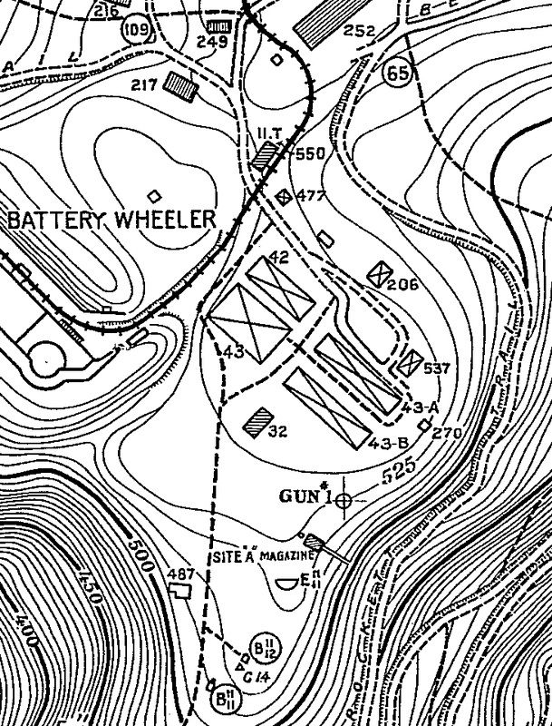
Map of the Battery Boston area.
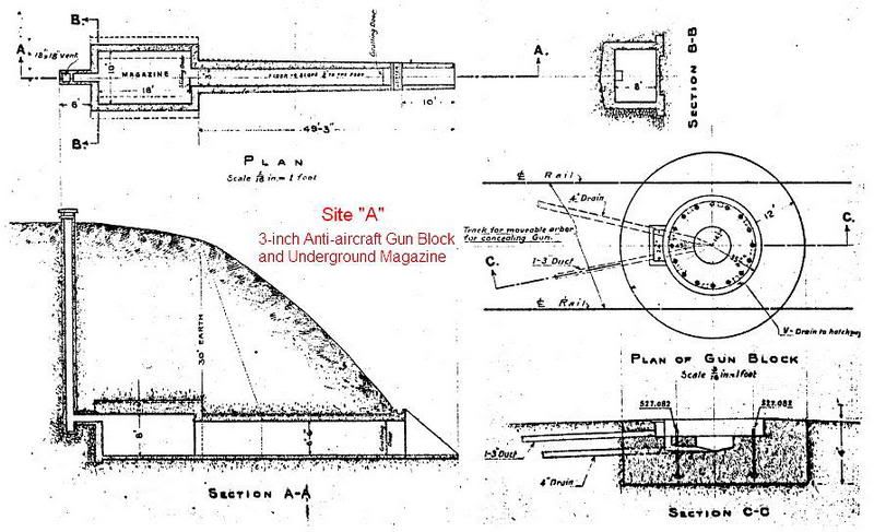
Earlier on this same ridge, anti-aircraft “Site A” was constructed starting in 1917 to repel any slow dirigibles that may carry bombs. A single AA gun block for mounting a 3-inch AA gun and an underground magazine were constructed at that time. During WWII, Battery Boston used the magazine for munitions storage but never utilized the gun block.
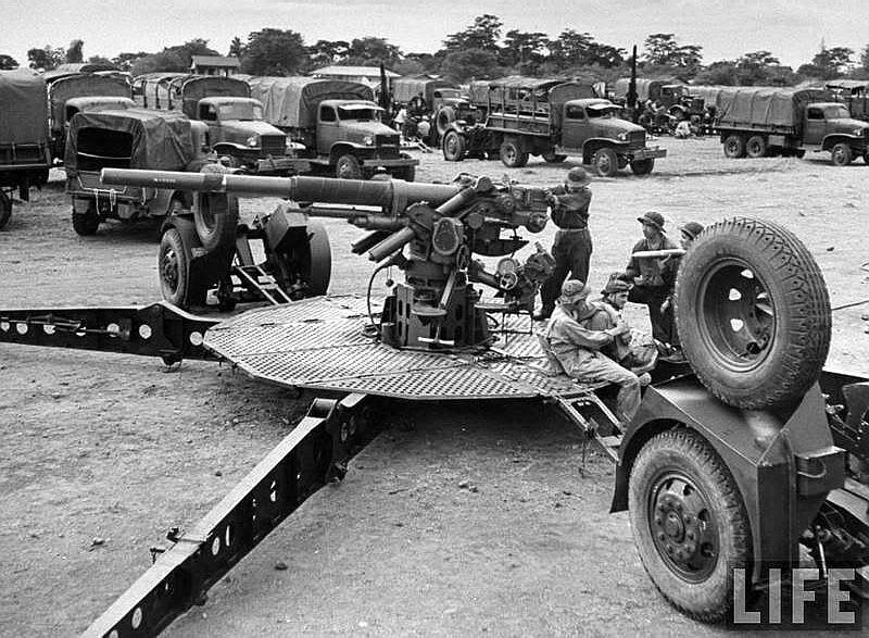
View of what these 3 inch anti-aircraft guns looked like. Note the four stabilizer legs referred to as “spider legs”.
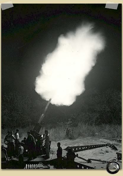
Pre war - Battery Boston night practice

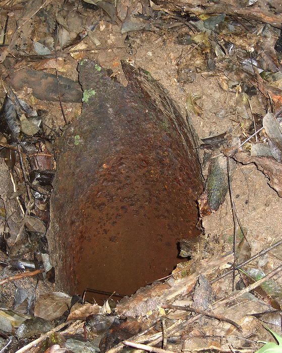
Photo showing one of the 3 inch AA guns destroyed. Note the centre metal pedestal with the oval holes in which the gun is mounted on. Only one of those pedestals remains today.
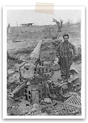
Destroyed AA gun position in 1945. The solitary structure in the moonscape background is the Battery Commander and Plotting station on top of Battery Wheeler.
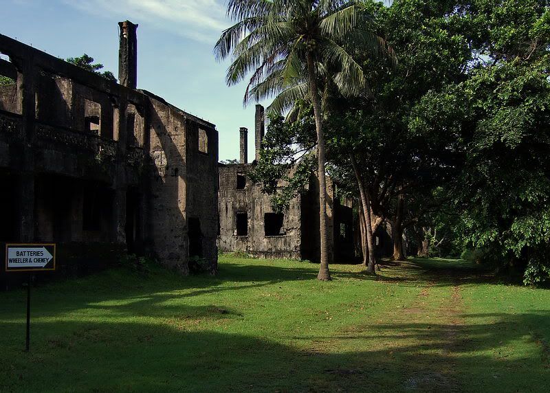
This area was bulldozed after the war so I guess we should be happy that anything remains today. However there are still lots of shell or bomb craters around so perhaps the bulldozer operator was just ‘putting in time’. He did not flatten the area. Note the background in this photo. Looking towards the Parade ground, one of the Senior Officers Quarters is to the right, Mile Long Barracks just left of it and Bataan to the far left.
I have tramped across the former Battery Boston area between Battery Wheeler and the C1 Command Post on a few occasions but it was time to refresh my memory due an upcoming visit. Months ago I was asked by a Corregidor Inn guide as to what I knew about Battery Boston. They had received an e-mail from someone coming to visit in October of this year and he had specific questions and requests. Thanks to batteryboy’s assistance, they received as much information as we can provide along with current travel details.
So who are these gents and why are they interested? Both of them are from the U.S. One of them is the grandson of a soldier of the 60th Coast Artillery who was assigned to Battery Boston gun #2 (and later wounded there). He is interested to know details such as where his grandfather fought.
The other person, a US Marine during WWII, was posted to Fort Hughes (Caballo Island) for awhile and later transferred to the Cavite Naval Yard. He was present when the Yard was bombed by the Japanese in 1942 and later a POW at Bilibid Prison and Cabanatuan. They will arrive in two days.
On arriving at Corregidor October 17th for a six day visit, I geared up with the intention of bumming a ride up to the Topside flagpole. On speaking with the hotel guides they wanted to come along and would provide transportation. Away we went. Fifteen minutes later, we were close to battery Wheeler.

Spanish Flagpole
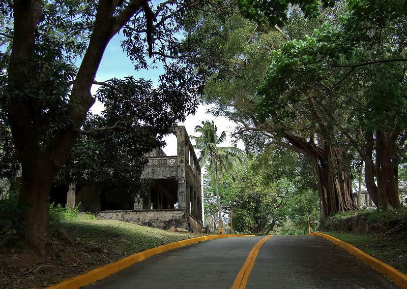
From the flagpole, the first part of the walk takes you past a few of the Senior Officer’s Quarters. (The big brass had fireplaces and chimneys so they could survive those cool Corregidor nights).
Just before arriving at Battery Wheeler, we entered the jungle to the left which is the ridge on which Battery Boston was located.
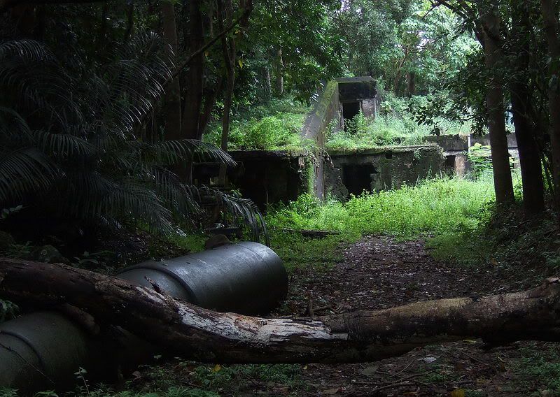
Cloudy and rainy season view of the approach to Battery Wheeler. The spare 12-inch barrel is in the foreground. I am standing on the old trolley line which is today’s road to the Battery.
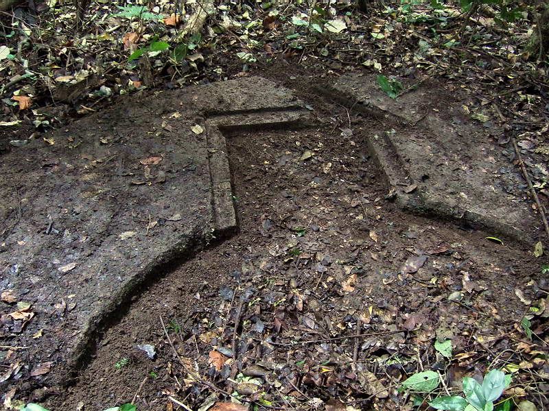
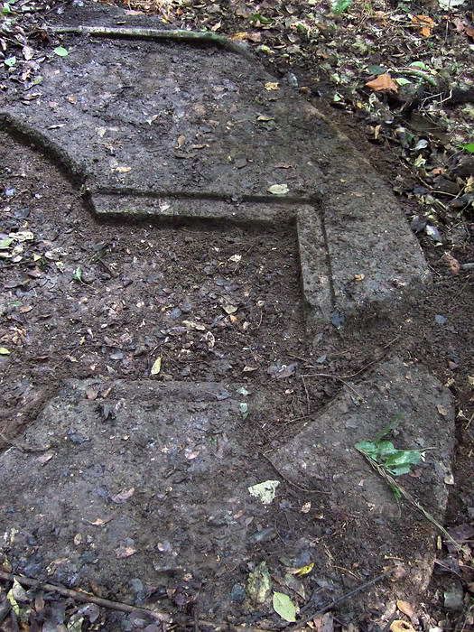
The only known remaining gun position was #1. It had recently been cleared of vegetation by these guides only days ago to prepare for the visit. We wandered around the whole area even down to C1 and the guides have their act together. No need for me to be there now but I will still meet the two gentlemen for dinner the day they arrive.
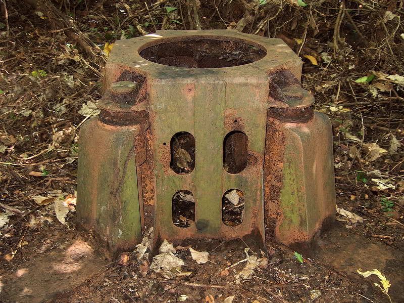
The recently cleaned out Battery Boston gun #1 position with its 3-inch AA gun mount. A circular mound of dirt still about three feet high surrounds the metal gun mount. It is difficult to photograph, but there are four equally spaced “notches” in this mound to accommodate the spider legs.
After the guides left, I had the rest of the afternoon to kill so I decided to wander around some more.
There is a hand-drawn sketch of the layout of Battery Boston during WWII. I have no idea who created it. It is rough and definitely incorrect in places but it shows detail that I have never seen anywhere else.

Sketch of the layout of Battery Boston
On the sketch, there is a “Director” position which was located up on the ridge behind Battery Wheeler. It is larger than I expect would be necessary for an AA battery so I wonder if the structure had a previous use. It still has a large raised platform with a concrete pad for mounting range and direction finding equipment. To one side, there is a circular blast type hole in the roof.
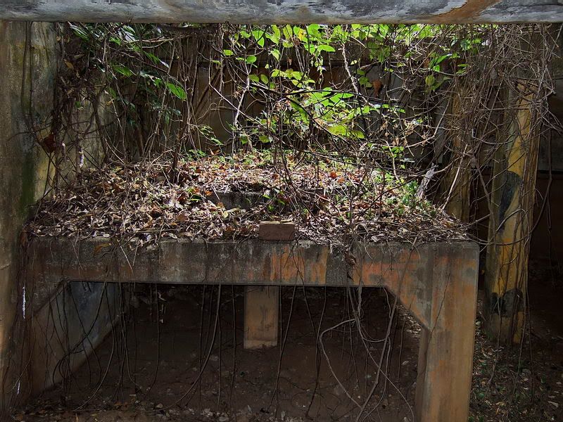
Elevated platform with a round concrete pad on top. The roof is open above the platform but I assume there must have been a wooden roof section here for weather protection.
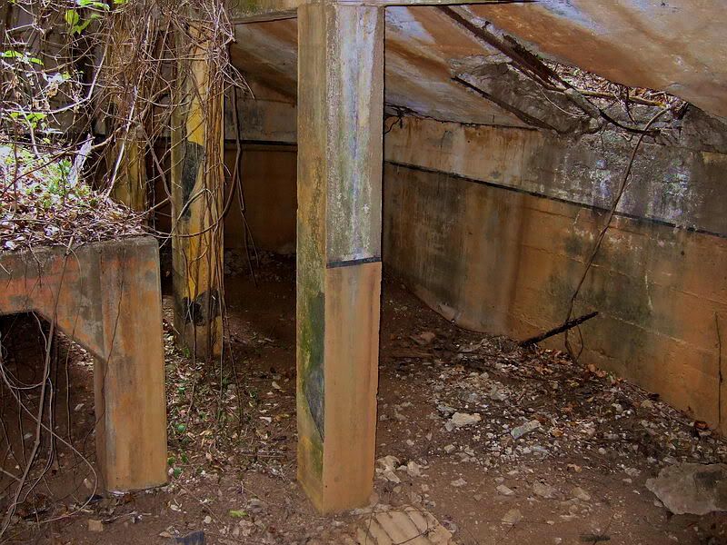
Interior view of the Director position. Camo paint scheme is still visible in the pillars. Note the blast hole visible in the roof.
Another interior view with a blast hole visible in the roof.
One of the two Battery Boston power generator buildings. (The other one beside the trolley line is gone now).

Interior view of the generator building. Note the brick floor.
Rusted exhaust pipe at the top of the generator building
Near one of the generator buildings is the Battery Office which is labeled Q217 on the sketch. Previous to Battery Boston taking it over, building 217 was labeled on maps as ‘N.C.O. Quarters’.
All that remains of the wooden Building 217 is the concrete foundation.
Building 550 was an ‘Ordnance Magazine’. Although the map shows it of concrete construction, again only the foundation remains.
Most surface buildings in this area were of wood or galvanized iron construction. With the exception of the kitchen, not a single wall is standing. All that remains today are either intact or destroyed concrete foundations. Since they basically all look alike, I will add only a couple more photos of them to give you an idea of what you will see there.
Corner of building 43-B (Gun shed).
This is a view of a short section of the newly cut hiking trail from Battery Wheeler to the C1 Command Post. It is very flat here due to the fact that you are walking on the concrete floor of a large gun shed. Kicking a few inches of soil and vegetation away will reveal the concrete.
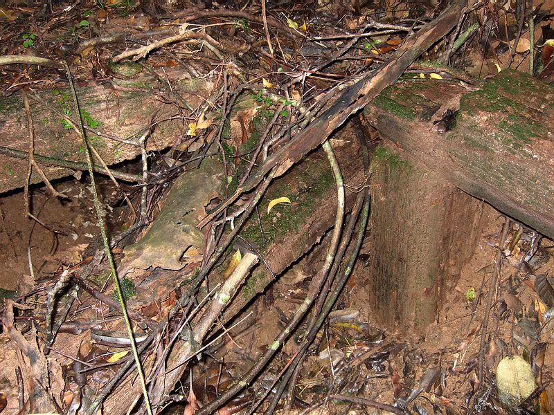
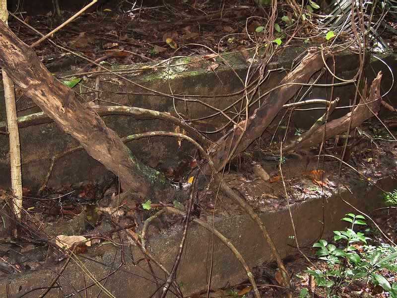
This appears to be perhaps and old destroyed bunker. It is constructed out of rail ties and held together by spikes. A small side section is covered with soil and goes underground a few feet.
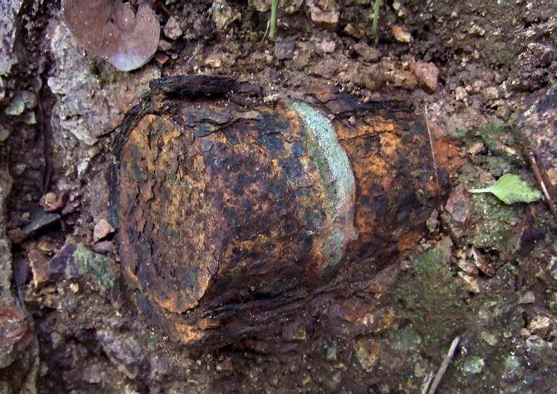
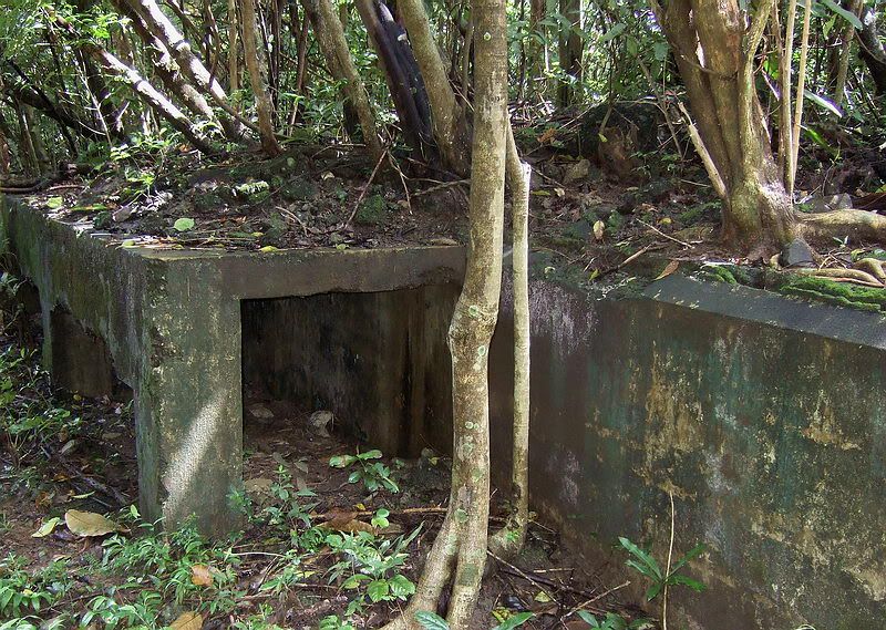
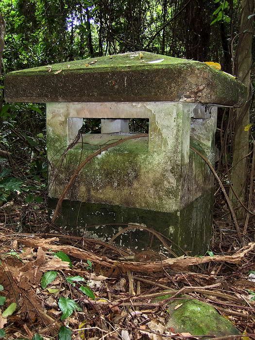
View of the “Site A” 3-inch AA keyhole gun block. It was one of the four AA gun positions which were built on Corregidor starting in 1917. Battery Boston never used this fixed gun block.
Another view of the partially cleared off gun block.
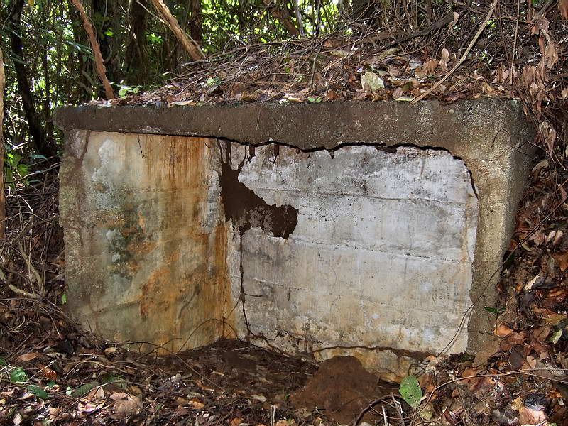
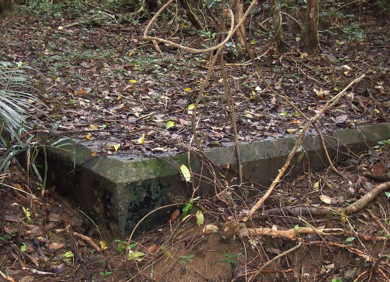
Thirty feet away from the gun block is this concrete shelter. There are no hinges so it may never have had a door.
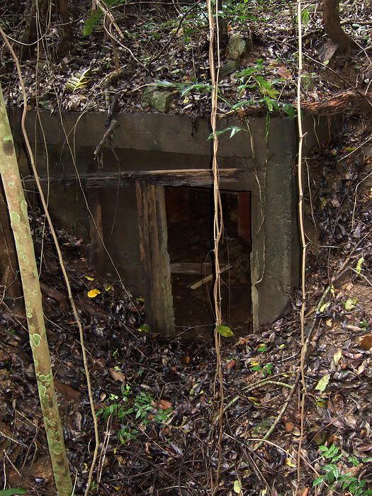
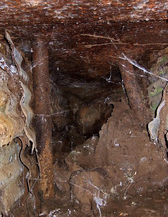
Along with the gun block, an underground magazine was also constructed at that time. This was used by Battery Boston to store ammunition for its AA guns.
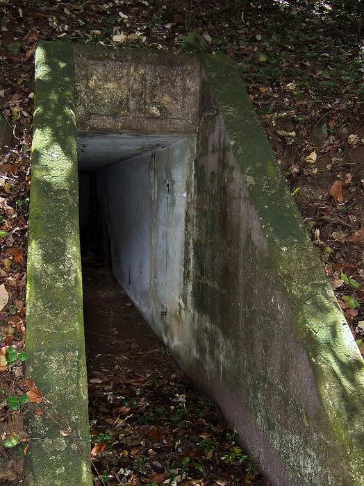
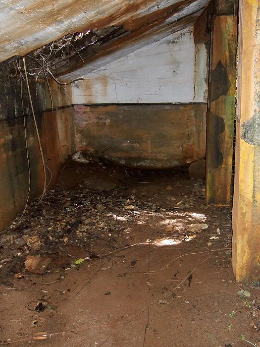
Outside view of the entrance to the magazine.
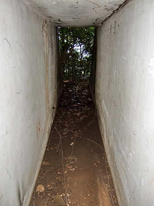
The passageway looking back towards the entrance.
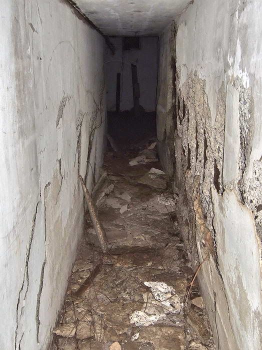
Looking further inside towards the magazine room.
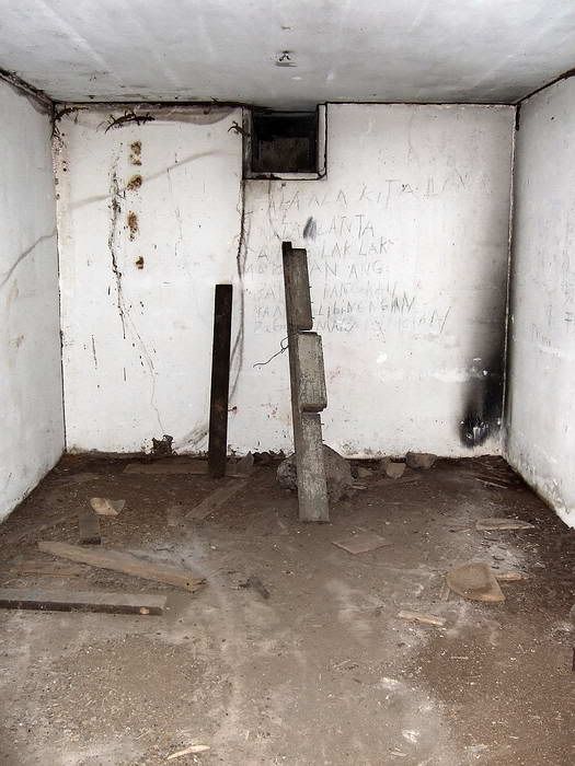
Inside the magazine room. A square air vent is at the top centre of the rear wall.

Inside the magazine room looking towards the entrance.
Reinforced concrete protection over the air vent above the magazine.
Here is something a little unusual. I decided to search for the gun #2 position of Battery Boston since this is really what the visitors wanted to see. Using the low resolution hand-drawn sketch, I had a ball park idea of where the gun position was located.
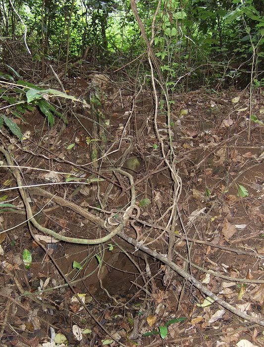
With gun #1 position as my starting point, I set the GPS to take me in the rough direction of gun position #2. Within a couple minutes I came to a large ring/circular mound of dirt 49 metres (156 ft) from gun #1. The centre of the circular mound is flat and has no metal gun mount, only vines and small trees. There are rusted upright 50 gallon fuel drums filled with rocks outside the ring plus scraps of corrugated sheet metal are lying around. I have seen this before and dismissed it as just another infantry defensive position. The easiest way past it was to go through it.
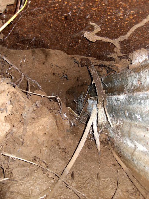
When I was inside and walking toward the far side of the ring, I noticed a small dark area a few inches across at the base of the dirt mound in front of me. Not wanting to stick my nose into a place that might be occupied, I kicked at it on the way by. My foot went right into the hole.
Ok, this was worth a second glance. I cleared away the hole and looked inside with my light. I was pretty sure I had found what I was looking for even though there is no centre metal pedestal. It is gone now but I have been told that all four gun positions did have them.
After a few minutes I found two more holes. Two days later I went back to clear the position better so the visitors could take photos and I found the fourth one.
I will try to describe what these are. The holes are actually the entrances to small horizontal tunnels. These four small tunnels (90 degrees apart when viewed from the centre) were constructed for the AA gun’s spider stabilizer legs. They are almost 2 feet wide, 2 feet or so high and go in at least 18 feet (very rough estimate there). Only one of these small tunnels is open enough when you stick your nose down there to see far inside.
The roof is made of ¼ in steel which is very rusted and even flaking near the entrance now. Both sides are made of corrugated steel or iron sheets that appear to taper together at the far end. Near the middle on each side of these little tunnels are 1 inch diameter steel rods supporting the roof. In the little tunnel closest to the new trail, there is a larger steel rod near the entrance so maybe they all had this at one time.
My dinky little pocket camera had no idea what to focus on when I stuck it inside the narrow tunnel. With that and dozens of unhappy ants I had to kneel on, the photos are not great but good enough to give you an idea of what these little tunnels look like.
A view of the first little tunnel I found after clearing away the roots, branches and leaves. You can see corrugated metal on the left hand side.
View inside the same little tunnel. It is mostly full of debris but you can distinguish the corrugated metal side and rusted sheet metal roof.
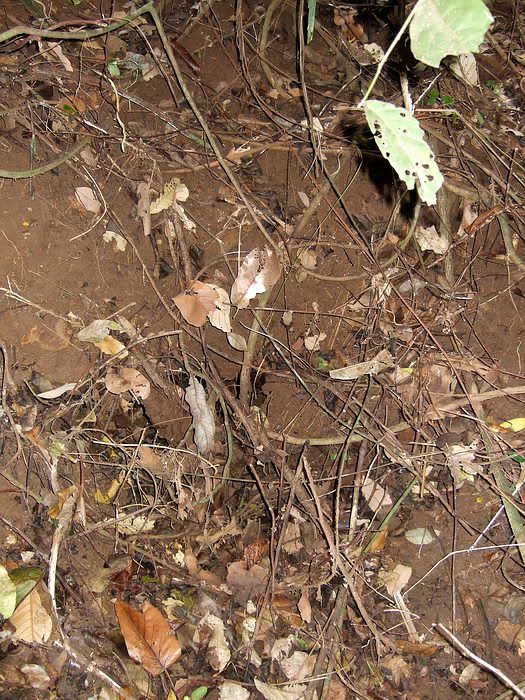
This photo shows one of the little tunnels after only clearing away the larger branches and roots. I could see gaps in the soil near the centre of the photo so I knew something was here also.
This is the same little tunnel seen above after clearing away the roots and leaves. The jagged roof is actually very rusted and flaking metal. Corrugated metal can also be seen to the left.

This is the most intact little tunnel showing both sides and the roof. One inch diameter
rods support the roof on both sides.
A closer view of the rods but the end is too far away to be clearly seen. The white streaks in the photo are spider webs illuminated by the camera’s flash.
Due to possible bad weather, Sun Cruises had a large group cancel their trip which meant that the ferry was cancelled the next day. The two guys from the US did the day tour plus a special trip to see the Battery Boston area. I had earlier let the guides know where gun position #2 was so they could show them. Later that day, the visitors wisely returned to Manila to continue their Philippines itinerary and not get stranded on Corregidor. Unfortunately I did not get to meet them but the important thing is that they got to see what they came for.
As for guns positions #3 and #4, according to the sketch, both were located over near the underground magazine. I don’t think anyone had found any traces of them. On the second day I spent lots of time walking the area and there is a 30% chance that I found another one. The circular mound, its size and flat inside etc suggest it may be one of the positions but there is zero evidence such as a pedestal, mini tunnels or notches for the spider legs. There is crumpled scrap metal around but that can be seen everywhere.
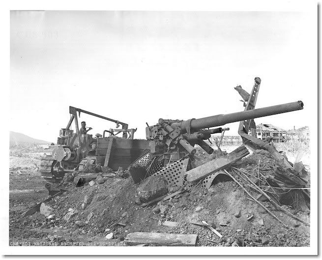
The old photo of the bulldozer at one of the gun positions may mean that the fourth position cannot be found due to it being demolished years ago.
If you quickly walk along this ridge you will see very little except craters, some defensive positions and remnants of foundations. You may think there is little of interest here. Using a good map and taking some time to explore uncovers as much history here as anywhere else on the island.
Walking back to the Corregidor Inn at the end of the day, I turned around to get a final shot of one of the Senior Officer’s Quarters.

Map of the Battery Boston area.
Earlier on this same ridge, anti-aircraft “Site A” was constructed starting in 1917 to repel any slow dirigibles that may carry bombs. A single AA gun block for mounting a 3-inch AA gun and an underground magazine were constructed at that time. During WWII, Battery Boston used the magazine for munitions storage but never utilized the gun block.
View of what these 3 inch anti-aircraft guns looked like. Note the four stabilizer legs referred to as “spider legs”.
Pre war - Battery Boston night practice
Photo showing one of the 3 inch AA guns destroyed. Note the centre metal pedestal with the oval holes in which the gun is mounted on. Only one of those pedestals remains today.
Destroyed AA gun position in 1945. The solitary structure in the moonscape background is the Battery Commander and Plotting station on top of Battery Wheeler.
This area was bulldozed after the war so I guess we should be happy that anything remains today. However there are still lots of shell or bomb craters around so perhaps the bulldozer operator was just ‘putting in time’. He did not flatten the area. Note the background in this photo. Looking towards the Parade ground, one of the Senior Officers Quarters is to the right, Mile Long Barracks just left of it and Bataan to the far left.
I have tramped across the former Battery Boston area between Battery Wheeler and the C1 Command Post on a few occasions but it was time to refresh my memory due an upcoming visit. Months ago I was asked by a Corregidor Inn guide as to what I knew about Battery Boston. They had received an e-mail from someone coming to visit in October of this year and he had specific questions and requests. Thanks to batteryboy’s assistance, they received as much information as we can provide along with current travel details.
So who are these gents and why are they interested? Both of them are from the U.S. One of them is the grandson of a soldier of the 60th Coast Artillery who was assigned to Battery Boston gun #2 (and later wounded there). He is interested to know details such as where his grandfather fought.
The other person, a US Marine during WWII, was posted to Fort Hughes (Caballo Island) for awhile and later transferred to the Cavite Naval Yard. He was present when the Yard was bombed by the Japanese in 1942 and later a POW at Bilibid Prison and Cabanatuan. They will arrive in two days.
On arriving at Corregidor October 17th for a six day visit, I geared up with the intention of bumming a ride up to the Topside flagpole. On speaking with the hotel guides they wanted to come along and would provide transportation. Away we went. Fifteen minutes later, we were close to battery Wheeler.
Spanish Flagpole
From the flagpole, the first part of the walk takes you past a few of the Senior Officer’s Quarters. (The big brass had fireplaces and chimneys so they could survive those cool Corregidor nights).
Just before arriving at Battery Wheeler, we entered the jungle to the left which is the ridge on which Battery Boston was located.
Cloudy and rainy season view of the approach to Battery Wheeler. The spare 12-inch barrel is in the foreground. I am standing on the old trolley line which is today’s road to the Battery.
The only known remaining gun position was #1. It had recently been cleared of vegetation by these guides only days ago to prepare for the visit. We wandered around the whole area even down to C1 and the guides have their act together. No need for me to be there now but I will still meet the two gentlemen for dinner the day they arrive.
The recently cleaned out Battery Boston gun #1 position with its 3-inch AA gun mount. A circular mound of dirt still about three feet high surrounds the metal gun mount. It is difficult to photograph, but there are four equally spaced “notches” in this mound to accommodate the spider legs.
After the guides left, I had the rest of the afternoon to kill so I decided to wander around some more.
There is a hand-drawn sketch of the layout of Battery Boston during WWII. I have no idea who created it. It is rough and definitely incorrect in places but it shows detail that I have never seen anywhere else.
Sketch of the layout of Battery Boston
On the sketch, there is a “Director” position which was located up on the ridge behind Battery Wheeler. It is larger than I expect would be necessary for an AA battery so I wonder if the structure had a previous use. It still has a large raised platform with a concrete pad for mounting range and direction finding equipment. To one side, there is a circular blast type hole in the roof.
Elevated platform with a round concrete pad on top. The roof is open above the platform but I assume there must have been a wooden roof section here for weather protection.
Interior view of the Director position. Camo paint scheme is still visible in the pillars. Note the blast hole visible in the roof.
Another interior view with a blast hole visible in the roof.
One of the two Battery Boston power generator buildings. (The other one beside the trolley line is gone now).
Interior view of the generator building. Note the brick floor.
Rusted exhaust pipe at the top of the generator building
Near one of the generator buildings is the Battery Office which is labeled Q217 on the sketch. Previous to Battery Boston taking it over, building 217 was labeled on maps as ‘N.C.O. Quarters’.
All that remains of the wooden Building 217 is the concrete foundation.
Building 550 was an ‘Ordnance Magazine’. Although the map shows it of concrete construction, again only the foundation remains.
Most surface buildings in this area were of wood or galvanized iron construction. With the exception of the kitchen, not a single wall is standing. All that remains today are either intact or destroyed concrete foundations. Since they basically all look alike, I will add only a couple more photos of them to give you an idea of what you will see there.
Corner of building 43-B (Gun shed).
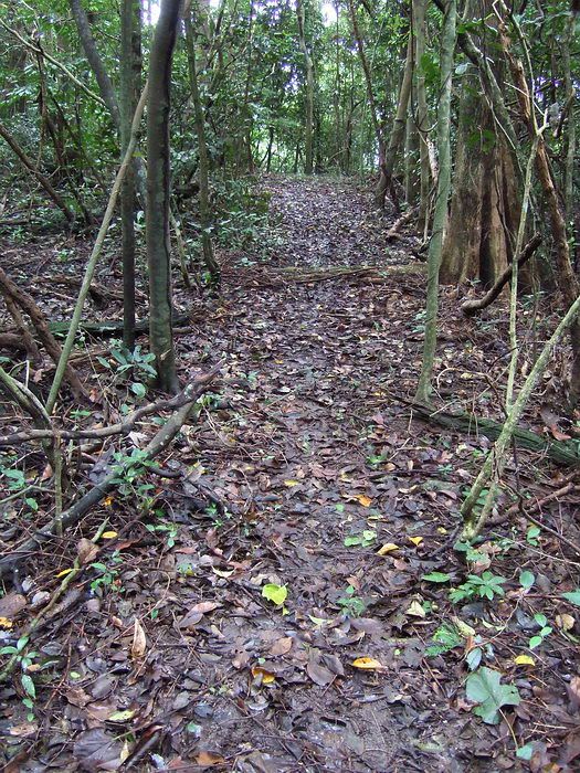
This is a view of a short section of the newly cut hiking trail from Battery Wheeler to the C1 Command Post. It is very flat here due to the fact that you are walking on the concrete floor of a large gun shed. Kicking a few inches of soil and vegetation away will reveal the concrete.
This appears to be perhaps and old destroyed bunker. It is constructed out of rail ties and held together by spikes. A small side section is covered with soil and goes underground a few feet.
View of the “Site A” 3-inch AA keyhole gun block. It was one of the four AA gun positions which were built on Corregidor starting in 1917. Battery Boston never used this fixed gun block.
Another view of the partially cleared off gun block.
Thirty feet away from the gun block is this concrete shelter. There are no hinges so it may never have had a door.
Along with the gun block, an underground magazine was also constructed at that time. This was used by Battery Boston to store ammunition for its AA guns.
Outside view of the entrance to the magazine.
The passageway looking back towards the entrance.
Looking further inside towards the magazine room.
Inside the magazine room. A square air vent is at the top centre of the rear wall.
Inside the magazine room looking towards the entrance.
Reinforced concrete protection over the air vent above the magazine.
Here is something a little unusual. I decided to search for the gun #2 position of Battery Boston since this is really what the visitors wanted to see. Using the low resolution hand-drawn sketch, I had a ball park idea of where the gun position was located.
With gun #1 position as my starting point, I set the GPS to take me in the rough direction of gun position #2. Within a couple minutes I came to a large ring/circular mound of dirt 49 metres (156 ft) from gun #1. The centre of the circular mound is flat and has no metal gun mount, only vines and small trees. There are rusted upright 50 gallon fuel drums filled with rocks outside the ring plus scraps of corrugated sheet metal are lying around. I have seen this before and dismissed it as just another infantry defensive position. The easiest way past it was to go through it.
When I was inside and walking toward the far side of the ring, I noticed a small dark area a few inches across at the base of the dirt mound in front of me. Not wanting to stick my nose into a place that might be occupied, I kicked at it on the way by. My foot went right into the hole.
Ok, this was worth a second glance. I cleared away the hole and looked inside with my light. I was pretty sure I had found what I was looking for even though there is no centre metal pedestal. It is gone now but I have been told that all four gun positions did have them.
After a few minutes I found two more holes. Two days later I went back to clear the position better so the visitors could take photos and I found the fourth one.
I will try to describe what these are. The holes are actually the entrances to small horizontal tunnels. These four small tunnels (90 degrees apart when viewed from the centre) were constructed for the AA gun’s spider stabilizer legs. They are almost 2 feet wide, 2 feet or so high and go in at least 18 feet (very rough estimate there). Only one of these small tunnels is open enough when you stick your nose down there to see far inside.
The roof is made of ¼ in steel which is very rusted and even flaking near the entrance now. Both sides are made of corrugated steel or iron sheets that appear to taper together at the far end. Near the middle on each side of these little tunnels are 1 inch diameter steel rods supporting the roof. In the little tunnel closest to the new trail, there is a larger steel rod near the entrance so maybe they all had this at one time.
My dinky little pocket camera had no idea what to focus on when I stuck it inside the narrow tunnel. With that and dozens of unhappy ants I had to kneel on, the photos are not great but good enough to give you an idea of what these little tunnels look like.
A view of the first little tunnel I found after clearing away the roots, branches and leaves. You can see corrugated metal on the left hand side.
View inside the same little tunnel. It is mostly full of debris but you can distinguish the corrugated metal side and rusted sheet metal roof.
This photo shows one of the little tunnels after only clearing away the larger branches and roots. I could see gaps in the soil near the centre of the photo so I knew something was here also.
This is the same little tunnel seen above after clearing away the roots and leaves. The jagged roof is actually very rusted and flaking metal. Corrugated metal can also be seen to the left.
This is the most intact little tunnel showing both sides and the roof. One inch diameter
rods support the roof on both sides.
A closer view of the rods but the end is too far away to be clearly seen. The white streaks in the photo are spider webs illuminated by the camera’s flash.
Due to possible bad weather, Sun Cruises had a large group cancel their trip which meant that the ferry was cancelled the next day. The two guys from the US did the day tour plus a special trip to see the Battery Boston area. I had earlier let the guides know where gun position #2 was so they could show them. Later that day, the visitors wisely returned to Manila to continue their Philippines itinerary and not get stranded on Corregidor. Unfortunately I did not get to meet them but the important thing is that they got to see what they came for.
As for guns positions #3 and #4, according to the sketch, both were located over near the underground magazine. I don’t think anyone had found any traces of them. On the second day I spent lots of time walking the area and there is a 30% chance that I found another one. The circular mound, its size and flat inside etc suggest it may be one of the positions but there is zero evidence such as a pedestal, mini tunnels or notches for the spider legs. There is crumpled scrap metal around but that can be seen everywhere.
The old photo of the bulldozer at one of the gun positions may mean that the fourth position cannot be found due to it being demolished years ago.
If you quickly walk along this ridge you will see very little except craters, some defensive positions and remnants of foundations. You may think there is little of interest here. Using a good map and taking some time to explore uncovers as much history here as anywhere else on the island.
Walking back to the Corregidor Inn at the end of the day, I turned around to get a final shot of one of the Senior Officer’s Quarters.


 It certainly looks like the same flag mast, at least the lower portion. Thanks much, for another superior presentation. Postscript....I think most folks who view your postings would agree that your little "pocket camera" does a first rate job. Without it, we would have no Fantastic Fots Foto Tours. Right?