|
|
Post by The Phantom on Dec 16, 2010 7:14:21 GMT 8
Good job fots.
Looking at the 1932 map and the 1936 map there is no trail going down the way you went down.
That part of the map of Malinta Hill is covered with the insides of Malinta Tunnel overlay-ed on the Hill.
Definitely a trip closer to the dry season.........
Want to look around by the Mast.
You mentioned my trip so I will describe it here, (and hope my wife doesn't read it.)
My trip down a few years ago was from the area above Malinta Tunnel's West Entrance. It is now the observation location to view Bottom-side.
There is a trail marked on my 1936 map going down from that approximate location and coming out on Malinta Point, where you came out.
I walked east from the observation point for a ways and came to a prepared road/trail also covered in obvious fox holes under the tree line.
This trail ended and so I headed for what was to be the area where the trail was located, northwest.
At this point, I started running into trouble, ( I had started this trip at 4:30 in the afternoon and was already tired.)
The hillside got very steep, my only way down was from tree truck to tree trunk, as I descended it got worse and I knew there was no way I could get back up the steep hill. I was committed to downhill all the way.
I saw some concrete markers on the hillside like the ones on Malinta hill, but couldn't get to them.
I realized I was in real trouble because I could see no easy way down and it was getting close to dark.
There was no trail to follow so I headed to a stream bed and determined to go down that way.
The stream bed was all sheer rock and steep, (with what looked like some posts attached to the top in some places, the old trail?)
I had to slid down some steep parts of the stream bed on my butt, jumping to the next level of the bed, several times.
Totally exhausted and soaked in sweat, I came to a level part of the stream bed that headed west out behind the conference center, (near the large barrel).
There was one last peril to overcome for me.
The last part of the stream bed was covered in trees, shrubs, and vines meaning I had to crawl on my hands in knees through a tunnel of low hanging vegetation, a perfect SNAKE area. I hate SNAKES.
I fought my way through and finally came out in grass over my head!
Forcing my way through, I walked slowly to Mac Arthur's just before dark and sat there having a few beers, with a new appreciation for being amongst the living and a healthy respect for what can happen to you on Corregidor if you are not mindful of your surroundings, and your limitations at all times.
|
|
|
|
Post by fots2 on Dec 16, 2010 15:50:47 GMT 8
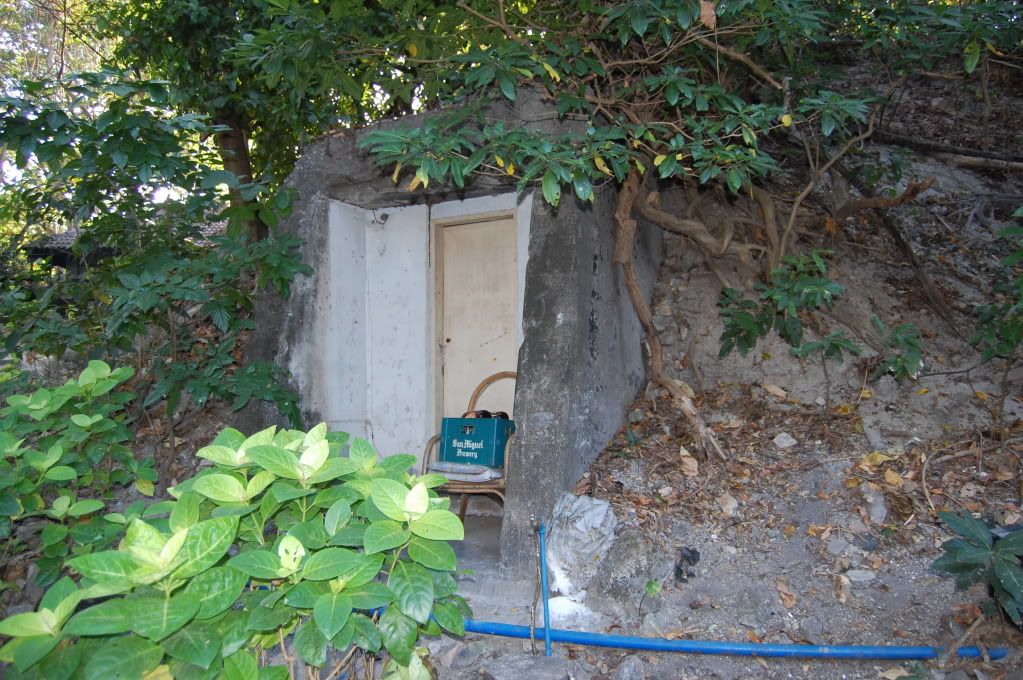
Hi okla, I would guess that the foxholes are from 1945 but I cannot say for sure. That was a nice walk down that ridge. Regarding the small hospital entrance, I have read that story a few times and it never says which of the two entrances is where this incident happened. If there were a lot of people involved then I would say that it definitely was not the small entrance. Only a few people can stand outside that entrance due to such a small standing space. The entrance is on the side of a little cliff. I have also read about a kitchen outside the Malinta Hospital entrance. Where was that? By the way, this tunnel, 69 meters long, is low (you cannot stand up) and its primary purpose may just have been disposal of sewage. There is only one toilet in the hospital area and the tunnel is straight out the north side of the hill to the outside from it. A 6” or so diameter clay pipe can be seen in the bottom of the tunnel a few places. I have been told that this is from the hospital toilet. In the view looking back at Enlisted Men's Beach is indeed one of the caves that the Japanese dug to house their Shinyo suicide boats. A few more of these caves are a ways around the corner east of here. The second dark opening is just a shadow in the rocks. Ask questions anytime buddy. Anything I don’t know, I make up.  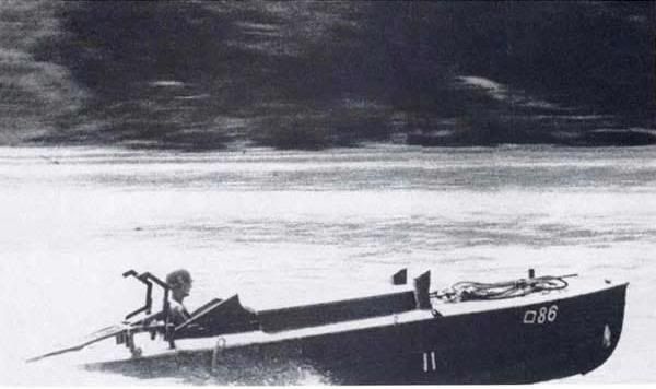 Shinyo suicide boat under way. 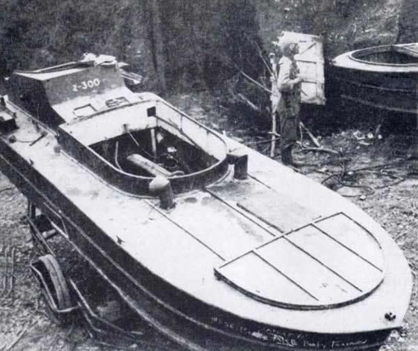 Captured Shinyo boats. 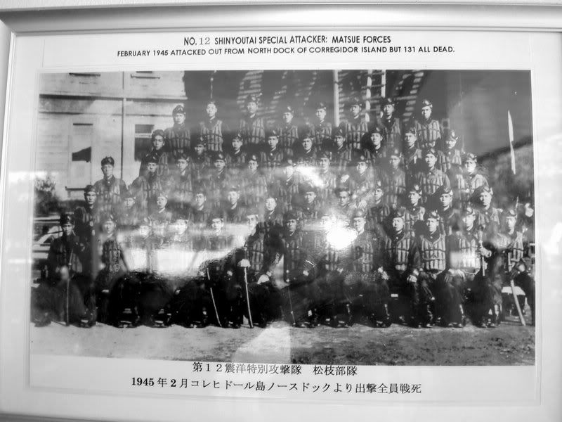 Corregidor Shinyo group photo. |
|
|
|
Post by fots2 on Dec 16, 2010 15:56:40 GMT 8
Hi Phantom, I never heard all those details before. Your ascent was further south than I remembered. The combination of dangerously steep hillside plus approaching darkness must have resulted in some excessive stress levels to say the least. Just thinking about it makes me nervous. I expect in a few places you could see MacArthur’s down below you towards the right and thought “So near yet so far”. The steep rock stream bed is just to the north of the west tunnel entrance. It is dry most of the time but I can imagine a real torrent there after even moderate rainfall. It is level after level of zigzag eroded steep areas and small horizontal areas. There must be a series of mini-waterfalls down there at times. I wandered around there but only the lower sections when looking for an airshaft. I don’t envy you taking the path that you did. Near the bottom I took the stream bed and also emerged into the grass. Here is a sample of the terrain that Phantom came down through. Note that these are only mid hill (dry season) views and not up higher where it is steeper. 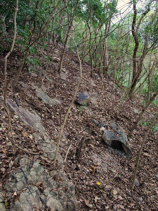 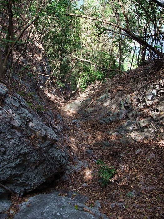 I hope this photo does not give Phantom nightmares but here is one view looking up that stream. Even at this lower level, I am looking up at about a 45 degree angle. There is little to hold onto and slipping on loose rock means you are in for a wild ride. In the last few years I think both of us are more conscious of where we go. There is certainly a possibility of a “bad day” but our old bodies tell us to take it easier now. |
|
|
|
Post by okla on Dec 16, 2010 23:23:05 GMT 8
Hey Fots....Wasn't aware about a second hospital entrance. Betcha you are correct in the belief that the smaller portal wasn't the site of the several shelling deaths. I have always had the impression that where this tragic occurence happened was something similar to the main Malinta entrances. Maybe not as large, but certainly not just a "hole in the wall" on the north slope of the hill. Enjoyed viewing the Japanese suicide boats. They were quite the little contraption, weren't they?  Cheers. |
|
|
|
Post by fots2 on Dec 17, 2010 9:23:04 GMT 8
Hi okla. Here are a few photos to show you the two hospital entrances. The first (and main) entrance is called the Malinta Tunnel North entrance. 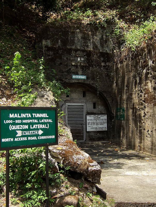 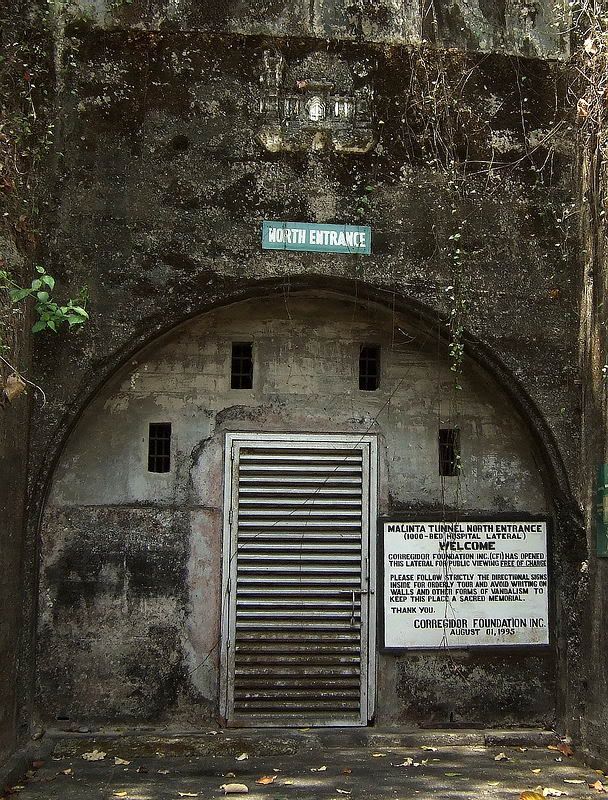 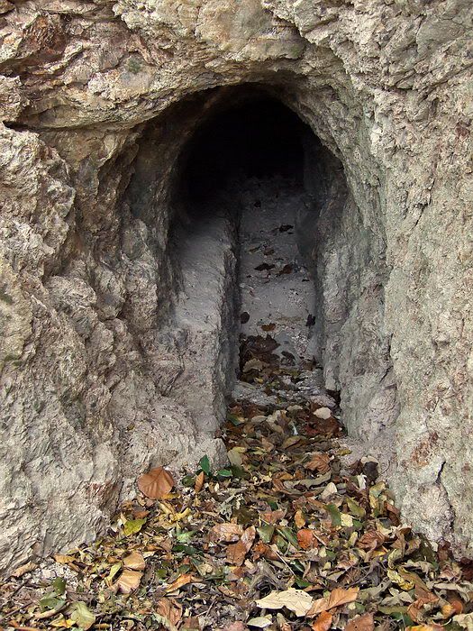 This is the small cliff side entrance. I am standing at the end of the cliff so there is not a lot of room here. 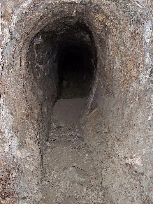 Inside the 69 meter tunnel |
|
|
|
Post by armyjunk on Dec 18, 2010 2:09:54 GMT 8
1.. As long as we are walking around I find this area of the Bottomside pretty interesting and few seem to go here.

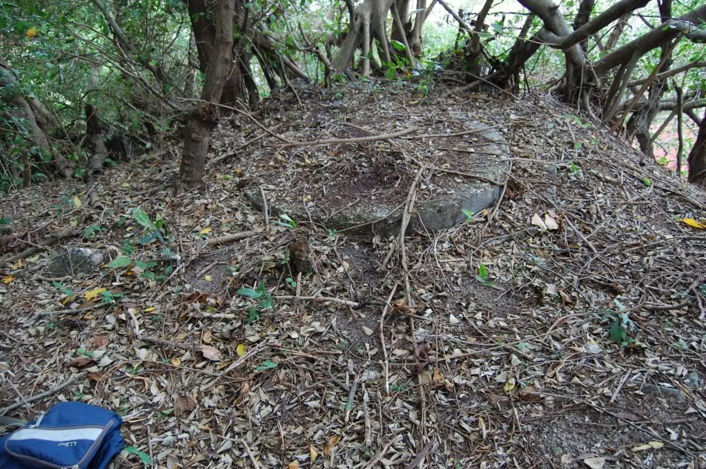
2.. On top of the hill are several items, a couple of these eye bolts, maybe for another flag pole, small a concrete pad
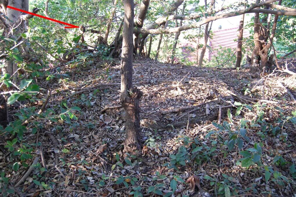
3.. This is one of the blocks for a saluting gun, the other is missing
as far as I can tell
4.. Up in the area of the gun block we have this foxhole
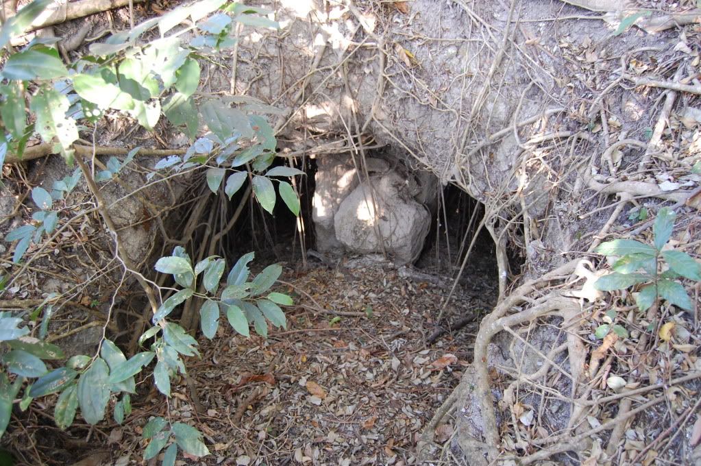
5.. The tunnel splits into two short parts, left
6.. And right, neither appear to go very far, but worth taking another look as I was tired that day

7.. This is on the south end of the hill next to the diesel generator set, doesn’t look like much
but it is the magazine for the salute battery, pic 1
8.. pic 2
9.. pic 3 lots of trash inside but again maybe someone that gets to spend a lot of time on the island might want to look a little closer
10.. Last we have Cable Hut number 4, quite a few things in a very small area
|
|
|
|
Post by okla on Dec 18, 2010 2:47:50 GMT 8
Hey Army...Thanks for posting the shots of the "Main" North Entrance. The photo depicts the portal about as I had it pictured in my mind. Now, thanks to you, I know for sure what the actual appearance is. Just another example of how I depend on you guys with access to the "rock" to keep my addiction under control. One question.... Is that the remnants of some type plaque,etc above the north entrance sign or is it the plaque itself covered with moss or other debris? Postscript....The other material pertaining to Bottomside is "good stuff" also. As you stated, this is an overlooked region of Corregidor. Topside with the "mile long barracks", Battery Way, etc offers pretty tough competition as does Malinta Hill and it's tunnel complexes. Cheers. |
|
|
|
Post by fots2 on Dec 18, 2010 20:18:07 GMT 8
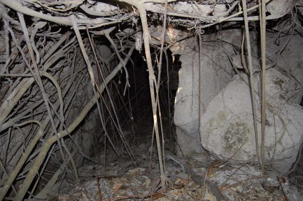
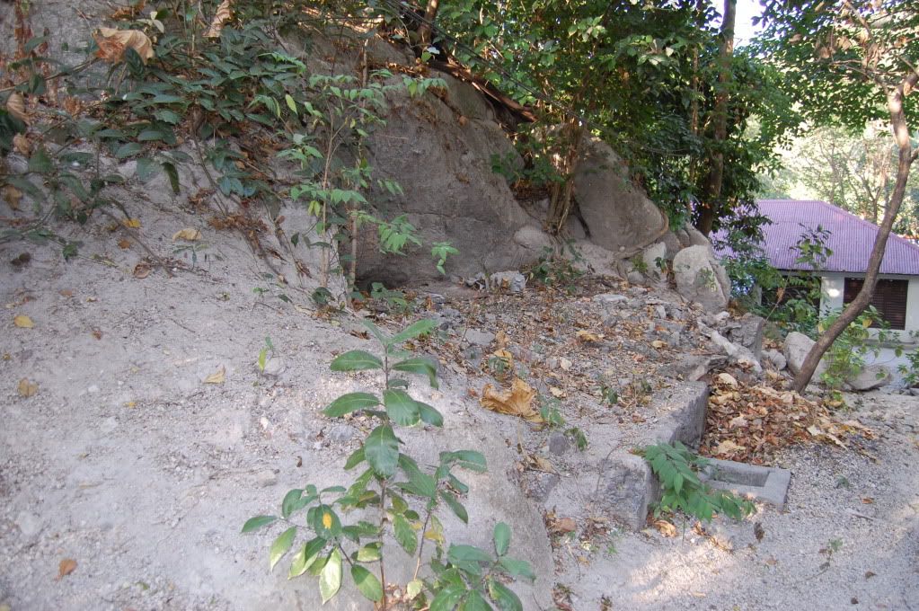
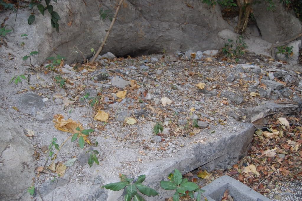
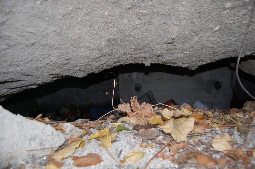
Hi armyjunk, Yes that ridge is overlooked. There are quite a few metal pipes etc up there that I do not know what were used for. I just learned something, I did not realize that there were two saluting guns. I never noticed that detail on the map before. As you said, the second block is missing. Here are a few photos of the area for you. 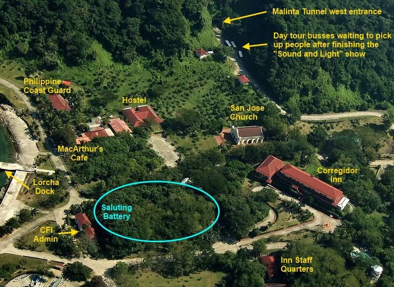 An aerial photo makes this north-south ridge look flat but it is not. I added some labels for everyone. The blue circle encompasses the ridge that armyjunk is talking about. 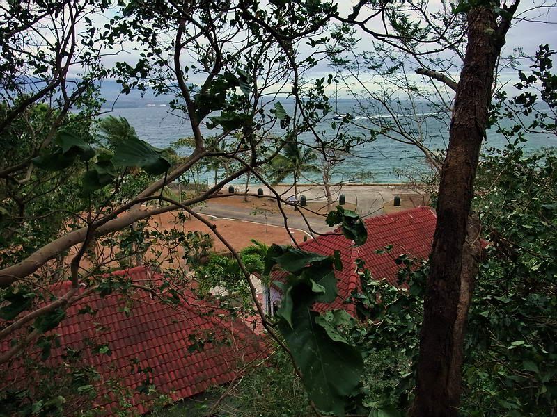 Standing on the Saluting Gun block looking northward over the CFI buildings. 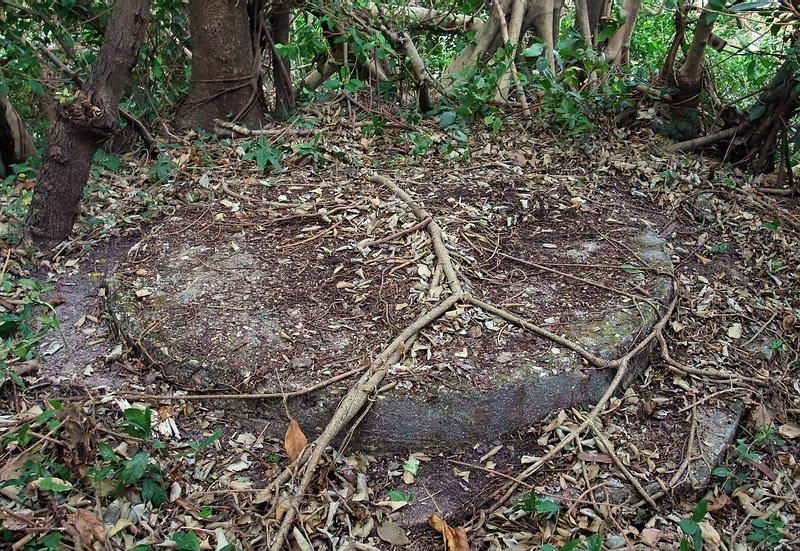 The remaining gun block. I had a look inside the little “twin” tunnel just below the gun block for the saluting gun. Neither side goes in very far. It is one hole cut into the rock with two small side-by-side rooms. I can’t tell from the photos if they are concrete lined or not but the walls are very smooth with square corners. When using the camera’s flash, all the vines and roots make crappy photos but I didn’t think it was worth the bother to clear the entrance much. 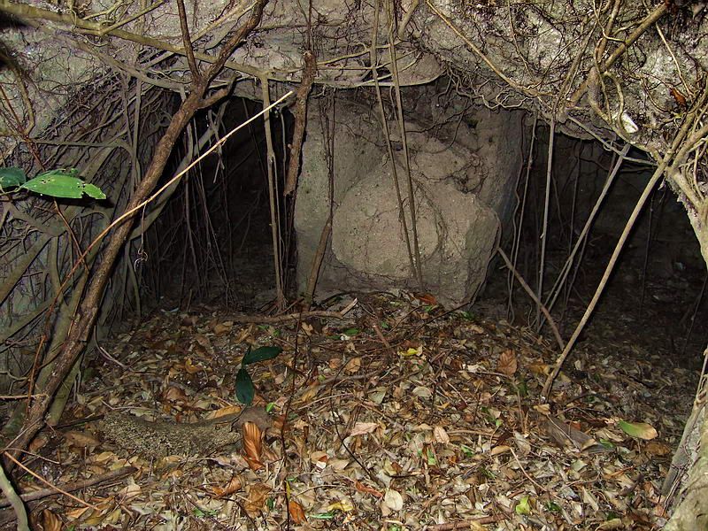 Outer entrance to the tunnel. 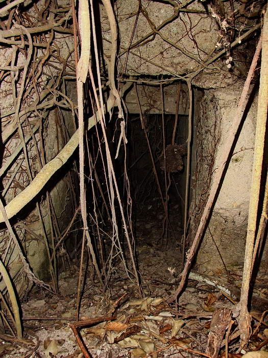 Close-up of the left side room. 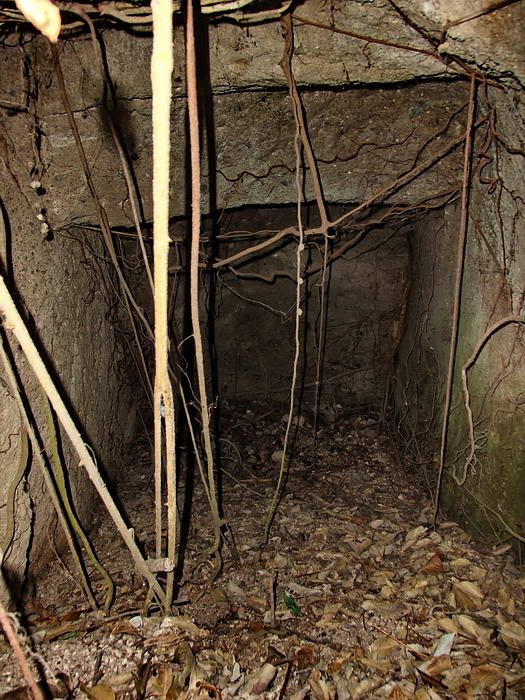 Close-up of the right side room. 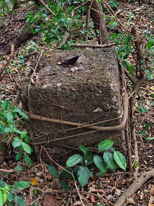 Up on top of the ridge this concrete block had a metal pipe sticking out of it. Perhaps a flagpole? 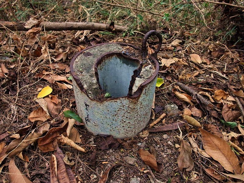 Sample of some of the metal/concrete up there. 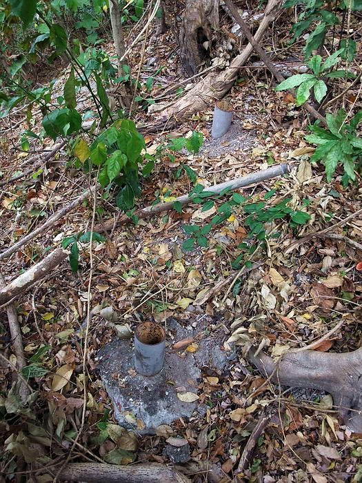 More of the same. 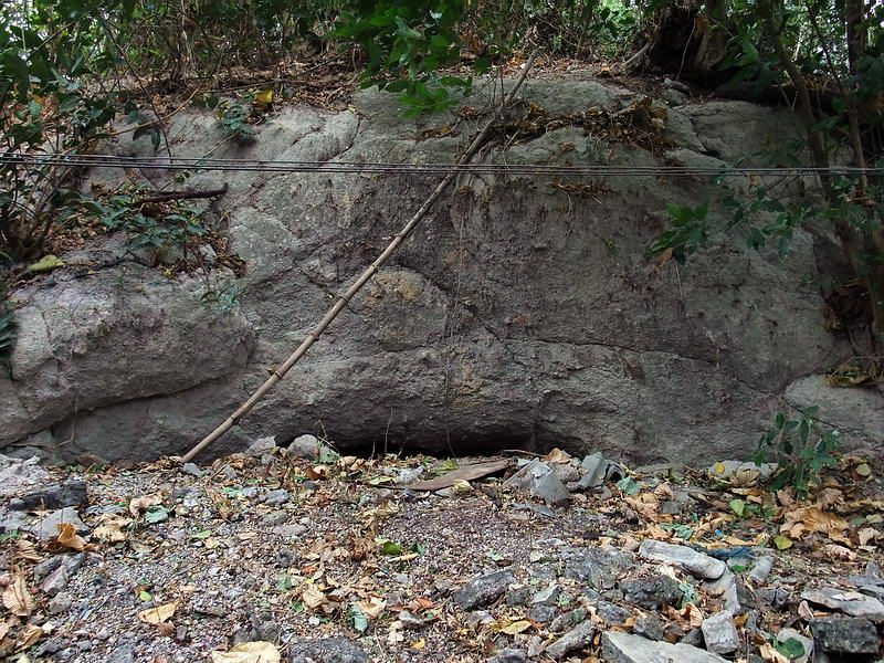 Here is the Saluting Guns magazine you mentioned. 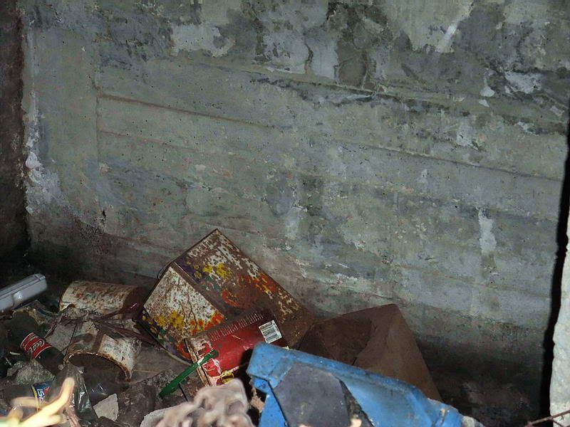 Interior view of the magazine (right-hand side). The slit entrance is quite narrow so I just stuck my head and arms in to look around with my light. The magazine is not very large, rectangular, undamaged with modern garbage such as Styrofoam everywhere. There are a couple pipes in the wall to the north that may be for ventilation. Have you heard this before? When the Corregidor Inn was built a tunnel inside Skipper Hill was sealed. It was said to have exited down the hill in the area of the Inn’s diesel building. I have found nothing to support this “story”. The manager was told this from one of his employees that who involved with the Inn’s construction. There are some rooms in the basement. The manager says one wall down there has a hollow sound when it is tapped on. Do you have a photo of these Salute Guns or even similar ones? |
|
|
|
Post by fots2 on Dec 18, 2010 20:25:27 GMT 8
Hi okla, Here is a closer look at the Malinta Tunnel north entrance. The white paint was new this year. I do not know if the faded inscription paint is original or not. (Corps of Engineers 1922-1932) 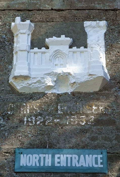 The more I learn about Malinta Tunnel, the more I disagree with these dates. Someday I will post the information I have collected and see if we can all sort it out. |
|
|
|
Post by okla on Dec 19, 2010 1:18:08 GMT 8
Hey Fots...I must be losing what little is left of my mind. The previous pics of the north entrance were posted by you and not Army Junk. I sent my appreciation to the wrong party. Army Junk posts good stuff, but the North Entrancephoto credits should have gone to you. Forgive my omission. It would appear that my addiction/fixation as concerns Corregidor is beginning to take a heavier toll than originally thought. Cheers.
|
|


 Cheers.