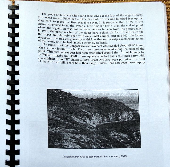
BATTLE OF THE POINTS, Quinauan Point
Quinauan or Quinawan Point,-Ridge,-Barangay,-Bay,-Valley 2013-02-24
On my 2nd day of joint operation with Conrad Buehler we went by boat from Bagac to this important place of the Battle of the Points. We didn’t find any artifacts nor did the Conrad’s metal detector help us, it beeped but no results. So my experience is mostly about vistas from the ridge and the village. Conrad did get from a local lady, what seems to be a 3 inch projectile and I failed to get a picture of that. Conrad will have a better description. THERE IS NO JUNGLE LEFT!
One of the best reference reading material is here, from: United States Army in World War II, The War in the Pacific, The Fall of the Philippines, Chapter XVII: The Battle of the Points by Louis Morton:
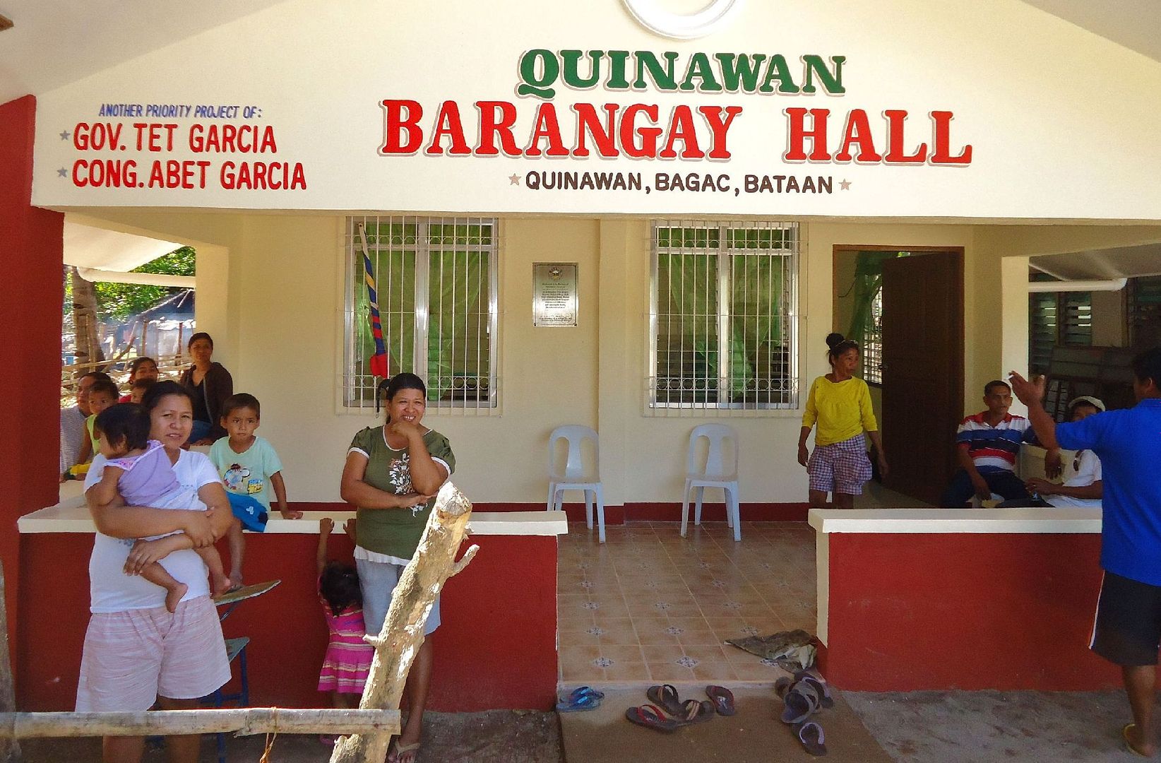
www.ibiblio.org/hyperwar/USA/USA-P-PI/USA-P-PI-17.htmlWhen we arrived at the Bagac Beach we were hustled towards a tour boat already afloat. By tour boat I mean with 2 rows of seats installed at the gunwale level. We couldn’t get it cheaper than 2000 Peso and off we went, It was about a 1 ½ hour ride including getting on and off the boat. It was about 2 hours coming back, head wind. The Barangay Hall personnel were helpful in assigning a parking place.
At Quinawan (that is the spelling here) we checked in with the Barangay Captain and told him what we wanted to do, no objections. A lady presented what appeared to be a 3 inch projectile. Conrad took it and gave her a little compensation. I failed to take a picture of it. Then a villager showed us the way to get on the Quinauan Ridge line and we started looking.
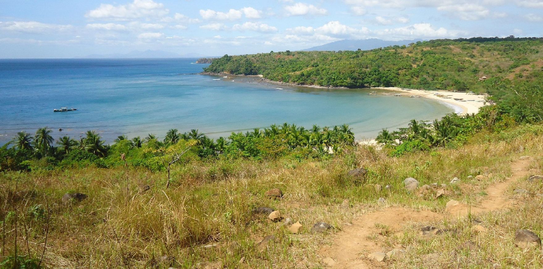
We didn’t find anything and the metal detector was no help. At the point end it is mostly a low scrub (2 feet high) . As I said I didn’t see any artifacts or other evidence of fighting. We went to the south side and enjoyed the view down to Agloloma Bay and village. At this point I was ready to explore the geography and Conrad went back to the village.
The most important impression and surprise to any visitor to the Battle of the Points areas is that THERE IS NO JUNGLE LEFT! Cattle is now the dominating factor and it is now grass land on the ridges and rice fields in the valleys. Pardon me but I enjoy it: THE VISTAS ARE SUPER!
So I did my roving and got my vista shots, they are here in this album, 138 images, including 3 maps. In the front of the album are 5 Hellships images because I noticed two new plaques. We also got a shot of Km Stone 167 on the West Road south of the Mauban Line because the Japanese established their roadblock there according the above reference. I think it is the wrong place and I further think that the positions of the km stones frequently mentioned in the WWII writings are not the same positions today!
THIS LINK WITH MULTIPLY IMAGE SHARING ACCOUNT IS DEAD FOR EVER. I have been having bad luck in choosing the right image sharing accounts. Multiply just dropped this service even though I had 2 year paid pro account with them.
Other personal activities will prevent me to tackle this problem for the next 4 month and today is 2013-03-24.
Also had problems with the Kodak sharing account in the past and now my Photobucket account is making things difficult also. DON’T RECOMMEND NEITHER ONE TO ANYONE!!!!!!!!!!!
pisailor.multiply.com/photos/album/165/Quinauan-or-Quinawan-Point-Ridge-Barangay-Bay-Valley-2013-02-24Here are some sample pictures:
301. Today was Sunday but when we were leaving I noticed the Barangay Captain in conference with a family.
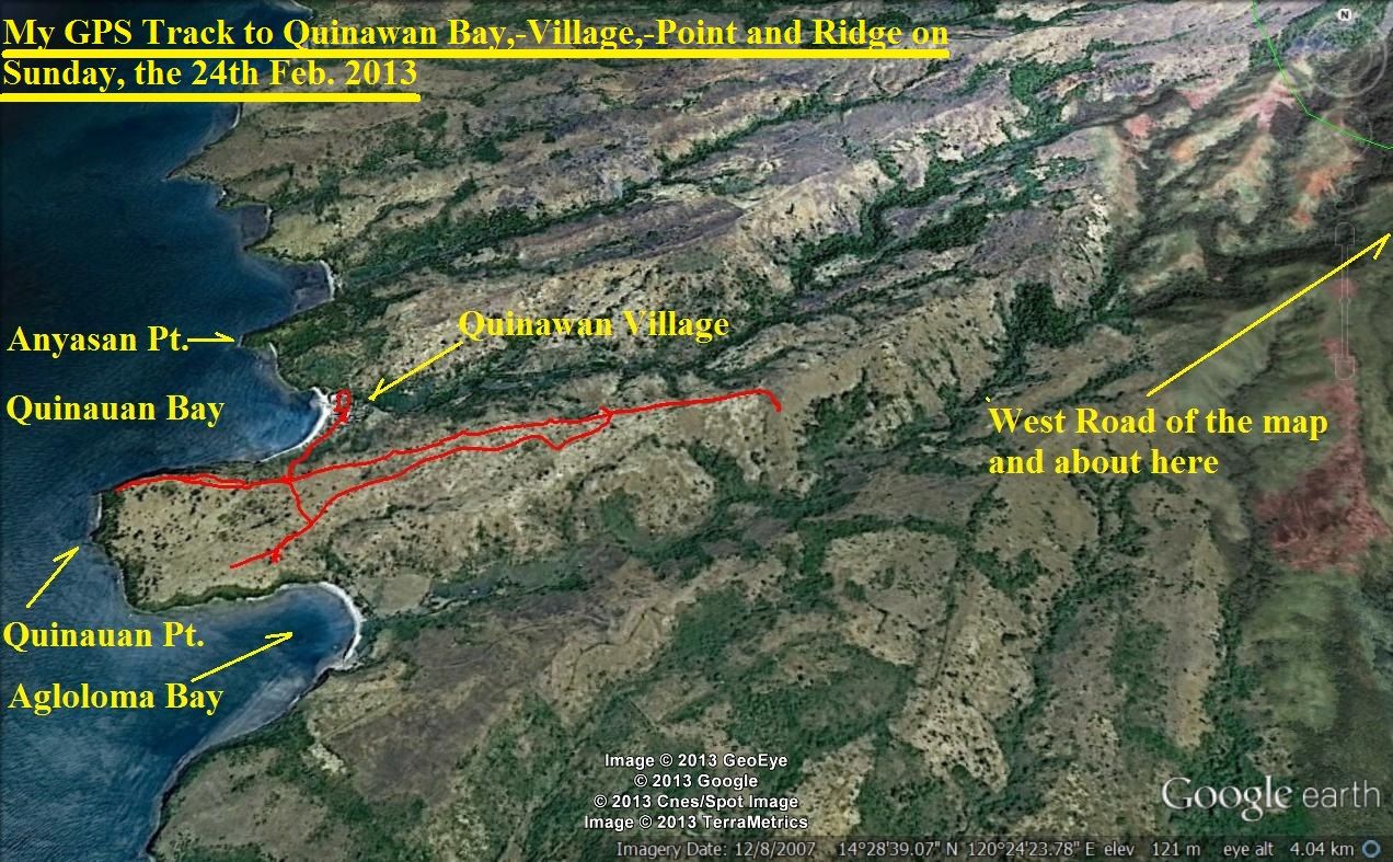
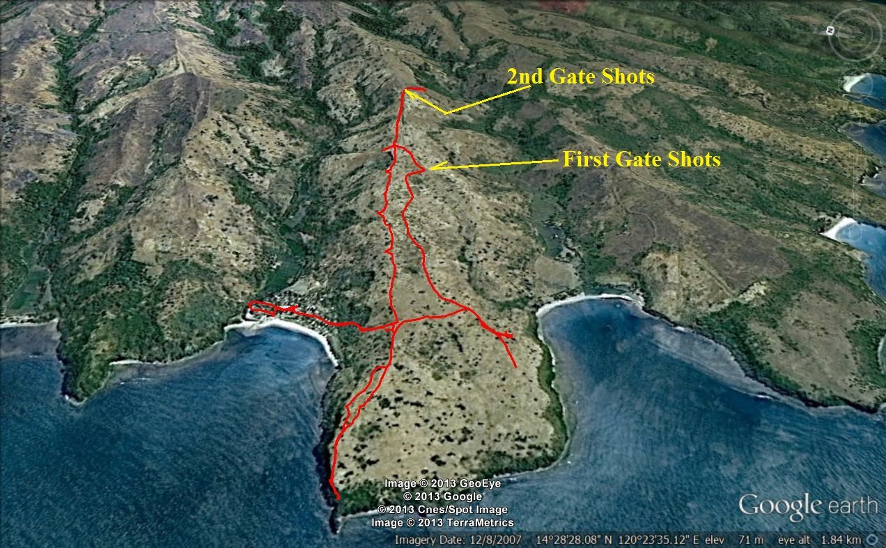
302. Google Earth map with my GPS track and the landmarks of the Quinauan Point area.
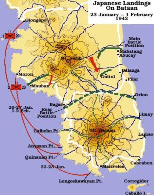
303. Again the map from -The Fall of the Philippines- to remind us at the dates and locality during the Battle of the Points.
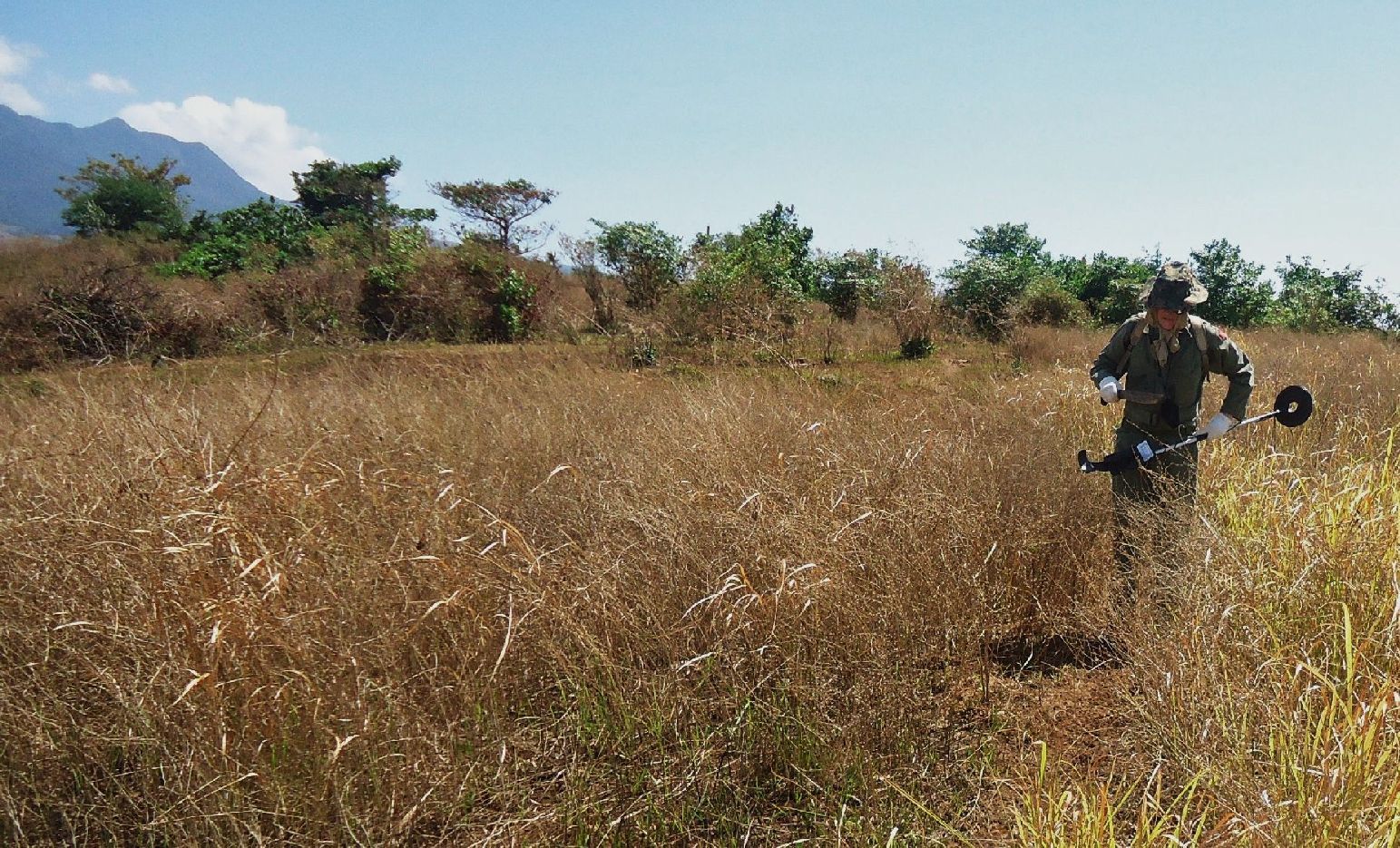
304. Conrad with his metal detector device on our way to the Quinauan Point.
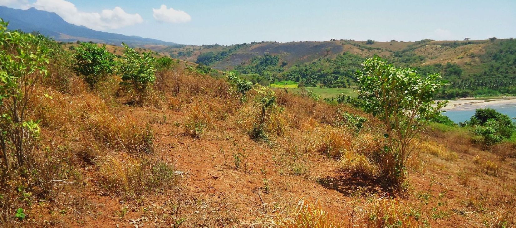
We crossed over the Quinauan Ridge and are looking down onto Agloloma Bay and Village.
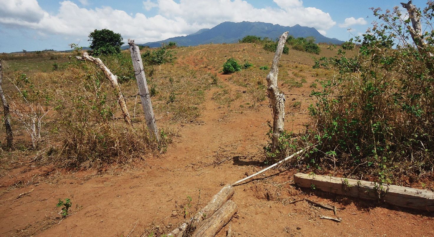
305. Conrad and I separated and I’m on way up the ridge. This is the 1st gate where I took a round of shots.
306. The Google Earth terrain map and at a tilt for remaining vista shots.
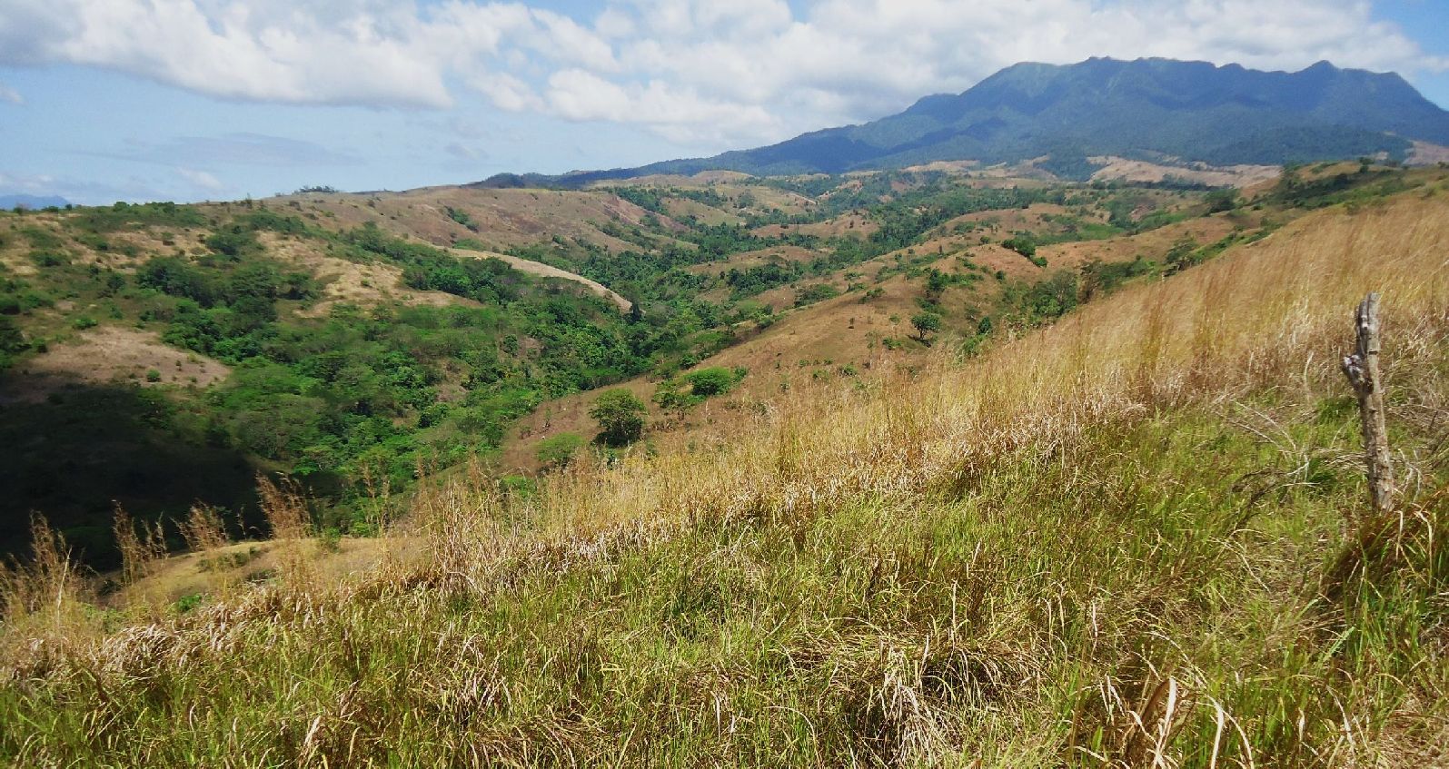
307. Looking up the Quinauan Valley, notice it becomes wider!
308. At the 2nd gate looking down and diagonal across the Quinauan Ridge. What we see is Agloloma Bay and that would be the Luzon Point where one can see the surf breaking over the shore rocks. Also notice about 4 fishing boats anchored there.
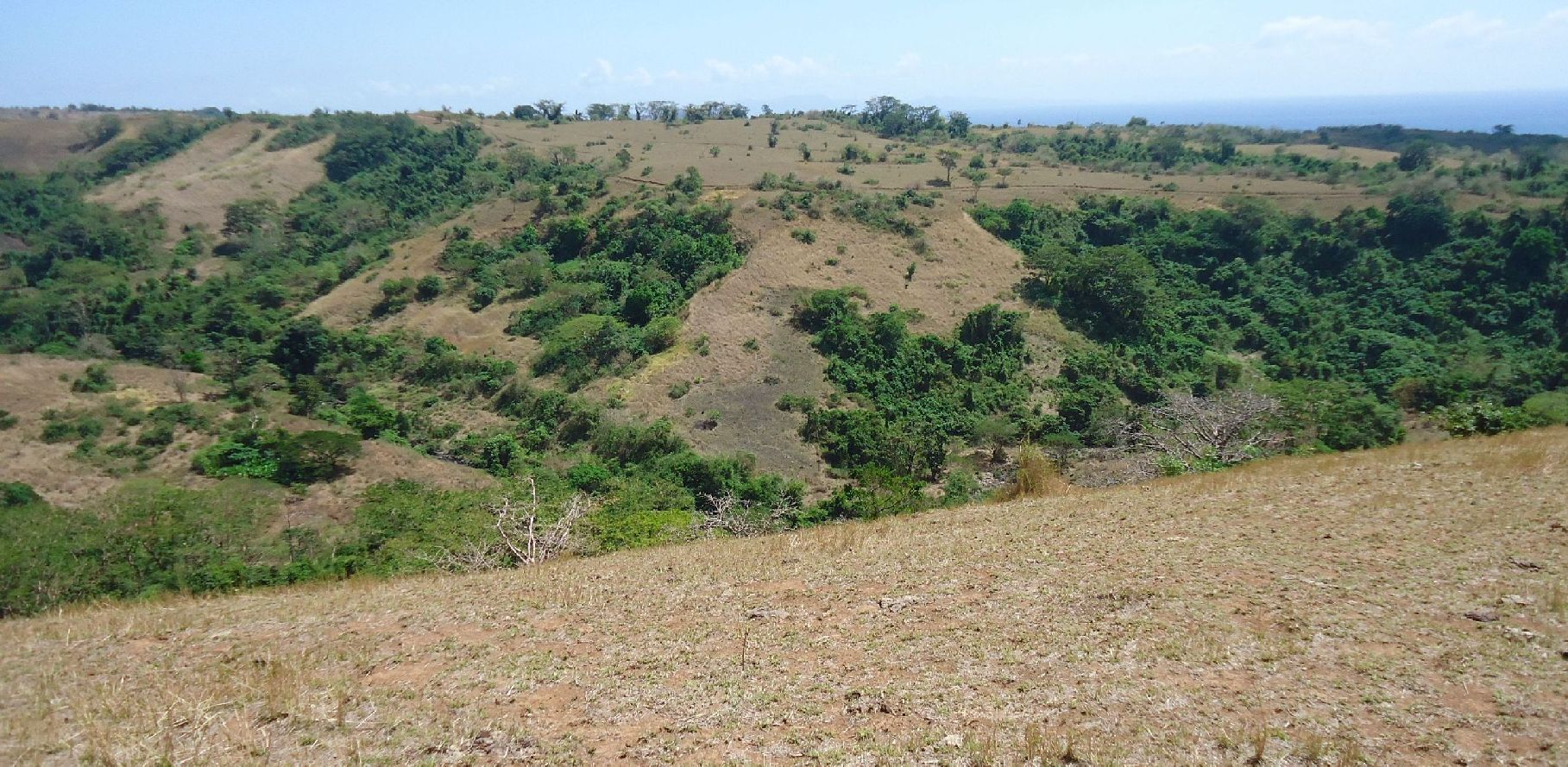
309. I stepped onto the south edge of the Quinauan Ridge and look a cross the Agloloma Valley and notice the tracks there. They interest me because that is the track from the Army camp on the West Road down to the Agloloma Village at the mouth of this valley.

310. On my way back to Quinawan Village and got a good shot of this place.
311. Descending down to Quinawan Village and we can see the Bataan Coast line stretching to the north
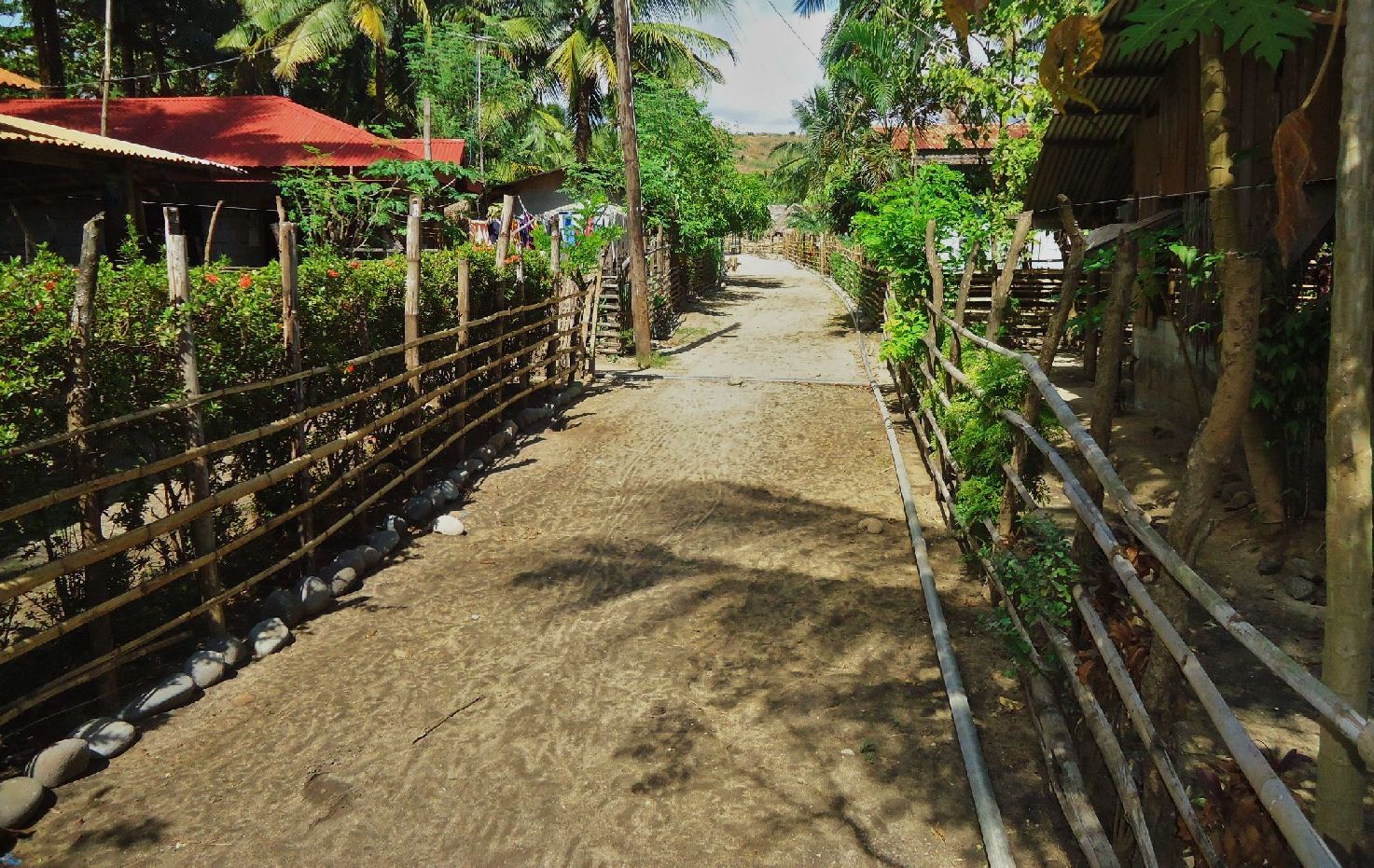
312. I think the Quinawan Village is laid out in a nicely spaces way.
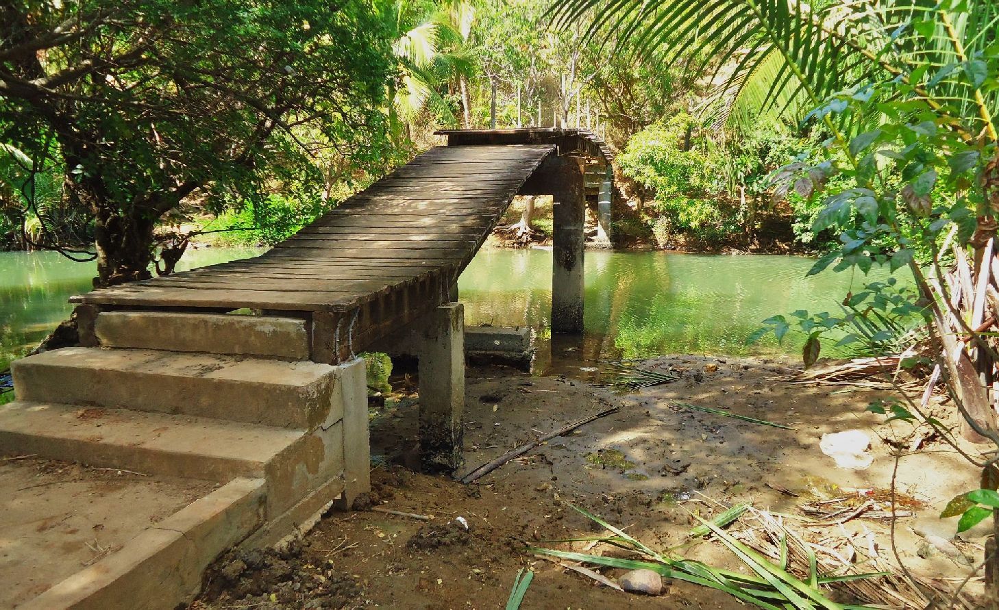
313. This bridge, I have crossed maybe already 10 times in the last 10 years.
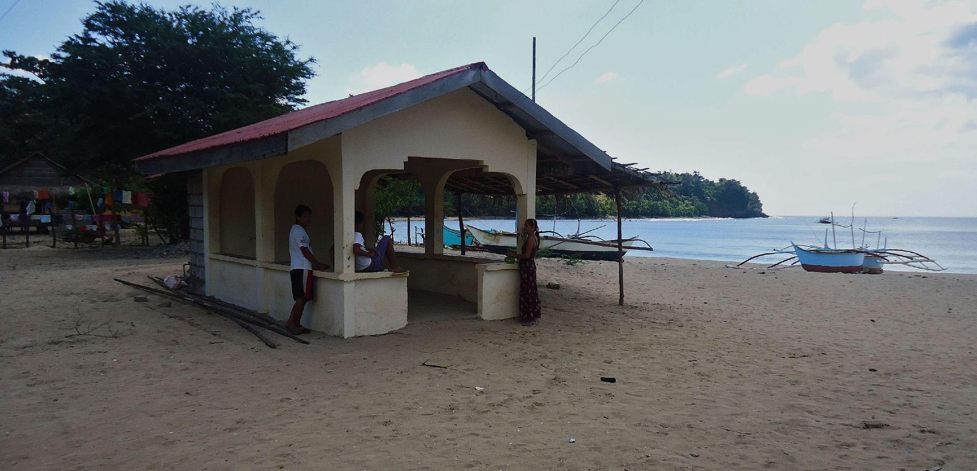
314. This is unique, a boat waiting shed, my wife’s village doesn’t have one.
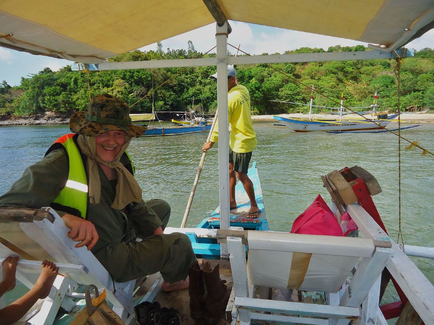
316. On our way home, we had to wade to the boat the tide was out. Conrad seems to be happy with our trip.
Note:
Bob Hudson, I’m glad that Conrad Buehler answered your question in regards the ammo, I wouldn’t even try. But I do know what a ½ inch shackle etc looks like.