|
|
Post by batteryboy on May 8, 2010 19:11:19 GMT 8
mapmaster,
excellent!!! Now for the abandoned railway, they used to be sugar railways ( 3ft guage) Found a few traces back in mid 80s. Will post a map of how it looked later.
Cheers,
B-boy
|
|
|
|
Post by mapmaster on May 8, 2010 20:09:43 GMT 8
Hi batterboy
The scale of the 1954 Luzon map is 1:250,000, so using that as a base map for this project should have produced a lot of inaccuracies, but it didn't. Most features overlaid OK.
The position of the abandoned railway, marked on the 1954 map, contains the only real inaccuracy. On the 1954, just north-west of Layac, the abandoned railway is marked as deviating further north away from the highway. I think this portion of the railway was actually a 100 metres or so south from the 1954 map position as I can see what appears to be the original railway alignment on Google earth. It is now a road with houses both sides and parallel to the highway.
Would be good to get more information on this area, so looking forward to any maps you can post.
Regards
mapmaster
|
|
|
|
Post by victor on May 8, 2010 21:39:30 GMT 8
Thanks for the maps and inputs. Absolutely invaluable research tools.
I'm in Tacoma, WA right now for the Phil. Scout reunion. I'll see Joe Calugas today. He said he'll have a copy of a sketched map for me made by the late Col. Mel Rosen (24th FA). I'll post it later this week. I hope it gives us a bit more info.
Cheers!
|
|
|
|
Post by batteryboy on May 9, 2010 17:09:16 GMT 8
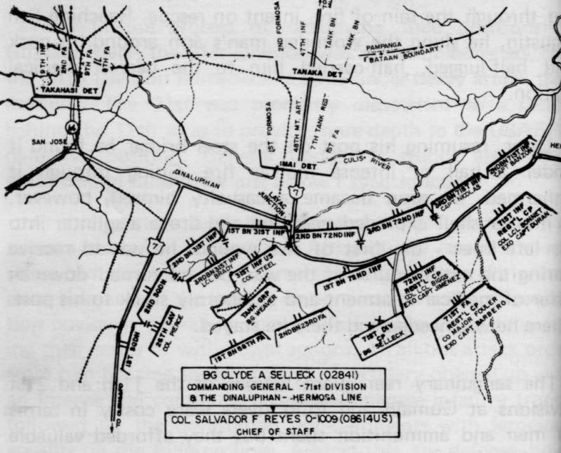
Hi mapmaster, As promised.  Regards, |
|
|
|
Post by okla on May 10, 2010 2:12:37 GMT 8
Hey Guys....This is great material and the maps/charts/aerial views make it even greater. Puts it right there in the reader/viewer's lap. Vic....Concerning the "bug out" member of the 31st Infantry, who was in a panic and sent to the rear, I would betcha that he survived the war and was the first guy down the gangplank of the first hospital/POW transport that tied up in San Francisco. Seems these types always "make out" when more worthy individuals fall by the wayside. I guess that's life and the way it is, all too often. Just my humble observation.
|
|
|
|
Post by mapmaster on May 11, 2010 19:08:34 GMT 8
Hi batteryboy
Good one! I should be able to get a better map now by using this information as well.
I'll post for results for Victor and all members as soon as I've finished the map.
Thanks again.
Regards
mapmaster
|
|
|
|
Post by victor on May 12, 2010 1:35:39 GMT 8
Again, thanks for all these material and analyses. Batteryboy's latest map is a totally different orientation. The line is facing east, not north. It jives with descriptions I've read that the 26th Cavalry were almost at the foothills of the Zambales mountains.
The map and description I got from Joe Calugas Jr isn't much help. It's basically the same info already quoted in some books. Batteryboy's latest map is new to me. Thanks!
Victor
|
|
|
|
Post by Karl Welteke on Jun 12, 2010 10:00:59 GMT 8
Here is a section from an 1:50000 map [img src=" ![]() "]  [/img] Hi Vic, looking forward to explore the area with you soon. Will also explore it next week beforehand. |
|
|
|
Post by Karl Welteke on Jun 12, 2010 10:09:33 GMT 8
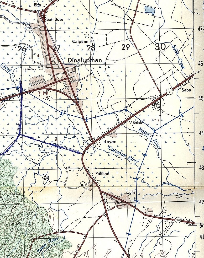
Here is an other section from an 1:50000 map, reaching a little further south and the SCTEX is drawn in by the looking over the thumb method. [img src=" ![]() "]  [/img] |
|
|
|
Post by victor on Jun 14, 2010 5:25:46 GMT 8
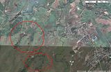
Thanks Karl. I think the artillery positions couldn't have been too far away from these areas I marked with red circles. They look like ridges or low hills and I measured the scale -- they're within the 75mm gun range of Layac with a couple of thousand yards to spare. Any farther away from Layac and they would have been pushing the effective range of their artillery pieces. (click for bigger)  |
|