|
|
Post by Karl Welteke on Mar 21, 2012 19:38:06 GMT 8
|
|
|
|
Post by Karl Welteke on Mar 23, 2012 16:45:22 GMT 8
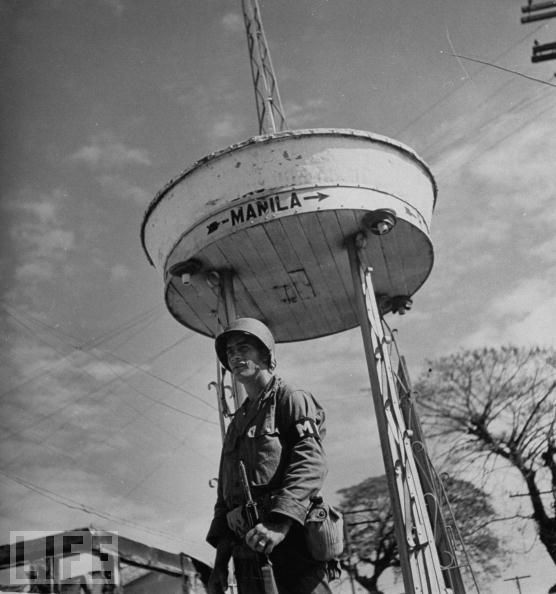
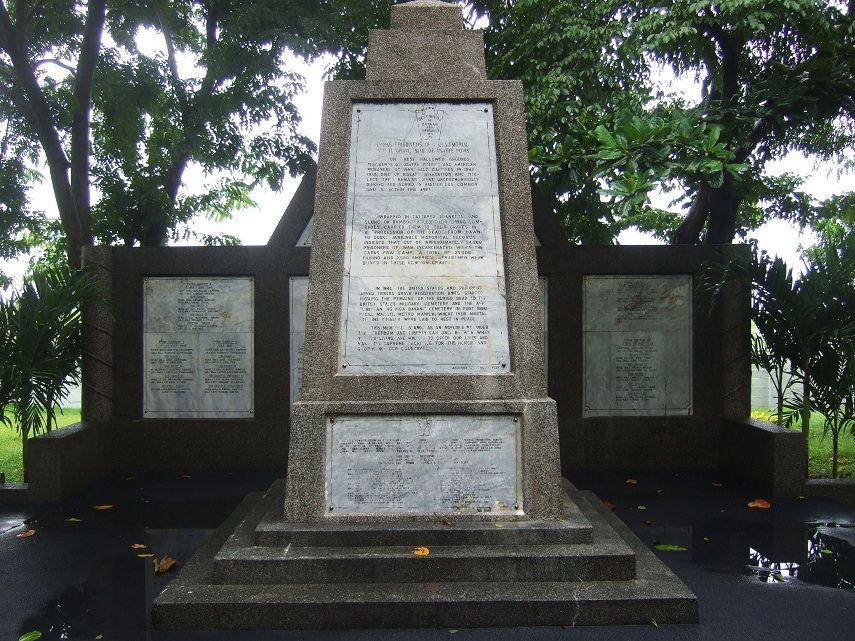
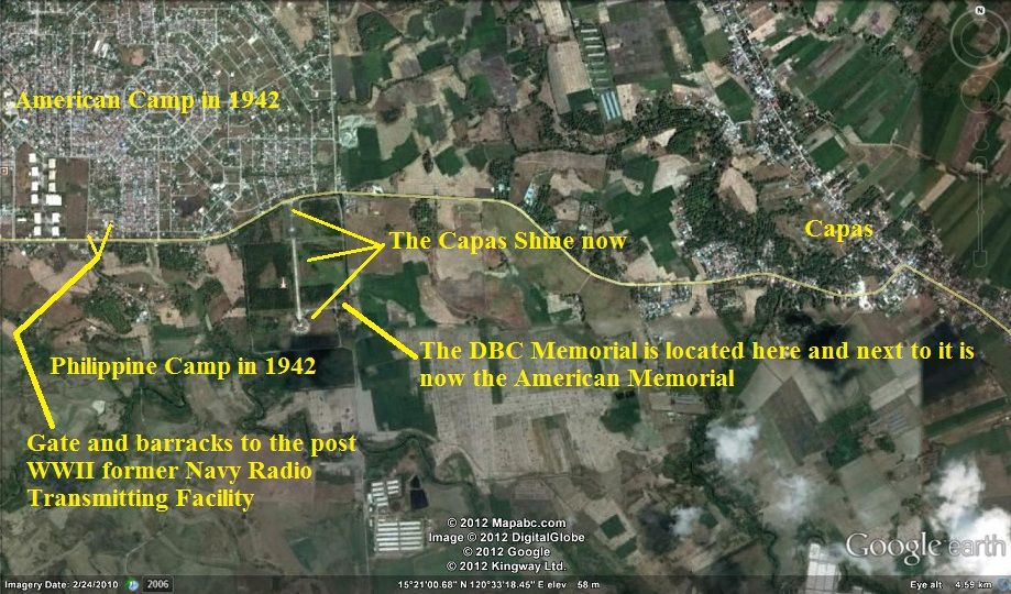
In the collection of Time-LIFE photos of Camp O’Donnell in 1945 several images show what seems to be a Philippine Memorial. I never heard about an early Philippine Memorial to the victims in the Japanese hands as POWs. The OIC of NRTF Capas 1970/71 answered my question whether anything in those pictures was familiar to him 1970/71 this way per email: -Nothing but the photo of a group at the cross is familiar to me. Attached is a photo of the Monument for the Philippine POWs located just south of the NRTF site fence. It was in very poor condition and I had hoped the cross would never be allowed to be in that condition. Roy- So in 1971 it still existed and here is the link to this picture. s74.photobucket.com/albums/i265/PI-Sailor/Z1%20images%20direct%20linked/?action=view¤t=PIPOWmonumentCapas1971fmLeroyEJones.jpgBut now the Philippine Government and NGO have established the very large -Capas National Shrine-. It has a wall, similar to our Viet Nam Memorial with all the Filipino victims of Camp O’Donnell. Here is the Wikipedia page: en.wikipedia.org/wiki/Capas_National_ShrineThe Battling Bastards of Bataan also were able to place their Memorial with the names of the American and Allied victims there and here is their link: www.battlingbastardsbataan.com/ |
|
|
|
Post by chadhill on Mar 24, 2012 15:18:11 GMT 8
The Camp O'Donnell cross, as it looked in February 1988. I have read it originally carried the additional inscription "Erected by the Japanese Imperial Army", which I presume was included in order for the US POWs to be given permission to make and raise the cross. That inscription was removed after the war.  (added enlarged photo) According to O'Donnell POW Abie Abraham in his 1971 book "Ghost of Bataan Speaks" (p. 84), the cross also had the inscription "ERECTED BY IMPERIAL JAPANESE ARMY". John Olson, in "O'Donnell, Andersonville of the Pacific" (p. 139) notes: "It was the desire of those who constructed, titled and emplaced the cross that there be no attribution to the Japanese. However, when the time came to display it to the captors either the work party decided to avoid the risk of having the cross destroyed because it had no word about the Japanese part or they were forced to add the words later. In any case, someone who was around the cross after the Liberation saw fit to obliterate the words, "Erected by the Imperial Japanese Army". They were not on the cross in 1961 when Lieutenant Colonel Frank O. Anders photographed it." Another photo of the cross I took in 1988.  Nice posts, Karl. I noticed the rifle monument in the 1971 photo and compare it with the photo I took during 1986 in Bagac:   Here is a 1988 photo of the Philippine POW Memorial shown in your links (excellent links, BTW). As I recall, the monument was undergoing restoration and any inscriptions on it were unreadable.  |
|
|
|
Post by okla on Mar 24, 2012 20:51:30 GMT 8
Hey Chad....Welcome back. You have been missed. I was almost ready to send out a "search and rescue" unit to facilitate your return. While I am at it, would one of you guys orientate me about the photo of the kids marching past the road sign that says Mariveles is 10 miles down the road. Ain't they going the wrong direction. Shouldn't they be marching AWAY from that city and headed toward Balanga??? No big deal, just wondering. I salute these lads and their sponsors for this long ago event. Cheers.
|
|
|
|
Post by sherwino on Mar 26, 2012 10:31:39 GMT 8
I think the numbers are in Kilometers. From Zero Km to Balanga arc is around 41 kilometers only, around 45 to the city, i guess. The picture might be in the vicinity of Cabcaben or Mt. View Village, could be at the fork on the road. I grew up in Mariveles and never seen that road sign. I'll try to take a picture of the vicinity when my car gets fixed. Or may be some one could beat me on it.
|
|
|
|
Post by Karl Welteke on Mar 27, 2012 20:36:10 GMT 8
|
|
|
|
Post by okla on Mar 28, 2012 1:37:43 GMT 8
Hey Karl...Thanks for clearing up my highly unimportant question. Little things like this bug me no end. Whichever direction those fine looking lads are marching, I appreciate what they were doing. I will always believe that we, today, cannot honor those poor devils who, isolated, from the rest of the Allies involved in the Pacific War, stood fast for five months in the PI while everything around them was going to Hell in a hand basket. Cheers. Postscript...Please keep your good stuff coming. I love that aerial view of the Camp O'Donnell area.
|
|
|
|
Post by chadhill on Mar 30, 2012 5:58:23 GMT 8
Okla, I've got lotsa things to post but have been real busy. Hope to have more free time before long- Karl, yes I agree with you, that must be the same memorial after it was restored. The shape indeed looks identical. I seem to remember that it was across the road and some distance away from the US cross, so I'll bet it was probably in the same location then as it is now. Real good posts and links, Karl. I wonder if your link to the January 1, 1945 LIFE photo of the US cross is the earliest known photo of it? The inscriptions are so faint they cannot be read from the angle the photo was taken. 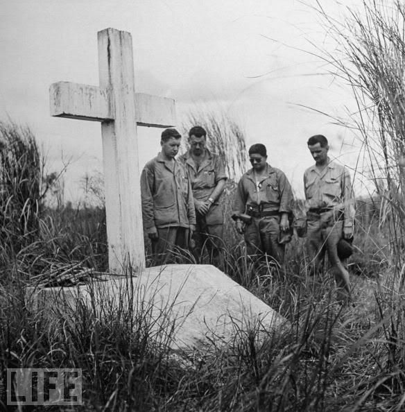 |
|
|
|
Post by Karl Welteke on Jul 15, 2012 14:38:43 GMT 8
Death March Marker (DMM) update on #B19, B20, B21 As I tour around the Philippine WWII Battle Fields I sometime have a chance to revisit some of the DMMs. Recently I have been walking around part of the Final Battle and have revisited the three DMMs listed above. And herewith even established a group of albums to update the conditions of the DMM. These are on the Pilar-Bagac Hwy. Some people don’t know that the Death March started at Bagac for some of the Soldiers Death March Markers were also established along this Hwy. Here are 13 images s74.photobucket.com/albums/i265/PI-Sailor/Death%20March%20Markers%20Death%20Camps%20and%20Memorials/DMM%20Updates/DMM%20Bagac%20No%201%20to%2026%20Updates/Here are some sample pictures:  2012-06-26. Bagac Death March Marker # 21 is sponsored by the International School of Manila; it is located across the Pilar-Bagac Hwy. from Barangay Nagwaling. 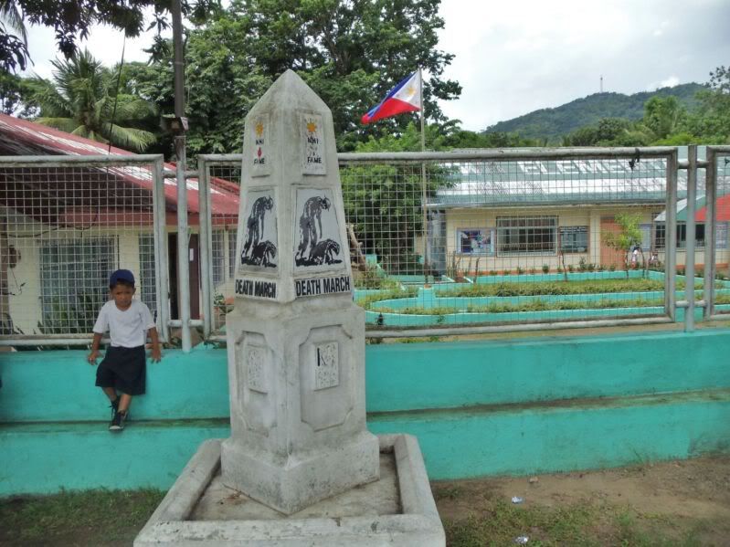 2012-06-26. Bagac Death March Marker # 20 is located in front of the Barangay Diwa Elementary School. The sponsor’s name can not be read anymore. That was already so in July 2010. 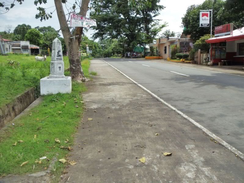 2013-06-26. Bagac Death March Marker # 19. Looking west and at the Mt. Samat Shrine Sign at the entrance of the road going up to the Mt. Samat Shrine.  2012-06-26. Bagac Death March Marker # 19 is located about 100 feet east from the road entrance to the Mt. Samat Shrine. Notice the Japanese Marker in back, it is remembering all The Fallen. |
|
|
|
Post by okla on Jul 15, 2012 23:34:48 GMT 8
Hey Karl....Thanks for pointing out the fact that there was also a "Death March" from Bagac eastward to the Manila Bay Hiway on the East Coast of Bataan. The I Corps guys probably suffered as much, in all probably, as the II Corps prisoners. Most folks probably think the Route from Mariveles-Cabcaban area constituted the whole Death March saga. Have you ever heard about the guy, who obviously must have been in much better physical condition than most of his fellow POWS, who made TWO Death Marches. If memory serves, I think I may have posted this yarn previously, but just in case, here it is again in briefer form. This POW marched out in one of the first groups. At San Fernando he was among a group selected by their captors to drive a number of trucks down to Mariveles/Cabcaban. Upon arrival he was thrown in with another group of POWs moving northward. He again survived that ordeal and was then loaded into a boxcar and ended up at ODonnell. I don't know where I read of this event, but I don't doubt it. I do know that some POWs made more than one trip driving vehicles for the Japanese, but have never heard of any prisoner who actually made two trips on foot. Amazing, if true.
|
|
