Deleted
Deleted Member
Posts: 0
|
Post by Deleted on Mar 27, 2013 18:41:45 GMT 8
Okay Bob acknowledged that.
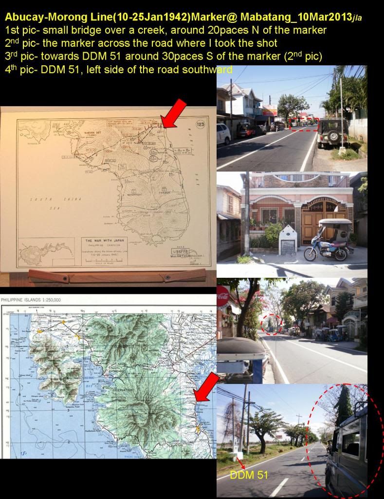
Karl, thank you for pasting the pics over the board. I don't have a GPS receiver so I will try using your old 1954 map if I can't get hold of a google map of the area. I have more pics connected to the first 2 and it should give you good references when you get there. I'll post it as soon as I'm ready with the pictures in my photobucket. Its not far from DDM 51 (around 30 paces S from this marker) and its in Mabatang, about 4+ km from the town of Samal.
Jon
|
|
|
|
Post by chadhill on Mar 28, 2013 7:50:51 GMT 8
In 1986 this similar marker, identifying the II Corps 7-8 APR line, was on the east coast road. On the back of the photo I wrote the location as being near Cabcaben, but was probably mistaken. I must have actually been between Limay and Lamao instead. The marker was in poor shape then, has anyone seen it recently?  |
|
|
|
Post by Karl Welteke on Mar 28, 2013 8:52:09 GMT 8
Thank you Jon. If you say there is a Death March Marker (DMM) Km 51 In Mabatang, I can find it. So much for my old eyes, when I walked the Death March Route 2007-11-27 I completely missed the Battlefield marker and DMM Km51 in Mabatang. But then traffic or parked vehicles may have caused that mistake. Here is the album I posted in 2007: s74.photobucket.com/user/PI-Sailor/library/Death%20March%20Markers%20Death%20Camps%20and%20Memorials/DMM%20No%2033%20to%2050%20Balanga?page=1The stretch of the old East Bataan National Road between Death March Marker Km 33 to Km 50, from Orion to Mabatang. The pictures in this album were in the right order ones, but the geeks in the Photobucket Corp. interpreted alphabetical order later that T comes before A. The church in Mabatang also has a great metal marker at its entrance. I did notice it and posted in the above album. It is big and I photographed it in two shots. Here are three images of the church and the plaque:  The Mabatang Church, the plaques is at left of the church entrance.  The Main Battle Line Marker-Plaque on the Mabatang Church upper portion.  The Main Battle Line Marker-Plaque on the Mabatang Church lower portion. |
|
Deleted
Deleted Member
Posts: 0
|
Post by Deleted on Mar 28, 2013 10:30:11 GMT 8
|
|
Deleted
Deleted Member
Posts: 0
|
Post by Deleted on Mar 28, 2013 10:57:42 GMT 8
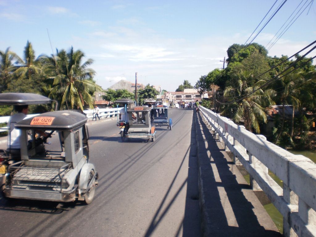
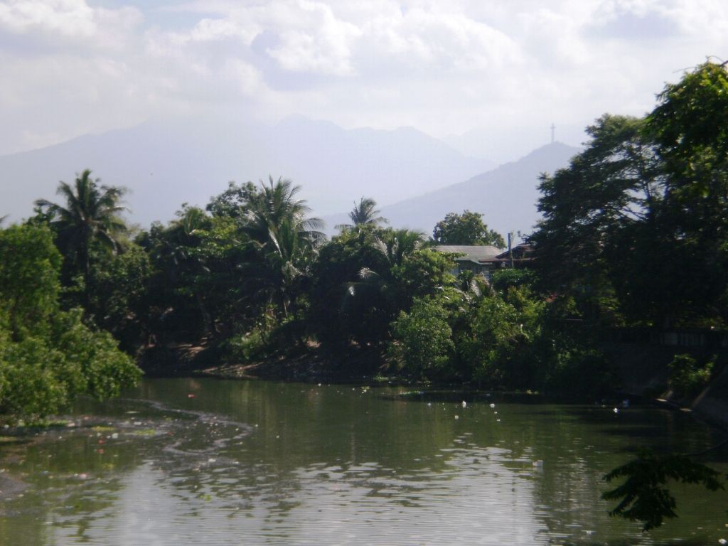
Sorry, it took me some time to review on how to paste the actual pics. I hope this works now.  Bridge over Talisay River spanning between Balanga and Pilar (shot taken on Balanga's side.  Mt. Samat and Talisay River in the foreground (shot to the East taken from same location on the bridge).  Jon |
|
|
|
Post by Karl Welteke on Mar 28, 2013 15:21:18 GMT 8
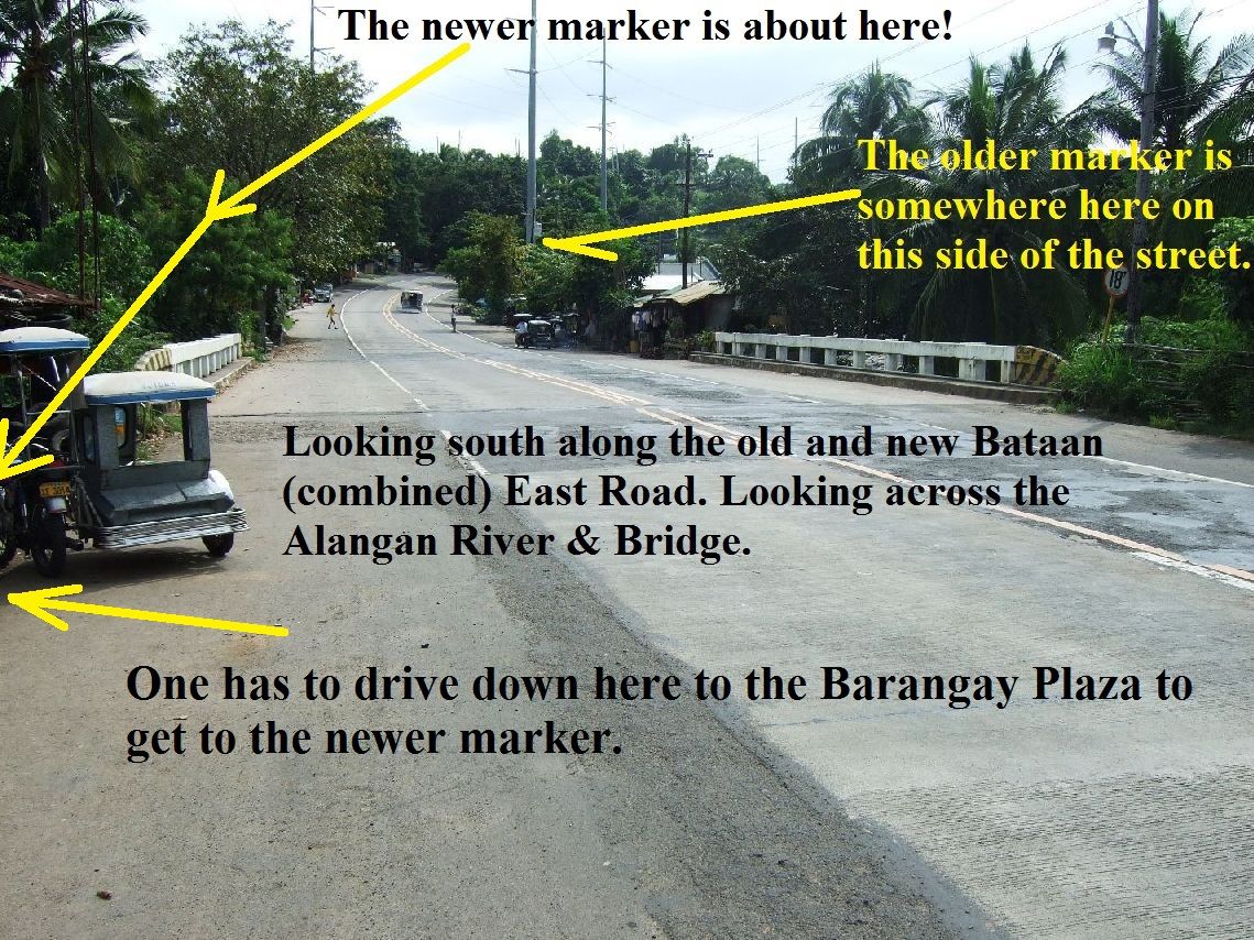
Thank you Jon, that will do. I should have no trouble finding it, the neglected Main Battle Line Marker in Mabatang. Chad I seen that Alangan River, Last Line of Defense Marker, and know where it is, my map and pictures below will tell. It is another marker I missed on my Death March Walk in 2007. The Kwiecinski family on Corregidor made me aware of it. They guided the Valor Tours sometime and they stopped there with the visitors on their bus to look at it. I stopped there about two years ago to find it and I did. If I took a picture of it I cant find the picture now. It is also neglected. A house has encroached on it and the marker is more or less imbedded in the structure’s wall. And it doesn’t look good. Every time I drive by there I try to spot it but when driving the car it is too hard to see. I will have to stop and take some good shots. Now in the Alangan Village, where it, Chad’s marker, is located, has a newer marker, near and across the street from Chad’s (diagonal, more or less) marker. It is part of the Village Hall as the pictures below will show. I discovered it on my Death March Walk and put that portion of the walk into this album: DMM No 19 to 23 Lamao s74.photobucket.com/user/PI-Sailor/library/Death%20March%20Markers%20Death%20Camps%20and%20Memorials/DMM%20No%2019%20to%2023%20Lamao?page=1Here are some pictures:  399. The Google Earth map marked up with the relevant landmarks.  400. Approximate locations of the markers in relation to the Alangan River and Bridge.  401. The newer marker of the Alangan River, Last Line of Defense Marker at the Alangan Village Square.  402. Close-up of the previous image. |
|
|
|
Post by Bob Hudson on Mar 28, 2013 15:43:23 GMT 8
This is less than two kilometers from where I live. I have heard mention of it but have not been there. I have been extremely ill the last few days but first chance I get I can go there. My fiancee knows exactly where it is. I have worked on this type of marker before and a new black sharpie pen will bring out the lettering on the marble structure. It is not far from the General King Memorial in Lamao, again next to a basketball court. The General King Memorial was being used as a place to urinate for the men and boys playing basketball. A few months ago, we complained about the horrible smell around the marker and asked the Barangay Captain to construct a "Comfort Room" as they are called here. He agreed something must be done but that's as far as it went.
|
|
|
|
Post by fortune40 on Mar 28, 2013 19:26:36 GMT 8
Thanks Bob that there are somebody like you and your fiancee taking care of those markers.I still have to see the next generation that would continue to take the cudgel in preserving these markers.I'm no young too.Sherwin is one of our hope from the "local"or hoping there were still other buffs out there.
The first time i saw some of the original markers way back 1978 it was just a piece of pipe with plate but not that special for the un informed on lookers to notice.
Things changed few years back when the new markers were erected with that white paint.Oh but i feel a bit spooky to see them while driving down the zig zag alone at past 10:00pm going to the town of Mariveles.
Aside from you and Sherwin i hope to see some more "Buffs" with the same passion for our dear Bataan and her rich history.
|
|
|
|
Post by chadhill on Mar 29, 2013 5:40:03 GMT 8
Jon, thanks for the post and nice pictures. Glad to have you aboard. Bob, hope you're feeling better soon. Karl, thanks for pointing out where the old marker is. Maybe Bob can snag a pic of it for us when he's better. I figured it had to be between Limay and Lamao because of the location of the Alangan River. On a more somber note, I went back and reviewed this thread from page 1 and discovered that a number of my photos are missing now. I assume it's due to the screwed-up heads at Photobucket, who couldn't leave well enough alone. Makes me wonder how many other threads our photos have disappeared from.  * * * * * Late update: Now all of the photos are back up! Go figure... |
|
|
|
Post by Bob Hudson on Mar 29, 2013 16:54:48 GMT 8
I went to the above Memorial marker a few minutes ago. If you look at the photo of the bridge "looking south", you would make a left turn just behind the trike on the left side of the photo, just north of the bridge. The photo of the Memorial must be an older one because the lettering on the Memorial looked pretty damn good today and needs no TLC. The cap on the right column is still missing as can determined by looking closely at the above photo.
We asked the Barangay Captain, Virgilio Mendoza, and he told us that the Memorial was erected in 2005 by Donel Mangundayao who is President of the Youth Council on Bataan. The Barangay maintains the Memorial of the "Last Stand on Bataan" which never really took place because the following day, General King went to Lamao to surrender Bataan.
|
|