|
|
Post by Bob Hudson on Jan 20, 2013 14:31:54 GMT 8
So, you are the Jim Erickson I know. Not some other Ericksons that I have run across. Funny! Haven't heard from you since April in Mariveles at KM 00. Come back and visit and well poke around that area. I have a feeling those villagers have more artifacts than they showed me. The BAR could have been the one your dad fired. It is a very beautiful area. Found that you cannot dive on the Oryoku without special permission. It's considered a shrine. If you want to hike around the area, come in Nov. or Dec. We'll get a couple of two man tents and spend a few days poking around. Could probably find a couple of other people to go with us. Here's an interesting photo of a cave just north of Quinawan. I'm sure locals have checked it out but would be interesting. Attachments:
|
|
|
|
Post by sherwino on Jan 21, 2013 9:29:07 GMT 8
Maybe snorkeling around those points can yield something, or the fishermen could have had beaten us to it. I was always thinking last year where can I snorkel here in Bataan.
|
|
|
|
Post by Bob Hudson on Jan 21, 2013 11:42:24 GMT 8
I'm not much of snorkeler but I would like to try. Really would like to purchase a six man inflatable raft with a five horse engine and poke around that whole area. I don't mean for the day but go for three or four days and carry in our own food.
|
|
|
|
Post by Karl Welteke on Jan 21, 2013 21:37:55 GMT 8
Reply 17 is asking this: Interesting find! Much of the coast to the North of the Points battle sites was defended by the 71st Inf (PA), then part of the 91st Div (PA). My Dad's unit, 1st Bn, 71st (PA), covered Caibobo point from the end of Jan 42 until the surrender. Can you give us a more precise location for Quinawan? Here are 5 maps that cover the whole west coast of Bataan. They are a little big and I can only present the IMG Thumb. 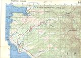 This 1st one is from Subic Bay down to the Bayandali River thru Morong Town. Morong Town can be easily reached from the former Subic Bay Naval Base by car. Morong, of course is famous, as the site of the last US Army Cavalry Charge by Philippine Scouts in 1942. 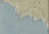 This 2nd map is from Bayandali River down to Kabayo Village, just north of Bagac. It covers the Mauben Line and in this area is the defunct Philippine Nuclear Power plant. The first 4 maps are sections scanned from1:50000 contour maps.  The 3rd map is from Kabayo Village down to Binuangan. It goes thru Bagac Town, thru Saysain Point where the US Army Coastal Artillery placed one of the Navy 8 inch guns. It could fire to Subic Bay or almost. On this map just above Binuangan is the village Romay indicated. That name does not exist today, that is Caibobo. And just left of it one can see the word point, that is Caibobo Point. I have driven with my car to Paysawan many times in recent years. I also know vehicles can drive safely all the way to Binuangan. But from Paysawan to Binuangan is a gravel road. At the bottom of the map is the Silalin Bay, it figured in the Battle of the points. 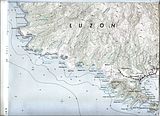 The 4th map is the biggest and starts at Silalin Bay and goes down all the way to Cochinos Point. On the upper portion of the map are all the locations of the upper Battle of the Points: Silalin Bay, Anyasan Point/Bay, Quinauan Point/Bay and Agloloma Bay. All these names figure in the Battle of the Points. The lower Battle of the Points is Longos Kawayan Point it is also on this map. The above 4 bays all have communities now and Quinauan Village may be the biggest. 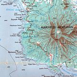 The 5th map is a section of an old Army 1:250000 map, I like it because it shows the old Bataan West Road and it shows the Bataan west Coast in question. Here is the URL of the whole map: www.lib.utexas.edu/maps/ams/philippines/txu-oclc-6539351-nd51-5-450.jpgRe: it is said “I was the first American anyone could recall seeing”. (Reply #19) -----I would say I been in that village about 6 times in the last 10 years. Here is some pictures of my visits, I always walked! 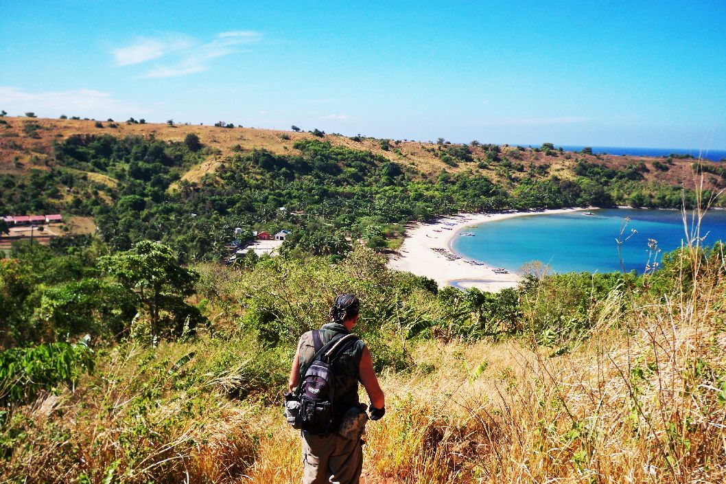 We are approaching Quinauan from the north. 23 March 2010 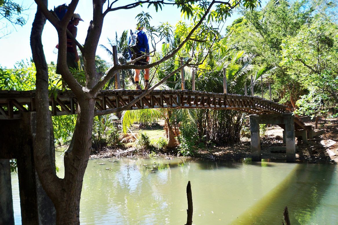 The bridge is on the north side of the village. 23 March 2010 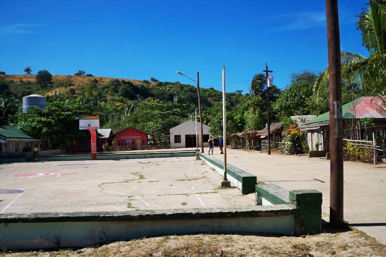 The Square, they spell the village Quinawan. 23 March 2010 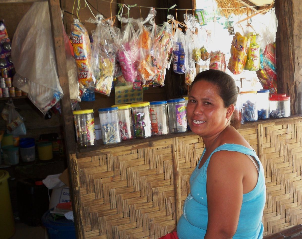 The owner of this sari sari store in Quinawan was our hostess for a cold beer when we returned here from Agloloma Bay. 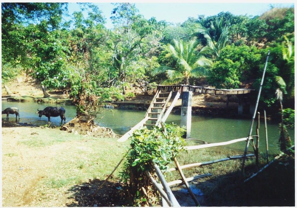 The same bridge on 23 April 2003. NOTE: fots2 and I been on Corregidor the last week. The laptop of fots2 quit and it may be a few days before you all hear again a beep from him. |
|
|
|
Post by okla on Jan 21, 2013 23:01:24 GMT 8
Hey Karl....I noticed, in the photo of the town square, that the local kids shoot a "few hoops". Isn't that a basketball goal at the far end and methinks I, also, espy the 3 point arc on the near end?  Could a budding NBA star be lurking in this peaceful setting?  |
|
|
|
Post by victor on Jan 21, 2013 23:33:59 GMT 8
Great photo of the BAR and ammo. That is such a priceless find. I'm fascinated with battlefield archeology. The items are such solid connections to history. Bob, when I saw your comment about someone telling you that you were the first American they've seen for a long time, I thought of Karl and maybe he didn't see Karl pass through. I thought I'd throw in a good online source to serve as a big picture background on what happened in that area where the BAR was found. Most of the members of this forum would be familiar with the history but it would be good info for the casual passers by. www.history.army.mil/books/wwii/5-2/5-2_17.htm#p303---- I'm glad to have some "free" time to surf the forums. It's been so long. (I'm actually robbing Peter to pay Paul... I'm technically at work but a very slow day since it's Martin Luther King Day). Glad to be able to come up for some air and look around at all the content added to the forum in the last 9 months. Hi Okla -- basketball is the most common past time sport in the Philippines. You can find makeshift hoops everywhere. Sometimes neighborhoods would close alleys and convert them into temporary basketball courts Victor |
|
|
|
Post by rickthelibrarian on Jan 22, 2013 1:15:18 GMT 8
Wow! Great find!! I'd like to know the specific dates you see on the headstamps on the cartridges. If you ever take out the powder and bullet, (and it is legal) would like to buy one or two of the brass cases from you.
|
|
|
|
Post by Bob Hudson on Jan 22, 2013 2:41:59 GMT 8
Karl, Victor and Rick, Karl, My trip to Quinawan was limited to visiting the school there which I can see in the photo of you (Karl) hiking into Quinawan. The school is the group of buildings in the upper left of your photo. We were fed at the school. When I asked about any artifacts being found, I was taken to the Barangay Captains home where he presented me with the BAR, magazines and loose ammo. We were fed at his home again and although we not hungry, we had to eat again because of the beautiful spread of food his wife made for us. For the first time, I drank coconut milk through a straw directly out of the coconut. It was the school principal who told me that I was the first American he recalled seeing since he arrived there. I have no idea how long he had been there. Great map of the area by the way. I plan on returning there next month to deliver a sign for their school, which does not have one, for the their kindness to me and the BAR and effects. From the descriptions f the battle in January of 42, it was a heavily forested area with dense undergrowth. You and I know it not even close to that now. Since the loggers came in and cut down all the mahogany trees and other species of beautifully grained wood, the area is pretty much open as evidenced by your photos. Victor, Loved the link to the detailed description of the battle in that area in January 1942. Thank you. I had wondered if I cleaned the BAR and found a serial number, could it be traced to the unit that used it and buried it there. There would be no way to discover whether it was lost in battle or ditched after the surrender, but because the magazine are all filled with shells and so many loose shells were discovered, I'm guessing all were buried to deny their use to the enemy. Rick, The United States Cartridge Co shells were all pretty much 41 or 1941. The FA's or Frankford Arms were 31's and 33's. The Remingtons, I don't recall a date stamp at all although there might be some. Do you live here in the Philippines or stateside? Attachments:
|
|
Deleted
Deleted Member
Posts: 0
|
Post by Deleted on Jan 22, 2013 4:08:22 GMT 8
Karl,
Wonderful maps. Thank you. The more Northern points had a minor role at end of the Battle of the Points. Japanese survivors from Quinauan, Silalin, Anyasan made their ways North either by sea or by infiltrating behind the lines. 1st Bn 71st on Caibobo point both shot escapees in the sea and captured about 20 wounded Japanese survivors either on the beaches or behind the lines. Presumably a few Japanese made it to locations farther North.
Since the maps are so good, I'll add what I know about on beach defenses North of the Points battle area from 30 Jan 42 on. They are a bit different from the little that has been published in Morton and Whitman.
South to North from:
Binuangan River to Paysawan River. 1st Bn 71st Inf (PA).
Paysawan River to Saysain ridge. 3rd Bn 71st Inf (PA) to 20 March 42, 2nd Bn 71st Inf (PA) from 20 March 42 to surrender.
Saysain ridge to MLR near Bagac. Unidentified Bn of 72nd Inf Regt (PA).
All the 71st Inf and 72nd Inf Regiments (PA) were made part of the 91st Div (PA) in mid Jan 42.
Jim
|
|
|
|
Post by Karl Welteke on Jan 22, 2013 12:06:43 GMT 8
A reminder, we have a great thread about the points of the Battle of the Points. It is this thread: Topic: -Walk to the Battle of the Points- in the group of threads: -The War On Bataan- corregidor.proboards.com/index.cgi?action=display&board=discussions&thread=667&page=1It has great contributions from chadhill and one aerial picture from fots2. Here are some more sample images: 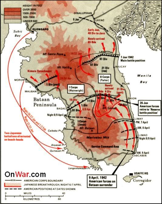 This map from the web gives a good overview of the battle area. 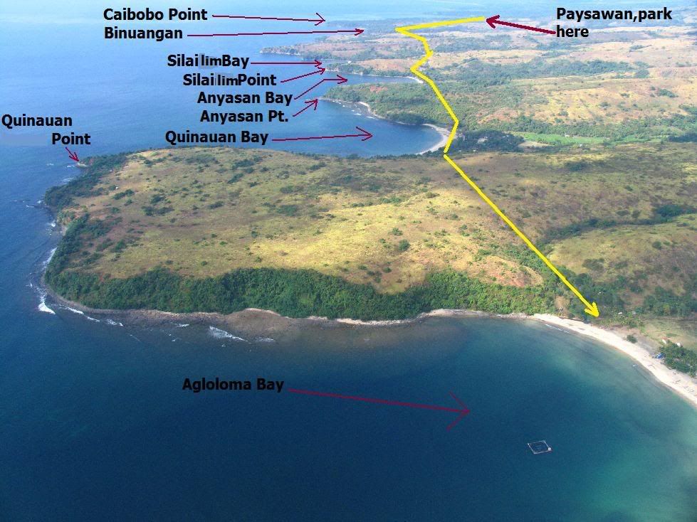 The Battle of the Points area, this shot came from my friend John Moffitt. 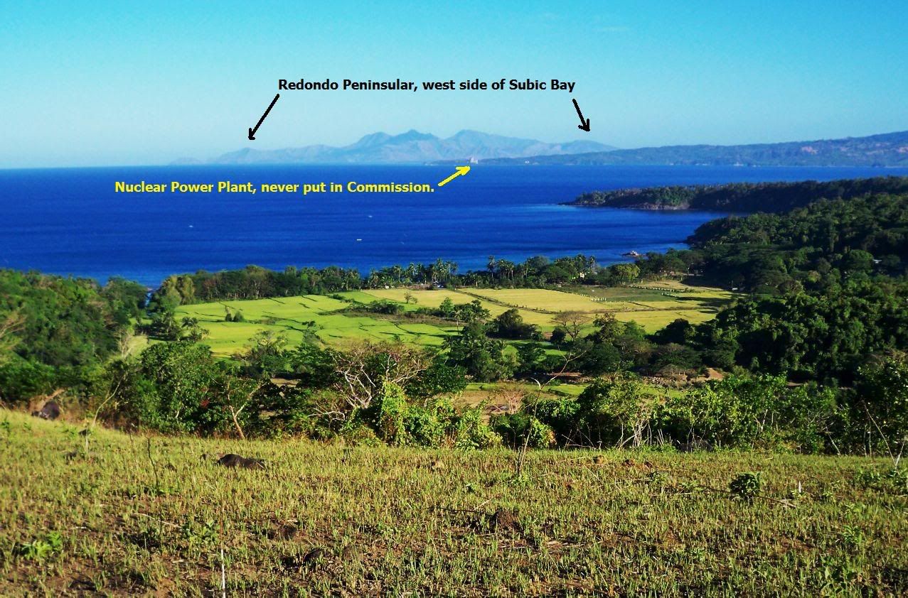 This is Paysawan, we parked here and are up on the 1st ridge. In back are Subic Bay and the defunct nuclear power plant. 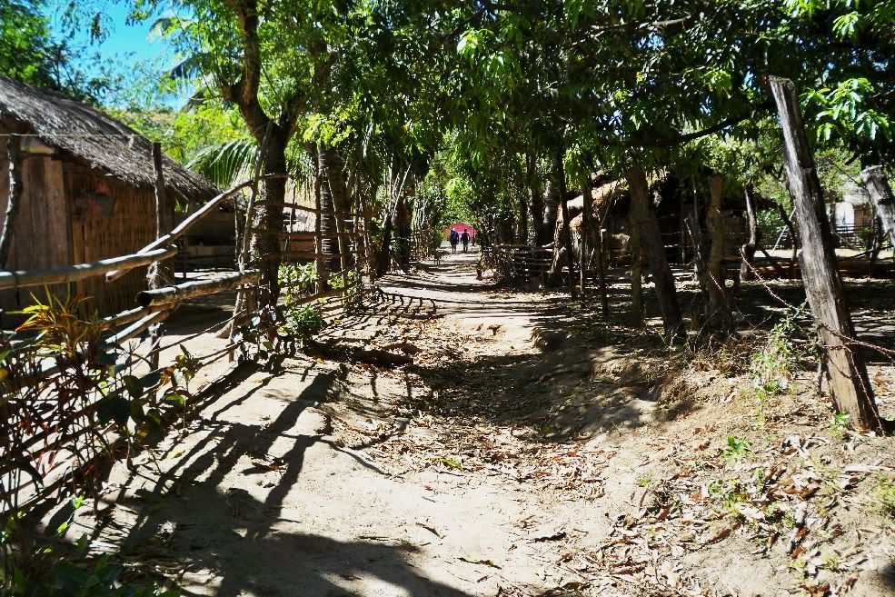 Quinawan community is large and we have a regular main street here. 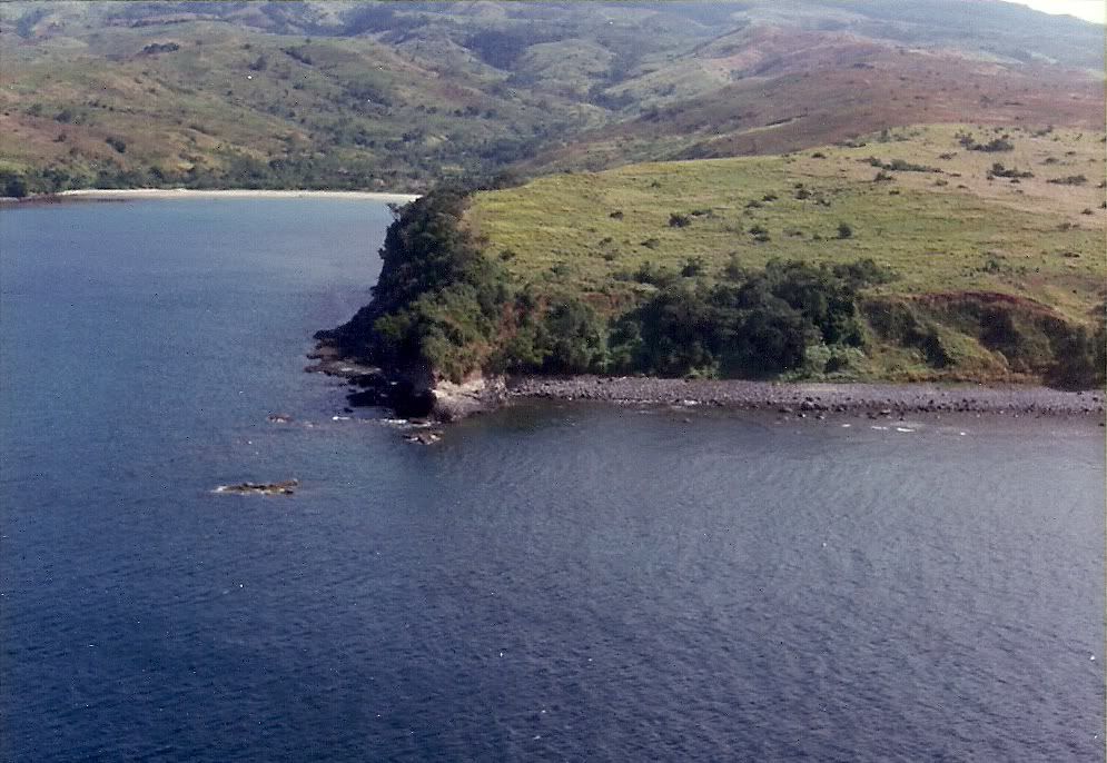 Quinauan Point, from the SW. This image is from chadhill 1986 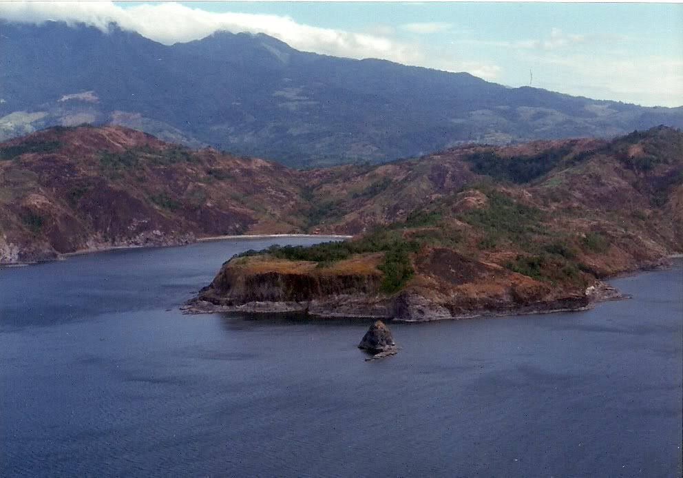 Longoskawayan Point. Mount Pucot is on the left. This image is from chadhill 1986 |
|


 Could a budding NBA star be lurking in this peaceful setting?


