Post by victor on Aug 18, 2013 11:03:08 GMT 8
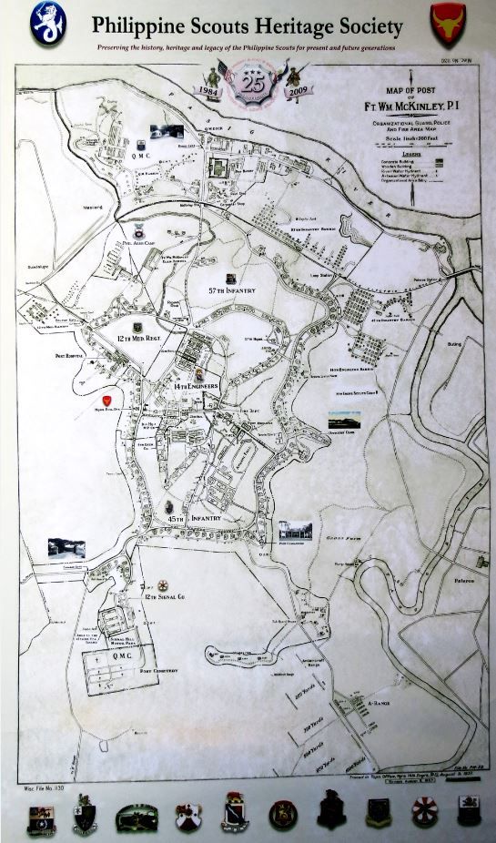
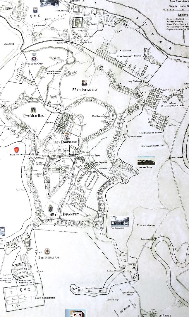
As many know… the ritzy Fort Bonifacio City in Metro Manila used to be the old Fort McKinley proper. I decided to compare the poster map of it made by a friend in 2009. The poster is of the old post map, comparing it with present day views and google map.
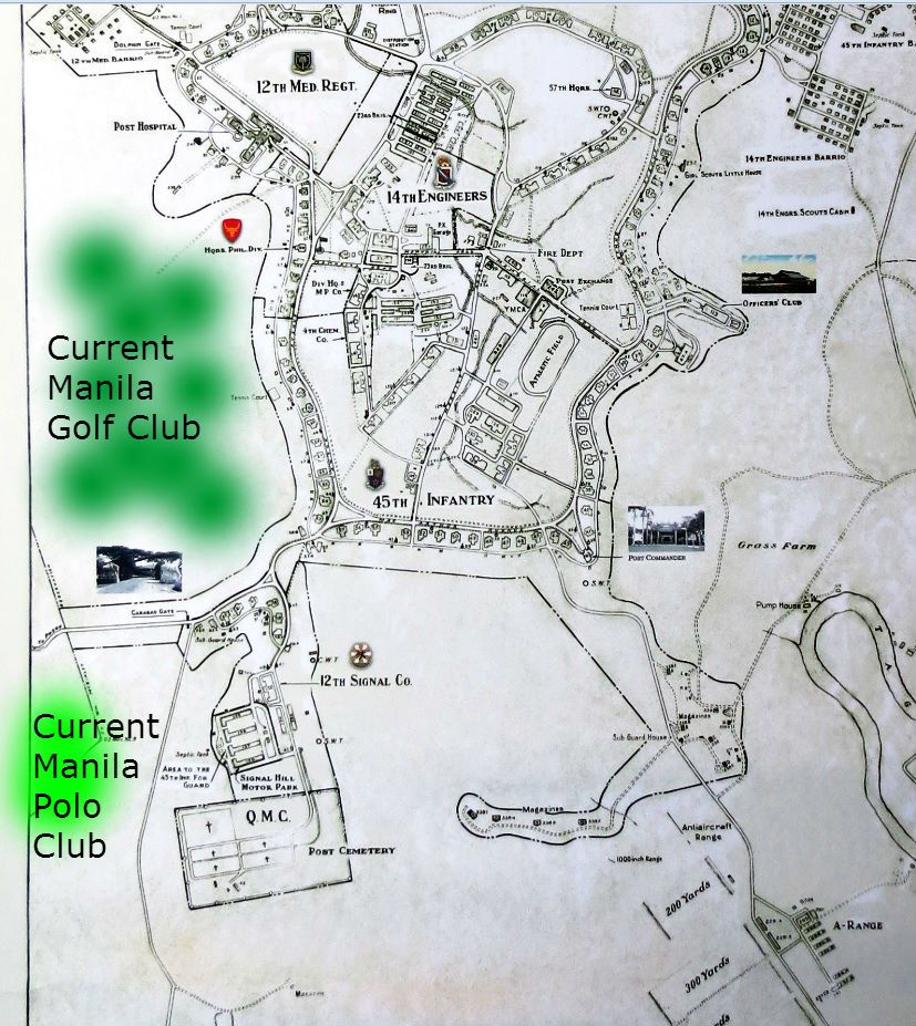
Here is the poster
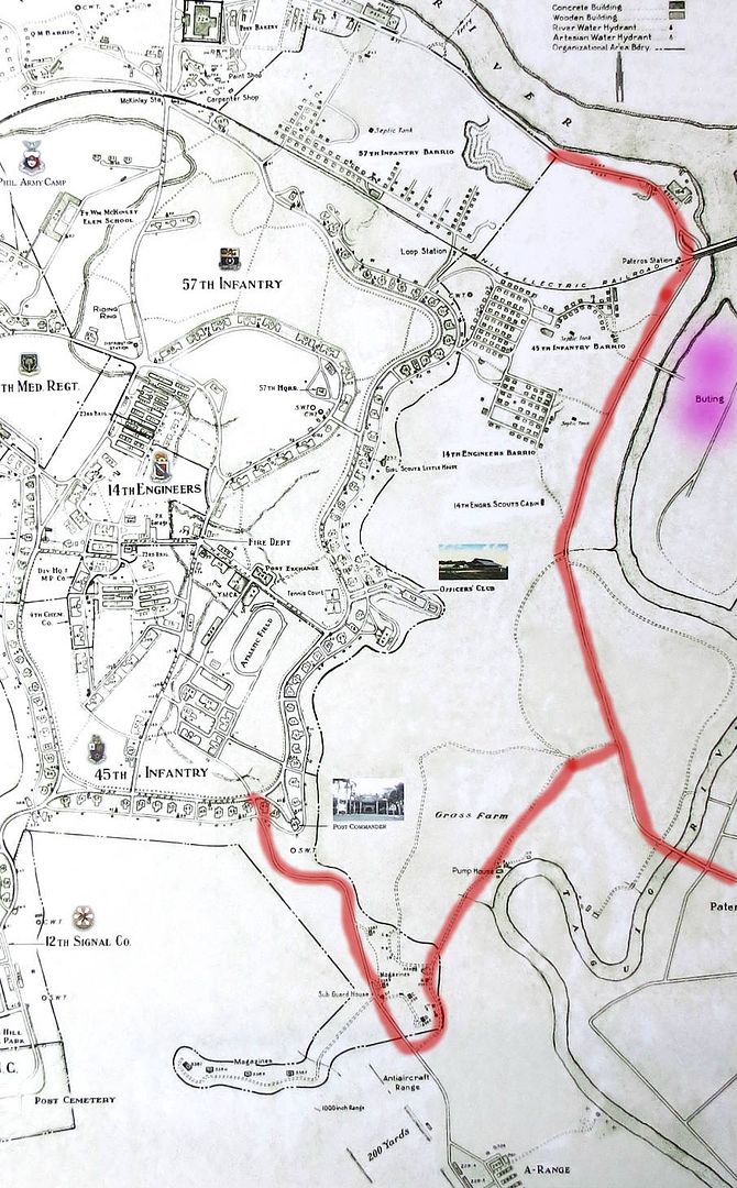
A slightly closer look at the map
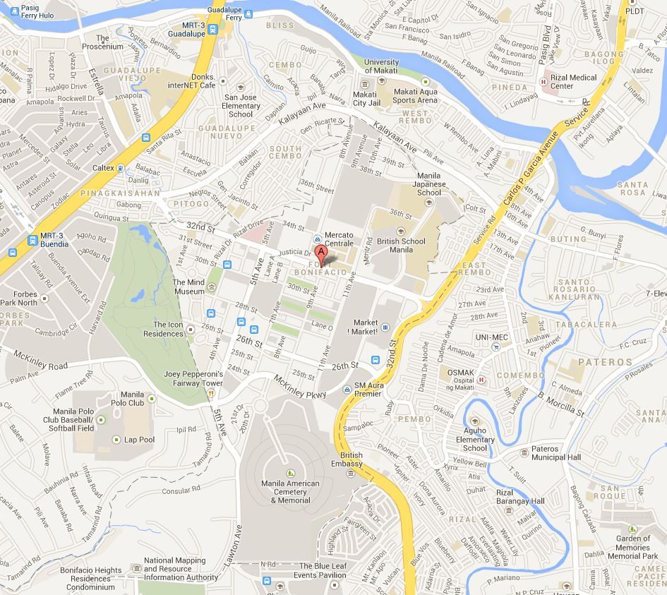
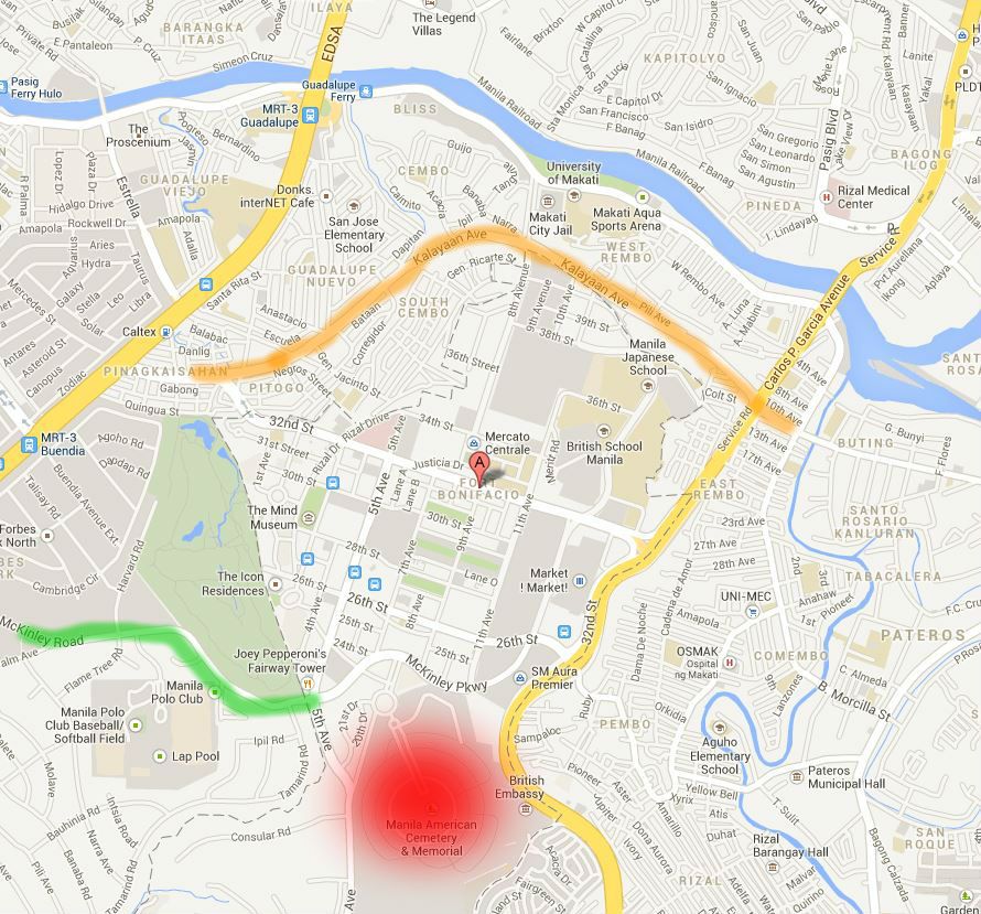
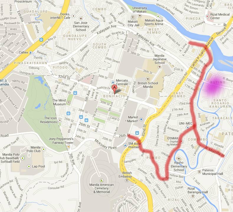
And here’s the google map
The current American WW2 Cemetery (red marked area) is simply a greatly expanded area of the old post cemetery that was near the carabao gate. The present day McKinley Rd was the old road that led to the carabao gate (marked green).
You can also tell that the old Manila Electric Railroad (marked with orange line) is the present day Kalayaan Ave.
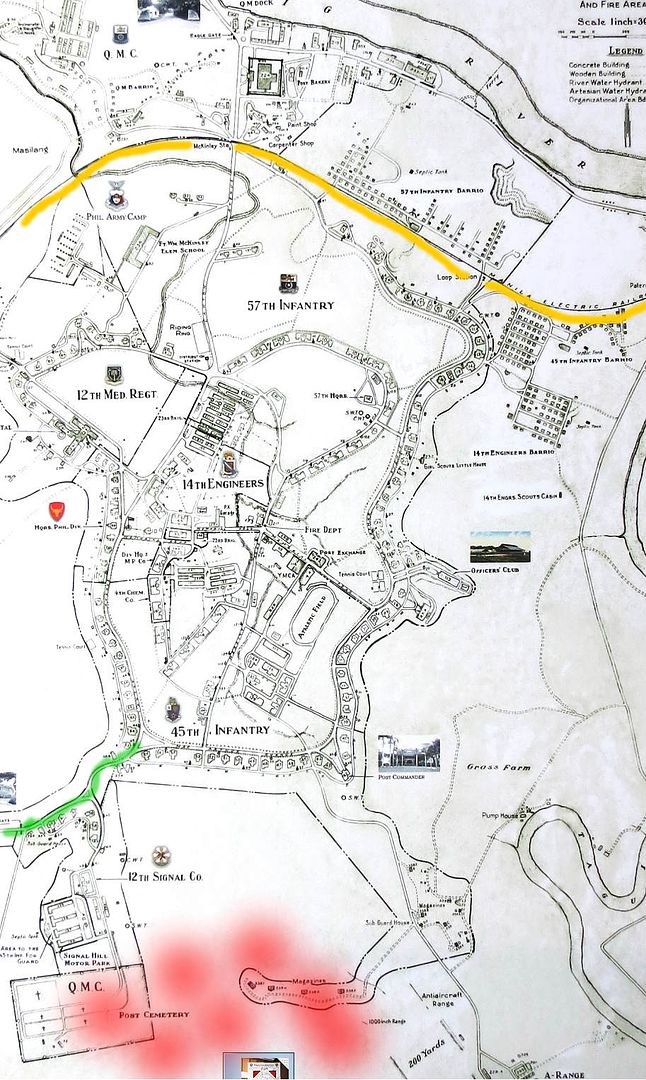
Some of the old trails or possibly dirt roads in the map are still present as paved roads today (red traced line). The same Buting area is marked in purple splotch.
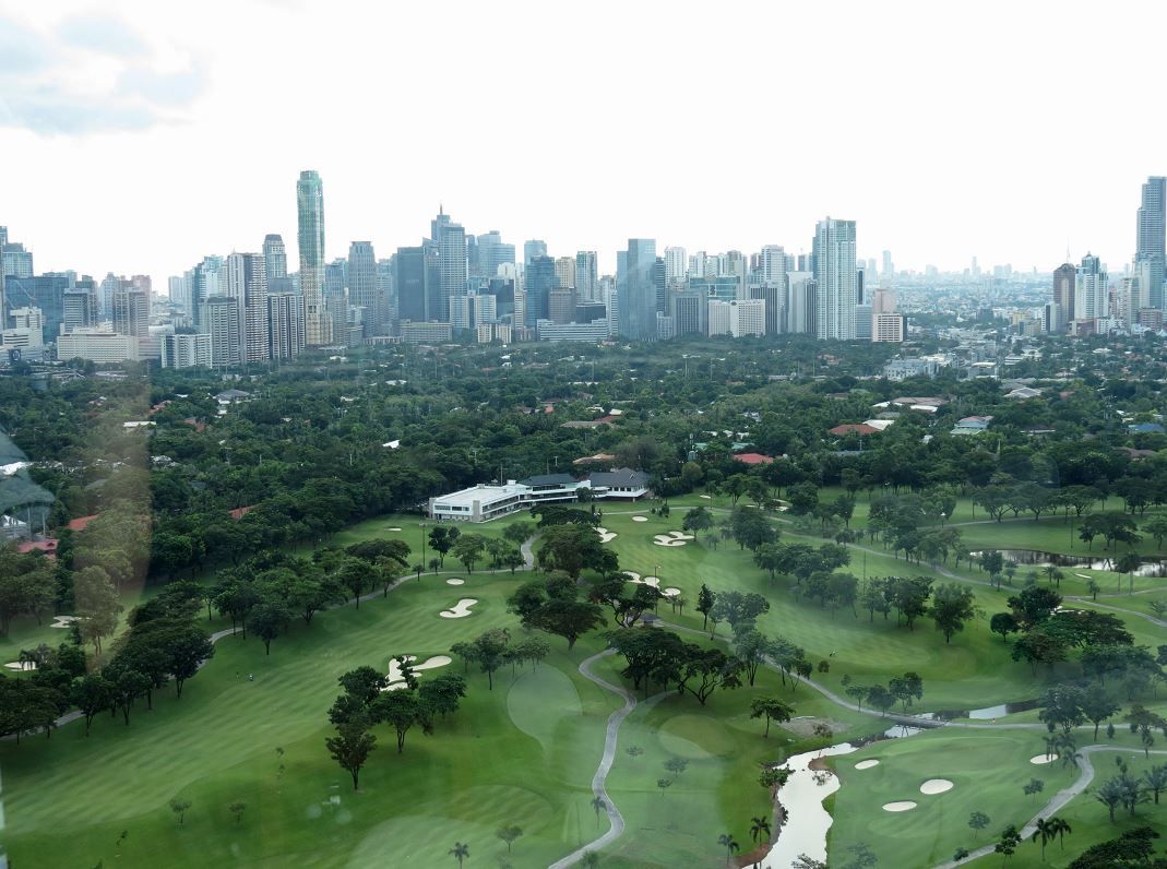
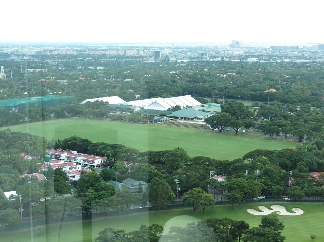
The Manila Golf Club is just outside to the west of the post. So is the Manila Polo Club which is just south and across the street on McKinley Road.
The view of the Manila Golf and Polo Clubs from the Pacific Plaza residential high rise, facing west. The skyline skyscrapers in the distance is Makati… and buried amidst these high rises is the old Nielson Field.
Manila Polo Club
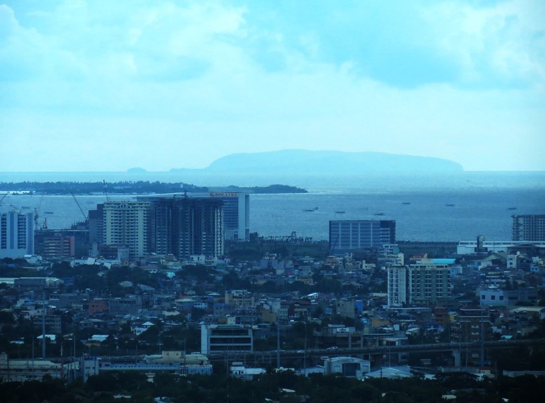
Zooming the camera a bit, Corregidor island can be seen out on Manila Bay. So is Cavite – much closer.
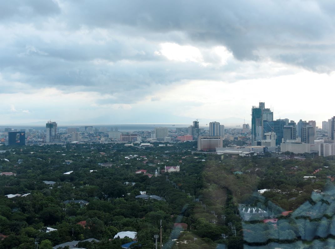
Manila Bay and the mountains of Bataan can be seen in the distance.
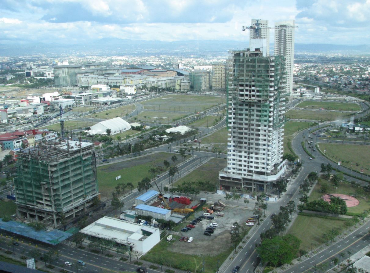
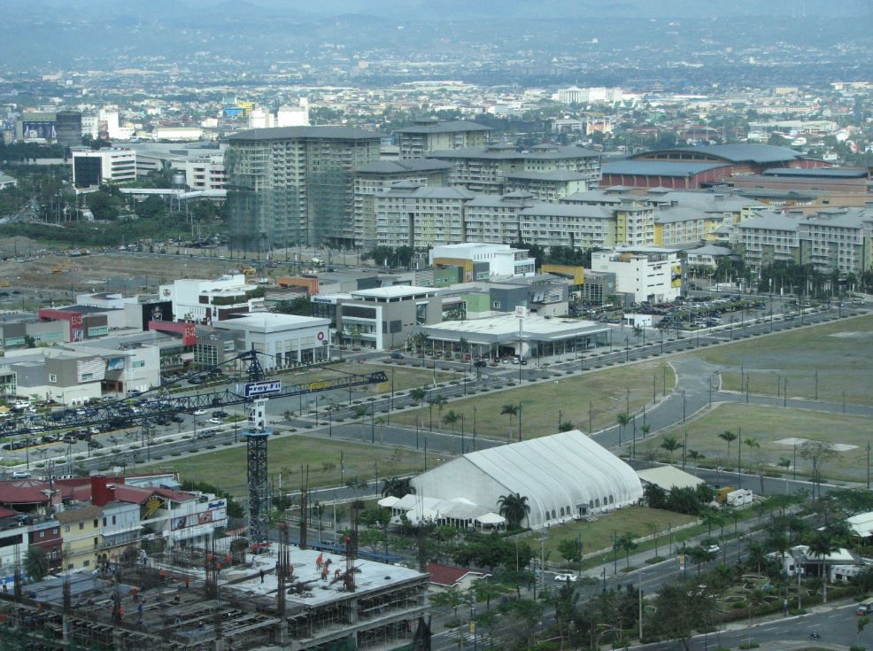
This is an old view circa 2009 facing east. This view is no longer available in 2013 because it’s been blocked by more high rise buildings. The Bonifacio High Street, Serendra condominiums, and Market Market mall can be seen. The old Officer’s Club was located somewhere where Market Market and Serendra now stand.
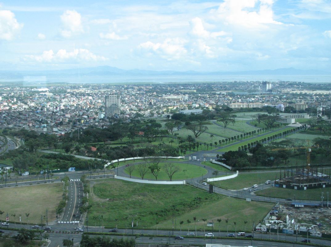
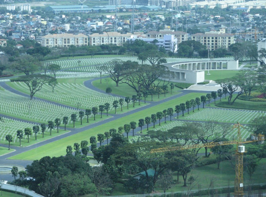
Looking to the south/southeast is the American Cemetery… This view is also severely limited in 2013 as again, more high rises have gone up.
Here is the poster

A slightly closer look at the map

And here’s the google map

The current American WW2 Cemetery (red marked area) is simply a greatly expanded area of the old post cemetery that was near the carabao gate. The present day McKinley Rd was the old road that led to the carabao gate (marked green).
You can also tell that the old Manila Electric Railroad (marked with orange line) is the present day Kalayaan Ave.


Some of the old trails or possibly dirt roads in the map are still present as paved roads today (red traced line). The same Buting area is marked in purple splotch.


The Manila Golf Club is just outside to the west of the post. So is the Manila Polo Club which is just south and across the street on McKinley Road.

The view of the Manila Golf and Polo Clubs from the Pacific Plaza residential high rise, facing west. The skyline skyscrapers in the distance is Makati… and buried amidst these high rises is the old Nielson Field.

Manila Polo Club

Zooming the camera a bit, Corregidor island can be seen out on Manila Bay. So is Cavite – much closer.

Manila Bay and the mountains of Bataan can be seen in the distance.

This is an old view circa 2009 facing east. This view is no longer available in 2013 because it’s been blocked by more high rise buildings. The Bonifacio High Street, Serendra condominiums, and Market Market mall can be seen. The old Officer’s Club was located somewhere where Market Market and Serendra now stand.


Looking to the south/southeast is the American Cemetery… This view is also severely limited in 2013 as again, more high rises have gone up.


