AERIAL 1927 OR 1933 AND 1945 IMAGES OF FORT MILLS ON CORREGIDOR ISLAND OF BOTTOMSIDE, STOCKADE LEVEL AND MALINTA HILL.
These high resolution images was given to me by Karl Schmidt from the Coastal Defense Study Group (CDSG.org) who got the images from NARA.
The original images was cropped and all images were snipped (Window tool) which is like taking a screen shot of the original images and you get a greatly reduced byte count but the picture still looks the same. None of the pictures in the Flickr album were reduced in size. So, it is like I zoomed in on the snipped copies.
This series of 17 shots are numbered i1a to i6 and are placed in this Flickr album in alphabetical order.
www.flickr.com/photos/44567569@N00/albums/72157658661455655The same 17 images are presented here in the forum but are smaller:
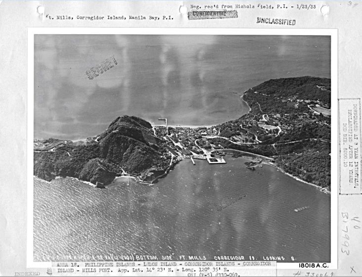
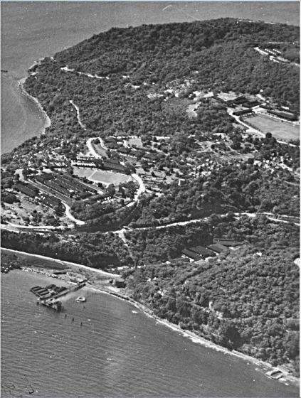
W519 (i1) a 1933 or 1927- Army aerial image of Fort Mills at Bottomside of Corregidor Island. This picture was provided by Karl Schmidt, a leader in the Coastal Defense Study Group organization (cdsg.org) who got it from the National Archives and Records Administration (NARA).
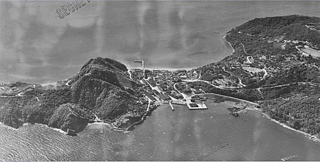
W520 (i1a) a 1933 or 1927- Army aerial image of Fort Mills at Bottomside of Corregidor Island. This picture was provided by Karl Schmidt, a leader in the Coastal Defense Study Group organization (cdsg.org) who got it from the National Archives and Records Administration (NARA).
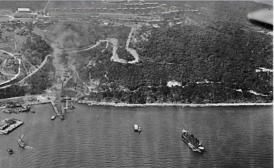
W521 (i1b) a 1933 or 1927- Army aerial image of Fort Mills at Bottomside with Malinta Hill of Corregidor Island. This picture was provided by Karl Schmidt, a leader in the Coastal Defense Study Group organization (cdsg.org) who got it from the National Archives and Records Administration (NARA).
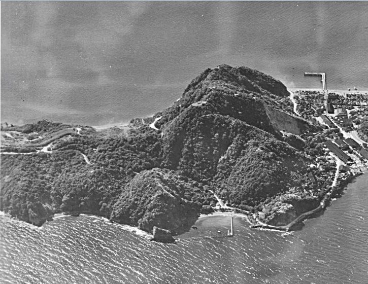
W522 (i1c) a 1933 or 1927- Army aerial image of Fort Mills at Bottomside of Corregidor Island. This picture was provided by Karl Schmidt, a leader in the Coastal Defense Study Group organization (cdsg.org) who got it from the National Archives and Records Administration (NARA).
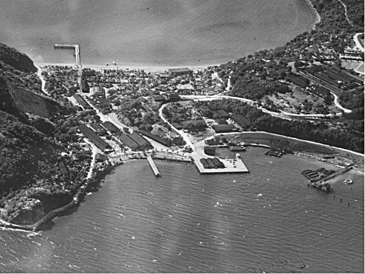
W523 (i1d) a 1933 or 1927- Army aerial image of Fort Mills at Bottomside with the Stockade level of Corregidor Island. This picture was provided by Karl Schmidt, a leader in the Coastal Defense Study Group organization (cdsg.org) who got it from the National Archives and Records Administration (NARA).
W524 (i2) a 1927- Army aerial image of Fort Mills at Bottomside of Corregidor Island. This picture was provided by Karl Schmidt, a leader in the Coastal Defense Study Group organization (cdsg.org) who got it from the National Archives and Records Administration (NARA).
W525 (i2a) a 1927- Army aerial image of Fort Mills at Bottomside with the Stockade Level of Corregidor Island. This picture was provided by Karl Schmidt, a leader in the Coastal Defense Study Group organization (cdsg.org) who got it from the National Archives and Records Administration (NARA).
W526 (i2b) a 1927- Army aerial image of Fort Mills at Bottomside of Corregidor Island. This picture was provided by Karl Schmidt, a leader in the Coastal Defense Study Group organization (cdsg.org) who got it from the National Archives and Records Administration (NARA).
W527 (i2c) a 1927- Army aerial image of Fort Mills at Bottomside of Corregidor Island. This picture was provided by Karl Schmidt, a leader in the Coastal Defense Study Group organization (cdsg.org) who got it from the National Archives and Records Administration (NARA).
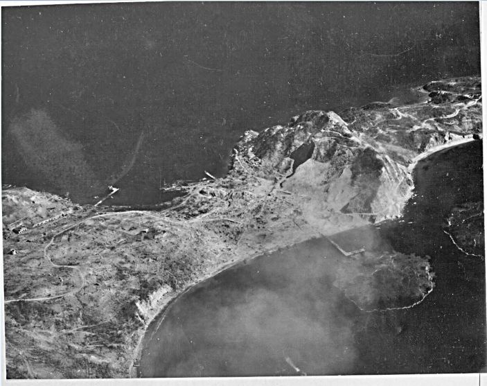
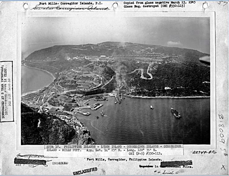
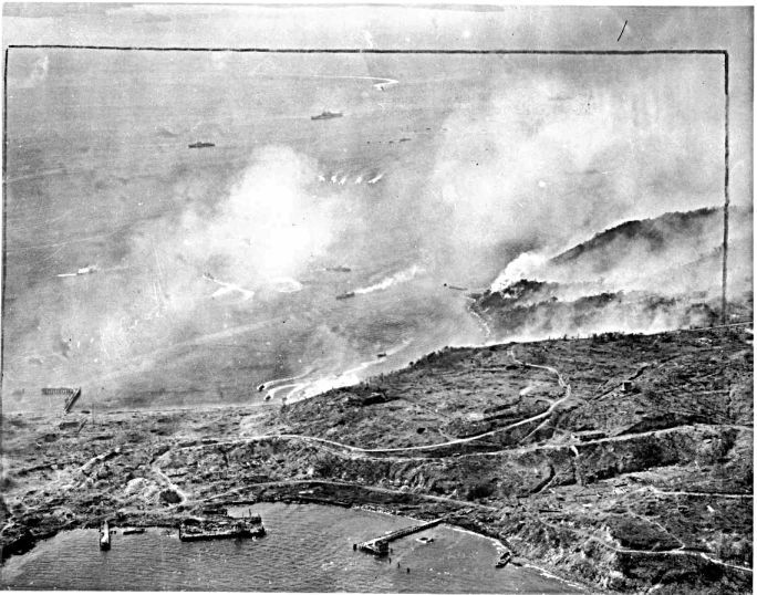
W528 (i3) a 1945 (during the Feb. assault) Army aerial image of Fort Mills at Bottomside of Corregidor Island. This picture was provided by Karl Schmidt, a leader in the Coastal Defense Study Group organization (cdsg.org) who got it from the National Archives and Records Administration (NARA).
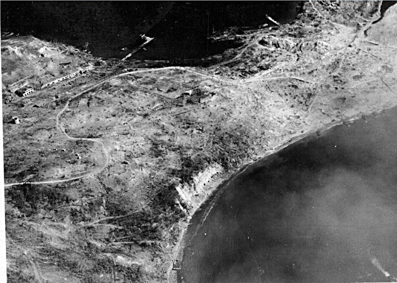
W529 (i3a) a 1945 (during the Feb. assault) Army aerial image of Fort Mills at Bottomside of Corregidor Island. This picture was provided by Karl Schmidt, a leader in the Coastal Defense Study Group organization (cdsg.org) who got it from the National Archives and Records Administration (NARA).
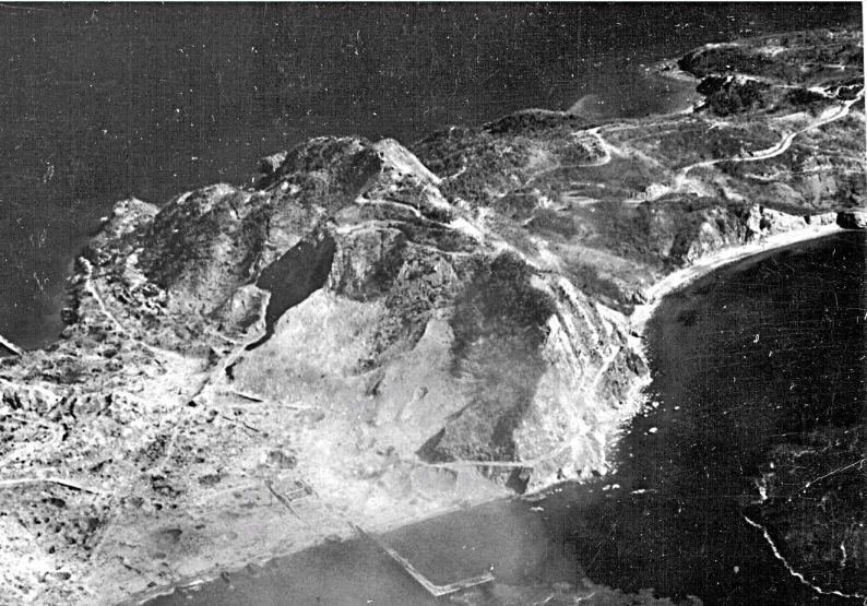
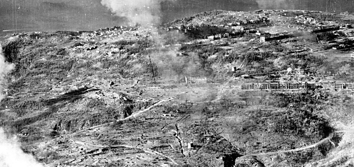
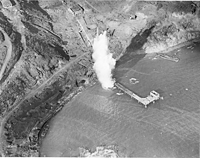
W530 (i3b) a 1945 (during the Feb. assault) Army aerial image of Fort Mills at Bottomside with Malinta Hill on Corregidor Island. This picture was provided by Karl Schmidt, a leader in the Coastal Defense Study Group organization (cdsg.org) who got it from the National Archives and Records Administration (NARA).
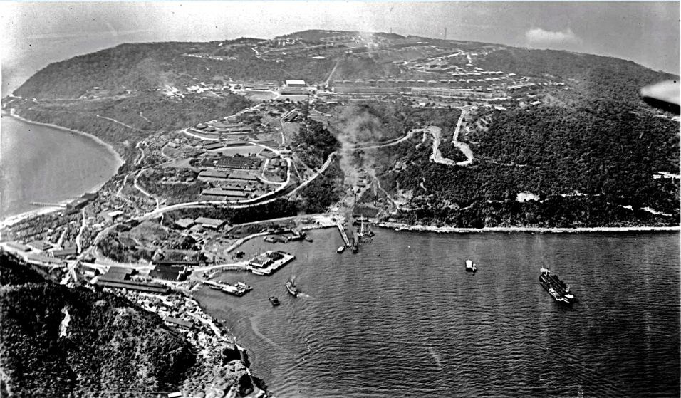
W531 (i4) a 1945 (during the Feb. assault) Army aerial image of Fort Mills at Bottomside on Corregidor Island. This picture was provided by Karl Schmidt, a leader in the Coastal Defense Study Group organization (cdsg.org) who got it from the National Archives and Records Administration (NARA).
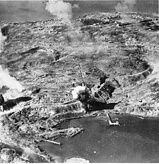
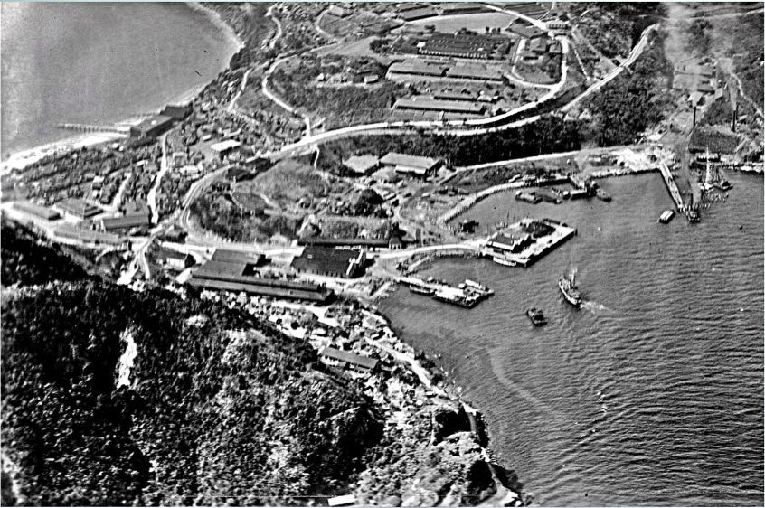
W532 (i5) a 1945 (during the Feb. assault) Army aerial image of Fort Mills at Bottomside with the Stockade Level and Eng. Ravine on Corregidor Island. This picture was provided by Karl Schmidt, a leader in the Coastal Defense Study Group organization (cdsg.org) who got it from the National Archives and Records Administration (NARA).
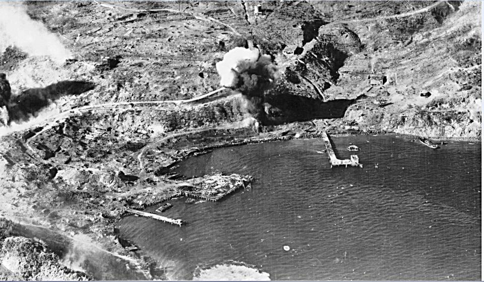
W533 (i5a) a 1945 (during the Feb. assault) Army aerial image of Fort Mills at Bottomside with the Stockade Level and Eng. Ravine on Corregidor Island. This picture was provided by Karl Schmidt, a leader in the Coastal Defense Study Group organization (cdsg.org) who got it from the National Archives and Records Administration (NARA).
W534 (i5b) a 1945 (during the Feb. assault) Army aerial image of Fort Mills at Bottomside with the Stockade Level and Eng. Ravine on Corregidor Island. This picture was provided by Karl Schmidt, a leader in the Coastal Defense Study Group organization (cdsg.org) who got it from the National Archives and Records Administration (NARA).
W535 (i6) a 1945 (during the Feb. assault) Army aerial image of Fort Mills at Bottomside with the Stockade Level and Eng. Ravine on Corregidor Island. This picture was provided by Karl Schmidt, a leader in the Coastal Defense Study Group organization (cdsg.org) who got it from the National Archives and Records Administration (NARA).


