

Post by Hounddog on Mar 30, 2024 21:12:33 GMT 8
It was my impatient longing for more information re the mystery surrounding the Battery Point bombproof infantry quarters tunnel that prompted me to organize this most recent trip to Corregidor. This, coupled with the fact that I had to return to the US for work in April, meant that the time to go was now, even though I had just visited barely 5 weeks previously.
Ah, but this trip would be different. To my knowledge, no one in recent memory has focused on one single area of the island like this so intently, and with such determination. So off I went! I was joined by two friends, who I'm greatly indebted to, and I thank them for their company, wisdom, and shared sense of enthusiasm. We made a great team and had a fruitful trip.
The boat left from Villa Carmen this time around, as they had apparently sorted their license issues and were cleared to depart from their resort again:

The goal for Day 1, a half day, was to hike down to James Ravine for a revisit to the bombproof infantry quarters tunnel there. This was helpful in the study of it's sister tunnel in Battery Point. Walking the length of this tunnel again, one gets a fresh understanding of its layout and design. I also had the opportunity to film some well-lit HD video inside it too, footage of which will be used in a future YouTube project about this whole subject.
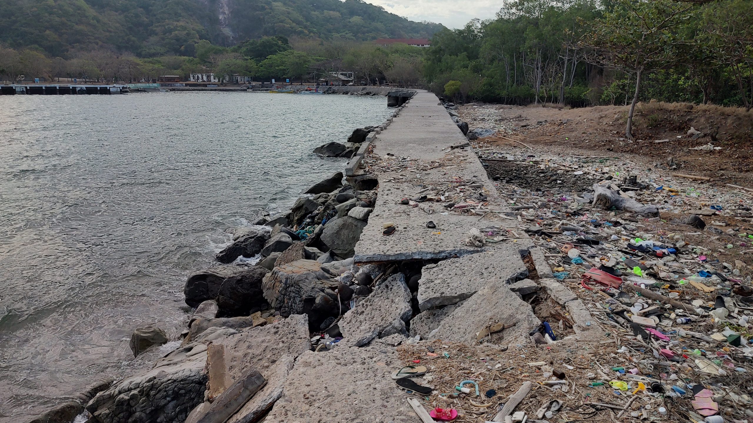
I took note of a few changes in the roads and landscape on the way down to James Ravine. Firstly, the boardwalk or concrete pathway leading past the Coast Guard station and towards the Engineer Warf has been damaged by ocean wave action. It's fallen into the sea in one large section.
Secondly, on the walk down the now paved road to James Ravine, I came across a rather large landslide that has now made the road impassable to any large vehicles. There's a big tree stump mixed with a ton of earth and rocks blocking the way.
This area will need to be cleared before any vehicles can pass down to the water tank area. The landslide taking place on a relatively newly repaved road demonstrates how the island is in a constant state of change.
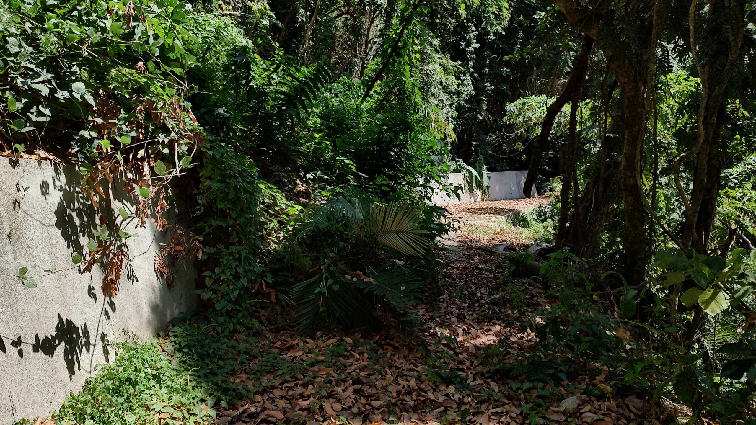
After passing the water tanks, our group managed to push through very heavy jungle growth, cross a stream or two, and finally find the entrance to the infantry tunnel. We passed by this tunnel in our 2023 visit but didn't go inside, noting how covered the entrance had become from the years of falling earth and organics from above. It was even more closed off on this visit. But we managed to push earth away and safely slide inside it.
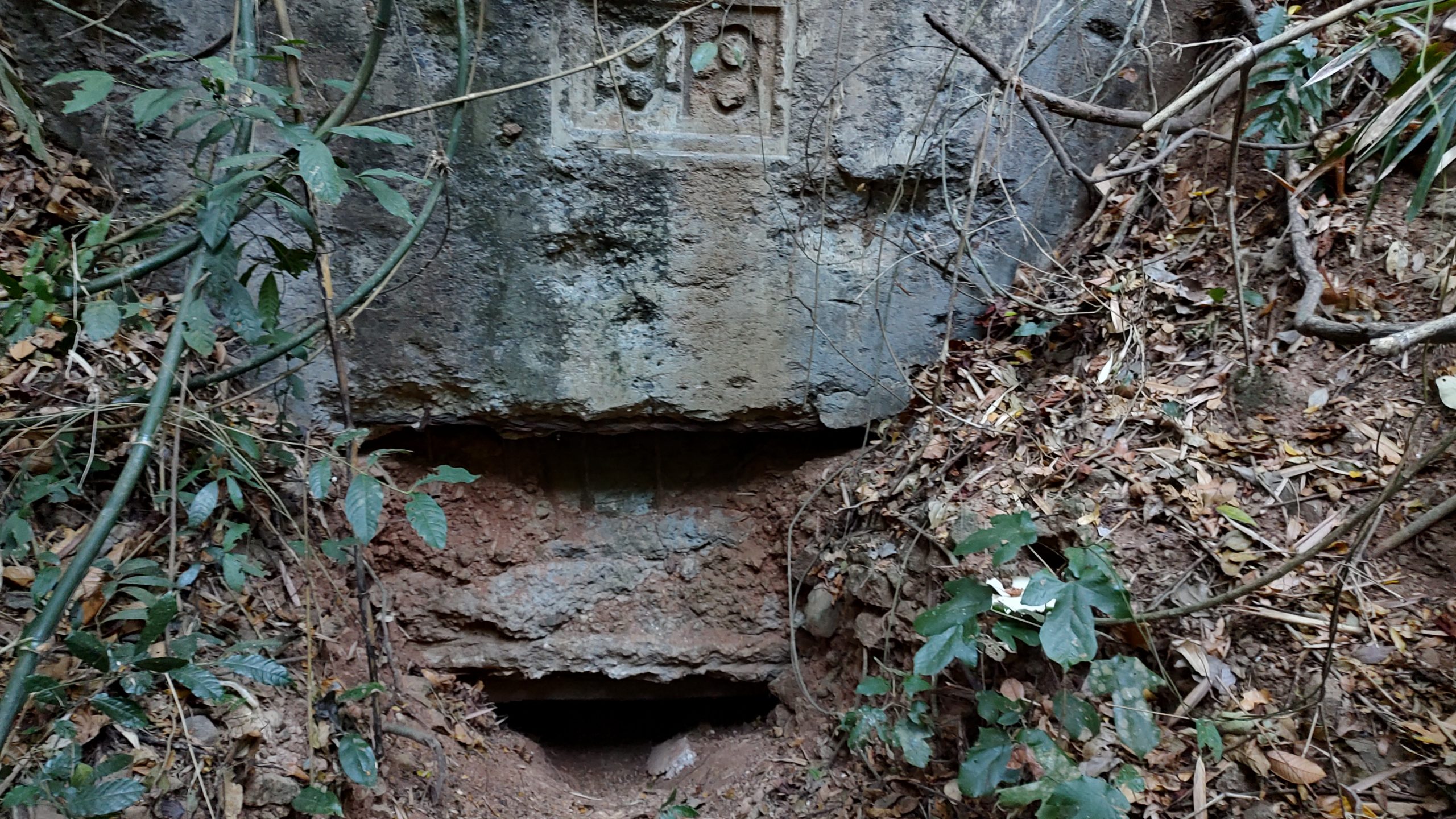
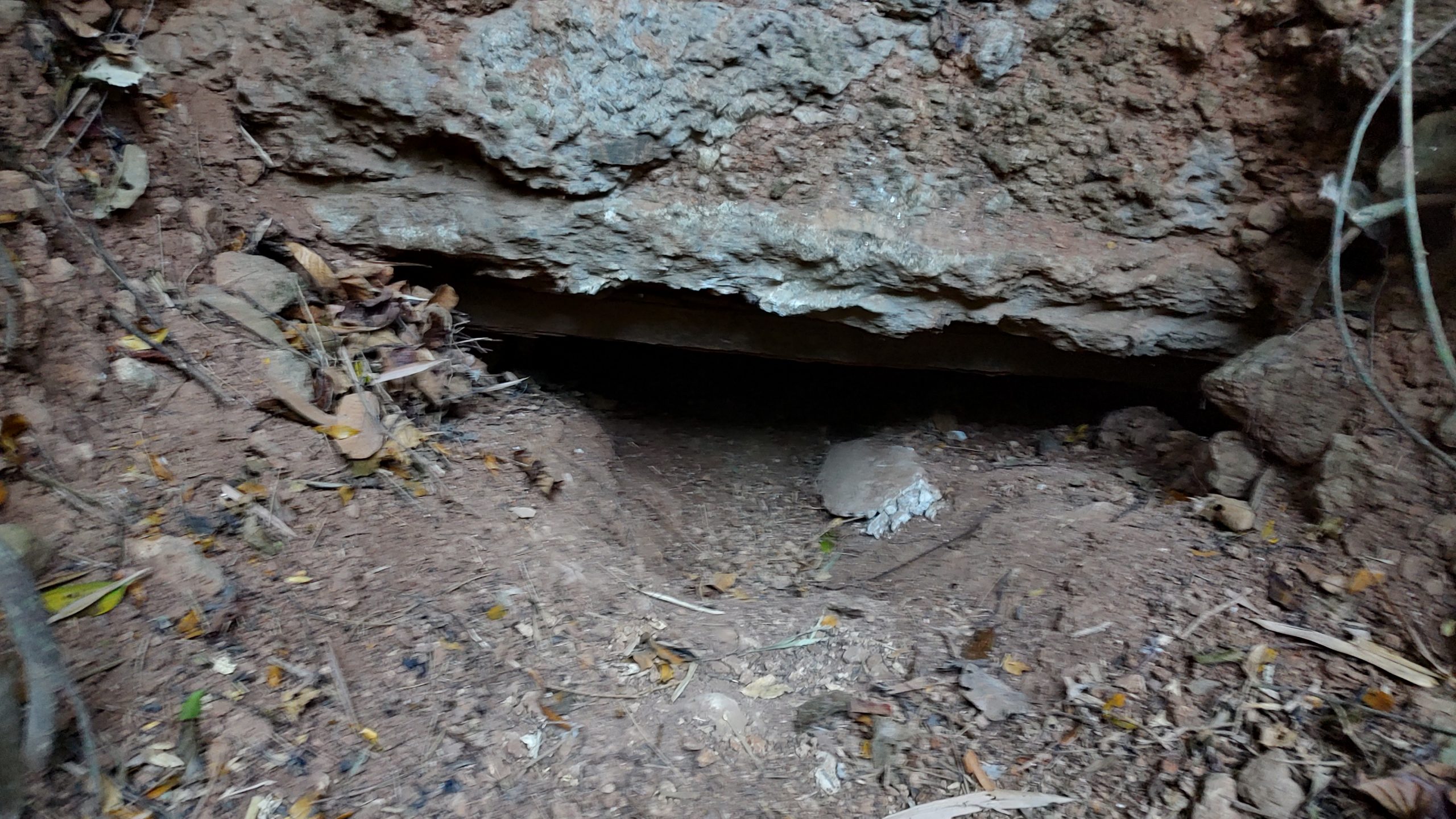
The entrance to the tunnel as of March 24, 2024:
I didn't take very many photos inside the tunnel, but did shoot several videos with my GoPro and bright lights, I'll try to add some screenshots from those videos here in the near future.
Day 2, our first full day in the Battery Point area, was spent carefully checking compass coordinates, measuring things, and then searching for concrete on the surface of what we now understand to be a 79 year old 100' wide by 30' deep crater. The crater was the aftermath of a massive explosion that occurred here on April 12, 1945. Long since overtaken by mother nature, it is all that remains of the Battery Point bombproof infantry quarters tunnel. At least, all that we know of so far. There were over a dozen chunks of concrete scattered around, partially submerged on the surface of the jungle floor. A typical chunk looked like this:
See the tiny bit of iron rebar sticking out? The concrete chunks seem to lay in roughly two distinct rows, forming a pattern that roughly aligns with our compass measurement of where the tunnel was once located. To me, it's obvious they are the remaining pieces of the tunnel, (perhaps the ceiling?) scattered after the massive explosion. We don't know how powerful the explosion was or how it destroyed the tunnel structure exactly, and some in the group posited that an implosion could have occurred, but regardless, the effect of that event left the earth, rocks, and concrete in its present state today.
Further careful examination of the entire site yielded various small ordinance, all of which needs to be accurately identified. It's entirely possible that this ordinance was part of the cataclysmic explosion that occurred here. Stored inside the tunnel perhaps? I also took the opportunity to film some drone shots of the whole crater/valley area, up through the forest canopy, and the out to the ocean, only to turn around and get a great shot of Battery Point from the air:
Again, these scenes will appear in a future YouTube video.
Finally, we got a good look at the so-called "bridge" or upper rain culvert that is laying in the creek bed not far from the lower rain culvert. We cleared off this damaged assembly of concrete and examined it more closely. In my opinion it looks like it's sitting destroyed, but in situ. Here's some photos of it:

Day 3, our final full day on The Rock, was spent at the location where I believe the tunnel's original air shaft exited and a cupola once stood. There is mostly earth and jungle in this area now, yet 79 years ago it was the site of notable activity. We read that soldiers from the 38th Infantry were preparing to, or in the process of, pouring oil down the air shaft of the tunnel in order to deal with the stubborn Japanese soldiers hiding inside, and it was at this very moment that the tunnel blew sky high. Curiously enough, one can find numerous small chunks of concrete in this area. Remains of Bill Blake's demolition work on the cupola perhaps? Here's what one of the chunks looks like:
There were newly discovered artifacts at this location, but I'll save that for a future post. All of them help to tell the tale of the bombproof infantry tunnel, and it's ultimate fate.
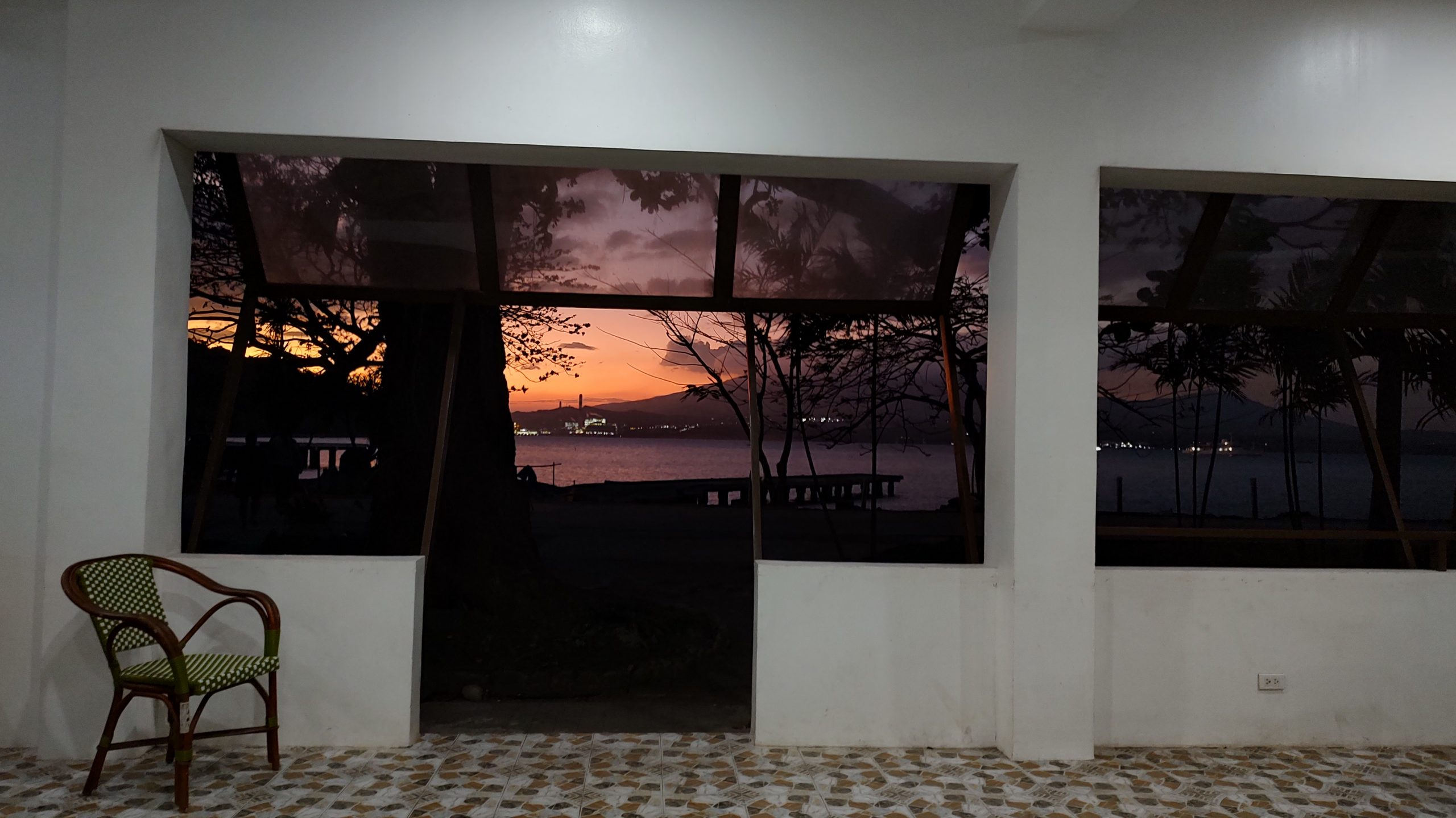
Sunset, as seen from the canteen building on bottom side. From this spot, on our last night, I opened a small bottle of Gentlemen Jack, and held a toast to a good trip and to the memory of all the men lost at Battery Point. May they rest in peace.
-Kevin Strahm (Hounddog)
Ah, but this trip would be different. To my knowledge, no one in recent memory has focused on one single area of the island like this so intently, and with such determination. So off I went! I was joined by two friends, who I'm greatly indebted to, and I thank them for their company, wisdom, and shared sense of enthusiasm. We made a great team and had a fruitful trip.
The boat left from Villa Carmen this time around, as they had apparently sorted their license issues and were cleared to depart from their resort again:
The goal for Day 1, a half day, was to hike down to James Ravine for a revisit to the bombproof infantry quarters tunnel there. This was helpful in the study of it's sister tunnel in Battery Point. Walking the length of this tunnel again, one gets a fresh understanding of its layout and design. I also had the opportunity to film some well-lit HD video inside it too, footage of which will be used in a future YouTube project about this whole subject.
I took note of a few changes in the roads and landscape on the way down to James Ravine. Firstly, the boardwalk or concrete pathway leading past the Coast Guard station and towards the Engineer Warf has been damaged by ocean wave action. It's fallen into the sea in one large section.
Secondly, on the walk down the now paved road to James Ravine, I came across a rather large landslide that has now made the road impassable to any large vehicles. There's a big tree stump mixed with a ton of earth and rocks blocking the way.
This area will need to be cleared before any vehicles can pass down to the water tank area. The landslide taking place on a relatively newly repaved road demonstrates how the island is in a constant state of change.
After passing the water tanks, our group managed to push through very heavy jungle growth, cross a stream or two, and finally find the entrance to the infantry tunnel. We passed by this tunnel in our 2023 visit but didn't go inside, noting how covered the entrance had become from the years of falling earth and organics from above. It was even more closed off on this visit. But we managed to push earth away and safely slide inside it.
The entrance to the tunnel as of March 24, 2024:
I didn't take very many photos inside the tunnel, but did shoot several videos with my GoPro and bright lights, I'll try to add some screenshots from those videos here in the near future.
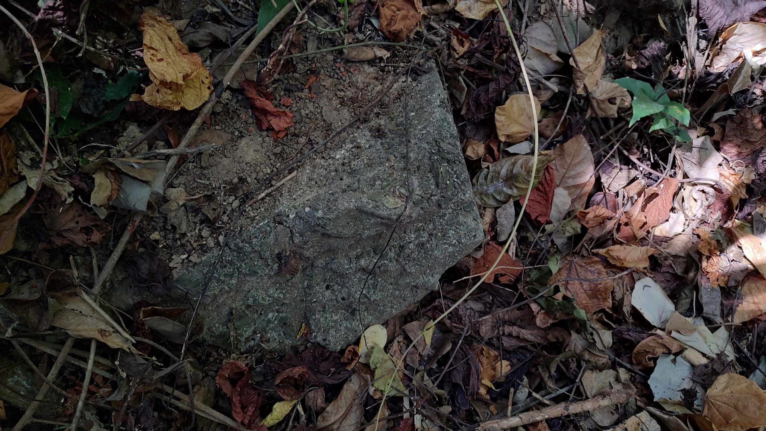
Day 2, our first full day in the Battery Point area, was spent carefully checking compass coordinates, measuring things, and then searching for concrete on the surface of what we now understand to be a 79 year old 100' wide by 30' deep crater. The crater was the aftermath of a massive explosion that occurred here on April 12, 1945. Long since overtaken by mother nature, it is all that remains of the Battery Point bombproof infantry quarters tunnel. At least, all that we know of so far. There were over a dozen chunks of concrete scattered around, partially submerged on the surface of the jungle floor. A typical chunk looked like this:
See the tiny bit of iron rebar sticking out? The concrete chunks seem to lay in roughly two distinct rows, forming a pattern that roughly aligns with our compass measurement of where the tunnel was once located. To me, it's obvious they are the remaining pieces of the tunnel, (perhaps the ceiling?) scattered after the massive explosion. We don't know how powerful the explosion was or how it destroyed the tunnel structure exactly, and some in the group posited that an implosion could have occurred, but regardless, the effect of that event left the earth, rocks, and concrete in its present state today.
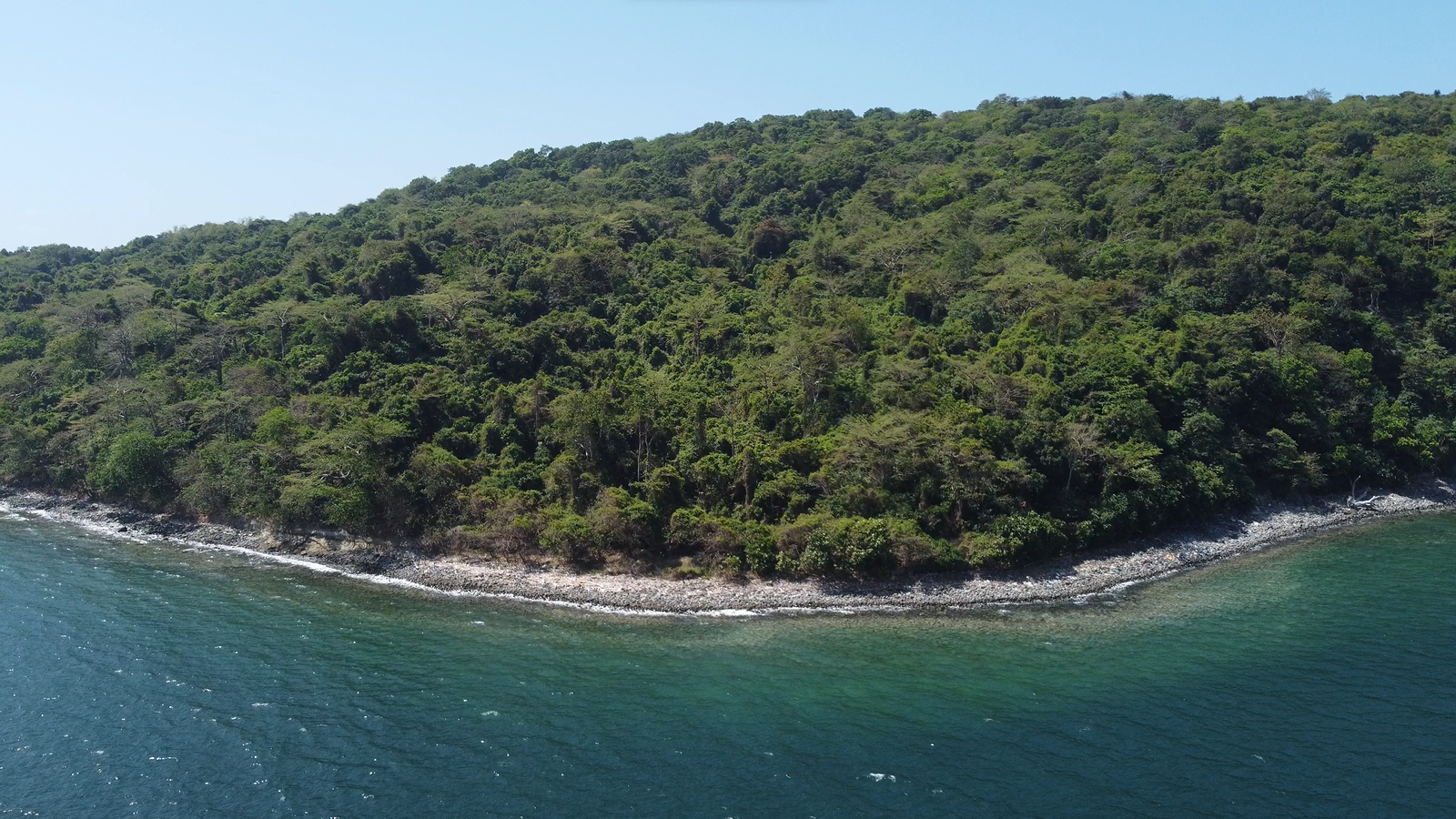
Further careful examination of the entire site yielded various small ordinance, all of which needs to be accurately identified. It's entirely possible that this ordinance was part of the cataclysmic explosion that occurred here. Stored inside the tunnel perhaps? I also took the opportunity to film some drone shots of the whole crater/valley area, up through the forest canopy, and the out to the ocean, only to turn around and get a great shot of Battery Point from the air:
Again, these scenes will appear in a future YouTube video.
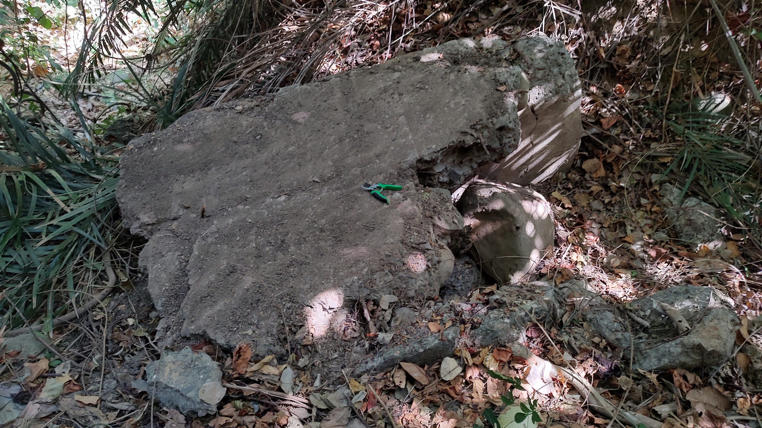
Finally, we got a good look at the so-called "bridge" or upper rain culvert that is laying in the creek bed not far from the lower rain culvert. We cleared off this damaged assembly of concrete and examined it more closely. In my opinion it looks like it's sitting destroyed, but in situ. Here's some photos of it:
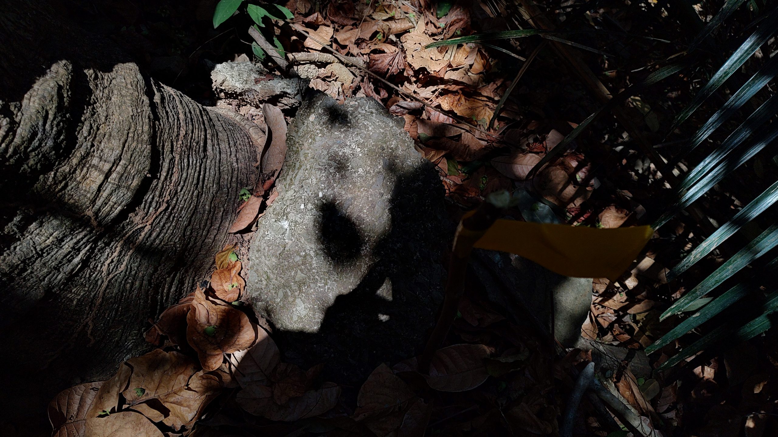
Day 3, our final full day on The Rock, was spent at the location where I believe the tunnel's original air shaft exited and a cupola once stood. There is mostly earth and jungle in this area now, yet 79 years ago it was the site of notable activity. We read that soldiers from the 38th Infantry were preparing to, or in the process of, pouring oil down the air shaft of the tunnel in order to deal with the stubborn Japanese soldiers hiding inside, and it was at this very moment that the tunnel blew sky high. Curiously enough, one can find numerous small chunks of concrete in this area. Remains of Bill Blake's demolition work on the cupola perhaps? Here's what one of the chunks looks like:
There were newly discovered artifacts at this location, but I'll save that for a future post. All of them help to tell the tale of the bombproof infantry tunnel, and it's ultimate fate.
Sunset, as seen from the canteen building on bottom side. From this spot, on our last night, I opened a small bottle of Gentlemen Jack, and held a toast to a good trip and to the memory of all the men lost at Battery Point. May they rest in peace.
-Kevin Strahm (Hounddog)