|
|
Post by Karl Welteke on Nov 19, 2007 19:40:19 GMT 8
This is resurrected thread. The previous link thru Kodak Image Sharing was dead because they don’t allow posting links on bulletin boards etc anymore. That was a great disappointment and let down. So now these images are being shifted to other accounts. In 2007 Nov. the 8th I walked up Mt. Samat and took many pictures. I divided them into three albums, this is the biggest one. The other two albums will follow. This album is mostly about plaques, descriptions, marble murals, gun displays and general scenery of the museum level. They are in great detail. The actual museum was closed and it is not allowed to take pictures in there anyway. Here are 126 images: app.photobucket.com/u/PI-Sailor/a/edd2cb3b-78a7-43fb-899f-5f216c08071b Here are some smaller sample images: The Entrance 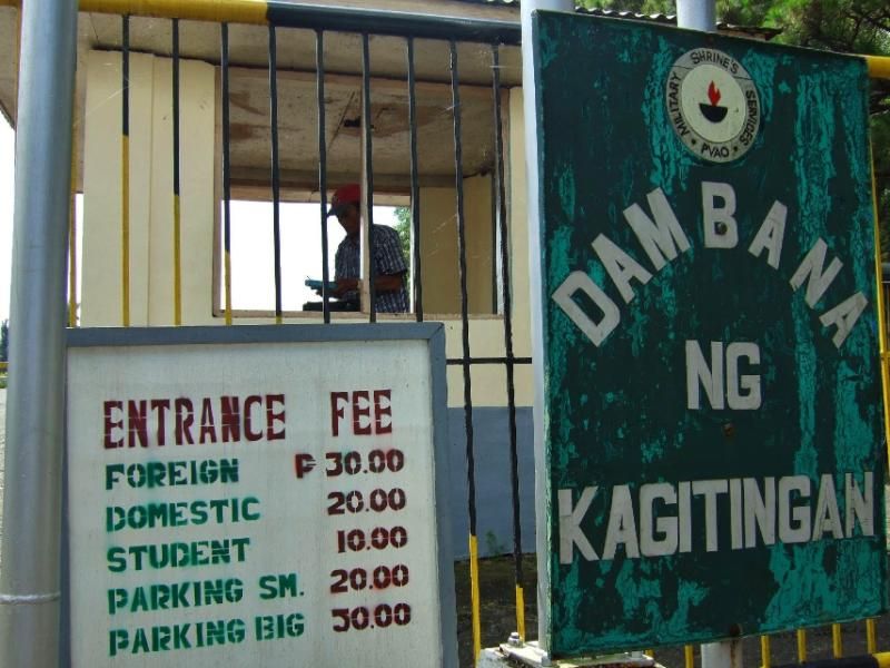 The Google Map 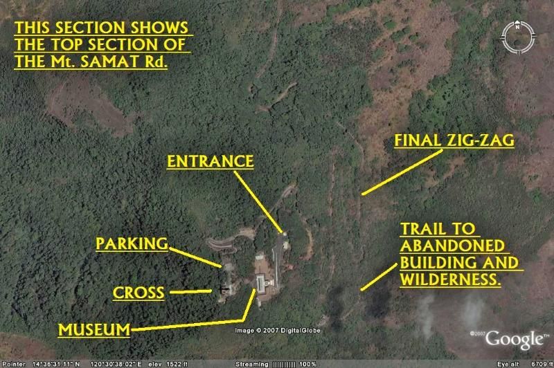 The Cross 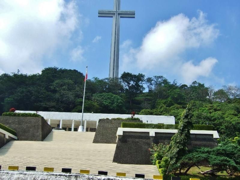 The Structure with the Museum 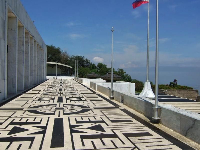 2nd Regular Division Icon 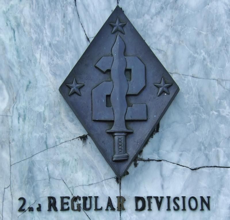 One of many Marble Murals 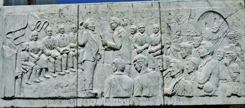 The Museum Grounds 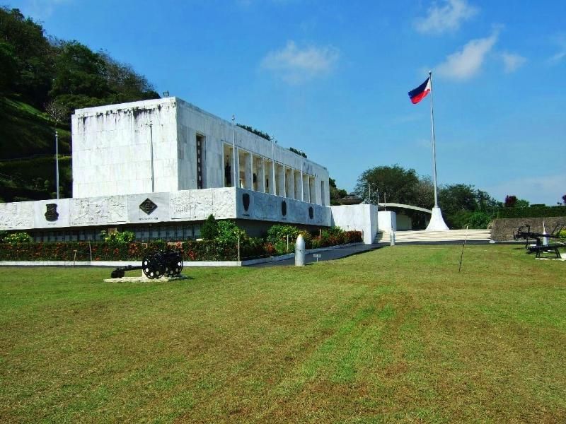 A Gun Display 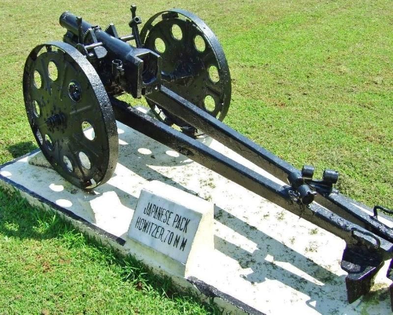
|
|
|
|
Post by okla on Nov 19, 2007 23:33:23 GMT 8
another excellent presentation. i have read in the past that the japanese artillery bombardment prior to the infantry assault on mount samat was every bit as intense as anything seen on the western front during world war I. an american veteran of the trenches in france was serving at mount samat during the japanese attack and he stated that the artillery preparation literally ripped a hole in the american-filipino positions just as was done during the struggle with germany 25 years before. this man was taken prisoner and survived the prison camps and made this report after his release. karl, you keep outdoing yourself with these excellent photo presentations. keep it up.
|
|
|
|
Post by Karl Welteke on Nov 20, 2007 6:05:28 GMT 8
Hello okla
Thank you for the kind comments. I really feel fortunate having the opportunity to be around so much history. I love to share the images. I could imagining that many people heard of this place but never get the chance to see it or feel it. Now it looks much different then on those tragic days but it is still the same place, the blood was spilled right here
|
|
|
|
Post by okla on Nov 26, 2007 0:57:55 GMT 8
karl....do you have in your excellent collection of photos any shots taken in the abucay area. as you, i am 100 percent sure, know this was the position of the first line of resistance (on bataan) of the american-filipino forces, hence the name "abucay line" came into being on the battle maps and subsequently the history of the 1942 bataan campaign. it would be reasonable to assume, that after all these years, not one trace (foxholes, tranches, etc) of the battle fought there in january 1942 would still exist. abcucay hacienda might still exist, but i would doubt that the original structures are still standing. the grandfather of my nephew's wife fought at this location with the 31st infantry regiment (US) in the initial USAFFE counter attack that january so long ago. would love to see shots of this area if you have any. thanks again for your super work on this neglected, in my opinion, part of our past military history and heritage.
|
|
|
|
Post by Karl Welteke on Aug 5, 2011 19:28:47 GMT 8
This is the 2nd album out of three. It is all about how the access road to the shrine looks like and some of the interesting sights along the way. In 2007 Nov. the 8th I walked up Mt. Samat and took many pictures. I divided them into three albums, this is the second one, has 90 images, and only deals with the walk. app.photobucket.com/u/PI-Sailor/a/9c8c1f95-f91c-48fa-b170-b485c7a6f917 Here are some smaller sample images: A VIP House on the Mt. Samat Slopes 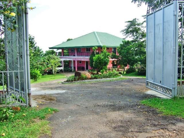 The Knights of Columbus planted trees 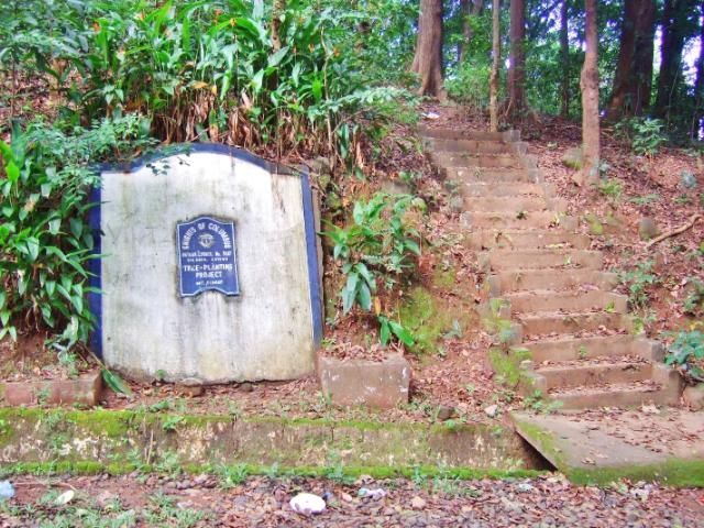 At this km stone is a short-cut to the top 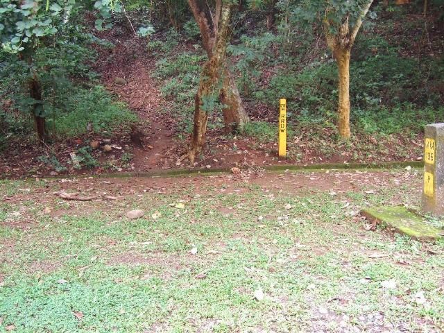 A Landmark for the Outstanding Engineering Work of the Shrine 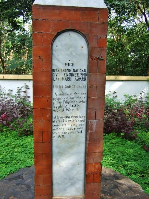 A Memorial to the Fallen 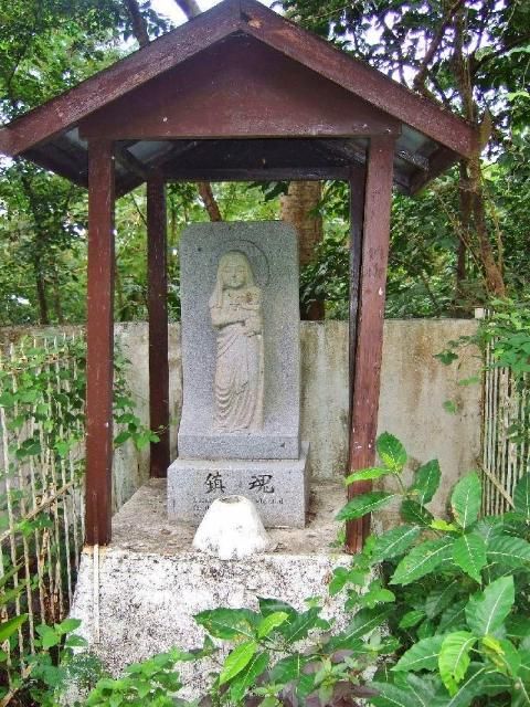 Road Maintenance Workers 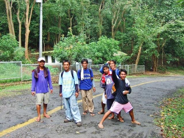 The abandoned house of President Marcos. 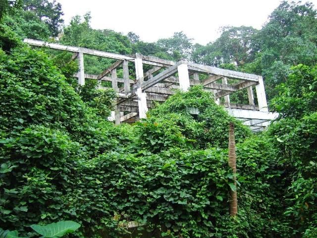 A Japanese Memorial Marker 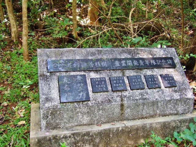 |
|
|
|
Post by The Phantom on Aug 6, 2011 1:31:28 GMT 8
Nice shots Karl.
Were the abandoned barracks you pictured near Marcos's former rest-house?
Barracks could have been built to house his guards when he was cooling off on top of Mount Samat.
It is remarkably cool up there. I visited in 2007.The Filipino staff at the cross were wearing heavy parkas.
...................................
The cave you pictured in picture #43 looks to be man made and not by water.
Lots of WWII caves and tunnels that were filled in in the 40's are again seeing the light of day due to rains and erosion.
I have seen a couple show up on Corregidor where they were none on previous visits.
An example is on the road across from the 92nd Barracks on the tail and below the Philippine War Memorial.
It is dug into the lahar ( hardened volcanic ash) type soil, easy digging there.
It's the same type of soil that those at Battery Denver dug though about 50 yards east of this dugout.
The tunnel at Denver goes down from the top of the hill, and then to the north and out through a level tunnel that was buttressed with old railroad ties, a few still remaining inside today.
Or maybe your dugout was made by water.............
|
|
|
|
Post by Karl Welteke on Aug 7, 2011 18:32:36 GMT 8
This is the 3rd album and shows the cross, the cross level, views, area around the cross. I took pictures of all the murals around the base of the cross. The elevator was not open but that was not in my plan to go up there anyway. This album has 56 images: app.photobucket.com/u/PI-Sailor/a/bb74affe-d30e-4f31-939e-c22c75d23579 Here are some sample small images Looking down on the museum level from the zig-zag path up to the cross level. 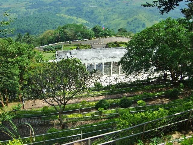 The base is capped with sculptural slabs and reliefs depicting important historical figures 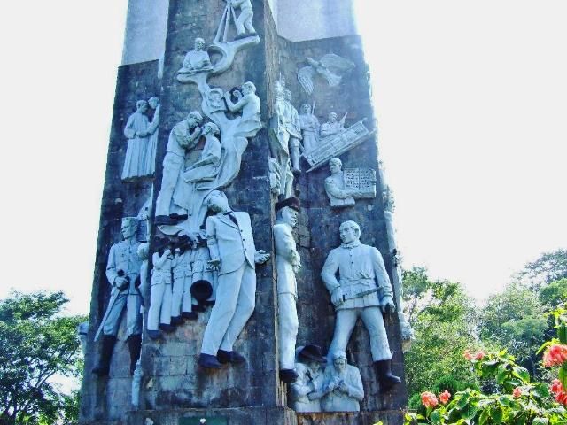 The dedication plaque for the Shrine of Valor 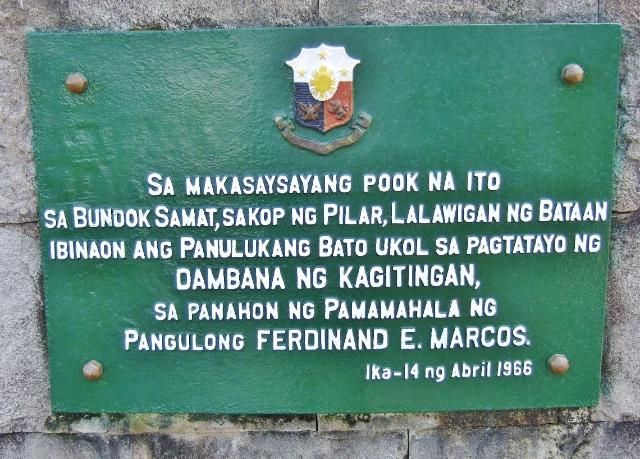 The Cross of the Shrine of Valor 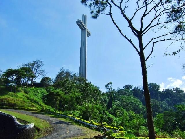 The last km stone to the Shrine of Valor located on Mt. Samat. 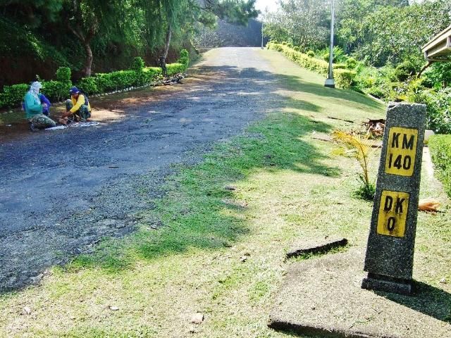 |
|
|
|
Post by Karl Welteke on Aug 24, 2022 14:24:45 GMT 8
This thread has been refreshed! This thread was generated because of my walk to Mount Samat Shrine on the 8th Nov. 2007, I took a lot of pictures and I posted them into three Photobucket albums, and the 3 links are now working again. 2007-11-08 Mount Samat Shrine Bataan Resurrected, it has these three album links! -Mount Samat Shrine Bataan Resurrected Museum Level app.photobucket.com/u/PI-Sailor/a/edd2cb3b-78a7-43fb-899f-5f216c08071b-Mount Samat Shrine Bataan Resurrected Cross Level: app.photobucket.com/u/PI-Sailor/a/bb74affe-d30e-4f31-939e-c22c75d23579-Mount Samat Shrine Bataan Resurrected, the walk up the Hill: app.photobucket.com/u/PI-Sailor/a/9c8c1f95-f91c-48fa-b170-b485c7a6f917When watching Photobucket albums which were posted a long time ago, be aware of this: My Photobucket note: Because Photobucket changed and changed procedures in recent years, my image descriptions don’t show anymore, but they are located in the title line. And because the image titles disappeared the pictures are no longer in the right order. In most of my albums they were original sorted, shown, in the alphabetical order but no longer so. Here are three additional sample images not shown in this thread: 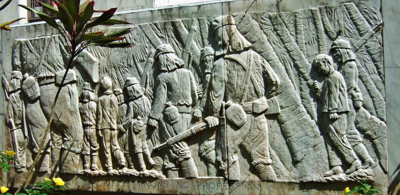 Sacrifice knows no profession. Marble Mural at Mt. Samat, Shrine of Valor or Dambana ng Kagitingan. 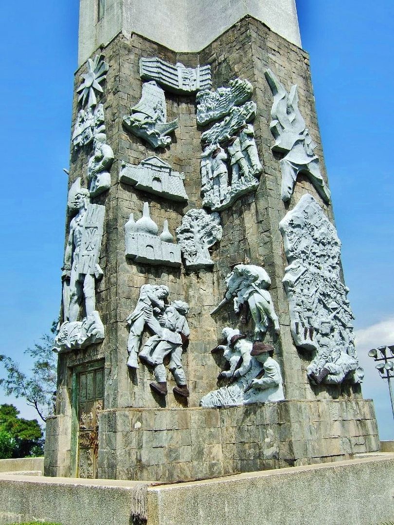 071108MtSamat240. The base of the cross, up to 11 meters (36 ft) level, is capped with sculptural slabs and reliefs. 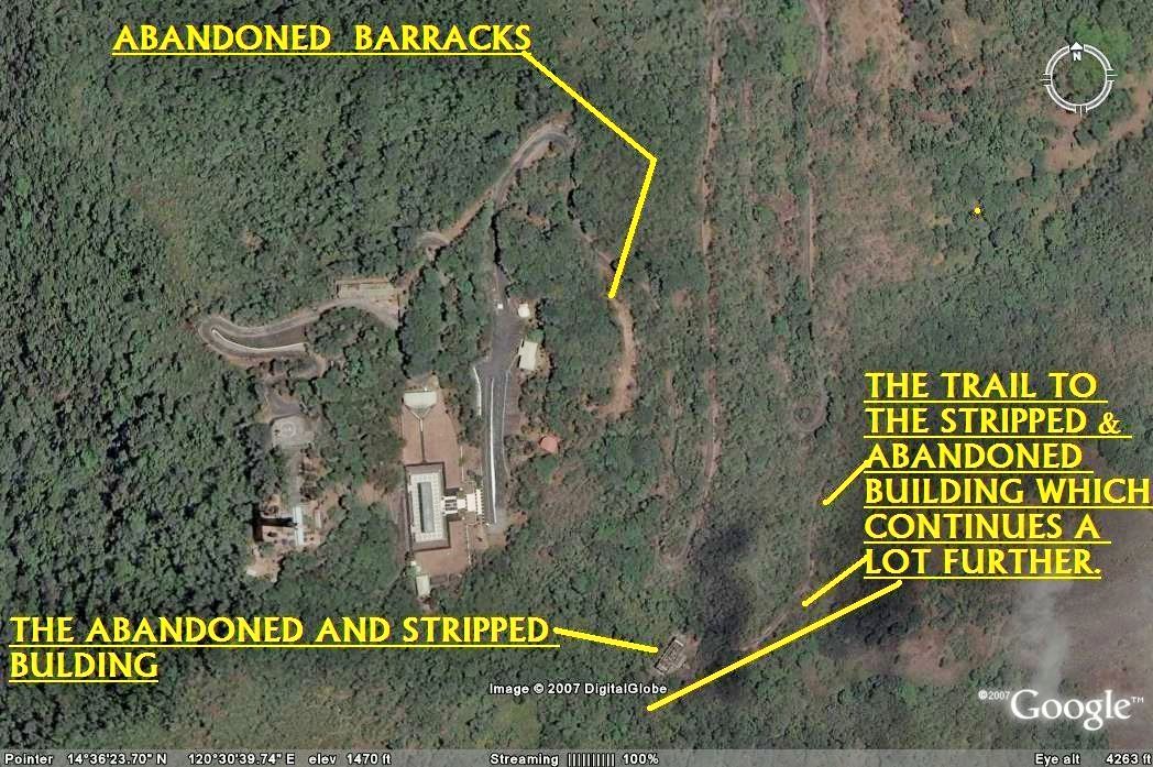 071108MtSamat65GEMtSamatthetopcloseup. This is my Google map to the abandoned President Marcos house and the abandoned barracks. |
|


