Ascending Malinta HillAbout two weeks ago I was on top of Malinta Hill searching for the elusive Corregidor Pom Pom. It had been photographed early in the war and has not been seen since. After doing as much as I could with that, I just wandered around taking a few photos. One thing a typhoon does is change the how the landscape looks after it passes. One spot at the top of the Hill now has a good easterly view down to the 92nd Garage area.
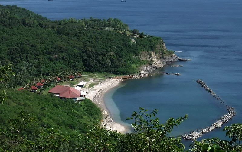
92nd Garage area with the Japanese Memorial Garden on the hill above it.
On the western side here is a shot of the Corregidor Inn.
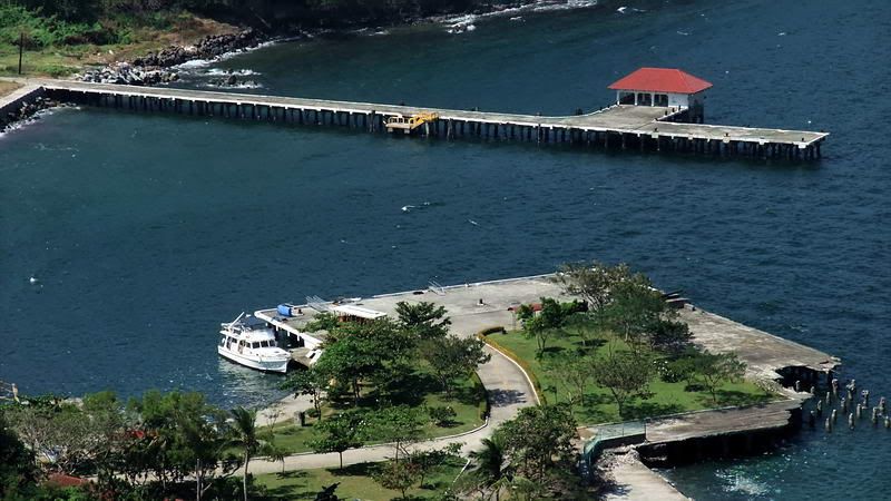
Further to the right we see the North and Engineer Docks.
Since it was just past 12 noon, I had lots of time and didn’t want to head back down the trail and end the day this early. I had been thinking of taking another way down Malinta Hill and today seemed like the perfect opportunity. Other than the hiking trail, I have gone up the east side of the hill once, up the south-west side once and down it three times. On previous trips I have zigzagged across the hill in various places during the days when my quest was to find all the entrances and airshafts of Malinta Tunnel.
Today I would go down the north-west corner of Malinta Hill following the ridge to Malinta Point and ending on the North Shore Road at the Enlisted Men’s Beach. In the back of my mind were the words of Mr. Phantom. He had come down the hill a bit south of the NW ridge and he did not have a pleasant experience at all. I was going to be very careful to not go down any slope that I could not easily get back up on my own. As it turned out, it was surprisingly easy and a very nice afternoon walking down new territory.

Aerial photo of my path down the NW corner of Malinta Hill.
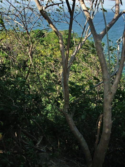
My starting point was the Searchlight #8 airshaft. The first 100 feet or so I kept to the left where it was not so steep. Soon the ground levelled off and it was nearly flat for a couple minutes. When the ridge started it was mostly easy walking with few vines or branches to cut. It is quite steep on both sides. The upper part of the ridge has a row of foxholes that are still quite obvious. Since the sun was shining down on them through the trees, they never look like what they really are in photos so I did not bother to take any. Cloudy days are better for this.
If anyone decides to try this route down the hill, remember this. You may have a tendency to walk straight ahead and if you do you will continually come to steep parts on the left. The ridge has a gentle curve to the north (right) so keep this general path. You cannot see anything in front of you except trees. I cheated, I have a GPS that shows me where I am and the ridge down to Malinta Point.
More than halfway down the ridge I noticed a couple metal pipes set in concrete. It has the look of a radio antenna mast but is cut off now. About 20 feet away was a metal pole with a loop on the end. Two pieces of stranded wire had been used to hold something at one time.

Radio mast?
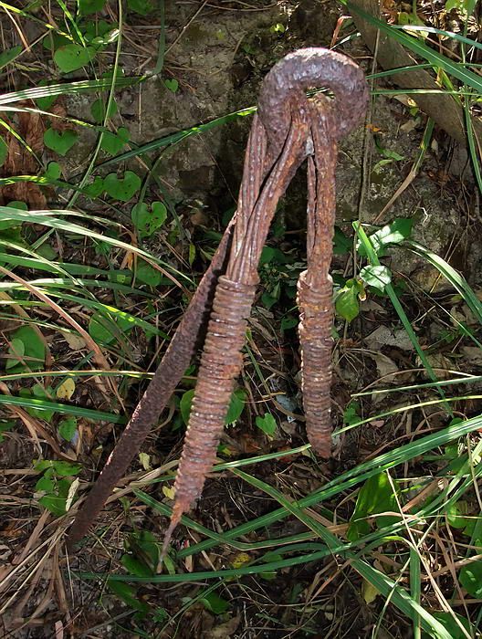
Guy wires for the mast?
About ¾ of the way down I came to a small opening in the trees facing west. Here I could see across to Mariveles, Bataan. In the middle bottom of the photo are tree tops.
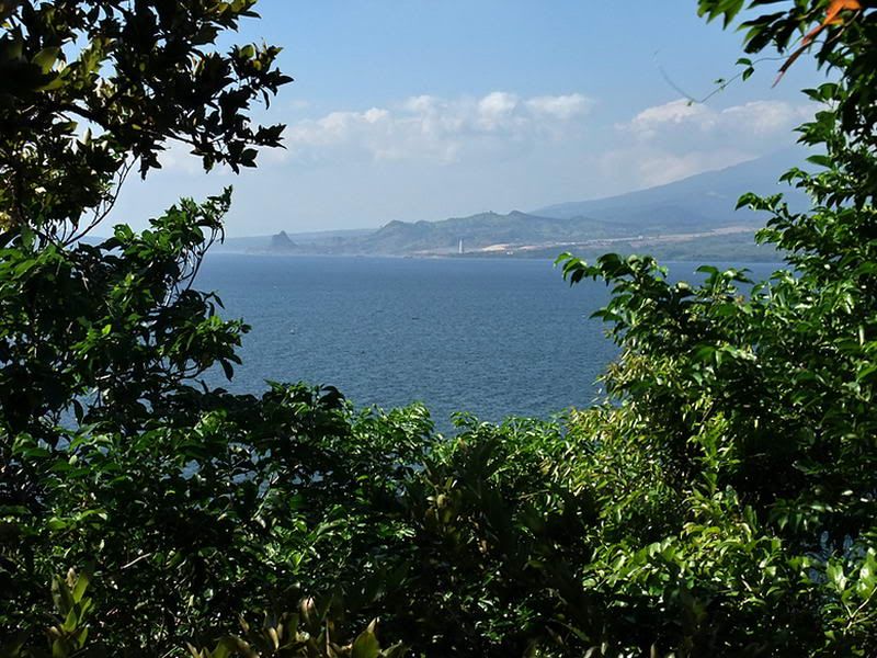
Bataan in the distance.
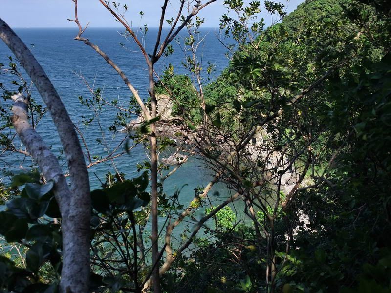
A minute or so further, I knew why I was looking at tree tops. The ridge stopped abruptly and a cliff was in front of me. No way could I get down there.
Malinta Point straight ahead with the cliff a few feet in front of me.
Standing in the same spot looking towards Enlisted Men’s Beach to the right.
Worst case I would backtrack a bit and come down the north ridge near the small hospital tunnel entrance. I was in the area before looking for an airshaft so I knew it was possible. At least I did not have to go back up to the top. Before doing that I decided to go left (towards Bottomside) and see how that looked. Not 50 feet away the cliff levelled out into an easy slope. I only had to hold onto a few trees to get to level ground. From here I knew the rest of the walk was no problem.
I had lots of time so I went towards the North Shore Road. There are three defensive positions in the area and I had a look at them before descending the final slope to the road.
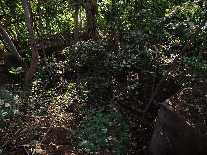
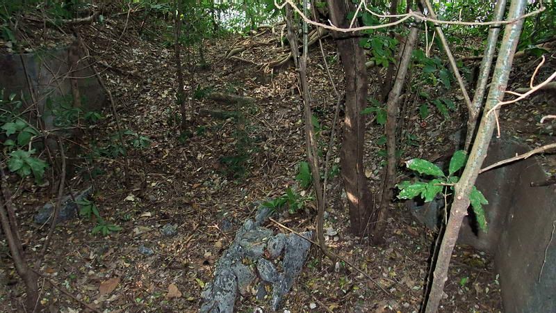
VII-M-1. This was a machine gun position but it is so covered with vegetation that I cannot really distinguish what is what. Unfortunately you only see sections of concrete.
VII-M-7. This machine gun position is much larger and appears to have a small shelter or magazine. I am not sure about that though. Again it is difficult to understand the layout.
Finally I made my way out onto Malinta Point. Here is a Siege gun position called VII-S-1. It consists of two gun positions and a central underground magazine.
Gun #2 position. Afternoon sun is shining down onto the position but you can still see two concrete walls. The gun would have pointed towards the top right corner of the photo.
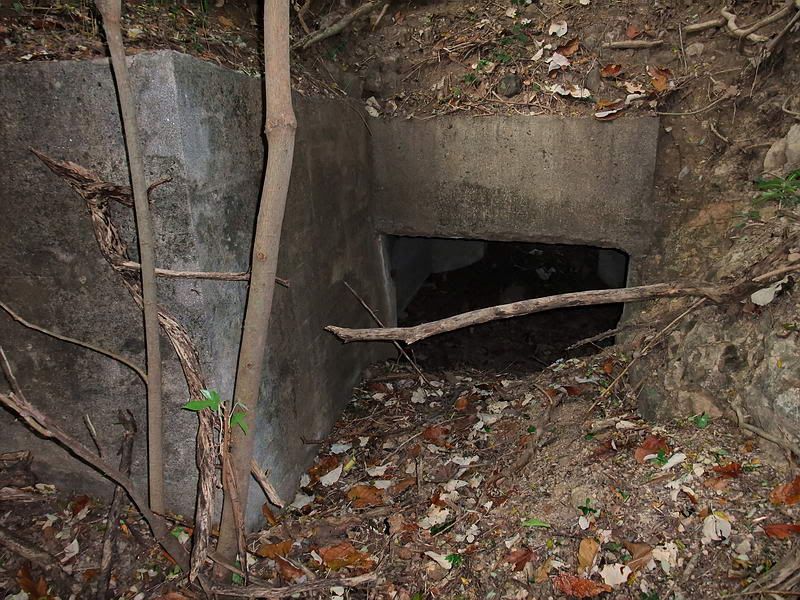
The magazine entrance facing Gun #2.
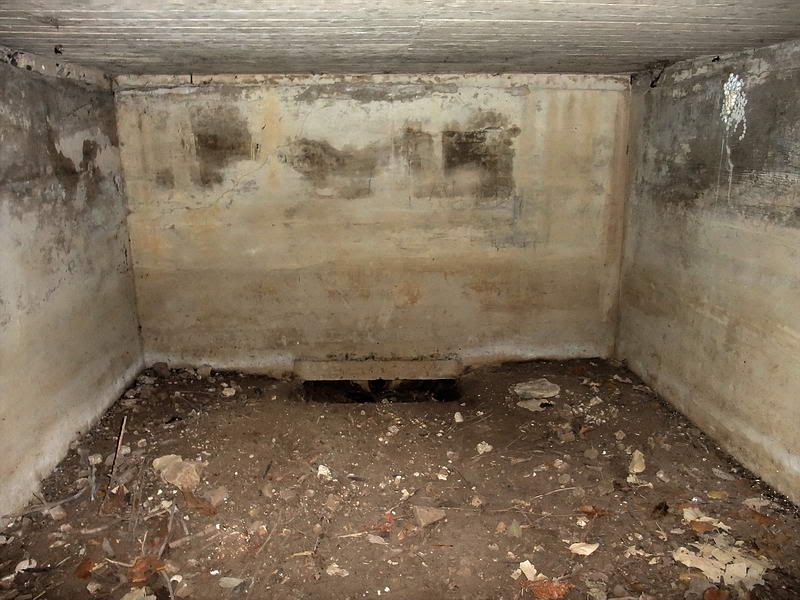
Interior view of the magazine.
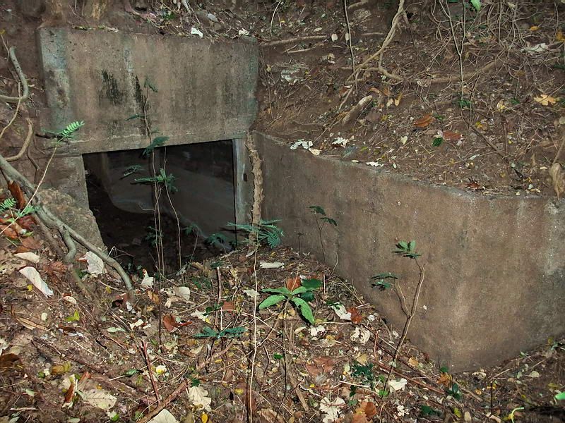
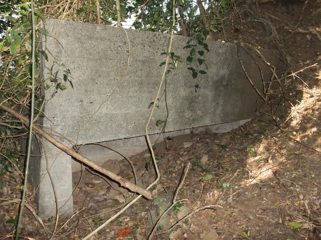
The magazine entrance facing Gun #1.
Gun #1 position. There appears to be damage to this position.
From here I backtracked a bit to where I made my way down to the North Shore Road above Enlisted Men’s Beach. The final leg was around Malinta Point and home to Bottomside.
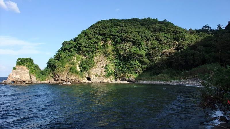
Looking back at Enlisted Men’s Beach. At this time of the afternoon, Malinta Point casts a shadow nearly halfway to Engineer Point.

The North Shore Road rounds Malinta Point directly below VII-S-1 where I just came from. Bottomside is just around the corner so a cold drink at MacArthur’s Café is less than 10 minutes away.


 The small hospital tunnel entrance...Is this the entrance where several medical personnel (taking a smoke break) were killed by shelling/bombing during the 1942 siege??? and lastly, in the view looking back at Enlisted Men's Beach, what is that opening/entrance just above the shore line??? Japanese Torpedo Boat mooring site. If so, I guess this shot is taken at low tide. Or is it some American defensive position?