|
|
Post by okla on Jun 30, 2012 22:46:38 GMT 8
Hey Karl....Thanks again for these latest pics/maps,etc. What a formidable defensive position this was. If only our guys had been better equipped, provisioned, and had some air support, you would think they could have held out indefinitely. But not to be as we know. Again, President Truman's words return to haunt---"hindsight, she is 20-20". Cheers.
|
|
|
|
Post by Karl Welteke on Jul 3, 2012 20:49:53 GMT 8
In reply #5 above the URL has been dead. As of today, the 3rd Dec. 2023, it is active again. app.photobucket.com/u/PI-Sailor/a/b133f8f7-6675-4d42-9ef2-b3abd1361a4f?field=TITLE&desc=descHere are some sample pictures: GE image of the Mt. Samat west flank where we walked Jan. 2010 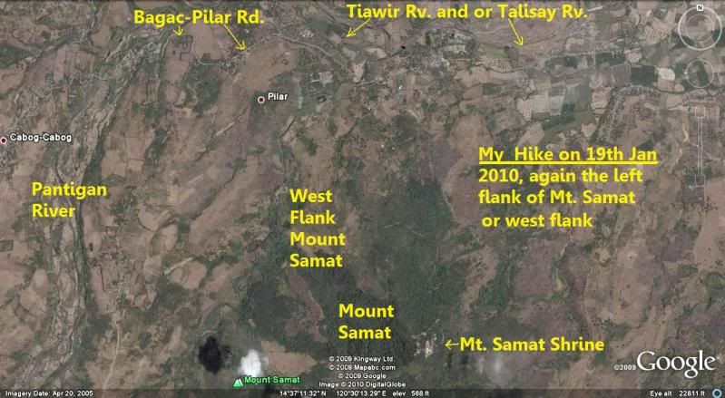 Looking across the Bataan Saddle; that is the Mt. Natib volcano complex. 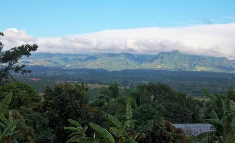 From the west flank of Mt. Samat we are looking across the Catmon River valley. Inside this valley the Battle Trail #6 runs. On the far ridge runs Battle Trail #29 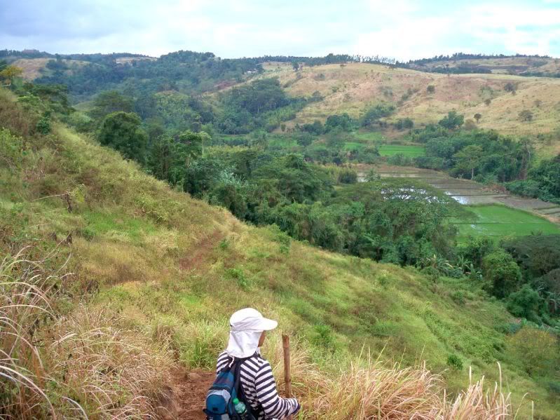 This is the GE image map of the 1st trail we walked on the west flank of Mt. Samat. At the large, deep and steep we lost the trail. 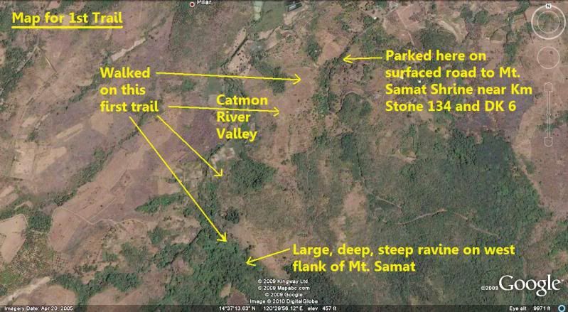 Looking down Catmon River valley. Battle Trail # 6 runs up into this valley and the Japanese broke thru here in April 1942. 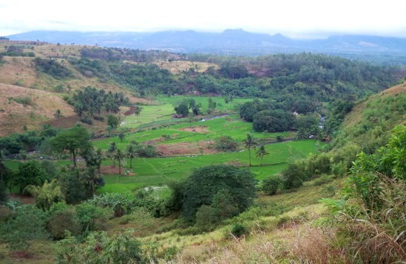 Here at the bottom end of the large, deep and steep Mt. Samat west Ravine we lost the trail. At another walk, at a later day, we picked it up again. 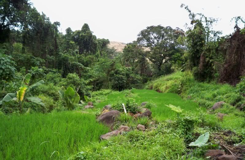 GE map of the 2nd trail we walked this day. We walked mostly thru replanted forest. 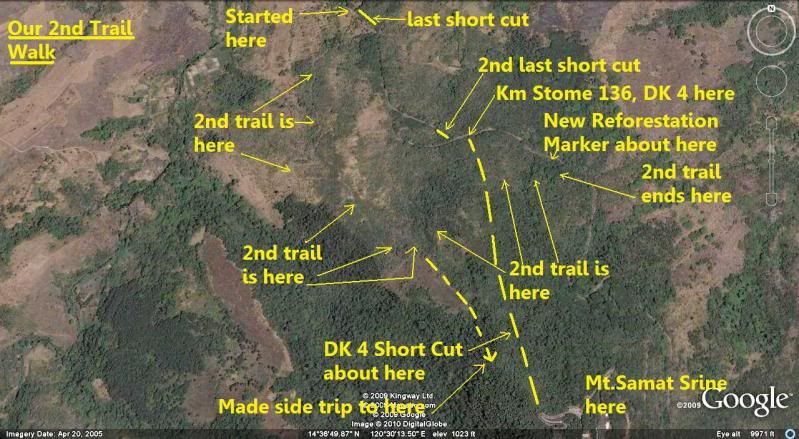 A new marker has been placed, remembering a 30 year effort of reforesting Mt. Samat, much with Japanese money. Because of the angle and light it is hard to read.  Here is more of that marker and perhaps you can read more. 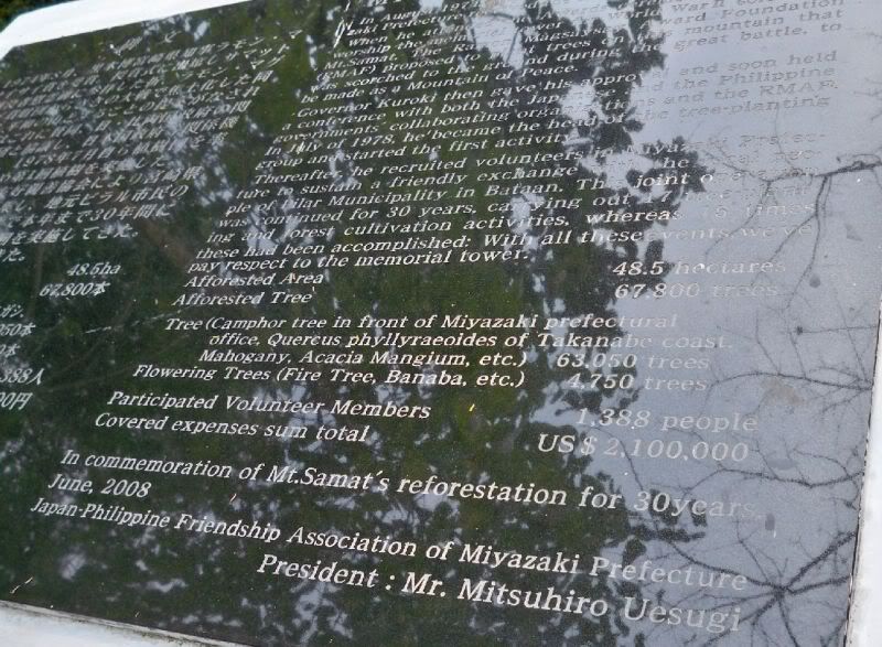 |
|
|
|
Post by Karl Welteke on Dec 5, 2023 8:49:13 GMT 8
Repaired: Walked on Bataan Battle Trail #6 The two Photobucket albums which support this presentation are repaired; the pics are in order again because I had to replace the tiles and descriptions and of course the album URLs work again!!!! That was caused by the Photobucket reorganizations! I also would like you to check this forum page in our Corregidor Forum, it deals with the Pantingan River Massacre and is located (marked green on my graph below) in the same general area of the Final Bataan Battle in April 1942: corregidor.proboards.com/thread/2205/pantingan-river-massacre-siteThe 7 pictures in the reply from Vic Vereno of the Bataan Diary by Capt. Paul Ashton (12th Medical Regiment, Philippine Scouts), are replaced and are active again in this forum page. 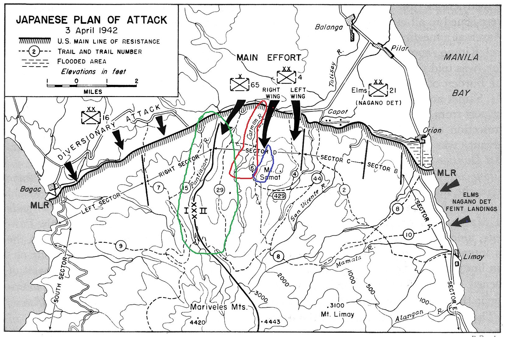 Z167. In this graph of the Japanese Attack in Apr 1942 from Wikipedia Commons. I circled the area of Trail #6 in red and this is the album description (58 pics): On the 14th Jan 2010 I had a chance to hike on the west side of Mount Samat, the Trail #6 area in the Catmon River Valley. I wanted to do that for a long time as the Japanese offensive of the 3rd April 1942 also broke thru to the west of Mt. Samat. In order to get a good picture of the geography one has to get ones feet on the ground or look at a good image description like this. Here are 58 images of that trip. app.photobucket.com/u/PI-Sailor/a/ec90eeda-cb1a-4fa5-b421-38c98995fef4?field=TITLE&desc=descI circled the NW Flank area of Mount Samat in blue and this is the album description (33 pics): More trails on the west flank of Mt. Samat came to my attention when I walked on the WWII Battle Field Trail #6 in the Catmon River Valley on the 14th Jan 2010. So, on the 19th Jan 2010, my friends Alan and Nory and I went to check them out. Let the images and their descriptions tell the story. app.photobucket.com/u/PI-Sailor/a/b133f8f7-6675-4d42-9ef2-b3abd1361a4f?field=TITLE&desc=desc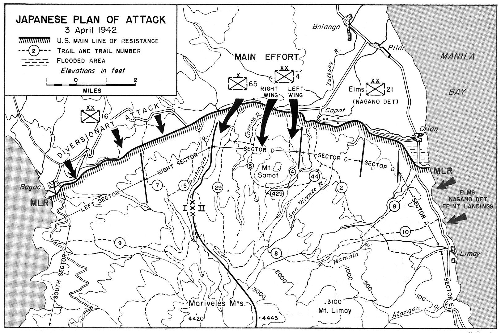 Z168. Clean copy (not marked) of this graph of the Japanese Attack in Apr 1942 from Wikipedia Commons. |
|


