|
|
Post by Karl Welteke on Jan 16, 2010 18:56:25 GMT 8
On the 14th Jan 2010 I had a chance to hike on the west flank of Mount Samat. I wanted to do that for a long time as the Japanese offensive of the 3rd April 1942 also broke thru to the west of Mt. Samat. In order to get a good picture of the geography one has to get ones feet on the ground or look at a good image description like this. After reading the below reference I realized I walked on the WWII Battle Field Trail #6. There is a lot more to experience and this area will see me again. Here are 58 images of that walk: This URL was dead and today 2023-12-03 I refreshed it and it should work for you again: app.photobucket.com/u/PI-Sailor/a/ec90eeda-cb1a-4fa5-b421-38c98995fef4?field=TITLE&desc=descThis is strictly for the person who would like to get a feel of the geography of this WWII battle field which was a test of endurance to the Philippine and US Forces under the most trying circumstance and ended in defeat and great loss of life of the Allied soldiers in the hands of the Japanese Imperial forces. If you like to read up on that history, the below source on the internet is available: The Fall of the Philippines, US Army, by Louis Morton Chapter XXIV: The Final Japanese Offensive: www.ibiblio.org/hyperwar/USA/USA-P-PI/USA-P-PI-24.htmlHere is a quote from “The Fall of the Philippines” describing the area I walked in: Sector D extended from KP 136 on the Pilar-Bagac road westward for about 5,000 yards to the corps boundary along the Pantingan River. Bisecting the sector front was the Catmon River, which, with the Pantingan, offered a natural route of advance southward. (Map 21) In addition to these two river valleys, Sector D contained three excellent north-south trails, two of which connected with the main east-west trail system. The westernmost of the was Trail 29, between the Pantingan and the Catmon. About five miles in length, this trail ran from the Pilar-Bagac road along the western foothills of Mt. Samat to Trail 8, the main east-west line of communication in II Corps. Along the east bank of the Catmon was Trail 6, which also began at the Pilar-Bagac road and ran to Trail 8. East of Mt. Samat was the third of the north-south trails in Sector D, Trail 4. In addition to Trail 8, lateral communication in Sector D was provided by Trail 429. This trail ran due east from Trail 29 to Trail 6 which it joined until it cleared the western foothills of Mt. Samat. At that point it branched east again, skirting the southern edge of the mountain to meet Trail 4 near the boundary of Sectors D and C. In the 21st Division area General Capinpin had placed two of his regiments, the 22d and 23d, east of the Catmon River, with the former holding the division right flank and tying in with Sector C to the right. The 21st Infantry on the division left flank held both banks of the Catmon as well as Trail 6, which cut diagonally across the regimental area from the right front to the left rear. |
|
|
|
Post by okla on Jan 17, 2010 0:38:49 GMT 8
Hey Karl....This is good stuff. I just did a quick look over, but as soon as I get my daily "honey do" chores completed this afternoon I will make a huge pot of coffee and spend (what will probably be several hours) prowling the bushes of Bataan courtesy of your latest info. I love this stuff that you resident gurus of the PI post on this site. As I keep telling FOTS, Battery Boy, Vic and others, its the next best thing to being there in person. Please keep it going. I do really appreciate it.
|
|
|
|
Post by okla on Jan 17, 2010 6:15:50 GMT 8
Hey Karl.....Viewing these photos just reinforces the knowledge of what a formidable defensive position Bataan presented to the Japanese invaders. I always will be intrigued as to how long the Fil/Amer defenders could have held out, in that near impregnable locale, had they anywhere near adequate food/medical supplies (a little air support wouldn't have hurt either) but it was not to be. As I understand it, the area around Mt Samat has been cleared of much of the undergrowth by the locals over the years. It still would present problems to modern infantry, methinks.
|
|
|
|
Post by Karl Welteke on Jan 17, 2010 10:20:14 GMT 8
Hello okla
Always appreciate your interest and positive comments, although I don’t respond to all your comments I do read them all and really appreciate your great interest.
Thanks
Karl
|
|
|
|
Post by victor on Jan 17, 2010 12:40:34 GMT 8
Karl, great stuff. I wish I was there with you. It's been almost a year since we walked the Abucay Hacienda... time flies. I wonder if that waterfall you took a picture of is the same waterfall that Capt. Paul Ashton talked about where his men ambushed a Japanese patrol that bathed in a waterfall. It's the same general Mt. Samat area where this happened. I'll see if I can find it in the book: Bataan Diary By Capt. Paul Ashton (12th Medical Regiment, Philippine Scouts) 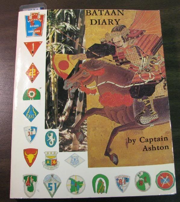 Z159. Bataan Diary By Capt. Paul Ashton (12th Medical Regiment, Philippine Scouts) 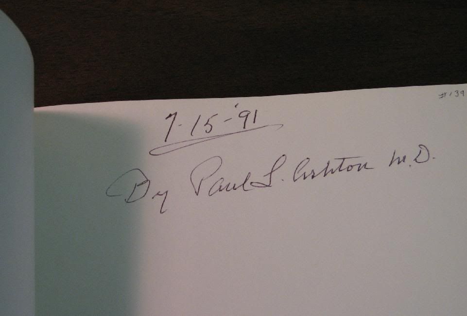 Z160. Bataan Diary. By Capt. Paul Ashton (12 Medical Regiment, Philippine Scouts). 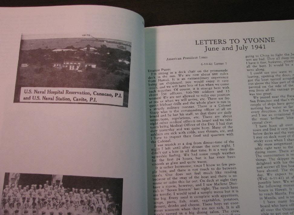 Z166. Bataan Diary. By Capt. Paul Ashton (12 Medical Regiment, Philippine Scouts). 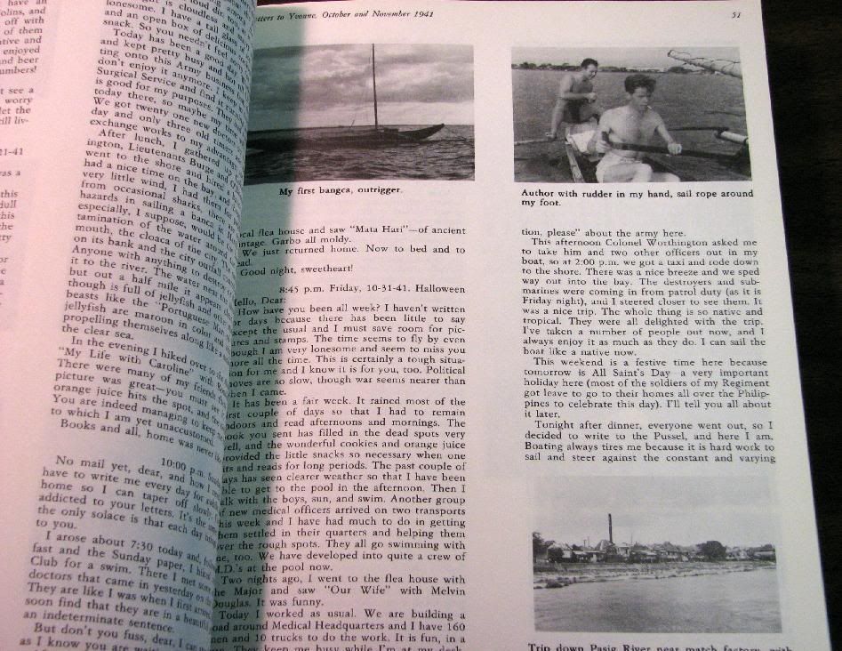 Z162. Bataan Diary. By Capt. Paul Ashton (12 Medical Regiment, Philippine Scouts).  Z163. Bataan Diary. By Capt. Paul Ashton (12 Medical Regiment, Philippine Scouts).  Z164. Bataan Diary. By Capt. Paul Ashton (12 Medical Regiment, Philippine Scouts).  Z165. Bataan Diary. By Capt. Paul Ashton (12 Medical Regiment, Philippine Scouts). |
|
|
|
Post by Karl Welteke on Jan 23, 2010 11:12:37 GMT 8
Vic That would be great if you can find the section of the waterfall. More trails on the west flank of Mt. Samat came to my attention when I walked on the WWII Battle Field Trail #6 in the Catmon River Valley on the 14th Jan 2010. So, on the 19th Jan 2010, my friends Alan and Nory and I went to check them out. Let the 33 images and their descriptions tell the story. This URL has been dead. As of today, the 3rd Dec. 2023, it is active again app.photobucket.com/u/PI-Sailor/a/b133f8f7-6675-4d42-9ef2-b3abd1361a4f?field=TITLE&desc=descWe explored 2 trails, made an excursion almost to the top and descended the modern surfaced Shrine road. We came across a new commemoration marker celebrating a 30 year effort of reforestation on Mt Samat (images are in this album). On the ‘2nd Trail (my designation) we practically walked thru nothing but reforestation area. But it seemed to us that one tree species is invested by termites and many trees are dying. On the 1st Trail (my designation) we found it difficult to walk passed the big, deep, steep West Mt Samat Ravine and deeper into the Catmon River valley and gave up that idea. I will attack the south flank and SW flank of Mt. Samat in the future from another direction. According to the US Army “The Fall of the Philippines” by Louis Morton the Japanese Imperial army stormed up this flank on the 5th of April 1942. Here is the paragraph from that publication on page # 430: www.ibiblio.org/hyperwar/USA/USA-P-PI/USA-P-PI-24.html#24-1The Right Wing under Colonel Sato had meanwhile been pushing ahead unopposed on the exposed left flank of the 21st Division, up the northwest slopes of Mt. Samat. Near the summit it met a single platoon of the 21st Infantry which it easily routed and at 1250 secured possession of the mountain top. The position of the 41st Field Artillery, whose fire was so effectively pinning down General Taniguchi's Left Wing on Trail 4, was now untenable, and the artillerymen were forced to evacuate. Before they did, they destroyed their equipment and rolled their guns over the cliffs. |
|
|
|
Post by victor on Jan 28, 2010 8:14:48 GMT 8
Hi Karl,
It looks like I recalled it wrong. The ambush described in the book happened in front of the MLR beyond the minefields, at a body of water but not a waterfall. I must have encountered the waterfall reference somewhere else in the book. I'll look for it.
|
|
|
|
Post by okla on Feb 1, 2010 8:43:17 GMT 8
Hey Vic, Karl,Battery Boy...Have you guys ever thought about prowling the "Pockets" area?  Maybe you already have before my becoming a member of the Corregidor and Pinoy websites. If not, since you all have checked out the Abucay Line, Mt Samat "breakthrough" area and the "points", maybe snooping out the "Big" and "Little" Pockets region, on the Second Line of Resistance in central Bataan, might be in order. Since you three guys are our Bataan experts it would seem appropriate that you could undertake this project in the future. I understand that the area looks nothing like it did in 1942. Much undergrowth has been cleared for agriculture purposes,etc, but those small "rivers", hills,etc are still there. Maybe they could give clues to the actual position of the Fil/Amer and Japanese positions. I am sure there is really nothing to see, but photos of the area would still fire up my imagination and might do the same for other "Bataan/Corregidor "geeks". Whatcha think? Many thanks for your previous efforts. I certainly enjoy all you do. |
|
|
|
Post by cbuehler on Jan 26, 2012 8:39:07 GMT 8
Very good stuff here! I did some very limited exploring of the west side and up of Mt. Samat about 7 years ago. I remember the reforestaion marker as well.
I am shocked as to just how much Samat has been overgrown during the past 25 years or so. I never realized is was so open until I saw the '86 pics.
Anyway, I would certainly like to do some more exploration of the area.
With regard to the Pockets, I also did some very limited exploring (my accompanyment unfortunately just wasnt up to it) south from the marker along the river (or creeks as they are) and it is very confusing as to just what the names of them are.
The historical maps often seem to be at odds with the modern designations in the area and the course of the creeks may have changed to some degree, but I am not sure.
The actual areas of where I assume the battles of the Pockets took place do seem to have been cleared for agricultural use which adds to the confusion in trying to be more specific as to just where the battles to place.
This one may be a lost cause?
Conrad
|
|
|
|
Post by Karl Welteke on Jun 30, 2012 11:17:53 GMT 8
In the first section of this thread the URL was dead and today 2023-12-03 I refreshed it and it should work for you again. app.photobucket.com/u/PI-Sailor/a/ec90eeda-cb1a-4fa5-b421-38c98995fef4?field=TITLE&desc=descBut I present it here again and this time with some sample pictures. No.6 Battle Trail Pictures: The Battle Trail #6 run along the right side or east bank of the Catmon River, this is my map. 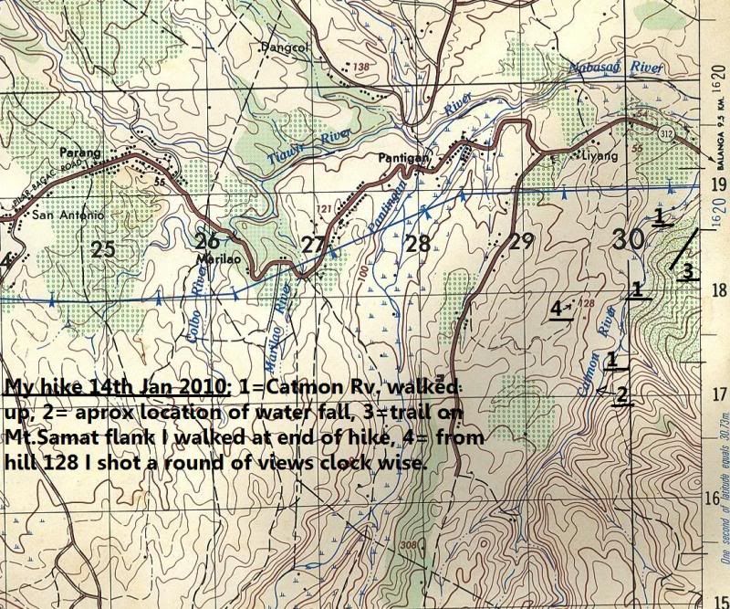 A good km up the Catmon River the existing trail today runs out, the river runs left or right, splits up and sometime one can the Mt. Samat Cross. 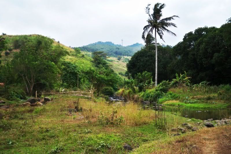 This is east of the Catmon River, the NW slopes of Mt. Samat.  The ex No. 6 Trail runs out and this friendly fellow offered to show me a waterfall which I didn’t know about. 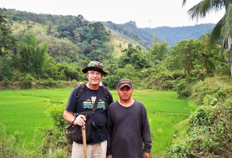 The waterfall of the Catmon River, it can be seen with Google Earth. 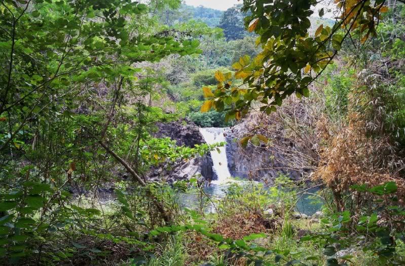 From near the waterfall, looking back. That is the right side or north side of a large western ravine coming from Mt. Samat. I call this ravine -The Great Mt. Samat West Ravine-. 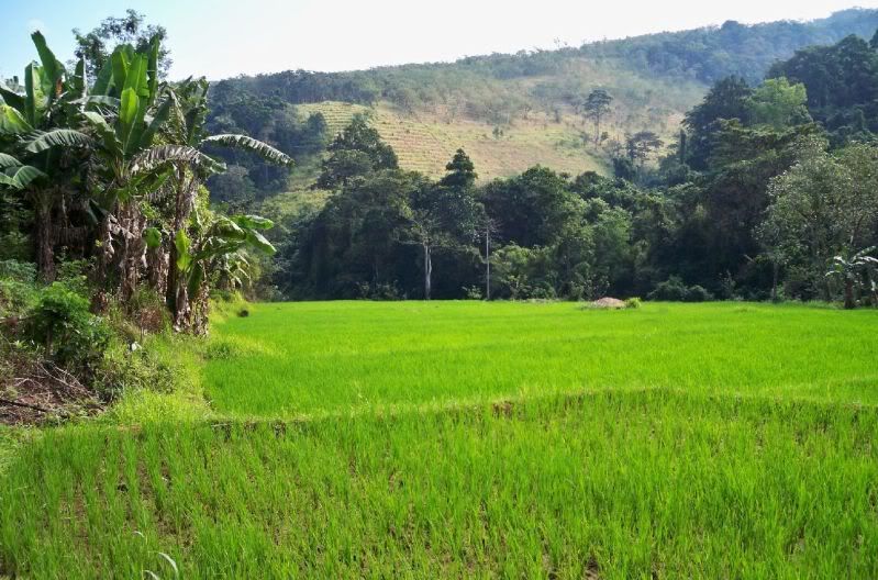 -The Great Mt. Samat West Ravine-. The Catmon River does not come from there, it comes from the right, south, from the Mariveles Volcano.  -The Great Mt. Samat West Ravine-. The Catmon River does not come from there, it comes from the right, south, from the Mariveles Volcano. Those terraces are from reforesting attempts. 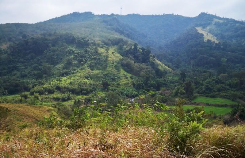 This view is from Hill 128 from west of the Catmon River. 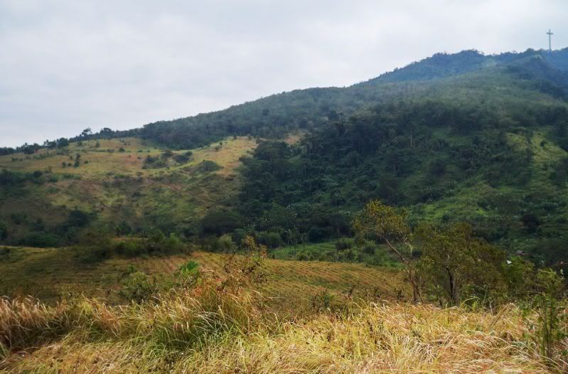 It gets pretty rugged in the Catmon River Valley and I lost the trail. Only on a later visit did I pick up the trail again. 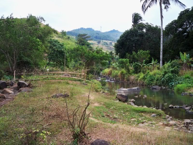 Along the 1st km up the river the former Battle Trail #6 still looks like this. 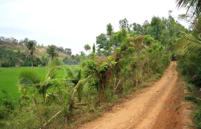 This picture is unique, here a farmer is making a new rice field by hand, leveling it by hand. It is up-river in the Catmon River Valley 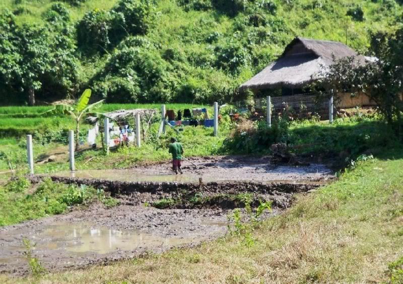 Much of my walking this day, I not only walked in the Catmon River valley I also explored a trail I seen. It is located on the Mt. Samat NW slopes between the Catmon River valley and the Mt. Samat Shrine access road. 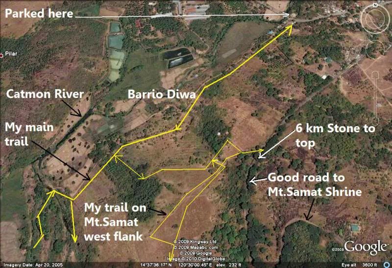 Looking from that trail towards north west (NW), across the Catmon River valley. That is the ridge line between the Catmon River valley and the Pantingan River and on top run Battle Trail # 29. In the distance are the SW slopes of the Mt. Natib mountain complex. There was the Mauben Defense Line. 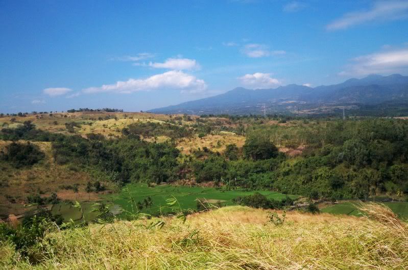 I met this couple on the NW slopes of Mt. Samat and they were going deep into the Catmon River valley. On a later walk I wanted to give them this picture (and others) but I couldn’t find them and left the picture with an other person who knew them. 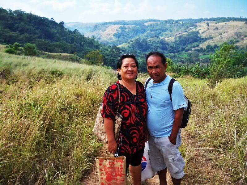 First time I seen this thing being made, I had seen it numerous times on Carabaos doing their hard work. This was also on the NW slopes of Mt. Samat. 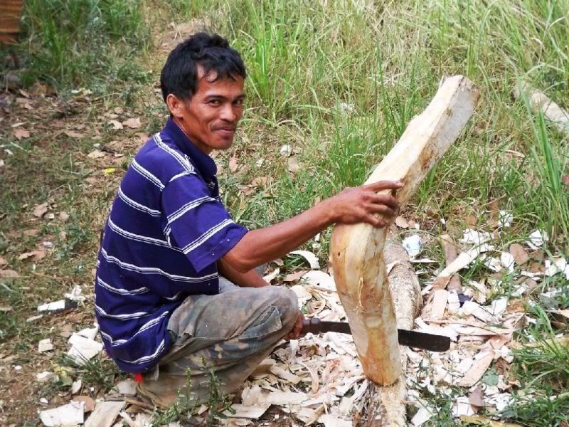 Looking across the -Saddle- between Mt. Mariveles (behind me) and the Mt. Natib volcano complex. The nearer hills are the southern foot hills of Mt. Natib. The slopes further back is the area where the Abucay Defense Line was.  |
|


 Maybe you already have before my becoming a member of the Corregidor and Pinoy websites. If not, since you all have checked out the Abucay Line, Mt Samat "breakthrough" area and the "points", maybe snooping out the "Big" and "Little" Pockets region, on the Second Line of Resistance in central Bataan, might be in order. Since you three guys are our Bataan experts it would seem appropriate that you could undertake this project in the future. I understand that the area looks nothing like it did in 1942. Much undergrowth has been cleared for agriculture purposes,etc, but those small "rivers", hills,etc are still there. Maybe they could give clues to the actual position of the Fil/Amer and Japanese positions. I am sure there is really nothing to see, but photos of the area would still fire up my imagination and might do the same for other "Bataan/Corregidor "geeks". Whatcha think?