Post by fots2 on Sept 26, 2010 1:28:21 GMT 8
(Recently I received maps and photos etc from Karol Ames who is the daughter of Captain Ames, Battery Chicago’s Commanding Officer. This has been invaluable in knowing what existed in the past and in understanding what remains today. Perhaps a quick review of “Battery Chicago Part 1” will refresh you as to what we know so far).
Morrison Hill is a little remote today but has always been an interesting location to explore. You will see a 1917 era 3-inch AA gun block and an underground magazine. In later years, the threat from enemy bombers became a reality so four more gun blocks were added along the ridge. Maps show nothing else being located on the hill.
I don’t know the exact date but as WWII approached, a battery of four mobile 3-inch Anti-aircraft guns (including machine guns) were stationed up here. This battery, Battery C (Chicago) of the 60th Coast Artillery was commanded by Capt. G.R. Ames.
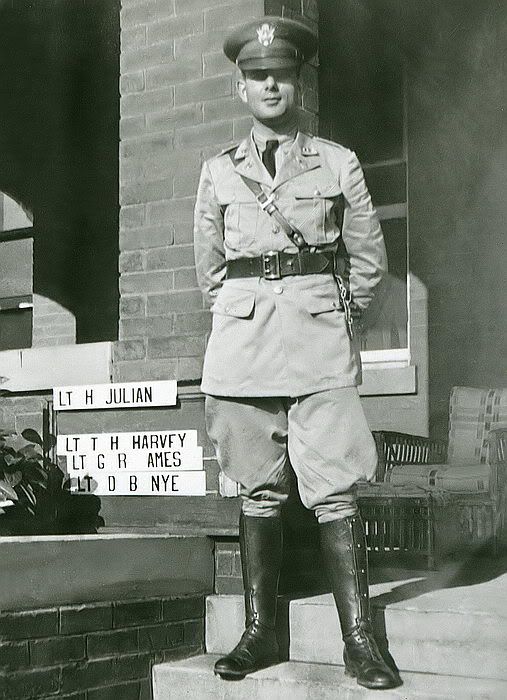
Photo of Lt. G.R. Ames taken at Ft. Monroe, Virginia, 1937 or 1938.
The five concrete gun blocks were un-used but the underground magazine did house the gun’s ammunition. Reinforced concrete structures were built for Height, Range Finding and Director equipment plus a Command Post. Comms shack, Mess and other structures were also added. In 1942, a bombproof tunnel was completed.
Now here is something of historical significance. It has been published before but I have never seen a copy with such great detail. The following sketch was drawn by Sgt. Pat Howell who was a member of this battery. He drew it from memory while a prisoner in the Cabanatuan POW camp.
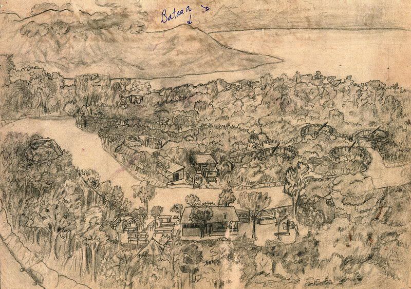
Overall sketch of Battery Chicago on Morrison Hill. Bataan is in the distance.
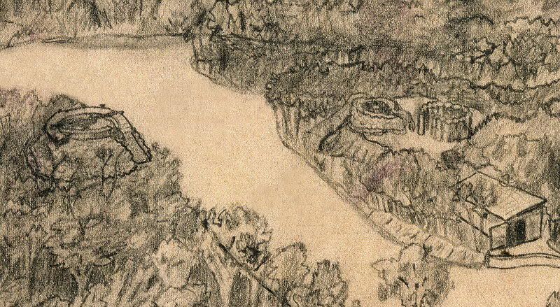
Close-up view (Left to Right) of the Height Finder (HF) position, Direction Finder (DF), Command Post (CP) and Command Shack.
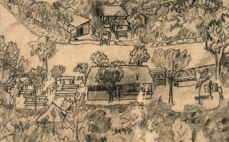
Close-up view of the Mess shack.
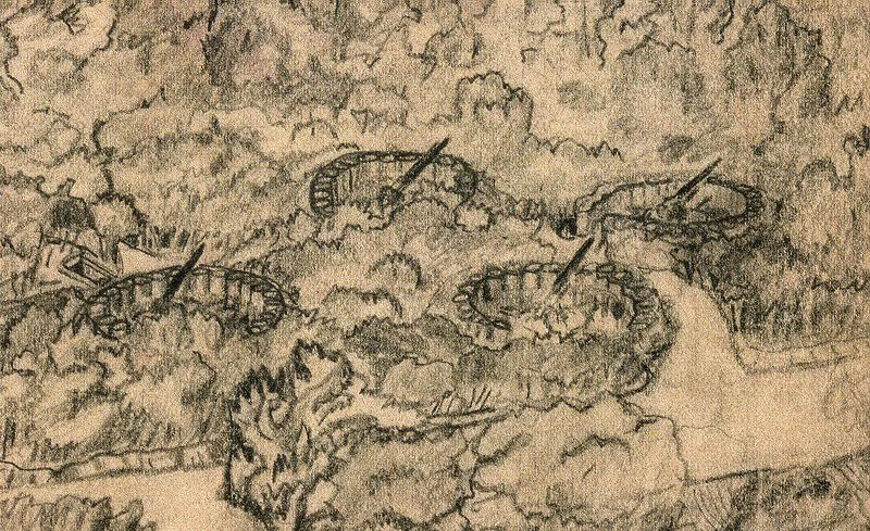
Close-up view of the four AA gun positions. Toward the left, note the southern entrance to the 1917 era underground magazine.
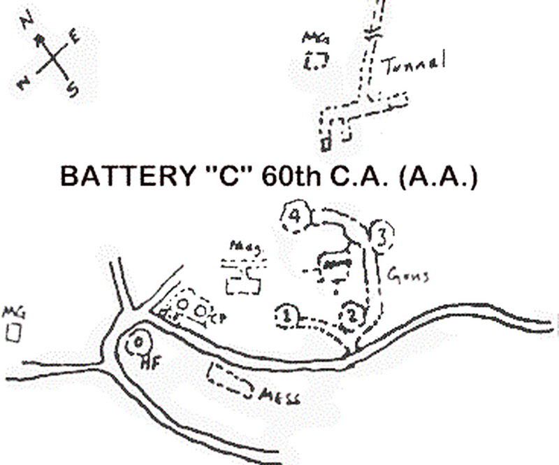
Here is a hand-drawn map detailing the layout of the battery on Morrison Hill.
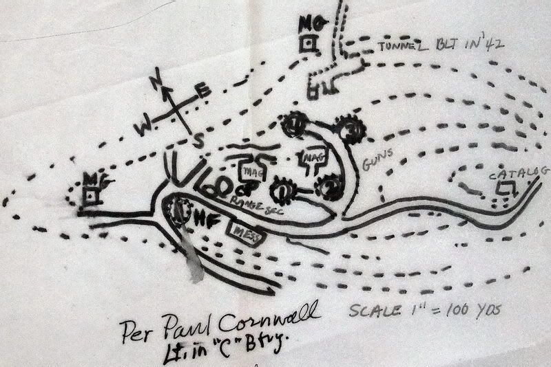
A similar drawing that has been annotated by Paul Cornwall who was a Lt. of Battery C.
These drawings along with the sketches are quite valuable when wandering around the site. Look to the far right of the second drawing, does anyone know what the structure labeled “Catalog” is?
The following Battery Chicago photos are a combination of those taken during Karol’s 1985 trip and my 2009 and 2010 trips.
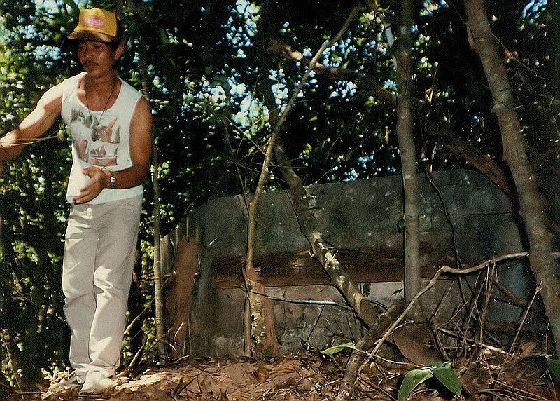
1985 – standing in front of the Height Finder position, this man is holding chicken wire that was used for camouflage. I notice wood is bolted to the front wall.
There are two amazing things in this photo. Look at this guy’s shoes and pants. Not only are they white but they are still clean!!! I come out of there looking like I got into a fight with a pack of monkeys and lost. Wonders never cease on this island.
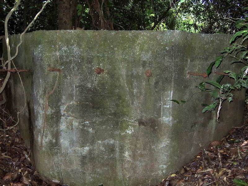
2009 – front of the Height Finder position. Today the wood is gone but the bolts and nuts are still there. Was this part of the camouflage?
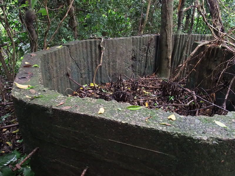
2010 – inside front of the Height Finder position.
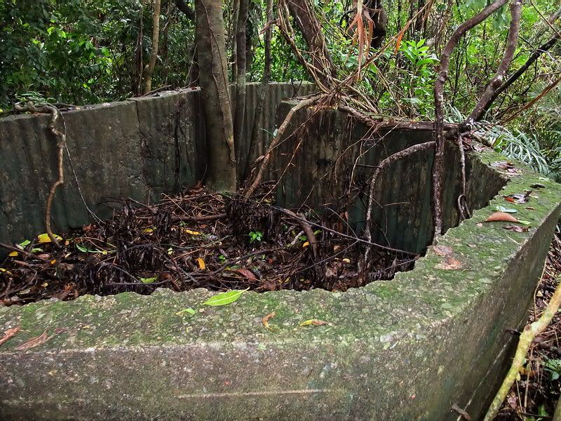
2010 – inside rear of the Height Finder position. On the center of the floor is a circular concrete pedestal with bolts for mounting the equipment. It looks like corrugated metal was the form used for the concrete during construction.
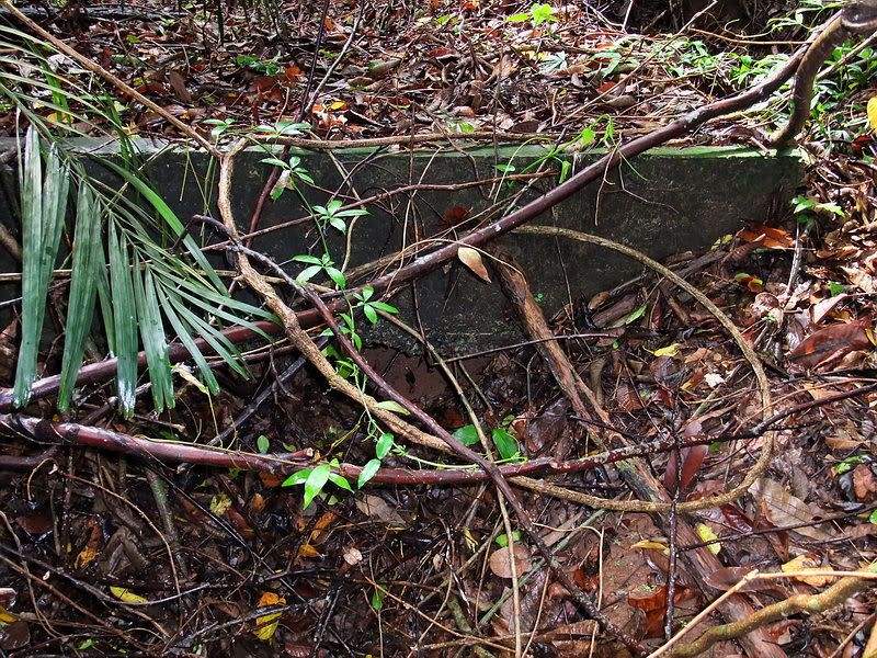
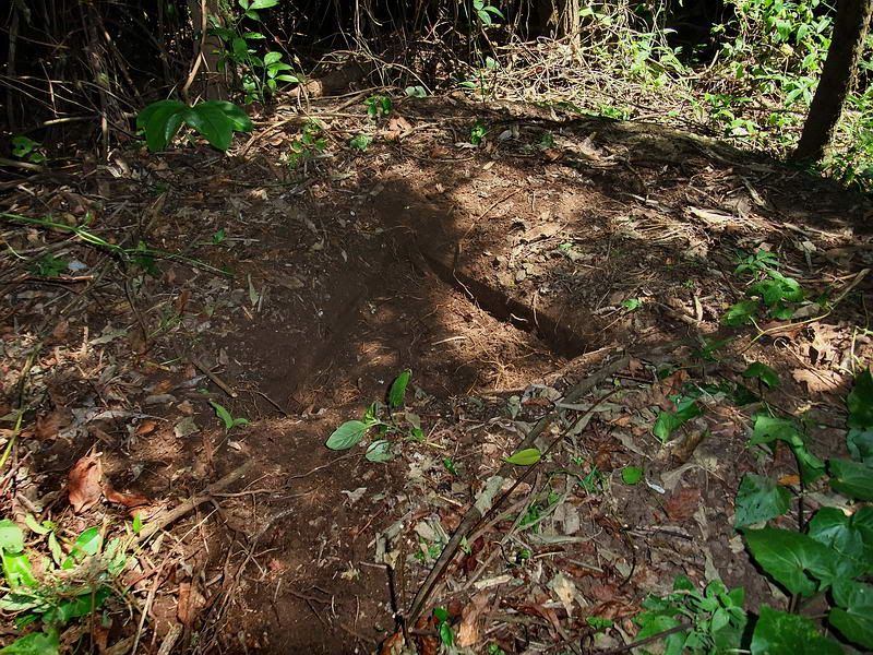
2010 – I am not sure what this structure near the HF was. It is shown on one of Sgt. Pat Howell’s sketches but not labeled. The area under the concrete is large enough to crawl into today so it may have been a shelter of some sort. A shallow trench along the hillside leading to this entrance is still visible.
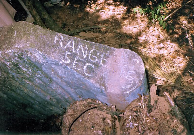
1985 – at the entrance to the HF is some text in the concrete. “RANGE SEC” and “C-60th 1941”.
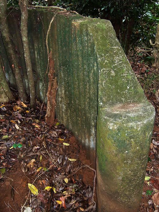
2009 – the text is still there but getting difficult to see. The two gravel filled barrels are gone.
If you remember my original report, I was up on Morrison Hill looking for the magazine and gun blocks of Battery Chicago. I knew that the four guns were “mobile” and did not require gun blocks but was told that they could use them if they chose to. I incorrectly assumed that the gun blocks were used but the hand-drawn maps clearly show otherwise. The guns were grouped together just to the south of the underground magazine.
Before I received Karol’s maps, I had used the 1936 Corregidor Map which shows nothing of Battery Chicago. In the small area of the DF and CP, I found a round pedestal (#2 in the original report). I noted that it did not look like the other gun blocks and now I know why. It is not a gun block.
When I view my own photos, I see what appears to be two different circular pedestals in the same immediate area. The maps show two adjacent circles so perhaps the DF and CP each had one. I need another trip back there again. With the help of the maps I should be able to determine exactly what remains there today.
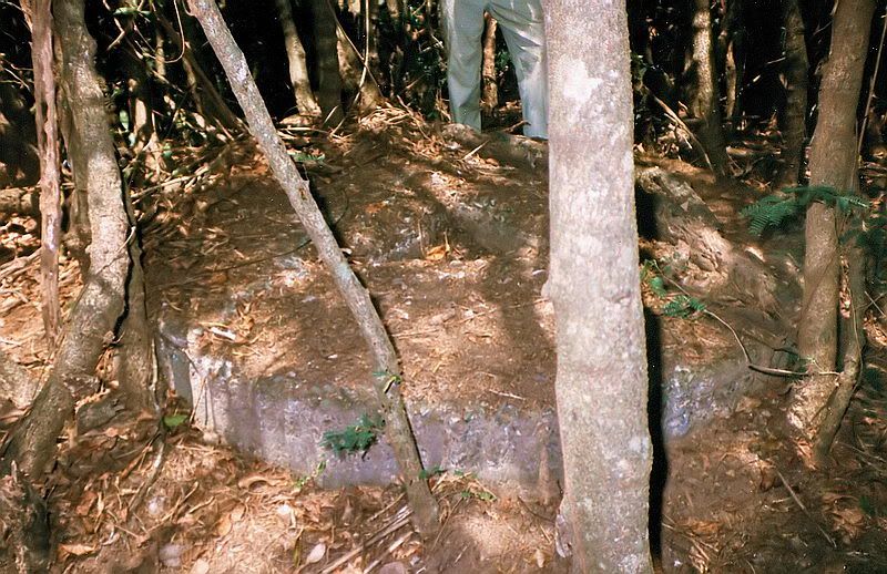
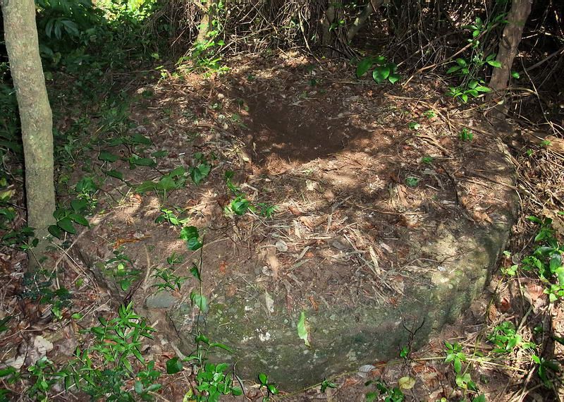
1985 – circular concrete pedestal
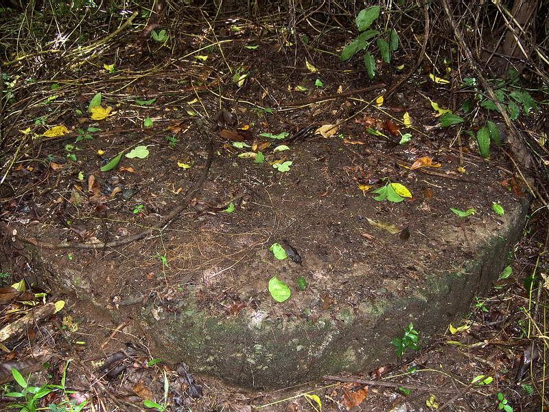
2009 – looks the same as the above pedestal. There is a depression in the middle but I did not clean it out for the photo.
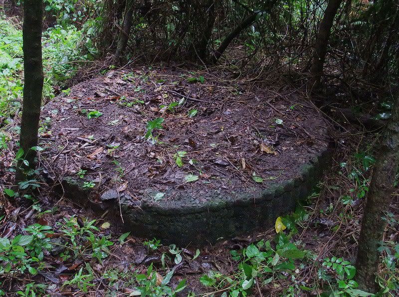
2010 – same immediate area but this appears to be a different pedestal. Note the wavy corrugated metal pattern to the outside of the ring.
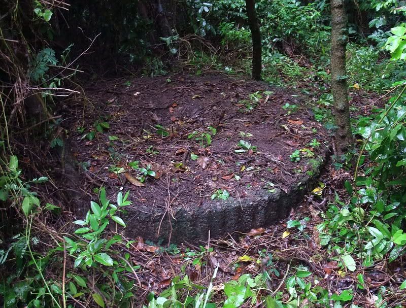
2010 – another view of this pedestal.
A few meters south of the pedestal photographed in 2010 are the destroyed remains of the Command Post. Today you can see pieces of crumpled metal cans, broken wood and even rusted corrugated metal sticking out of the ground. Another of Sgt. Pat Howell’s sketches from Cabanatuan shows Capt. Ames crawling out of the destroyed Command Post.
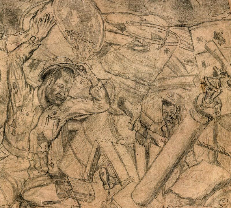
The sketch’s caption reads “Capt. G.R. Ames emerging from the wreckage of C-60th ‘s CP bombed April 12, 1942”.
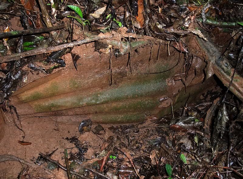
2010 – some corrugated sheet metal still in the rubble of the Command Post.
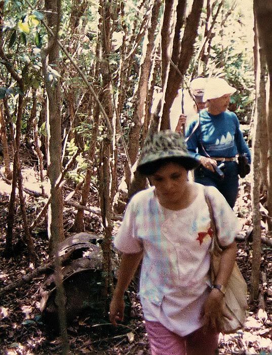
1985 – Karol says this piece of metal may have been a sink from the Mess shack.
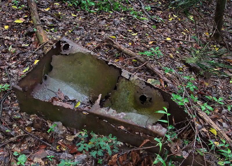
2010 – this may be the same sink turned upside down. It is in the location of the Mess shack. There are also bricks lying around here.
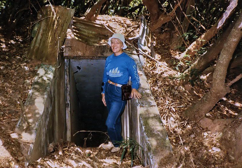
1985 – Karol Ames standing in front of the underground magazine’s south entrance. Her father must have walked down the steps behind her numerous times.

2009 – same view of the south entrance.
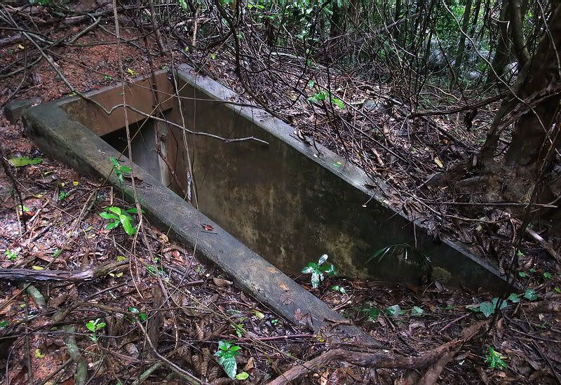
2010 – different view, same entrance.

2010 – at the bottom of the steps looking up towards the south entrance.

2010 – on turning 90 degrees west you see the second set of steps going down into the magazine room.

2009 – in the magazine room looking back towards the stairs.

2010 – up the steps to the north entrance you can see gravel filled cans still in place.

2010 – view of the outside of the magazine’s north entrance.

2010 – Morrison Hill must be the most littered area for mangled metal on all of Corregidor Island.

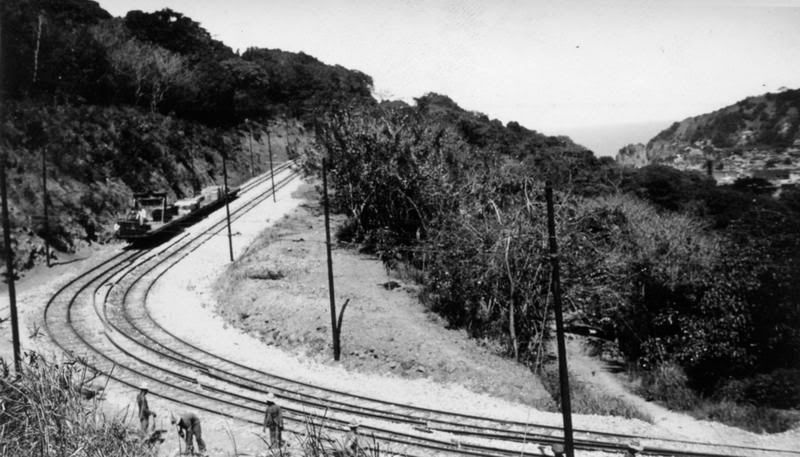
2010 – another prized material for bunker or other defense construction was wooden rail ties. Some piles of them can still be seen. I expect they came from the nearby trolley line going to Battery Morrison.

2010 – this concrete foundation is on the opposite side of the road from the Mess shack. It is shown on the sketch but not labeled.

2010 – not all concrete structures are recorded on the sketch or maps. If you get your nose down there you will see a room inside.

1985 – this photo shows a row of gravel filled cans. Some of the metal cans look to still be there and some missing. It is common today to see the circular gravel shape remaining but the actual metal can is gone. For hurried defenses this was a very common method of reinforcing positions throughout Corregidor. I have not stumbled across this row of cans yet.

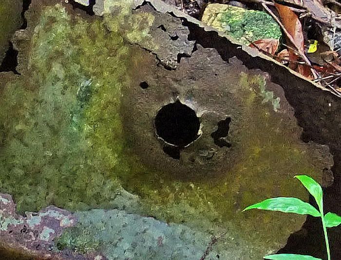
2010 – for some of the scrap lying around, I have no idea what it was. This time I thought I would record the stamp on the bottom of what might be a can then do some internet searches. The stamp is on the inside so appears reversed.
As best as I can determine, the stamp says:
PAT. NO. 1,756,596
REEVES
II S (I thought the II might be a ‘U’ but I don’t see the bottom horizontal part of the letter)
Unreadable letters to the left (24?) and perhaps ‘CAL’ to the right.
1940 or 1941
PAT.NO. 1,756,585
A query at the US Patent and Trademark Office for PAT. NO. 1,756,596 shows it was issued on April 29th, 1930. Wow, I might have something here. I click for details and get this.

PAT. NO. 1,756,596 is a SEWER FLUSHING DEVICE.
Did the boys of Battery C have a backup plan in case they ran out of 3-inch shells? Throw something else at the enemy? Well I doubt it. Are military patent numbers different that civilian patent numbers? A search for PAT.NO. 1,756,585 gave me no results.

2010 – here is the same stamp with the photo reversed so you can read it. If anyone wants to take a crack at determining what this is, please do so.
One thing that still baffles me is how good these WWII defenses still look. I can understand the fairly recent removal or rusting away of metal cans allowing their soil walls etc to keep their shape but I think there is more to it than that. The answer might be that the soil is not sand and rocks but hard red clay.

2009 – this position has metal cans at the front and a couple metal pipes sticking up along the sides. Notice how well that the side walls have survived. I doubt they ever had metal along the sides as there is no evidence of anything being removed or chunks of rusted metal lying around.
East of the underground magazine was a short side road. Halfway along the road is a low culvert with a drainage ditch on the down-hill side. The foot high walls of this ditch do not look like they are more than two generations old. A ditch would never have been lined. The ditch feeds water into two tile pipes.

2010 – view of the ditch feeding into two pipes. Look how good shape the walls are in after all these years.

2010 – close-up of the ditch feeding into two pipes.

2010 - perhaps another testament to the hardness of the clay is this shell/bomb crater. It is difficult to get decent photos of these things but even after all these years, it is still at least eight feet deep.
At one point in my explorations, I came across a mound of soil on an otherwise flat area. Sure enough, up on top was a metal air vent. This is man-made. There was no visible entrance on any side but one part has a concave look to it. At the time, I thought this might have been a bunker near the guns that now had a sealed entrance. I see from the hand-drawn map that this most likely was the second magazine shown to be between the four guns.

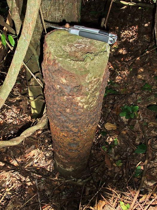
2010 – metal air vent pipe on top of the mound.
Regarding the actual AA gun positions, I am pretty sure I know where gun #2 was. Even though trees grow throughout the position, you see a large circle, flat in the middle, with a ring of soil completely around it. Thanks to the maps, the other positions can be determined. I have been here a couple times and this is where numerous barrels and what I thought were defensive positions are located. Some nasty vegetation is where gun three used to be. As I write this, I wonder if defensive work after 1942 is confusing what we see today. i.e. did the Japanese scrap the material of the gun positions to construct what looks like infantry positions?
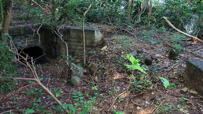
On the map, NE of the guns was one of the Battery Chicago machine gun positions. It sits on top of Morrison Hill just where the terrain starts to slope quite steeply. Without trees there would be a perfect view down the hill. The top of the position is flat and at the rear are two shallow concrete slots or trenches. They are too small for a man so perhaps ammo was temporarily stored here. That is an assumption only. The front and sides of the position have been shored up with rocks stacked upon each other. I have read that these were hastily built positions.

2010 – looking up the hill at the NE machine gun position.
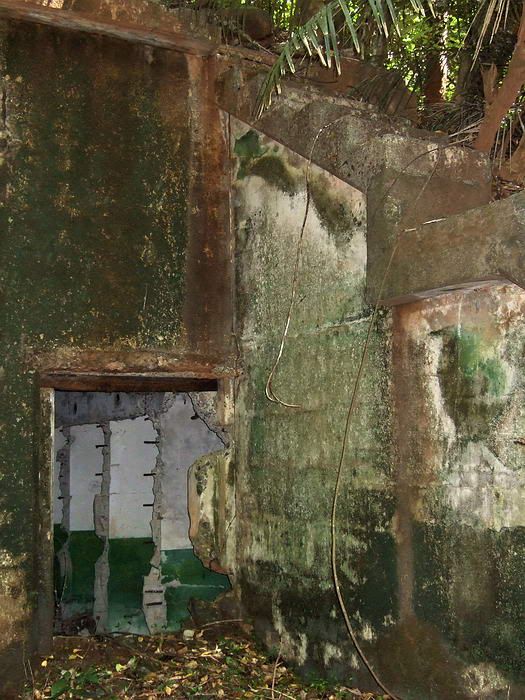
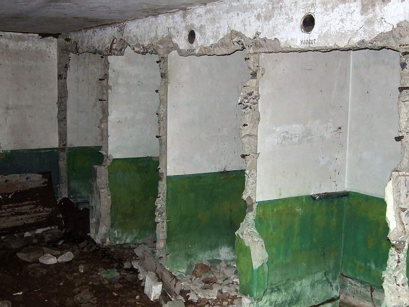
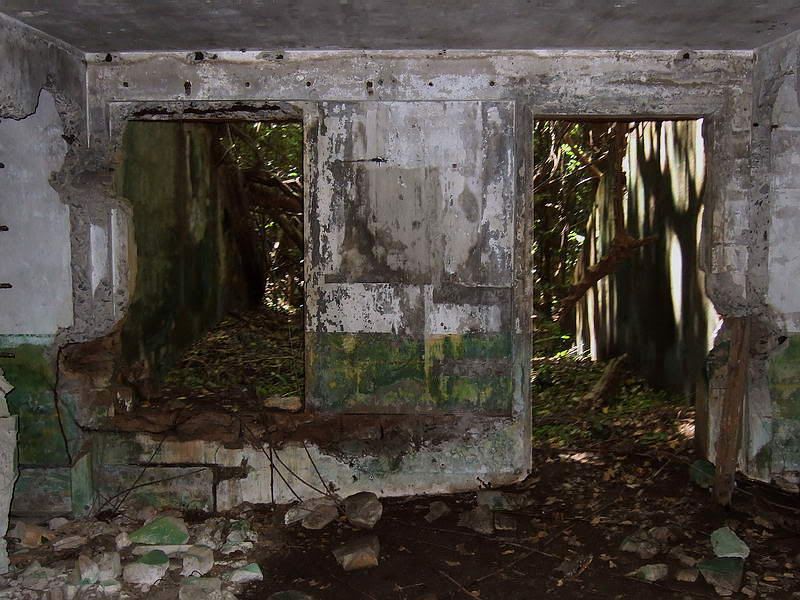
Finally lets have a look at the Battery Chicago tunnel. Construction was started in January of 1942 with its main purpose being a bomb-proof personnel shelter. After the Mess shack was destroyed, the Mess was also moved into the tunnel.
Walking NE from the gun positions will bring you to what appears to be a curved concrete wall about three feet high. Here you are actually standing on top of the tunnel. The wall is above the entrance which is down below on the opposite side. The top center of the wall has a concrete marker with the text “1942”. It appears that half of the marker is missing and Karol believes that it said “C-60th“ or something similar to that.
When looking in the entrance you see that the tunnel is collapsed just a few feet inside. On a closer look, this is a mound of soil that can be crawled over. Unfortunately you come to a complete collapse just ten feet or so inside the tunnel’s entrance. Again the soil is red clay with very few rocks.
Outside the entrance facing downhill, a walkway is cut into the hillside curving towards the north. The walkway ends at a nearby old road.

As you approach the wall from the uphill side, this is the view looking towards the left. Note the concrete marker with half of it missing. I did a little search on both sides of the wall for it but found nothing. The tunnel entrance is down below on the opposite side.

As you approach the wall from the uphill side, this is the view looking towards the right.

Overall view of the curved wall. Uphill is to the left and the tunnel entrance is down below to the right.

The front of the wall with the tunnel entrance below it.

A wider view of the Battery Chicago tunnel entrance.

Standing on the old road and looking uphill towards the tunnel. The walkway cut into the hillside starts at the bottom right of the photo and curves around towards the upper left. Near top center of the photo, you can see part of the concrete wall with the marker on top.
Morrison Hill was in clear view of the nearby enemy guns on Bataan. In later stages of the battle as the number of Japanese guns increased across the channel, Battery Chicago on Morrison Hill became a very dangerous place to be.

Sgt. Pat Howell’s sketch of battle damaged Morrison Hill. This sketch was also drawn from memory while he was a POW at Cabanatuan.
I found some information that okla had been interested in. According to the book “Harbour Defenses of Manila and Subic Bays”, the destruction and damages inflicted upon enemy air forces by the Anti-aircraft Defense during the entire campaign were as follows:
Planes shot down . . . . . . . . . . . . . . . . . . . . . . . . . . . . . . . . . . . 87
Additional planes heavily damaged and probably lost to the enemy . . 19
Additional planes hit but less severely damaged . . . . . . . . . . . . . . . 66
Morrison Hill still has a few more secrets to be uncovered. With the information that Karol has provided I now know what and where to look for things and should be able to identify what I find. Thank-you very much for that.
Vegetation has really overtaken the island in recent years which makes objects harder to find. Recent typhoon damage does not help either. However, it is well worth the effort not to mention the fun. If there is anything worth updating, I will do so here.
The hunt continues.

Battery Chicago tunnel.
Morrison Hill is a little remote today but has always been an interesting location to explore. You will see a 1917 era 3-inch AA gun block and an underground magazine. In later years, the threat from enemy bombers became a reality so four more gun blocks were added along the ridge. Maps show nothing else being located on the hill.
I don’t know the exact date but as WWII approached, a battery of four mobile 3-inch Anti-aircraft guns (including machine guns) were stationed up here. This battery, Battery C (Chicago) of the 60th Coast Artillery was commanded by Capt. G.R. Ames.

Photo of Lt. G.R. Ames taken at Ft. Monroe, Virginia, 1937 or 1938.
The five concrete gun blocks were un-used but the underground magazine did house the gun’s ammunition. Reinforced concrete structures were built for Height, Range Finding and Director equipment plus a Command Post. Comms shack, Mess and other structures were also added. In 1942, a bombproof tunnel was completed.
Now here is something of historical significance. It has been published before but I have never seen a copy with such great detail. The following sketch was drawn by Sgt. Pat Howell who was a member of this battery. He drew it from memory while a prisoner in the Cabanatuan POW camp.

Overall sketch of Battery Chicago on Morrison Hill. Bataan is in the distance.

Close-up view (Left to Right) of the Height Finder (HF) position, Direction Finder (DF), Command Post (CP) and Command Shack.

Close-up view of the Mess shack.

Close-up view of the four AA gun positions. Toward the left, note the southern entrance to the 1917 era underground magazine.

Here is a hand-drawn map detailing the layout of the battery on Morrison Hill.

A similar drawing that has been annotated by Paul Cornwall who was a Lt. of Battery C.
These drawings along with the sketches are quite valuable when wandering around the site. Look to the far right of the second drawing, does anyone know what the structure labeled “Catalog” is?
The following Battery Chicago photos are a combination of those taken during Karol’s 1985 trip and my 2009 and 2010 trips.

1985 – standing in front of the Height Finder position, this man is holding chicken wire that was used for camouflage. I notice wood is bolted to the front wall.
There are two amazing things in this photo. Look at this guy’s shoes and pants. Not only are they white but they are still clean!!! I come out of there looking like I got into a fight with a pack of monkeys and lost. Wonders never cease on this island.

2009 – front of the Height Finder position. Today the wood is gone but the bolts and nuts are still there. Was this part of the camouflage?

2010 – inside front of the Height Finder position.

2010 – inside rear of the Height Finder position. On the center of the floor is a circular concrete pedestal with bolts for mounting the equipment. It looks like corrugated metal was the form used for the concrete during construction.

2010 – I am not sure what this structure near the HF was. It is shown on one of Sgt. Pat Howell’s sketches but not labeled. The area under the concrete is large enough to crawl into today so it may have been a shelter of some sort. A shallow trench along the hillside leading to this entrance is still visible.

1985 – at the entrance to the HF is some text in the concrete. “RANGE SEC” and “C-60th 1941”.

2009 – the text is still there but getting difficult to see. The two gravel filled barrels are gone.
If you remember my original report, I was up on Morrison Hill looking for the magazine and gun blocks of Battery Chicago. I knew that the four guns were “mobile” and did not require gun blocks but was told that they could use them if they chose to. I incorrectly assumed that the gun blocks were used but the hand-drawn maps clearly show otherwise. The guns were grouped together just to the south of the underground magazine.
Before I received Karol’s maps, I had used the 1936 Corregidor Map which shows nothing of Battery Chicago. In the small area of the DF and CP, I found a round pedestal (#2 in the original report). I noted that it did not look like the other gun blocks and now I know why. It is not a gun block.
When I view my own photos, I see what appears to be two different circular pedestals in the same immediate area. The maps show two adjacent circles so perhaps the DF and CP each had one. I need another trip back there again. With the help of the maps I should be able to determine exactly what remains there today.

1985 – circular concrete pedestal

2009 – looks the same as the above pedestal. There is a depression in the middle but I did not clean it out for the photo.

2010 – same immediate area but this appears to be a different pedestal. Note the wavy corrugated metal pattern to the outside of the ring.

2010 – another view of this pedestal.
A few meters south of the pedestal photographed in 2010 are the destroyed remains of the Command Post. Today you can see pieces of crumpled metal cans, broken wood and even rusted corrugated metal sticking out of the ground. Another of Sgt. Pat Howell’s sketches from Cabanatuan shows Capt. Ames crawling out of the destroyed Command Post.

The sketch’s caption reads “Capt. G.R. Ames emerging from the wreckage of C-60th ‘s CP bombed April 12, 1942”.

2010 – some corrugated sheet metal still in the rubble of the Command Post.

1985 – Karol says this piece of metal may have been a sink from the Mess shack.

2010 – this may be the same sink turned upside down. It is in the location of the Mess shack. There are also bricks lying around here.

1985 – Karol Ames standing in front of the underground magazine’s south entrance. Her father must have walked down the steps behind her numerous times.

2009 – same view of the south entrance.

2010 – different view, same entrance.

2010 – at the bottom of the steps looking up towards the south entrance.

2010 – on turning 90 degrees west you see the second set of steps going down into the magazine room.

2009 – in the magazine room looking back towards the stairs.

2010 – up the steps to the north entrance you can see gravel filled cans still in place.

2010 – view of the outside of the magazine’s north entrance.

2010 – Morrison Hill must be the most littered area for mangled metal on all of Corregidor Island.

2010 – another prized material for bunker or other defense construction was wooden rail ties. Some piles of them can still be seen. I expect they came from the nearby trolley line going to Battery Morrison.

2010 – this concrete foundation is on the opposite side of the road from the Mess shack. It is shown on the sketch but not labeled.

2010 – not all concrete structures are recorded on the sketch or maps. If you get your nose down there you will see a room inside.

1985 – this photo shows a row of gravel filled cans. Some of the metal cans look to still be there and some missing. It is common today to see the circular gravel shape remaining but the actual metal can is gone. For hurried defenses this was a very common method of reinforcing positions throughout Corregidor. I have not stumbled across this row of cans yet.

2010 – for some of the scrap lying around, I have no idea what it was. This time I thought I would record the stamp on the bottom of what might be a can then do some internet searches. The stamp is on the inside so appears reversed.
As best as I can determine, the stamp says:
PAT. NO. 1,756,596
REEVES
II S (I thought the II might be a ‘U’ but I don’t see the bottom horizontal part of the letter)
Unreadable letters to the left (24?) and perhaps ‘CAL’ to the right.
1940 or 1941
PAT.NO. 1,756,585
A query at the US Patent and Trademark Office for PAT. NO. 1,756,596 shows it was issued on April 29th, 1930. Wow, I might have something here. I click for details and get this.

PAT. NO. 1,756,596 is a SEWER FLUSHING DEVICE.
Did the boys of Battery C have a backup plan in case they ran out of 3-inch shells? Throw something else at the enemy? Well I doubt it. Are military patent numbers different that civilian patent numbers? A search for PAT.NO. 1,756,585 gave me no results.

2010 – here is the same stamp with the photo reversed so you can read it. If anyone wants to take a crack at determining what this is, please do so.
One thing that still baffles me is how good these WWII defenses still look. I can understand the fairly recent removal or rusting away of metal cans allowing their soil walls etc to keep their shape but I think there is more to it than that. The answer might be that the soil is not sand and rocks but hard red clay.

2009 – this position has metal cans at the front and a couple metal pipes sticking up along the sides. Notice how well that the side walls have survived. I doubt they ever had metal along the sides as there is no evidence of anything being removed or chunks of rusted metal lying around.
East of the underground magazine was a short side road. Halfway along the road is a low culvert with a drainage ditch on the down-hill side. The foot high walls of this ditch do not look like they are more than two generations old. A ditch would never have been lined. The ditch feeds water into two tile pipes.

2010 – view of the ditch feeding into two pipes. Look how good shape the walls are in after all these years.

2010 – close-up of the ditch feeding into two pipes.

2010 - perhaps another testament to the hardness of the clay is this shell/bomb crater. It is difficult to get decent photos of these things but even after all these years, it is still at least eight feet deep.
At one point in my explorations, I came across a mound of soil on an otherwise flat area. Sure enough, up on top was a metal air vent. This is man-made. There was no visible entrance on any side but one part has a concave look to it. At the time, I thought this might have been a bunker near the guns that now had a sealed entrance. I see from the hand-drawn map that this most likely was the second magazine shown to be between the four guns.

2010 – metal air vent pipe on top of the mound.
Regarding the actual AA gun positions, I am pretty sure I know where gun #2 was. Even though trees grow throughout the position, you see a large circle, flat in the middle, with a ring of soil completely around it. Thanks to the maps, the other positions can be determined. I have been here a couple times and this is where numerous barrels and what I thought were defensive positions are located. Some nasty vegetation is where gun three used to be. As I write this, I wonder if defensive work after 1942 is confusing what we see today. i.e. did the Japanese scrap the material of the gun positions to construct what looks like infantry positions?
On the map, NE of the guns was one of the Battery Chicago machine gun positions. It sits on top of Morrison Hill just where the terrain starts to slope quite steeply. Without trees there would be a perfect view down the hill. The top of the position is flat and at the rear are two shallow concrete slots or trenches. They are too small for a man so perhaps ammo was temporarily stored here. That is an assumption only. The front and sides of the position have been shored up with rocks stacked upon each other. I have read that these were hastily built positions.

2010 – looking up the hill at the NE machine gun position.
Finally lets have a look at the Battery Chicago tunnel. Construction was started in January of 1942 with its main purpose being a bomb-proof personnel shelter. After the Mess shack was destroyed, the Mess was also moved into the tunnel.
Walking NE from the gun positions will bring you to what appears to be a curved concrete wall about three feet high. Here you are actually standing on top of the tunnel. The wall is above the entrance which is down below on the opposite side. The top center of the wall has a concrete marker with the text “1942”. It appears that half of the marker is missing and Karol believes that it said “C-60th“ or something similar to that.
When looking in the entrance you see that the tunnel is collapsed just a few feet inside. On a closer look, this is a mound of soil that can be crawled over. Unfortunately you come to a complete collapse just ten feet or so inside the tunnel’s entrance. Again the soil is red clay with very few rocks.
Outside the entrance facing downhill, a walkway is cut into the hillside curving towards the north. The walkway ends at a nearby old road.

As you approach the wall from the uphill side, this is the view looking towards the left. Note the concrete marker with half of it missing. I did a little search on both sides of the wall for it but found nothing. The tunnel entrance is down below on the opposite side.

As you approach the wall from the uphill side, this is the view looking towards the right.

Overall view of the curved wall. Uphill is to the left and the tunnel entrance is down below to the right.

The front of the wall with the tunnel entrance below it.

A wider view of the Battery Chicago tunnel entrance.

Standing on the old road and looking uphill towards the tunnel. The walkway cut into the hillside starts at the bottom right of the photo and curves around towards the upper left. Near top center of the photo, you can see part of the concrete wall with the marker on top.
Morrison Hill was in clear view of the nearby enemy guns on Bataan. In later stages of the battle as the number of Japanese guns increased across the channel, Battery Chicago on Morrison Hill became a very dangerous place to be.

Sgt. Pat Howell’s sketch of battle damaged Morrison Hill. This sketch was also drawn from memory while he was a POW at Cabanatuan.
I found some information that okla had been interested in. According to the book “Harbour Defenses of Manila and Subic Bays”, the destruction and damages inflicted upon enemy air forces by the Anti-aircraft Defense during the entire campaign were as follows:
Planes shot down . . . . . . . . . . . . . . . . . . . . . . . . . . . . . . . . . . . 87
Additional planes heavily damaged and probably lost to the enemy . . 19
Additional planes hit but less severely damaged . . . . . . . . . . . . . . . 66
Morrison Hill still has a few more secrets to be uncovered. With the information that Karol has provided I now know what and where to look for things and should be able to identify what I find. Thank-you very much for that.
Vegetation has really overtaken the island in recent years which makes objects harder to find. Recent typhoon damage does not help either. However, it is well worth the effort not to mention the fun. If there is anything worth updating, I will do so here.
The hunt continues.

Battery Chicago tunnel.


 They aren't in an area of the "sink" that would lead one to think they were drains. Whatever, this thing does resemble that damned thing I used to peer into while pulling KP duty. Greasy tray after tray waiting to be washed by yours truly and other suffering "pearl divers". Many thanks for posting the number of enemy planes claimed to have been destroyed/damaged by Corregidor's gunners. It is just my humble, uninformed opinion, but those numbers seem to be kinda high. We all know that the total of Japanese claimed by our forces varies from one report to another. Anywhere from a total of 5 for the whole campaign to the numbers you have posted. Battery Boy reports that he is still making an effort, using Japanese records that he has an angle on, to determine the actual total. The invaders know how many of their aircraft were lost and should have accurate figures. It is so difficult for the gunners to make accurate claims. For example the gunners in Battery Denver are claiming hits while the guys in Battery Hartford, for example, are firing at the same plane. Thus, we have two destroyed Japanese aircraft according to our guys when, in truth, only one bandit was shot down. We ran into this problem often when evaluating gun camera film from my outfit's F-86s. After the inflated claims from WW 2, the USAF was much stricter during the Korean War when it came to awarding credit for enemy destroyed. It was only natural for AA gunners to make exaggerated claims, especially so when they were getting clobbered day after day by the emperor's flyers. Those records Battery Boy is pursuing will hopefully give us a clearer picture of this little question. Thanks again for this excellent posting. You the man. Cheers.
