|
|
Post by oozlefinch on Apr 27, 2015 7:29:42 GMT 8
On one of my sleepless nights I got to thinking. Several books refer, in the retaking of the island, of a Japanese gun in a cement lined tunnel firing on the naval support ships. As I don't know of any others, does anyone think this could have been Battery Monja? The canopy over the front of the casement has certainly changed its look from before the war. And, if it was Monja, does anyone have any SWAG as to whether it was a Japanese gun, or the original 155mm?
|
|
|
|
Post by Karl Welteke on Feb 1, 2016 15:33:43 GMT 8
WHAT ARE THESE THINGS? A forum friend sent these 3 pictures to EXO and was wondering what these things are. 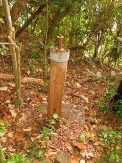 W611 item photographed by William Kirwan and sent to the forum web master, EXO. Photo was shot above Wheeler Point, on top of the hillside. 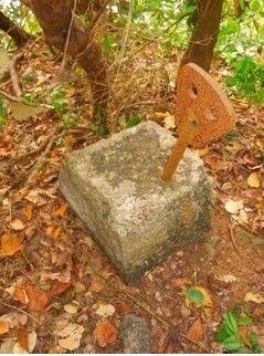 W612 item photographed by William Kirwan and sent to the forum web master, EXO. Photo was shot above Wheeler Point, on top of the hillside. 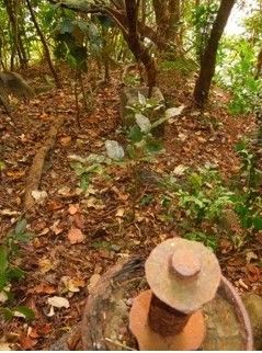 W613 item photographed by William Kirwan and sent to the forum web master, EXO. Photo was shot above Wheeler Point, on top of the hillside. EXO sent an email to some of us and asked: “ Any Idea”. Answers will follow! |
|
|
|
Post by Karl Welteke on Feb 1, 2016 18:08:48 GMT 8
ARE THESE THINGS MINE FIELD RANGE MARKERS? Fots2 offered this possible explanation as to what these things are and also sent two images: Good day Paul, I have seen items such as these in my off-road travels but never paid much attention to them. I did not recorded where they are and may or may not be able to find them again. (Two sample photos are attached; these ones are south-west of Crockett). Most are cut-off metal pipes embedded in concrete. I assume scrappers got the pipes. They were along the south side of the island similar to the ones in Mr. Kirwan's photos. I do not know their exact purpose but I do have a possibility for you. They are pedestals to support marker signs for identifying the start/end points of the submarine minefields. Why I say this is that in the past I have seen a map or drawing that showed the minefields and lines drawn to pairs of marker posts on the south side of Corregidor. There were a few pairs of them. Have any of you ever seen this map? Imagine a mine-tender far off-shore from Corregidor trying to locate the start/end of a row of mines that are out of sight underwater. For a specific location, the map showed two sets of markers on Corregidor, one of each set was 'in land' of the other one. I assume they moved so that they lined up one set of markers and followed that line until they lined up another set of markers. "X" marks the spot so to speak. Damned if I can find that map now and I do not remember where I saw it. (Old age coming I guess!). I cannot imagine any other purpose for the markers at the moment unless these photos were taken right beside "bathtubs". Anyway, as Chadhill says, that is my SWAG. I hope all is well with you these days. I wish I could join you on The Rock February 14th; some other year for sure. Take care. John Here are the two pictures from fots2: 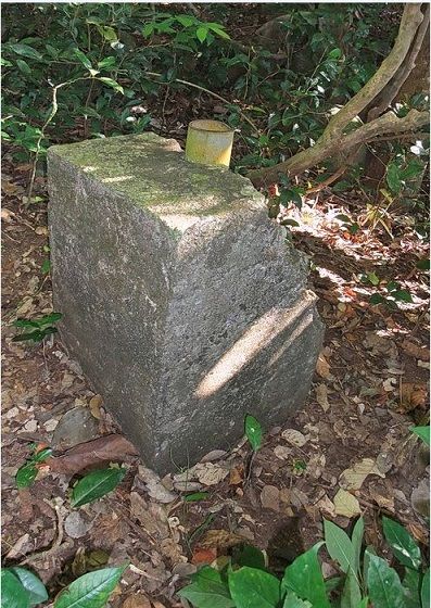 W615 this image is courtesy of John Moffitt (fots2), he places this item at the 155mm artillery semi emplaced positions south of Battery Crockett, Fort Mills on Corregidor Island. 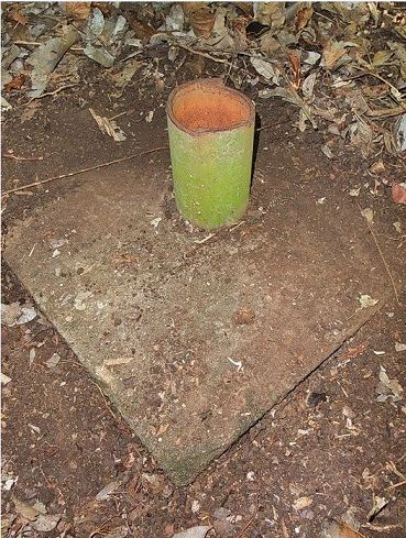 W614 this image is also courtesy of John Moffitt (fots2), and he was not specific as to the exact position but we can assume is also in the general area of the 155mm artillery semi emplaced positions south of Battery Crockett, Fort Mills on Corregidor Island. Batteryboy in another email offered this comment: Same here and I concur with John. It’s one of those structures that take a back seat against gun batteries, emergency and base end stations so it did not catch my eye. Good finds though. |
|
|
|
Post by Karl Welteke on Feb 1, 2016 18:50:20 GMT 8
WE KNOW THE EXACT LOCATION OF THESE THINGS. Karl also came across at least of two of those THINGS and offers the picture and map below. The two shown on the image are at the cliff above Wheeler Point and on the sea side of the Battery Target Position Finder Station B-1-4 (Wheeler). I thought then and now that the one item was an antenna mast and the other thing an anchor to connect a guy wire to that mast. John, from my sailor days and standing watches on ships bridges, I do recall, Range Markers are common and useful to enter and stay in a channel, approach a pier etc. The markers certainly must have been useful navigating in the minefield or maintaining it. Here is my 2005-01-06 picture of two of those things: 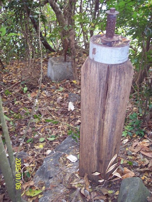 W516 the two items located at the cliff above Wheeler Point and on the sea side of the Battery Target Position Finder Station B-1-4 (Wheeler), Fort Mills on Corregidor Island. 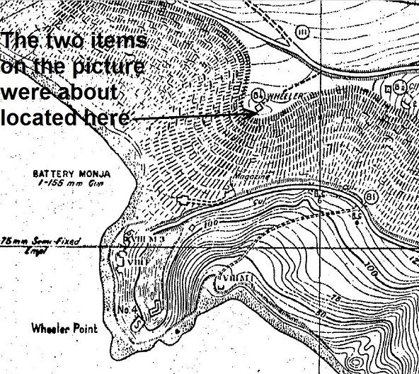 W517 is a section of Fort Mills on Corregidor Island showing the location of the two items in image # W516. EXO is this location not a place of a most historical battle action by the paratroopers in 1945? Don’t you have a good link or more and perhaps a picture or two of this action? And many visitors and armchair historians refer to this area as Banzai Point, do you know the history? |
|
|
|
Post by EXO on Feb 2, 2016 8:29:24 GMT 8
KARL has thrown me a challenge of sorts, to background this area (once again) because it is a much overlooked area on Corregidor. People tend to be fixated on walking down to Battery Cheney, and after stopping at the look-out area, they tend to pass on down the road without any idea that they just passed the site of probably the largest battle on the island. The area is, in fact, one of the two battles which occurred on the night of the 18/19th February in which the Japanese attempted major attacks towards Topside from their strong-points in the ravines. (The other, later in the night, was at the other side of the ravine, when they came up through Battery Smith and had to pass through the choke-point between Way Hill and the top of the Battery Hearn magazine. This is described in THE NIGHT OF A THOUSAND HOURS which is one of the stand-alone essays which are a part of the BLESS 'EM ALL feature.) D Company had been stretched out along the road towards Battery Cheney, unable to return to the main perimeter by nightfall. Lulled by low regard for the number of Japanese forces remaining against them , Regimental HQ believe the extended perimeter is an acceptable risk. They are wrong, and it is a grievous error. In the morning's early hours, the Japanese attack in force directly through their positions, literally pinning a small group of Troopers backs to the sheer cliffs of Wheeler Point. Lt. Turinski and twelve men are KIA, and thirteen wounded, of which twelve are evacuated. "D" Co has received a serious mauling. I do have a number of links concerning this battle, but feel that the article by Lt. John Lindgren (John would later retire as a Colonel) is most appropriate here - because John was one of the group who took part in the battle. He was, in fact, seriously wounded, and stretchered out to Topside the following morning. ( List of Casualties is here.) Later in life, John revisited the battle site many times, and his writing about the battle is the most authoritative. One of my favourite articles (because John allowed me to have a hand in it) is " NIGHT AT WHEELER POINT" which describes John's return to Wheeler Point later in life. As for the so-called SUICIDE CLIFF, that's pure bunk that the guides tell the Japanese tourists, because they know it will make the Japanese cry, and they will get more tips. Don Abbott, also a 503d PRCT veteran who has visited Corregidor many times, mentioned to me that when he tried to set the tour guides right, he was told that the place was a good "tip earner" from teary Japanese tourists. I understand that more lately, the guides are describing another area of Corregidor as "Suicide Cliff," no doubt for the same reason. The truth is that on the morning of February 19, the D Company soldiers who survived the night at Wheeler Point removed nearly 300 bodies of Japanese soldiers they had killed during the terrible night battle. There was no way the company, probably then less than 70 able bodied men, could have shoveled in the hard ground to bury the corpses. Instead they simply carried the dead Japanese marines and dropped them over the cliff 10 metres south of Wheeler Point. That is the explanation for the remains found on the sheer cliff but the reasoning is dead wrong. Tony Sierra was one of the men there that morning, and confirmed the details directly to me. John Lindgren preferred that the area be known as "BANZAI CLIFF", but definitely not "Suicide Cliff." Also, because the geographical feature is strictly not at WHEELER POINT itself, he felt that the battle should be known as THE BATTLE AT BANZAI POINT, which is why I have labeled the drawing accordingly. As authorities of sorts, I urge that you refer to the battle using that name, keeping faith with the wishes of the men who were there. |
|
|
|
Post by beirutvet on Feb 2, 2016 11:05:34 GMT 8
Karl
I agree. Most assuredly a radio mast and an anchor for supporting cable.
EXO
Banzai Point it shall be.
|
|
|
|
Post by Karl Welteke on Feb 4, 2016 20:00:23 GMT 8
MACHINE GUN MOUNTS FOR LOCAL AA DEFENSE? Karl Schmidt offers this input about those things above Wheeler Point, on top of the cliff, the area we call Banzai Point. He said this and sent these two pictures the 1st Feb 2016: I'm pretty sure the mystery posts discussed in your recent addition to the site are machine gun mounts for local AA defense of the nearby CA batteries attached is a photo... before people burn me at the stake, the BAR and tripod are not part of my ID -- the goose neck adapter is the key --it was a standard item for the 30 caliber mg, you can see how it would fit on the "mystery post". I think I can find better photos. The other Karl Wilhelm 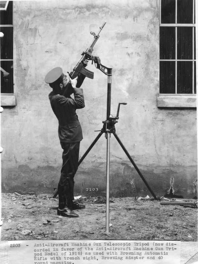 W620 Karl Schmidt, from the Coastal Defense Study Group (cdsg.org) sent this image and gave this description: They are or could be machine gun mounts for local AA defense of the nearby CA batteries on Corregidor. 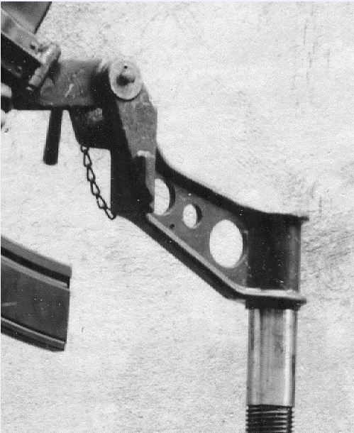 W621 close up image of a part in the previous image # W620 |
|
|
|
Post by Karl Welteke on Feb 8, 2016 20:17:32 GMT 8
More pictures to back up that these mystery posts may be Machine gun posts. Karl Schmidt (from CDSG) sent 5 more pictures and said this: Here are some more photos of the pipe type 30 caliber MG mounts. Sorry for the poor quality they are John D. Bennett photos from various articles in the CGSG journal. John explores Hawaii as you do Corregidor. The mounts were still in place in the early 2000's when photographed. I'll keep looking for better photos. Regards Karl Schmidt 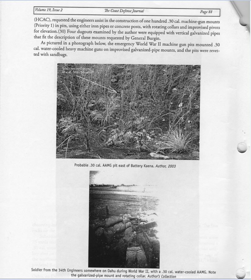 W628 story from the Coast Defense Journal about the installation of many .30 cal machine gun mounts. This picture was sent by Karl Schmidt, a leader in the Coastal Defense Study Group organization (cdsg.org). 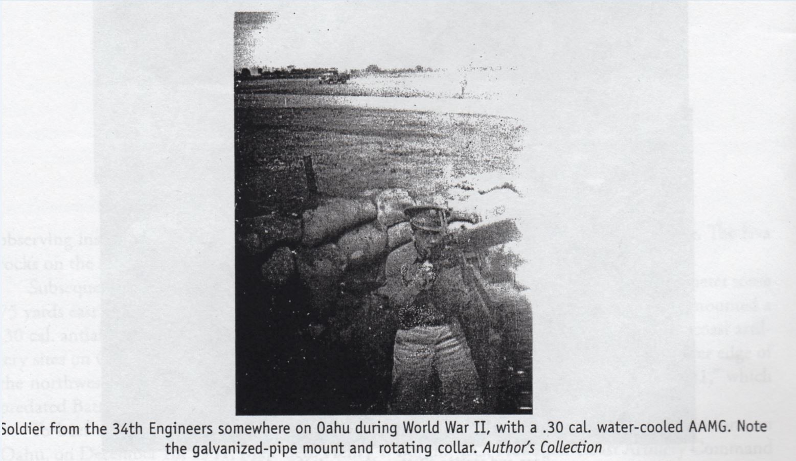 W629 a soldier is manning a 30 cal machine gun. The picture is out of a Coast Defense Journal about the installation of many .30 cal machine gun mounts. This picture was sent by Karl Schmidt, a leader in the Coastal Defense Study Group organization (cdsg.org). 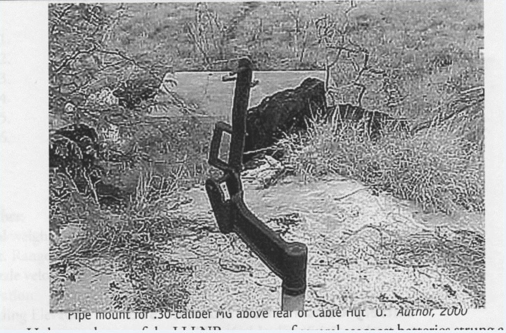 W630 a pipe mount for a.30 cal machine gun. The picture is out of a Coast Defense Journal about the installation of many .30 cal machine gun mounts. This picture was sent by Karl Schmidt, a leader in the Coastal Defense Study Group organization (cdsg.org). 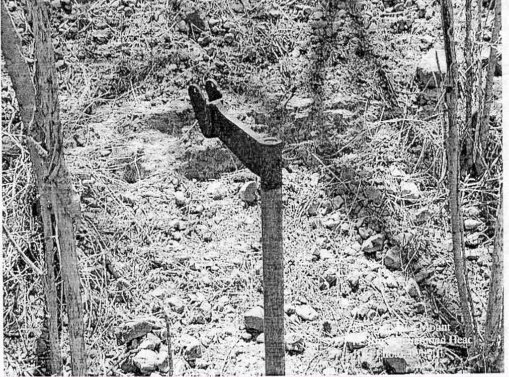 W631 a pipe mount for a.30 cal machine gun. The picture is out of a Coast Defense Journal about the installation of many .30 cal machine gun mounts. This picture was sent by Karl Schmidt, a leader in the Coastal Defense Study Group organization (cdsg.org). 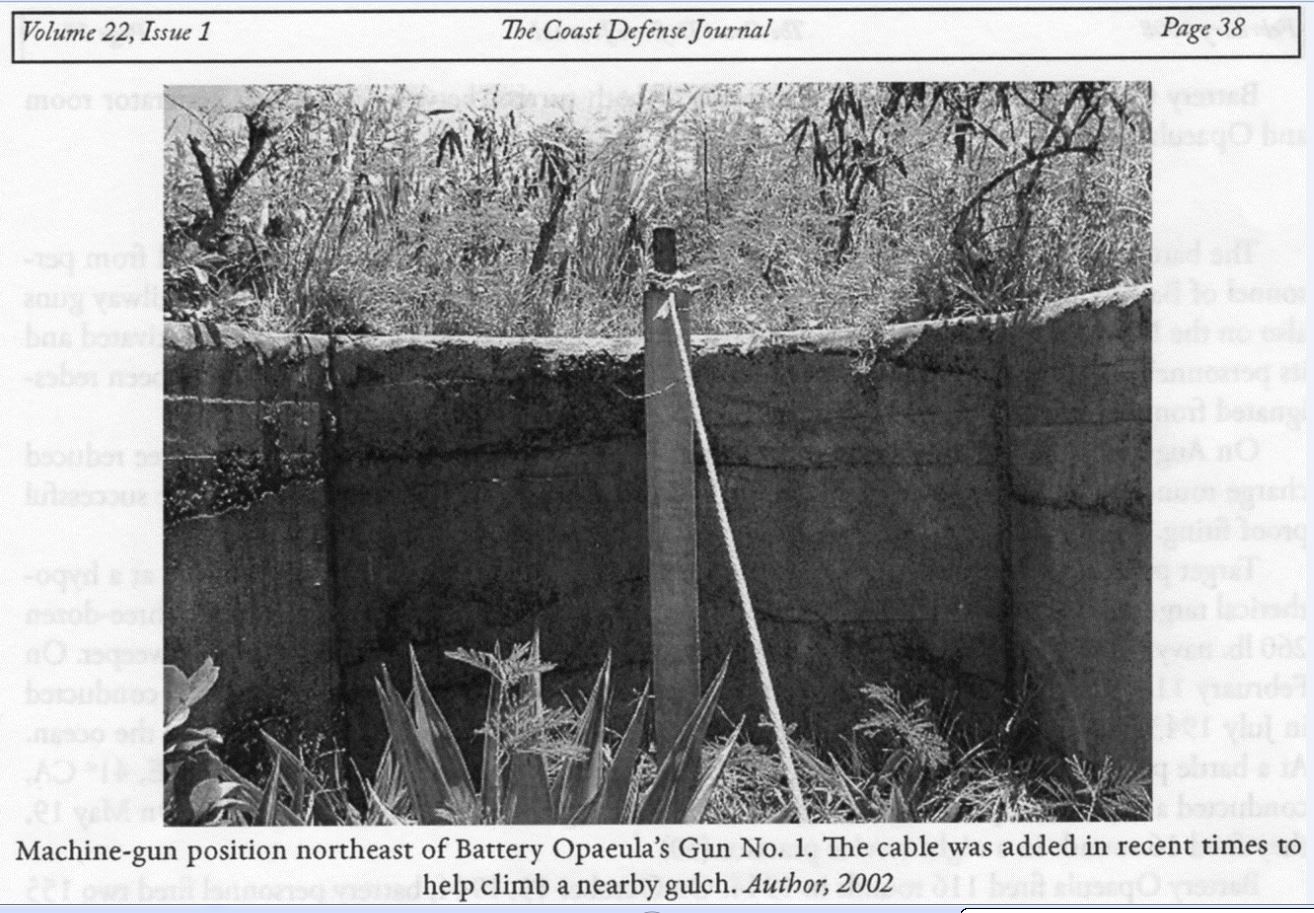 W632 this is a.30 cal machine gun mount. The picture is out of a Coast Defense Journal about the installation of many .30 cal machine gun mounts. This picture was sent by Karl Schmidt, a leader in the Coastal Defense Study Group organization (cdsg.org). |
|
|
|
Post by roland1369 on Feb 9, 2016 23:08:21 GMT 8
I would concur with the ID of the post as Pipe MG mount for the 30 Cal M 1917A1 water cooled Mg installed as anti strafing weapons. There was however a possible misunderstanding of the Controlled Mine Field. There were no markers on shore, only land mines used Marking Stakes. As each controlled mine was planted each mine was equipped with a temporary numbered Planting Buoy. A bearing was then taken using the azimuth instruments located in the Mine primary and secondary station as was done in wartime fire control and the position of the mine with its number marked on the chart of the plotting board located in the Mine Casemate. When the position were marked the planting bouys were removed, leaving no marks on shore or the water to show mine locations.
|
|
|
|
Post by Karl Welteke on Jul 4, 2022 13:15:04 GMT 8
Wheeler Pt. or Banzai Pt. & Battery Cheney These two locations the day visitors normally do not get to visit. But they are very special, at Banzai Point a terrible night battle occurred in the night of the 18th to 19th Feb. 1945 and Battery Cheney fired her last gun to last day in the Battle of the Corregidor Siege. My friends and I visited these two locations on the 14th June 2022. Plus at Banzai Pt. or Wheeler Pt. one gets a great view of the SW corner of Corregidor with 300+ Ft. cliff and where interesting history occurred. This is the picture descriptions for the first 3 images: This is one of 3 images at the lookout point at and above Wheeler Point or called Banzai Point by the 503d PIR troopers, near by the terrible night battle occurred. You can see the impressive steep Corregidor SW cliff. We see Searchlight Point, No-Name Point and Wheeler Point. Concrete defense positions are hidden down there on the points. Japanese Defenders withstood three paratrooper assaults and did not get defeated and on the 1st of Jan 1946 finally surrendered. We see a tunnel where the Japanese kept suicide boats. Down there on Wheeler Point is the impressive concrete Battery Monja with its concrete tunnel and the paramount concrete rings, but is very hard to get to. On top the Corregidor Foundation prepared this lookout point, great idea. 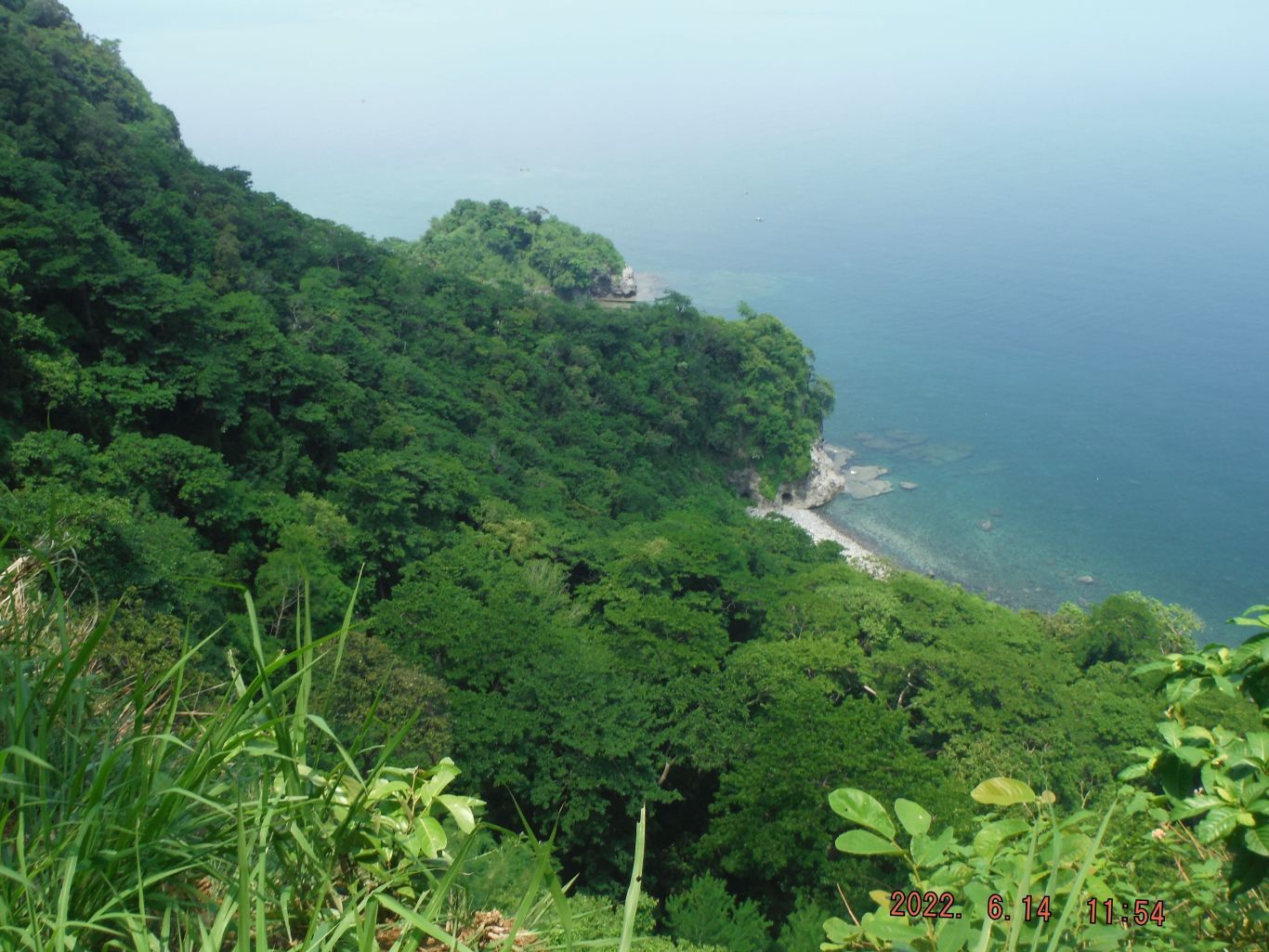 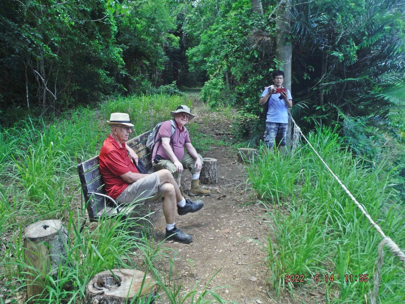 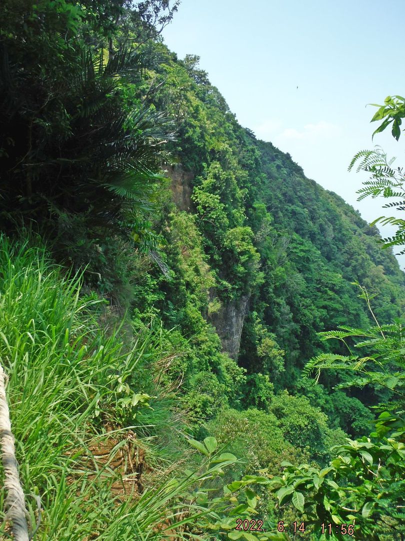 This is the picture descriptions for these two drawing images: These two drawings (courtesy of Corregidor.org WebPages) were made by the paratroopers who defended this pot in the night of the 18/19th Feb. 1945. They suffered heavy casualties and John Lindgren wrote these words later: At about 9:30 on Monday morning the litter party from the 161st Engineers left Topside and finally got through to Wheeler Point. They left with seven litter cases and fourteen walking wounded. As the column moved slowly up Cheney Trail it passed by twelve of "D" Company's riflemen covered with green ponchos. Here are two URLs of John Lindgren’s eye witness reports: corregidor.org/taps/control/KIA%20banzai%20pt.htmcorregidor.org/heritage_battalion/lindgren/banzai_point/lindgren_01.html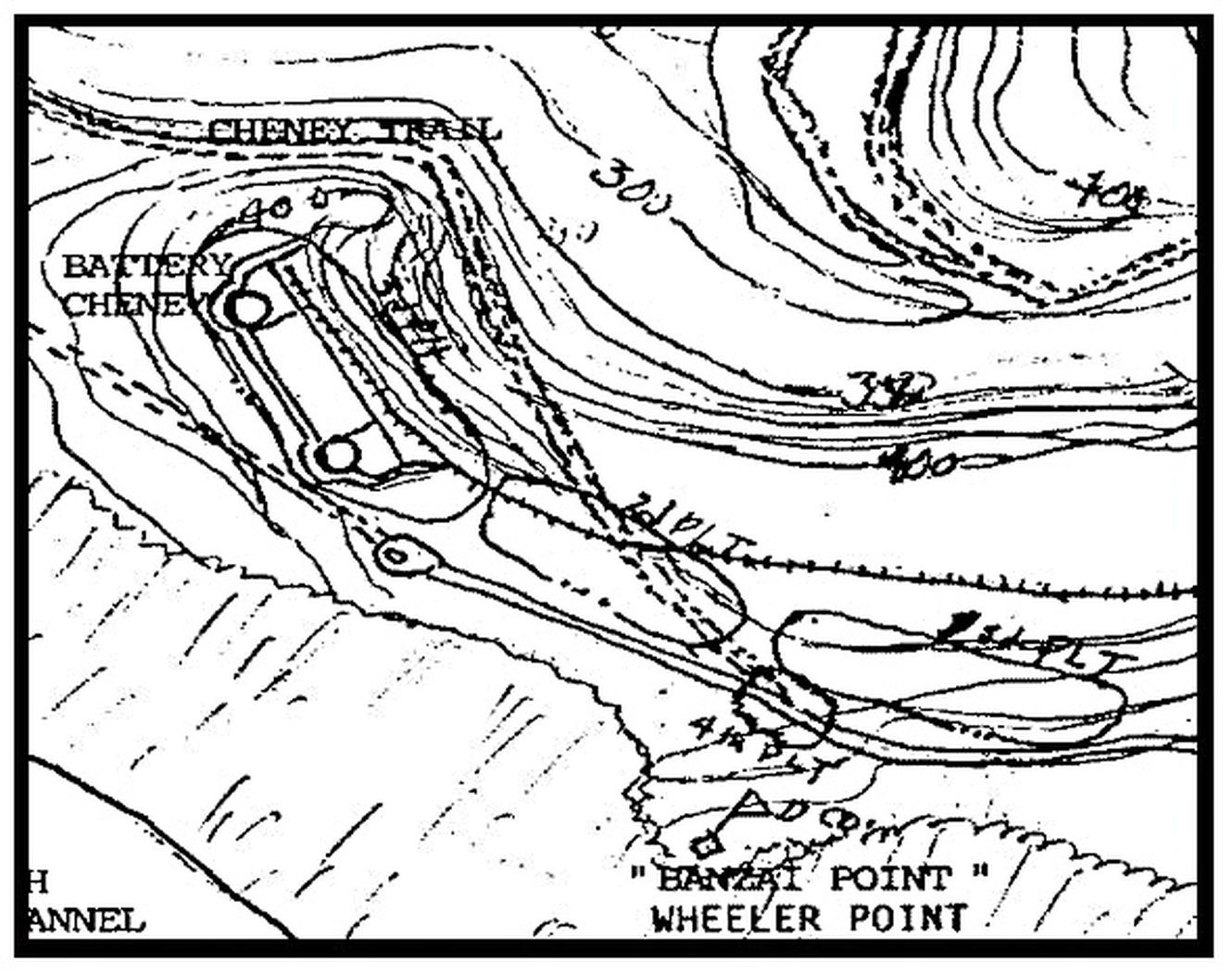 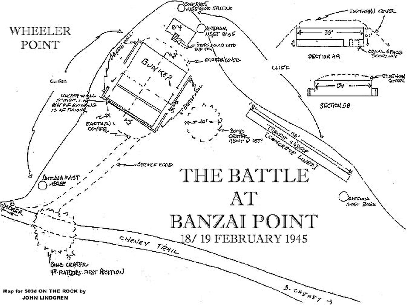 This is the picture descriptions for the last 3 images: This is one of 3 images of the concrete trench; see the 503d PIR map above. This trench is not on the official Fort Mills maps and we don’t know the history of this trench. On our visit in June 2022 I looked at it again and shot these 3 images. I believe in the 1980s John Lindgren spent a night there to relive that terrible battle and he wrote this article. corregidor.org/heritage_battalion/lindgren/fox1.htmlHis and his troops used a concrete bunker there which was part of the Battery Cheney gun fire control system. Today it is destroyed, one cannot go inside now, and it is a big pile of earth with concrete sticking out or showing out.  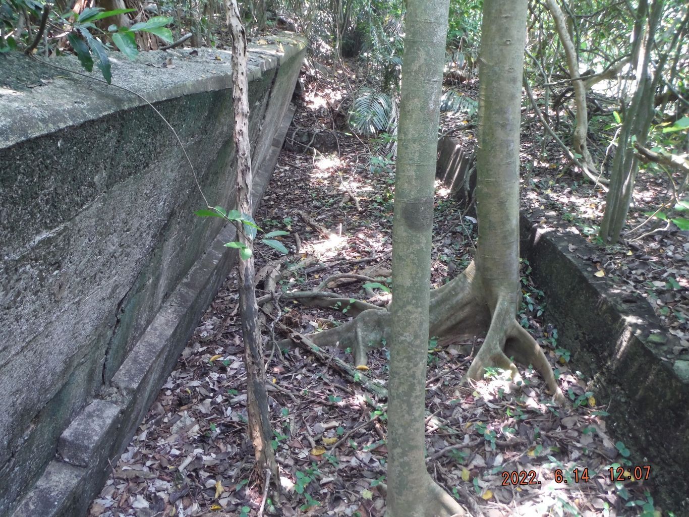 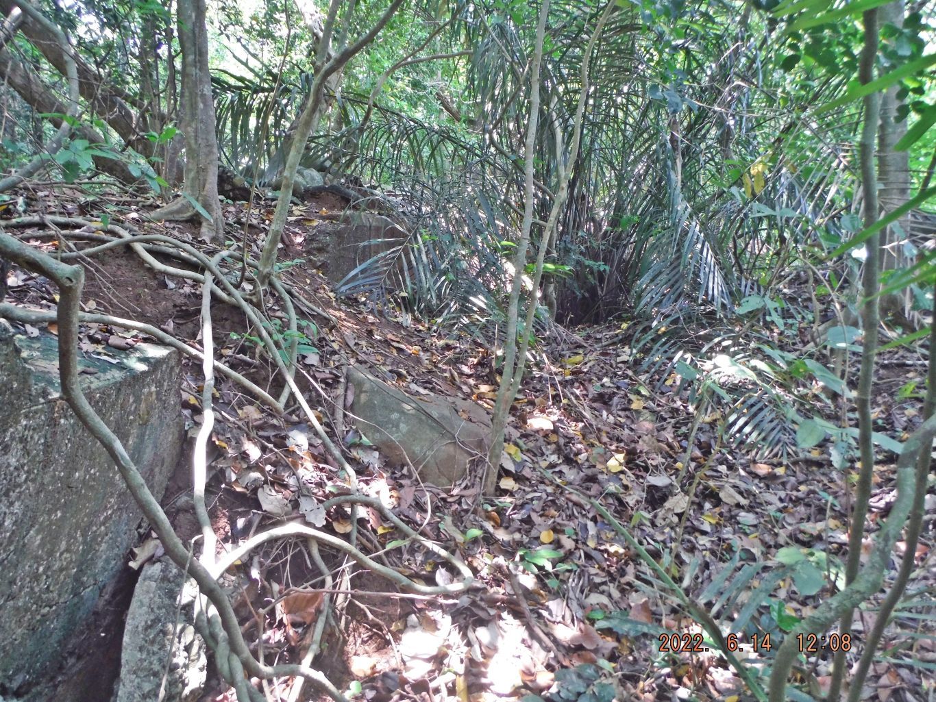 -------------------------------------------- URLs: Map of Battery Cheney: corregidor.proboards.com/thread/478/map-battery-cheney-aaBattle of Wheeler point: corregidor.proboards.com/thread/129/battle-wheeler-pointDay Report, 18th Feb. 1945 includes the battle corregidor.org/heritage_battalion/moh/mccarter.htmlBattery Cheney, short, Corregidor.org: corregidor.org/ca/btty_cheney/cheney.htmBattery Cheney, longer, Corregidor.org: corregidor.org/btty_histories/control/cheney_text.htmCorregidor - Battery Cheney, Traces of War, nice aerial pic www.tracesofwar.com/sights/137314/Corregidor---Battery-Cheney.htmNight at Wheeler Point, Lindgren corregidor.org/heritage_battalion/lindgren/fox1.htmlAN OUTLINE OF EVENTS AT WHEELER POINT ON THE NIGHT OF 18/19 FEBRUARY, 1945 corregidor.org/heritage_battalion/lindgren/banzai_point/lindgren_01.htmlTHE CASUALTIES AT BANZAI POINT, (WHEELER POINT 18/19 FEB 1945) corregidor.org/taps/control/KIA%20banzai%20pt.htmWalk to Battery Cheney, 2018-07-06, Karl’s web, Corregidor, CI Visit 2018-07-06 philippine-sailor.net/walk-to-battery-cheney-2018-07-06/I visited Corregidor 2018-07-06 to 08 to see what is happening on Corregidor under the new Corregidor Foundation Inc. (CFI) management. But I was also able to get two walks in; this is my first one, from Bottomside to Battery Cheney and back. app.photobucket.com/u/PI-Sailor/a/80c4ba95-d2eb-44ee-9bcf-c6feeee68440 |
|