|
|
Post by Karl Welteke on May 16, 2018 15:04:16 GMT 8
The Cruise Ship Costa Atlantica returned to Subic Bay 2018, April the 3rd!  Za980. The Cruise Ship Costa Atlantica returned to Subic again, this 3rd of April 2018.This spot is very special to me; I stepped ashore here in the Philippines for the first time in 1962. This was the Enlisted Men Boat Landing. |
|
|
|
Post by Karl Welteke on Jun 12, 2018 14:04:28 GMT 8
|
|
|
|
Post by Karl Welteke on Jul 5, 2018 16:18:31 GMT 8
|
|
|
|
Post by Karl Welteke on Jul 5, 2018 17:25:45 GMT 8
VFW Post 11447, Subic Bay celebrates the 4th of July  Zc234. The VFW Post 11447 Subic Bay organized again and as usual the 4th of July celebration on our Day of Independents. This year we did it at the Midnight Rambler Beach Club. This is the rainy season and maybe more people would have showed up if it had been a better day. But it was still a good day, Happy 4th of July to all of you. What many people may not think about, a terrible and long war had to be fought against the mighty British Empire at that time to actually gain that independent. We often jack, jack the French; they helped us, could we have done it without them? I posted 5 sample images here. 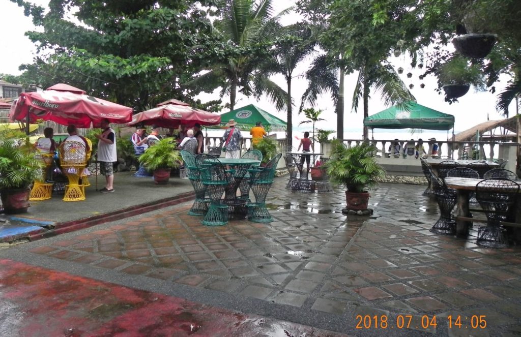 Zc235. One of several images showing the beach, the bay of Subic Bay at the beach side of the Midnight Rambler Beach Bar where our VFW Post 11447, Subic Bay, celebrated the 4th of July 2018. 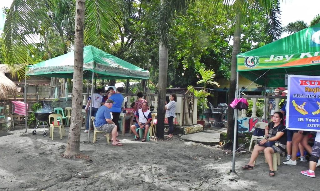 Zc236. One of several images showing the beach, the bay of Subic Bay at the beach side of the Midnight Rambler Beach Bar where our VFW Post 11447, Subic Bay, celebrated the 4th of July 2018. 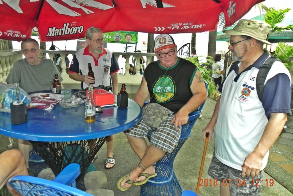 Zc237. One of several images showing mostly our members of VFW Post 11447, Subic Bay, celebrating the 4th of July at the Midnight Rambler Beach Bar. 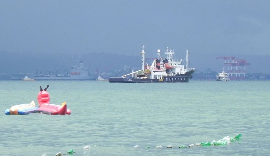 Zc238. One of several images showing the beach, the busy bay of Subic Bay at the beach side of the Midnight Rambler Beach Bar where our VFW Post 11447, Subic Bay, celebrated the 4th of July 2018. In the background, if you look close, a Military Sealift Command Ship (MSC) an oiler is pulling in. They frequently stay in Subic Bay. I uploaded 33 images into this Flickr album: www.flickr.com/photos/44567569@N00/albums/72157695514326202 or look at the 57 images that I uploaded into this Facebook album: www.facebook.com/karlwilhelm.welteke/media_set?set=a.10214086557511658.1073741861.1643946293&type=3Best wishes from Subic Bay Karl |
|
|
|
Post by Karl Welteke on Jul 13, 2018 18:56:19 GMT 8
NAVSTA Olongapo and Olongapo Town 1928  Zc265. This is NAVSTA Olongapo and Olongapo Town 1928 from NARA via Wiki Vividley. Zc265. This is NAVSTA Olongapo & Olongapo Town 1928 from NARA via Wiki Vividley. Before WWII the town or village of Olongapo, under the administration of the U.S. Navy, was located at, what after WWII became the Naval Station (NAVSTA) Subic Bay and in the 1950s then, with the addition of the Naval Air Station Cubi Point and the Naval Magazine area, the Naval Base Subic Bay. In the late 1940s Olongapo Town was reestablished where it is today, across the drainage river, that divides the two entities now. The former Naval Base is now the Subic Bay Freeport Zone (SBFZ) as of 1992. This and many other Subic Bay, Olongapo, Naval Station Olongapo, pre WWII images are uploaded into these two Albums: Flickr album, Subic Bay Historic Images: www.flickr.com/photos/44567569@N00/sets/72157647790469238/Facebook album, Subic Bay Historic Images #1, www.facebook.com/karlwilhelm.welteke/media_set?set=a.10203706281251239.1073741828.1643946293&type=3&uploaded=1 |
|
|
|
Post by chadhill on Jul 13, 2018 20:57:16 GMT 8
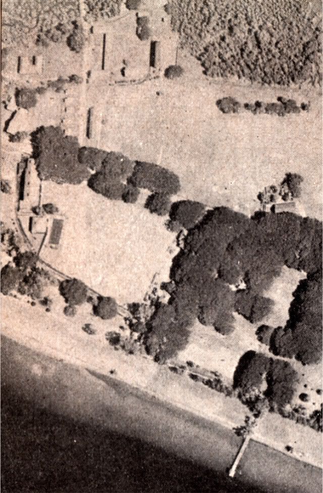
Great photos of Subic and Olongapo, Karl! I will spend some time studying them. One thing I noticed is that the infamous tennis court does not seem to have existed in 1928; I cannot see it in your photo. Below is a late 1941 view of the tennis court area. The nearby "club house" and quarters buildings are seen there in 1928.
 |
|
|
|
Post by Karl Welteke on Jul 24, 2018 19:09:03 GMT 8
Grande Island Resort, how it looks now, 2018-07-20! My friend Charlie Moser and I wanted to see Battery Warwick and take pictures for the 50th Anniversary of the “Big Guns” (10 Inch Disappearing Guns) arriving at the Fort Casey Washington State Park 50 years ago. We were lucky and met the right people and were invited to come on the island. I already uploaded pictures, about Battery Warwick, other batteries and the boat trip. This is the last presentation of some images of the resort. In about 2004 investors built a resort on Grande Island, the former Fort Wint, but it was not successful. For some time now the resort is closed and Grande Island is not available to be visited by the general public. The new General Manager, a 2nd generation Filipino-Chinese, said that other Mainland Chinese investors got control of this resort and have plans to revive the resort. He said they will specialize in landscaping and are working on that right now. The existing landscaping still looks pretty good! They do want to take advantage of the former Fort Mills Battery structures and maybe even mount some guns made out of synthetic materials, and make them part of the attraction. The chalets will be two storey structures, no work has been started. The wave pool, which was the baseball field, is now stocked with fishes. The hotel and restaurant are going to be renovated. It was not clear to me as to when they are planning to open it, so who knows? Grande Island, Fort Wint has a separate thread in our forum. Next month, on the 11th of Aug. 2018, The Fort Casey Washington State Park will celebrate the 50th Anniversary of receiving the two 10 Inch guns from Battery Warwick of the ex Fort Wint on Grande Island. We have covered the event and the sites of the two guns, at the new and old location, Fort Casey and Fort Wint in these thread pages: corregidor.proboards.com/thread/987/fort-wint-subic-bay?page=9The story started on page 8, scroll down: corregidor.proboards.com/thread/987/fort-wint-subic-bay?page=8In this Subic Bay, ex Naval Base presentation I chose 5 images to be presented here: 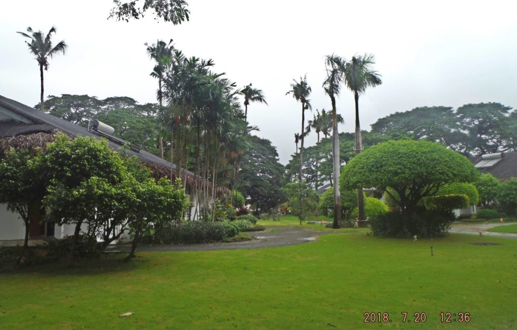 Zc319. This is the resort on Grande Island, the former Fort Wint, 2018-07-20; landscaping between the chalets. 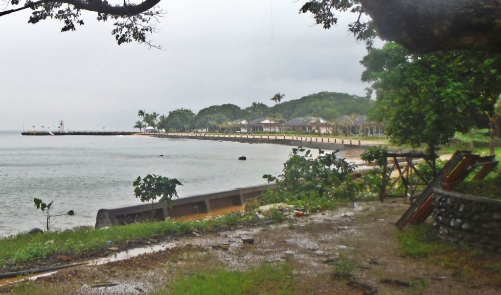 Zc320. This is the resort on Grande Island, the former Fort Wint, 2018-07-20; we are looking from near the breakwater from west to east along the north beach/coast. This is the main beach now and was for the Navy before. 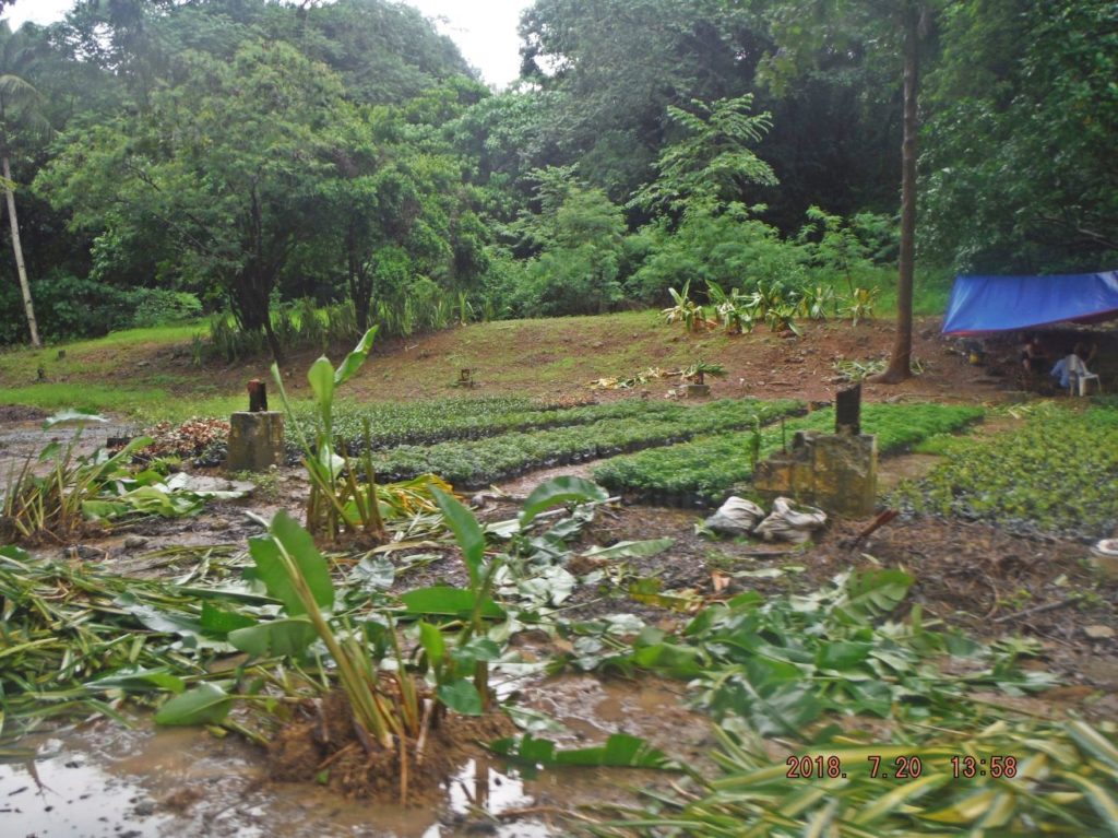 Zc321. This is the resort on Grande Island, the former Fort Wint, 2018-07-20; this is one of their seed beds for their landscaping work. This is located where the Army barracks were, one can see the foundation posts. 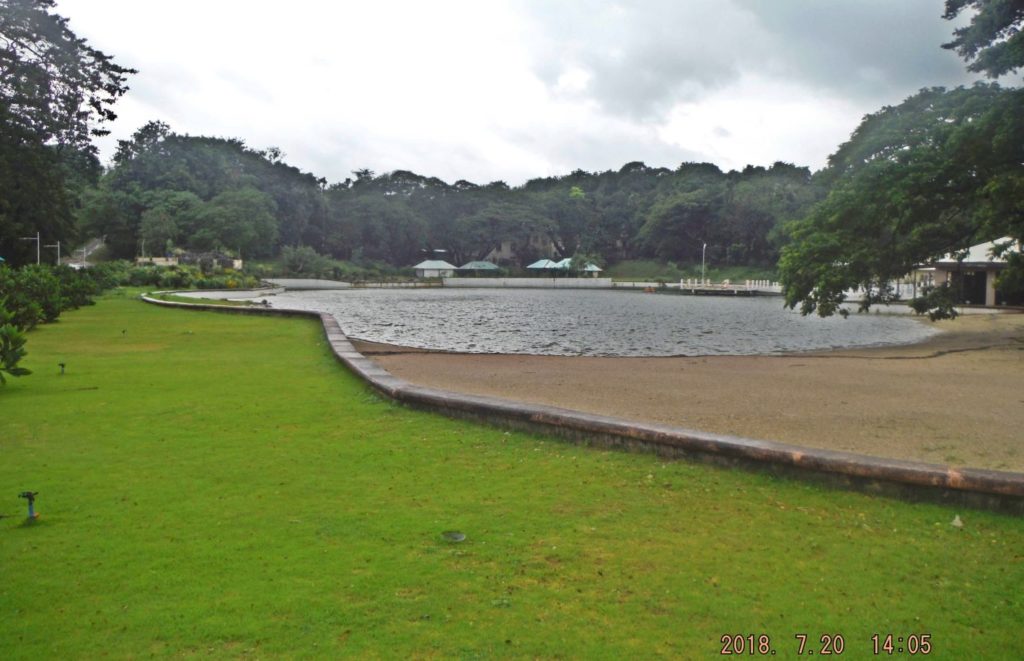 Zc322. This is the resort on Grande Island, the former Fort Wint, 2018-07-20; we are looking to the south across the wave pool, which is now a fish pond. Left we see the road that leads to Batteries Flake and Hall. This was a ball field during our time. 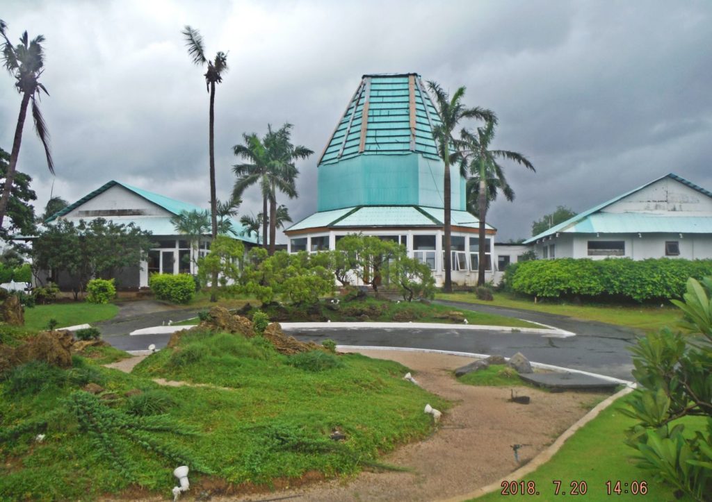 Zc323. This is the resort on Grande Island, the former Fort Wint, 2018-07-20; we are looking at the front of the reception building as we step off the pier. I started a web page about the visit: philippine-sailor.net/2018/07/22/ex-fort-wint-on-grande-island-visit-with-charlie-2018-07-20/43 Grande Island Resort pictures were put into this Photobucket album, if you like to see them all: s74.photobucket.com/user/PI-Sailor/library/Manila%20Bay%20Forts-Other/Fort%20Wint%20and%20Grande%20Island/Ft-Wint%20Visits%20Grande-Isl/Ft-Wint%2018-07-20%20w%20Charlie%20Grande%20Island?sort=9&page=1 |
|
|
|
Post by Karl Welteke on Aug 9, 2018 10:45:33 GMT 8
Heavy Rain Olongapo and SBFZ 2018-08-22 Sustained rainfall triggered flooding in 16 villages here on Sunday (July 22), prompting 343 families, many from Barangay Sta. Rita, to stay in evacuation centers. Heavy rain also caused a landslide at the Subic Bay Freeport. Many residents posted their condition over social media to seek aid. The Olongapo government suspended classes in all levels in public and private schools on Monday (July 23). On the 24th of July 2018 I took a walk from Barrio Barretto, thru SBFZ, the former Naval Base and then walked to the Olongapo Market. On the 25th July I walked thru Barrio Barretto. These pictures were shot during these two walks. In this forum presentation I uploaded 12 images. When I made these two walks I generated 64 images and I put them into this Photobucket album, (Photobucket harasses you with advertisements) s74.photobucket.com/user/PI-Sailor/library/Philippines/No%202%20Phil%20Events%20Group%20Albums/2018%20SB%20OC%20BB%20ZAM%20Events/Heavy%20Rain%20Olongapo%202018-08-22?sort=9&page=1About 60 of those images I also put them into this Facebook album, if interested: (not everybody can watch Facebook). www.facebook.com/karlwilhelm.welteke/media_set?set=a.10214334500270072.1073741862.1643946293&type=3I started a webpage about this heavy rain and it has only 28 images: (you should not have advertisement or need to be member looking at this one). philippine-sailor.net/2018/08/06/heavy-rains-22nd-july-2018-in-subic-bay/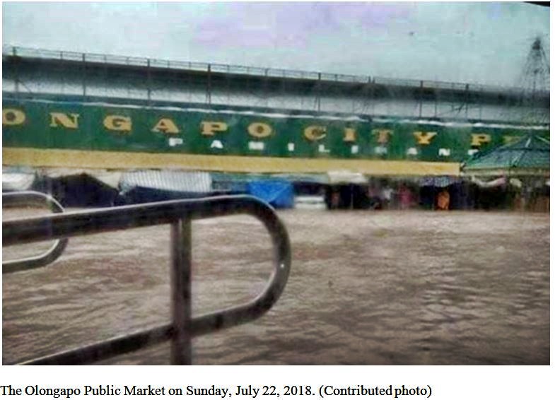 Zc471.Olongapo Market flooded 22nd July 2018 from the Inquirer: Heavy rainfall floods 16 villages in Olongapo By: Joanna Aglibot - @inquirerdotnet Inquirer Northern Luzon / 10:27 PM July 22, 2018 Read more: newsinfo.inquirer.net/1012861/olongapo-flooding#ixzz5NOAZ7sKK Follow us: @inquirerdotnet on Twitter | inquirerdotnet on Facebook 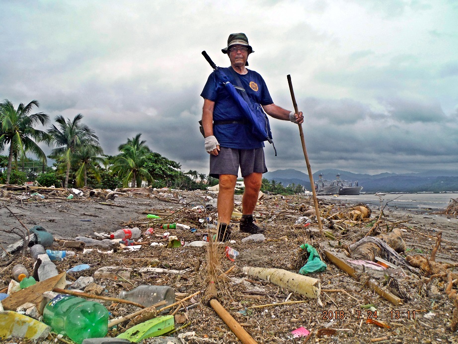 Zc472. Karl on his walk thru SBFZ 2018-07-24, much of this trash ended up here on the Subic Bay Freeport Zone Beach because of the heavy rains on the 22nd Jul. Notice the two U.S. Military Sealift Command (USNS) ships, they are oilers, moored in a nest along the Alava Extension Wharf. These types of ships are often in port here. 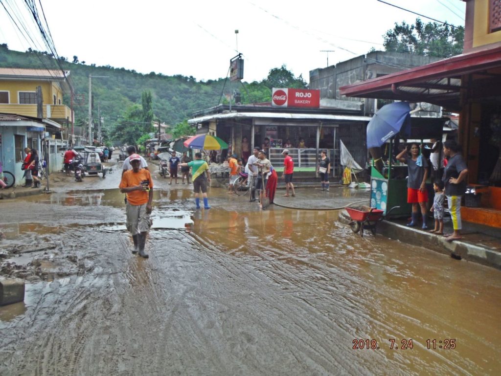 Zc474. This is the intersection of Dagupan St. and Rizal St. at the Barretto Market, called Tally Papa (not sure about the spelling}. The dirty water was at least a foot deep or more here; they used fire fighter water truck to wash down this intersection. I live nearby but where I live it is higher and we did not have this problem. 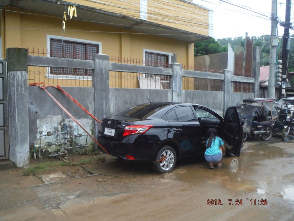 Zc475. I walked down the Dagupan Street in Barrio Barretto, a car had to be tied up so it did not float away but it got flooded. Other houses had sand bags piled up in front of their house doors. Remember this walk was about two days after the heavy rain. 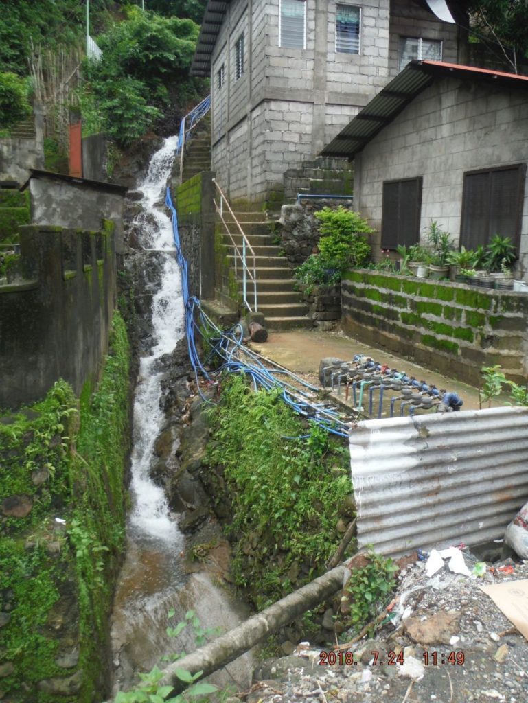 Zc477. Walking on the National Road from Barrio Barretto to the Kalaklan Gate of the SBFZ, this is above Sierra Beach, just leaving Barretto. This picture is interesting because of several reasons- the water rushing down and the fresh water connections, they are new, and maybe a year ago all these people living here on the slopes got their fresh water connection-FINALLY! A thought, why are there so many floods and landslides? There are too many people and no room to live except to build residences on these slopes all around Subic Bay. Do we need to curb this uncontrollable population increase and or do we need better living standards to afford high rise apartments? 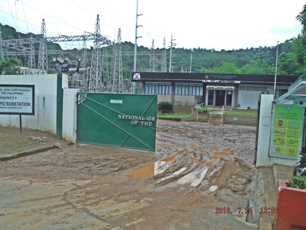 Zc479. Walking on the National Road from Barretto to the Kalaklan Gate of the SBFZ; this is power transformer station at Halfmoon Beach/Valley, it looks they got hit by the flood also. I had to run my generator for 30 hours. 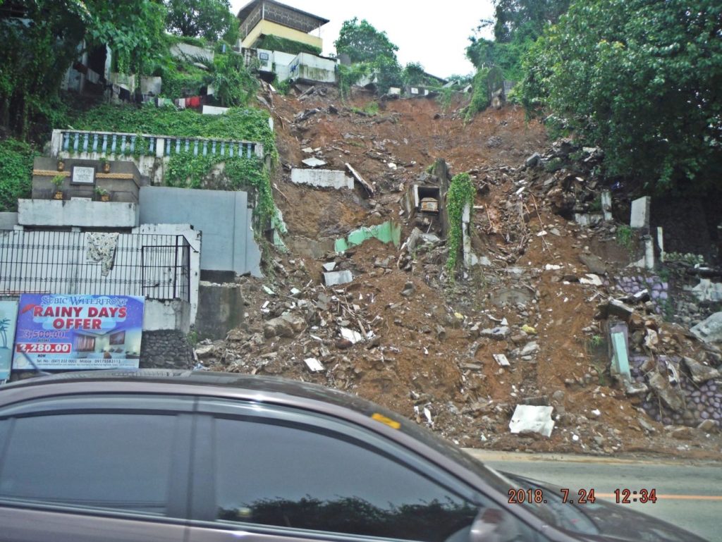 Zc480. The Olongapo City cemetery, near the Kalaklan Bridge suffered two landslides; this is the bigger one and made the National news. 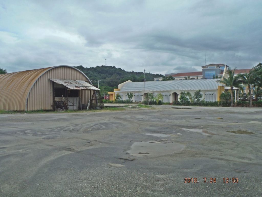 Zc482. After the Mt. Pinatubo explosion the Navy built several of these large Quonset type huts. These two are near the Kalaklan Gate; this is a nice comparison view after one was modified to become a church. 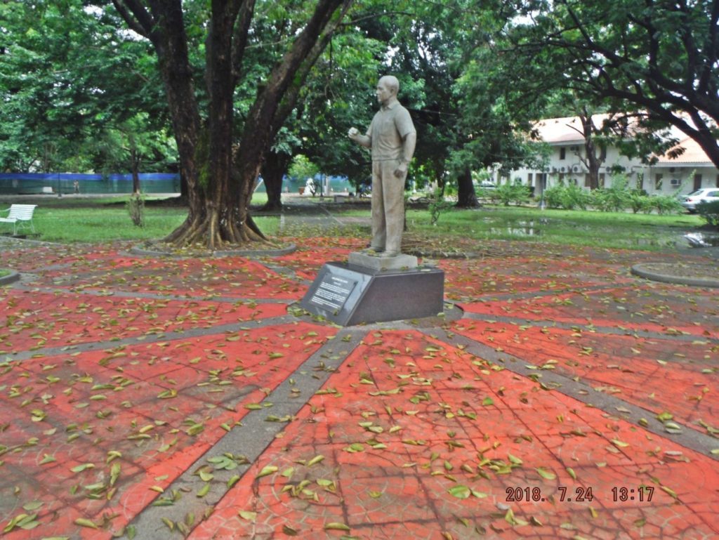 Zc486. This is the Tappan Park of the former Naval Station, the park is not always maintained the way it should. It, the church, and the Spanish Gate are about the only things left from the pre WWII Olongapo Naval Station. After we (the US Navy) left in 1992 a stature of James Gordon Sr. was added. 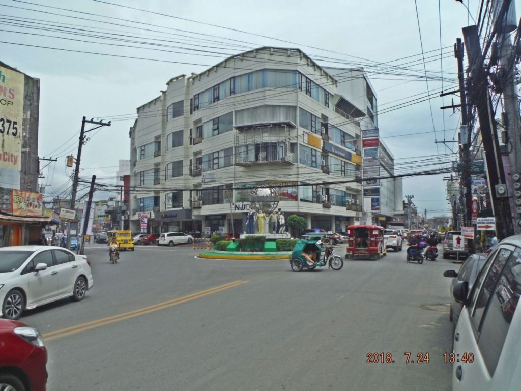 Zc489. This is a shot of the circle, rotunda, at the intersection of Magsaysay Drive and Rizal Ave. in Olongapo. Straight ahead the road is called Rizal Extensions and the traffic now runs ONE WAY along Rizal Extension, before the drainage canal, the traffic must turn left or go straight across the Rizal Bridge into SBFZ. Then at the main gate bridge, the traffic turns left again and follows Magsaysay Drive ONE WAY back to the rotunda. Those two large buildings were built after the Navy left in 1992. 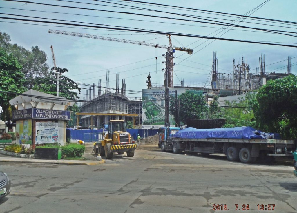 Zc490. This is the Hospital Road, next to the Marikit Park and used to go the hospital, museum and the convention center. All three establishments are torn down, are gone and a 2nd and bigger SM Mall is going up. 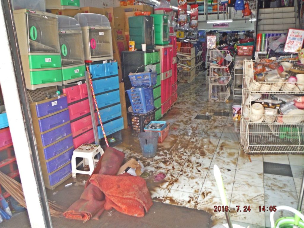 Zc493. This is on Rizal Ave. near the Olongapo Market, as the lead picture showed it flooded here about hip high and the shops are cleaning up. |
|
|
|
Post by Karl Welteke on Aug 24, 2018 13:50:44 GMT 8
Subic Bay & Olongapo 1981 from DVIC. These pictures are about the Naval Station Subic Bay & Olongapo City in 1981. These pictures were downloaded from the Defense Visual Information Center at about 2003. Two pictures were shot on different dates, one in 1987, the other 1992. Unfortunately I did not down load the images in high resolution; I just started to learn about the internet and was an ignorant beginner I uploaded 19 images onto this web page: philippine-sailor.net/2018/08/24/subic-bay-olongapo-1981-from-dvic/ For this forum presentation I chose 4 images: 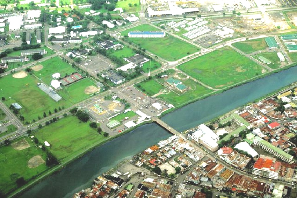 Zc548. DVIC ID: DNST8201704 An aerial view which includes part of the Naval Base, Subic Bay, the city of Olongapo , bottom right, and the bridge that is built over the canal to join the two communities. Date Shot: 28 AUG 1981 Camera Operator: PHC LARRY FOSTER  Zc550. DVIC. ID: DNST9301131. CAPT Bruce Wood, commanding officer of NAS, Cubi Point, presents one of the station`s original commissioning plaques to Richard Gordon, mayor of Olongapo , during the Station`s close-out ceremony. Subic Bay Metropolitan Authority will be assuming control of the facility. Date Shot: 30 OCT 1992 Camera Operator: UNKNOWN  Zc552. ID: DNST8201698. An aerial view, which includes part of the Naval Base, Subic Bay, left, part of the city of Olongapo and the bridge that is built over the canal to join the two communities. Date Shot: 28 AUG 1981 Camera Operator: PHC LARRY FOSTER  Zc561. ID: DNST8200647. A view of a city street, OLONGAPO, LUZON REPUBLIC OF THE PHILIPPINES (PHL). Date Shot: 01 JUL 1981 Camera Operator: PH2 R.H. TURNER II |
|
|
|
Post by Karl Welteke on Aug 25, 2018 17:51:16 GMT 8
Subic Bay with USS Midway CV41 after1980 from DVIC. These pictures are about the Naval Base Subic Bay after 1980 and were downloaded from the Defense Visual Information Center (DVIC) at about 2003. As a PC beginner then I failed to download the pictures in high resolution. Most of the pictures are about the USS Midway CV41 and the Chief of Naval Operations (CNO) visiting Subic Bay. USS Midway CV41 was home ported in the Western Pacific (WESTPAC) in her last years and was a frequent visitor to Subic Bay. 16 images were put into this webpage: philippine-sailor.net/2018/08/25/subic-bay-with-cv41-after1980-from-dvic/For this forum presentation I chose these 4 images: 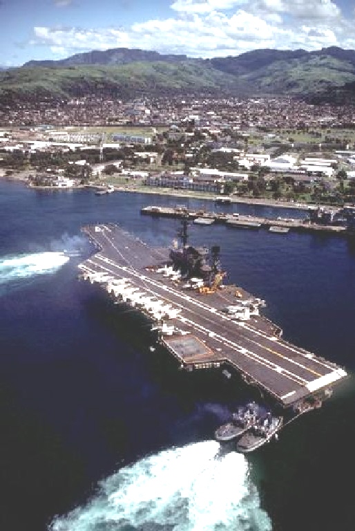 Zc665. ID: DNST8400333. A port quarter view of the aircraft carrier USS MIDWAY (CV 41) being maneuvered into Alava Pier by four tugs. This is a good shot into the Gordon Heights Valley. Date Shot: 14 SEP 1981 Camera Operator: PHCS STEVEN HARRIS  Zc671. ID: DNSN8403461. A view of damage caused to three F-4 Phantom II aircraft and the optical landing system platform of the aircraft carrier USS MIDWAY (CV 41) in a collision with the Panamanian freighter CACTUS. Navy collisions did not start this or last year! Location: NAVAL STATION, SUBIC BAY Date Shot: 31 JUL 1980 Camera Operator: UNKNOWN  Zc674. ID: DNST9300664. Racks of ordnance line the pier beside the cargo ship BUYER (T-AK-2033) prior to being loaded aboard the vessel. Ordnance and equipment is being removed from the area as the U.S. Navy prepares to close the station and relinquish it to the Subic Bay Metropolitan Authority. Location: NAVAL STATION, SUBIC BAY Date Shot: 14 AUG 1992 Camera Operator: PH1 R. WILCOX  Zc675. ID: DNST8400244. Hospital Corpsman J.J. Burke directs a Vietnamese refugee as he hoses down a portion of the aft section of the Military Sealift Command merchant ship USNS MASON LYKES. The ship has just arrived at the Naval Supply Depot with 59 refugees who were rescued from a small boat in the open ocean. Location: NAVAL STATION, SUBIC BAY. Date Shot: 01 MAY 1982 Camera Operator: JOC B. CORNFELD |
|