|
|
Post by Karl Welteke on Aug 26, 2018 17:03:18 GMT 8
Subic Bay after1980 with SECDEF C. W. Weinberger from DVIC These pictures are about the Naval Base Subic Bay after 1980 and were downloaded from the Defense Visual Information Center (DVIC) at about 2003. As a PC beginner then I failed to download the pictures in high resolution. Many of the pictures are about Secretary of Defense Caspar W. Weinberger visiting Subic Bay. There are a few more pictures of the USS Midway CV41 and other subjects. USS Midway CV41 was home ported in the Western Pacific (WESTPAC) in her last years and was a frequent visitor to Subic Bay. 12 images were put into this webpage: philippine-sailor.net/2018/08/26/subic-bay-after1980-with-secdef-c-w-weinberger-from-dvic/For this forum presentation I chose these 3 images: 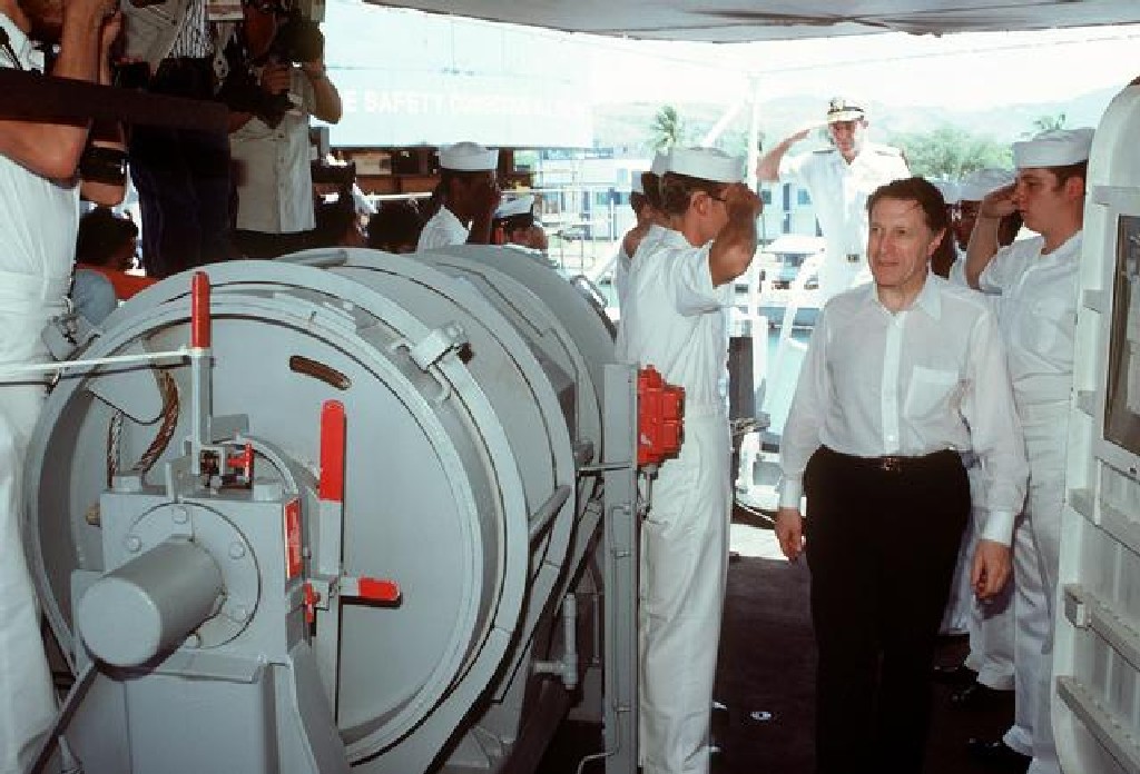 Zc683. ID: DNST8207731. Secretary of Defense Caspar W. Weinberger tours the replenishment oiler USS ROANOKE (AOR-7) during his visit to the Naval Air Station Cubi Point. Date Shot: 02 APR 1982 Camera Operator: PH2 BALLARD 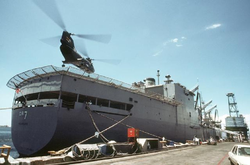 Zc685. ID: DNST8207721. Secretary of Defense Caspar W. Weinberger, aboard a CH-46A Sea Knight helicopter from Helicopter Combat Support Squadron 11 (HC-11), prepares to land on the stern of the USS ROANOKE (AOR-7) for a tour of the replenishment oiler. Location: NAVAL STATION, SUBIC BAY. Date Shot: 02 APR 1982 Camera Operator: PH2 BALLARD 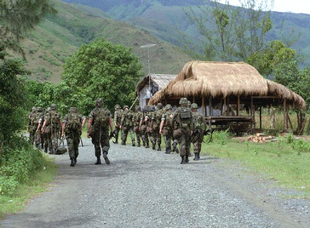 Zc688. ID: DNSC8703510. Members of the Marine detachment from the nuclear-powered aircraft carrier USS CARL VINSON (CVN-70) march down a gravel road en route to the live-fire exercise training site. Location: NAVAL STATION, SUBIC BAY. Date Shot: 16 SEP 1986 Camera Operator: PH2 EDDIE C. CORDERO USS Midway CV41 from Wikipedia: en.wikipedia.org/wiki/USS_Midway_(CV-41)USS Midway (CVB/CVA/CV-41) was an aircraft carrier of the United States Navy, the lead ship of her class. Commissioned a week after the end of World War II, Midway was the largest ship in the world until 1955, as well as the first U.S. aircraft carrier too big to transit the Panama Canal. She operated for 47 years, during which time she saw action in the Vietnam War and served as the Persian Gulf flagship in 1991's Operation Desert Storm. Decommissioned in 1992, she is now a museum ship at the USS Midway Museum, in San Diego, California, and the only remaining U.S. aircraft carrier commissioned right after World War II ended that was not an Essex-class aircraft carrier. |
|
|
|
Post by Karl Welteke on Aug 27, 2018 13:37:33 GMT 8
Subic Bay Post WWII These are pictures that a Marine Friend shared with me and who encourages me to put them into the www. I just put 7 images into this webpage: philippine-sailor.net/2018/08/27/subic-bay-post-wwii/But I decided to post all of the 7 pictures here also. 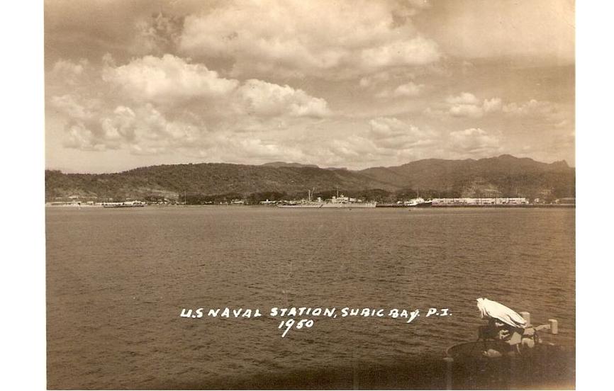 Zc690. The U.S. Naval Station Subic Bay in 1950, I certainly recognize the mountains behind Olongapo. Left are Kalaklan Ridge and a little right of center we are looking into the Gordon Heights Valley. This picture was provided by Bert Caloud in 2015. ---------------------------- These are Subic Bay historical pictures I have received from my USMC friend Bert Caloud, thank you Bert and the USMC! ---------------------------- 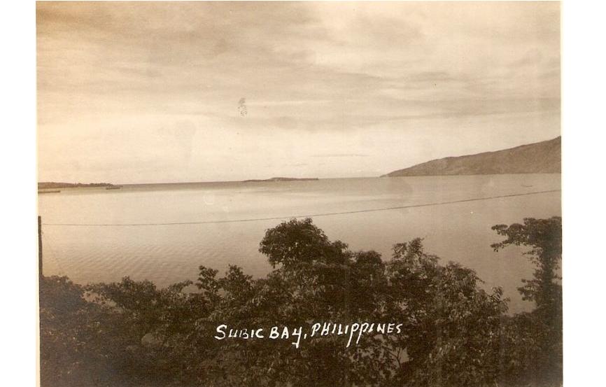 Zc691. This is a full view of Subic Bay in 1950; in the middle of the picture is Grande Island the former U.S. Army Coastal Defense Fort Wint. This picture was provided by Bert Caloud in 2015. 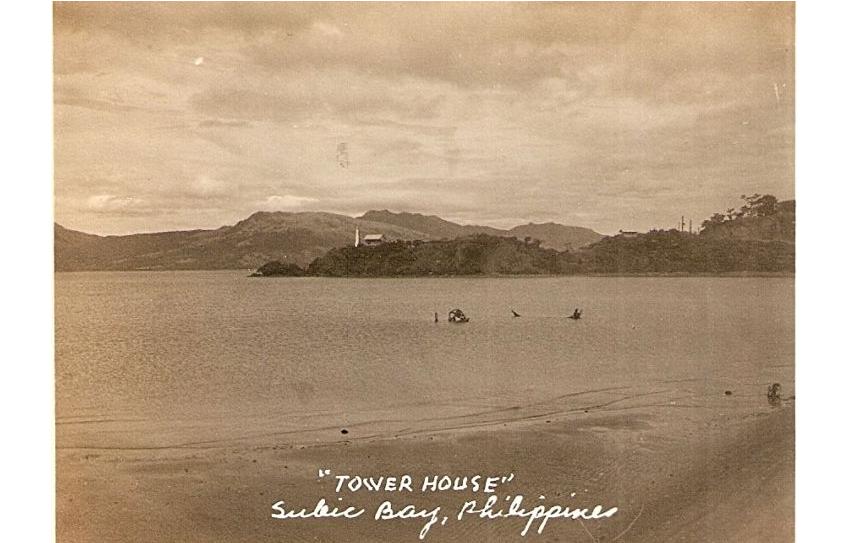 Zc692. This is certainly Kalaklan Point with a light house in 1950. I recognize Mt. Redondo behind the point and it is on the other side of the bay Subic Bay. This picture was provided by Bert Caloud in 2015. 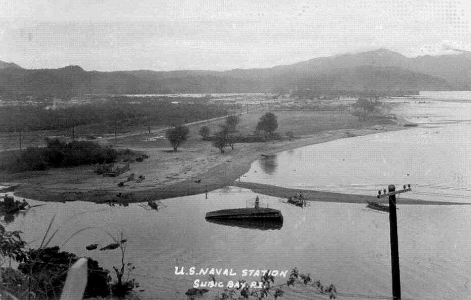 Zc693. This is the Naval Station Subic Bay in 1950 from Kalaklan Point. This picture is actually a sad one to me. We can recognize the future Dewey Ave. Before WWII on both sides of that street was the bustling town of Olongapo, praised by many as the best town in the Philippines. It has been moved across the drainage canal and had to be reestablished as a town. I guess the Navy had plans for all this real estate. This picture was provided by Bert Caloud in 2015. 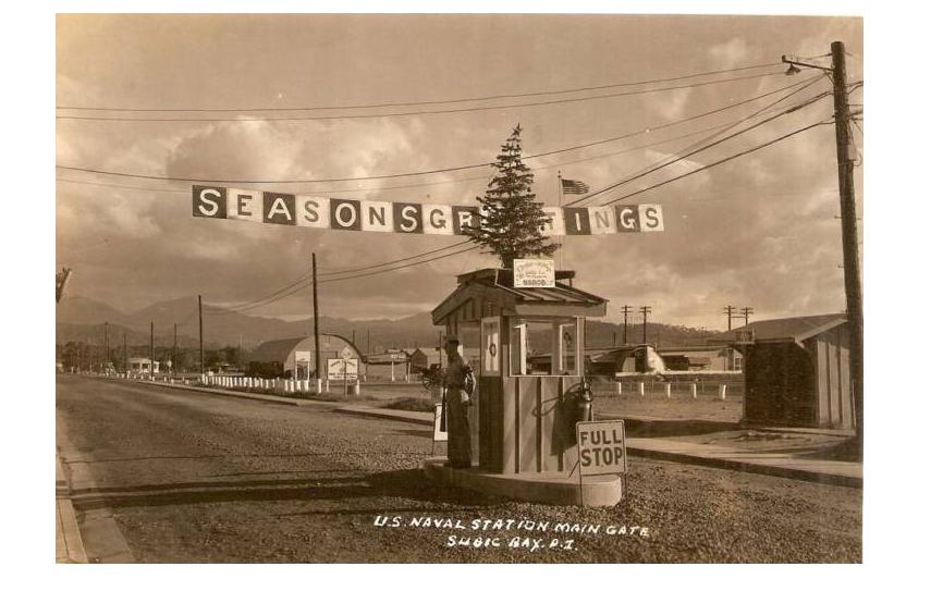 Zc694. This is the main gate of the Naval Station Subic Bay. I am relative sure this must be Manila Ave. still the same as today but I am not sure which direction we are looking at. This picture was provided by Bert Caloud in 2015. 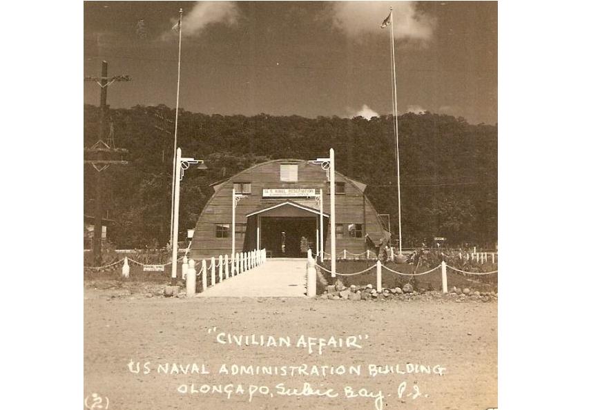 Zc695. This is the Naval Station Subic Bay Administration Building for Civilian Affairs in 1950. We can assume the hill in back must the Kalaklan Ridge. This picture was provided by Bert Caloud in 2015. 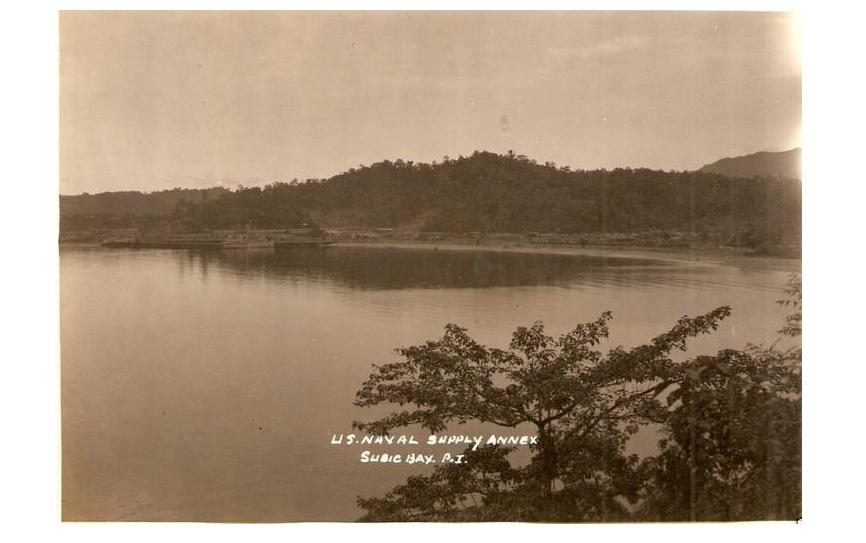 Zc966. This is the Naval Station Subic Bay Supply Annex in 1950; it is at the Maquinaya Valley Beach. This is where the barangay (we still prefer to say Barrio) Barretto has been established and it is the place I call home now. We know it was established in 1945 here and I assume that in the early 1950s the supply annex was moved to the Naval Station Subic Bay proper. This picture was provided by Bert Caloud in 2015. |
|
|
|
Post by Karl Welteke on Sept 6, 2018 18:46:16 GMT 8
Subic Bay WWII, Olongapo Leatherneck Post in 1941 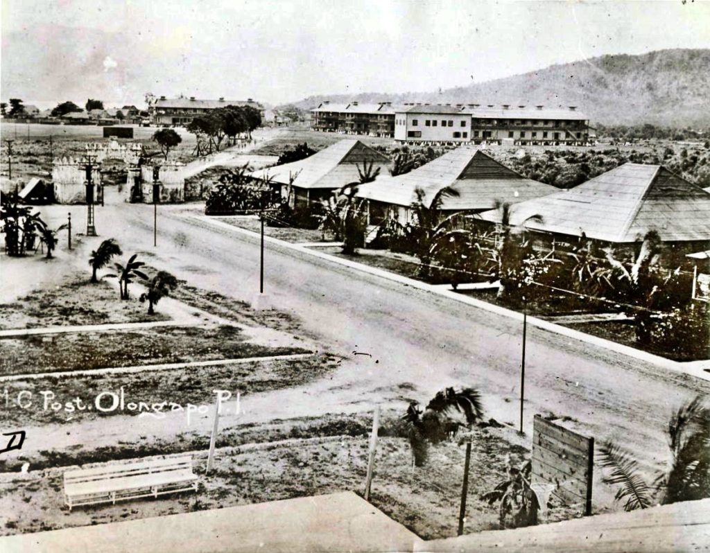 Zc720. Olongapo Leatherneck Post in 1941, this is an International News Photo; descriptions are in the next 2 images. I received this photo from my USMC friend Bert Caloud. This pictures show the Spanish Gate and the barracks on the North West side of the gate. The resident units may be assigned to Officers or NCOs. The Marines guarded the Olongapo Naval Station and the whole Subic Bay Naval Reservation. 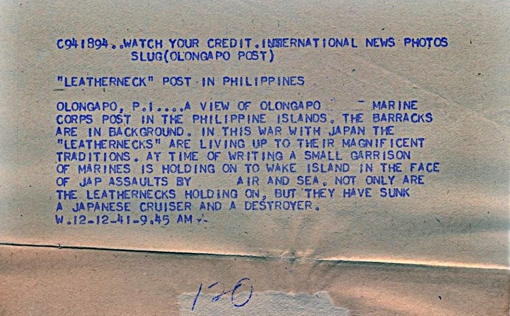 Zc721. This is the 1st of 2 descriptions for the previous image No. Zc720. Olongapo Leatherneck Post in 1941, this is an International News Photo; descriptions are in the next image. I received this photo from my USMC friend Bert Caloud. This pictures show the Spanish Gate and the barracks on the North West side of the gate. The resident units may be assigned to Officers or NCOs. The Marines guarded the Olongapo Naval Station and the whole Subic Bay Naval Reservation. 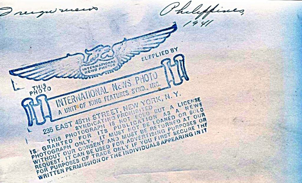 Zc722. This is the 2nd of 2 descriptions for the previous image No. Zc720. Olongapo Leatherneck Post in 1941, this is an International News Photo; descriptions are in the next image. I received this photo from my USMC friend Bert Caloud. This pictures show the Spanish Gate and the barracks on the North West side of the gate. The resident units may be assigned to Officers or NCOs. The Marines guarded the Olongapo Naval Station and the whole Subic Bay Naval Reservation. |
|
|
|
Post by Karl Welteke on Sept 8, 2018 19:23:16 GMT 8
Raft-Race in Barrio Barretto 180901 Barrio Barretto was the Naval Firing Range before WWII! It was called Maquinaya then, the river has that name also. Between 1945 to about 1950 Barretto was the Naval Supply Depot and it was called Maquinaya also. Barretto was named after a Zambales Governor when the Navy turned over the Maquinaya area to the Philippine Authority, early 1950s I believe. This is a sample story of life in Subic Bay after the U.S Navy left 26 years ago. Life goes on and the people here are doing just fine. Richard Gordon is a 2nd time a Philippine Senator, a high Rise hotel is being built in Barretto. And in the Olongapo City Hall a Mr. Rolen Paulino is the city mayor now! The Raft-Race is an annual Olongapo City public event. Schools participate and organize teams to participate. Driftwood Beach is the barangay (Barrio) Barretto Public Beach and is located at the beginning of Bo. Barretto coming from Olongapo. I stumbled on it because I was doing one of my weekly walks on that day. If you are interested; I established one album in Facebook with 21 higher resolution images: www.facebook.com/karlwilhelm.welteke/media_set?set=a.10214549172796751&type=3&fb_dtsg_ag=AdweI7W7iGyUumnEQ-BTS5y52Jv_JnxbRlNcmjiWPhyI_g%3AAdydU3huBYCGhCWuwpNOrnb_pREm6WEZJqCM-el-brcPewI also put the same pictures into this Photobucket album but with less resolution: s74.photobucket.com/user/PI-Sailor/library/Philippines/No%202%20Phil%20Events%20Group%20Albums/2018%20SB%20OC%20BB%20ZAM%20Events/Raft-Race%20180901?sort=9&page=1For this forum presentation I only chose these 3 images: 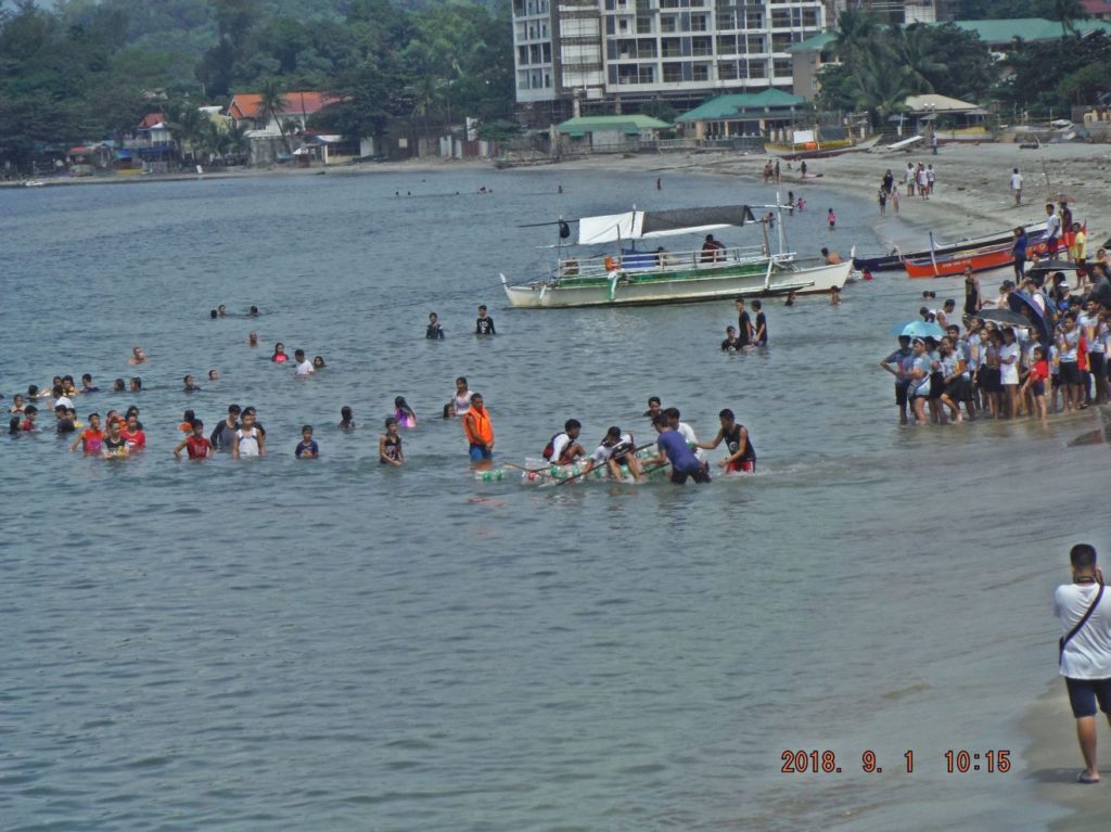 Zc723. (180901 Raft Race, Driftwood Beach, Bo. Barretto 07). After the rafts reach the beach again, other team members help and carry the raft to the finish line. In back we see the first High Rise in Barretto being worked on. 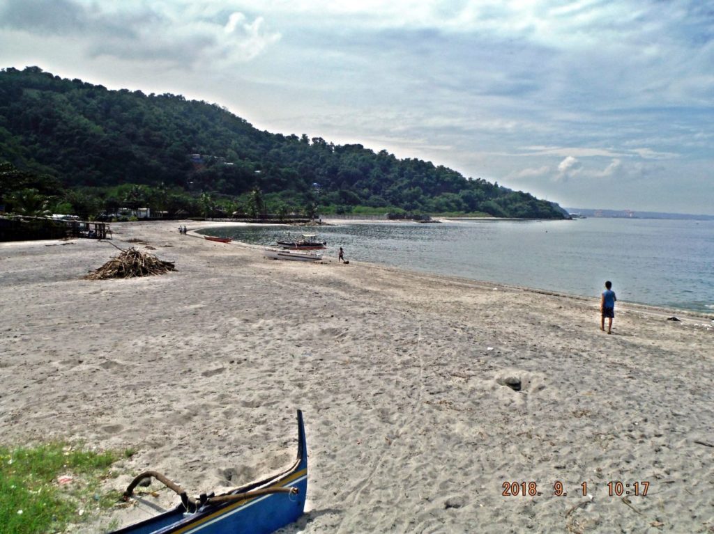 Zc724. (180901 Raft Race, Driftwood Beach, Bo. Barretto 13). This is a view in the other direction, where the walls are is a private Beach, for sale now. Then comes Sierra Beach and Christian Skipper Beach; more room to expand. 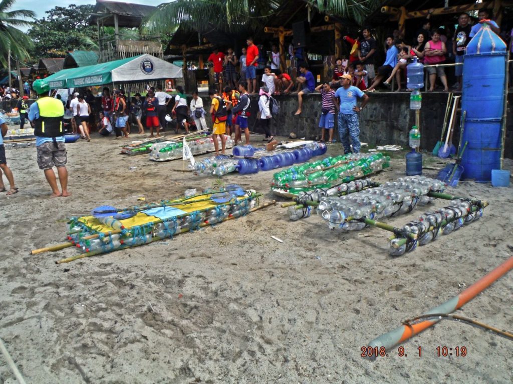 Zc725. 180901 Raft Race, Driftwood Beach, Bo. Barretto 15. Here are some of the rafts sitting at Driftwood Beach, the managing tent and the many participant and spectators. |
|
|
|
Post by Karl Welteke on Sept 11, 2018 17:33:27 GMT 8
Projects 2018 in Barrio Barretto Barrio Barretto is part of Olongapo City and before WWII it was Naval Rifle Range and during the war it was a Supply Depot. Barrio Barretto (Formerly Maquinaya) is growing relentless, everywhere there is something new being built. Between the Matain River Bridge and the Baloy Beach entrance, a new large project has started and others are in progress or are finished. The widening of the National Road thru Barretto was announced maybe 15 years ago. Last year they started with the Maquinaya River Bridge, now they are widening the road and build draining ditches. That project is causing a lot of inconveniences. 26 images were uploaded into these two albums, take your pic: Facebook: www.facebook.com/karlwilhelm.welteke/media_set?set=a.10214571707560106&type=3Photobucket: s74.photobucket.com/user/PI-Sailor/library/Philippines/No%202%20Phil%20Events%20Group%20Albums/2018%20SB%20OC%20BB%20ZAM%20Events/Projects%202018%20in%20Barretto?sort=9&page=1For this forum presentation I used only 2 images: 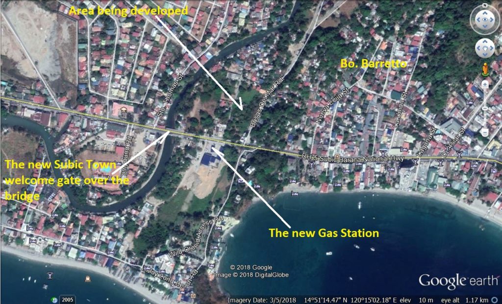 This is a marked-up Google Earth image showing the area between the Matain River Bridge and the Baloy Beach entrance, a new large project has started and others are in progress or are finished. 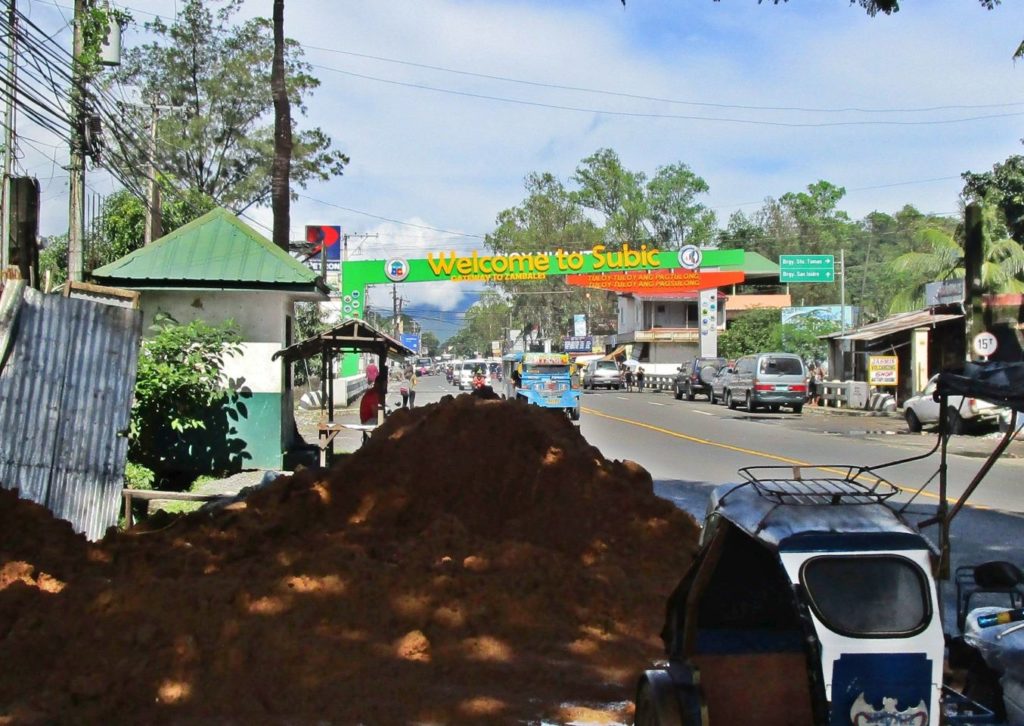 This is a view of the new Subic Municipality entrance gate. There was one for Olongapo but it got removed. That Matain River and bridge is the boundary between the Subic Municipality and Olongapo City. |
|
|
|
Post by Karl Welteke on Sept 14, 2018 18:56:12 GMT 8
Reposted two disappeared pictures from fireball at their original location. It was done on this page with this URL: corregidor.proboards.com/thread/1541/subic-bay-sbfz-naval-base-Date of posting from fireball: 14th Dec. 2013, here is the IMG THUMB URL:  And this was the text: Karl is doing a great & important job documenting Subic and its changes. He brings an in-depth knowledge of the Base as it was (combined with the energy to explore it now) at a time when so many of the old buildings are being destroyed or placed off limits. I had the benefit of Karl's company in 2011 for a tour of the Base and, as I think someone else said about something else, he took me to places I had never been before. It was also while looking around Karl's old workplace (the Diving Center) that I discovered his dark side: To my mind, even more than Clark AFB, a day spent exploring Subic is essential for anyone visiting the Philippines. So thanks Karl for the great work! -Date of posting from fireball: 17th Dec. 2013, here is the IMG THUMB URL: 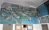 And this was the text: Hey Karl for next time you are wandering around SBFZ it is worth visiting the various fire stations as each has a map on the wall (they are big maps & I am talking the whole wall ) which date back up the navy days and show every building within their area of responsibility. All buildings are numbered (& some are named) - while unfortunately in some cases they have been painted over with the subsequent company user name / paint has peeled away I think you would find it a useful resource. And I just remembered when showing my son around Subic I took aka forced him to look at one of the fire stations I snapped a pic of one of the maps as the ones I had taken on earlier visits were all close ups so were hard to put in sequence. This is one of about 4 or five maps in the one at the old Naval Air Station Fire station (next to the old swimming pool and near the failed Bat World). Another section of the map actually shows the three quonset huts mentioned above but only gives a number - I am pretty sure that I saw a list there with names against each building number. The guys in this station were really friendly and may well be able to give a use or name to those huts. |
|
|
|
Post by Karl Welteke on Sept 15, 2018 14:00:42 GMT 8
I started an album of the historic Barrio Barretto: Barrio Barretto, now an important tourist spot, was called Maquinaya before WWII and has a Military History. We senior Navy Petty Officers liked to hang out here vice in Olongapo with its Super Club hassles; here it was more like a country atmosphere. But before WWII it was exclusively used by the US. Naval Forces, it was a shooting range and was used for field training by the Marines. In 1945 it became the Subic Bay Naval Supply Depot. In 1950 (I’m not sure about the accurate date) it was turned over to the Philippine Authorities. Then, first it was a hangout for people like me and then it became a large community and tourist spot. I live here now. This is the URL and has 28 images: philippine-sailor.net/2018/09/12/barretto-maquinaya-wwii/Two sample pictures are attached: 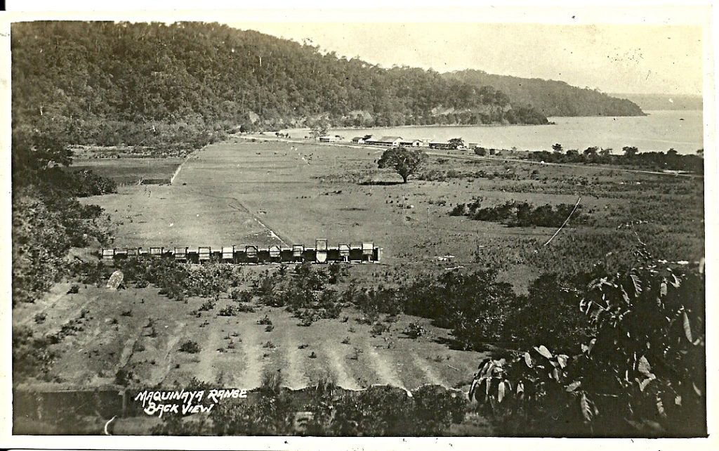 Zc729. This is the back view of a 1930 image of the Navy Rifle Range (a better description would be to call it the Marine Corps Rifle Range) located in the area called Maquinaya, This area became Barrio Barretto. The river is still called Maquinaya River. This picture was provided by my Marine friend Bert Caloud. 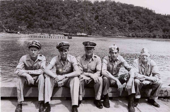 Zc741. Officers of the F.S.-182 at Subic Bay on Aug.22. 1946; engineering officer William Davidson is seated on the far right. The F. S.-182 was a U.S. Army supply ship and was manned by the Merchant Marine. I am sure this is the Navy pier in Maquinya, Barretto now. This voyage of F. S.-182 was from Puerto Princesa on Palawan to Subic Bay. It had a very special cargo on board; the bodies of 139 American Prisoners that were executed (Karl says murdered) by the Japanese on Dec. 14 1944 at the Puerto Princesa prison camp. The above two pictures came from a California Valley Veterans web page, I cannot find it anymore. |
|
|
|
Post by Karl Welteke on Sept 24, 2018 16:33:29 GMT 8
Submarine Base Subic Bay Subic Bay, the Olongapo Navy Yard supported submarines from the earliest time. In 1945 a Submarine Operating Base was established on the western side of the bay. During the Viet Nam war a special war fare submarine, the USS Grayback LPSS 574 operated out of Subic Bay. That boat had a bad diving accident and 5 people died; the lone survivor is a personal friend and lives here in the Philippines some of the time. I established a web page about the submarines in Subic Bay, it already has some pre WWII images, the submarine base, this is the URL: philippine-sailor.net/2018/09/16/submarine-base-subic-bay/This section I share today in the forum is about the USS Grayback. -------------------------------------------- USS Grayback, one of the last Diesel-Boats, was home ported in Subic Bay. It was home ported in Subic Bay many years and I had the privilege to meet and befriend a few of her crew. As usual Wikipedia is a good source for information, and I copied much of it. This is the URL: en.wikipedia.org/wiki/USS_Grayback_(SSG-574)----------------------------------------------- 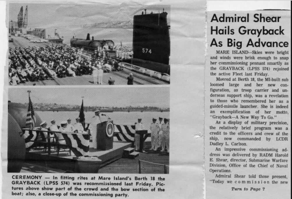 Zc771. This Diesel-Boat underwent a 2nd conversion and she was re-classified from a guided missile submarine to an amphibious transport submarine with hull classification symbol LPSS-574 on 30 August 1968. This picture came from this web page. www.ussgrayback574.com/pictures1.html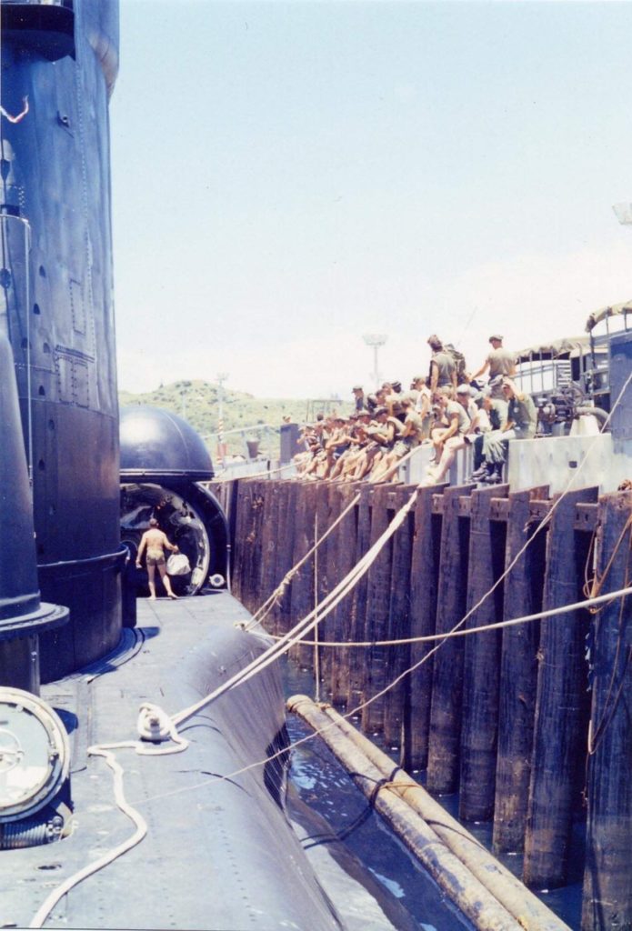 Zc772. In June 1972, the Grayback carried a team of Navy SEALs into the coastal waters of North Vietnam as part of Operation Thunderhead. This was the last attempt during the Vietnam War to rescue American POWs held in North Vietnam. Grayback (LPSS-574) at Subic Bay, Philippines in 1970 before underway ops. SEAL's on pier. Right side of submarine = open hanger doors & ships diver. This picture came from a Navy source web page. You got to copy and paste this URL: file:///C:/Users/Karl/Documents/MD%20USA/MD%20US%20Military/MD-US%20NAVY/USN%20Ships/USS%20Grayback/Submarine%20Photo%20Index,%20Navy.htm 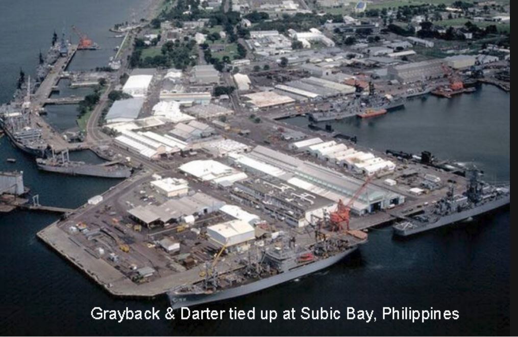 Zc773. This is a picture of the Subic Bay Ship Repair Facility, I was a diver there and I remember diving under and inside the submarines many times at that location. It feels like home, looking at this picture. This picture came from this URL. www.ussgrayback574.com/pictures1.htmlIn January 1982 five U.S. Navy divers died when a vacuum was inadvertently drawn in a chamber on Grayback off the coast of Subic Bay, P.I. The diving accident led to changes in how the Navy designed, built, maintained and operated complex submarine based diving systems. The 6th diver survived and is a personal friend of mine and lives here in the greater Subic Bay area some of the time. 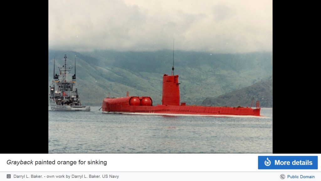 Zc774. The USS Grayback was decommissioned for the second time on 15 January 1984 at Subic Bay Naval Station in the Republic of the Philippines. After decommissioning, Grayback was sunk as a target on 13 April 1986 in the South China Sea. This picture came from a Navy source. But that is not the end of the special boats, just the Diesel Boats are gone; there are now a few nuclear boats converted for these missions. |
|
|
|
Post by Karl Welteke on Oct 1, 2018 15:21:08 GMT 8
Subic Bay Naval Base early 1980s These are mostly aerial shots of the Naval Station Subic Bay and a few other shots from the greater Naval Base from about 1981 to 1983. They are all from U.S. National Archives. I downloaded these images many years ago and it is about time I do something with them. I think they are very interesting for people with interest to Subic Bay. I added comparable images from Google Earth for you to compare the changes that have occurred under the new management of the former base, which is now the Subic Bay Freeport Zone (SBFZ). These pictures are available at high resolution in this Flickr album: www.flickr.com/photos/44567569@N00/albums/72157671843428567There are about 20 shots and here are the first 4 images: 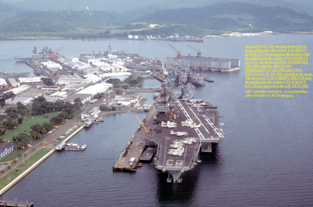 Zc797. A view of the U. S. Naval Base Subic Bay in 1981 from the U. S. National Achieves. An aerial deck view, looking from bow to stern, of the aircraft carrier USS KITTY HAWK (CV-63) docked in the harbor with the guided missile cruiser USS STERETT (CG-31), the destroyer USS INGERSOLL (DD-990), and the oilers USNS MISPILLION (T-AO-105) and USNS NAVASOTA (T-AO-106) docked at its stern. The destroyer USS O'BRIEN (DD-975) and the guided missile cruiser USS HALSEY (CG-23) are docked at the left. Photo is from the U.S. Archives. 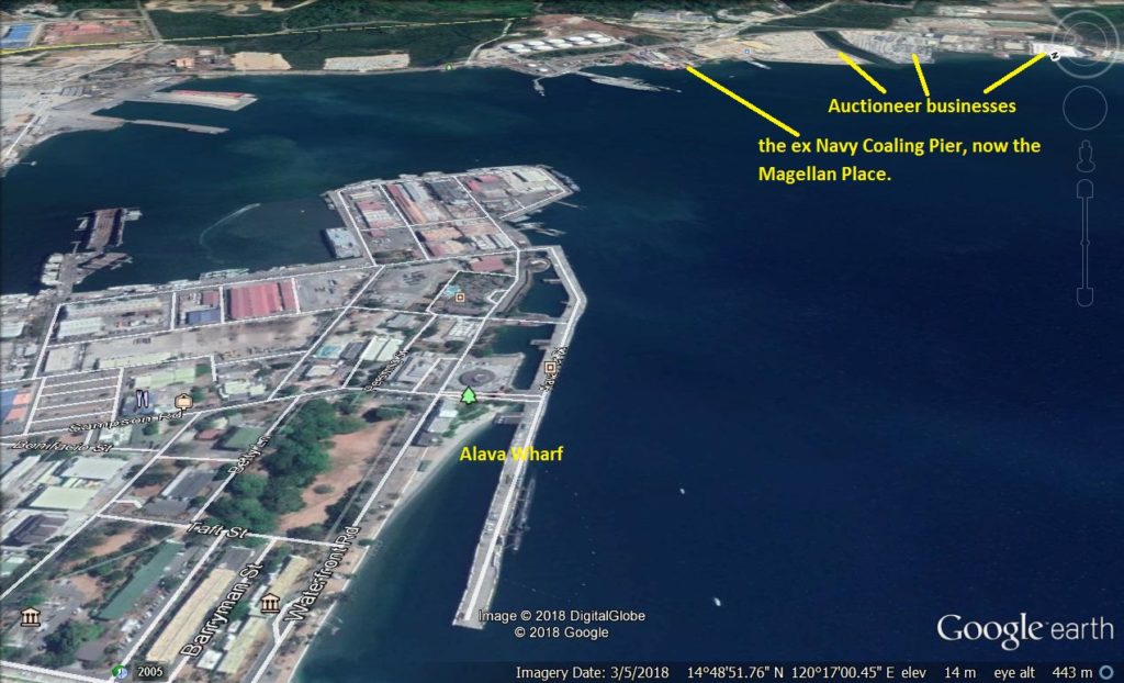 Zc798. A comparable view of the former U. S. Naval Base Subic Bay in 1981 from the U. S. National Achieves, as it looks now from Google Earth in 2018. U.S. War Ships and Naval Auxiliaries still visit Subic Bay and moor to the Alava Wharf. Look across the harbor and you see one more fuel pier has been added and many more large fuel tanks. We also see the auctioneer businesses, the ex Navy Coaling Pier, now the Magellan Hotel and Restaurant Place. Photo is from Google Earth. 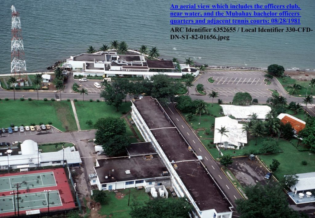 Zc799. A view of the “Officer Country” in the U. S. Naval Station Subic Bay in 1981 from the U. S. National Achieves. An aerial view which includes the officers club, near water, and the Mabuhay bachelor officer’s quarters and adjacent tennis courts. Photo is from the U.S. Archives. 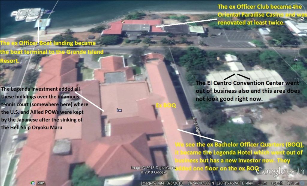 Zc800. A comparable view of the former “Officer Country” in the U. S. Naval Station Subic Bay in 1981 from the U. S. National Achieves, as it looks now from Google Earth in 2018. We see the ex Bachelor Officer Quarters (BOQ), it became the Legenda Hotel which went out of business but has a new investor now. The ex Officer Club became the Oriental Paradise Casino and was renovated at least twice. The El Centro Convention Center went out of business and this area does not look good right now. The Legenda Investment added all these buildings over the infamous tennis court (somewhere here) where the U.S. and Allied POWs were kept by the Japanese after the sinking of the Hell Ship Oryoku Maru. The ex Officer Boat landing became the boat terminal to the Grande Island Resort. Photo is from Google Earth. 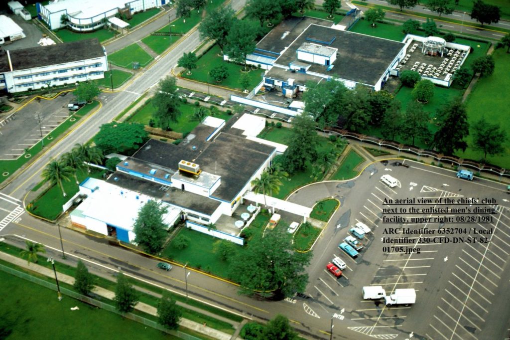 Zc801. A view of the CPO Club and the EM Club in the U. S. Naval Station Subic Bay in 1981 from the U. S. National Achieves. Photo is from the U.S. Archives. 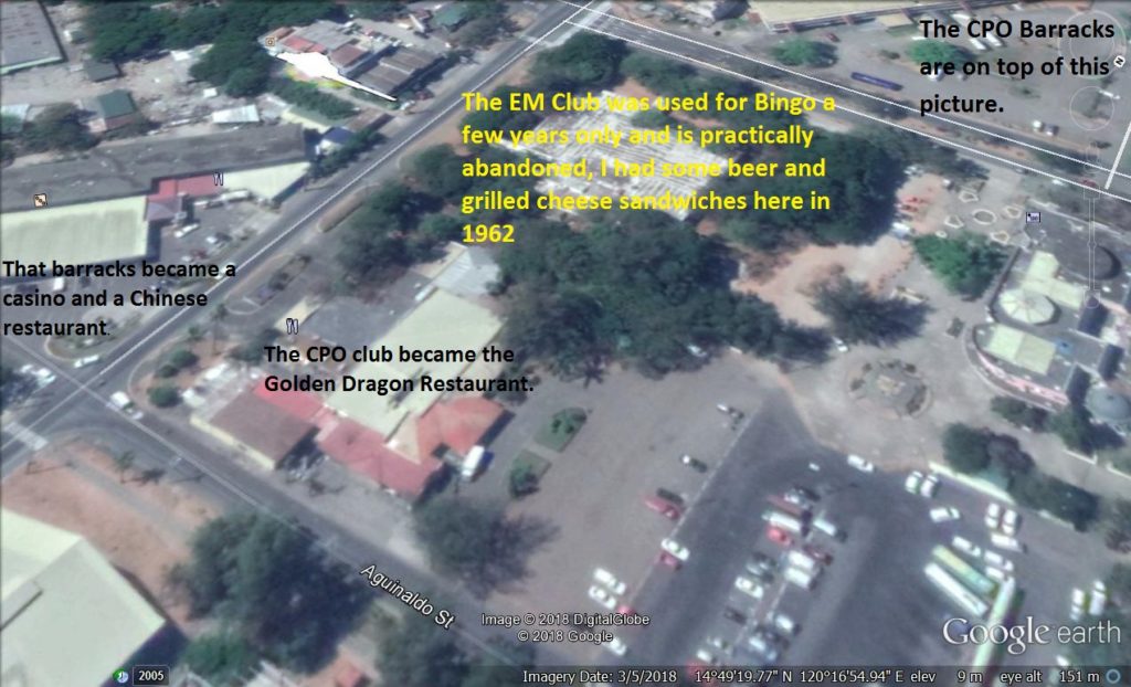 Zc802. A comparable view of the former Chief Petty Officer (CPO) Club and the Enlisted Men (EM) Club in the U. S. Naval Station Subic Bay in 1981 from the U. S. National Achieves, as it looks now from Google Earth in 2018. The CPO club became the Golden Dragon Restaurant. The EM Club was used for Bingo a few years only and is practically abandoned, I had some beer and grilled cheese sandwiches here in 1962. That barracks became a casino and a Chinese restaurant. The CPO Barracks are on top of this picture. Photo is from Google Earth. 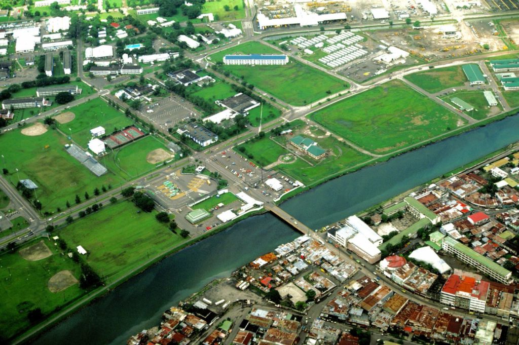 Zc803. A view of the Main Gate area in the U. S. Naval Station Subic Bay in 1981 from the U. S. National Achieves. Photo is from the U.S. Archives. 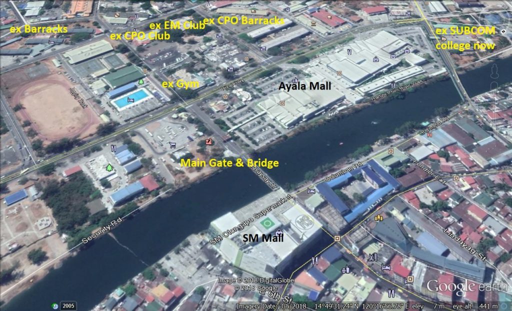 Zc804. A comparable view of the former Main Gate area in the U. S. Naval Station Subic Bay in 1981 from the U. S. National Achieves, as it looks now from Google Earth in 2018. Photo is from Google Earth. |
|
|
|
Post by Karl Welteke on Oct 2, 2018 20:41:10 GMT 8
Subic Bay Naval Base early 1980s 2nd set with 3 original images. These are mostly aerial shots of the Naval Station Subic Bay and a few other shots from the greater Naval Base from about 1981 to 1983. They are all from U.S. National Archives. I downloaded these images many years ago and it is about time I do something with them. I think they are very interesting for people with interest to Subic Bay. I added comparable images from Google Earth for you to compare the changes that have occurred under the new management of the former base, which is now the Subic Bay Freeport Zone. These pictures are available at high resolution in this Flickr album: www.flickr.com/photos/44567569@N00/albums/72157671843428567There are about 20 shots and here is the 2nd set with 3 images: 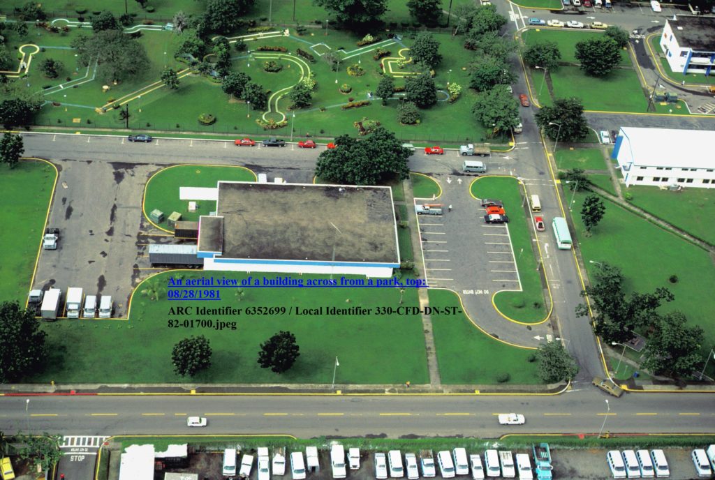 Zc805. A view of the U. S. Naval Base Subic Bay in 1981 from the U. S. National Achives. That was the US Post Office and behind it is the Mini Golf Course. The vehicles on the bottom were MWR (Moral-Welfare & Recreation) vehicles for rent. There was a building but it collapsed from the Mt. Pinatubo ash and was never rebuild. 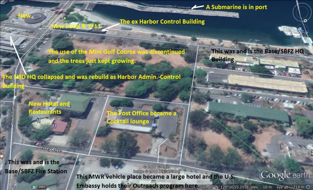 Zc806. A comparable view of the former U. S. Naval Base Subic Bay in 1981 from the U. S. National Achieves, as it looks now from Google Earth in 2018. That was the US Post Office and behind it is the Mini Golf Course. The use of the Mini Golf Course was discontinued and the trees just kept growing. The Post Office became a Cocktail lounge. This MWR vehicle place became a large hotel and the U.S. Embassy holds their Outreach Program here. This was and is the Base/SBFZ Fire Station. New hotel and Restaurants, it was empty during our time. A submarine is in port. This was and is the Base/SBFZ HQ Building. The NSD HQ collapsed and was rebuild as the Harbor Admin.-Control Building by the SBFZ. This is a Google Earth 2018 image of the SBFZ marked-up by me. 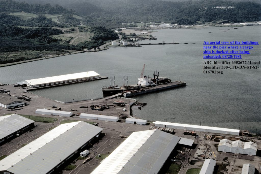 Zc807. This is a view of the U. S. Naval Base Subic Bay in 1981 from the U. S. National Archives. The view is from above the former Naval Supply Depot towards the Boton Valley across the Fueling Pier. 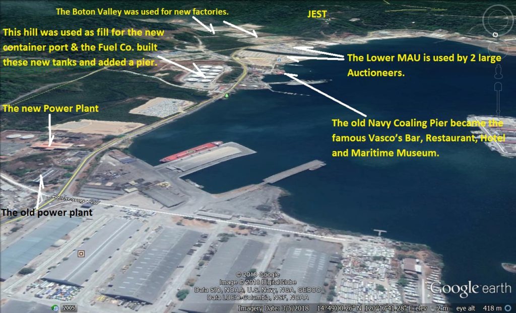 Zc808. This is a comparable view of the former U. S. Naval Base Subic Bay in 1981 from the U. S. National Archives. The view is from above the former Naval Supply Depot towards the Boton Valley across the Fueling Pier. The Boton Valley was used for new factories. The Lower MAU is used by 2 large Auctioneers. This hill was used as fill for the new container port & the Fuel Co. built these new tanks and added a pier. The old Navy Coaling Pier became the famous Vasco’s Bar, Restaurant, Hotel and Maritime Museum. This is a Google Earth 2018 image of the SBFZ marked-up by me. 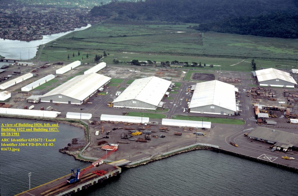 Zc809. This is a view of the U. S. Naval Base Subic Bay in 1981 from the U. S. National Archives. The view is from above the former Naval Supply Depot towards the empty wet land across the former MWR Skeet Shooting Place. 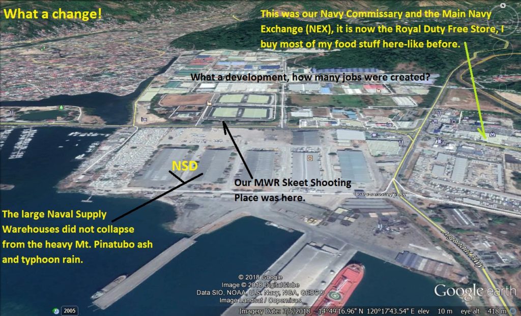 Zc810. A comparable view of the former U. S. Naval Base Subic Bay in 1981 from the U. S. National Archives. The view is from above the former Naval Supply Depot towards the empty wet land across the former MWR Skeet Shooting Place. What a Change, can you believe it? The large Naval Supply Warehouses did not collapse from the heavy Mt. Pinatubo ash and typhoon rain. What a development, how many jobs were created? This was our Navy Commissary and the Main Navy Exchange (NEX), it is now the Royal Duty Free Store, I buy most of my food stuff here-like before. Our MWR Skeet Shooting Place was here. This is a Google Earth 2018 image of the SBFZ marked-up by me. |
|


