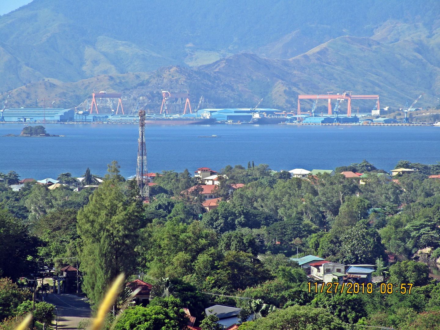
|
|
Post by Karl Welteke on Oct 5, 2018 18:34:18 GMT 8
Subic Bay Naval Base early 1980s 3rd set with 3 original images. These are mostly aerial shots of the Naval Station Subic Bay and a few other shots from the greater Naval Base from about 1981 to 1983. They are all from U.S. National Archives. I downloaded these images many years ago and it is about time I do something with them. I think they are very interesting for people with interest to Subic Bay. I added comparable images from Google Earth for you to compare the changes that have occurred under the new management of the former base, which is now the Subic Bay Freeport Zone. These pictures are available at high resolution in this Flickr album: www.flickr.com/photos/44567569@N00/albums/72157671843428567There are about 19 shots and here is the 3rd set with 3 images:  Zc811. This is a view of the U. S. Naval Base Subic Bay in 1981 from the U. S. National Achieves. This is the area near and around the Naval Base Kalaklan Gate, the way north into the Zambales Provence. Much of the area was used by the Public Works Center (PWC) and the Seabees. I know the Naval Investigating Service (NIS) had a large building here. The Naval Station Armory in a bunker was here. The Transient Personnel Unit (TPU) was here and also handled all the Filipinos joining the Navy. In the 80s the Officer in Charge (OIC) told me that he had 64 personnel on legal hold who were waiting for an outcome of their legal cases. Much has changed, look at the next image! 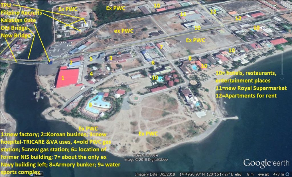 Zc812. A comparable view of the former U. S. Naval Base Subic Bay in 1981 from the U. S. National Achieves, as it looks now from Google Earth in 2018. This is the area near and around the former Naval Base and now the Subic Bay Freeport Zone (SBFZ) Kalaklan Gate. We see: the old bridge not dismantled, the new bridge, the hotel & entertainment developments, the ex PWC areas still available for development, the locations of some Navy structures gone and the few that still remain. This is a Google Earth 2018 image of the SBFZ marked-up by me.  Zc813. This is a view of the U. S. Naval Base Subic Bay in 1981 from the U. S. National Archives. I bet most old hands will not know where this was! Left is the Subic Bay Naval Station Chief Petty Officer (CPO) barracks. In the middle was a Seabee camp housed in mobile trailers. They were here only a few years but in the 90s the HQ and Quarterdeck area was still there. The next picture will help you in your orientation.  Zc814. This is a comparable view of the former U. S. Naval Base Subic Bay in 1981 from the U. S. National Archives. Left is the Subic Bay Naval Station Chief Petty Officer (CPO) barracks. In the middle was a Seabee camp housed in mobile trailers. Location Key: 1= ex CPO barracks-now various businesses; 2= ex Sampaguita EM Club; 3=ex MWR bowling alley, was remodeled but was not successful; 4=ex NAVSTA swimming pool-was not successful-not used; 5=ex Navy Lodge-now International Hotel, 6= ex newer EM barracks-now the International Hotel; 7= various businesses; 8=SBFZ Admin; 9=college and or schools; 10=two large commercial buildings going up-very slow; 11= hotels & apartments; 12=not used; 13= started as a Korean High-rise-a big failure-lots of concrete to be cleared!; 14= ex Navy Dispensary-still medical-a little-all buildings behind it are hotels or entertainment places. This is a Google Earth 2018 image of the SBFZ marked-up by me.  Zc815. This is a view of the U. S. Naval Base Subic Bay in 1981 from the U. S. National Archives. In front is much of the former Ship Repair Facility (SRF), Navy Ships and across the harbor water we see left-the Boton Valley, middle-the Boton Wharf and JEST on the hill, right is part of the former Cubi Point Naval Air Station.  Zc816. A comparable view of the former U. S. Naval Base Subic Bay in 1981 from the U. S. National Archives. This is a Google Earth 2018 image of the SBFZ marked-up by me. In front is much of the former Ship Repair Facility, Navy Ships still visit sometime and across the harbor water we see left-the Boton Valley, middle-the Boton Wharf and JEST on the hill, right is part of the former Cubi Point Naval Air Station. Location key: 1= fuel piers; 2= ex Navy coaling pier-now famous Vasco Hotel etc; 3 =two large auctioneer outfits; 4= Boton Valley houses large manufacturing buildings and many other small businesses; 5=the Boton pier area also houses many various businesses; 6=was the SRF HQ-Pinatubo collapsed it and is now an upscale hotel; 7 was the NSD HQ-it also collapsed- it has become the Harbor Administration Building; 8= was a Navy hangar and was remodeled as a terminal for the Subic Bay International Air Port. |
|
|
|
Post by Karl Welteke on Oct 9, 2018 9:21:34 GMT 8
Submarine Base Subic Bay Subic Bay, the Olongapo Navy Yard supported submarines from the earliest time. In 1945 a Submarine Operating Base was established on the western side of the bay. After the Naval Base Subic Bay was terminated and the remaining infrastructure was returned to the Philippine Authority in Nov. 1992 the area was developed into the Subic Bay Freeport Zone (SBFZ). US war ships, including submarines and other US Naval vessels visit SBFZ frequently. I established a web page about the submarines in Subic Bay, it is completed now! I started with some pre WWII images, then the WWII submarine base, followed by the US submarines visiting the SBFZ, this is the URL: philippine-sailor.net/2018/09/16/submarine-base-subic-bay/Here are 3 sample images:  Zc757. That is the area of the Rivera Wharf in 1926; 5 submarines are in a nest alongside the wharf. It seems in the woods are the officer quarters. The tower building may be the Olongapo Port Control Place. The Kalaklan Ridge in back is recognizable; maybe the cemetery is still small. This picture was sent to me by my shipmate Chuck Thompson. These last 4 pictures can be downloaded with a higher resolution from this Flickr album: www.flickr.com/photos/44567569@N00/albums/72157647790469238 Zc762. This is the Subic Bay, and this is a section of a post WWII 1:50000 map which shows the streets of the former 1945 Submarine Base. Newer maps don’t show those streets anymore. And for many decades this area was no longer accessible by vehicle, only on foot or boat. Most sections of that road were grown over during my walking time.  Zc789. USS Chicago SSN 721 visits Subic Bay in 2015 this picture is from the AFP. I got it via the Manila Star news paper and it must have got shot from the stern of the USNS Mercy in 2015. Photo credit AFP. |
|
Deleted
Deleted Member
Posts: 0
|
Post by Deleted on Oct 13, 2018 9:27:14 GMT 8
My Grandmother sent me several photos that my Grandfather, Robert E. Norris took while stationed at the Naval Supply Depot, Subic Bay in 1945-1946. He was an Electrician's Mate 3rd Class and an avid photographer. Help with figuring out the location, structures, who L.E. Johnson is, etc. would be great. I have posted the photos on my Facebook page (I don't know how to post them here but I'm willing to post them) www.facebook.com/angela.simmonsjones.5/media_set?set=a.10155818294836367&type=3 Thanks--MSgt (USAF, Ret) Angela Simmons-Jones |
|
|
|
Post by Karl Welteke on Oct 13, 2018 19:04:12 GMT 8
Hello ggrae.
I tried to open your Facebook URL but it did not work for me. I tried to answer another way but this forum system did not cooperate. I do not know what in the heck happened.
Here I go again.
How about send me a picture to my email address, here it is but I left the @ out so it cannot be harvested: bonootrowena yahoo.com
|
|
|
|
Post by Karl Welteke on Oct 14, 2018 18:26:09 GMT 8
Subic Bay Naval Base early 1980s 4th set with 3 original images. These are mostly aerial shots of the Naval Station Subic Bay and a few other shots from the greater Naval Base from about 1981 to 1983. They are all from U.S. National Archives. I downloaded these images many years ago and it is about time I do something with them. I think they are very interesting for people with interest to Subic Bay. I added comparable images from Google Earth for you to compare the changes that have occurred under the new management of the former base, which is now the Subic Bay Freeport Zone. These pictures are available at high resolution in this Flickr album: www.flickr.com/photos/44567569@N00/albums/72157671843428567There are about 19 shots and here is the 4th set with 3 images:  Zc817. A view of the U. S. Naval Base Subic Bay in 1981 from the U. S. National Archives, this picture shows much of the eastern part of the Naval Station Subic Bay in 1981.  Zc818.A comparable view of the former U. S. Naval Base Subic Bay in 1981 from the U. S. National Achieves, as it looks now from Google Earth in 2018. We notice that 1= this admin building has been extended, 2=these two barracks became 1 hotel, 3= Enlistment Men Boat Landing where I stepped ashore in 1962, the Movie theatre still stands but is not used much for anything, 5=other barracks that are hotels now, 6=Spanish Gate, 7= these MWR buildings collapsed and here is now a big hotel, 8= ex Post Office-now a cocktail lounge, 9= ex mess hall houses various businesses, 10= the former Fleet Exchange houses a similar business, 11=various businesses and USS William H. Standley-CG32. This is a Google Earth 2018 image of the SBFZ marked-up by me.  Zc819. This is a view of the U. S. Naval Base Subic Bay in 1981 from the U. S. National Archives; we are looking from above the Ship Repair Facility (SRF) towards the fuel pier, Lower MAU (Marine Amphibious Unit) and the Boton River Valley.  Zc820. A comparable view of the former U. S. Naval Base Subic Bay in 1981 from the U. S. National Archives. This is a view of the former U. S. Naval Base Subic Bay in 1981 from the U. S. National Archives; we are looking from above the Ship Repair Facility (SRF) towards the fuel pier, Lower MAU (Marine Amphibious Unit) and the Boton River Valley. I have described before the many changes in that area that have occurred under the new Philippine management. You study all the changes! This is a Google Earth 2018 image of the SBFZ.  Zc821. This is a view of the U. S. Naval Base Subic Bay in 1981 from the U. S. National Archives; we see most of the Ship Repair Facility (SRF), the west end of the Naval Supply Depot (NSD), the Special Warfare Camp (SEAL), the US Bicentennial Park and Pond which is now the Volunteer Park,-Pond and Memorial, my Diving Locker Building, the two floating dry docks etc.  Zc822. A comparable view of the former U. S. Naval Base Subic Bay in 1981 from the U. S. National Archives. This is a Google Earth 2018 image of the SBFZ marked-up by me. In front is much of the former Ship Repair Facility, Navy Ships still visit sometime. We see also: 1=Spanish Gate, 2=part of the SRF HQ-Pinatubo collapsed it, now an upper resort, 3 + 4=the floating dry docks, 5=my diving locker, 6=ex Bicentennial Park-now Volunteer Park, 7=SPECWAR Camp (Special Warfare-SEALS),8= birthplace of my Harbor Clearance Unit-1 (HCU-1) now the SBFZ =Marina,9=the Causeway-ex road to the Navy Coaling Pier and Boton area, 10=the ex Far East Fleet Exchange-now a similar store, 11= the Navy Mess Hall-one of the Best-now various businesses. |
|
|
|
Post by Karl Welteke on Nov 17, 2018 20:42:51 GMT 8
Recently I added 22 pictures about Subic Bay into these two albums; they are about low tide at Barretto Beach, Naugsol scenes, RAO Subic in the Halloween Spirit, rice planting in Layac (First Line of Defense). You got to scroll down: Uploaded to Facebook album Subic Bay News 2018, 2nd Half: www.facebook.com/karlwilhelm.welteke/media_set?set=a.10214435667919200&type=3Uploaded to Photobucket: s74.photobucket.com/user/PI-Sailor/library/Philippines/No%202%20Phil%20Events%20Group%20Albums/2018%20SB%20OC%20BB%20ZAM%20Events/2018%202nd%20Album?sort=9&page=1Here are 8 sample images: 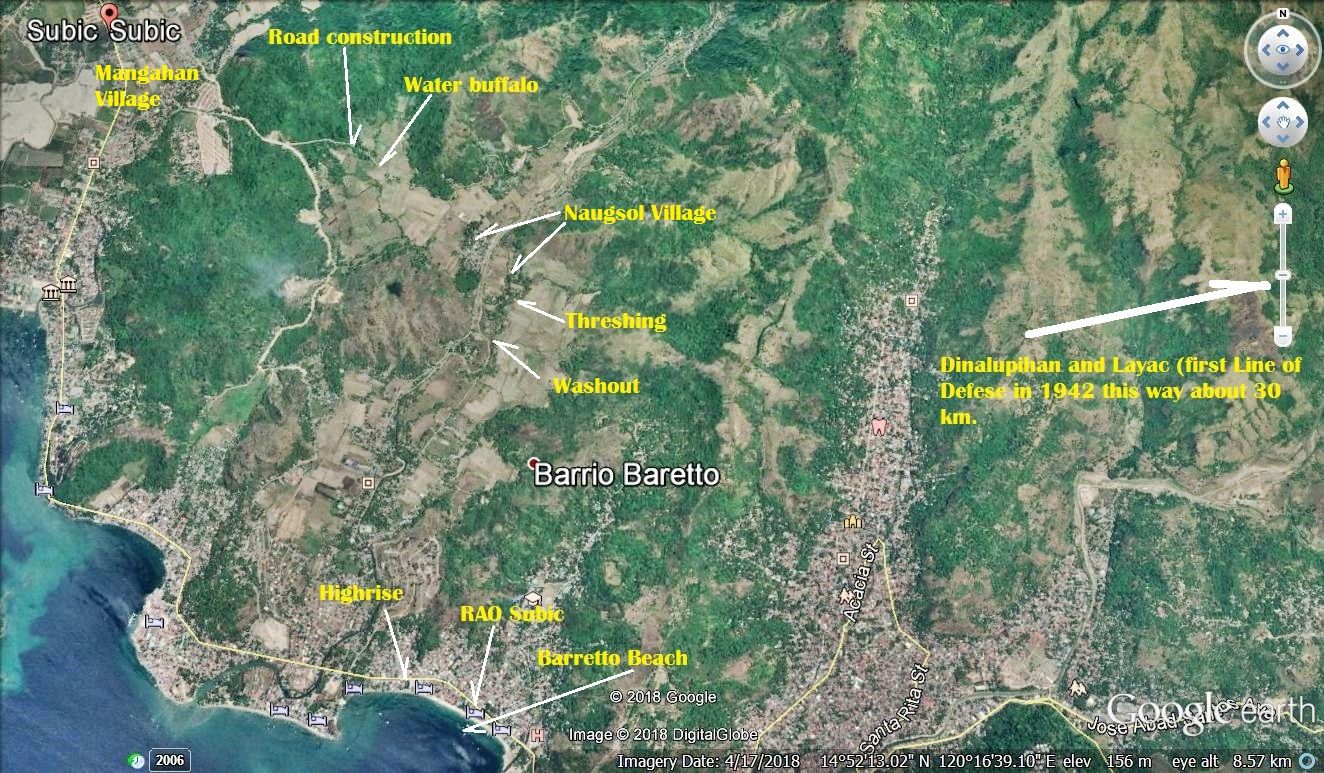 Z221. Locations map of the 22 pictures added. 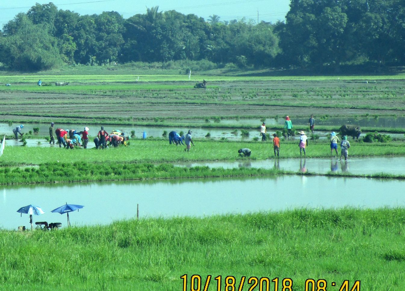 Z222. -181018 rice planting, near Layac 1a. This is at the Dinalupihan (Layac) entrance of the Subic-Clark-Tarlac Expressway when I returned from Corregidor on the 18th of Oct. 2018.  Z223. 181029 Naugsol, Phil.-scene 1.I find it very interesting to catch scenes like this away from the highways and big towns, on walks in my wider neighbor hood. . 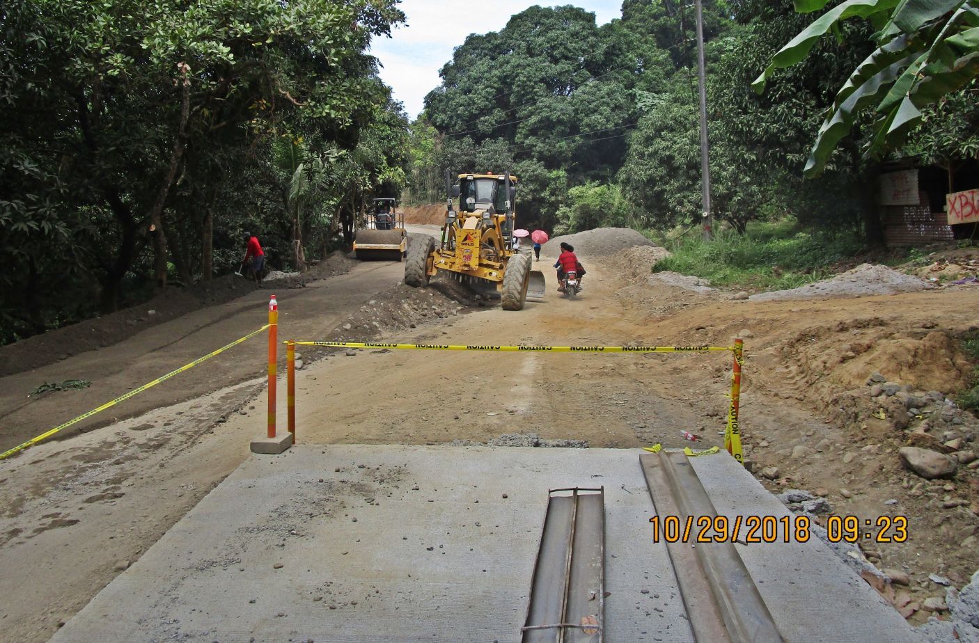 Z224. 181029 road work west of Naugsol 3. This is about half way between Naugsol and Mangahan. 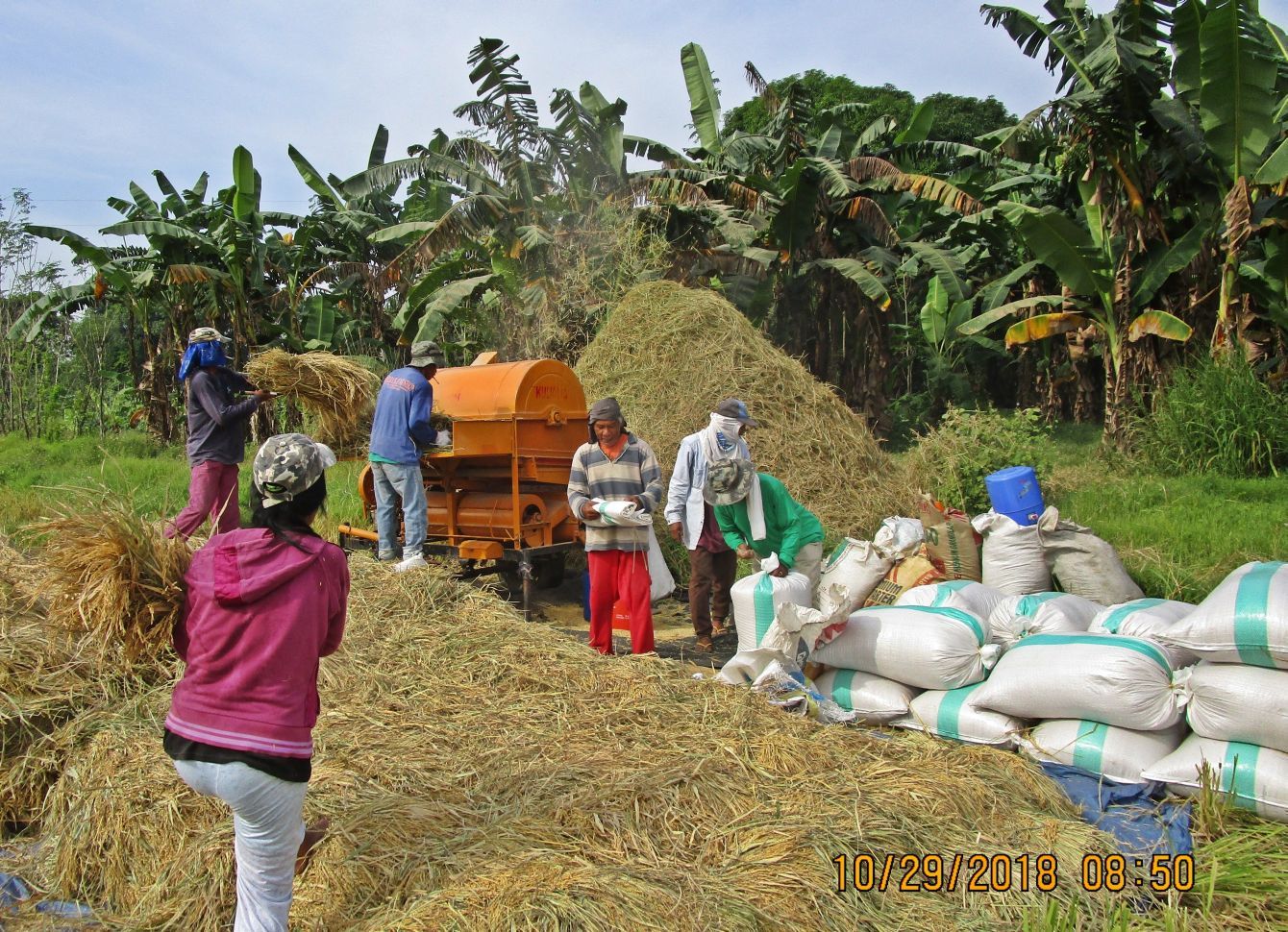 Z225. 181029 threshing, Naugsol 1. Threshing in East Naugsol. Photobucket doesn't let this picture open, at least not on my PC; here is the alternative, click on this IMG Thumb:  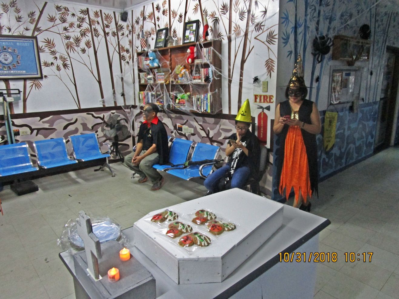 Z226. 181031 RAO Subic in the Halloween Spirit 1. The helpers had the spirit, grade A for their effort!  Z227. 181106 Barretto Beach 2. These are Barrio Barretto Beach Scenes. The floating bars are back at the Arizona Club and the Blue Rock.  Z228. 181106 Barretto Beach 8. These are Barrio Barretto Beach Scenes. The High-rise is rising. |
|
|
|
Post by Karl Welteke on Jan 11, 2019 20:33:15 GMT 8
|
|
|
|
Post by EXO on Jan 12, 2019 10:13:26 GMT 8
Karl,
My info is that despite all sorts of people (such as former Subic Bay Metropolitan Authority Chairman Roberto Garcia) telling us that the shipbuilding conglomerate Hanjin Heavy Industries and Construction-Philippines (HHIC-Phil) operating at Subic is not associated with the financially-troubled Hanjin Shipping, the contagion of falling orders and asset sell-offs has led to the Hanjin Philippines company filing for corporate rehabilitation at the Olongapo Regional Trial Court, seeking protection from its creditors. The filing, which occurred last Tuesday (8 January) follows the laying off some 7,000 workers in December, and sources said the company plans to fire 3,000 more in the coming months, and retain some 300 workers. I would guess that the 300 would be held on for maintenance and asset protection purposes.
The shipyard was known around financial circles to be struggling to pay hundreds of millions of dollars in loans to some of the Philippines’s leading banks, so there may be an issue with knock-on effects.
the current SBMA Chairman Wilma T. Eisma is reported as saying that she was “saddened” to learn that Hanjin Philippines is facing serious financial trouble. “The bottom line is that the company said it does not have enough cash to repay its loans, and that it cannot continue with its operations under these circumstances,” she said.
That may well crimp SBMA's style.
What I am sure will disturb everyone is the prospect that the shipyard, which is being offered for sale at an estimated $1.6 billion, is that China is expressing interest. The possibility that China will end up owning the shipyard is a pretty horrific, and it speaks loads for the economic stewardship of the Philippine economy, and its recent estrangement from U.S. interests.
(I am, you might recall, an insolvency lawyer, well experienced in the field of corporate bankruptcy. The sniff of Hanjin Philippines demise has been on the air a long while, particularly since the mother company in Korea started its own restructuring in 2016. If the SBMA acts surprised, I will recommend them for an Academy Award for best supporting actors in a fiscal drama.)
|
|
|
|
Post by Karl Welteke on Jan 13, 2019 12:19:54 GMT 8
|
|
|
|
Post by Karl Welteke on Jan 15, 2019 19:10:01 GMT 8
SBMA ‘saddened’ by Hanjin debt problem  Zc992. Hanjin shipyard at the Subic Bay Freeport Zone, this picture, this head line and this text came from this URL: subicnewslink.blogspot.com/2019/01/sbma-saddened-by-hanjin-debt-problem.htmlThis is a great picture of the former US. Marine Corps Green Beach Training Area, in the Agusuhin Valley, the Agusuhin Village was here which is now the Hanjin Shipyard, on the Redondo Peninsular. I used to walk around there freely after the SBMA took over the administration of the former Naval Base but the shipyard stopped that! SBMA ‘saddened’ by Hanjin debt problem Posted: 11 Jan 2019 06:35 PM PST Subic Bay Metropolitan Authority (SBMA) Chairman Wilma T. Eisma said she was saddened to learn that Korean shipbuilder Hanjin Heavy Industries and Construction Philippines (HHIC-Phil) is facing serious financial trouble. Hanjin, which is currently the biggest foreign investor in the Subic Bay Freeport Zone, filed on Tuesday a petition at the Regional Trial Court in Olongapo City to initiate voluntary rehabilitation under Republic Act 10142, otherwise known as “An Act Providing for the Rehabilitation or Liquidation of Financially Distressed Enterprises and Individuals”. Hanjin officials, Eisma said, had revealed that the company owes some $400 million in outstanding loans from Philippine banks on top of another $900 million in debts with lenders in South Korea. Eisma said she was informed that the company still has six pending multi-million new building projects at its Redondo Peninsula shipyard here, and that these may have to be cancelled if a rehabilitation plan does not materialize. “The bottom line is that the company said it does not have enough cash to repay its loans, and that it cannot continue with its operations under these circumstances,” Eisma said. “It’s really sad that Hanjin would be in dire financial straits after successfully building some of the world’s biggest ships here and putting the Philippines in the map as the world’s fifth largest shipbuilder,” she added. HHIC-Phil, which has focused in building high-value vessels, was established in 2006 as a subsidiary of Hanjin Heavy Industries & Construction Co., Ltd., a multi-national company that provides shipbuilding, construction, and plant services in South Korea and internationally. After frenzied construction of its 300-hectare shipyard began in May 2006, HHIC-Phil rolled out its first ship, the “Argolikos” in July 2008. With some $2.3 billion in foreign direct investments here, the firm proceeded to manufacture some of the world’s biggest cargo and container ships, bulk carriers, liquefied petroleum gas carriers, very large crude oil carriers (VLCC) and very large ore carriers (VLOC). According to company records, Hanjin has delivered since 2008 a total of 123 vessels to valued clients across the globe, thus cementing its foothold in the highly competitive shipbuilding market. In the course of its operation, the Korean firm also became the biggest employer among all registered businesses in the Subic Bay Freeport Zone with some 30,000 employees at peak season, and was recognized by both the Philippine Exporter Foundation (Philexport) and the Department of Trade and Industry (DTI) as top export performer. However, in the face of recent liquidity problem, Hanjin has laid off more than 7,000 workers last December, Eisma said. The firm is about to lay off another 3,000 early this year until just about 300 local workers and as few as seven Korean supervisors would remain in March to do facility maintenance, she added. “The SBMA, of course, expressed its concern about the separation of shipyard workers, but we received assurances that those who were laid off were amply compensated. Still, we’re having this aspect checked out,” Eisma said. She added that the SBMA is now working with Hanjin officials to find some way to keep the shipbuilder, which has helped build Subic’s huge reputation in the global maritime industry. “I really hope that Hanin’s creditors would agree to some rehabilitation plan, or that the company would find some financial partner to continue with its shipbuilding operations in Subic,” Eisma also said. (HEE/MPD-SBMA) PHOTO: Hanjin shipyard at the Subic Bay Freeport Zone You are subscribed to email updates from SubicNewsLink. To stop receiving these emails, you may unsubscribe now. Email delivery powered by Google |
|


