|
|
Post by Karl Welteke on Oct 10, 2013 13:25:24 GMT 8
Subic Bay, SBFZ, ex Naval Base A new thread about my most favorite Base in all the world. It was once a mighty Naval Base, once it had been an Army Coastal Defense Fort, it served as a refugee camp for the Indochina Refugees. After its return to the Philippine Authorities it became the Subic Bay Freeport Zone (SBFZ) and it is administered by the Subic Bay Metropolitan Authority (SBMA). It offers a lot of things to many different people. I like its History, its Warm Weather, most things are priced reasonably, I think it is a secure area and last but not least for the most part the majority of the people here are very friendly. And the Navy has not forgotten this place, units of the Seventh Fleet come visit Subic Bay almost on a regular basis, for joint service training, rest and repair and people to people relations. SBFZ LANDSLIDE AT CUBI POINT SEP. 2013 As far as I can tell this landslide was not mentioned in the news. When I descended from Cubi Point via Upper Mau on the 8th Oct. 2013 I came across the blocked road just below JEST. A massive landslide occurred here, I assume it happened on the 23rd of Sep 2013, the same day everywhere else in this regions massive flood and rain damage occurred. This is at the Subic Bay Freeport Zone (SBFZ), the former US Naval Base. I stopped and I had to take pictures of this story. In this album are 24 pictures including 4 about the former Cubi Point Sky Club area: s74.photobucket.com/user/PI-Sailor/library/SBFZ%20Ex%20Naval%20Base%20Subic%20Bay/SBFZ%202012%20and%202013/SBFZ%20Landslide%20at%20Cubi%20Pt%20Sep%202013?sort=9&page=1Here are 13 sample pictures: 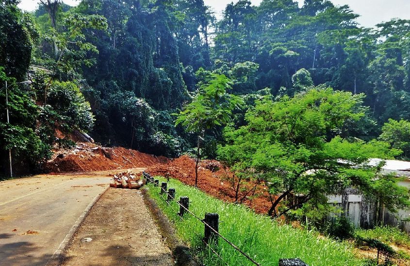 Z729-Looking down onto the Landslide on the road to JEST and Upper Mau, a pass has been cleared but the road is still blocked for traffic. 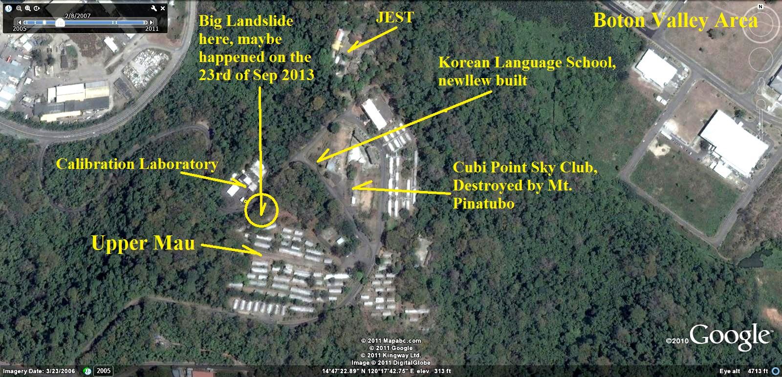 Z729a-A 2006 GE image about the area, the GE image available today had a cloud covering this area. The map has been marked-up with the objects of this album. 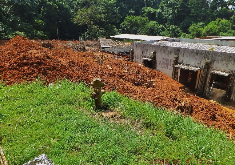 Z730-At right is the former Cubi Point Naval Air Station Gauge Calibration Laboratory, the landslide partially buried it. We divers took some of our gauges there. This facility was not used before the landslide although it was used a few years after the Base Closure by an American Manufacturing Company. 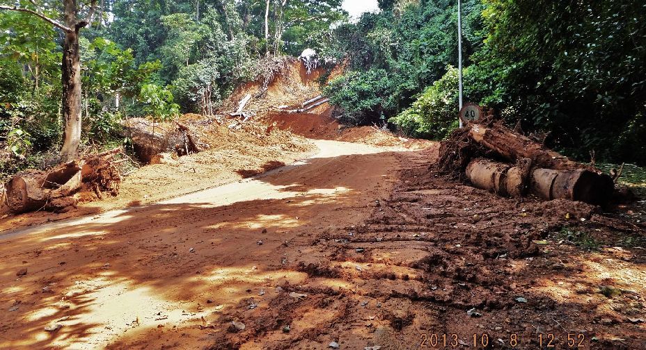 Z731-I walked down thru the cleared mud and this picture is shot up-road of the Upper Mau, Cubi Point landslide. 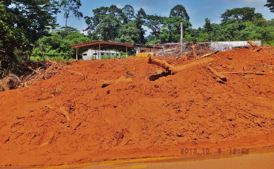 Z732-This was the gate to the former Cubi Point Naval Air Station Gage Calibration Laboratory. The mud was still wet after a week. 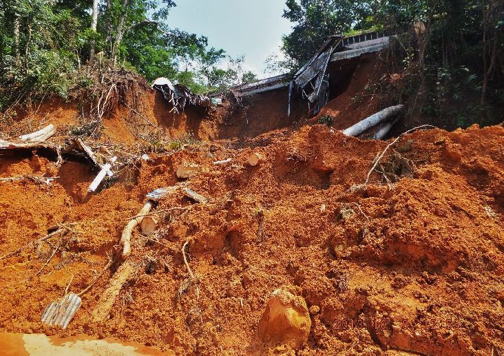 Z733-Standing in front of the Upper Mau, Cubi Point landslide and looking at the source. Obviously some Quonset huts of Upper Mau got destroyed. Upper Mau was used by the US Marines when they came to Subic for training. The Subic Bay Freeport Zone (SBFZ) management used them for budget group commendations. 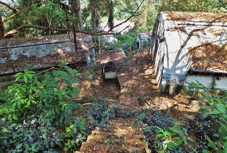 Z734-The picture story is not complete less we got some shots from above, so here we go. I worked my way thru Upper Mau to the destroyed Quonset buildings. It looks like that Upper Mau has not been used by SBMA for some time. 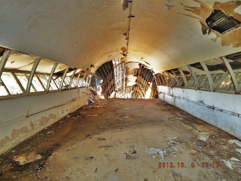 Z735-One of the partially destroyed Upper Mau Quonset huts at Upper MAU. I believe MAU stands for Marine Amphibious Units of the USMC. 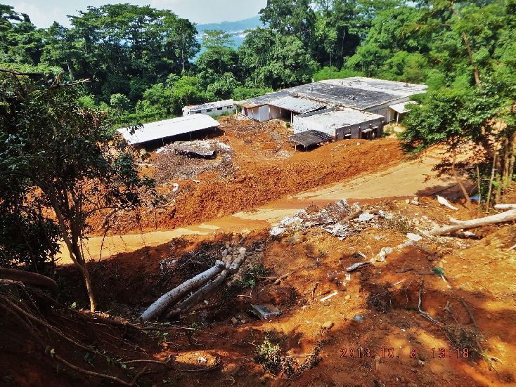 Z736- An overall look at the landslide at Upper Mau, the former Cubi Point Naval Air Station, looking from above. The facilities across the street are the former Cubi Point Naval Air Station Gage Calibration Laboratory. I have no idea why the landslide occurred, natural-too much rain or was there a drainage problem at Upper Mau. I do not know! 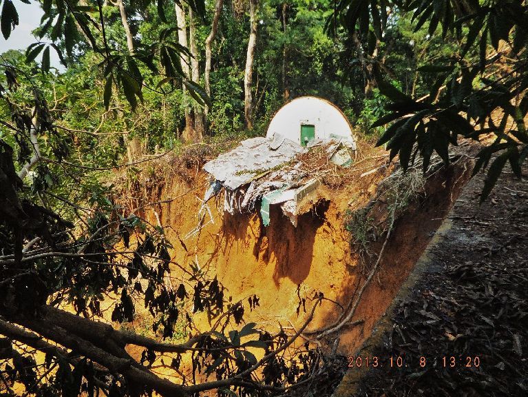 Z737-A close-up shot from above of the opposite destroyed Quonset hut (from the Quonset in a previous picture) at Upper Mau, the former Cubi Point Naval Air Station. 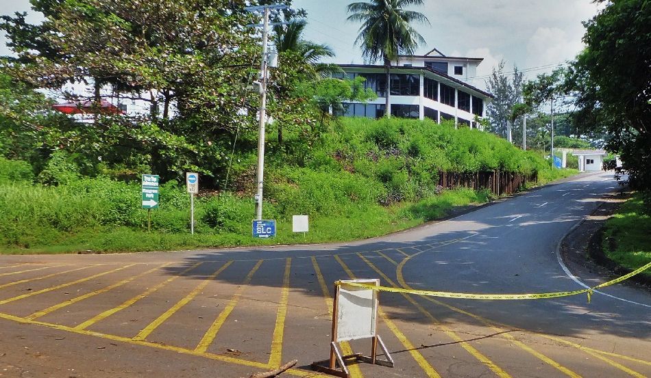 Z738-This is the road going up to Upper Mau camp. The building at left is a relative new building and it is Korean Language School. The road to my right was blocked, I parked here and investigated on foot. For your orientation the road to the left leads to the entrance of JEST. 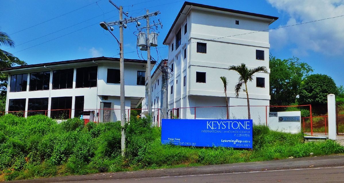 Z739-This is the entrance to that Korean Language School. Here in Subic there are more than one, the Koreans like to bring young Korean students here to teach them English to be ready to compete in the world. Some of my expats shipmates had become teachers here but they do not pay well. 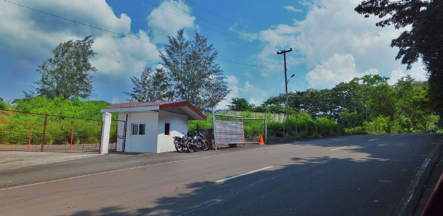 Z740-Looking passed the entrance of the Korean Language School. This was the location of the famous ex Cubi Point Naval Air Station Enlisted Men Sky Club, you can see a wall. The ash sands of Mt. Pinatubo crushed it and it was not reopened. |
|
|
|
Post by Karl Welteke on Oct 15, 2013 15:25:52 GMT 8
MAIN EXCHANGE & COMMISSARY AREA ON EX SUBIC BAY NAVAL BASE NOW THE SBFZ 2013 OCT. 08 It has been now 21 years since the US Navy left and Subic Bay became the Subic Bay Freeport Zone. Many old buildings are still being used, others are not or have been replaced. Subic Bay is a dynamic place and things change all the time. Looking thru the eyes of a retired Navy man, mine, life is better now as a retiree, at least in my opinion. We have two modern shopping malls now and my family loves to go there every week end. The Commissary and Main Exchange Building (NEX) is now the biggest supermarket in the Subic area and we are their best customer. As a retire in 1990-92 one did not have a civilian mall in the Subic Bay area or anywhere close. Retirees were not allowed to buy big ticket items, could not go into the commissary and were only allowed a purchase of about 50 $ a month in a little Mickey Mouse store that was not well stocked. I don’t know whether that was an US or Philippine regulation. As an active duty man during that time the Base often closed the gates for various reasons, we were not allowed to go here or go there etc. Now I can go almost anywhere. So I’m a happy sailor, a happy camper, being retired here in Subic Bay. I have established a new picture album with the name “2013 Oct. to Dec. SBFZ” and it will have pictures of the ex Base during the 2013 Oct. to Dec time frame. So far there are only 13 images inside here: s74.photobucket.com/user/PI-Sailor/library/SBFZ%20Ex%20Naval%20Base%20Subic%20Bay/SBFZ%202012%20and%202013/2013-Oct%20to%20Dec%20SBFZ?sort=9&page=1Here are 4 sample pictures, remember the images in the album are more and are bigger: 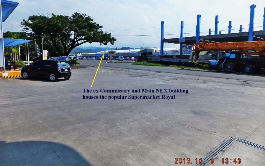 Z807-2013-10-08 A view of the ex Navy Commissary and Main NEX (Navy Exchange) building from the ex NEX gas and automotive service station. 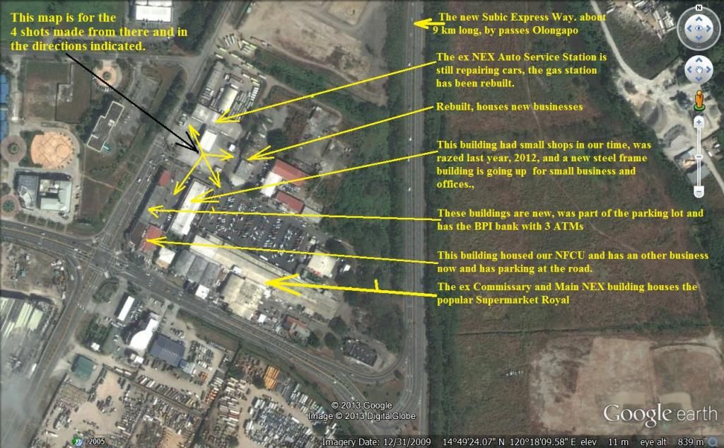 Z808-This GE map of the former Subic Bay Main NEX complex, marked-up by me, is to explain the different shots in the album. 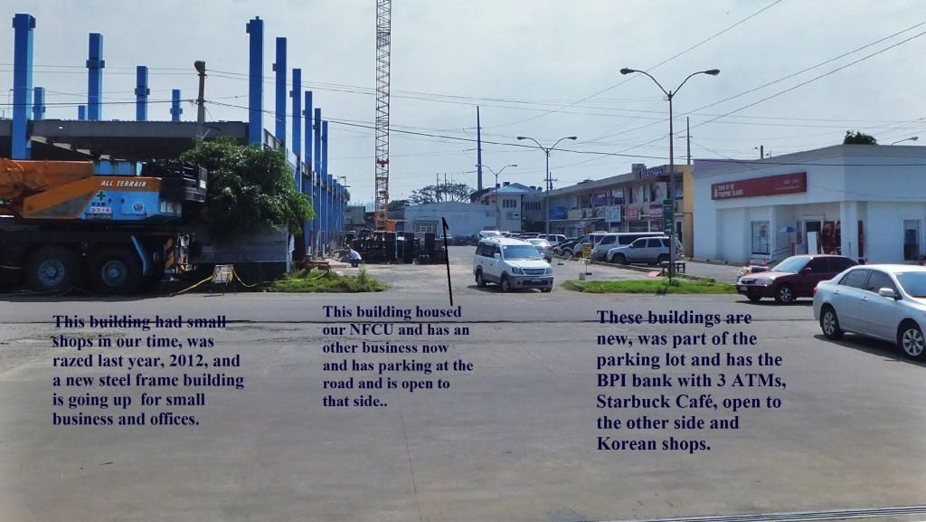 Z809-2013-10-08 A view from the ex NEX gas station at the building that used to house our credit union, the NFCU. The description on the picture cover everything else. This area has and is changing completely. 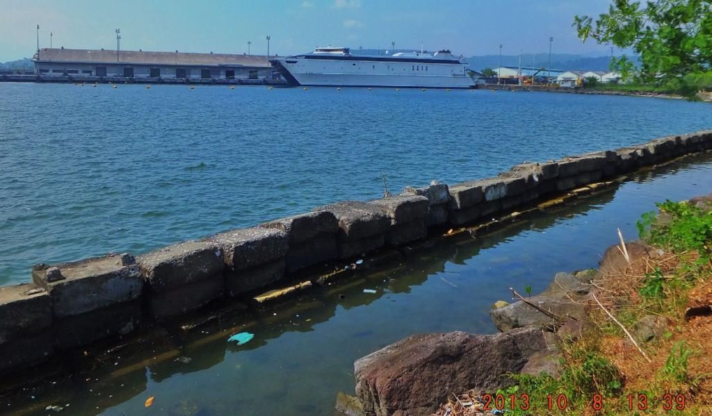 Z810-2013-10-08 On this day I drove home from a walk near Morong Bataan and seen this Roll-on Roll-off ship at the old NSD Pier and had to take this picture. Did they transport US Military Forces during the recent joint exercises? Note to okla: Thanks for your comment. The Japanese did have an advantage, they did not worry about a defense, sent out a detail and expected them to succeed or die. And after having succeeded the mission, although surrounded, it was a given, defend or die, they were ready to die. Note to oozlefinch: Thanks for your comment, what an honor to have teamed up with Al McGrew. And that was good work discovering the Japanese gun by yourself. It was shown to me. |
|
|
|
Post by cbuehler on Oct 24, 2013 0:49:00 GMT 8
Hi Karl,
Great to see your work presented on here on Subic. For those who have not been here, the area is indeed massive when one includes the Naval Base, Cubi Point, the Magazine area etc.
Even the post war facilities which remain are now approaching the "historical age" due its vintage and importance. I do wish that more of it was preserved for its historical value and I hope they dont transform everything. It is perhaps time that the local authorities think twice before demolishing or transforming some of the facilities, but as we all know, they are not very good at this in PI.
I guess the fact that the Subic bay area is such a busy and vibrant area ( and probably will be for a long time to come) dooms much of what we see in these photos.
CB
|
|
|
|
Post by Karl Welteke on Nov 6, 2013 13:09:00 GMT 8
OLONGAPO PORT VIEWS 24 IMAGES FERRY RIDE TO GRANDE ISLAND IN SUBIC BAY IN THE YEAR 2004 s74.photobucket.com/user/PI-Sailor/library/SBFZ%20Ex%20Naval%20Base%20Subic%20Bay/SBFZ%202004%20and%20earlier/Olongapo%20Port%20Views%202004-04-22?sort=9&page=1These are 2004 pictures of the former Naval Station Subic Bay which is now called SBFZ or SBMA. These pictures are about the waterfront, left and right of the ex Officer Club and a ferry ride to Grande Island. There is also images of the former carrier pier, Leyte Wharf. At that pier a grain port was established and next to the former Officer Beach, a new container port is being started. Also included are 2 shots of Grande Island. Here are 12 sample images from that album, remember the images in the above album are bigger: 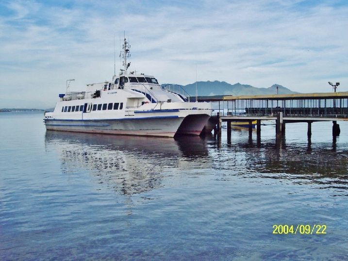 Y4- The ferry boat to the new Grande Island Resort at the former Officer Boat Landing. 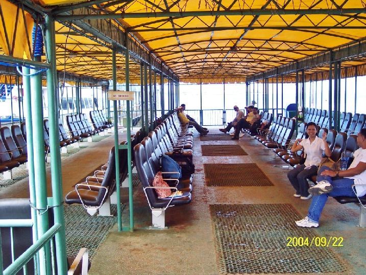 Y5- The waiting area on the new pier were the Officer's boat landing used to be. No comparison to the old Officer boat landing. 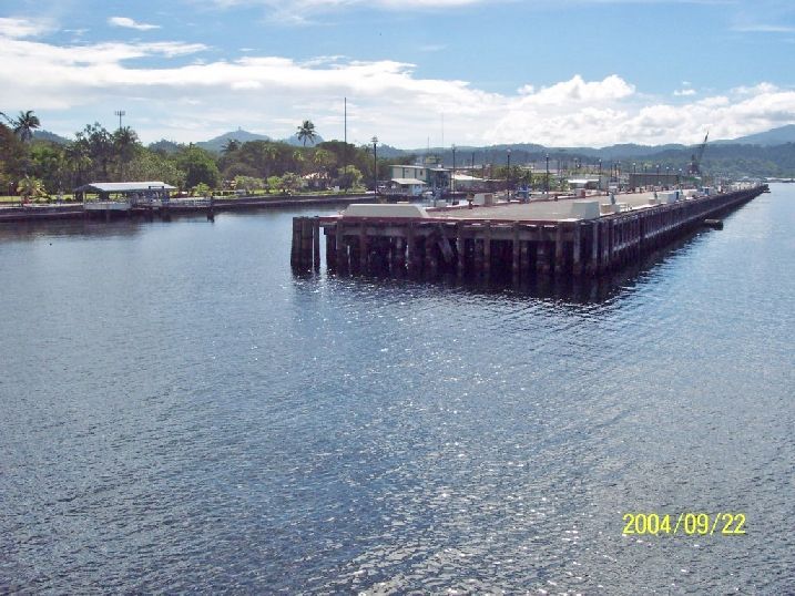 Y6- Alava Extension Wharf, where my ship has tied up many times in the past. We used to call it a pier in my Navy days. No ships today but Navy ships visit frequently, as of 2010, before and after. Left is the former Enlisted Men boat landing, it is gone now as of 2013. That is the very spot where I stepped onto the Philippine Shore for the first time in 1962, loved this place ever since. 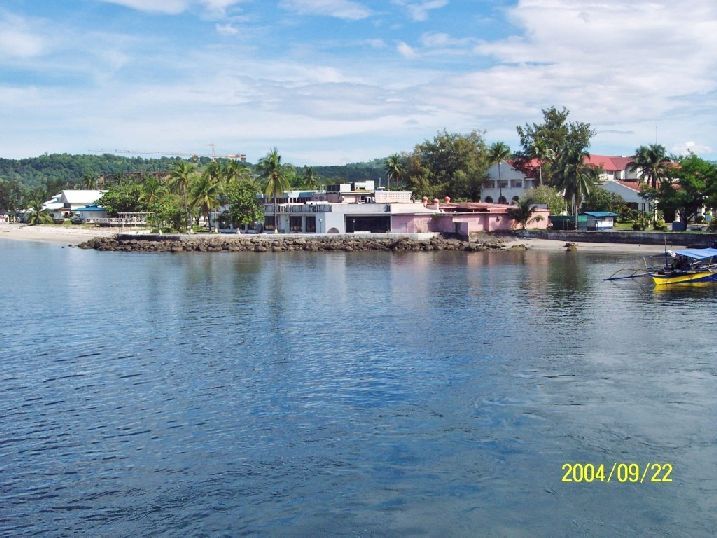 Y7- The former Officer's Club, modified at least twice since and you wouldn't recognize it now. To the right is the former BOQ, it was extended, became a hotel, failed and is in litigation now. Left is a new ocean water sport complex with a popular restaurant. 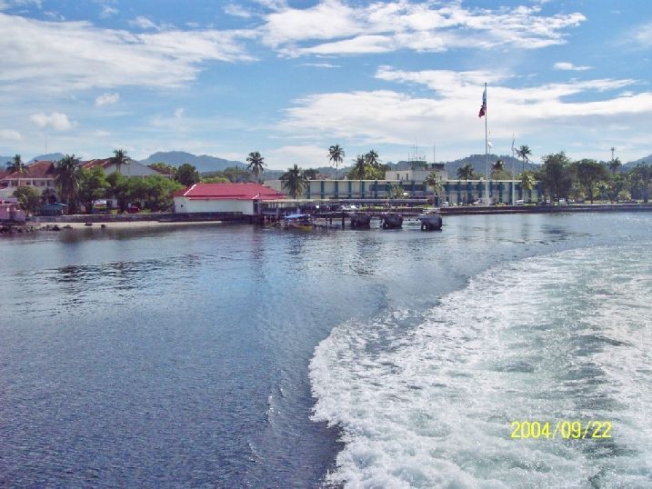 Y8- The boat landing to the Grande Island Resort ferry and the ex Naval Base HQ and now again the HQ of the present Subic Bay Freeport Zone management. 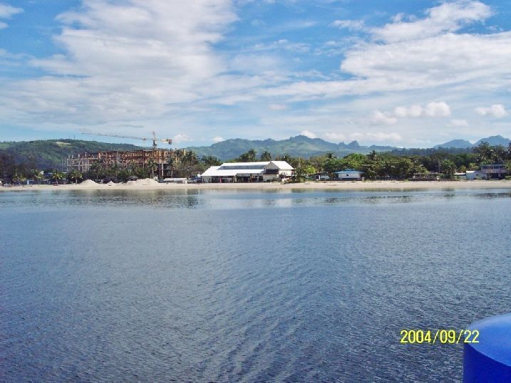 Y9- One of the new waterfront entertainment places, a new ocean water sport complex with a popular restaurant. The ex Officer Club is right of it, it was at least twice remodeled and is now a casino. That steel structure was a failed project and as 2013 has been removed, actually a couple years earlier. 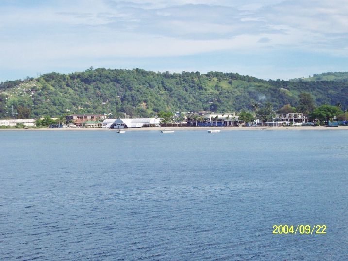 Y10- The waterfront of the former Naval Station and Kalaklan Ridge is in back. That nice 'Boardwalk' along the beach has become a casualty of time and the sea, it isn’t there anymore! During our time this was an empty beach and now at has become a tourist place. 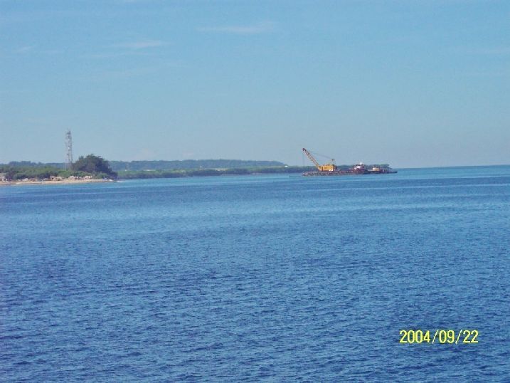 Y11- This is the beginning of the new container port at Cubi Point, butted against what was the Officer's Beach. 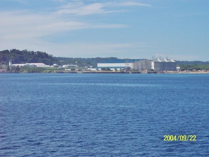 Y12- A closer view of the old carrier Leyte Wharf, this area has become a grain port. The silos and that large bulk ware house were built for the grain shipments, importing mostly. Way left was our the place of our MWR sailboats. 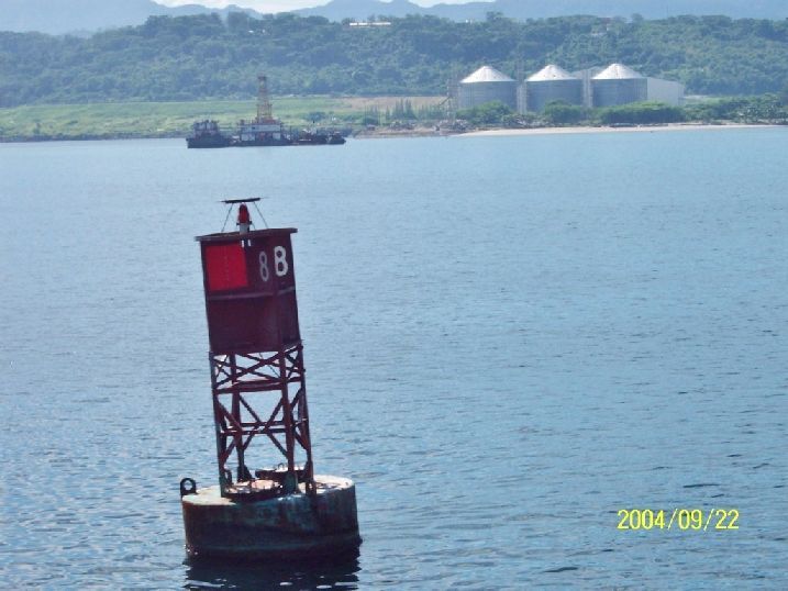 Y13- Yeap, we didn't take the buoy's when we left. The barges are making the beginning moves to built the container port which went in operation in 2008. Behind the barges are the Leyte Wharf and the new Subic Bay Grain Port facilities. Right is the former Naval Officer Beach and the actual geographic -Cubi Point- which will disappear with the construction of the container port. 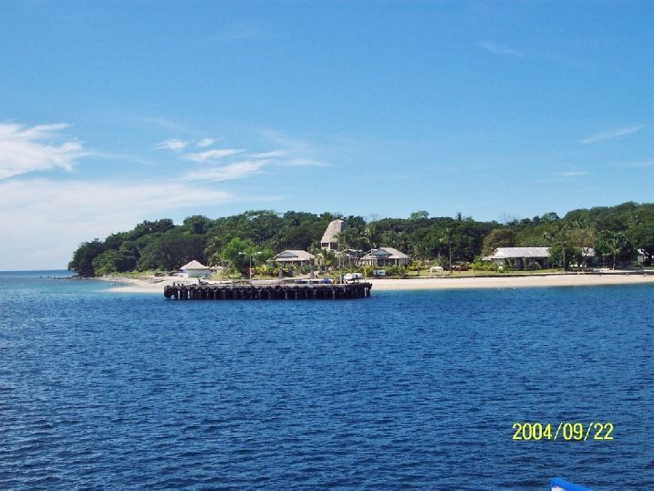 Y14- Grande Island, the old Navy pier and the reception area of the new Grande Island Resort. Grande Island, of course, used to be Fort Wint. 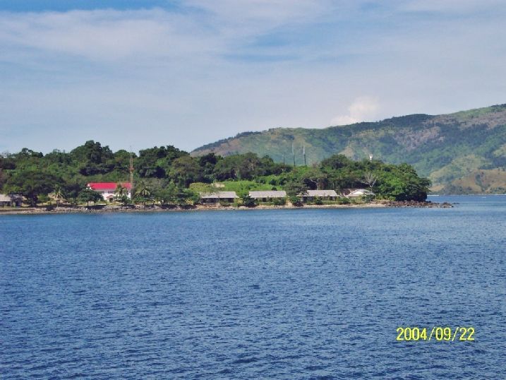 Y15- The new Grande Island Resort Chalets, all the old Navy recreation structures at this beach were razed. The red roof building serves some communication purpose. Behind the last building (on the right) is the old US Army, Ft. Wint mine magazine, it is still there. |
|
|
|
Post by fireball on Nov 6, 2013 17:09:53 GMT 8
In the last pic the red roofed building was at one time used for a power plant with at least 2 and possibly up to four generators. With each generator about 300kva I'm not sure what they would power (as for when - I am guessing 1970/80s - but that's it, just a guess). But also as Karl points out the building must have also had a communication role given the distinctive radio mast.
|
|
|
|
Post by okla on Nov 7, 2013 1:41:01 GMT 8
Hey All, I have a gut feeling that 'ole Subic will, again, be a very valuable military installation in the near future. Methinks, the basic Naval facilities, that still remain, should be nurtured/maintained/upgraded/etc for what I think will be an inevitable confrontational period in the coming years with the folks up North. The same thing, I suppose, could be said about Clark Field. Guam, now, the big US Bastion in the Pacific, is not nearly as strategically located as is Luzon. Can't help but think that the Philippines would welcome the fact that those two bases could handle a rapid influx of a US military presence if the Chinese began to flex their muscles in an attempt to "bully" our Filipino partners. Just sayin'
|
|
|
|
Post by Karl Welteke on Nov 12, 2013 12:31:17 GMT 8
THREE QUONSETS MYSTERY AT CUBI POINT 2013 I been behind these three Quonsets a few times because one could get a view of the Cubi-Point airfield. I always wondered what they were used for, I never found out. They were built special (different than most other Quonsets) with more security and no windows. AS far as I remember they were never used by anyone since the Base closure in 1992. As of 2013-11-07 the fronts are still intact but the rear of 2 of the Quonsets have been gutted after 2009, it looks fishy to me! 15 pictures of this Quonset Story have been uploaded here: s74.photobucket.com/user/PI-Sailor/library/SBFZ%20Ex%20Naval%20Base%20Subic%20Bay/SBFZ%202012%20and%202013/3%20Quonsets%20Mystery%20Cubi-Pt%202013?sort=9&page=1Here are 5 sample images: 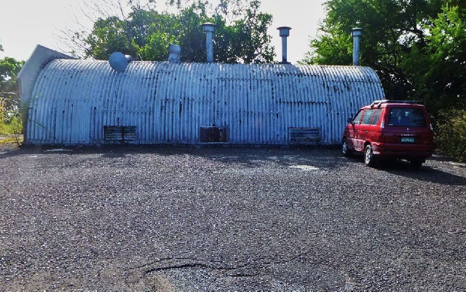 Y21- When you drive by these Quonsets that is what you see. I parked here to get a shot over the Cubi Point airfield of the Dungaree Beach area because a big project has been started there. 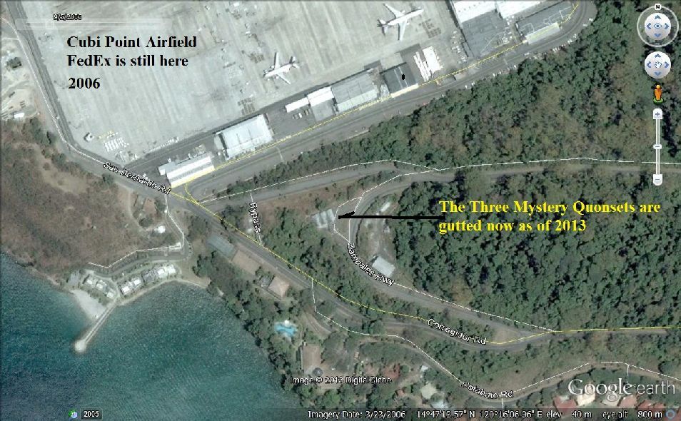 Y22- Google Earth location map (dated 2006) of the Three Mystery Quonsets on the former Cubi Point Naval Air Station, now the SBFZ which is now run by the SBMA in Subic Bay. 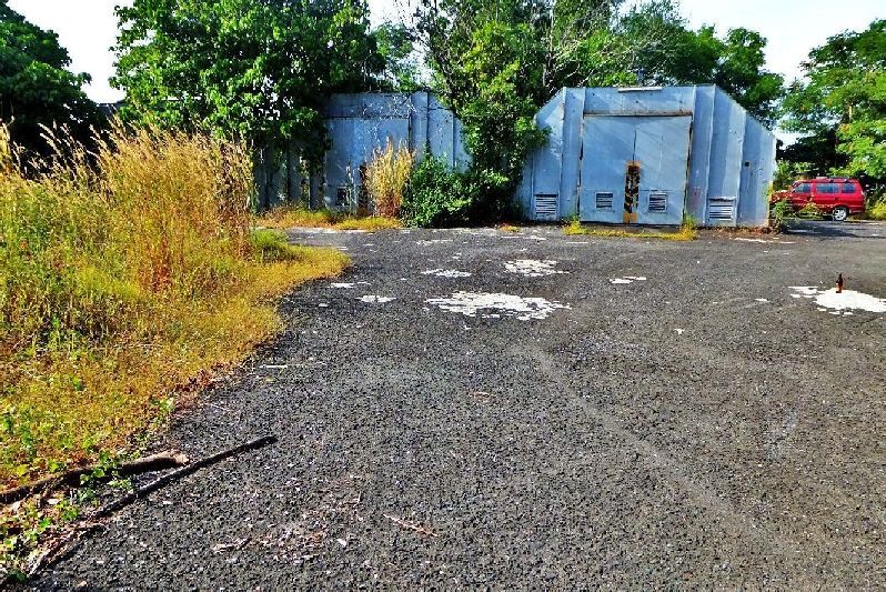 Y23- The front of the Three Mystery Quonsets, the trees have grown a bit, comparing them on the previous 2006 GE map image. 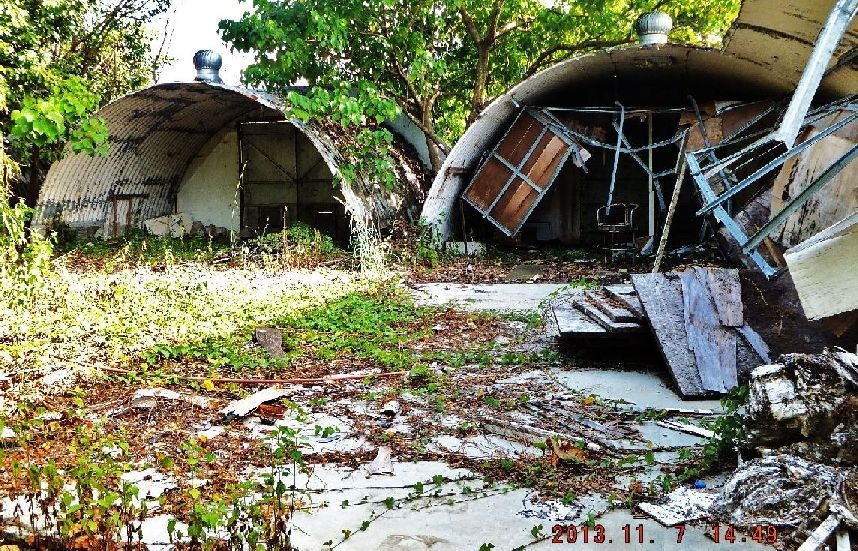 Y24- What a surprise, the 2 Quonsets out of view have been gutted, in the rear only, out of view, after 2009!!! I went here to get a shot of the Dungaree Beach area because a big project has been started there. 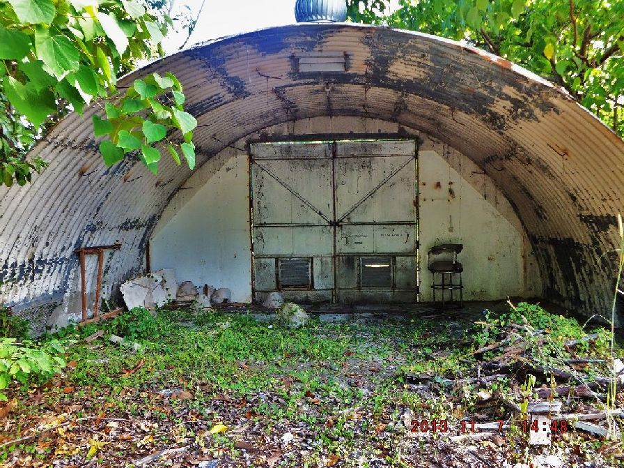 Y25- A closer view of what is left from the middle Quonset. |
|
|
|
Post by Karl Welteke on Nov 12, 2013 17:46:13 GMT 8
DUNGAREE BEACH PROJECT 2013 Now called “Sands of Triboa”. A friend told me a major project is happening next to the Dungaree Beach. It looks like Dungaree Beach is being incorporated into this project. I went there and took these pictures 2013-11-07. Don’t know what it is going to be, another resort? It would be kind of close to the runway! A web page with the name of “Sands of Triboa” says the following: Enjoy the peaceful, serene, and clean blue waters of Sands of Triboa. Previously known as Dungaree Beach, it has relaunched as Sands of Triboa and is set in improving its facilities and accommodations to give you an enjoyable experience while still retaining the affordability that it has always had. Located inside the Subic Bay Freeport Zone, this hidden retreat is your quick and easy get away from the hustle and bustle of the city. 14 pictures of this Dungaree Beach Project 2013 have been uploaded here: s74.photobucket.com/user/PI-Sailor/library/SBFZ%20Ex%20Naval%20Base%20Subic%20Bay/SBFZ%202012%20and%202013/At%20Dungaree%20Beach%20Project%202013?sort=9&page=1Here are 7 sample images: Remember the pictures are larger in the album above! 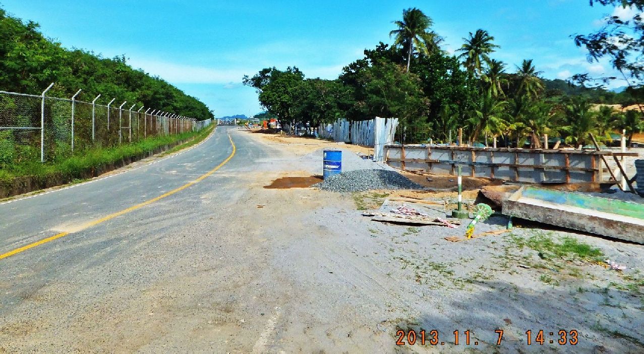 Y29---2013-11-07 Dungaree Beach view from near the end of the Cubi Point Airfield. One of the gates onto the airfield can be seen ahead, that is where this road makes a right turn before the gate. 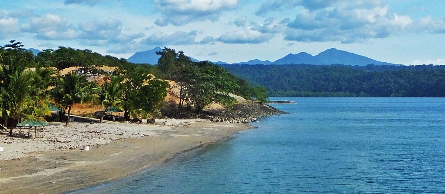 Y30---2013-11-07 Dungaree Beach view the way it was, how will it look in the future? In the distance is the mighty Mt. Natib volcano complex, caldera. The first Bataan Defense Line in 1942 was anchored on this mountain, west and east of it. 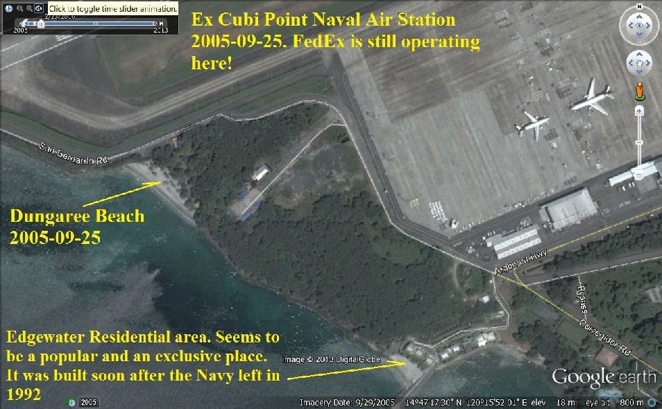 Y31---Google Earth location map of the Dungaree Beach on the former Cubi Point Naval Air Station, now the Subic Bay Freeport Zone (SBFZ) managed by the Subic Bay Metropolitan Authority (SBMA). 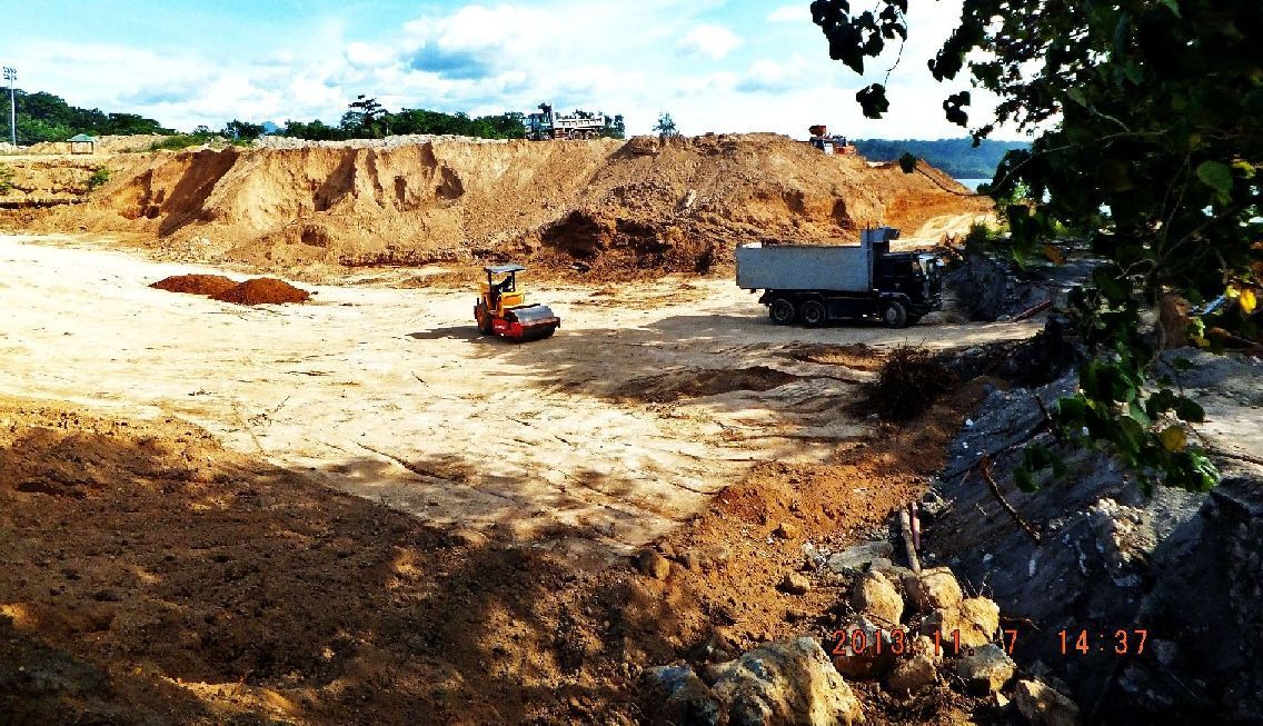 Y32---2013-11-07 A lot of heavy machinery and workers are preparing a lot of ground between the former Dungaree Beach and the Cubi Point Airfield at the SBFZ for a new project. 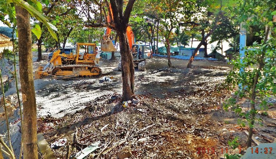 Y33---2013-11-07 A lot of heavy machinery and workers are preparing the ground between the trees of the former Dungaree Beach. 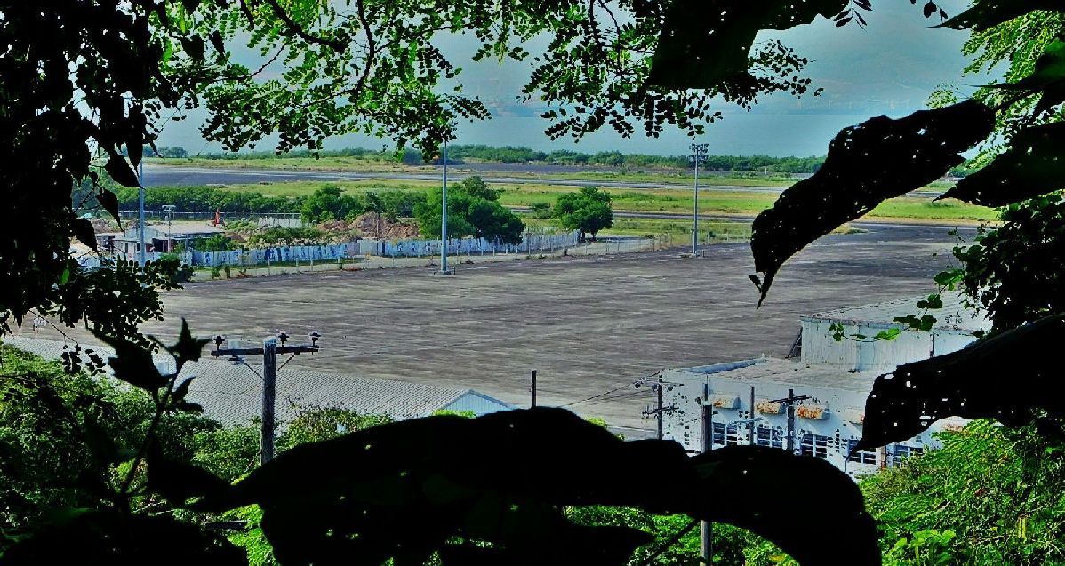 Y34---2013-11-07 A view of the project at the Dungaree Beach area across the Cubi Point Airfield at the SBFZ for a new project. This view is from the 3 Mystery Quonsets above the airfield hangars. 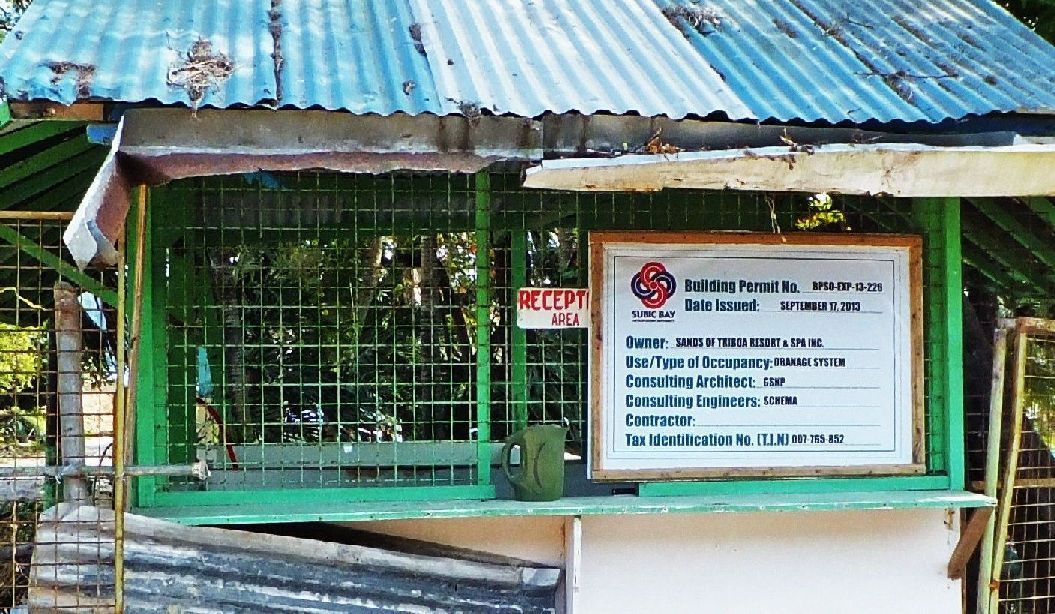 Y35---2013-11-07 This was the entrance to the Dungaree Beach. This sign gives some clues as to what this project is going to be. You can find info about this project with that name on the www. |
|
|
|
Post by fireball on Nov 13, 2013 4:55:40 GMT 8
THREE QUONSETS MYSTERY - I had a look through them in early 2012 and apart from signs of them having been lived in unofficially there was little to see. I just looked through my photos and see there was a 1998 calendar on the wall (not 1988 as I incorrectly put originally) & it does look possible they were refitted post Americans. The only indication of its possible previous use was"INERG COMBUSTABLE PHYSICAL CAPACITY" stencilled on the wall. But, INERG is just a guess as it it's unclear in the photo I took.
Incidentally the rear outside of the three huts were in perfect condition & looked very sturdy as no rust / lifting tin sheets / windows.
|
|
|
|
Post by fireball on Dec 14, 2013 5:34:01 GMT 8
Karl is doing a great & important job documenting Subic and its changes. He brings an in-depth knowledge of the Base as it was (combined with the energy to explore it now) at a time when so many of the old buildings are being destroyed or placed off limits. I had the benefit of Karl's company in 2011 for a tour of the Base and, as I think someone else said about something else, he took me to places I had never been before. It was also while looking around Karl's old workplace (the Diving Center) that I discovered his dark side: 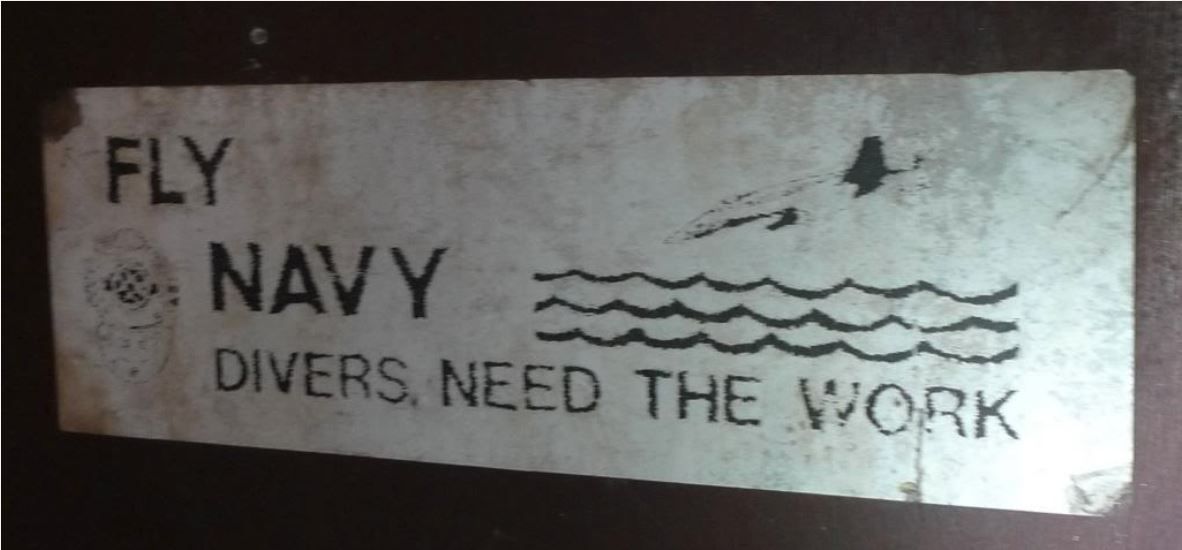 (14th Sep. 2018. Note from Karl: This picture had disappeared and is now showing again from a different server!) To my mind, even more than Clark AFB, a day spent exploring Subic is essential for anyone visiting the Philippines. So thanks Karl for the great work! |
|


