Post by Karl Welteke on Jul 12, 2020 8:05:18 GMT 8
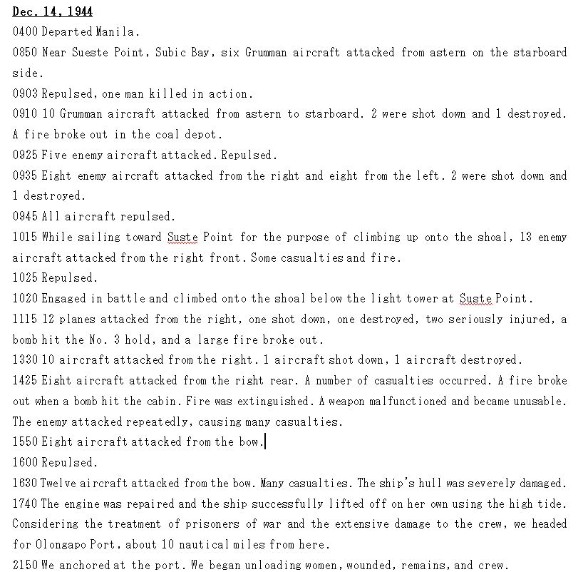
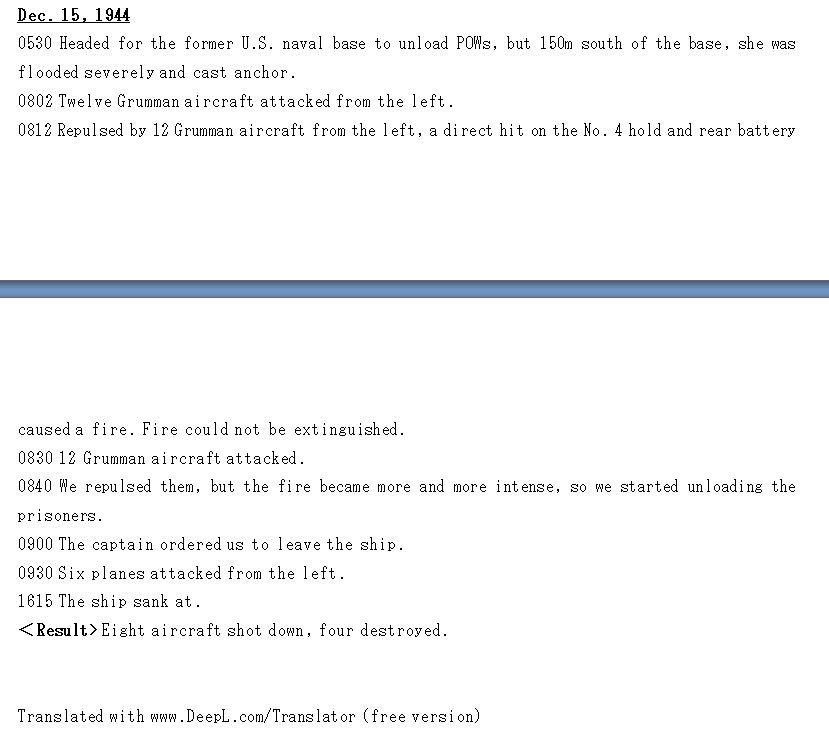
The grounding of the Oryoku Maru and more history of the area.
Previously I have said in this forum: 2017-10-14 note from K.W.W.: I cannot identify the exact spot in this picture, this could be at many places. The ship was hugging the coastline.
I studied it a little closer and I learned that Chad Hill, Mark Kelso and the Army Lt. Chester K. Britt Research Team have nailed down the location and I agree with them. But I add these pictures and graphics to add more to history of this area.
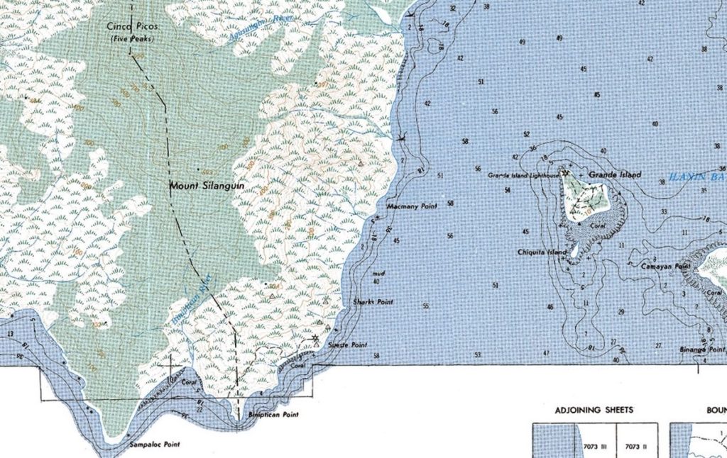
Zo802. A cropped section of the 1:50000 San Antonio, Zambales map, Sheet No. 7072 IV. It shows all the relevant landmarks.
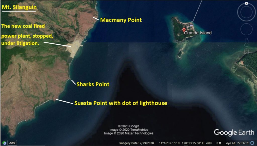
Zo803. A Google earth image of the entrance to Subic Bay with the relevant landmarks drawn in.
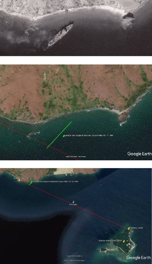
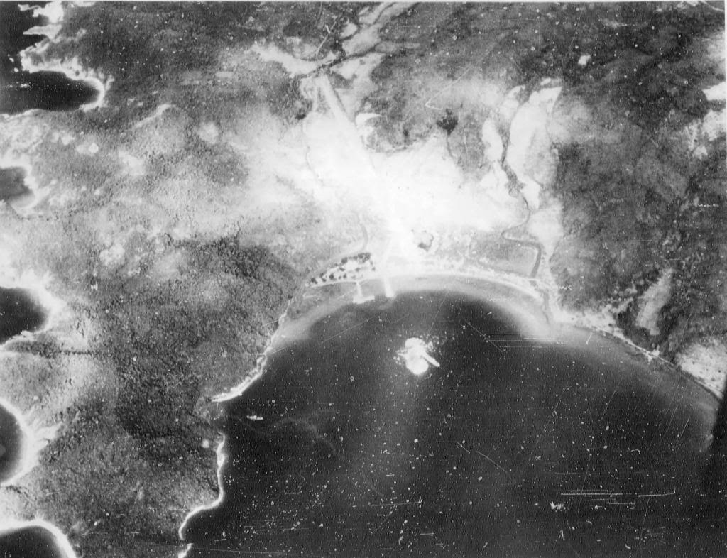
Zo804. A combination of 3 images put together by the Army Lt. Chester K. Britt Research Team. The team said this about these 3 images:
Top one is a photo provided by Tim Hampton, Air Group Eleven archivist showing the beached Oryoku Maru near Sueste point. Bottom photo was an earlier estimate of a possible line that the men firing from battery Jewel on Fort Wint may have taken firing at the barge approaching Sueste lighthouse noted in the attached report. Middle photo shows where the shot from December 1941 would have coincidentally intersected where the Oryoku Maru was beached in December 1945.
The above paragraph is connected to their research, writing a book about Army Lt. Chester K. Britt.
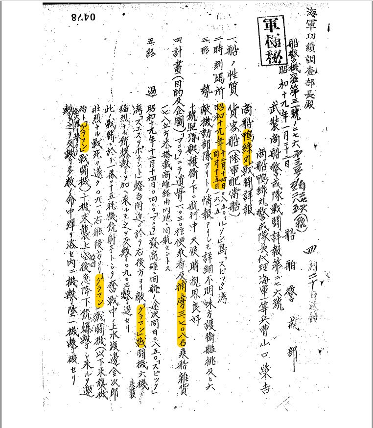
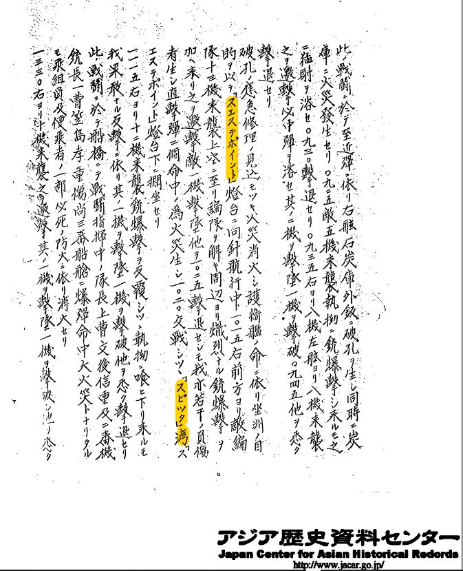
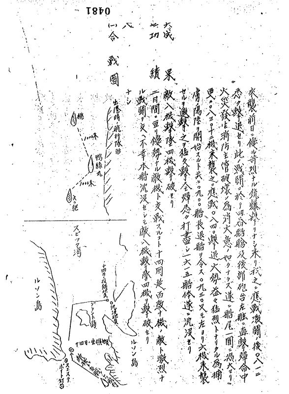
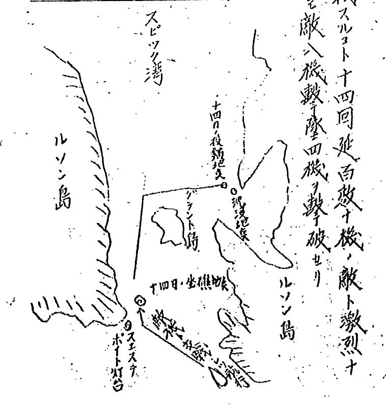
Their research lists two actions connected to the Sueste Point Light House area. One has a Japanese plane shot down and crashing into the water around the lighthouse and another has a barge being sunk around the lighthouse. We have looked everywhere on wreck maps of Subic Bay and can't locate any marker that matches either wreck. You might want to pass this on to your dive friends to see if they can locate either wreck. Would be a great find.
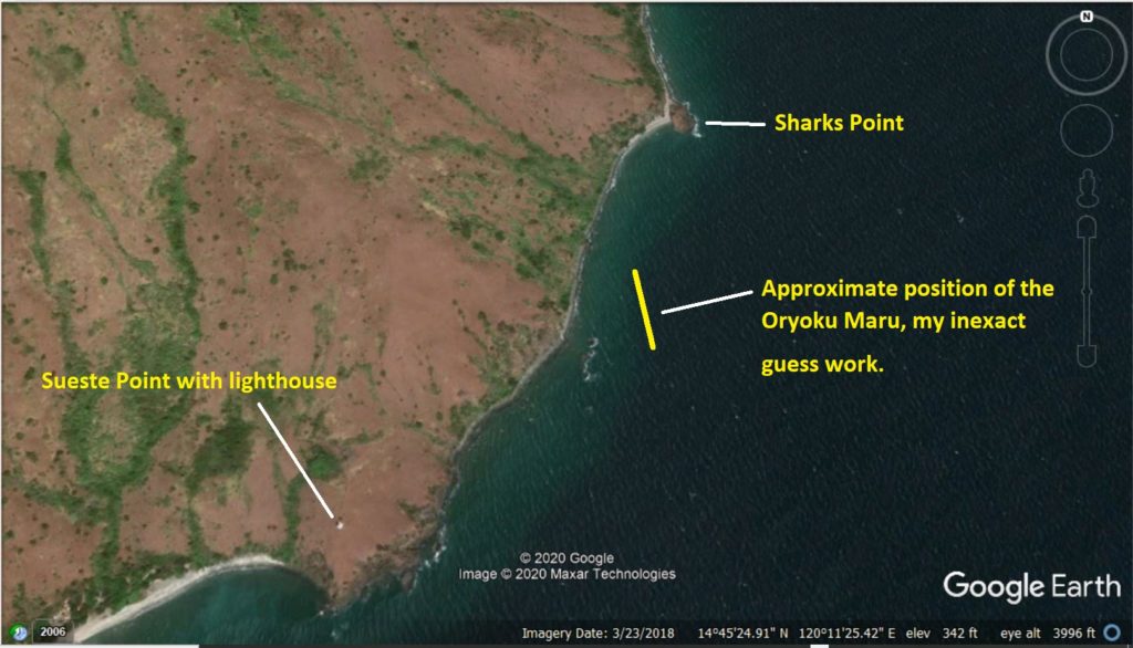
Zo805. A close-up Google Earth image of the area between Sueste Point and Shark Point, where the Oryoku Maru was aground for some time. I marked the picture with the relevant information.
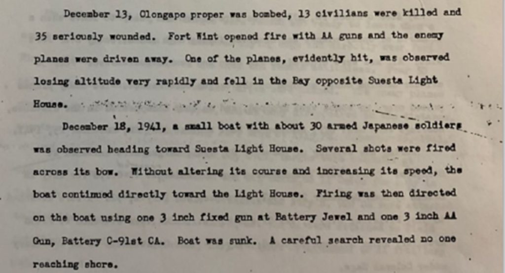
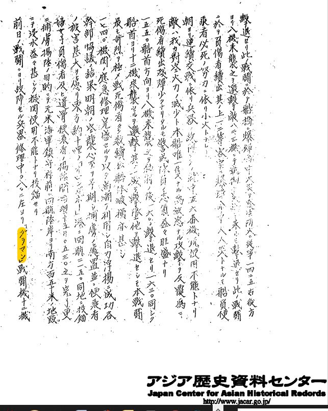
Zo806. Here is a copy of the two actions connected to the Sueste Point Light House area. These paragraphs are copied from the Fort Wint action report, covering the time from 8th Dec to the 25th Dec 1941. The report was submitted by the Fort Wint Commanding Officer Col. CAC Napoleon Boudreau. I will post the whole report to Fort Wint and Olongapo forum pages, one of these days.
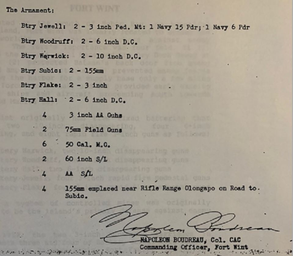
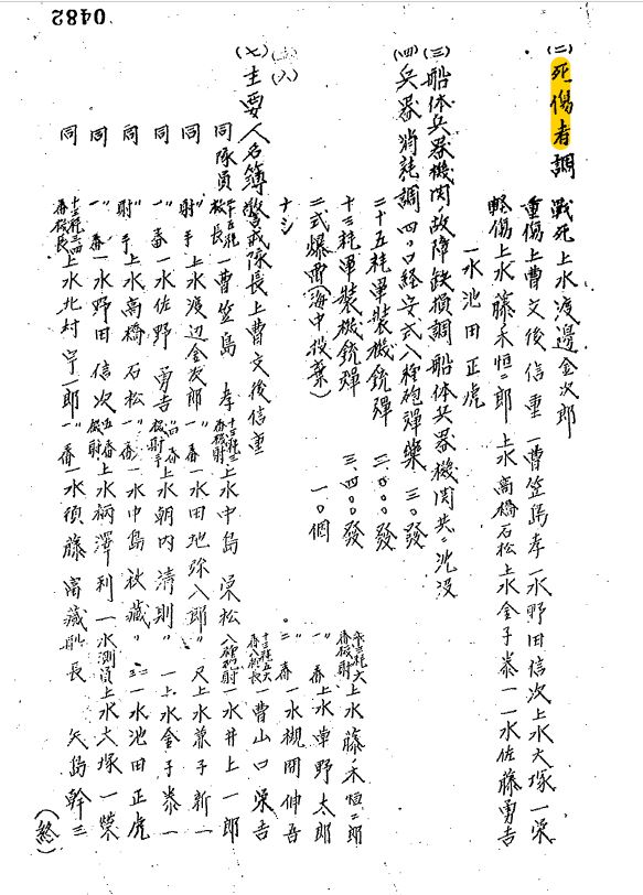
Zo807. Here is the signature of the Fort Wint Commanding Officer Col. CAC Napoleon Boudreau. The last paragraph of his report lists all the large caliber weapons he had under his command. I see (4) four 155mm artillery pieces were at the rifle range on the way to Subic. That is now the suburb Barrio Barretto, where I live now. I did not know that, that is news to me!
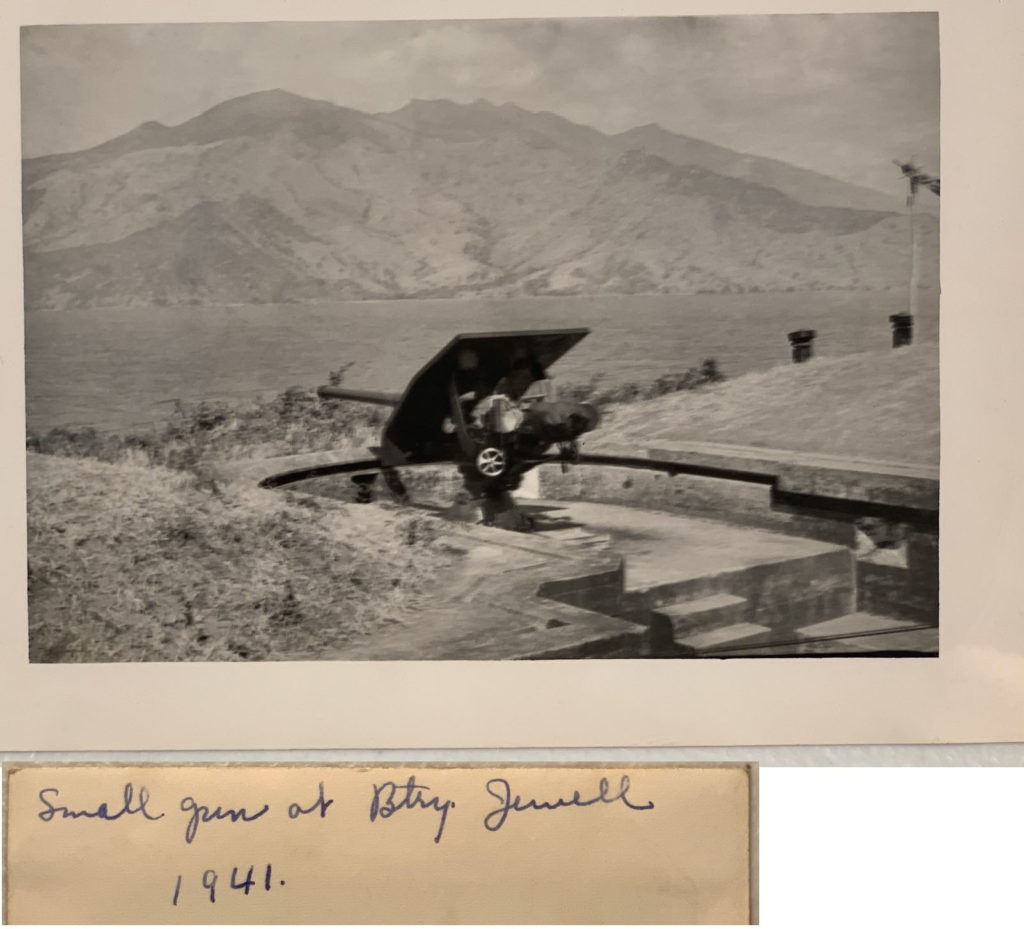
Zo808. The Army Lt. Chester K. Britt Research Team reports this: Also, report mentions a 3" gun at Battery Jewel. Attached is a photo of a 3" gun taken in 1941 which was labeled by Grace Britt, we assume some time after she was evacuated on 5/5/1941. Could be a gun that shot at that barge. We are guessing by coincidence that gun in the photo is aimed right about at Sueste Point. Again, you're welcome to use that photo. Pretty good shooting with a 3" gun to hit what I assume was a relatively small barge, that's roughly 4.4 miles from Battery Jewel to the light house area.
-------------------------------------------
U.S. Marine Coastal Defense in the Philippines
The Hell Hill Battery
The U.S. Marines installed Coastal Defense Artillery before the Army arrived and established the Coastal Defense Fort Wint on Grande Island. We established a forum page on the subject; this is not a comprehensive study of the subject. It is only, telling a story of a picture and pictures. These pictures came from the Earl Hancock "Pete" Ellis Picture Collection in the U.S.M.C. Archives, this is the URL of the form page:
corregidor.proboards.com/thread/2243/coastal-defense-philippines
Here are two pictures that relate to this area, specifically to Macmany Point, near Sueste Point.
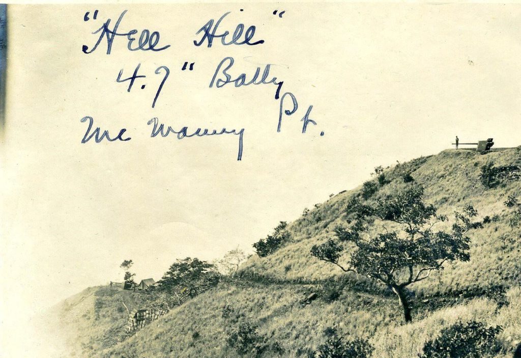
Ze739. There were more than 2 guns on “Hell Hill” in Subic Bay. Zoomed in we can see at least one other gun. Notice the tent and it seems wooden barrels are used to fortify a position, perhaps a magazine or bunker.
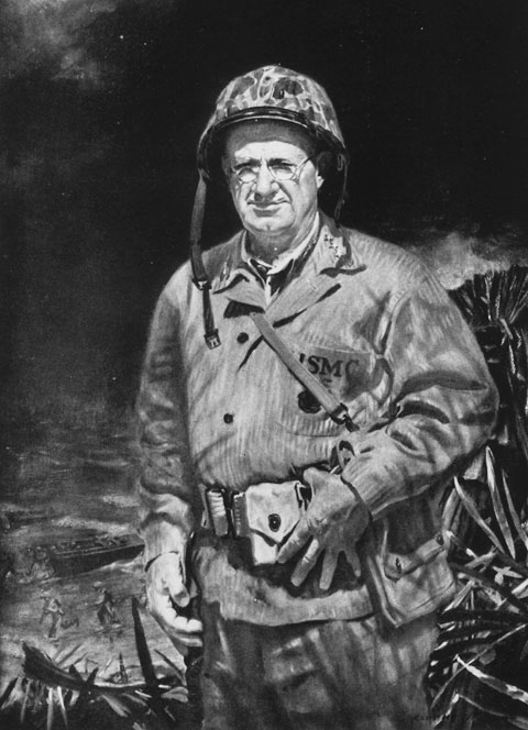
Ze742. GENERAL HOLLAND M. SMITH, U.S.M.C. From a painting by Commander Albert K. Murray, U.S.N.R. and this URL: Autobiography of General Holland "Howling Mad" Smith. Here is the URL:
www.ibiblio.org/hyperwar/USMC/Coral&Brass/index.html#index
Even GENERAL HOLLAND M. SMITH, U.S.M.C got in the shits as a young officer. As a young officer he got in trouble with his Commanding Officer in Cavite and got condemned to the battery on Hell’s Hill. Here, at Macmany Point, he had his first experience of violent death in service.
Previously I have said in this forum: 2017-10-14 note from K.W.W.: I cannot identify the exact spot in this picture, this could be at many places. The ship was hugging the coastline.
I studied it a little closer and I learned that Chad Hill, Mark Kelso and the Army Lt. Chester K. Britt Research Team have nailed down the location and I agree with them. But I add these pictures and graphics to add more to history of this area.

Zo802. A cropped section of the 1:50000 San Antonio, Zambales map, Sheet No. 7072 IV. It shows all the relevant landmarks.

Zo803. A Google earth image of the entrance to Subic Bay with the relevant landmarks drawn in.

Zo804. A combination of 3 images put together by the Army Lt. Chester K. Britt Research Team. The team said this about these 3 images:
Top one is a photo provided by Tim Hampton, Air Group Eleven archivist showing the beached Oryoku Maru near Sueste point. Bottom photo was an earlier estimate of a possible line that the men firing from battery Jewel on Fort Wint may have taken firing at the barge approaching Sueste lighthouse noted in the attached report. Middle photo shows where the shot from December 1941 would have coincidentally intersected where the Oryoku Maru was beached in December 1945.
The above paragraph is connected to their research, writing a book about Army Lt. Chester K. Britt.
Their research lists two actions connected to the Sueste Point Light House area. One has a Japanese plane shot down and crashing into the water around the lighthouse and another has a barge being sunk around the lighthouse. We have looked everywhere on wreck maps of Subic Bay and can't locate any marker that matches either wreck. You might want to pass this on to your dive friends to see if they can locate either wreck. Would be a great find.

Zo805. A close-up Google Earth image of the area between Sueste Point and Shark Point, where the Oryoku Maru was aground for some time. I marked the picture with the relevant information.

Zo806. Here is a copy of the two actions connected to the Sueste Point Light House area. These paragraphs are copied from the Fort Wint action report, covering the time from 8th Dec to the 25th Dec 1941. The report was submitted by the Fort Wint Commanding Officer Col. CAC Napoleon Boudreau. I will post the whole report to Fort Wint and Olongapo forum pages, one of these days.

Zo807. Here is the signature of the Fort Wint Commanding Officer Col. CAC Napoleon Boudreau. The last paragraph of his report lists all the large caliber weapons he had under his command. I see (4) four 155mm artillery pieces were at the rifle range on the way to Subic. That is now the suburb Barrio Barretto, where I live now. I did not know that, that is news to me!

Zo808. The Army Lt. Chester K. Britt Research Team reports this: Also, report mentions a 3" gun at Battery Jewel. Attached is a photo of a 3" gun taken in 1941 which was labeled by Grace Britt, we assume some time after she was evacuated on 5/5/1941. Could be a gun that shot at that barge. We are guessing by coincidence that gun in the photo is aimed right about at Sueste Point. Again, you're welcome to use that photo. Pretty good shooting with a 3" gun to hit what I assume was a relatively small barge, that's roughly 4.4 miles from Battery Jewel to the light house area.
-------------------------------------------
U.S. Marine Coastal Defense in the Philippines
The Hell Hill Battery
The U.S. Marines installed Coastal Defense Artillery before the Army arrived and established the Coastal Defense Fort Wint on Grande Island. We established a forum page on the subject; this is not a comprehensive study of the subject. It is only, telling a story of a picture and pictures. These pictures came from the Earl Hancock "Pete" Ellis Picture Collection in the U.S.M.C. Archives, this is the URL of the form page:
corregidor.proboards.com/thread/2243/coastal-defense-philippines
Here are two pictures that relate to this area, specifically to Macmany Point, near Sueste Point.

Ze739. There were more than 2 guns on “Hell Hill” in Subic Bay. Zoomed in we can see at least one other gun. Notice the tent and it seems wooden barrels are used to fortify a position, perhaps a magazine or bunker.

Ze742. GENERAL HOLLAND M. SMITH, U.S.M.C. From a painting by Commander Albert K. Murray, U.S.N.R. and this URL: Autobiography of General Holland "Howling Mad" Smith. Here is the URL:
www.ibiblio.org/hyperwar/USMC/Coral&Brass/index.html#index
Even GENERAL HOLLAND M. SMITH, U.S.M.C got in the shits as a young officer. As a young officer he got in trouble with his Commanding Officer in Cavite and got condemned to the battery on Hell’s Hill. Here, at Macmany Point, he had his first experience of violent death in service.


