FIRST TRY TO GET PERMISSION FROM THE PHILIPPINE MARINE BASE AT THE PICO DE LORO MOUNTAIN TO VISIT CARABAO AND FRAILE ISLANDS.
On the 21st Jan. 2015 I traveled to the Philippine Marine Base at Ternate to present my letter requesting information how to do that. I did speak to the leaders at the Marine Base gate but was told I need to go the Philippine Marine Corps Head Quarters on Fort Bonifacio.
This was the letter:
Karl-Wilhelm Welteke
Address etc
21st Jan. 2015
To: Commanding Officer Philippine Marine Corps Base in Ternate, Cavite Province.
Subj: Request information to get permission to visit the islands of Carabao and Fraile.
On the 28th Feb. 2014 the international organization Coastal Defense Study Group (CDSG) visited Carabao Island (the ex Fort Frank). Troops under your command directed us to leave the island, stating it was now part of your training area. We had organized the visit with Corregidor Foundation Inc. from Corregidor, notified the Philippine Coast Guard on Corregidor which provided an armed guard. The URL for the CDSG is:
cdsg.org/We did not know about this new arrangement and had visited Carabao Island and Fraile Island (the ex Fort Drum) several times before in past years. It was disappointing having spent much money to visit the Philippines to study the WWII Coast Defense of Manila Bay.
I am a friend of the CDSG, live as a permanent resident in the Philippines with my Filipino wife and child. With other people here and in the world we share a deep interest in the Philippine-USA History. As a retired US Navy man it is has become a personal hobby to study our history, to visit historical sites and share them with the public.
Corregidor.org
corregidor.org/ is a world renowned web page of the coastal defense forts in Manila Bay and Subic Bay, I am proud to have contributed to it.
This is the forum URL for the above web page (http://corregidor.proboards.com/) and here are just three particular contributions by me:
corregidor.proboards.com/thread/121/ex-fort-frank-carabao-islandcorregidor.proboards.com/thread/806/fort-drum-2009-august-14thcorregidor.proboards.com/thread/295/fort-hughes-caballo-island-marchWe have one more specific interest to find out from you and your command, if possible, whether the water source for Fort Frank on Carabao Island during the siege of the Manila Bay Forts came from a physical location on your base. If so would it be possible to visit and photograph that site?
Sincerely and with great respect
Karl-Wilhelm Welteke
After this disappointment I carried out my 2nd goal of walking up the Pico de Loro Peak in the Mt. Palay-Palay National Park. This mountain and its foot hills played important roles in the siege of Corregidor and the other Manila Bay forts.
My thoughts on this walk were about the Japanese artillery spotters on these ridges, the Japanese artillery placed behind ridges of the foothills of this mountain. The Japanese Imperial Forces cutting the water supply from this hill to Fort Frank on Carabao Island and the fort crew reestablishing that water line again was on my mind. That the American-Philippine Forces sent a detail onto these hills to spot the Japanese artillery but then were driven off. Another thought was that Capt Villamore flew a mission over here on the 9th of Feb, 1942 to spot the Japanese artillery; that action resulted in a dogfight over Mt. Mariveles with Lt. Earl Stone and his enemy crashing onto the Tarac Ridge on Mt. Mariveles.
Here are some relative images about this trip:
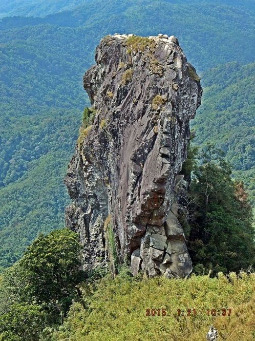
X33. The landmark Pico de Loro, it only can be seen from the top or from the SE to SW directions. People actually climb onto that peak, not me though. This is a popular hiking goal and there is much on the www about it.
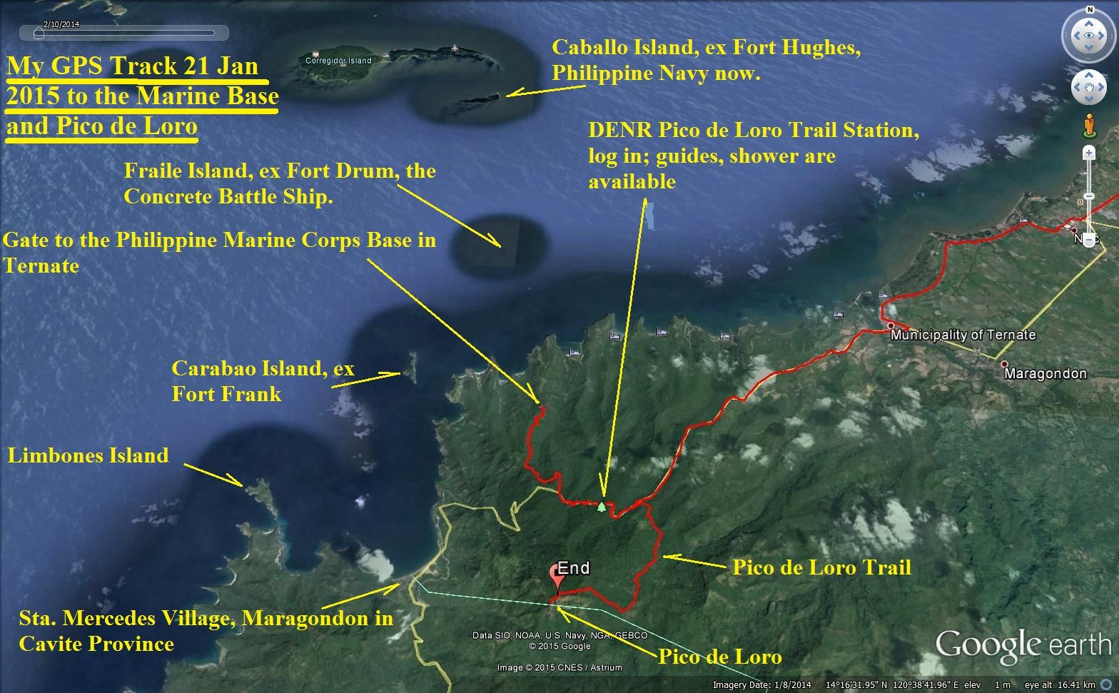
X34. The landmarks of the trip and the GPS track to the Marine Base Ternate gate and the track to the Pico de Loro peak.
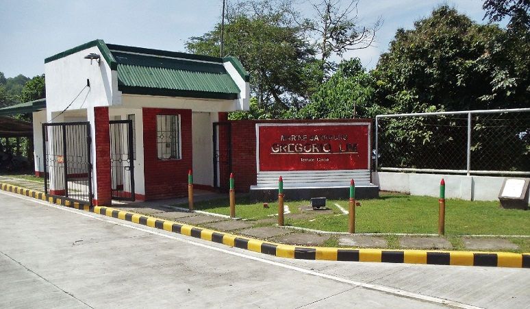
X35. The Marine Corps gate shack, they set me down and leaders of the gate came but said that I needed to go to the Philippine Marine Corps Head Quarters on Fort Bonifacio. On base is a public beach but they asked for a passport, my Philippine driver license and Subic Bay Metropolitan Authority ID card was not good enough.
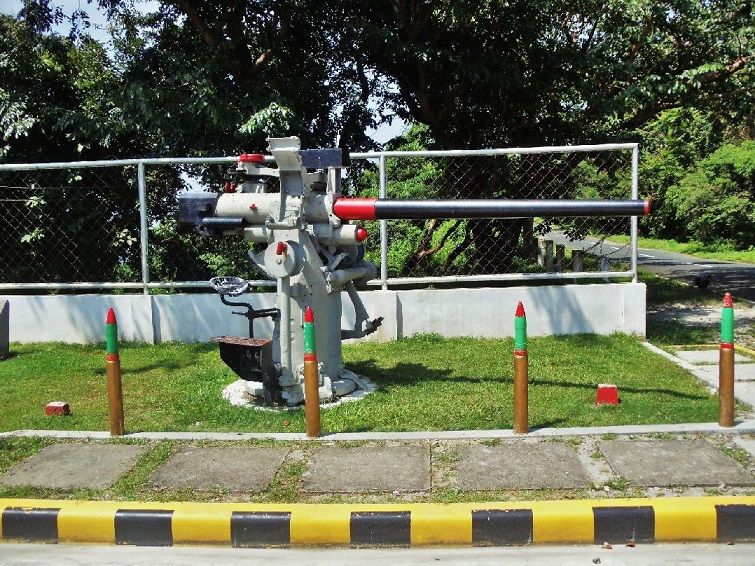
X36. At the Ternate Marine Base gate they have the decorative naval gun.
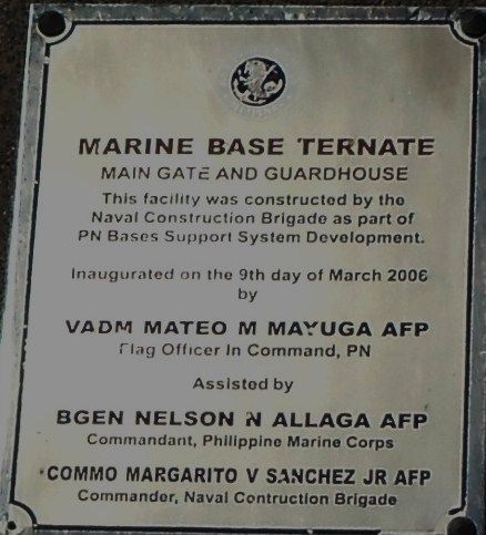
X37. This information plaque is also mounted outside the Ternate Marine Base gate to view.
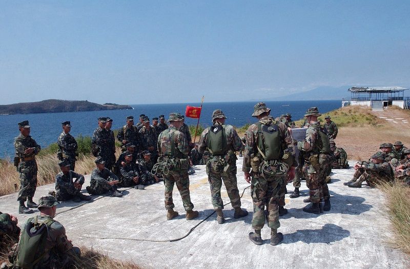
X38. This picture came from US Government sources and shows US and Philippine Marines in training on the Ternate Marine Base. What was of interest to me, it shows Carabao Island. I wonder did the island and Ft. Frank get their water from near here.
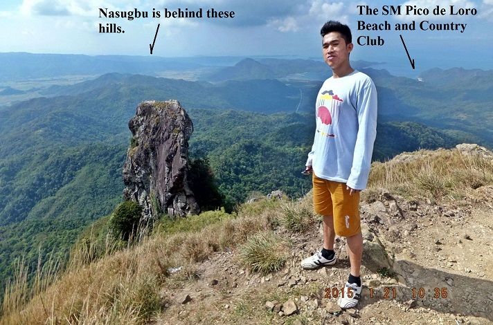
X39. On top of the Pico de Loro peak, that young man is an in-law relative and was my partner on this trip. We met three groups of hikers coming and going on this Wednesday; all three were or are going to camp up there.
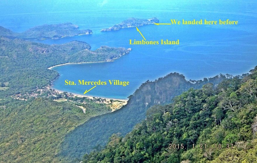
X40. This view from the Pico de Loro peak is in a west direction and shows the village of Santa Mercedes where John Moffitt and I rented a boat and visited Carabao and Limbones Islands in 2012.
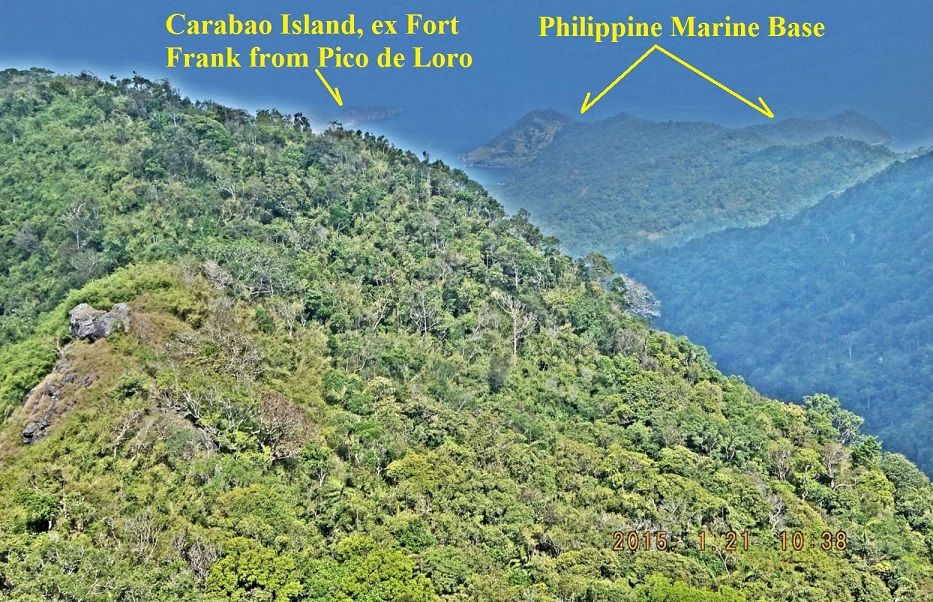
X41. This view is in the north direction from Pico de Loro peak. It was a very hazy day and Carabao Island only can be partially seen. I am sure the Japanese spotters were in a better position.
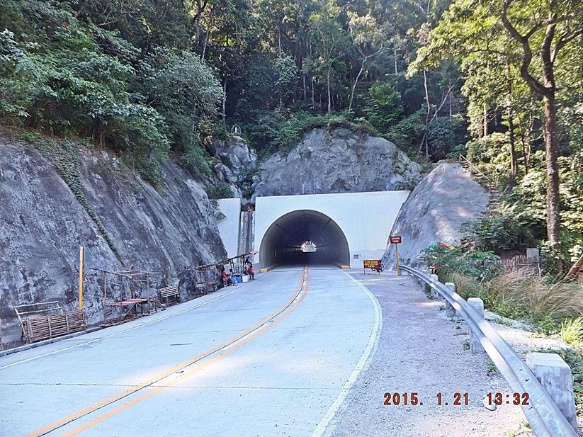
X42. After the walk up the Pico de Loro Hill I wanted to check out the new and now opened tunnel from Ternate to Nasugbu. The Marines had a manned check point at the other side, the Nasugbu side; but we were not stopped.
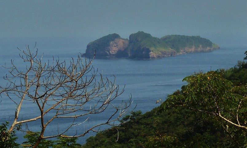
X43. Carabao Island (the ex Fort Frank) from the new Ternate-Nasugbu Road, this is a 2012 picture. It is the object of all this effort to get permission to visit this historical island.
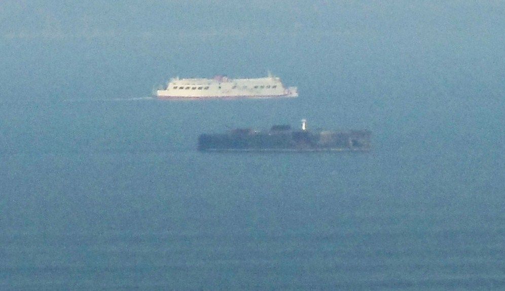
X44. Fraile Island, the ex Fort Drum. This is also a 2012 image; it was a hazy day then also. This image was shot from near the Ternate Marine Base.
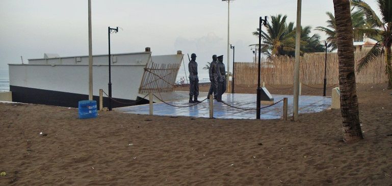
X45. I continued to Nasugbu to stay there over night. Nasugbu is also a historical place, on the 31st of Jan. 1945, in a few days 70 years ago, the Allied Forces landed here and marched on Manila to liberate it. The people here built this Memorial on the beach in a form of a landing boat. Will they observe the 70 Anniversary of this landing here in a few days?
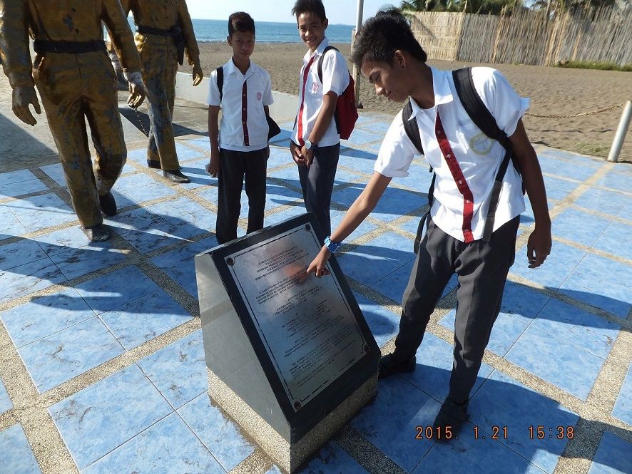
X46. I asked the student when the landing had taken place and had to direct him to the marker plaque to find out and he showed me the date.
Here is a link in our forum exploring the area:
History Trip 2012 Oct 14 to 16 to Cavite, etc
corregidor.proboards.com/thread/1321/history-trip-2012-oct-caviteIf anybody has a suggestion who and how to see to get permission to visit those two islands, please say so.