|
|
Post by Karl Welteke on Aug 24, 2014 14:08:55 GMT 8
EXPLORING THE VILLA VERDE TRAIL AND THE BALETE OR DALTON PASS Both locations are located in the Caraballo Mountains which connect the Cordillera Mountains with the Sierra Madre Mountains. The Japanese Army had retreated into the Cordillera Mountains and into the Cagayan Valley. After Manila and Central Luzon was liberated the march after the Imperial Army in the north started at the end of Feb. 1945. The 33rd Div went towards Baguio. The 32nd Div. went to Santa Fe via the Villa Verde Trail and the 25th Div, advanced via San Jose, the Balete Pass also towards Santa Fe. 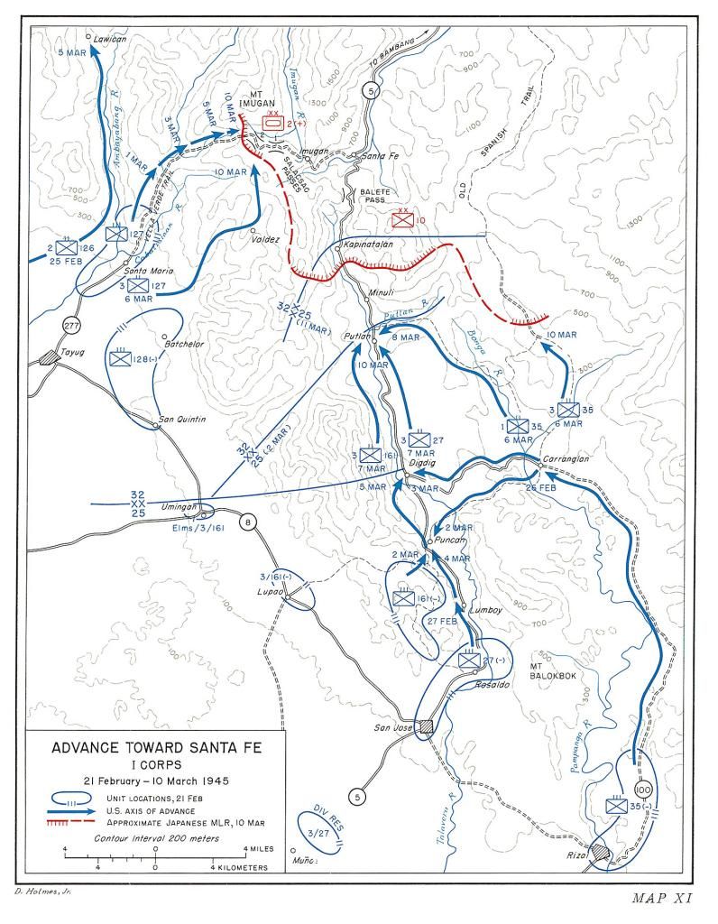 Z759---this image from the Army publication Triumph in the Philippines [Chapter 26] Villa Verde gives you the big picture.  Z759a---this is a large copy of the Army publication Triumph in the Philippines [Chapter 26] Villa Verde map. On the 18th to the 20th Aug 2014 I drove to the Caraballo Mountains to explore the battle field in order to get a clearer picture of the geography so I can better understand the written material available about this very difficult and bloody battle. 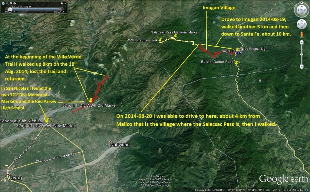 Z760---this GE image includes the three GPS tracks of the three different walks I did in exploring the Villa Verde Trail and driving thru the Balete (also known as the Dalton Pass). It also includes the Placemarks of the different memorials and other historical markers I seen.  Z760a--- this is a large copy of the GE image that includes the three GPS tracks. I started out at San Nicolas and recorded three important historical Placemarks. 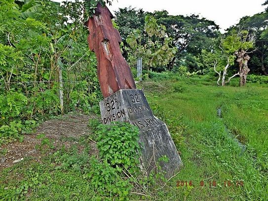 Z761---the old 32 Div. Memorial Marker is located exactly at the beginning of the Villa Verde Trail. The 32nd Inf. Div. wore the Red Arrow Symbol on their uniform sleeve and it is the Division symbol. 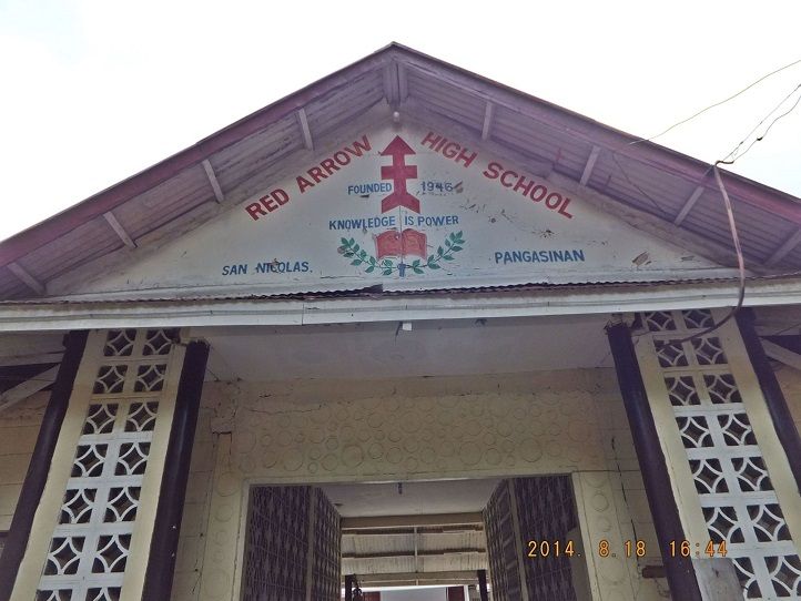 Z762---the 32nd Div. must have made great impression on the local community and maybe helped in getting the high school started here in 1946. The San Nicolas High School apparently was established in 1946 and was named the Red Arrow High School. 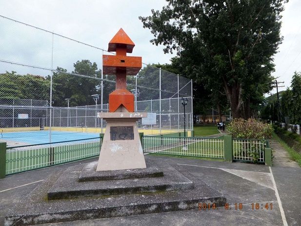 Z763---in later years the Officers and Men of the Division erected a new Red Arrow Memorial Marker at the SW corner of the San Nicolas Municipality Compound. 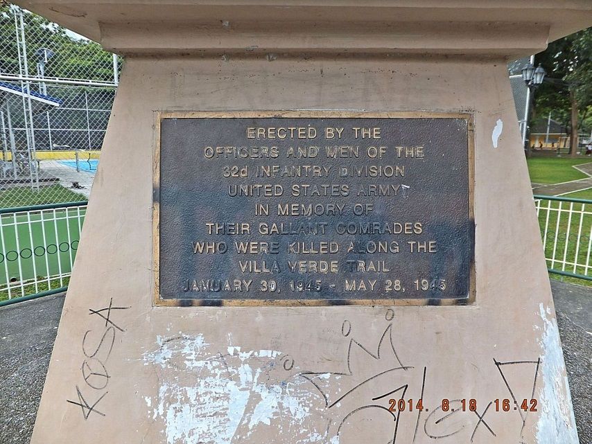 Z764---this is the plaque on the new 32nd Inf. Div. Memorial Marker located at one corner of the San Nicolas Municipality Compound. San Nicolas did not have any lodging but there was a swimming pool resort towards the Villa Verde Trail from San Nicolas and it was not that reasonable priced. It was called Kristal and I stayed there one night, next morning I drove to San Jose and then up to the Balete Pass. The Balete Pass, also called the Dalton Pass is where Highway No 5 goes thru and all traffic to the Banaue Rice Terraces and the Cagayan Valley can’t miss all the WWII Memorial that have been built here. For the purpose of this introduction I will present only two images. 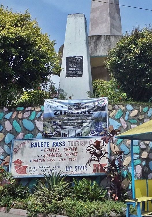 Z765---this is the Memorial in Honor of the 25th Inf. Div. 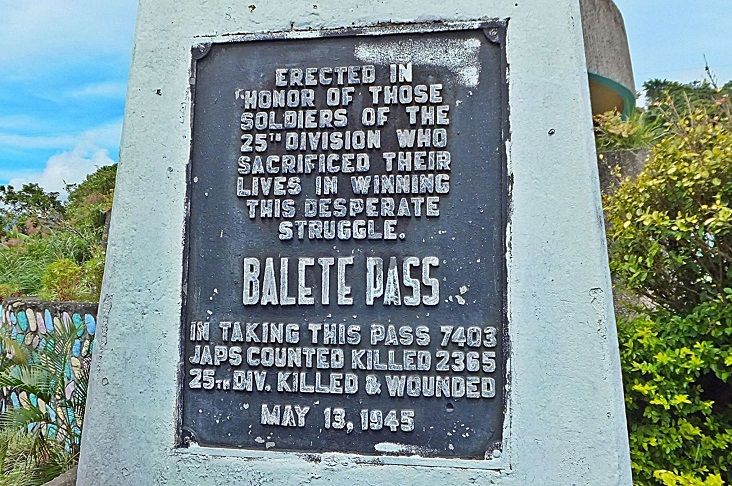 Z766---the plaque on the 25th Inf. Div. say in part that in taking this pass 7403 JAPS COUNTED KILLED 2365 25TH DIV. KILLED AND WOUNDED. It was bloody, it was 3 month long, it was hell, and it was for the liberation of the Philippines and to defeat the imperialistic Japanese Empire. Then I descended on the zig-zag road to Santa Fe and was pleasantly surprised in that Santa Fe had reasonable priced lodging and I booked for two nights. Then I changed, hired a tricycle and went to the Imugan Village that is on the way to the Salacsac Pass. It is 7 km to Imugan and 5 km are paved and widened to a two lane road as the new Pangasinan-Nueva Viscaya Road. The trice was 135 peso. Then I walked up towards the Salacsac Pass another 3 km and found the major road construction is also going on here. So I made the plan for tomorrow to ride up here as far as I can and then walk to the Salacsac Pass. Then I walked down to Santa Fe, about 10 km and called it a day. On the third day I was able to drive to about 4 km from Malico that is the village where the Salacsac Passes are. The clouds still blocked my view but were gone in two hours. The old road was ok where it still existed. Because of the construction of the new widened Pangasinan to Nueva Viscaya the road was not drivable for my car and parked it at a construction site. I went to the school in Malico Village and the principle assigned three young students as my guides. They took me about 2 ½ km down the San Nicolas Road, the Villa Verde Road, to the tank that is still there from WWII. They also pointed me in the direction of Salacsac Pass WWII Memorial. Then I walked back to the car and went home to Olongapo the next day. 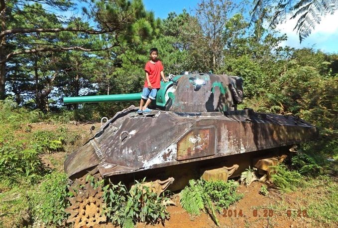 Z767---the WWII Sherman tank abandoned on the Villa Verde Trail, it is about 2 ½ km from the Salacsac Pass towards San Nicolas. and about 100 meter lower in elevation. 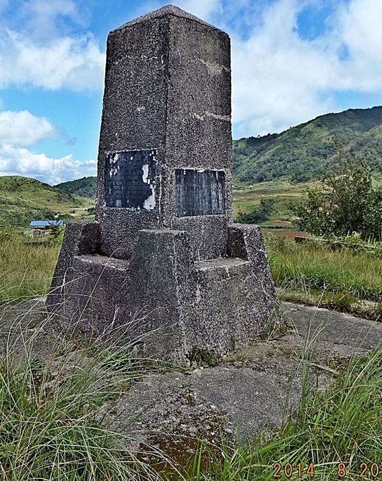 Z768---the Salacsac Pass area is like a plateau with low hills/knobs, on the highest one the Japanese, the people here with the support of the 32nd Inf. Div. erected a Memorial to remember all the dead, all the sacrifices. 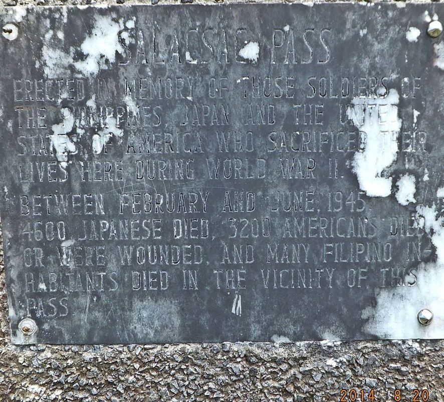 Z769---this plaque says that between Feb.-June 1945 4600 Japanese died, 3200 Americans died or were wounded and many Filipino Inhabitants died in the vicinity of this Salacsac Pass. 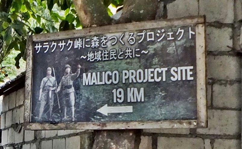 Z770---at the beginning of the road to Malico Village and Salacsac Pass, next to the National Highway No. 5 is this sign for the Malico Project, the Salacsac Pass Memorial Marker. This is only the beginning of this thread; in the future I will establish image albums about this exploration and share the images here. |
|
|
|
Post by dmether on Aug 26, 2014 9:46:46 GMT 8
Hiill 604 on the Villa Verde Trail 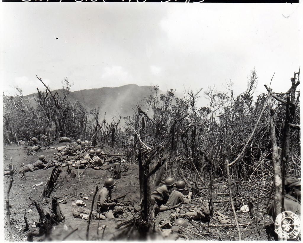 |
|
|
|
Post by Karl Welteke on Aug 28, 2014 16:52:44 GMT 8
32nd INF. DIV. RED ARROW MEMORIAL MARKERS AT VILLA VERDE TRAIL The 32nd Infantry Division started their advance up the Villa Verde Trail, here in San Nicolas Town in Jan. 1945. It was a hard and long struggle. The Division built two Memorial Monuments in the San Nicolas, one in 1945 and the newer one later but I don’t know when. The Division must have made an impression on the local population because they named their High School the Red Arrow High School. A good reference of the battle to clear the Villa Verde Trail is Chapter 26 of the US Army publication: “Triumph in the Philippines” by Robert Ross Smith. Here is the URL: www.ibiblio.org/hyperwar/USA/USA-P-Triumph/USA-P-Triumph-26.htmlAt the end of this chapter it says this: The three infantry regiments of the 32d Division had suffered the following battle casualties during their operations to clear the Villa Verde Trail and adjacent terrain.  Z803 In addition, another 6,000 or so of the 32d Division were evacuated from the front lines either permanently or for varying periods of time because of sickness and disease of all types, mainly respiratory infections, skin troubles, intestinal afflictions, and combat fatigue and associated psychoneurotic upsets. I established an album about these Markers with 20 images including 2 maps and all the images have descriptions; this is the URL of this album: tinyurl.com/nlnnfdkAnd here are 10 sample images: 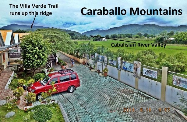 Z804--- after a long drive from Subic Bay to San Nicolas my first priority was finding a place to stay. I stayed here at the Kristal Resort for 2000 peso the night; it is half way between San Nicolas and the beginning of the Villa Verde Trail. And this was my first view of the Caraballo Mountains and the ridge the Villa Verde is running up on. 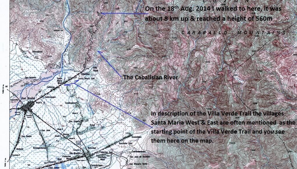 Z805---this section of a 1: 50000 topographic map help you get orientated in the San Nicolas Town and the Villa Verde Trail area. This is the URL for the NAMRIA 1:50000 map (Sheet No. 7175-II San Nicolas) which covers San Nicolas, Villa Verde Trail, Balete Pass and Santa Fe: www.namria.gov.ph/7175-IISanNicolas.html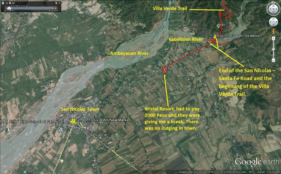 Z806---this Google Earth image covers the same area (San Nicolas and the Villa Verde Trail) and it helps understand the geography better that just looking on a map. 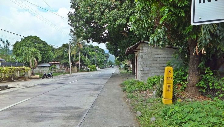 Z807---as I was approaching the Villa Verde Trail and I seen this km stone and I thought: “Jesus, a marathon and up 1300m, that is going to be fun”. But then I was only exploring this time. 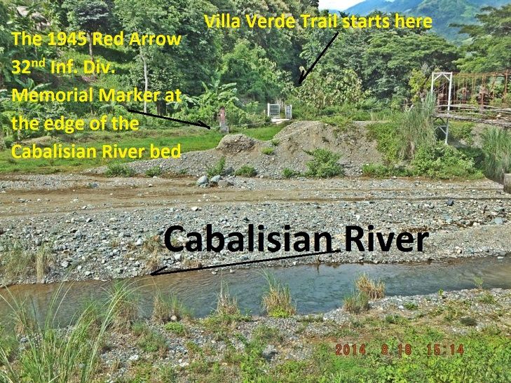 Z808---the National Road ended abruptly at the Cabalisian River but one crosses the river on that hanging foot bridge. It is about 3 km from San Nicolas. That gate leads to private property and not to the trail. I started the hike right away and one has to swing to the right around some trees and maneuver along a wet foot path to get onto the trail. I only noticed the 1945 Memorial Marker of the 32nd Inf. Div. when I returned. I almost missed it and only got aware of it because I was watching a heavy loaded truck getting thru the river. 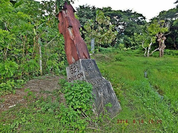 Z809--- the 32nd Inf. Div. 1945 Memorial Marker at the beginning of the Villa Verde Trail. Sitting practically in the Cabalisian River bed caused the monument to lose some of its stability. 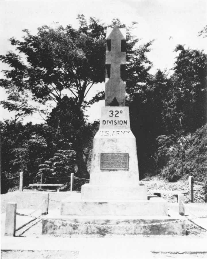 Z810---this picture of the old 32nd Inf. Div. 1945 Memorial Marker at the beginning of the Villa Verde Trail is from the web pages of the 32nd Inf. Div Association. I wonder whether that metal plaque is the same one as the one on the new Marker. This is the actual URL where the picture came from. www.32nd-division.org/history/ww2/32ww2-13.html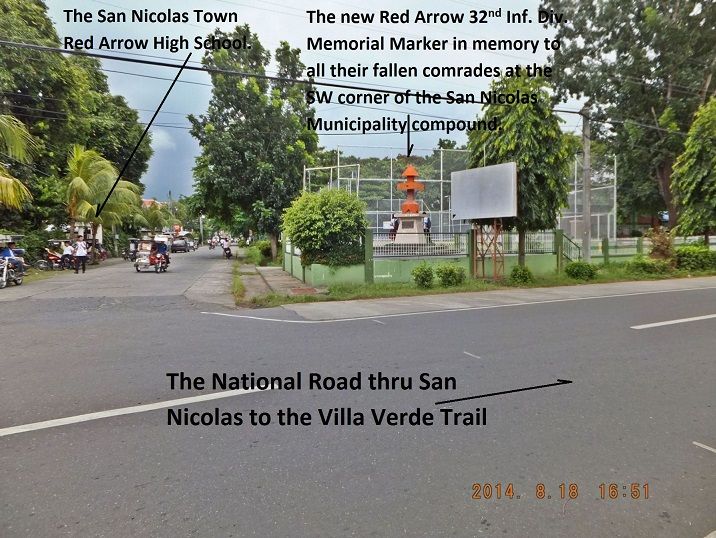 Z811---when I arrived in San Nicolas I noticed this Marker and was going to look for it after my exploring hike. Mistakenly I associated that marker with the San Nicolas High School; that is the reason I searched for another Memorial Marker and was a little confused in my search later. That location is actually the SW corner of the San Nicolas Municipality compound and that is the new 32nd Inf. Div. Memorial Marker. 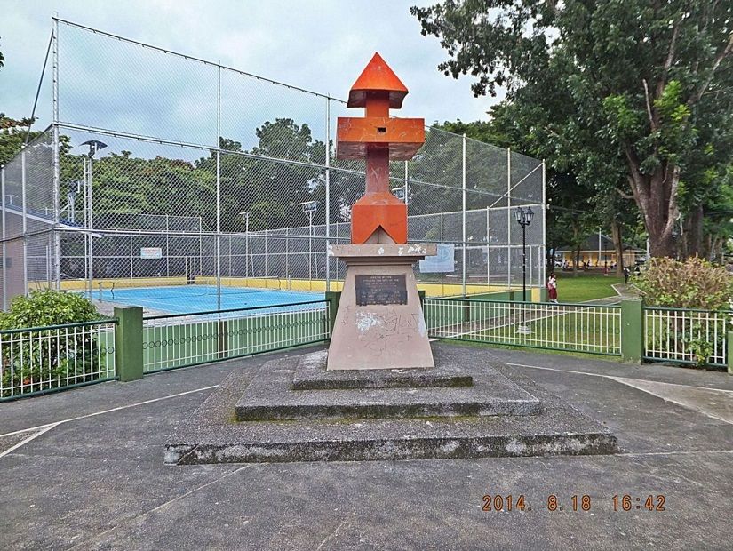 Z812---that is the new 32nd Inf. Div. Memorial Marker and it is located at the SW corner of the San Nicolas Municipality compound. The plaque is shown in the introductory and first segment in this thread above. I asked many people at the compound, including the police that I was looking for the 32nd Inf. Div. Monument and the Villa Verde Trail Monument but people did not understand me or did not know where it was or knew that it is was right there at the Town Hall compound. Then I went to the Mayor’s office, he was not there and the about 6 office personnel also did not know. Then one person got a Fiesta Book and started looking because he remembered something. He showed me something about the Red Arrow high School. I said thank you and proceeded to the High School and then seen the Memorial Marker right away!!!! 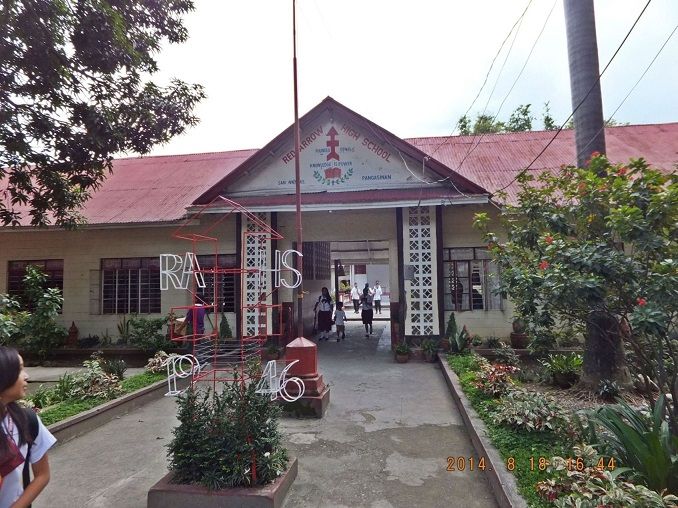 Z813---the new 32nd Inf. Div. Memorial Marker is at the very SW corner of the San Nicolas Town Hall compound and the entrance to the High School is about 150 feet diagonal across the street from this Memorial Marker. The 32nd Infantry Division must have been an important player in the history of San Nicolas at that time. The people decided to name their High School the Red Arrow High School in 1946, it appears. But here is the sad part (very sad to me) I asked three different student groups, it was afternoon school out time, why the school had the name Red Arrow, none knew. Then I asked what that Memorial across the street was and again no one knew!!!!!!!! |
|
|
|
Post by Karl Welteke on Sept 4, 2014 17:41:36 GMT 8
32nd INF. DIV. UP THE VILLA VERDE TRAIL 1945 THIS SEGMENT DISCRIBES THE FIRST 8Km OF THE VILLA VERDE TRAIL On the 18th Aug. 2014 I drove to San Nicolas, Pangasinan which is the last town on the way to the Villa Verde Trail. I arrived about noon, found a place to stay and marched up the trail. I was here for the purpose to explore the beginning of the Villa Verde Trail. The next day I planned to drive to Santa Fe, Nueva Viscaya and explore the top end of the trail. At the 8km mark I turned around and got a good feel of the beginning of the Villa Verde Trail and considered the mission accomplished. During the walk I took pictures and uploaded 35 images into this, one of my albums: tinyurl.com/ne87u3lAnother good reference about the difficult struggle up the trail is this URL from the 32nd Inf. Div. Association: corregidor.proboards.com/thread/1694/villa-verde-trail-balete-daltonAs usual I present some sample pictures here from my album above and the URL from the 32nd RED ARROW Inf. Div. above. The numbered pictures and description Z830 to Z833 are from the 32nd Div Association URL above: 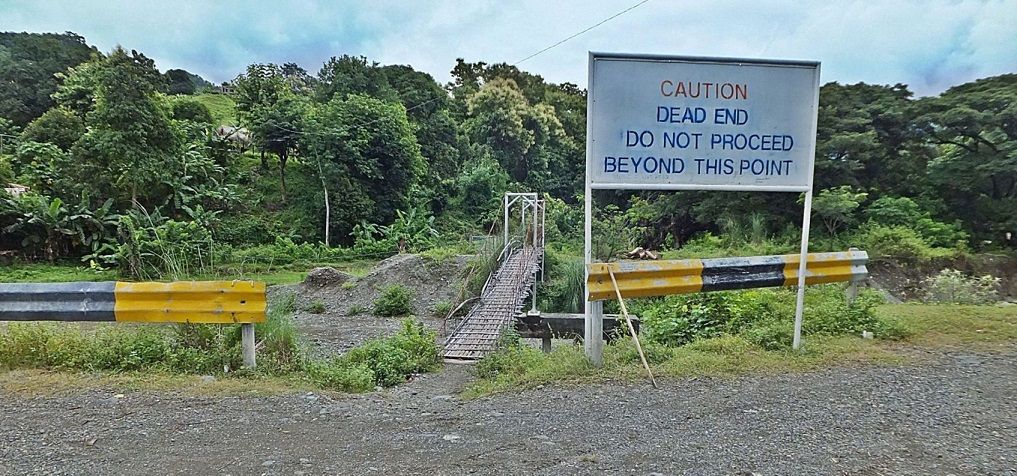 Z828--- the end of the line to the Villa Verde Trail, the road from San Nicolas ends here at the Cabalisian River edge. This area is often called Santa Maria East in the Villa Verde Trail description but it may be the Cabalisian Community. Once upon a time here was a vehicle bridge across the Cabalisian River and I read that up to 1970 vehicles still could drive all the way up to the village Malico at the Salacsac Passes. 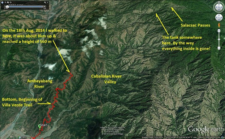 Z829--- this is my GPS track and other landmarks on the Villa Verde Trail. I arrived here at noon and walked up the 8km and then returned, that was my plan. Tomorrow I drive to Santa Fe in Nueva Viscaya, and explore the other end of the Villa Verde Trail. 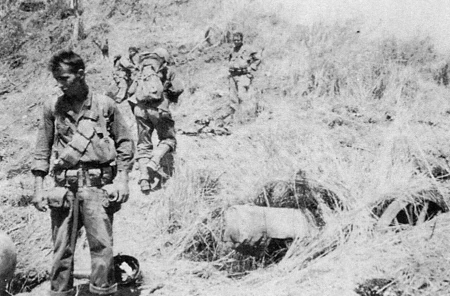 Z830--- a very effectively camouflaged Japanese artillery piece that was captured by the 2D Battalion, 127TH Infantry on the Villa Verde Trail circa 5 February 1945. The Japanese used this gun to attack bombard the road between Santa Maria and San Nicholas until it was silenced by counter battery fire from the 126TH Field Artillery Battalion. 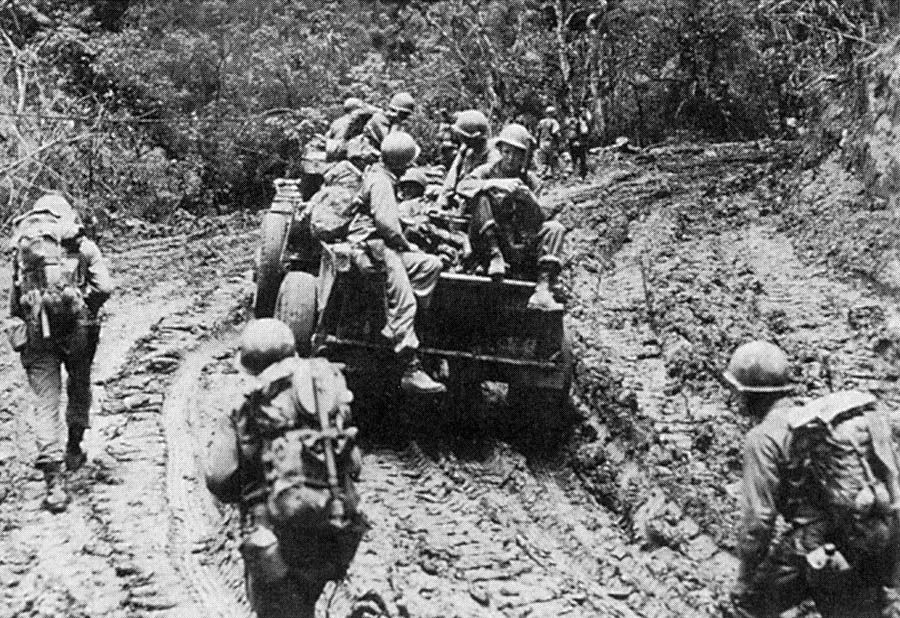 Z831--- 32D Division Soldiers advancing up a particularly muddy section of the Villa Verde Trail on Luzon in May of 1945. 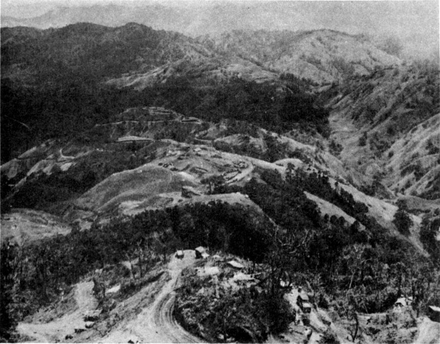 Z832--- aerial view of the Villa Verde Trail near San Nicolas, Luzon. 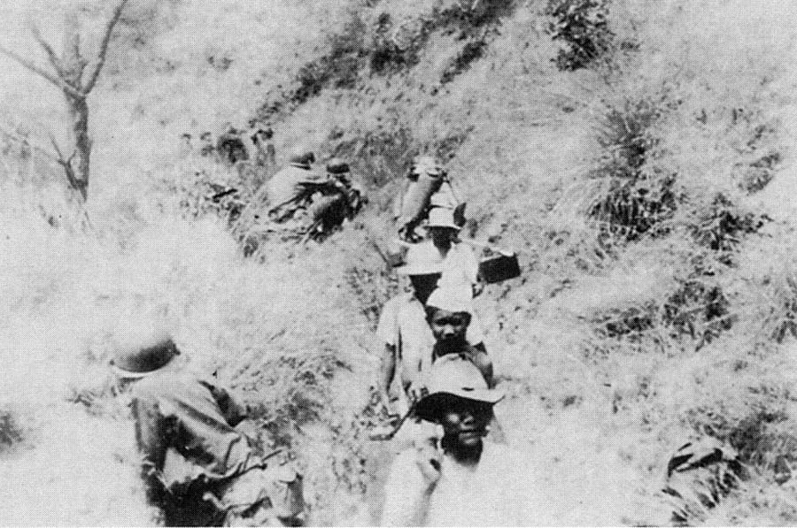 Z833--- Filipino carriers deliver ammunition and water to 2D Battalion, 127TH Infantry emplacements along the Villa Verde Trail. 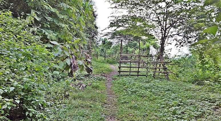 Z834--- This is how the Villa Verde Trail looks today at its lower elevation. I guess this means the slope of the ridge where the villa Verde Trail is on is used for grazing of cattle. This looks like a corral. 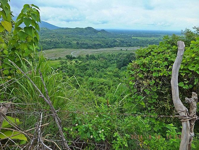 Z835--- the Villa Verde Trail ridge runs on a SE to NW axis and during the whole 8km, I only traveled on the NE slopes of that ridge and only a few times did I get a glimpse of the Cabalisian River Valley and never of the Ambayabang River. 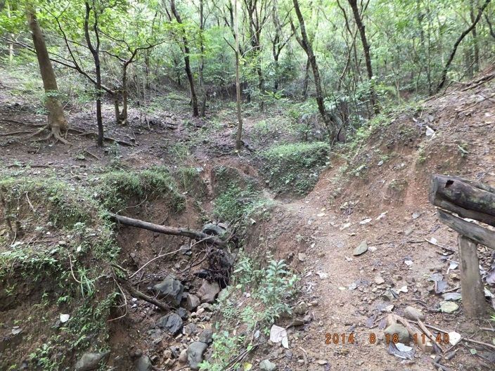 Z836--- here again the Villa Verde Trail almost got washed away in this ravine; we can see the trail where it comes from the left and moves around the drop off. I am looking back. 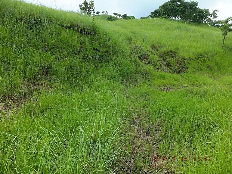 Z837--- finally I am out of the woods on the Villa Verde Trail but the road is going both to the right and to the left, which way is correct? Plus both roadways are over grown with grass and I do not see a trail A very indistinct trail seems to go straight up on this rise but the clay ground was slippery. There is hooch on top and I wanted to go. My GPS device said I walked 8km and I called it quits and will return now. 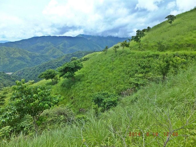 Z838--- At this point was the first time that I was able to look down to the other side of the Villa Verde Trail. Down there is the Ambayabang River. One regiment of the 32nd Inf. Div followed it and tried to outflank the Japanese from the left. Here we can see the road-cut also went to the left and around the rise at right. 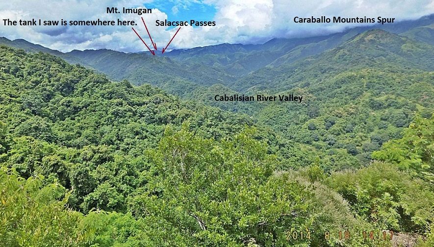 Z839--- on my return march down the Villa Verde Trail I tried to get a glimpse of the Salacsac Passes and I finally got a shot. 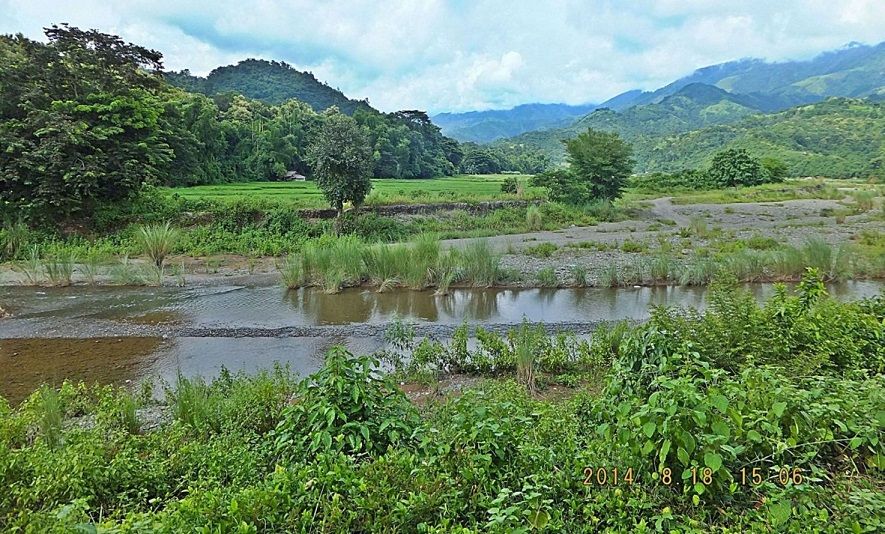 Z840--- when I returned to my starting point of the Villa Verde Trail I decided to go up river a little and get a feel of the Cabalisian River and Valley. This is the Cabalisian River Valley and the Caraballo Mountains connecting the Cordillera Mountains and the Sierra Madre Mountains. |
|
|
|
Post by Karl Welteke on Sept 8, 2014 20:56:08 GMT 8
BALETE OR DALTON PASS BATTLE FROM THE ARMY. This is probably the best and easiest to read written material about the Balete or Dalton Pass. Triumph in the Philippines, Chapter XXVII, The Bambang Front—II, The 25th Division on Route 5 www.ibiblio.org/hyperwar/USA/USA-P-Triumph/USA-P-Triumph-27.htmlAfter reviewing all the vast material I have found and saved on my hard drive I decided to share some of that material in smaller segments in this thread. Original I only planed to show my pictures about all the memorials at the pass, I will do that last. These images are from the above URL 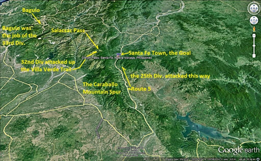  a larger copy Z845--- this is the large image graph of the Villa Verde and Balete Pass Battle Front from Google Earth 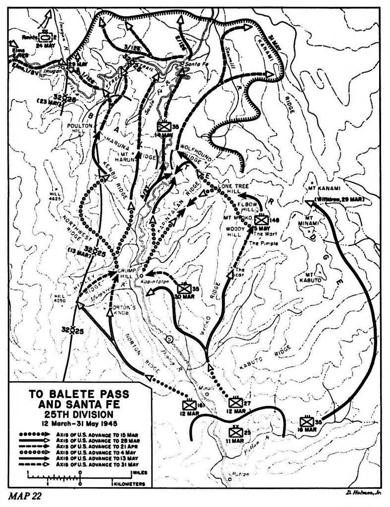  a larger copy Z846---this is the Balete Pass battle map from Triumph in the Philippines publication (USA-P-Triumph-22). 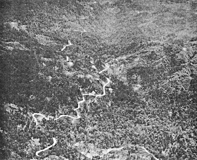 Z847---ROUTE 5, heading south through Balete Pass (USA-P-Triumph-p519 Balete Pass) 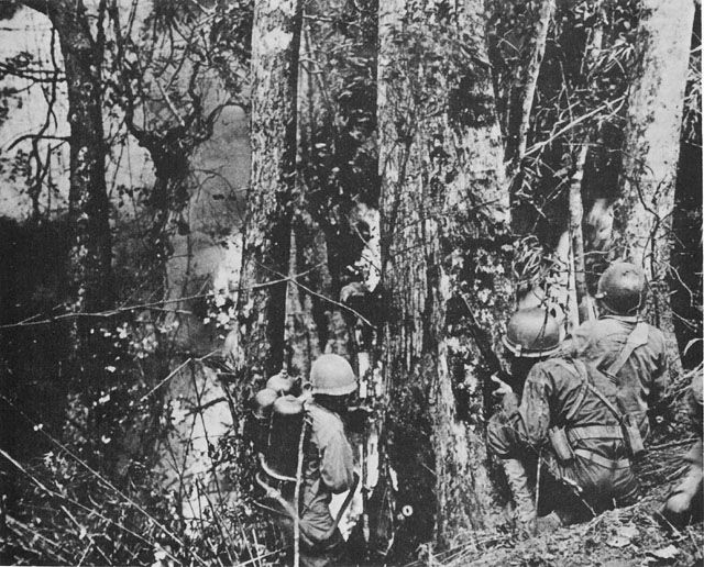 Z848---NEUTRALIZING THE ENEMY ON CLIMB TO NORTON'S KNOB (USA-P-Triumph-p523) 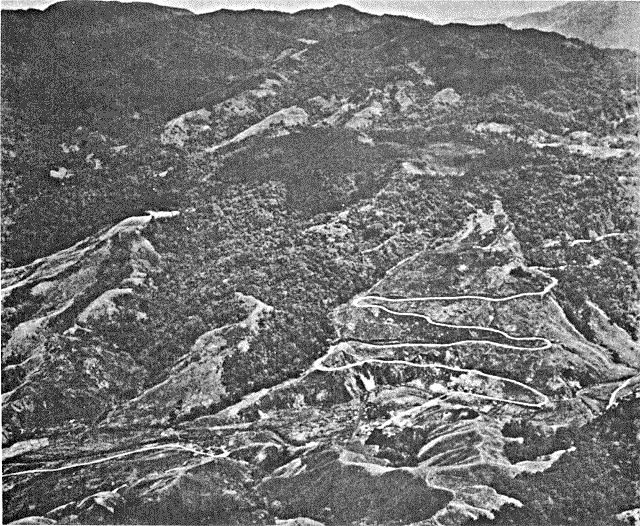 Z849---ROUTE 5, winding south from Santa Fe.( USA-P-Triumph-p537), that means going up the hill after the pass was breached and this area was captured. 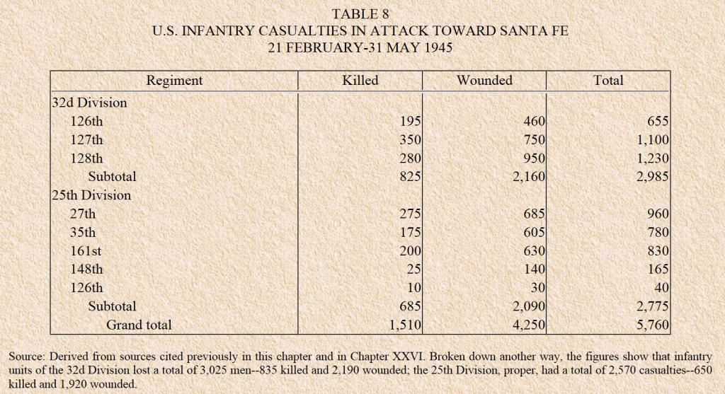 Z850---the casualties, the cost, the price of blood , pain and misery (USA-P-Triumph-p538) |
|
|
|
Post by Karl Welteke on Sept 9, 2014 20:12:28 GMT 8
GENERAL DALTON AT THE BALETE PASS Here is the Wikipedia page on the General with 3 images and this lead paragraph: en.wikipedia.org/wiki/James_Dalton_IIThe Pass URL is this one: en.wikipedia.org/wiki/Dalton_PassJames Leo Dalton II (January 20, 1910 - May 16, 1945) was a general and commander of United States Army forces during World War II. He graduated from West Point in 1933 and earned the Silver Star during the strategically significant Guadalcanal Campaign in which he commanded the 161st Infantry Regiment as a colonel. Dalton later commanded the 161st during the New Georgia Campaign in 1943 and Battle of Luzon in 1945 before being promoted and reassigned as assistant commander of the 25th Infantry Division. He was killed by a Japanese sniper during the Battle of Balete Pass on May 16, 1945. The three images from the above URL: 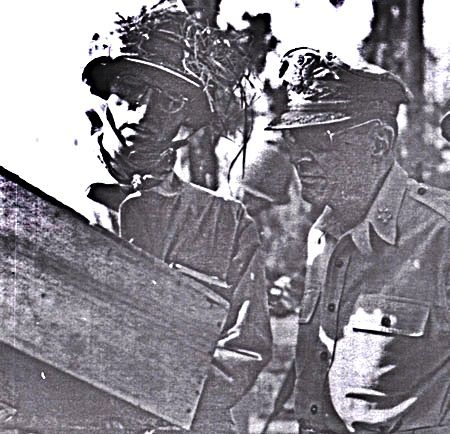 Z583---James Dalton (left) with Douglas MacArthur, most likely on Luzon in 1945. This picture is from the Wikipedia URL above. 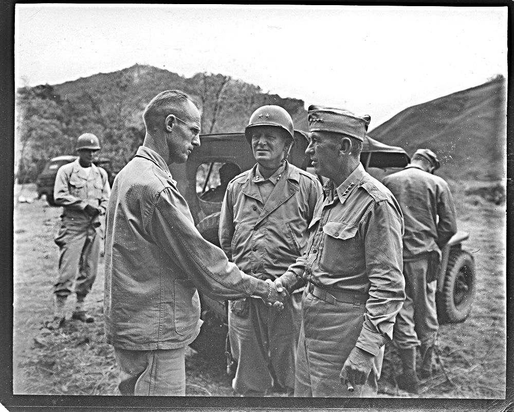 Z584---Dalton (left) greets General Walter Krueger on Luzon in an undated photo. That General Krueger and I got something in common!This picture is from the Wikipedia URL above. Read more: corregidor.proboards.com/thread/1694/villa-verde-trail-balete-dalton#ixzz3CoxXFScl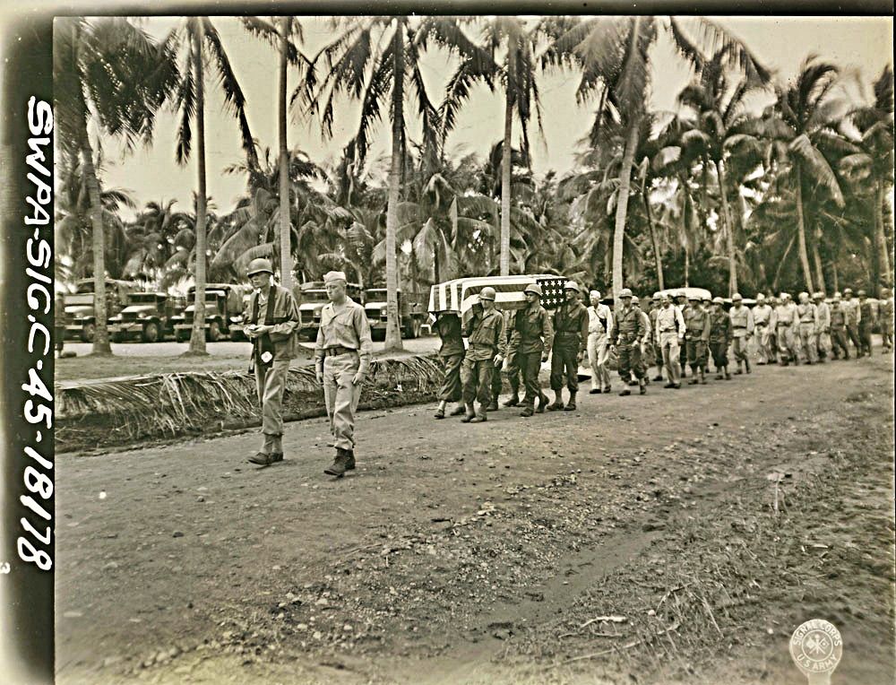 Z585---Funeral procession on Luzon for General Dalton two days after his death.This picture is from the Wikipedia URL above. Read more: corregidor.proboards.com/thread/1694/villa-verde-trail-balete-dalton#ixzz3CoxXFScl |
|
|
|
Post by Karl Welteke on Sept 10, 2014 8:02:14 GMT 8
BATTLE OF THE BALETE PASS ALSO CALLED THE DALTON PASS from Wikipedia en.wikipedia.org/wiki/Dalton_PassThe above URL says this about the Balete Pass also called the Dalton Pass: Dalton Pass, also called Balete Pass, is a zigzag road and mountain pass that joins the provinces of Nueva Ecija and Nueva Vizcaya, in central Luzon Island of the Philippines. The summit of the mountain pass is at around 3,000 feet (910 m) in elevation, located where the Caraballo Sur (mountain range) and the Sierra Madre (mountain range) meet. The headwaters of the Digdig River originate just south of the pass. Balete Ridge starts two miles to the west-northwest of the pass, with a high point at Mt. Imugan (5,580 feet), and extends nine miles to the east-southeast, where it ends at Mt. Kabuto (4,600 feet) Dalton Pass is a gateway to the Cagayan Valley, and the Ifugao Rice Terraces. The Japanese strategy during the Battle of Luzon was to fight a delaying retreat from Baguio to Bayombong, and then to a final defensive position in Kiangan, Ifugao. The pass was the only access between Central Luzon and the Cagayan Valley, and was the scene of much bloody fighting in the Battle of Luzon, during the final stages of World War II. Here are 4 of my pictures showing the Balete Pass, this pass is also now the Balete Battle Memorial Park but those pictures will be shown a little later: 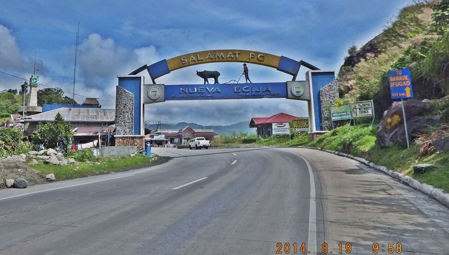 Z857---the Nueva Ecija Goodbye and Exit Gate is right on top of the Balete Pass, left is a tower indicating the beginning of the Philippine administering Region No. 2. 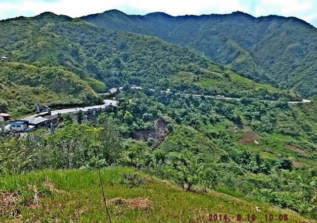 Z858---this is the approaching No. 5 Highway from the south. Left one can see the Nueva Ecija Exit Gate and Region No. 2 Tower from the previous image. 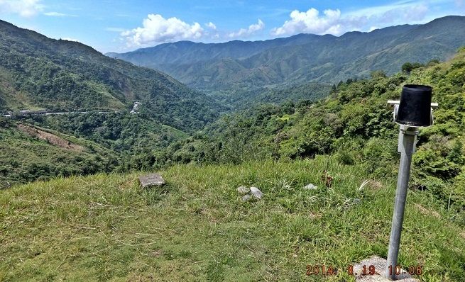 Z859---This the upper end of the Digdig River and Valley, starting here at the Balete Pass and runs down, south, about 66 km to San Jose. The 25th Div fought its way up here thru the Valley but also went along the ridges at right and left and another track along the old Spanish Trail further east. That stand seems to be an abandoned viewer and stands now outside of the park wall. 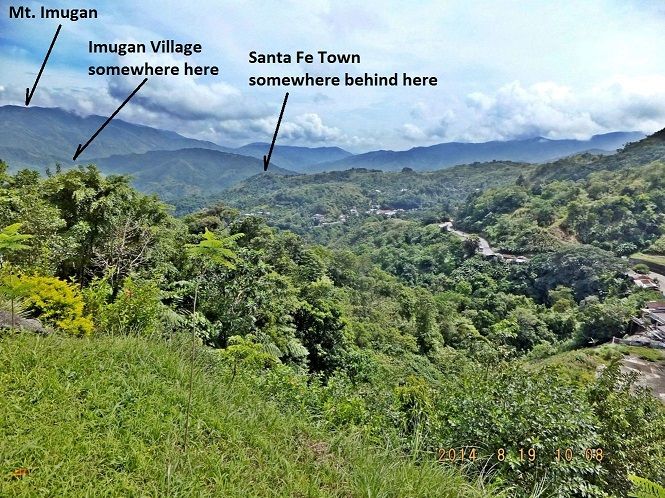 Z860---this is the view in the other direction from the Balete Pass, towards the north and I marked some landmarks. After the 25th Division captured this pass the Imperial Japanese Army retreated to Ifugao with those few forces that survived the American-Philippine onslaught. |
|
|
|
Post by Karl Welteke on Sept 10, 2014 11:54:40 GMT 8
BATTLE OF THE BALETE PASS 1945 The below photos and descriptions come from the Hugh Morton Collection of Photographs and Films dc.lib.unc.edu/cdm/search/collection/morton_highlights/searchterm/25th%20Division/field/all/mode/all/conn/and/order/title/ad/asc/cosuppress/0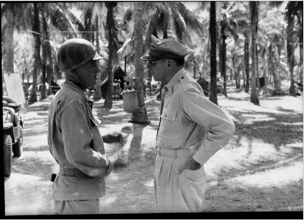 Z866---General Douglas MacArthur (right), talking with Major General Charles L. Mullins, Jr. Taken during Hugh Morton's World War II service with the 161st Signal Photography Corps in the Pacific Islands, when Morton was assigned to photograph the 25th Infantry Division as they invaded Luzon in early 1945. Labeled "MacArthur: Mac and Moon at Binalonan, Luzon." 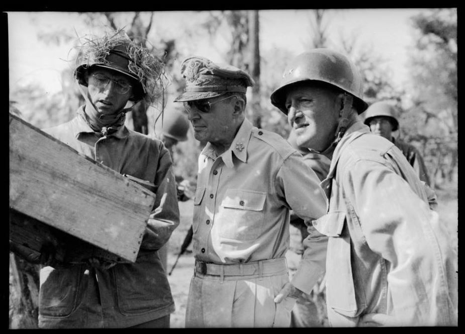 Z867---Brig. Gen. James L. Dalton ("Dusty"), Gen. Douglas MacArthur, and Major General Charles L. Mullins, Jr. at San Manuel, Luzon. Taken when Morton was assigned to photograph the 25th Infantry Division as they invaded Luzon in early 1945. Dalton was supposedly killed by a Japanese sniper within hours of this photo being taken; if so, the date of this photograph would be May 16, 1945. Photographer's caption: "General Douglas MacArthur was really a great one. I had nothing but admiration for him. This picture was made of him on the front line on Luzon. Everybody else wore steel helmets. He stood there in his suntans and scrambled eggs hat. Mortar shells were whistling by, and the other men were cringing on the ground while MacArthur was standing there straight as an arrow. He set a wonderful example for his troops. I made movies of the same event." 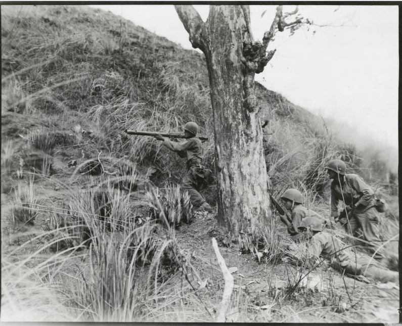 Z868---Caption on back reads: "Infantrymen cover bazooka man as he stands and fires at a Japanese pillbox position near Balete Pass, Luzon where the enemy is putting up a fierce battle because the pass is a key route to Baguio. Men are from K Company, 3rd Bn, 161 RCT, 25th Infantry Division." Taken during Hugh Morton's World War II service in the Pacific Islands. 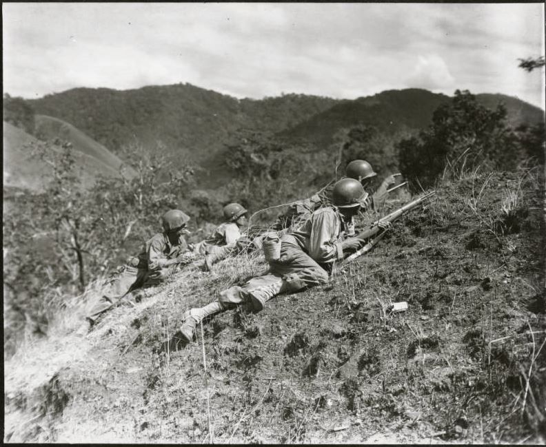 Z869---American soldiers with rifles scouting enemy position from mountaintop. Caption on back of print reads: "A squad leader of K Company, 3rd Bn, 161 RCT, 25th Infantry Division points to a Japanese position at the edge of Balete Pass where the 25th Infantry Division is now doing fierce fighting in Luzon." Taken during Hugh Morton's World War II service in the Pacific Islands. 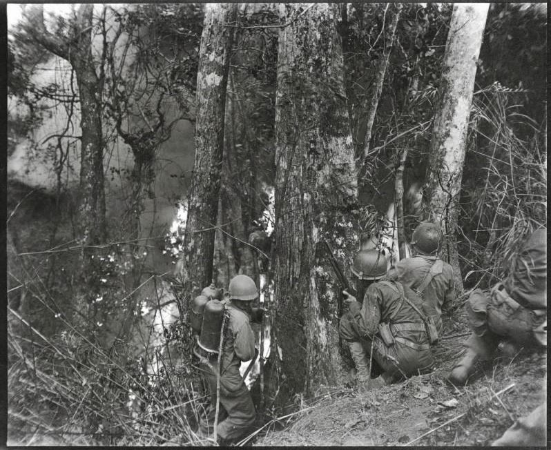 Z870---Caption on back reads: "Flame thrower man of K Company, 3rd Bn, 161 RCT, 25th Infantry Division turns his head away from the intense heat as he squirts the flame into a well fortified Japanese pillbox at the edge of Balete Pass where the 25th Infantry Division is meeting fierce enemy resistance on Luzon. Other infantrymen are shown covering him with rifles and a BAR." Photograph appears (cropped) in TRIUMPH IN THE PHILIPPINES by Robert Ross Smith, with caption "Neutralizing the Enemy on Climb to Norton's Knob." 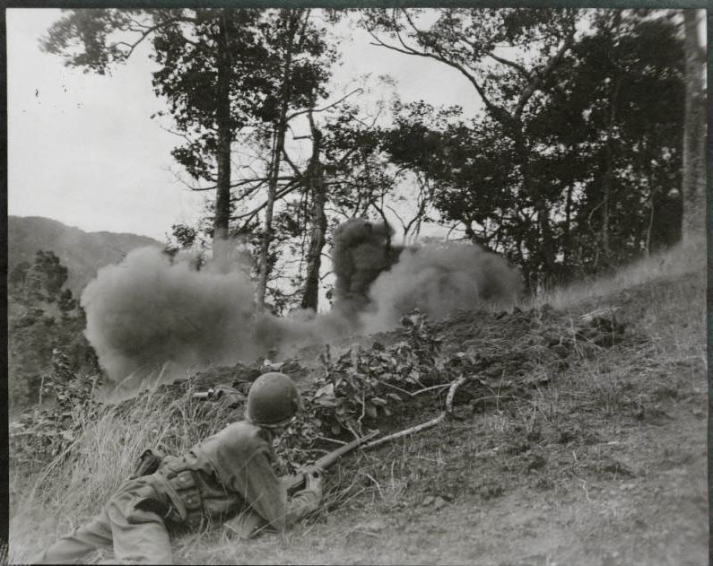 Z871---Caption on back reads:"25th Infantry Division doughboy watches a Japanese position go up in smoke from a demolition charge of dynamite thrown in by men of K Company, 3rd Bn, 161 RCT, 25th Infantry Division near Balete Pass. The Japanese are fiercely defending Balete Pass because it is one of the key routes to Baguio." 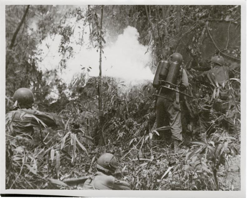 Z872---Caption on back of a similar photograph reads: "Flame thrower man of K Company, 3rd Bn, 161 RCT, 25th Infantry Division turns his head away from the intense heat as he squirts the flame into a well fortified Japanese pillbox at the edge of Balete Pass where the 25th Infantry Division is meeting fierce enemy resistance on Luzon. Other infantrymen are shown covering him with rifles and a BAR." 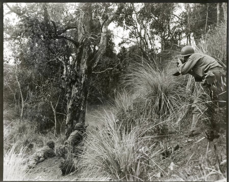 Z873---Caption on verso of photograph: "A US Army Signal Corps Photographer is shown photographing infantrymen of the 25th Infantry Division as they are in process of knocking out a Japanese pillbox position near Balete Pass, Luzon. The enemy is fiercely defending Balete pass because it is a key route to Baguio. The Japs set off an explosion which wounded both Infantry men and Cameraman shortly after this picture was taken. Photographer: Allen" The caption on the verso of a print of this photograph in the United States Army Military History Institute's collection of Signal Corps photographs states that the cameraman was Hugh Morton. Two soldiers lie behind a tree with rifles pointed, while a photographer at right photographs them. Taken during Hugh Morton's World War II service with the 161st Signal Photography Corps in Luzon, Philippines. 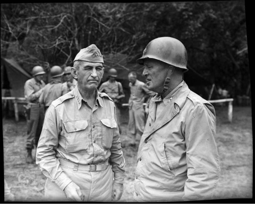 Z874---General Walter Krueger (left) standing with unidentified man. Soldiers/tents in background. Taken during Hugh Morton's World War II service with the 161st Signal Photography Corps in the Pacific Islands, probably when Morton was assigned to photograph the 25th Infantry Division as they invaded Luzon in early 1945. 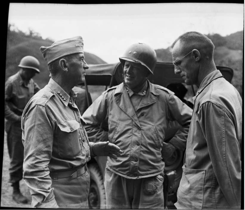 Z875---General Walter Krueger (left), talking with General James Dalton (right) and Maj. Gen. Charles L. Mullins (center). Soldiers and jeep in background. Taken during Hugh Morton's World War II service with the 161st Signal Photography Corps in the Pacific Islands, probably when Morton was assigned to photograph the 25th Infantry Division as they invaded Luzon in early 1945. |
|
|
|
Post by Karl Welteke on Sept 10, 2014 15:13:28 GMT 8
WHERE WAS THE ARMY AIR CORPS AT THE BALETE PASS BATTLE? Justin Tylan from Pacific Wreck tabulated a lot of air support missions as shown below! Here is his URL: www.pacificwrecks.com/provinces/philippines/nueva_vizcaya/missions-balete.htmlAmerican missions against Balete Pass January 27 - June 18, 1945 January 27, 1945 (FEAF) B-24s hit Balete Pass February 9, 1945 (FEAF) Support of ground forces, A-24s and P-40s attack bridges and roads February 19, 1945 (FEAF) fighters, B-25 A-20s support ground forces Balete Pass March 6, 1945 (FEAF) B-24s, B-25s, and fighter-bombers bomb Balete Pass March 7, 1945 (FEAF) B-24s hit Balete Pass area March 8, 1945 (FEAF) B-24s hit road targets at Balete Pass March 15, 1945 (FEAF) P-47s hit Minuli bridge and enemy concentrations in Balete Pass March 20, 1945 (FEAF) B-24s, A-20s, and fighter-bombers fly ground support missions at Balete Pass March 22, 1945 (FEAF) B-24s, B-25s, A-20s, and fighters continue to hit Balete Pass March 23, 1945 (FEAF) B-24s, B-25s, A-20s, and fighters hit Balete Pass March 24, 1945 (FEAF) B-24s, B-25s, A-20s, and P-38s attack Balete Pass March 28, 1945 (FEAF) B-24s and fighter-bombers hit Balete Pass tracts and ridges March 30, 1945 (FEAF) B-24s bomb Balete Pass April 1, 1945 (FEAF) B-24s, A-20s, and fighter-bombers hit targets north of Balete Pass April 2, 1945 (FEAF) B-25 and fighter-bombers attack the Balete Pass-Bagio area April 3, 1945 (FEAF) Fighter-bombers and A-20 hit Balete Pass-Bagio area April 6 , 1945 (FEAF) Ground support sorties in areas around Balete Pass April 9, 1945 (FEAF) A-20s and fighter bombers support ground forces at Balete Pass April 10, 1945 (FEAF) A-20s and fighter bombers support ground forces at Balete Pass April 12, 1945 (FEAF) B-24s, B-25s, A-20s, and fighter-bombers blast defenses at Balete Pass April 18, 1945 (FEAF) Fighter bombers and A-20s hit Balete Pass area in support of troops April 25, 1945 (FEAF) B-24s bomb Balete Pass bridges, while B-25s, A-20s, and fighters support troops April 28, 1945 (FEAF) Fighter-bombers hit Balete Pass April 29, 1945 (FEAF) Fighter-bombers support troops at Balete Pass May 7, 1945 (FEAF) B-25s, A-20s, and fighter-bombers support ground forces at Balete Pass May 9, 1945 (FEAF) A-20s and fighters support ground forces at Balete Pass May 23, 1945 (FEAF) A-20s and B-25s hit Balete Pass targets May 24, 1945 (FEAF) B-25s, A-20s, and P-51s hit targets in Balete Pass May 26, 1945 (FEAF) A-20s and fighter-bombers pound Balete Pass area May 27, 1945 (FEAF) B-24s, A-20s, and fighter-bombers support ground forces in Balete Pass May 28, 1945 (FEAF) B-24s, B-25s, A-20s, and fighter-bombers hit guns and defenses at Balete Pass June 2, 1945 (FEAF) B-25s, A-20s, and fighter-bombers support ground forces at Balete Pass June 4, 1945 (FEAF) A-20s and fighter-bombers support ground forces strike defensive position. June 5, 1945 (FEAF) Fighter-bombers support ground actions in Balete Pass June 6, 1945 (FEAF) Fighter-bombers pound the Balete Pass area June 12, 1945 (FEAF) Fighter-bombers support ground forces at Balete Pass June 18, 1945 (FEAF) B-25s, A-20s, and fighter-bombers continue attacks on targets at Balete Pass Last Updated February 18, 2014 He also found a park with a gun (and I did not see it-next time) and here is that URL, the text and the image: www.pacificwrecks.com/gun/105mm/dpwh.htmlDPWH / Perez Park Located just beyond the memorial ridge line is a small memorial park, with a 150mm Japanese Howitzer (no serial visible) is on display. There is an entrance to a large natural cave directly behind the gun. Presumably this cave was used by Japanese forces. 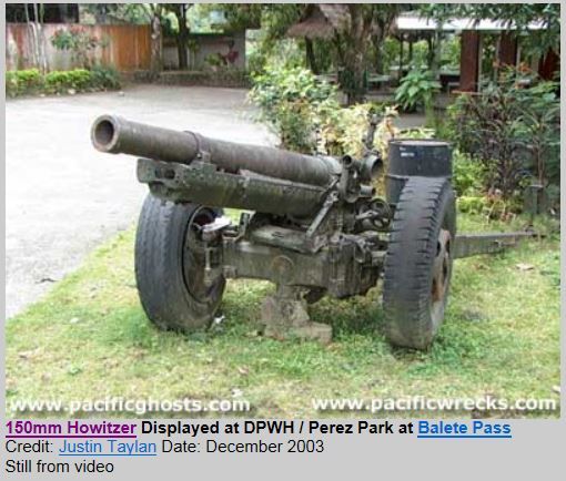 Z876—Pacific Wreck Image |
|
|
|
Post by Bob Hudson on Sept 11, 2014 0:12:38 GMT 8
Impressive work Karl. If only I had the stamina to tack along with you on these missions. In photo Z874, the unknown man is General Dalton.
|
|


