Deleted
Deleted Member
Posts: 0
|
Post by Deleted on Jun 21, 2016 21:06:44 GMT 8
My images aren't showing. I wonder why.
Karl, you have my permission to post my photos. I haven't figured out yet why the links aren't working.
(Delzky, I suspect that FLICKR has a code that prevents the link from working in the way we want. I went into the account and located the hosting address, and copied that. EXO)
|
|
|
|
Post by Karl Welteke on Jun 23, 2016 10:07:13 GMT 8
VILLA VERDE TRAIL REVISITED, FROM RODEL SOTTO MALLILLIN He found that the WWII 32 Inf. Div. Villa Verde Trail Monument was severely damaged during road construction work. The big news is that work has started on the Pangasinan side to build the new highway from San Nicolas, Pangasinan to Santa Fe in Nueva Vizcaya. This road will eliminate the long drive around the Caraballo Mountain Spur and driving thru Nueva Ecija. The road follows the old and historical Villa Verde Trail. Based on my visit to Santa Fe, Imugan and Malico in 2014 the road on the Nueva Vizcaya side should be finished by now or nearly so! Mr. Rodel Sotto Mallillin is a resident of San Nicolas and revisited the trail on the 18th June 2016. H e took some great pictures and shared them in his Face book page. This is the URL with 17 images: www.facebook.com/rodel.mallillin.3/media_set?set=a.1252675731409510.1073741890.100000012853603&type=3&pnref=storyHe, like me, contributes entries to the Corregidor Forum page and we both have trouble linking our Facebook images to this forum. He gave me permission to do that and my first step was to upload his pictures into my Flickr account with all the credit to him of course! This is the URL: www.flickr.com/photos/44567569@N00/albums/72157670093594015Here are 10 sample images with his and my comments and the images here in the forum are much, much smaller than in the two URLs above: 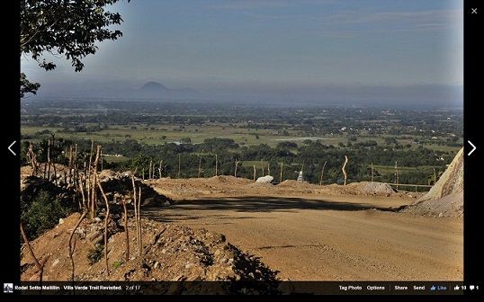 W858 (3) there are several vantage points along the trail where spectacular views of San Nicolas plains open up. This is a June 2016 image from Rodel Sotto Mallillin. 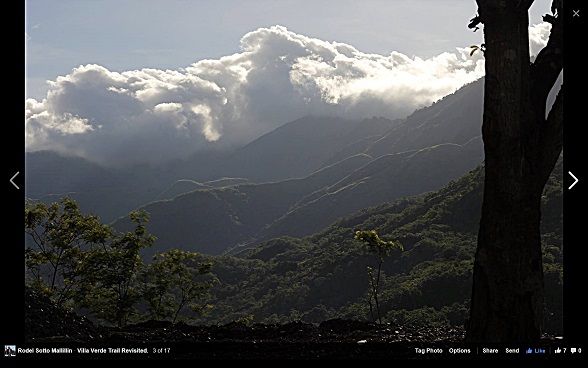 W859 (4) the green outline of the grass-covered ridges of the Caraballo is highlighted by the rising sun. This is a June 2016 image from Rodel Sotto Mallillin. 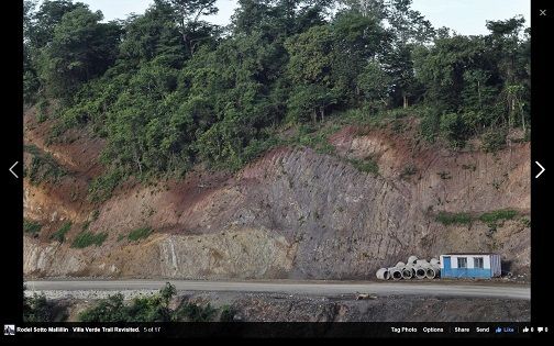 W860 (6) construction is going on the Pangasinan side to build a new highway to Santa Fe in Nueva Vizcaya, along the old Villa Verde Trail. This is a June 2016 image from Rodel Sotto Mallillin. 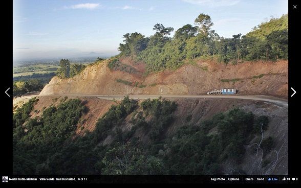 W861 (7) construction is going on the Pangasinan side to build a new highway to Santa Fe in Nueva Vizcaya, along the old Villa Verde Trail. This is a June 2016 image from Rodel Sotto Mallillin. 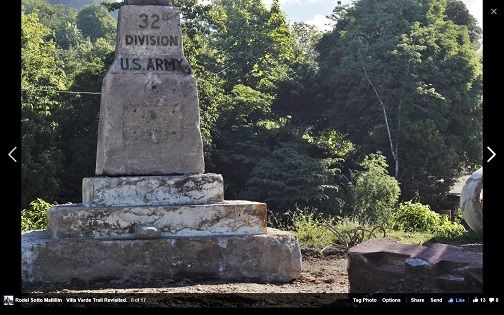 W862 (9) Villa Verde Trail Battle Monument from Rodel Sotto Mallillin; the WWII Red Arrow monument is broken down. It is a casualty of lack of foresight. (and hindsight... for the men who fought and died here). This is a June 2016 image from Rodel Sotto Mallillin. "Goat Path in the Clouds", the American G.I.'s called it. The Villa Verde Trail was the scene of one of the bloodiest battles waged in the closing days of WW2 in the Philippines, as American and Filipino forces pursued the retreating Japanese soldiers way deep into the hinterlands of the Caraballo. Closed for decades, it is now being rehabilitated and upgraded. Once opened it will reduce travel time from Pangasinan to Cagayan Valley by 3 hours. 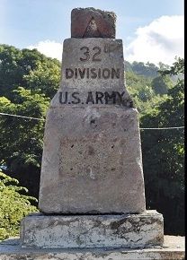 W863 (10) 32nd Division U.S. Army, the name of the unit that fought here, having the insignia "Red Arrow". Displaced and severely damaged by road construction, this monument which was built by war veterans is badly in need for reconstruction and a new home. This is a June 2016 image from Rodel Sotto Mallillin. Erected by the officers and men of the 32D Infantry Division, United States Army, in memory of their gallant comrades killed along the Villa Verde Trail. January 30, 1945 – May 28, 1945.” 20th Sep 1945 dedicated to the 891 Soldiers of the 32D Division who were killed during the unit’s campaign on Luzon in the Philippines during WWII. Built by Co. A, 114TH Engr. Bn. The information came from this webpage: www.32nd-division.org/history/monuments/monuments.html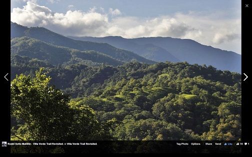 W864 (11) there are several vantage points along the trail with spectacular views of the Caraballo Mountains. This is a June 2016 image from Rodel Sotto Mallillin. 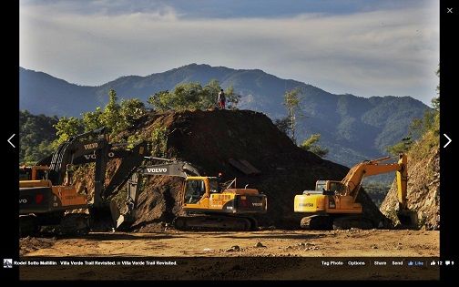 W865 (13) construction is going on the Pangasinan side to build a new highway to Santa Fe in Nueva Vizcaya, along the old Villa Verde Trail. This is a June 2016 image from Rodel Sotto Mallillin. 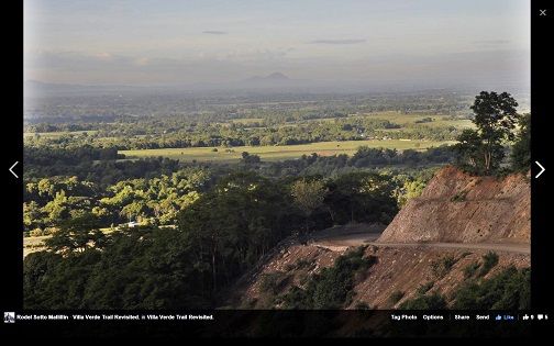 W866 (15) construction is going on the Pangasinan side to build a new highway to Santa Fe in Nueva Vizcaya, along the old Villa Verde Trail. This is a June 2016 image from Rodel Sotto Mallillin. 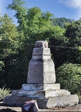 W867 (16) the 32nd Div. Monument in San Nicolas; Villa Verde Trail Battle Monument is broken down. This is a June 2016 image from Rodel Sotto Mallillin. "The Villa Verde Trail cost us too high in battle casualties for the value received. In other words the supreme commander (Mc Arthur) and his staff violated one of the great principles of shopping." - said Major Gen. William Gill, commander of the 32nd Division U.S. Army, bitter toward his superiors for committing him to Villa Verde Trail without reinforcement and replacement for his decimated and... |
|
|
|
Post by Karl Welteke on Jun 23, 2016 18:31:05 GMT 8
WWII VILLA VERDE TRAIL MONUMENT DESTROYED! JAPANESE MONUMENT IS THE ONLY ONE ON THE VILLA VERDE TRAIL NOW! WHAT WILL HAPPEN TO THE WWII TANK RELIC ON THE VILLA VERDE TRAIL NOW? A NEW HIGHWAY BETWEEN PANGASINAN AND NUEVA VIZCAYA ALONG THE VILLA VERDE TRAIL! HOW ABOUT REPAIRING OR RESTORING THE DESTROYED VILLA VERDE TRAIL MONUMENT? HOW ABOUT A VILLA VERDE TRAIL PARK LIKE THE ONE AT THE BALETE OR DALTON PASS? THE ATTIUDE AND FEELING IN 1945 WAS DIFFERENT, WE ARE FORGETTING OUR HERITAGE! This entry is really a cry for help and a discussion do something in line of the discussion points above. I think the situation at the Villa Verde Trail needs to be brought to the attention of personalities of leadership in the community. How about the former President and General Fidel Ramos (he is from Pangasinan) or Dr. Ricardo T. Jose or any other person who might be able to help. 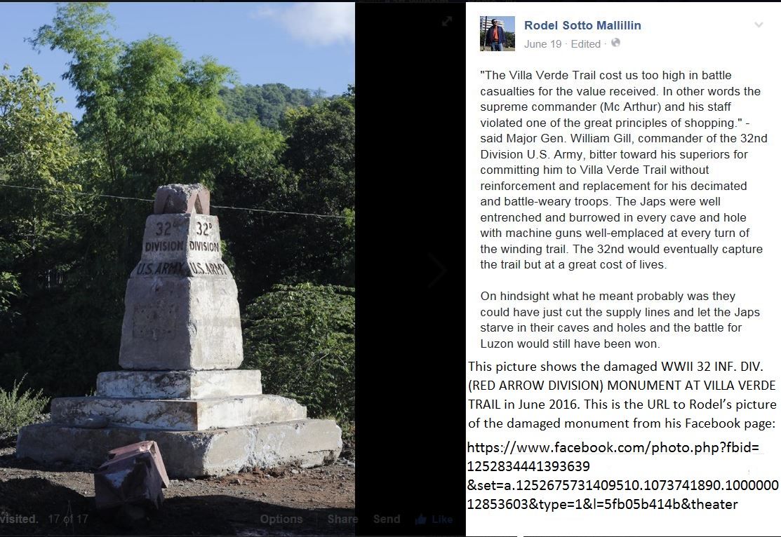 W855 this picture shows the damaged WWII 32 INF. DIV. (RED ARROW DIVISION) MONUMENT AT VILLA VERDE TRAIL in June 2016. This damage occurred recently during the construction of the new Pangasinan-Nueva-Vizcaya Highway. This picture was shot in June 2016 by Rodel Sotto Mallillin. This is the URL to Rodel’s pictures of the damaged monument from his Facebook page: www.facebook.com/photo.php?fbid=1252834441393639&set=a.1252675731409510.1073741890.100000012853603&type=1&l=5fb05b414b&theaterErected by the officers and men of the 32D Infantry Division, United States Army, in memory of their gallant comrades killed along the Villa Verde Trail. January 30, 1945 – May 28, 1945.” 20th Sep 1945 dedicated to the 891 Soldiers of the 32D Division who were killed during the unit’s campaign on Luzon in the Philippines during WWII. Built by Co. A, 114TH Engr. Bn. The information came from this webpage: www.32nd-division.org/history/monuments/monuments.html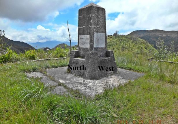 Y384. The track to the Japanese Monument in Malico Village at the Salacsac Passes enters the site from the NW corner. The low areas at left and ahead are the Sta. Fe and Imugan River Valleys. This Japanese monument is located on the villa Verde Trail in the middle of the Salacsac Passes Battle Field which is the center of Barangay Malico in San Nicolas but until now only can be reached thru Santa Fe in Nueva Vizcaya. Is this Japanese monument going to be the only WWII Monument on the Villa Verde Trail and the Salacsac Passes Battle Fields? 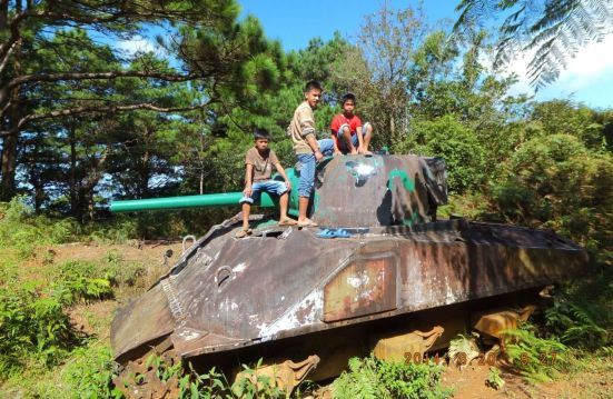 Y306. The front of the American tank on the Villa Verde Trail near Malico Village, San Nicolas, Pangasinan but can be reached easier from Santa Fe, Nueva Viscaya. It is located about 2km down the Villa Verde Trail, towards San Nicolas, from the village Malico. The tracks and everything inside the tank is gone. This is a 2014 image. What will happen to this tank now? Will it be scrapped? Will they use it in a future Villa Verde Trail Park? 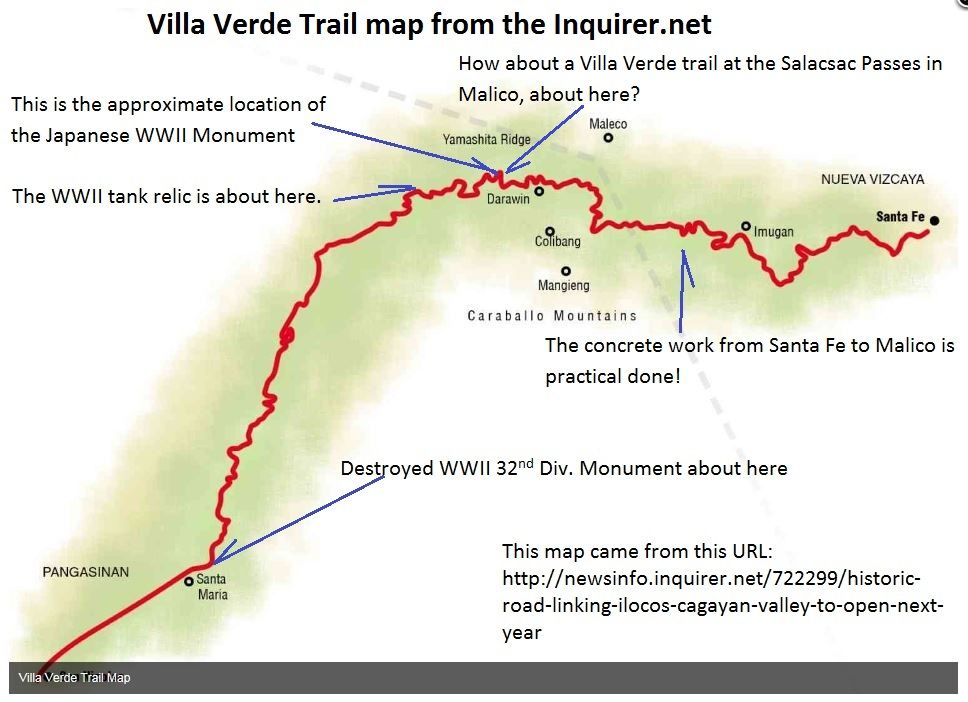 W868 this is a track map of the Villa Verde Trail from the Inquirer .net. I marked it up with location of the discussion point items. This is the Inquirer.net URL where this map came from: newsinfo.inquirer.net/722299/historic-road-linking-ilocos-cagayan-valley-to-open-next-year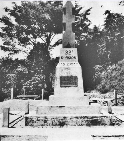 W857a 32D Inf. Div. History Commission photograph. But now it is severely damaged. What can be done? Erected by the officers and men of the 32D Infantry Division, United States Army, in memory of their gallant comrades killed along the Villa Verde Trail. January 30, 1945 – May 28, 1945.” 20th Sep 1945 dedicated to the 891 Soldiers of the 32D Division who were killed during the unit’s campaign on Luzon in the Philippines during WWII. Built by Co. A, 114TH Engr. Bn. The picture and information came from this webpage: www.32nd-division.org/history/monuments/monuments.html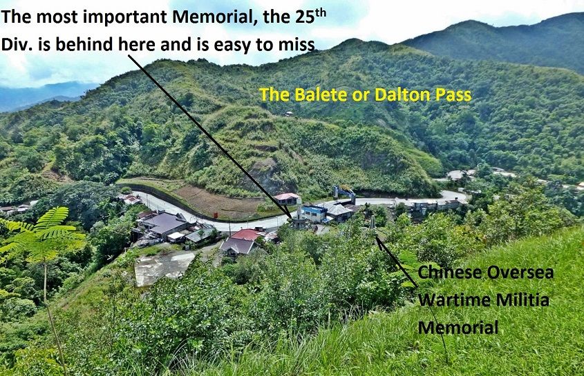 Z880--- the Balete Pass Shrine is really on the Nueva Viscaya Province side of that boundary gate and they are behind maintaining it. The shrine has 4 levels, we are looking east and down onto the Pass from the 4th level. HOW ABOUT A VILLA VERDE TRAIL PARK LIKE THIS ONE AT THE BALETE OR DALTON PASS? This picture does not give credit as to what is there all to see and to learn. But I chose this image because it shows you the location of the park. Below the view across the highway is the boundary gate between the two provinces!  Z762---the 32nd Div. must have made great impression on the local community and maybe helped in getting the high school started here in 1946. The San Nicolas High School apparently was established in 1946 and was named the Red Arrow (the icon of the 32nd Div.) High School. THE ATTIUDE AND FEELING IN 1945 WAS DIFFERENT, WE ARE FORGETTING OUR HERITAGE! What is our attitude now? Why was that WWII 32nd Div Villa Verde Trail Monument in such bad condition and why was not better care taken in saving it during this new road construction |
|
|
|
Post by EXO on Jun 25, 2016 6:35:36 GMT 8
There's a bunch of messages on my e-mail this morning concerning the severe damage to the Villa Verde Trail Marker, so I have edited them and will give you an idea of what's been happening. I want to highlight the role that Karl Welteke has played in this, as (other than Rodel Mallillin, who lives in the immediate region), it's Karl who has brought this cause to our attention. Is there no trail that Karl isn't familiar with? - EXO)
Lou Jurika to Rick Ramos, (and others)
MJ Bugante reply to Lou Jurika (and others)
Marcia Kwiecinski to Karl Welteke (and others)
Bob Hudson to Lou Jurika (and others)
Lou Jurika to Bob Hudson (and others)
Bob Hudson to the group
|
|
|
|
Post by Karl Welteke on Jun 25, 2016 20:19:26 GMT 8
TRUCKS AND ENGINEERS ON THE VILLA VERDE TRAIL I saw another interesting image of the Villa Verde trail and I like to share it. 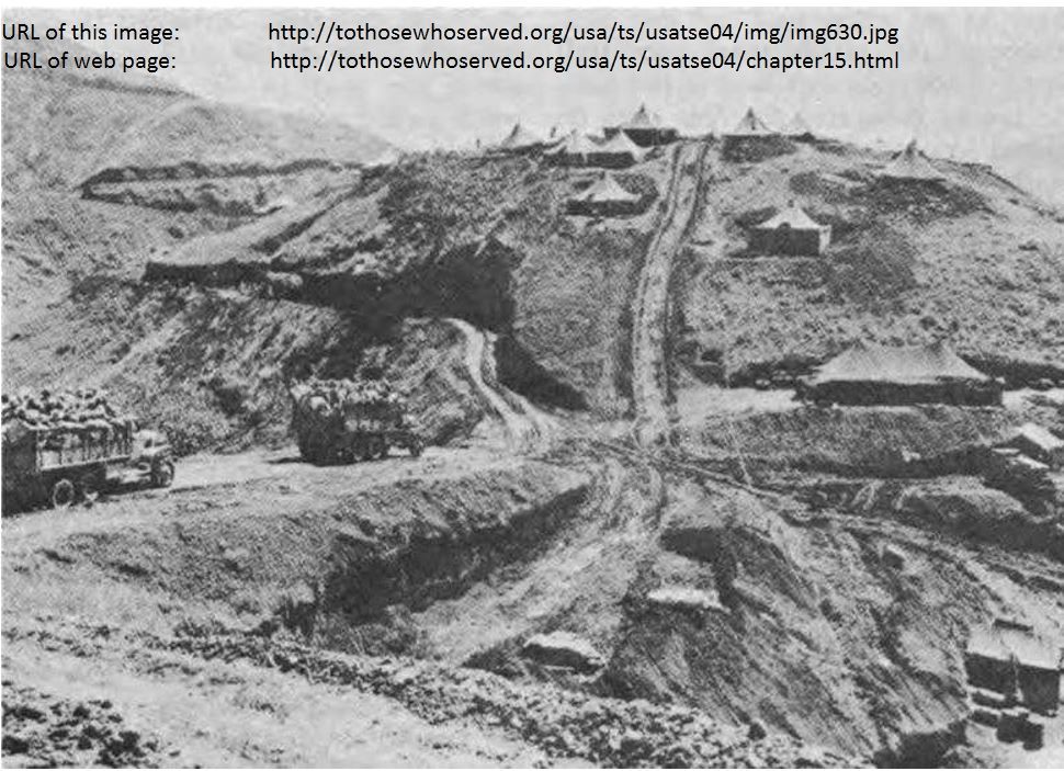 W869 trucks negotiate the Villa Verde trail where engineer construction is in progress. This picture came from the webpage: to those who served tothosewhoserved.org/index.htmlThey said about all their illustrations: “All illustrations are from Department of Defense files.” |
|
|
|
Post by Karl Welteke on Dec 8, 2016 15:54:51 GMT 8
Villa Verde Trail is being worked on at the Pangasinan end. This is the new bridge section. More sections are to follow! On the 21st of June 2016 Mr. Rodel S. Mallillin (resident of San Nicolas, Pangasinan) reported in this forum and thread, that the Villa Verde trail is being worked on with the goal to establish a two lane road from Pangasinan to Nueva Viscaya. He further reported that the 32nd Div. Monument was damaged during the road construction. A friend and I planned to visit the Villa Verde Trail on the 30th Nov 2016 and check on the progress of building the road and whether anything further is happening to the damaged WWII 32d Inf. Div. Monument. With Canadian George and his wife Marisa, we drove to San Nicolas and teamed up with Mr. Rodel S. Mallillin. He briefed us that the work on the Ville Verde Road is continuing, that the bridge over the Cabalisian River got started. He and his wife were very gracious and treated us to coffee and a few bites. It was possible to ford the river by my car and the road bed was so well prepared that we were able to drive up to the 3 km Mark. We were able to walk the next 7 km up to the 10 km mark because the construction crew had cleared the trail with machinery to there. We tried to go further but it was too difficult, even hazardous to maneuver around the ravines, the trail was grown over too much, we could not get thru. I uploaded 6 images to this Flickr album at about 600 KB size of each image: www.flickr.com/photos/44567569@N00/albums/72157675844936502The same 6 images are presented here but the pictures are much smaller: 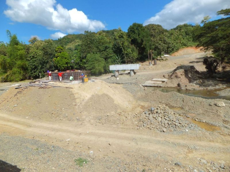 V438. (g1 161130 Villa Verde Bridge,S.N. 1). A bridge over the Cabalisian River is being built to establish a two lane road from Pangasinan to Nueva Viscaya along the track of the historical Villa Verde Trail. This is a 30th Nov. 2016 image. Pictures #g1 to #g6 are dedicated to the Villa Verde Trail bridge construction. 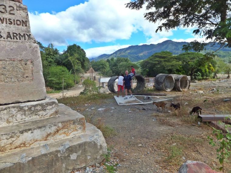 V439. (g2 161130 Villa Verde Bridge,S.N. 3). A bridge over the Cabalisian River is being built to establish a two lane road from Pangasinan to Nueva Viscaya along the track of the historical Villa Verde Trail. The damaged 32nd Div. Monument has been moved to this side of the river. This is a 30th Nov. 2016 image. Pictures #g1 to #g6 are dedicated to the Villa Verde Trail bridge construction. 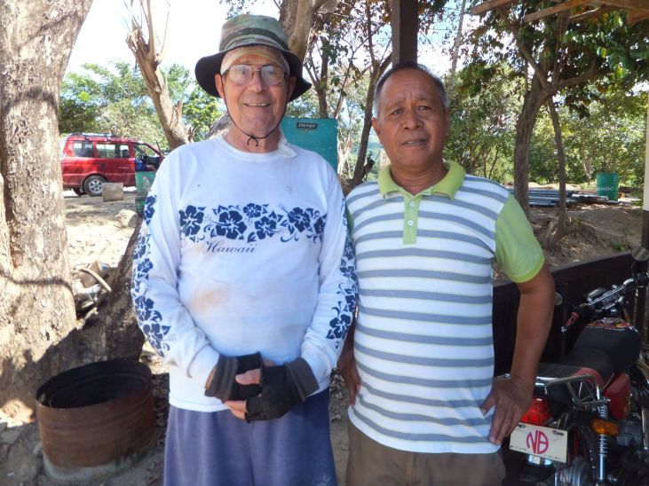 V440. (g3 161130 Villa Verde Bridge Site 5). At the bridge building site across the Cabalisian River a construction camp exist. We checked in the office and found a leading engineer, in spite today being Bonifacio Day, a Philippine National Holyday. We told him what our plan is and he gave us a rundown of the construction progress. He told us that it was no problem with us walking the Villa Verde Trail. This is a 30th Nov. 2016 image. Pictures #g1 to #g6 are dedicated to the Villa Verde Trail bridge construction. 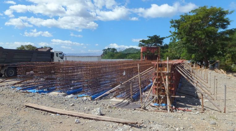 V441. (g4 161130 Villa Verde Bridge,S.N. 5). The bridge girders are constructed on site. It is unique that now a days the main bridge components are built right at the construction site. This is a 30th Nov. 2016 image. Pictures #g1 to #g6 are dedicated to the Villa Verde Trail bridge construction. 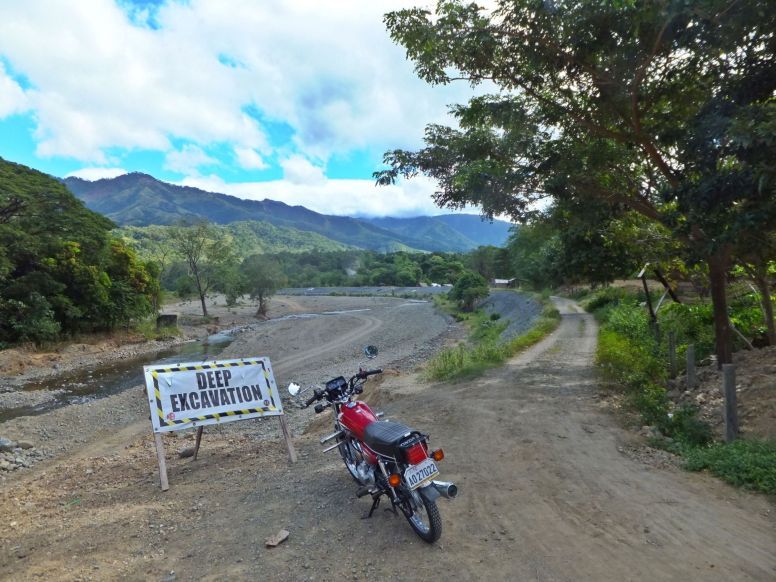 V442. (g5 161130 Villa Verde Bridge Site 4). This is a view up river of the Cabalisian River from the bridge construction site. This is a 30th Nov. 2016 image. This is a 30th Nov. 2016 image. Pictures #g1 to #g6 are dedicated to the Villa Verde Trail bridge construction. In back is Caraballo Mnt.Spur running south to San Jose. So right now if want to travel to Barangay Malico,(on top of the Villa Verde Trail, about 20 km up) from and part of San Nicolas, this town here, you have to drive south, around the bottom end of this spur, then up and thru the Balete or Dalton Pass and down to Santa Fe, Nueva Vizcaya. Then you have to drive another 20 km up to Malico, all together about 110 km. 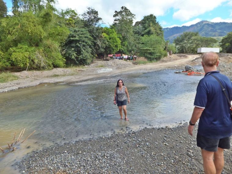 V443. (g6 161130 Villa Verde Bridge Site 2). My friend Canadian George and his wife are checking the depth of the ford across the Cabalisian River. It was our hope that we could drive across with my car and some distance up the road so we could walk further up the trail, more than the last time I did. Both the engineer and Mr. Rodel S. Mallillin said it should be possible and that is what we did on the next day. This is a 30th Nov. 2016 image. Pictures #g1 to #g6 are dedicated to the Villa Verde Trail bridge construction. |
|
|
|
Post by Karl Welteke on Dec 12, 2016 22:37:08 GMT 8
Villa Verde Trail is being worked on at the Pangasinan end. This is the WWII Damaged Monument section. More sections are to follow! On the 21st of June 2016 Mr. Rodel S. Mallillin (resident of San Nicolas, Pangasinan) reported in this forum and thread, that the Villa Verde trail is being worked on with the goal to establish a two lane road from Pangasinan to Nueva Viscaya. He further reported that the 32nd Div. Monument was damaged during the road construction. A friend and I planned to visit the Villa Verde Trail on the 30th Nov 2016 and check on the progress of building the road and whether anything further is happening to the damaged WWII 32d Inf. Div. Monument. With Canadian George and his wife Marisa, we drove to San Nicolas and teamed up with Mr. Rodel S. Mallillin. He briefed us that the work on the Ville Verde Road is continuing, that the bridge over the Cabalisian River got started. He and his wife were very gracious and treated us to coffee and a few bites. It was possible to ford the river by my car and the road bed was so well prepared that we were able to drive up to the 3 km Mark. We were able to walk the next 7 km up to the 10 km mark because the construction crew had cleared the trail with machinery to there. We tried to go further but it was too difficult, even hazardous to maneuver around the ravines, the trail was grown over too much, we could not get thru. I uploaded 10 images to this Flickr album at about 600 KB size of each image: www.flickr.com/photos/44567569@N00/albums/72157675844936502Only 4 images are presented here and the pictures are much smaller: 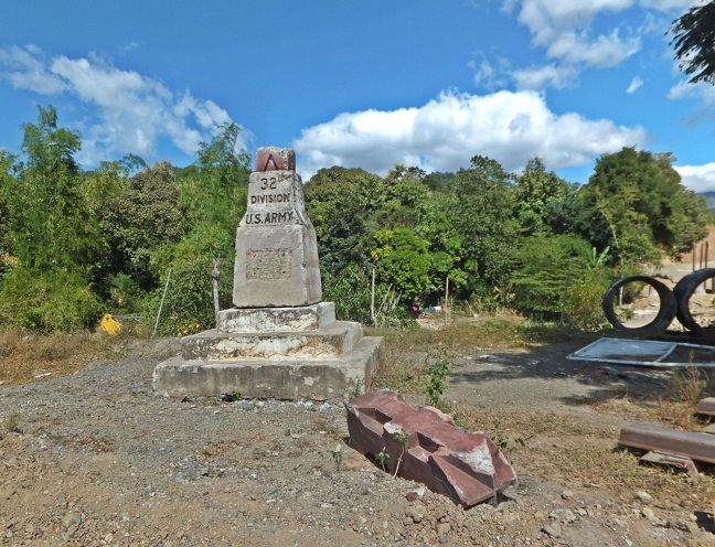 V451. (f4 161130 Monument,WWII, 32d Div. 4). This 30th Nov. 2016 image shows the damaged WWII 32d Div Monument. It is now on the left side of the Cabalisian River. This picture shows the complete parts of the damaged monument. The new bridge is being built at right and the Cabalisian River runs to the left behind the monument. We are wondering whether the plaque, missing from this old WWII Monument, next to the Cabalisian River was moved to or used on the newer WWII 32d Div. Red Arrow Monument. It is located at a corner of the San Nicolas Plaza, at the corner next to major road intersection; Ville Verde, San Roque Dam, Tayug and Natividad. 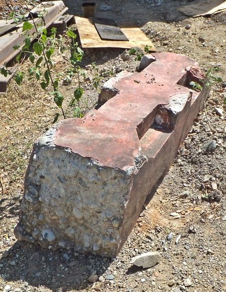 V452. (f6 161130 Monument,WWII, 32d Div. 6). This 30th Nov. 2016 image shows the tip of the damaged Red Arrow WWII 32d Div Monument. It is now on the left side of the Cabalisian River. 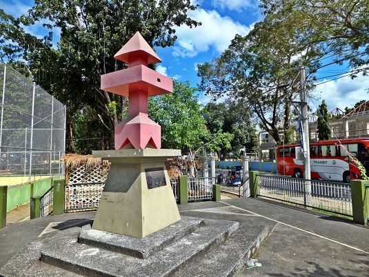 V453. (f7 161130 SanNicolas 32dDiv.Monument 1). This 30th Nov. 2016 image shows the newer WWII 32d Div. Red Arrow Monument. It is located at a corner of the San Nicolas Plaza, at the corner next to major road intersection; Ville Verde, San Roque Dam, Tayug and Natividad. 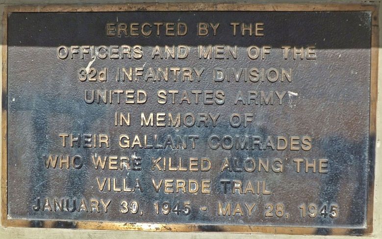 V454. (f10 161130 SanNicolas 32dDiv.Monument 3). This is the plaque of the newer WWII 32d Div. Red Arrow Monument. It is located at a corner of the San Nicolas Plaza. We are wondering whether this is the plaque from the old WWII Monument, next to the Cabalisian River which is damaged now. |
|
|
|
Post by Karl Welteke on Dec 20, 2016 11:09:01 GMT 8
Villa Verde Trail is being worked on at the Pangasinan end. This entry is about the first three (3) km. More sections are to follow! On the 21st of June 2016 Mr. Rodel S. Mallillin (resident of San Nicolas, Pangasinan) reported in this forum and thread, that the Villa Verde trail is being worked on with the goal to establish a two lane road from Pangasinan to Nueva Viscaya. He further reported that the 32nd Div. Monument was damaged during the road construction. A friend and I planned to visit the Villa Verde Trail on the 30th Nov 2016 and check on the progress of building the road and whether anything further is happening to the damaged WWII 32d Inf. Div. Monument. With Canadian George and his wife Marisa, we drove to San Nicolas and teamed up with Mr. Rodel S. Mallillin. He briefed us that the work on the Ville Verde Road is continuing, that the bridge over the Cabalisian River got started. He and his wife were very gracious and treated us to coffee and a few bites. It was possible to ford the river by my car and the road bed was so well prepared that we were able to drive up to the 3 km Mark. We were able to walk the next 7 km up to the 10 km mark because the construction crew had cleared the trail with machinery to there. We tried to go further but it was too difficult, even hazardous to maneuver around the ravines, the trail was grown over too much, we could not get thru. The first 3 km of the new Pangasinan-Nueva Vizcaya Road, These 12 images, named e01 to e12 cover only the first 3 km of the new Pangasinan-Nueva Vizcaya Road, which follows the historic Villa Verde Trail. I estimate the distance from the new bridge across the Cabalisian River up to Malico Village at the Salacsac Passes as 20 km. From Malico, the Salacsac Passes, down to Santa Fe is another 20 km. That portion of the Nueva Vizcaya to Pangasinan is practically finished and is drivable. I uploaded 12 images to this Flickr album at about 600 KB size of each image and they are numbered e01 to e12: www.flickr.com/photos/44567569@N00/albums/72157675844936502The same 12 images are presented here but the pictures are much smaller: 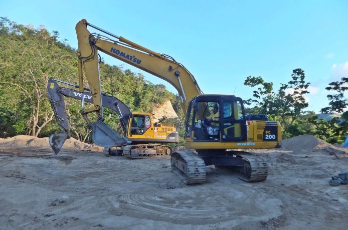 V457. (E01). On the 1st Dec 2016 we drove thru the Cabalisian River, near the bridge being built, up the new Pangasinan-Nueva Vizcaya Road, which follows the historic Villa Verde Trail. We stopped and parked at the approximate 3 km mark from the bridge over the Cabalisian River. We seen these two backhoes and checked with the operators. 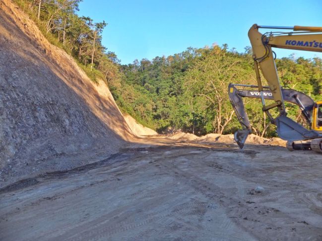 V458. (E02). This is how the new Pangasinan-Nueva Vizcaya road looks like going up from the approximate 3 km mark from the bridge over the Cabalisian River. 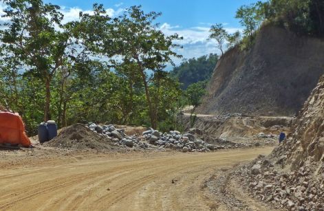 V459. (E03). This is how the new Pangasinan-Nueva Vizcaya road looks like going down from the approximate 3 km mark from the bridge over the Cabalisian River. 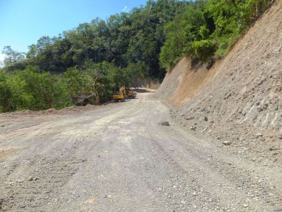 V460. (E04). This shot is much later and we are on our walk back down to the 3 km mark (from the bridge over the Cabalisian River). The backhoes have moved further up, passed the next ravine, and this shot is from the next ridge point up from the 3 km mark on the new Pangasinan-Nueva Vizcaya Road, which follows the historic Villa Verde Trail. 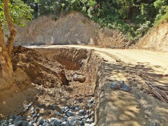 V461. (E05). This is the ravine between the last image and the 3km mark of the new Pangasinan-Nueva Vizcaya Road, which follows the historic Villa Verde Trail. We had parked our car at that 3km mark. The backhoes prepared the foundation ground for an embankment. 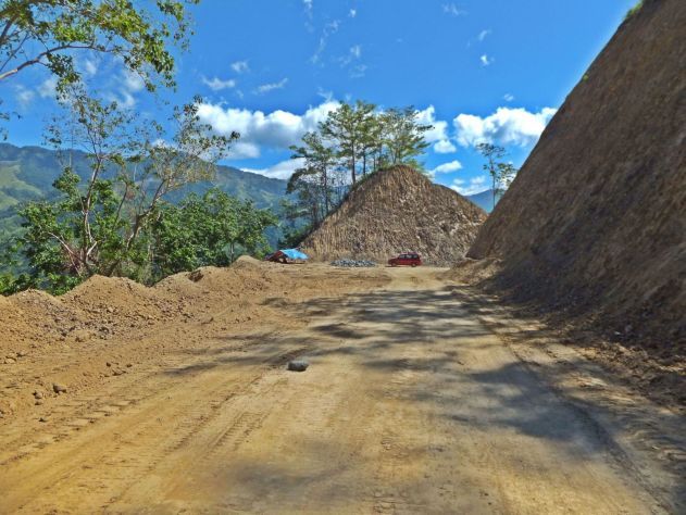 V462. (E06). That is the 3 km mark from the bridge over the Cabalisian River on the new Pangasinan-Nueva Vizcaya Road, which follows the historic Villa Verde Trail. We parked our car there and the two backhoes are gone and had worked on the ravine in the previous picture. 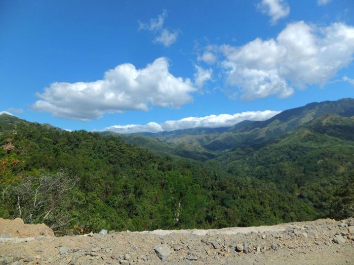 V463. (E07). At the 3 km mark from the bridge over the Cabalisian River on the new Pangasinan-Nueva Vizcaya Road, which follows the historic Villa Verde Trail we had a look back. This is the view up the drainage area of the Cabalisian River. That grassy ridge, far ahead, is the watershed boundary of the Cabalisian River and the Villa Verde Trail runs behind it. 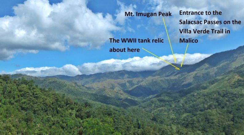 V464. (E08). This is a close-up of the last image but I marked it with some important landmarks of the Villa Verde Trail at the 3 km mark from the bridge over the Cabalisian River on the new Pangasinan-Nueva Vizcaya Road, which follows the historic Villa Verde Trail we had a look back. This is the view up the drainage area of the Cabalisian River. That grassy ridge, far ahead, is the watershed boundary of the Cabalisian River and the Villa Verde Trail runs behind it. 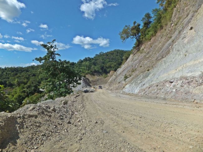 V465. (E09). A view of a stretch of the new Pangasinan-Nueva Vizcaya Road, which follows the historic Villa Verde Trail down road from the 3 km mark where we parked. We shot this image as we drove down-road from our parking spot at the 3km mark. 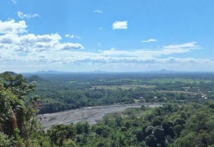 V466. E10. A view down onto the Cabalisian River and the grand province of Pangasinan as we drove down road from our parking spot at the 3km mark. We can see three hills in the distance. I do know they are south of the Agno River but I do not know their names. 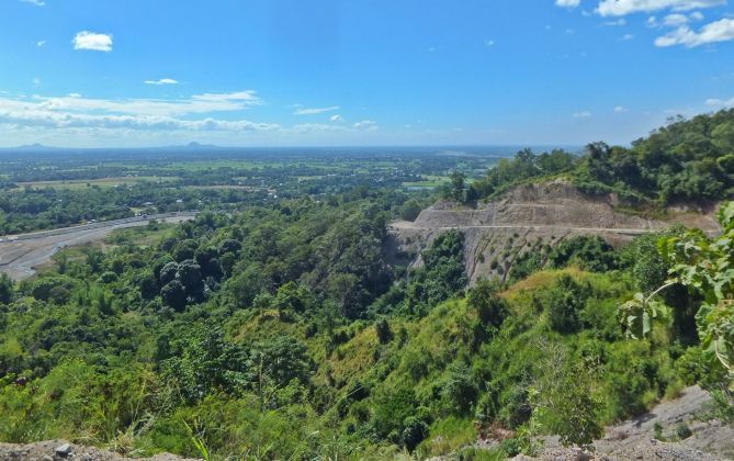 V467. (E11). This grand view from the new Pangasinan-Nueva Vizcaya Road, which follows the historic Villa Verde Trail, shows us Pangasinan, 2 of the 3 hills in the previous image and the Agno River in the distance. 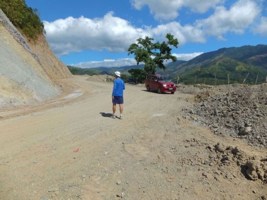 E12. This is a last view of a stretch of the new Pangasinan-Nueva Vizcaya Road, which follows the historic Villa Verde Trail. This is down-road from the 3km mark from the bridge over the Cabalisian River. |
|
|
|
Post by Karl Welteke on Jan 1, 2017 13:42:54 GMT 8
Villa Verde Trail is being worked on at the Pangasinan end. This entry is about the seven (7) km we walked out of the ten (10) km we moved up the trail. More sections are to follow! We drove up to the 3 km mark. On the 21st of June 2016 Mr. Rodel S. Mallillin (resident of San Nicolas, Pangasinan) reported in this forum and thread, that the Villa Verde trail is being worked on with the goal to establish a two lane road from Pangasinan to Nueva Viscaya. He further reported that the 32nd Div. Monument was damaged during the road construction. A friend and I planned to visit the Villa Verde Trail on the 30th Nov 2016 and check on the progress of building the road and whether anything further is happening to the damaged WWII 32d Inf. Div. Monument. With Canadian George and his wife Marisa, we drove to San Nicolas and teamed up with Mr. Rodel S. Mallillin. He briefed us that the work on the Ville Verde Road is continuing, that the bridge over the Cabalisian River got started. He and his wife were very gracious and treated us to coffee and a few bites. It was possible to ford the river by my car and the road bed was so well prepared that on the 1st Dec. 2016 we were able to drive up to the 3 km Mark. We were able to walk the next 7 km up to the 10 km mark because the construction crew had cleared the trail with machinery to there. We tried to go further but it was too difficult, even hazardous to maneuver around the ravines, the trail was grown over too much, we could not get thru. The 7 km walk out of the 10 km trail of the new Pangasinan-Nueva Vizcaya Road. These 22 images (22 in the album) are numbered A01 to A22. They cover only the section from the 3 km mark to the 10 km mark which is the section we walked. Authorities are now building a new road along the old Villa Verde Trail which also played a vital role in WWII. It is about 20 km from the Cabalisian River Bridge to Malico but so far only 3 km have been prepared. From Malico, the Salacsac Passes, down to Santa Fe is another 20 km. That portion of the Nueva Vizcaya to Pangasinan is practically finished and is drivable. I uploaded 22 images to this Flickr album at about 600 KB size of each image and they are numbered a01 to a22: www.flickr.com/photos/44567569@N00/albums/72157675844936502Only 16 images are presented here but the pictures are much smaller: 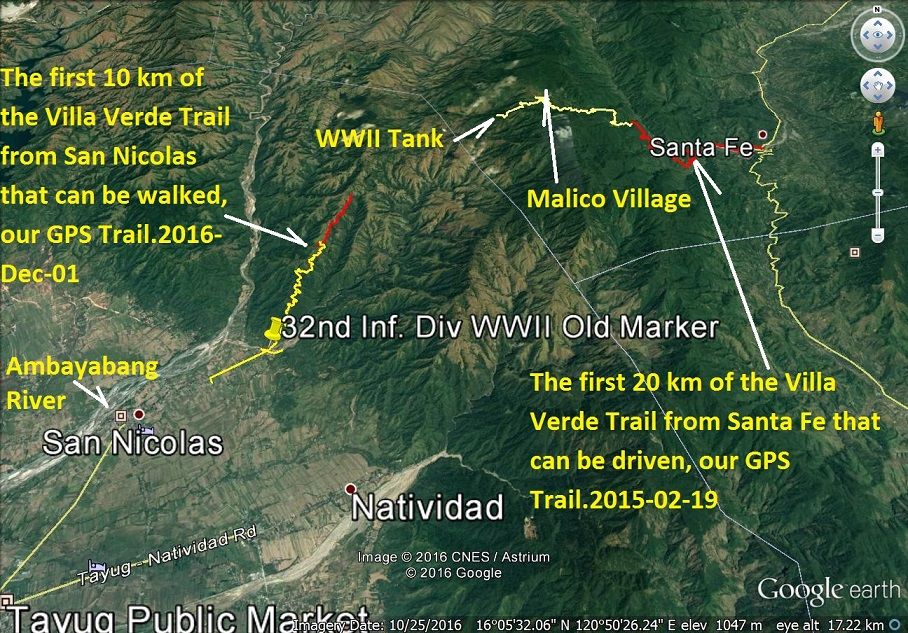 V507. (A01). Google earth map of the Villa Verde trail. We heard that the Villa Verde Trail is going to be build as a road to Nueva Vizcaya. On the 1st Dec. 2016 friends and I drove to San Nicolas, found a place to stay in Tayug and checked it out. 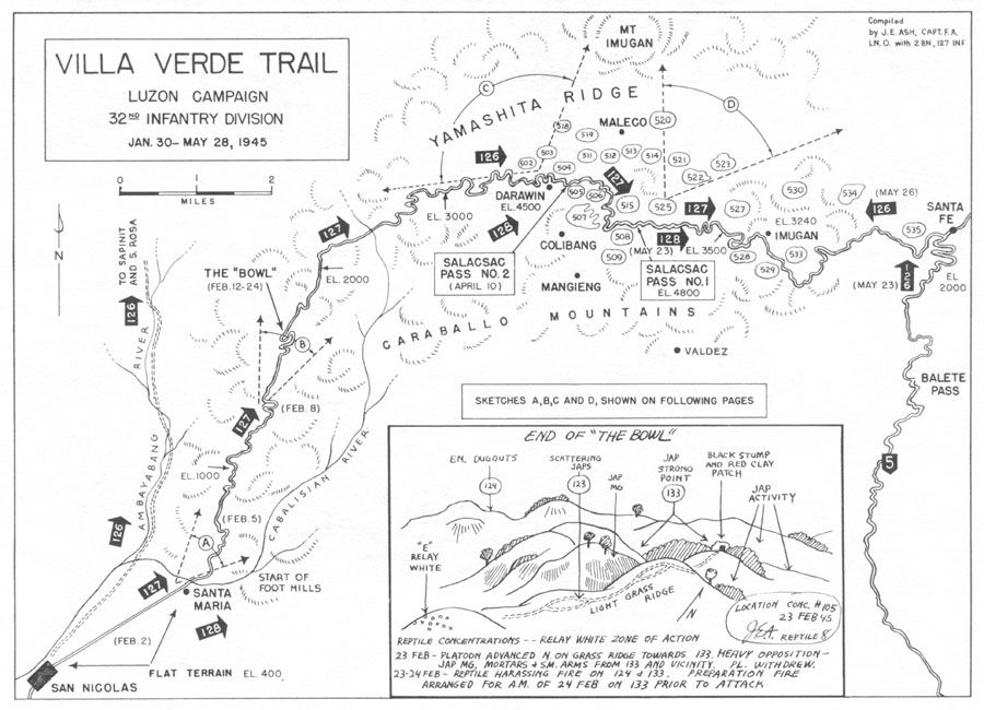 V508. (A02). This is a WWII map of the Villa Verde Trail from San Nicolas to the Salacsac Passes. It came from the 32 Inf. Div, Red Arrow, and Association web pages. 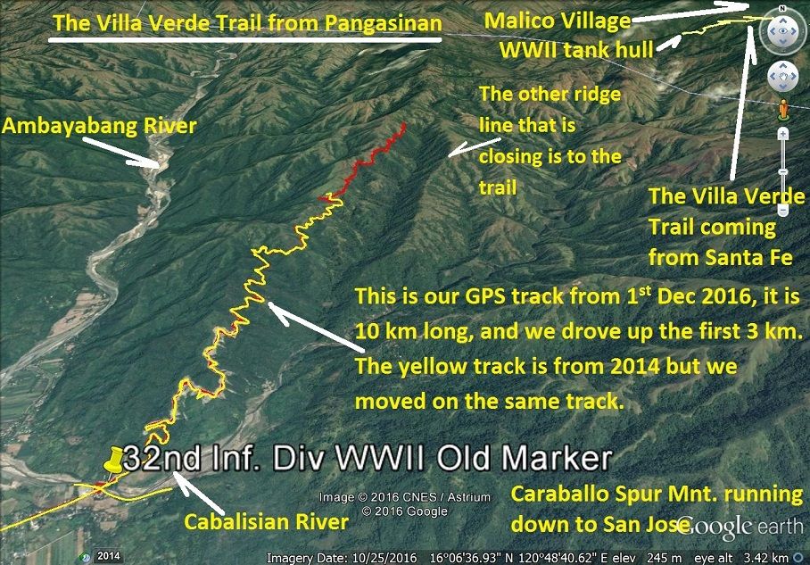 V509. (A03). This is a Google Earth map of the Villa Verde Trail, Pangasinan side, and shows the area of the 10 km we moved up the trail on the 1st Dec 2016. 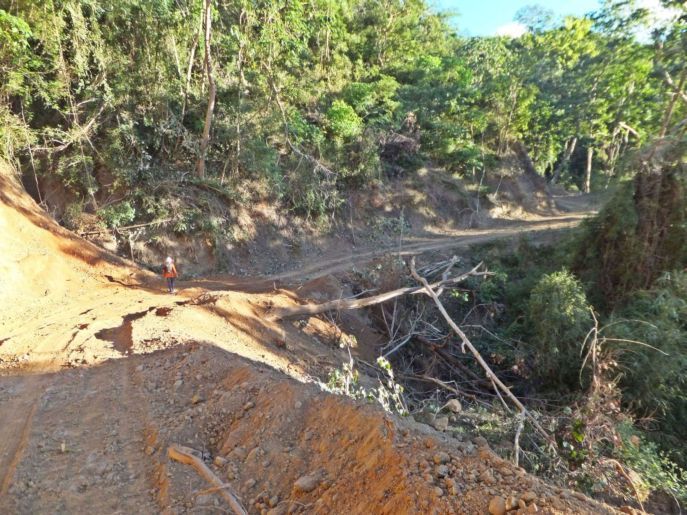 V510. (A04). After we drove thru the Cabalisian River and up to the 3km Mark, on the new road being prepared, we parked the car. We continued on foot, as planned, and soon we walked on the road that only recently had been retraced by machinery. 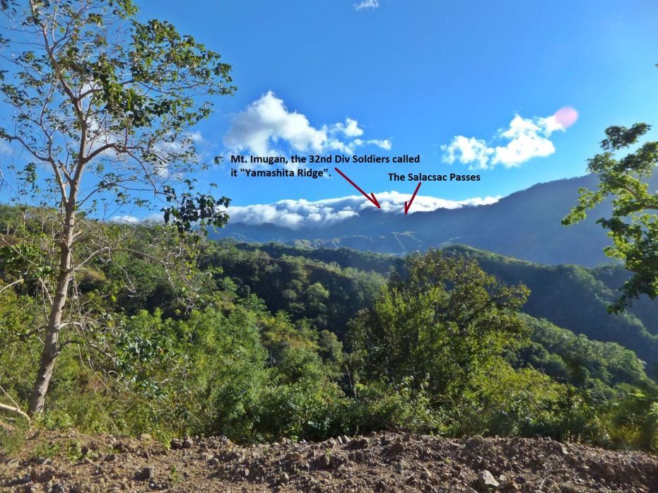 V511. (A05). Every so often we had a view of our goal, the Salacsac Passes, at Malico Village. 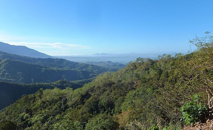 V512. (A06). Sometime we got a view back towards the Pangasinan flat lands from our Villa Verde Trail. 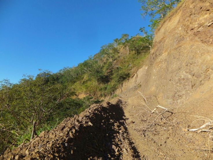 V513. (A07). The Villa Verde Trail in preparation to build it as a road was retraced with Machinery and so we were able to follow it on foot. 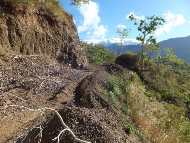 V514. (A08). The Villa Verde Trail in preparation to build it as a road was retraced with Machinery and so we were able to follow it on foot. We are looking ahead and this stretch of trail is pointing directly at the Salacsac Passes on the Villa Verde trail. 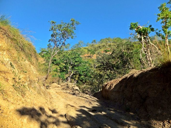 V515. (A09). This is interesting; we are approaching the area that is called the Bowl on the WWII map. But I will enter another segment about it in the future. Notice, that the ridgeline ahead is now grassy one. 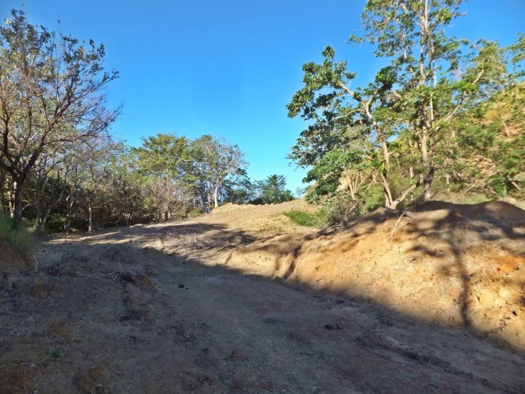 V516. (A10). This is interesting; we are approaching the area that is called the Bowl on the WWII map. But I will enter another segment about it in the future. This was the only place where we were able to get a view of the Ambayabang River. 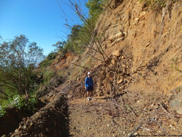 V517. (A13). Sometime we had to climb over landslides, this one was a little difficult for us old ones. 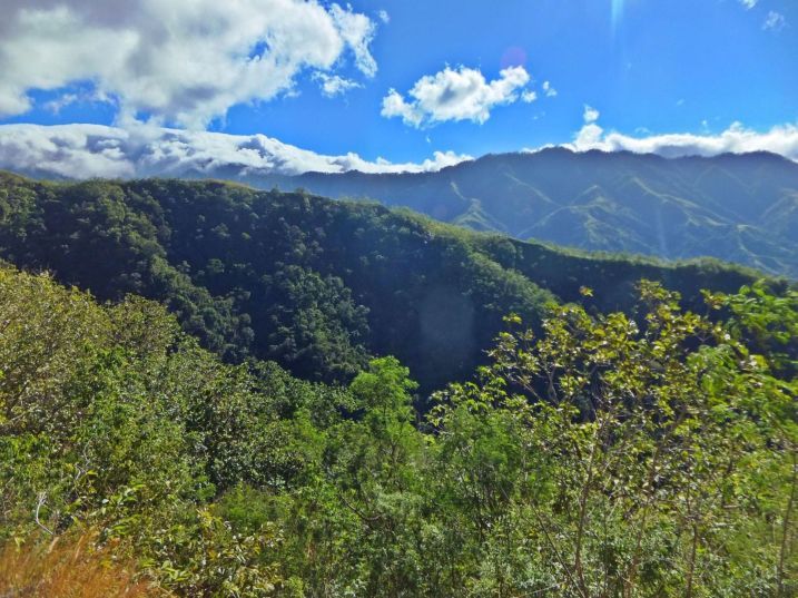 V518. (A14). This is a look from the Villa Verde Trail across the ridge to our right closing in but in back is the Caraballo Mountain Spur running to the right and down to San Jose. The Salacsac Passes and Mt Imugan are at left in the clouds. 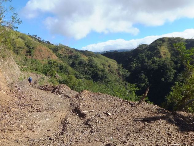 V519. (A15). The Villa Verde trail, as traced by the road builders, goes on wand we pursue. The ridge line a right is getting closer. 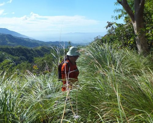 V520. (A18). This was the end, not the grass. Tracing of the Villa Verde Trail with Machinery stopped here. This is the 10 km mark from the new bridge across the Cabalisian River. We tried to go on but at the next ravine it was plain dangerous, it became too risky. Plus there were no traces that people used this trail in recent times. 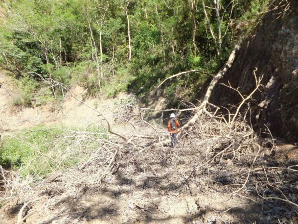 A19. We had to turn back, here is view of a tree fallen, thru, over it we had to climb. 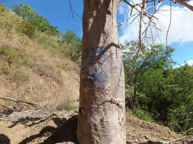 A20. Some of the trees were marked this way, maybe it means 213 km and 580m meters from Manila. |
|
|
|
Post by Karl Welteke on Jan 20, 2017 18:20:39 GMT 8
Is this the Bowl? Are there two Trails? The Villa Verde Trail. As I mentioned before, with Canadian George and his wife Marisa, we drove to San Nicolas, Pangasinan on 2016-11-30 to check out the new work that is going on, building the new road from Pangasinan to Santa Fe, Nueva Vizcaya.  V508. (A02). The Bowl is indicated on this map and that they were fighting here about 2 weeks. That got our interest up and this entry is dedicated to the Bowl! This is a WWII map of the Villa Verde Trail from San Nicolas to the Salacsac Passes. It came from the 32 Inf. Div, Red Arrow, and Association web pages. 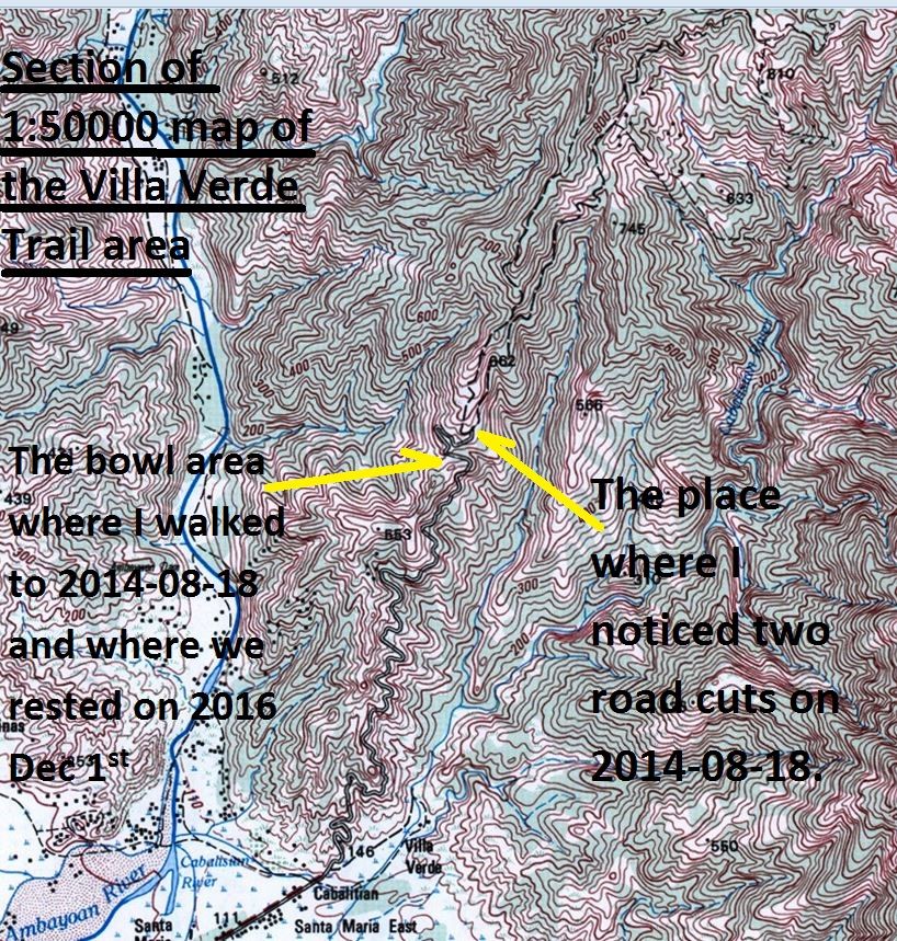 V562. (bo2). This is a section of a 1:50000 scale Philippine Map from the Villa Verde Trail area. I marked the Bowl area. What is interesting is that this map shows two tracks continuing up from the Bowl area. The new construction follows the right track. On my walk up the Villa Verde Trail on the 18th Aug. 2014 I stopped at the point where the trail split up and two road cuts continued right and left. That was about 8 km up from the bottom of the trail, starting at the new bridge over the Cabalisian River. 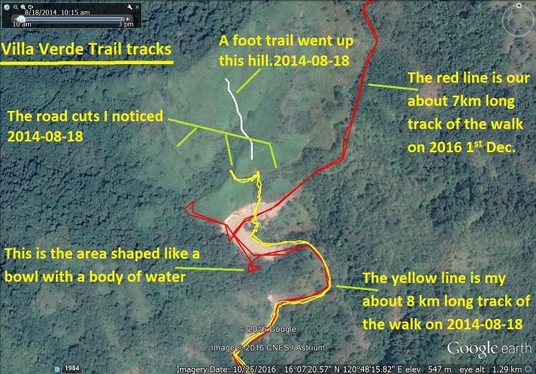 V563. (b01). This is a zoomed-in GE image of the Bowl area and it shows the red track which we walked on the 1st Dec. 2016 and the yellow track which I walked on the 18th Aug. 2014. That is where I stopped then and I did notice two road cuts continuing left and right from that point.  V515. (A09). This was interesting; we are approaching the area that is called the Bowl on the WWII map. Notice, that the ridgeline ahead is now a grassy one. Up to this 8 km mark the slopes were mostly wooded.  V516. (A10). This is interesting; we are approaching the area that is called the Bowl on the WWII map. This was the only place where we were able to get a view of the Ambayabang River. Dead ahead is the water hole and on our return walk we rested here. This place is about 8 km up from the bottom of the trail, starting at the new bridge over the Cabalisian River. 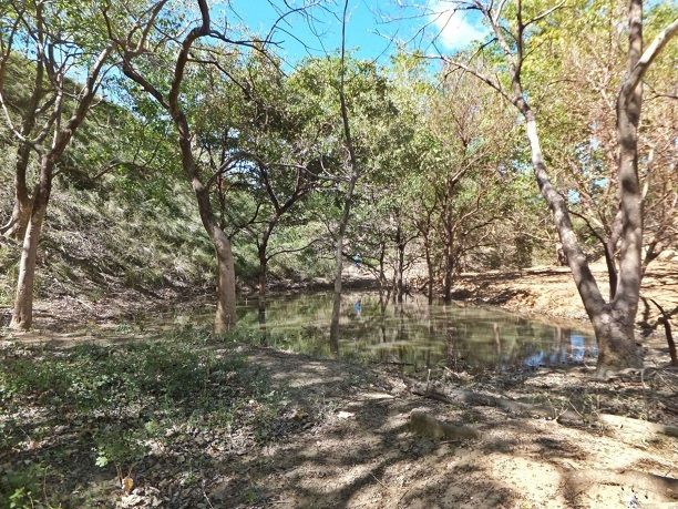 V564. (b03) We are resting at the water hole in the Bowl area on the Villa Verde Trail. This was the only place where we were able to get a view of the Ambayabang River. This place is about 8 km up from the bottom of the trail, starting at the new bridge over the Cabalisian River. I showed my two partners, where I walked to on the 18th Aug. 2014. 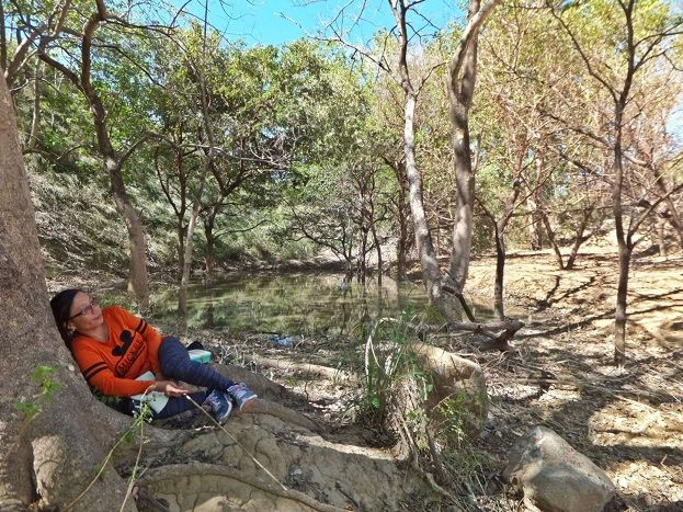 V565. (b04) We are resting at the water hole in the Bowl area on the Villa Verde Trail. This was the only place where we were able to get a view of the Ambayabang River. This place is about 8 km up from the bottom of the trail, starting at the new bridge over the Cabalisian River. 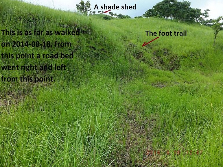 V566. (b05) This is where I stopped my walk on the 18th Aug. 2014 because of time and my plans and the picture is from that walk. But it is interesting because I seen a foot trail continue straight up to a shack and the road bed split up left and right like it is indicated on the above map. This place is about 8 km up from the bottom of the trail, starting at the new bridge over the Cabalisian River. 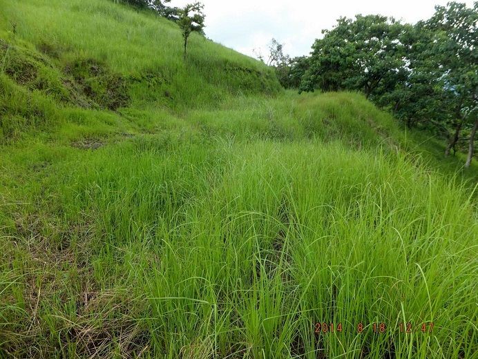 V567. (b06) This is where I stopped my walk on the 18th Aug. 2014 because of time and my plans. But it is interesting because I seen a foot trail continue straight up to a shack and the road bed split up left and right like it is indicated on the above map. Here we see the road bed continue to the right! This place is about 8 km up from the bottom of the trail, starting at the new bridge over the Cabalisian River. 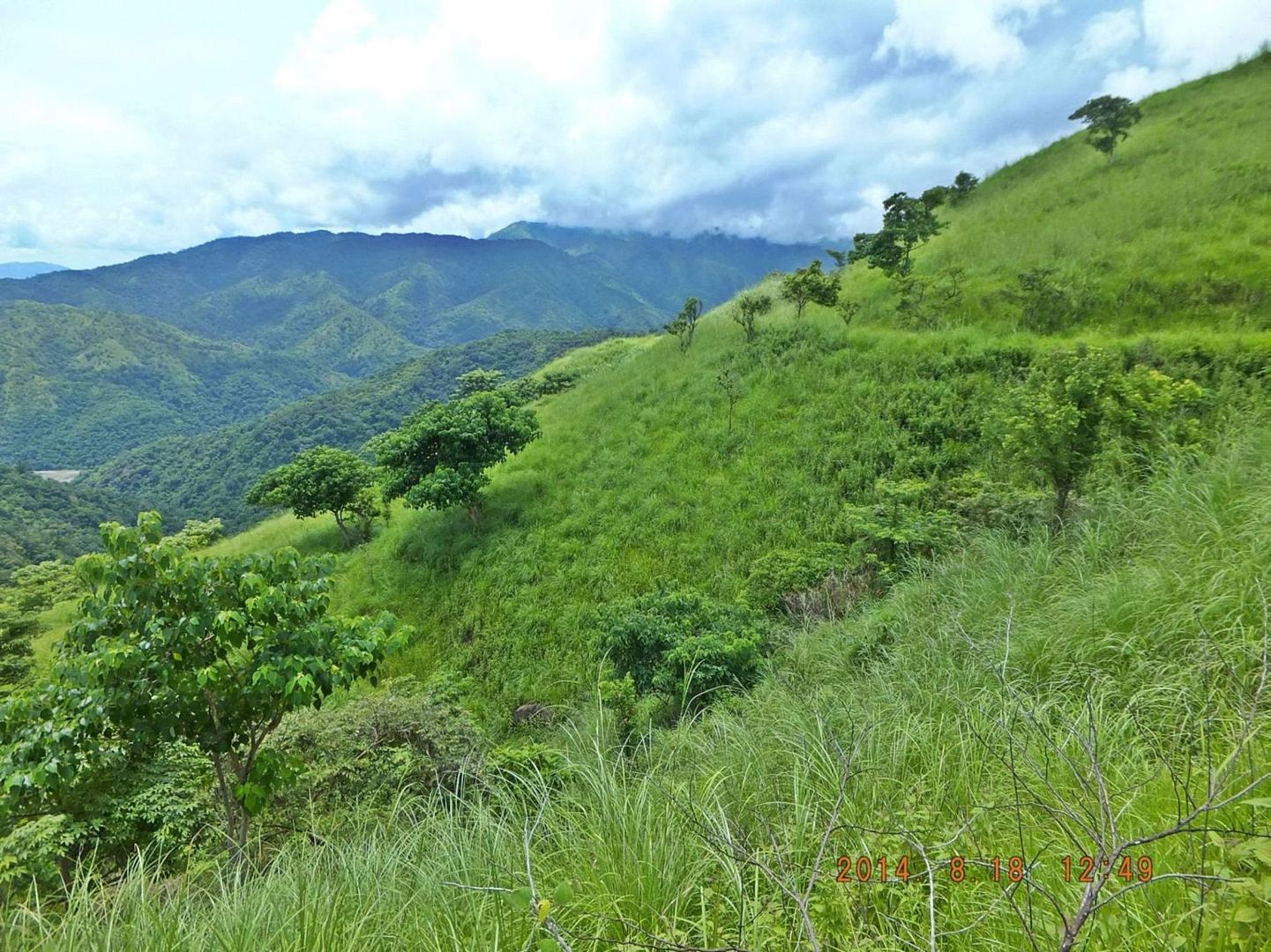 V568. (b06) This is where I stopped my walk on the 18th Aug. 2014 because of time and my plans. But it is interesting because I seen a foot trail continue straight up to a shack and the road bed split up left and right like it is indicated on the above map. Here we see the road bed continue to the left! This place is about 8 km up from the bottom of the trail, starting at the new bridge over the Cabalisian River. These 7 images, numbered b01 to b07 show part of the area we 3 walkers believe is and we called it the “Bowl” in this album. We believe this could be the “Bowl” area of the WWII maps. We certainly found it to be an interesting spot and it was the only time we got a glimpse of the Ambayoan River. They are uploaded into this Flickr album: “Villa Verde Trail is being worked on from San Nikolas”. www.flickr.com/photos/44567569@N00/albums/72157675844936502 |
|


