|
|
Post by T2 on Jul 16, 2018 7:39:58 GMT 8
|
|
|
|
Post by T2 on Jul 16, 2018 7:40:53 GMT 8
 ...just WOW. I must return now!!!!! |
|
|
|
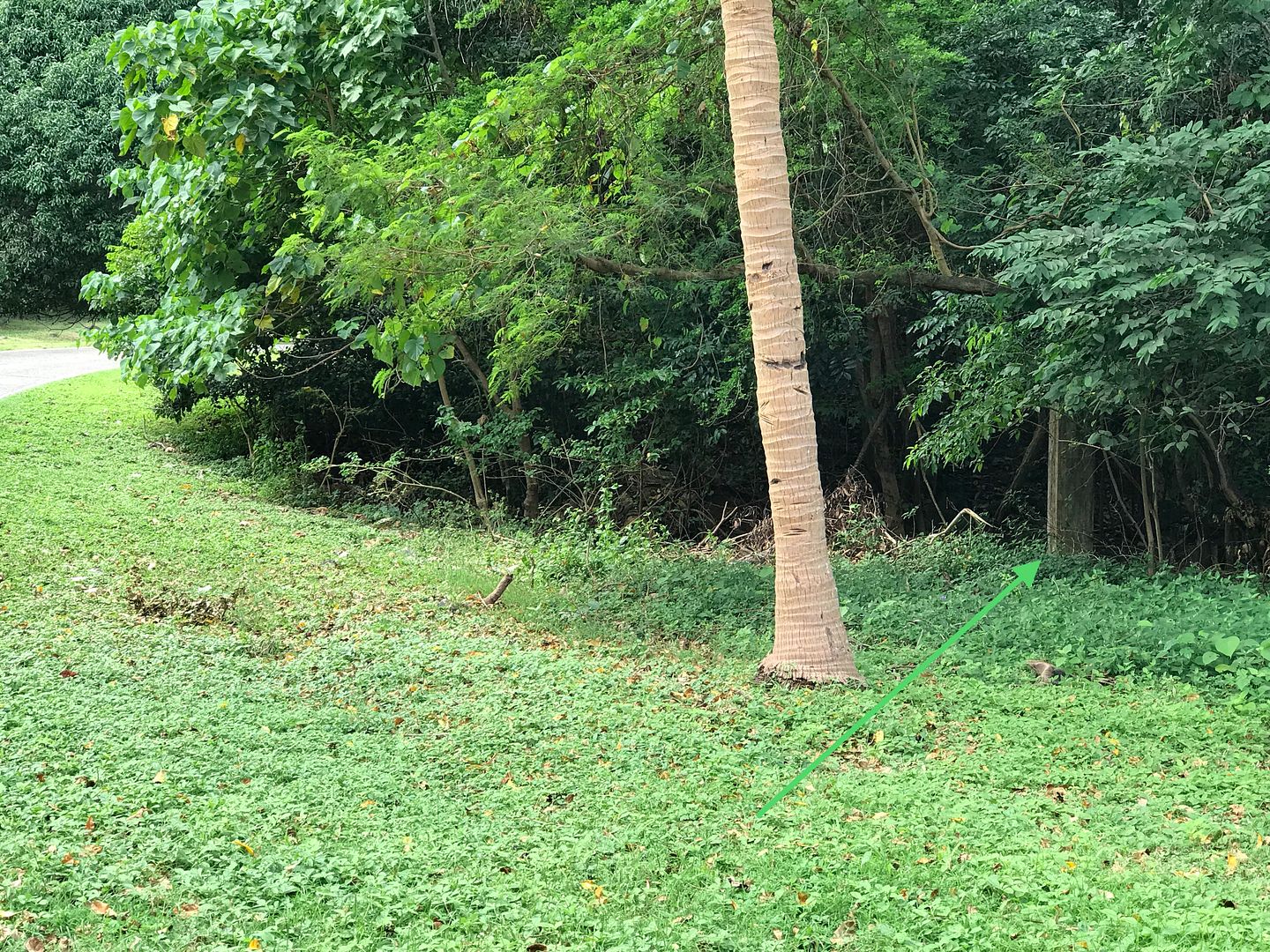
Post by T2 on Jul 16, 2018 7:53:02 GMT 8
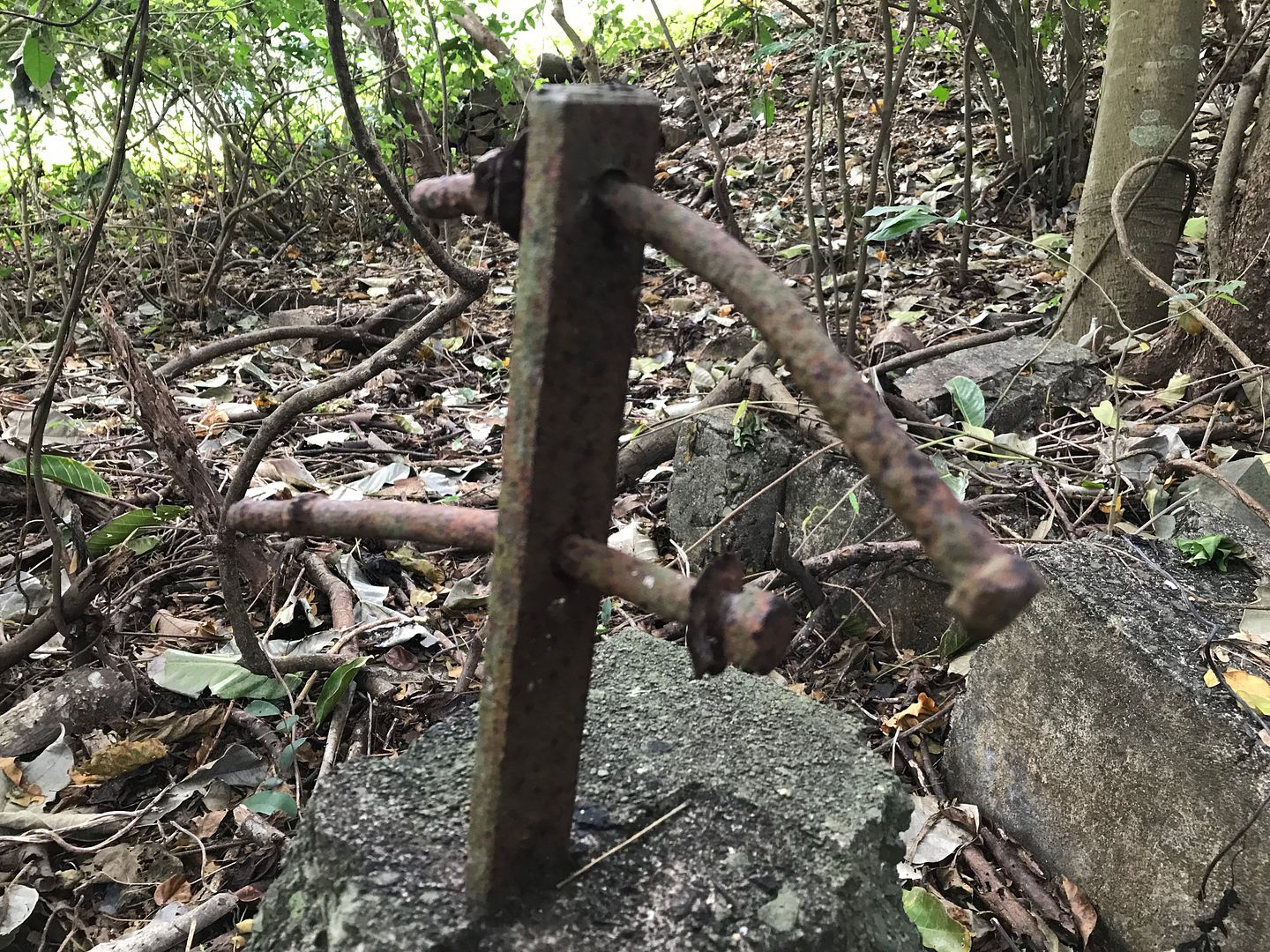 Some demolished column supports and hardware... 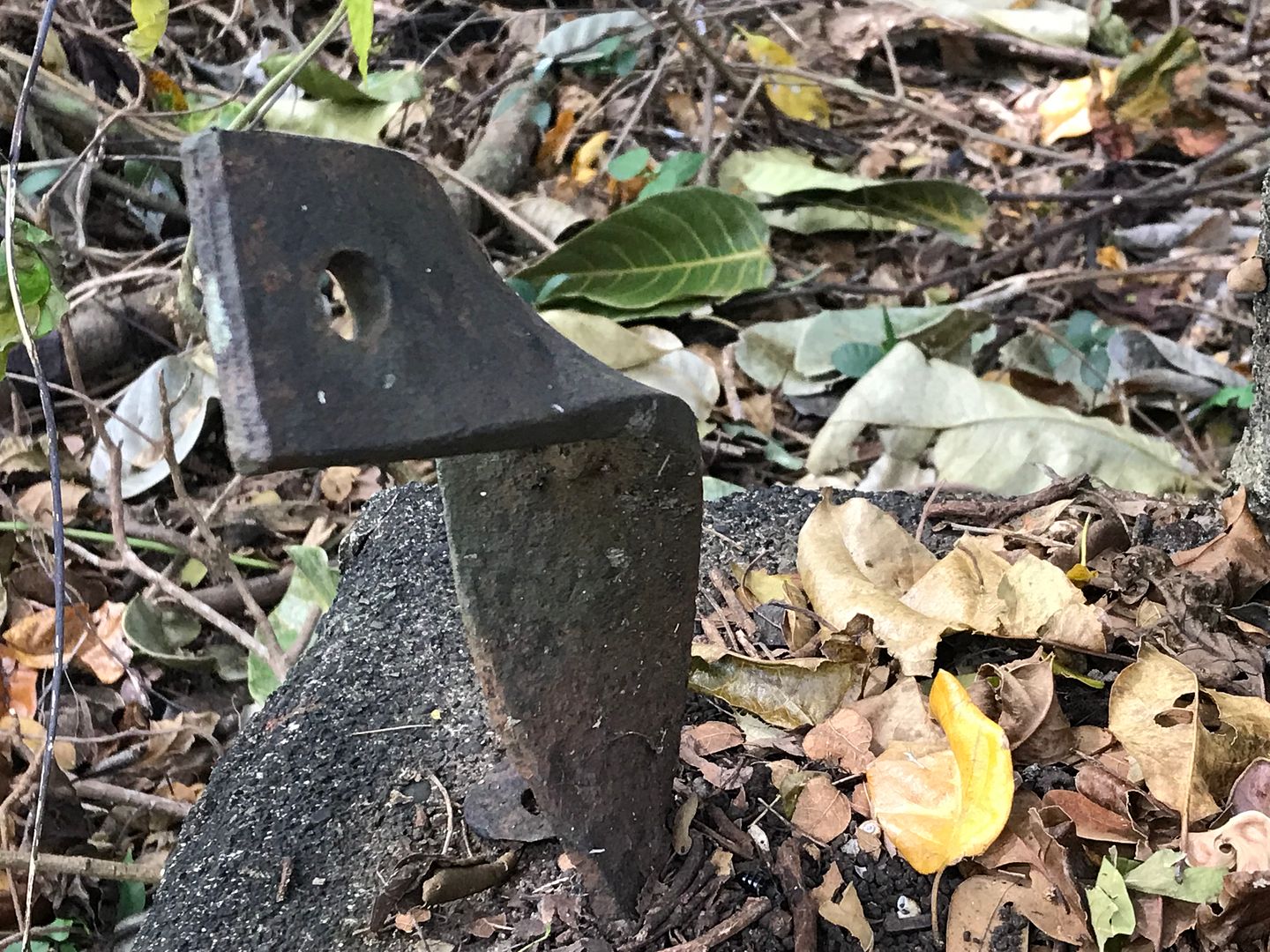 |
|
|
|
Post by T2 on Jul 27, 2018 6:38:39 GMT 8
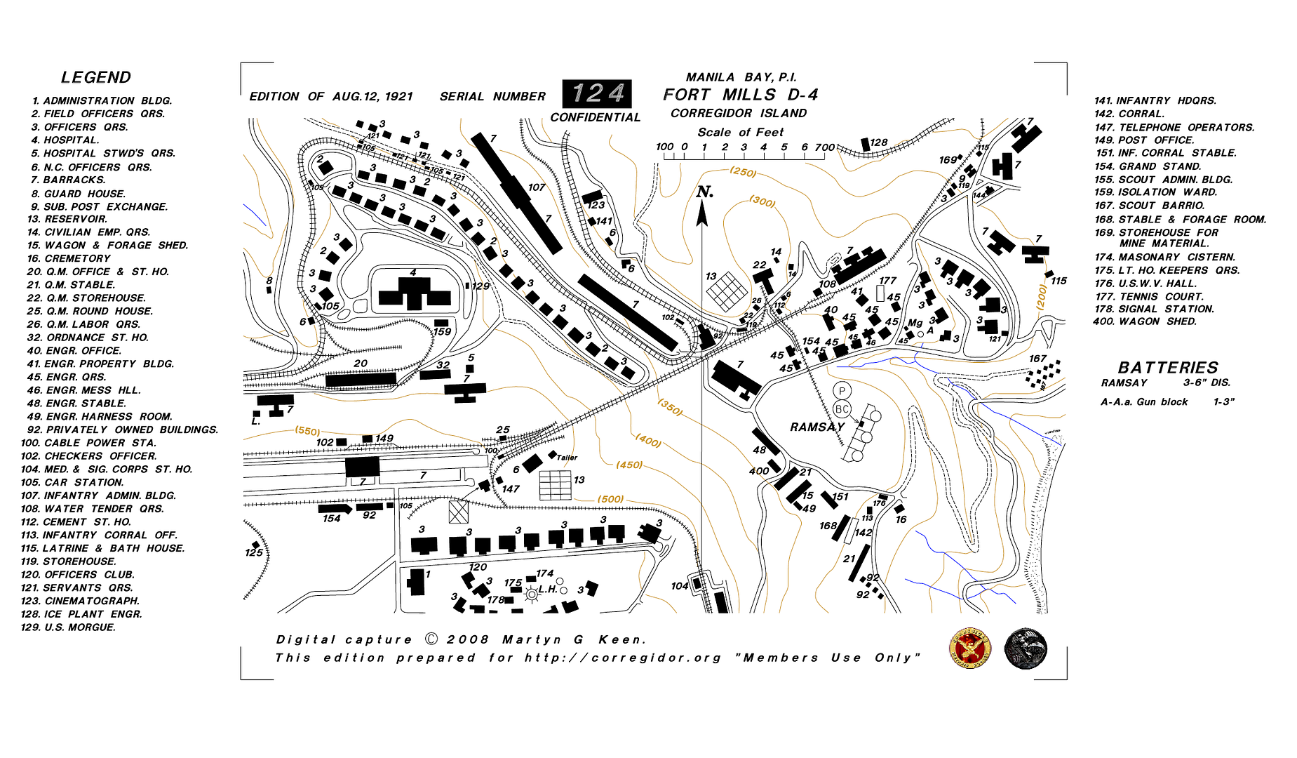 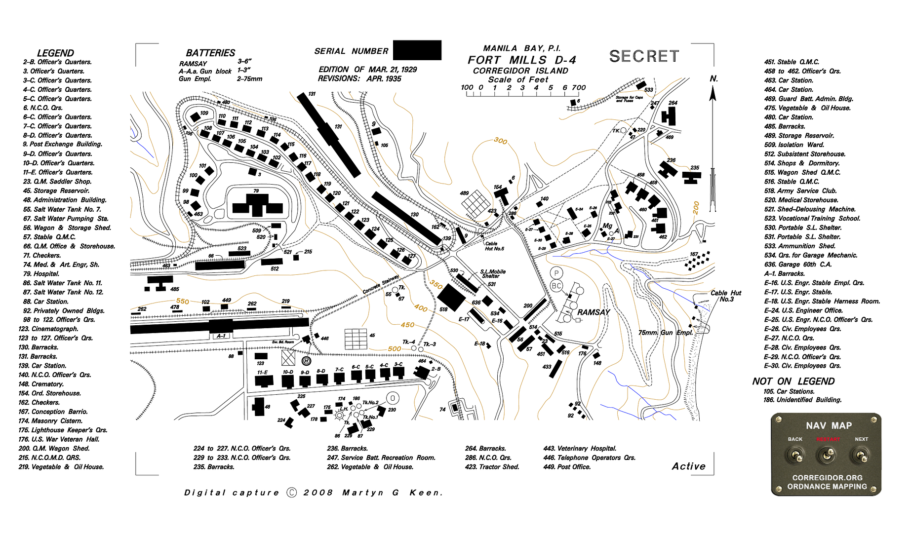 Taking the advise of our EXO...digging in and looking for more! I will continue to follow Al and Spencer. The 1921 map shows a slightly different Middleside near the parade grounds, the 1929/35 is what we know today. There is a huge amount I need to see in this area, I will make day 1 here. |
|
|
|
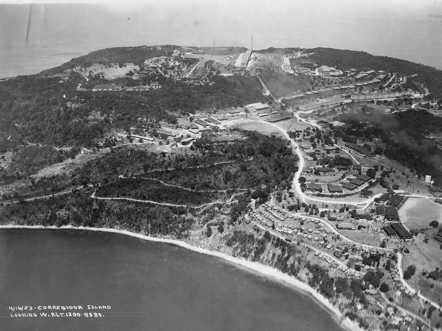
Post by T2 on Jul 27, 2018 6:42:06 GMT 8
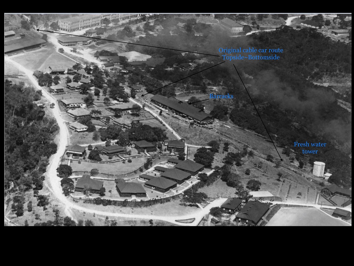 This is clear to see on both maps. This would have been Al and Spencer's vision for a few weeks anyway. This photo was taken April 16 1923 so the layout is closer to the 1921 map with many buildings and features easily cross referenced. Just saw something new, top left large building below my arrow tip was also a Barracks as referenced #7 in the 1921 map. This was demolished and the materials probably re-purposed to build another. The Middleside Parade Grounds were established late 20's early 30's I would imagine with the T junction as our road of today. |
|
|
|
Post by T2 on Jul 27, 2018 6:43:09 GMT 8
 ...more views |
|
|
|
Post by T2 on Jul 27, 2018 6:43:57 GMT 8
|
|
|
|
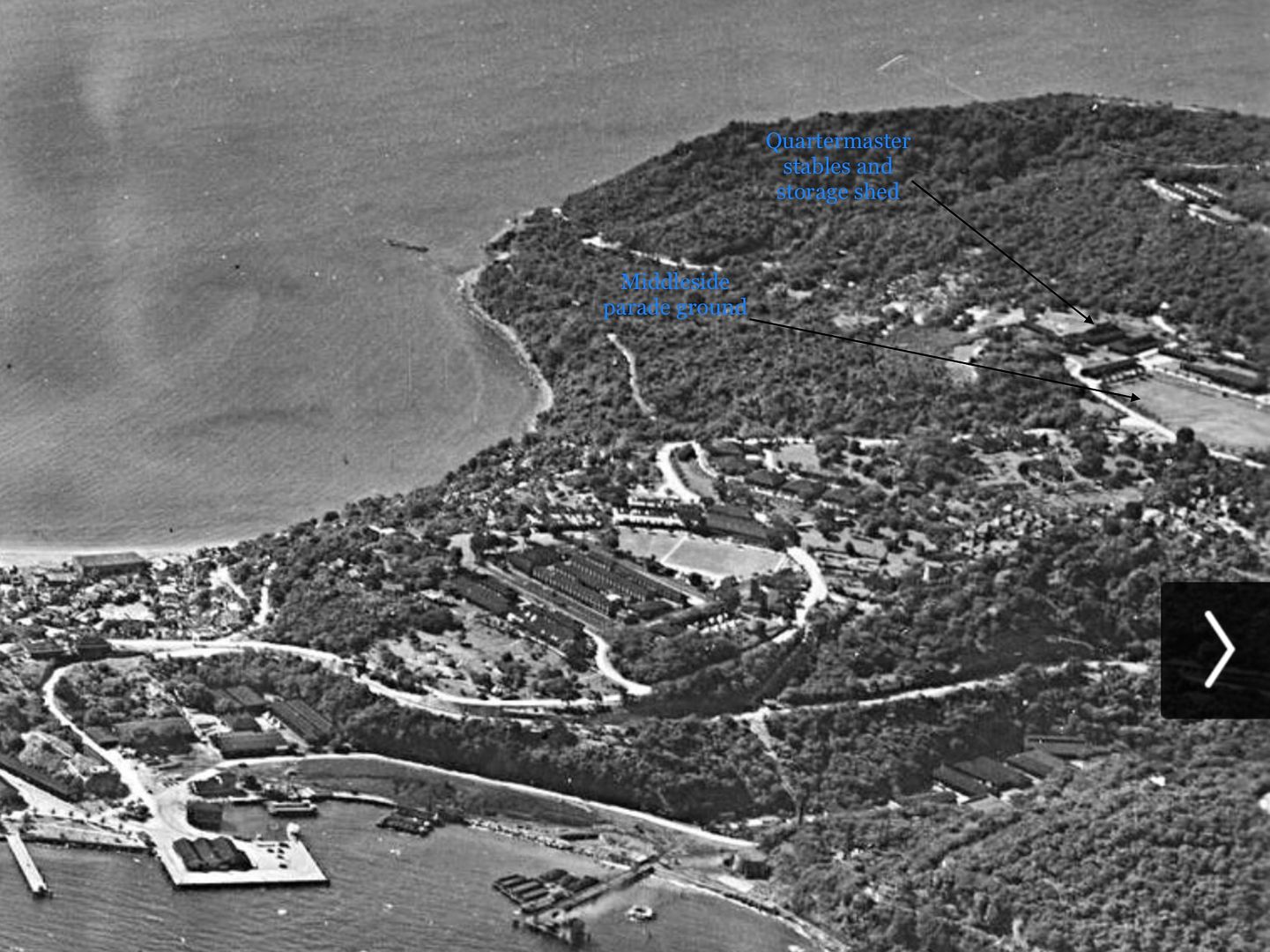
Post by T2 on Jul 27, 2018 6:47:36 GMT 8
 All of those glorious photos.....today. Straight ahead would be the Q M wagon shed and I bet that low level wall has a connection to the structure. The Q M stables are on the other side of the road...oh boy I'm going to be busy! |
|
|
|
Post by T2 on Jul 27, 2018 6:55:51 GMT 8
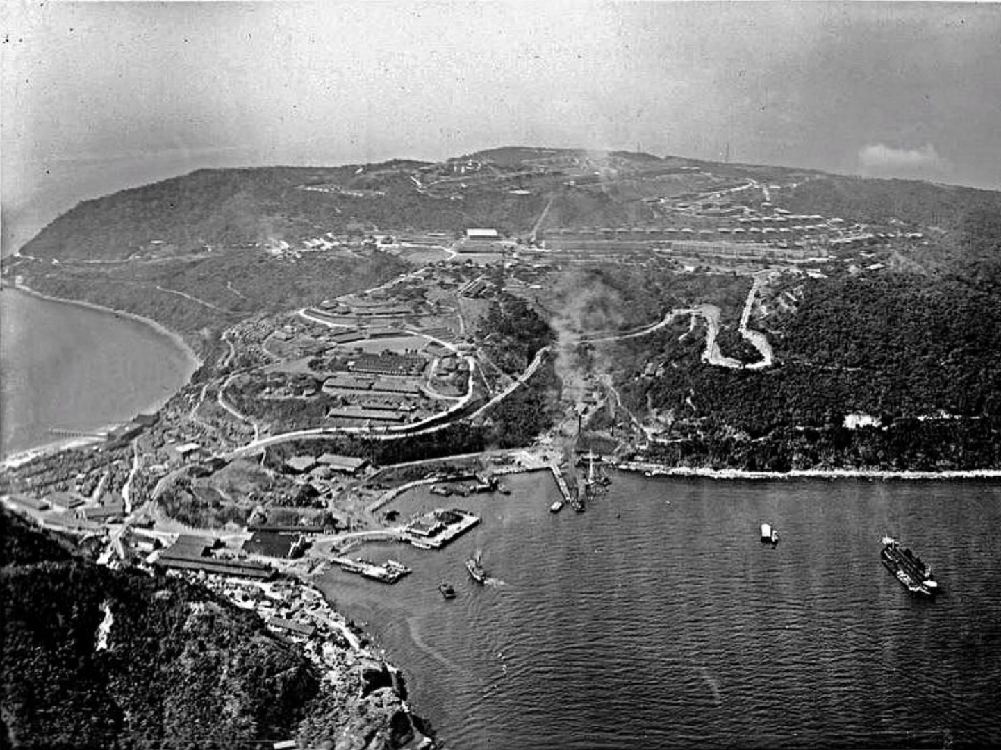 The full view...with 3 stacks billowing out smoke from the power plant. Please advise, I think it was still coal during this photo, January 7 1927 |
|
|
|
Post by T2 on Jul 27, 2018 19:12:56 GMT 8
 The official WOW photo. Corregidor is just perfect here! Note: In less than 2 years YMCA building is complete, nothing on the 1921 map. |
|


