|
|
Post by tomasctt on Jan 3, 2017 10:23:21 GMT 8
Hi all,
I'll be doing a road trip at Bataan sometime later this month and was planning to drive around the peninsula to Subic. I've seen maps showing the snaking/zig-zagging Mariveles-Bagac road, but from wot I've found on the net so far is dated (circa 2010-2014) information that most of the road is unpaved.
Any idea how much of the road is paved, and if the unpaved sections can be driven by a vehicle that is not a 4x4?
Thanks.
|
|
|
|
Post by Karl Welteke on Feb 7, 2017 16:46:14 GMT 8
Hello tomasctt Status of the Bataan West Road Sorry for the late answer; only seen it again today. 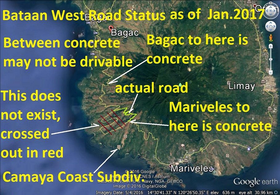 V583. Status of the Bataan West Road! I was at the Mariveles end last year and the Bagac end this year. There may be a section in the middle that is completely grown over, plus rivers may be very had to cross with an ordinary vehicle. This is the status as I know it. |
|
|
|
Post by cbuehler on Feb 16, 2017 0:05:57 GMT 8
Well, this I would like to know more about. Karl, do you have any old maps of the road that you could possibly overlay onto the what is currently known to be the west road to check if it actually is the same road today? I would assume that it is, but you mention that some sections may be grown over or otherwise obliterated.
I remember you mentioning the fact during my visit that there still was no way to get through to Mariveles from Bagac back in 2014.
Myself and I think others would certainly like to know what exactly is the current state of the road and if it is the original.
I might add that this old west road and the areas surrounding it must look far more like it did during the war than the old east road, which is now mostly unrecognizable from the war years.
CB
|
|
|
|
Post by Karl Welteke on Jan 16, 2018 15:55:25 GMT 8
Bataan West Road almost finished as of 2018-01-11 1st of 4 presentations. The last 5.7 km are 50 % concreted! I predict it will be open to the public within one year. A friend and I walked it on the 11th Jan. 2018 and took these pictures. My friend isa Naval Academy Graduate is about 70+, younger then I, but can outpace me like a rabbit and he even brings weights along to make my walks worthwhile. The pictures are uploaded at high resolution into this Flickr album; they are in the high and original resolution: www.flickr.com/photos/44567569@N00/sets/72157664688444838We also walked down the Anyasan Point Ridge Line, which will be a later presentation. The walk from the Bataan West Road to the Anyasan Point is 4 km. This ridge is between the Quinauan and Anyasan Bays, this was the main battle area of the WWII Battle of the Points. The sad news is that this whole ridge is now being developed as an upscale settlement area and perhaps a public amusement park. Camaya Coast hast started now and chased us away from the actual Anyasan Point. I edited 31 pictures for this presentation and will upload about 6 to 9 images at a time. Here are the first 8 images. 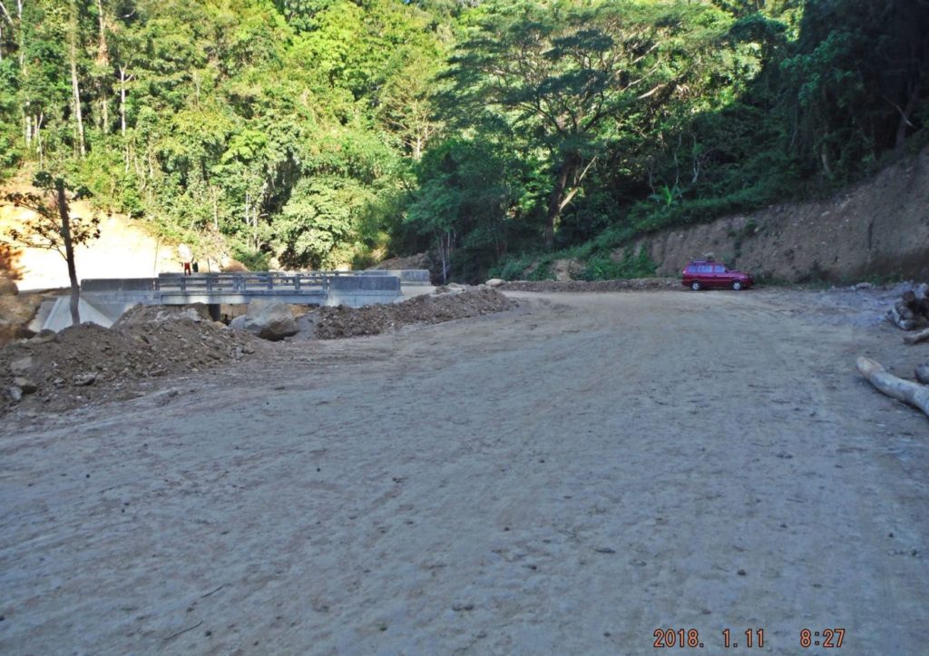 Za546. Quinawan River Bridge on the Bataan West Road. 001 We parked at Quinawan River Bridge and started walking on the Bataan West Road from here; it was 5.7 km, one way, from here to the Camaya Coast Gate. Quinawan is spelled on the old maps as Quinauan. 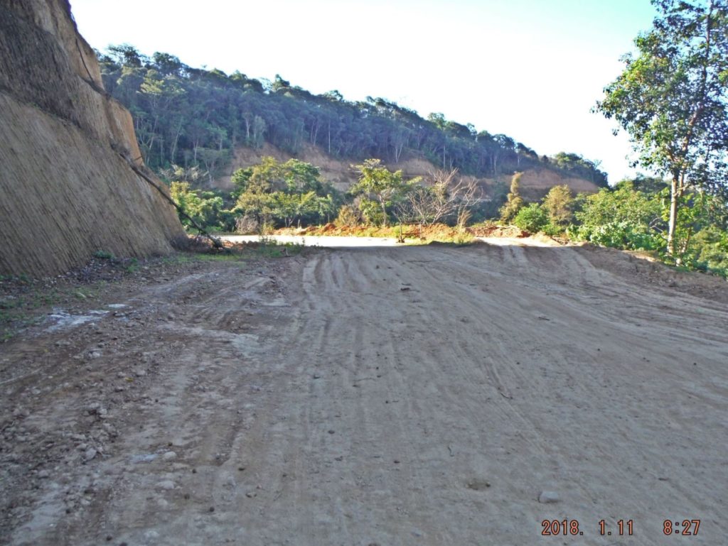 Za547. Bataan West Road, this is about 100 meters from the Quinawan River Bridge. 002. The last 5.7 km on the Bataan West Road is in the process of being finished. This is about 100 meters from the Quinawan River Bridge. 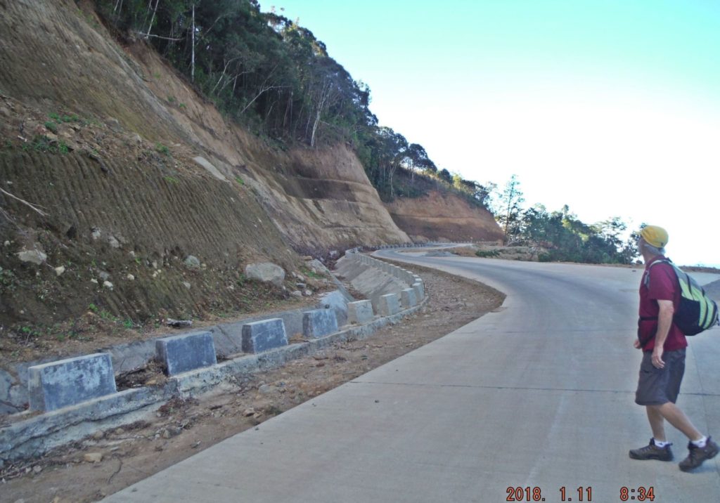 Za548. Bataan West Road, this was not far from Quinawan River Bridge. 003. This was not far from Quinawan River Bridge, concrete is completed here. We estimated that 50 % of the remaining 5.7 km is already finished. 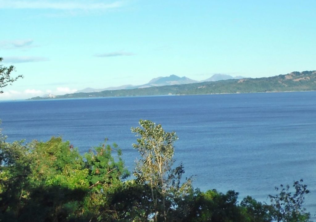 Za549. View north from the south end of the Bagac Bay. 004. A view from the south end of the Bagac Bay, we had a good vista today. Left is the nuclear power plant with the Subic Mountains behind it. In the middle are the Cabusilan Peeks near Dinalupihan and right are the western slopes of the Mt. Natib volcano. At the right edge of the picture the Bataan West Road crosses over. 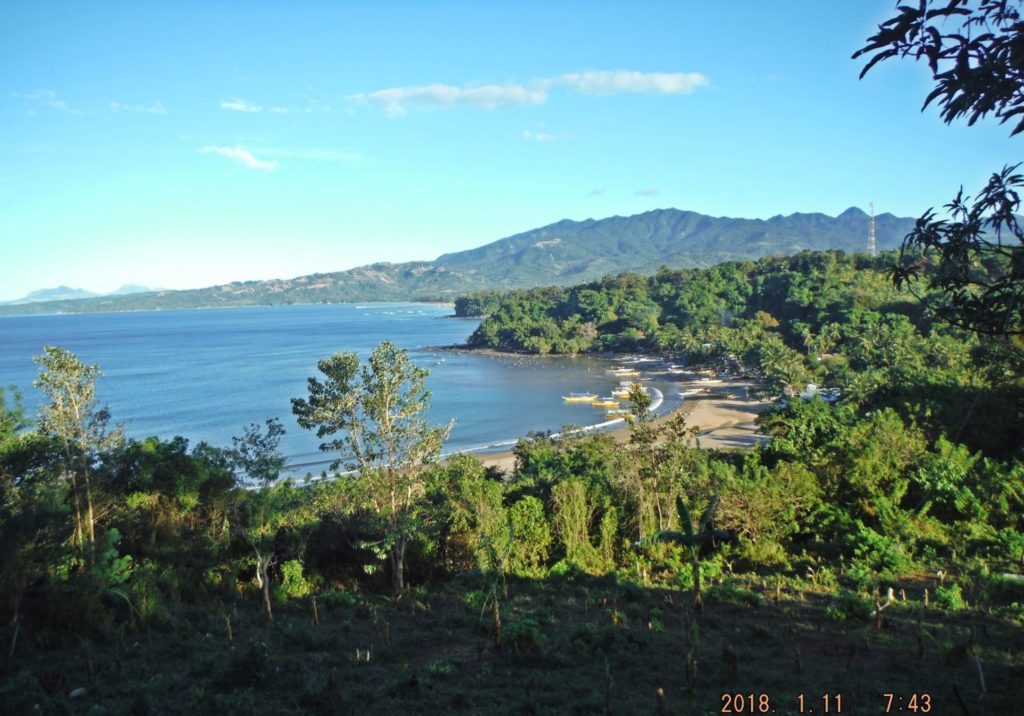 Za550. Mt. Natib volcano complex from the Saysain Point Ridge line. 005. This view is from the Saysain Point Ridge line and we see the Mt. Natib volcano complex, the Mt. Natib peek is at right. 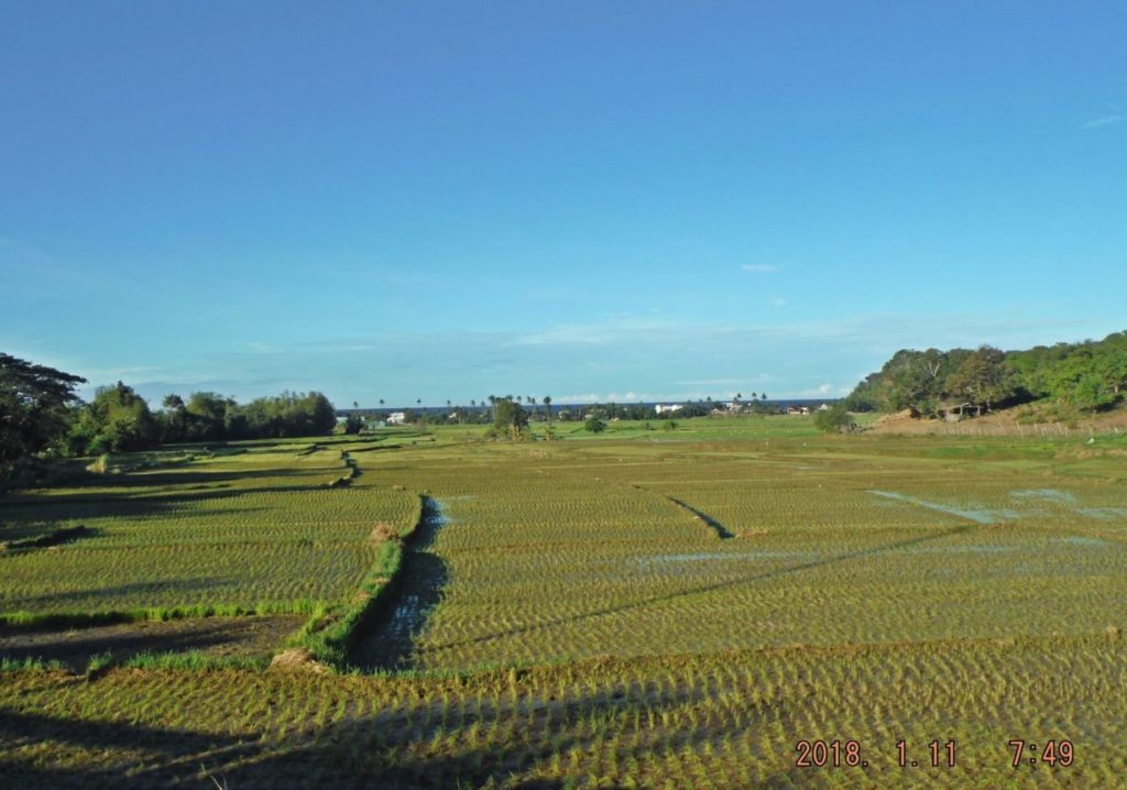 Za551. Saysain Valley,-Bay from inland on the Bataan West Road 006. We are passing the Saysain Valley and bay inland on the Bataan West Road. At right is Saysain Point. The Army put an 8inch naval gun there in 1941 and it fired at the Japanese in 1942 towards Port Binanga, just south of Subic Bay. 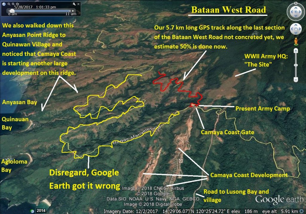 Za552. A Google Earth image with the 5.7 km GPS track (one way) on the Bataan West Road. 007. A Google Earth image with the 5.7 km GPS track (one way) of our walk on the 11th Jan. 2018 to check on the progress of finishing the Bataan West Road. I marked in many other points of interest including the HQ site of Bataan Rear Command in 1942. 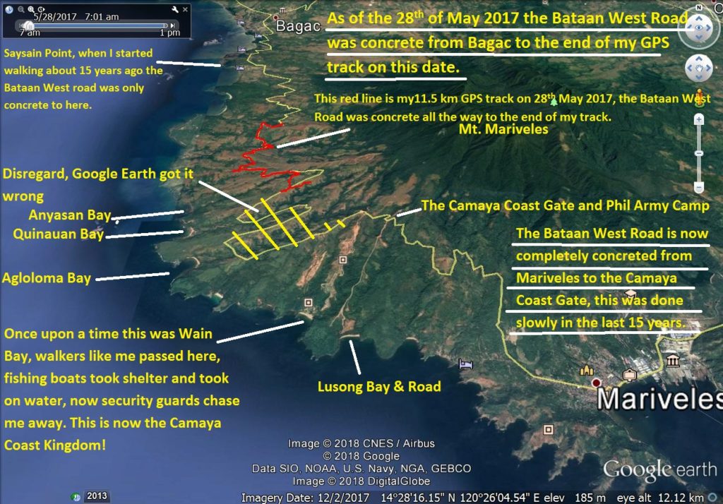 Za553. A Google Earth image with the status of the Bataan West Road being concreted. 008. Another Google Earth image that tells the complete status of the Bataan West Road being concreted. I marked in the important WWII Battle of the Points landmarks. |
|
|
|
Post by Karl Welteke on Jan 18, 2018 13:56:37 GMT 8
Bataan West Road almost finished as of 2018-01-11 2nd of 4 presentations. The last 5.7 km are 50 % concreted! I predict it will be open to the public within one year. A friend and I walked it on the 11th Jan. 2018 and took these pictures. My friend is a Naval Academy Graduate is about 70+, younger then I, but can outpace me like a rabbit and he even brings weights along to make my walks worthwhile. The pictures are uploaded at high resolution into this Flickr album; they are in the high and original resolution: www.flickr.com/photos/44567569@N00/sets/72157664688444838We also walked down the Anyasan Point Ridge Line, which will be a later presentation. The walk from the Bataan West Road to the Anyasan Point is 4 km. This ridge is between the Quinauan and Anyasan Bays, this was the main battle area of the WWII Battle of the Points. The sad news is that this whole ridge is now being developed as an upscale settlement area and perhaps a public amusement park. Camaya Coast hast started now and chased us away from the actual Anyasan Point. 2018-01-20 Note from Karl: Today I learned in regards the maps in these presentations which are were posted in a higher resolution, if you copy the image address, open it in another page you then can zoom in. I edited 31 pictures for this presentation and will upload about 6 to 9 images at a time. Here is the 2nd set with 7 images. 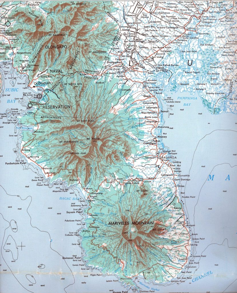 Za554. An old Army 1:250000 map that covers Bataan and the northern boundaries. 009. Much of an old Army 1:250000 map that covers Bataan and the northern boundaries. 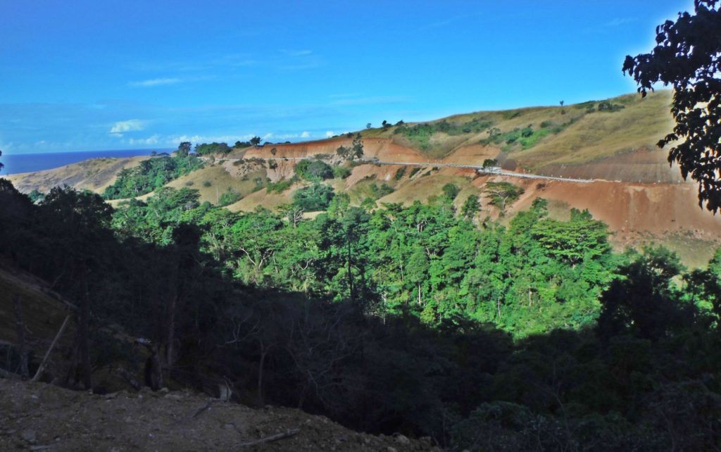 Za555. A view back of the Bataan West Road. 010. This is a view back of the Bataan West Road after we rounded one of the many tributary valleys of the Quinauan and Agloloma River. 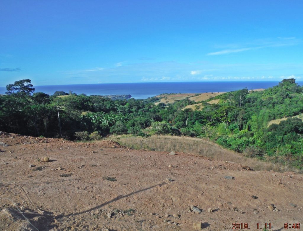 Za556. That is Quinauan Bay and the Quinauan Point is south, left of it. 011. That is Quinauan Bay and the Quinauan Point is south, left of it. At right is the Anyasan Point Ridge and you can notice a fresh road cut. We learned the the Camaya Coast started another major development on that Anyasan Point Ridge. 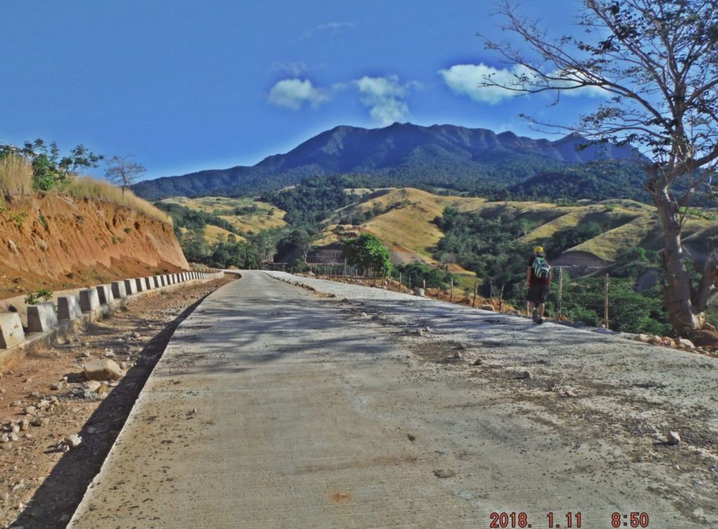 Za557. Continuing our walk on the Bataan West Road. 012. We are continuing our walk on the Bataan West Road following the many tributary valleys of the Quinauan and Agloloma River. I like that Mt. Mariveles shot. 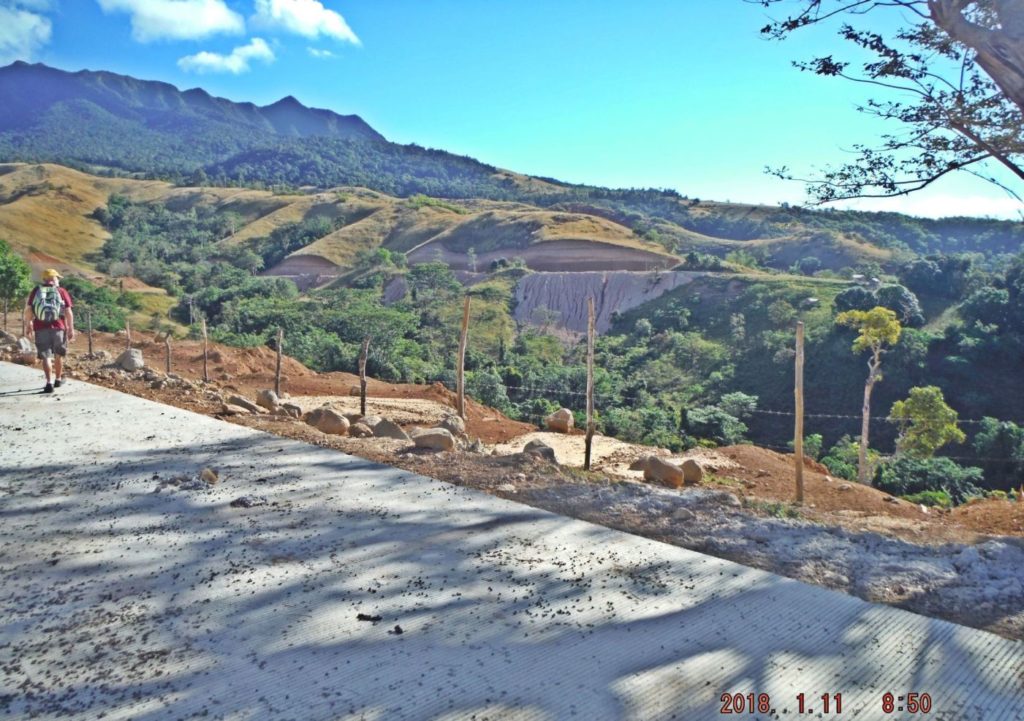 Za558. Continuing our walk on the Bataan West Road 013. We are continuing our walk on the Bataan West Road following the many tributary valleys of the Quinauan and Agloloma River. 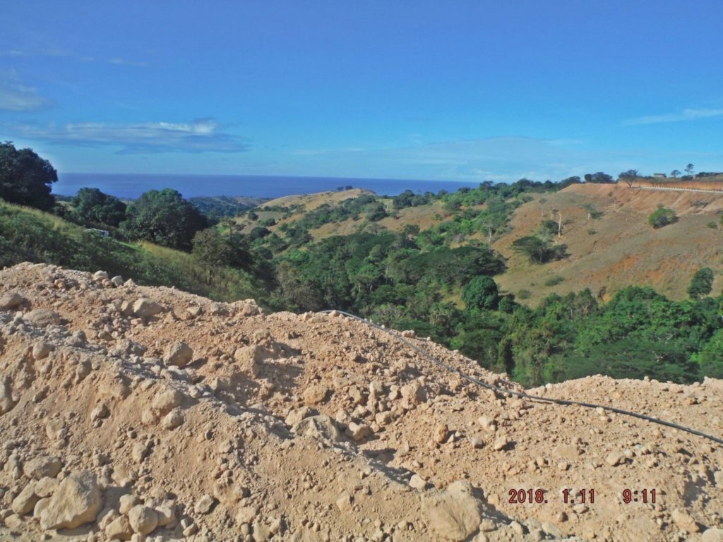 Za559. Agloloma River Valley. 014. We have rounded the Quinauan Pt. Ridge and are looking down the Agloloma River Valley. Notice the cattle on the south slopes of the Quinauan Pt. Ridge and a trail above the cattle. 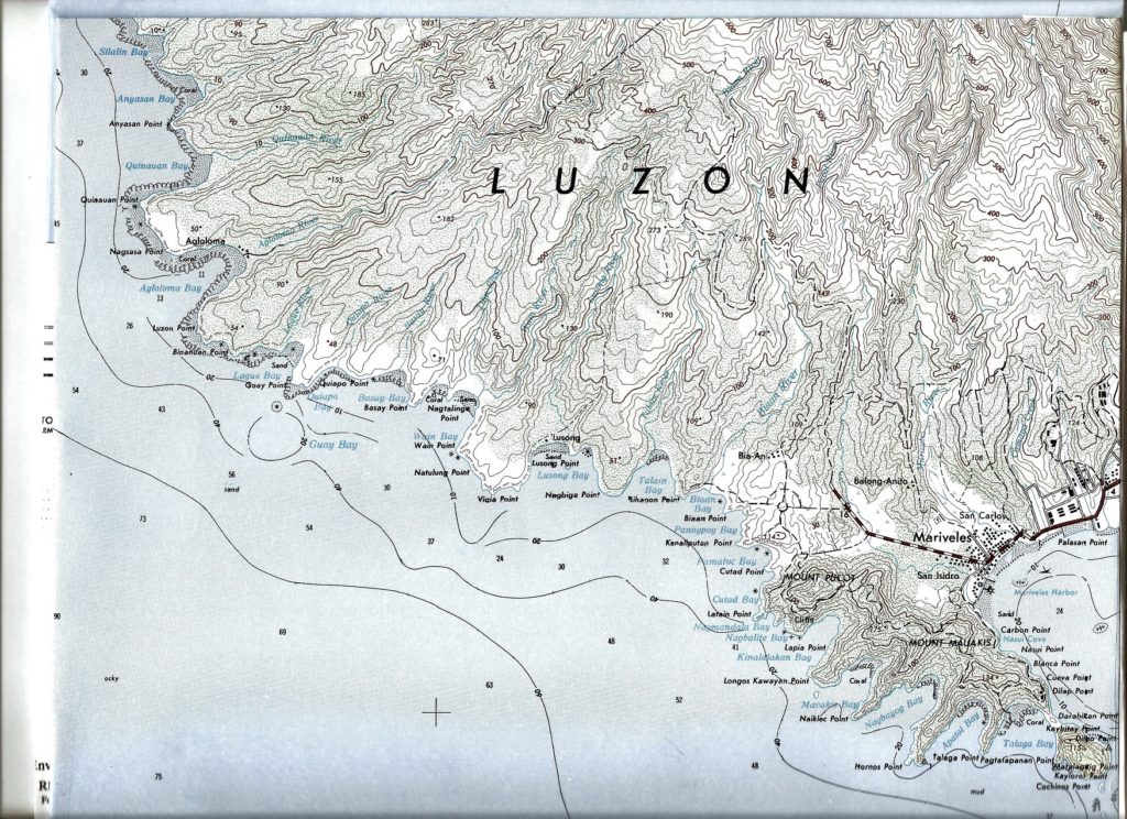 Za560. 1:50000 map of the Bataan SW Coast. 016. A section of a 1:50000 map of the Bataan SW Coast that covers just about all of the Battle of the Points area. |
|
|
|
Post by Karl Welteke on Jan 21, 2018 8:22:27 GMT 8
Bataan West Road almost finished as of 2018-01-11 3rd of 4 presentations. The last 5.7 km are 50 % concreted! I predict it will be open to the public within one year. A friend and I walked it on the 11th Jan. 2018 and took these pictures. My friend is a Naval Academy Graduate is about 70+, younger then I, but can outpace me like a rabbit and he even brings weights along to make my walks worthwhile. The pictures are uploaded at high resolution into this Flickr album; they are in the high and original resolution: www.flickr.com/photos/44567569@N00/sets/72157664688444838We also walked down the Anyasan Point Ridge Line, which will be a later presentation. The walk from the Bataan West Road to the Anyasan Point is 4 km. This ridge is between the Quinauan and Anyasan Bays, this was the main battle area of the WWII Battle of the Points. The sad news is that this whole ridge is now being developed as an upscale settlement area and perhaps a public amusement park. Camaya Coast has started now and chased us away from the actual Anyasan Point. I edited 31 pictures for this presentation and will upload about 6 to 9 images at a time. Here is the 3rd set with 8 images. 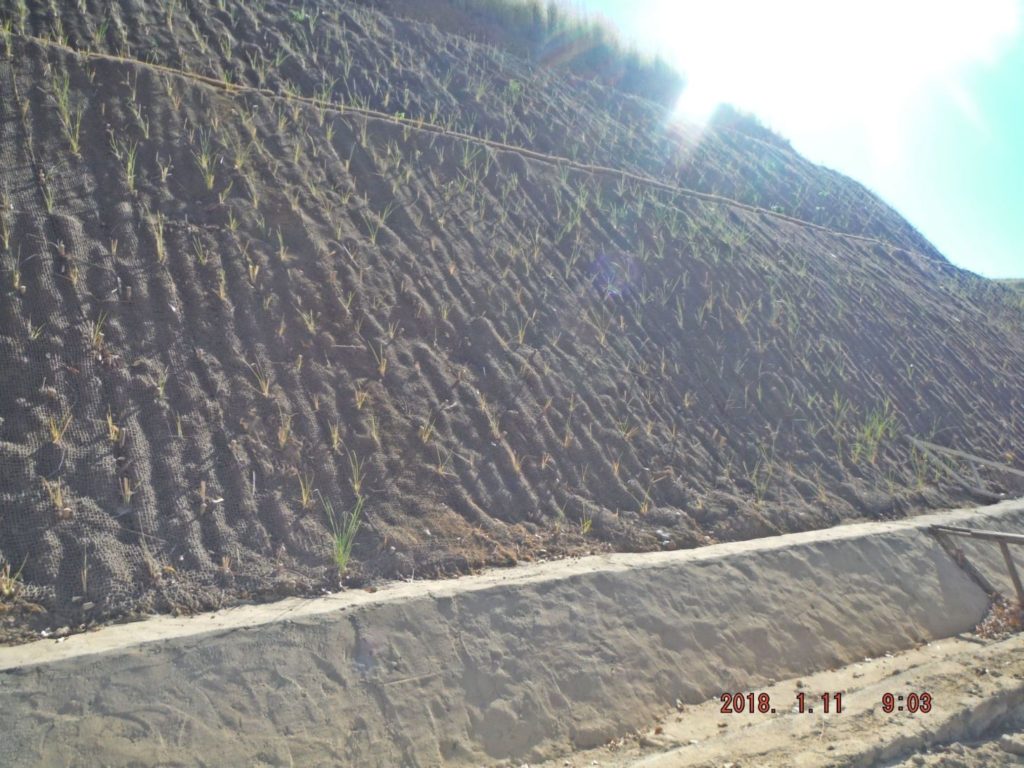 Za561. Bataan West Road embankment slopes are covered with biological fiber netting and life plants. 017. I think this is noteworthy, many of the road cut slopes or embankments are covered with netting (maybe made out of coco nut shell fibers).They use pegs to hold the netting in place and plant a grass plant. 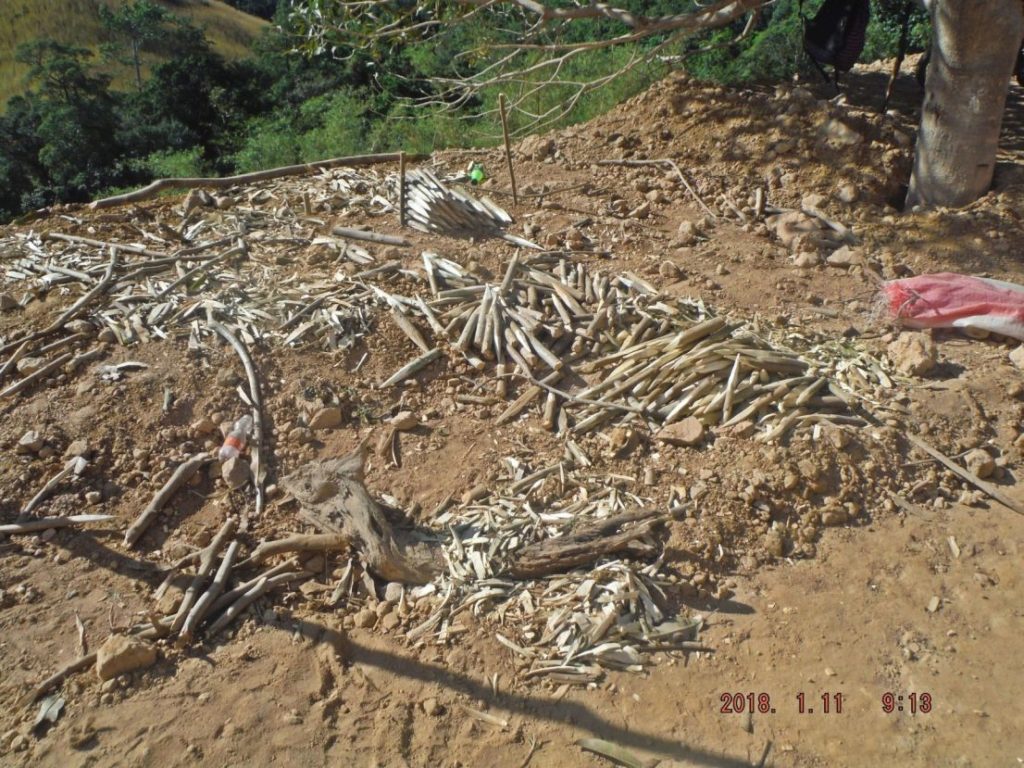 Za562. Bataan West Road embankment slopes are covered with nettings and these pegs hold them in place. 018. We came across several crews cutting the pegs for the netting for the road embankment. 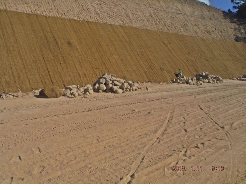 Za563. Bataan West Road worker driving in pegs to hold nettings in place 019. Here is a worker driving in the pegs for the netting on the road embankment. 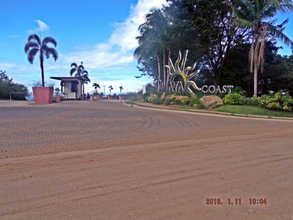 Za564.The gate to the Camaya Coast Development on the Bataan West Road. 020. We reached our goal, the gate to the Camaya Coast Development. The road from here to Mariveles, about 15 km, is concreted. When I walked into the development along the coast, a few years ago, they escorted me up to this gate, about 5 km and 300 meter elevation, on foot. 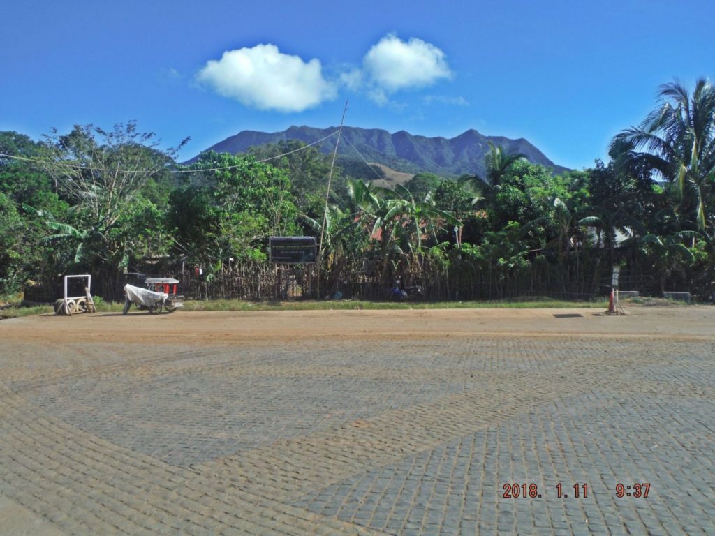 Za565. A Philippine Army Camp across the Bataan West Road from the Camaya Coast Gate 021. Across the Bataan West Road from the Camaya Coast Gate is a Philippine Army Camp. It was established when the Camaya Coast development started a few years ago. Before the Army came we had a forest ranger outpost here. 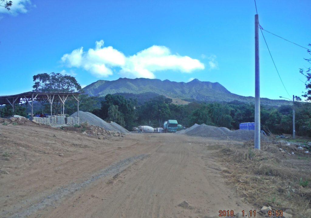 Za566. Concrete plant next to the Camay Coast gate on the Bataan West Road. 022. Next to the Camay Coast gate is this concrete plant, it only serves the Camaya Coast development. Again I like the shot of the Mariveles Volcano. 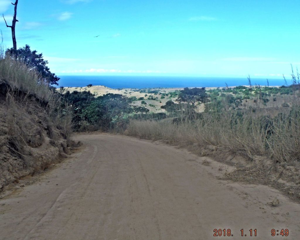 Za567. The road to the Agloloma Bay and community. 023. Next to the concrete plant is this road to the Agloloma Bay and community, it also goes to a beautiful private beach, south of the Agloloma Bay and a few other beaches between Agloloma Bay and Wain Bay. Wain Bay is now called Camaya Coast. If you zoom in one can see a trail on top of the Quinauan Point Ridge and the new road on the Anyasan Point Ridge which is also now being developed by the Camaya Coast org. 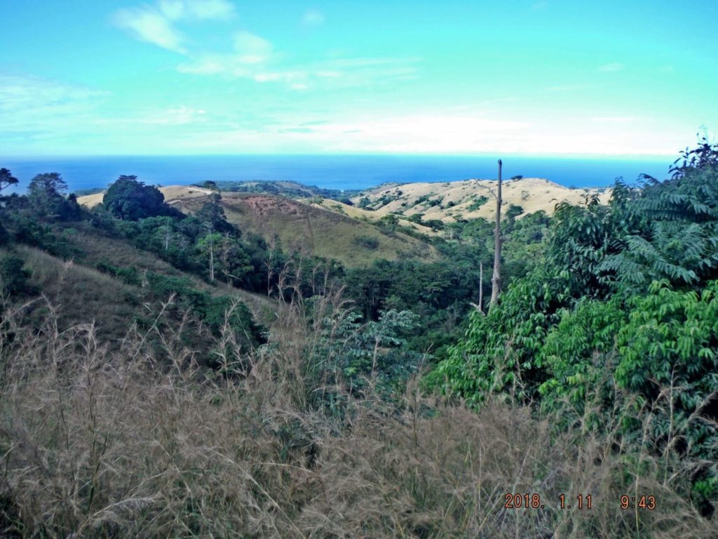 Za568. This is the Agloloma River Valley. 024. This is the Agloloma River Valley, left is the Luzon Point Ridge and right is the Quinauan Point Ridge. Note: Today I learned in regards the maps and some pictures in these presentations which are were posted in a higher resolution, if you copy the image address, open it in another page you then can zoom in. |
|
|
|
Post by Karl Welteke on Jan 21, 2018 15:30:15 GMT 8
Bataan West Road almost finished as of 2018-01-11 4th and last of 4 presentations. The last 5.7 km are 50 % concreted! I predict it will be open to the public within one year. A friend and I walked it on the 11th Jan. 2018 and took these pictures. My friend is a Naval Academy Graduate is about 70+, younger then I, but can outpace me like a rabbit and he even brings weights along to make my walks worthwhile. The pictures are uploaded at high resolution into this Flickr album; they are in the high and original resolution: www.flickr.com/photos/44567569@N00/sets/72157664688444838We also walked down the Anyasan Point Ridge Line, which will be a later presentation. The walk from the Bataan West Road to the Anyasan Point is 4 km. This ridge is between the Quinauan and Anyasan Bays, this was the main battle area of the WWII Battle of the Points. The sad news is that this whole ridge is now being developed as an upscale settlement area and perhaps a public amusement park. Camaya Coast hast started now and chased us away from the actual Anyasan Point. I edited 31 pictures for this presentation and will upload about 6 to 9 images at a time. Here is the 4th and last set with 8 images. 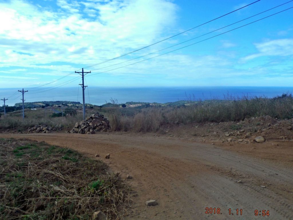 Za569. Wain Point Ridge which the Camaya Coast org is developing from the Bataan West Road. 026. This is mostly the Wain Point Ridge which the Camaya Coast org is developing. Most development is out of view, further down the slopes. I guess they cannot change the name of the point, Wain Point. Nobody is using the name of Wain Bay anymore, it is now Camaya Coast. 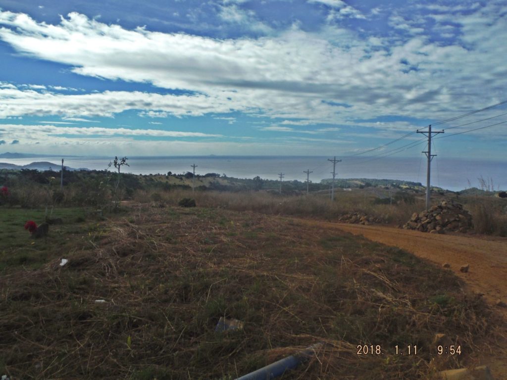 Za570. A south view from near the Camaya Coast Gate on the Bataan West Road. 027. A south view from near the Camaya Coast Gate. Left is Mt. Pucot of WWII fame and across Manila Bay are Cavite and Batangas provinces. In the middle is Fortune Island way offshore from Nasugbu, (WWII landing there). Right is the Wain Point Ridge used by the Camaya Coast Org. 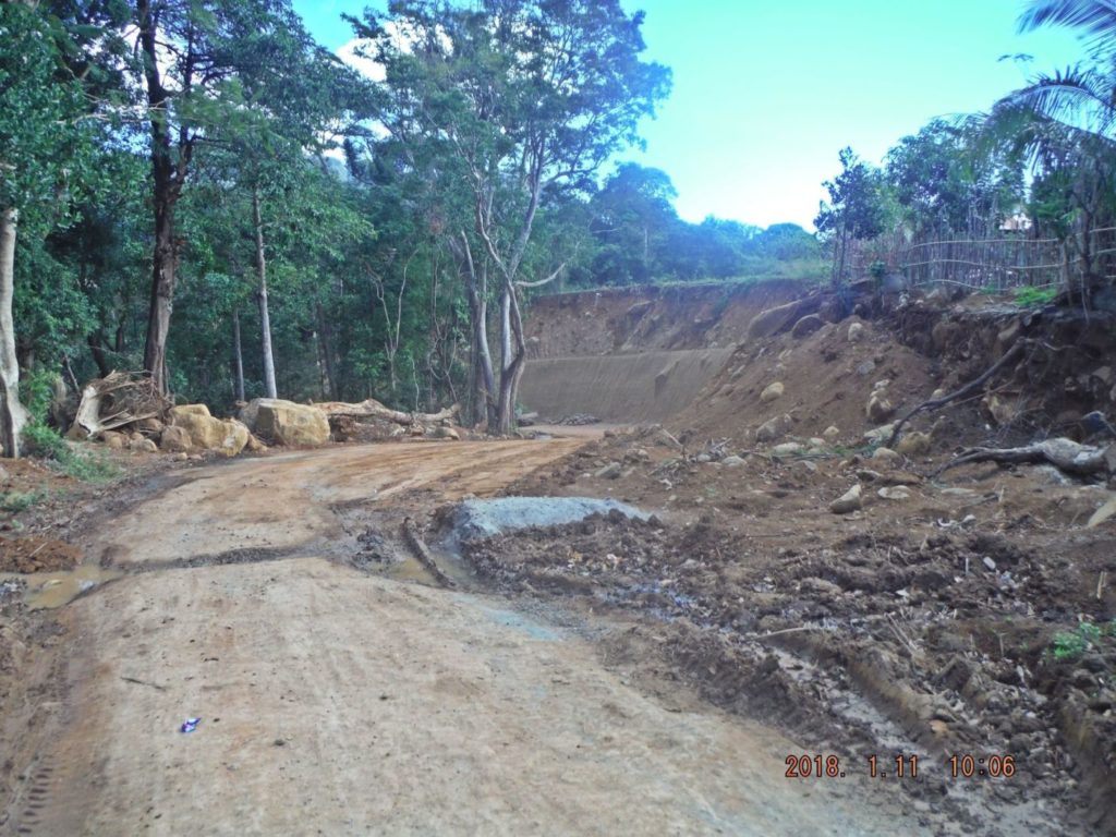 Za571. Bataan West Road when leaving the entrances of Camaya Coast Gate and the Army camp 028. We started our return walk; this is the immediate view when we enter the Bataan West Road when leaving the entrances of Camaya Coast Gate and the Army camp which is right on to top of the embankment. 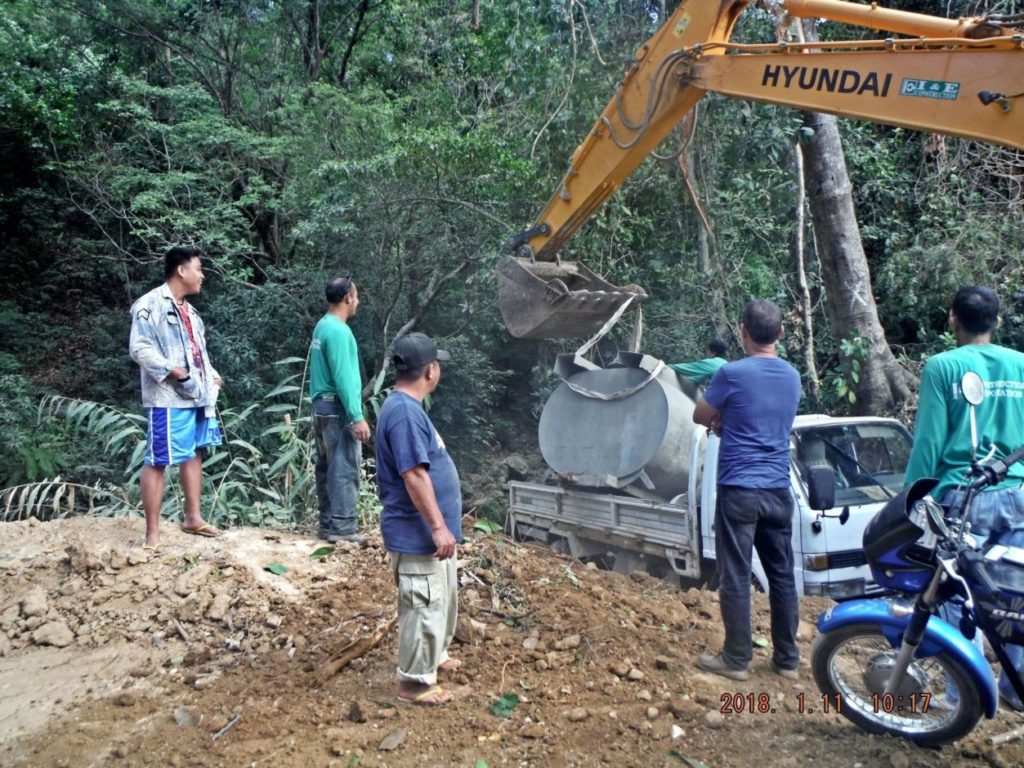 Za572.A little bad luck story building the Bataan West Road, this load just dropped. 029. We came across this little bad luck story building the Bataan West Road, something gave and the tank fell back on the vehicle, nobody got hurt. 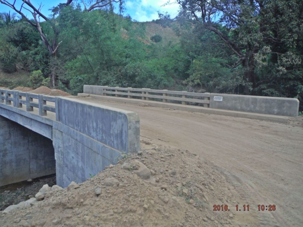 Za573. This bridge is over a tributary of the Agloloma River on the Bataan West Road. 030. Upgrading the Bataan West road required building a few new bridges, where only culverts existed before. This bridge is over a tributary of the Agloloma River. 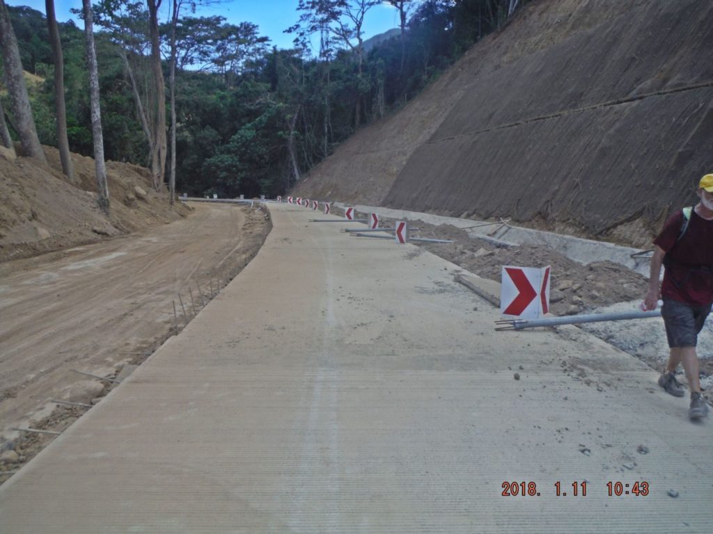 Za574. The new upgrade of the Bataan West Road near the Agloloma River. 031 The new upgrade Bataan West Road, it is going to be a nice road with grand vistas, all the ridge lines are mostly grass now. And it has a lot of nice curves. 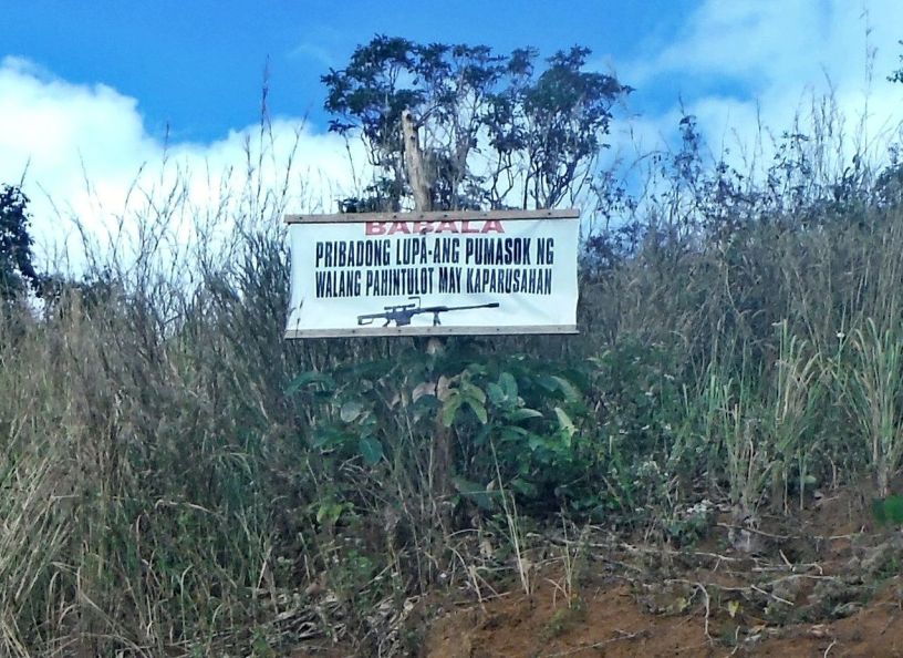 Za575. A warning sign with a gun image on the Bataan West Road. 032. I thought this sign was cute: Warning-don’t enter and a sniper rifle to emphasize the point! Bataan West Road. This was at the head waters of the Agloloma River. 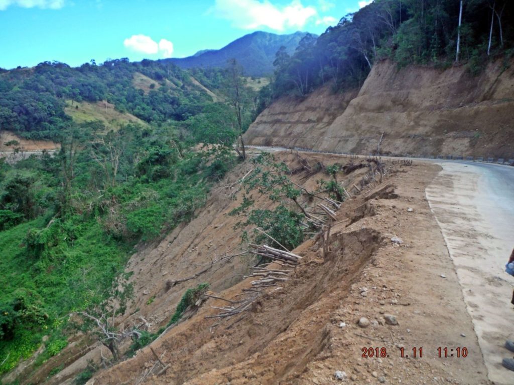 Za576. Stability to watch on sections of the Bataan West Road. 033. This section of the upgraded Bataan West Road has to be watched closely, it started to move! This was at the head waters of the Agloloma River. |
|
|
|
Post by chadhill on Jan 22, 2018 12:26:20 GMT 8
"We also walked down the Anyasan Point Ridge Line, which will be a later presentation. The walk from the Bataan West Road to the Anyasan Point is 4 km. This ridge is between the Quinauan and Anyasan Bays, this was the main battle area of the WWII Battle of the Points. The sad news is that this whole ridge is now being developed as an upscale settlement area and perhaps a public amusement park. Camaya Coast has started now and chased us away from the actual Anyasan Point".
Oh, no...imagine if historically significant portions of Gettysburg were developed as an upscale settlement area and as a public amusement park.
Another fine job, Karl! Please keep up the great work. Those of us stuck in CONUS truly appreciate your efforts and wonderful photos.
|
|
|
|
Post by nolruiz on Sept 25, 2018 12:45:48 GMT 8
This explains the disappoinment of most of us Filipinos who value the historical past of our country, historical sites and landmarks are either left to rot without attempts to put markers to show the public of its significance or sold to developers who dont have any intention of preserving the original appearance of the property.
|
|