|
|
Post by Karl Welteke on Feb 21, 2019 14:26:40 GMT 8
The Corregidor Railway, Trolley or Tram System
In the Corregidor,org Website are at least 2 pages!
This is the first one with the URL, a picture and a paragraph:
corregidor.org/chs_campbell/rails.htm
Ze021. Corregidor Trolley, from Corregidor.org, Paul Whitman
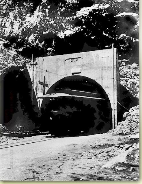
A poor picture of a car leaving the Malinta tunnel. The picture's caption describes it as "Car 66 leaving Malinta tunnel between Monkey Point and Bottomside - 1934-36." Note the single track. The currently restored portion of the main Malinta tunnel has two tracks, and suggests that the rail system was expanded from its original design. Cars 65 and 66 were two 14-bench bogie (8-wheel) cars delivered in 1927. These, plus a 35 foot motorised flat car, were the last pieces of railway equipment brought to the Island.
Ralph Forty. It will come as a surprise to many readers that some tramways of the United States have evaded documentation. One of the least known electric systems outside the continental United States was also the west-most tramway in the Philippines. On the small island of Corregidor at the entrance of Manila Bay was located a strategic defense post of the U.S. Forces, known as 'Fort Mills', or more commonly just "The Rock."
This is the second one with the URL, a picture and a paragraph, our forum member Tony Feredo produced it:
corregidor.org/chs_feredo/rails.htm
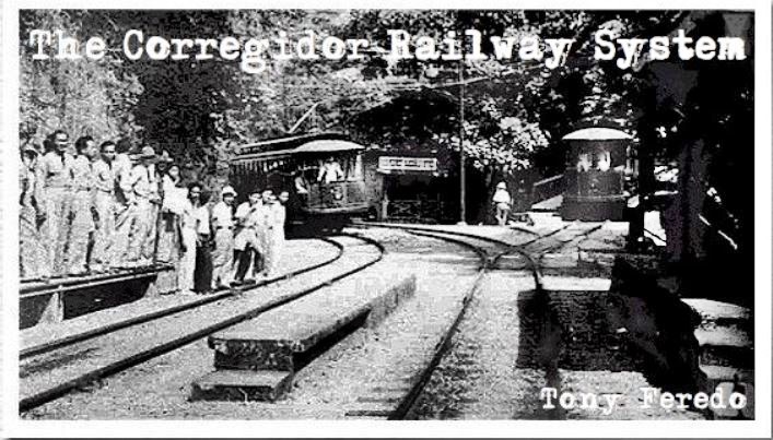
Ze022. Corregidor Trolley from Tony Feredo
Work on the railroad system began with the construction of a new pier, which was later called Engineers Wharf , there , Corregidor ’s first rail tracks were born. From the old warehouses located at the said wharf, the railroads ran from level to a grades varying from 16% to 25%. To get to Middleside (elevation 300 feet), a cable incline was built to haul construction materials. The cable line extended all the way to the summit (Topside) by the route later known as "the Golden Staircase." From the summit, the steam engines serviced the hauling of men and materiel, thus paving the way for the construction of the early concrete structures and gun batteries that we know today. The first rails in the island covered the paths that led to the major structures and coast defense batteries.
With the trolley line at Ft. Mills, the system had a separate "freight" -almost UPS system.
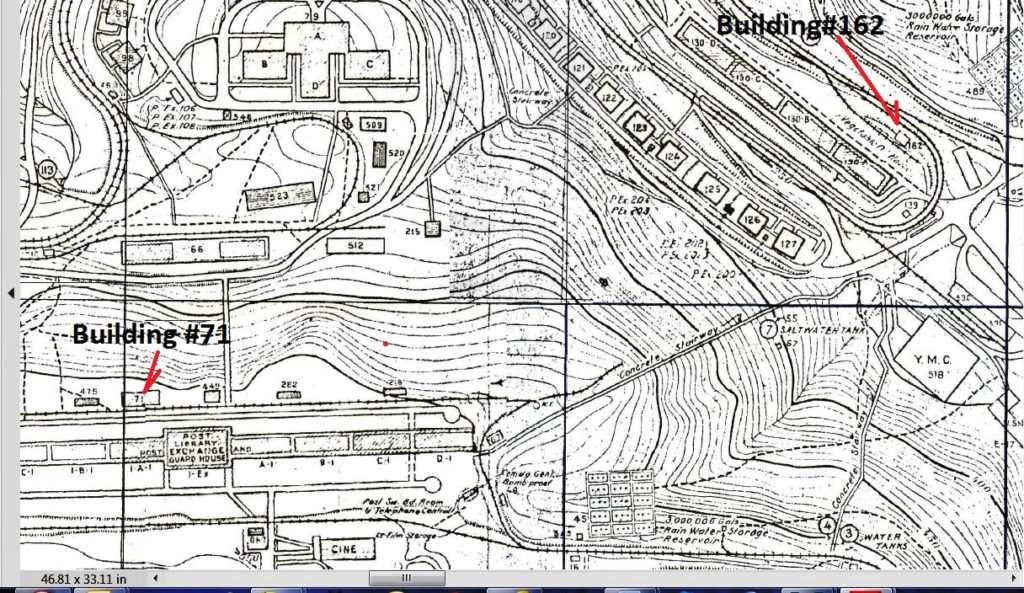
On the 25th to 28th Jan 2019 Glen Williford a leader in research about Coastal Defense and author about this subject visited Corregidor again. He invited me to go along and we looked at building #162 which I was interested in. On the list of buildings it and building #71 are listed as“cheker”.
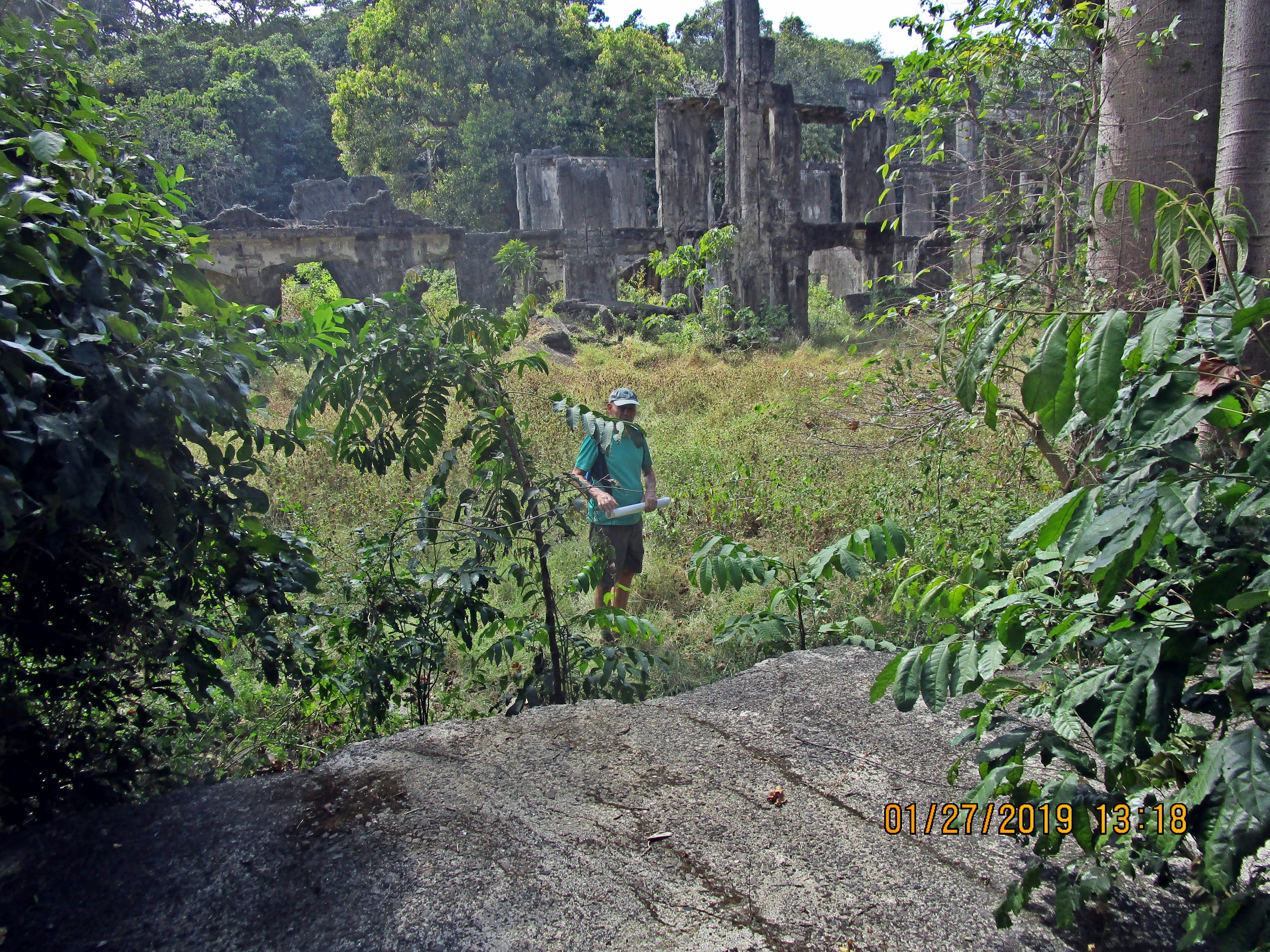
Ze023. A view from the Building #162 at/near the SE end of the former Ft. Mills Middleside Barracks with my German Army (Pal) friend on the 27th Jan. 2019.
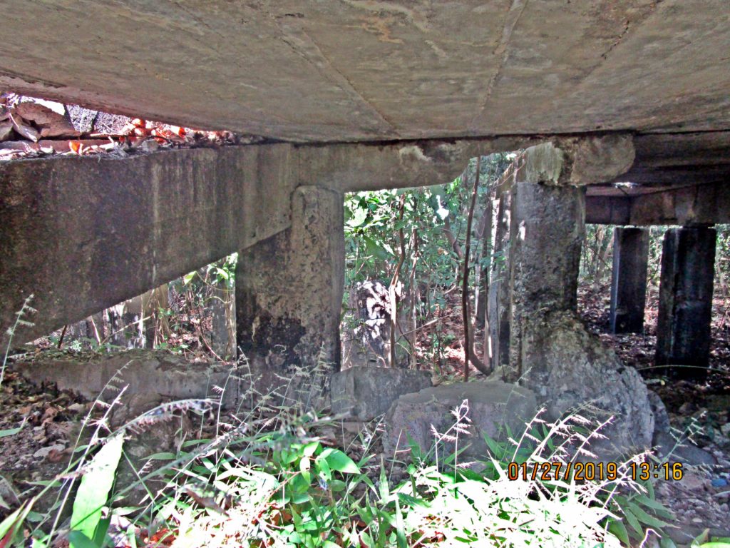
Ze024. A view under the deck surface of Building #162 at/near the SE end of the former Ft. Mills Middleside Barracks with my German Army friend on the 27th Jan. 2019.
On the 3rd of Feb. 2019 Glen wrote this and sent the two pictures below here. Thank you Glen:
Karl, after considerable plane and weather problems I returned home safely. Thank you once again for journeying out to visit and help and old friend on the Rock, I much appreciate it and enjoyed seeing you again and meeting your German Pal.
While I am slowly going through my notes and promises, let me cover one here.
With the trolley line at Ft. Mills, the system had a separate "freight" -almost UPS system. Freight and packages were delivered to separate trolley stations known as "Checker" stations, with dedicated personnel, beefed-up unloading ramps, and road access. They kept these separate from the passenger stations we are more familiar with; they were also fewer in number and located at more intensive office and depot facilities. This is the building we saw near the end of the Middleside Barracks. I think is was described on the map as building 162.
Here's a picture of the Middleside Checker Station (162) and another (T-71) elsewhere. Note the wagons and freight handling.
Thought you'd be interested, feel free to post or share.
Glen
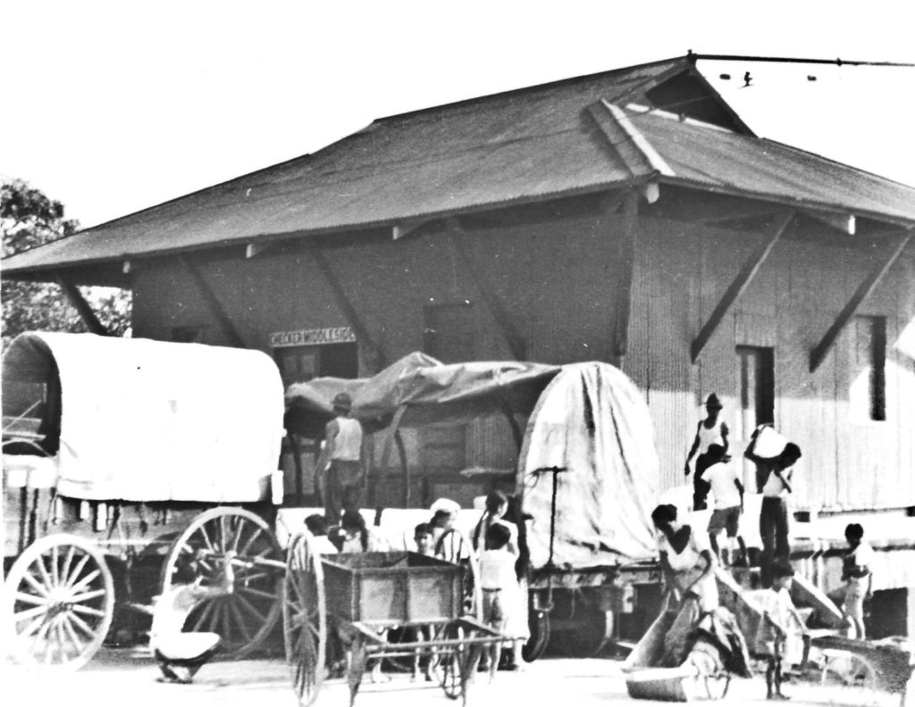
Ze025. Middleside Checker Station, Building #162, Fort Mills on Corregidor from Glen Williford.
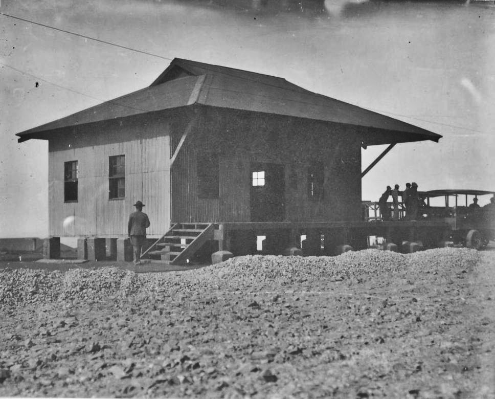
Ze026. Checker Station, Building #71, Fort Mills on Corregidor from Glen Williford.

Ze027. Part of the list of buildings on Corregidor from the Fort Mills 1936 drawing.
Ze028. Part of the drawing of buildings on Corregidor from the Fort Mills 1936 drawing.
|
|
|
|
Post by rickthelibrarian on Feb 21, 2019 22:46:47 GMT 8
Excellent - thanks for posting.
|
|
|
|
Post by Karl Welteke on Feb 22, 2019 17:40:59 GMT 8
----------------------------------------- The last Trolley Station was also a Checker Station. ---------------------------------------------- Perhaps it served mainly the 92nd CA PS and the Kindley Airfield. It is great to belong to a community that has the same interests; they share information, pictures and stuff. A friend, who I joined several times in the Philippines and is the only other person I know with the same name, Karl-Wilhelm, sent me some pictures for the recent post about the Fort Mills Rail, Trolley, Tram System on Corregidor Island. It is called Building # 643 but I don’t have a map that shows the number but the pictures are labeled with that number. But the map says clearly Checker and Car Station. 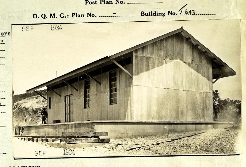 Ze030. Bldg. 643 Kindley Station, from Karl Wilhelm Schmidt. 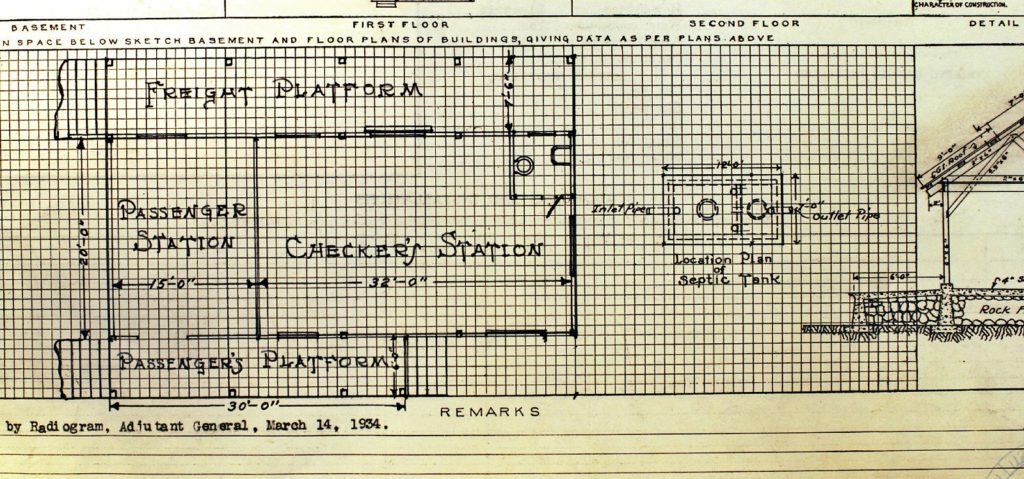 Ze029. The drawing for Bldg. 643 Kindley Station, from Karl Wilhelm Schmidt. Karl wrote me this: Hi Karl, Here are a couple of station photos, the Middleside might be a little better than the one you have (did’t use it-too much work). The Kindley field station was a unique passenger / freight combination. As shown on the maps there was a fork in the rail line where the train driver could choose what side of the station to pull into, freight only or mixed. Best regards, The "other" Karl Wilhelm 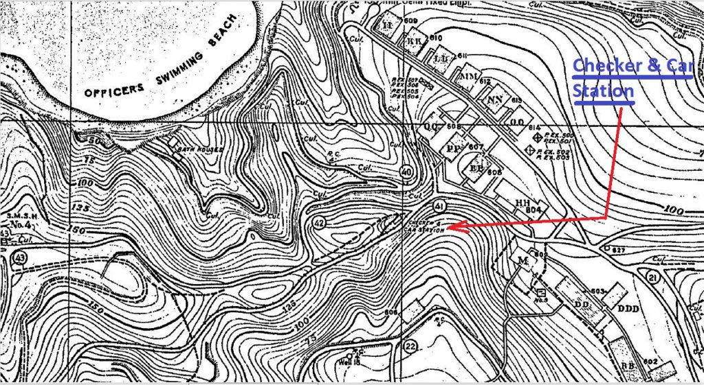 Ze031. A map showing Bldg. 643 the last, east Checker and Car Station to Kindley Airfield. |
|
|
|
Post by Karl Welteke on Feb 24, 2019 13:57:42 GMT 8
---------------------------------- Malinta Tunnel, One or Two Rail Tracks? ---------------------------------- This has been extensively discussed in this forum by some very knowledgeable people who backed up their arguments with unique pictures. This is the URL: corregidor.proboards.com/thread/253/malinta-rails?page=1Here are only 2 sample images in the above URL, they were provided by fots2. 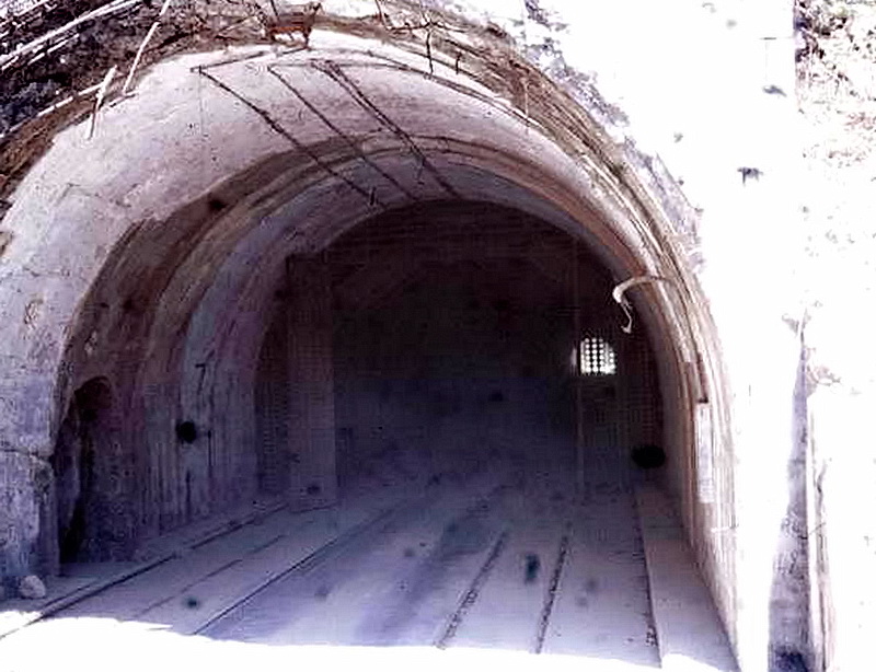 Ze032. Photo was taken in 1967 and shows the Malinta main tunnel after clean-up but before restoration work had begun. It shows a second set of tracks there before restoration and after war debris clean-up. The picture was provided by fots2 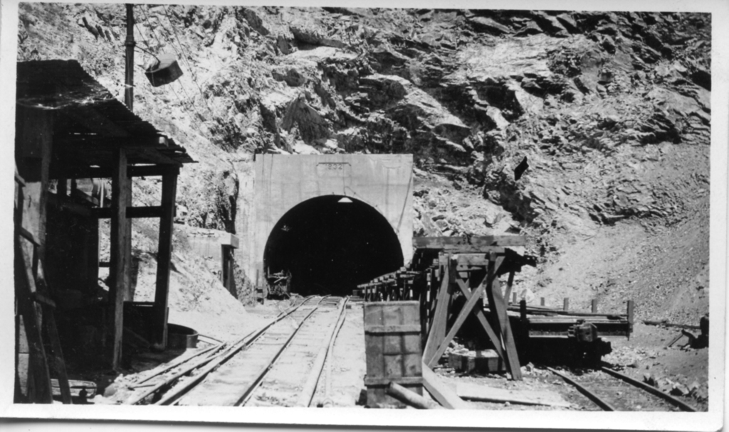 Ze033. The Malinta Hill Tunnel during construction, picture was provided by fots2 |
|
|
|
Post by fots2 on Feb 24, 2019 18:10:25 GMT 8
The first photo confirms the existence of two trolley lines within Malinta Tunnel pre-war. Here we see the Malinta Tunnel east entrance with both lines visible. The right side line is the main line from Bottomside to Tailside. The left side line is a siding within the tunnel. We even see the complete “plumbing” to join with the main line. 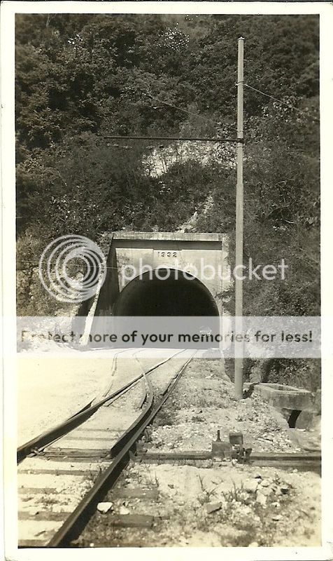 So where did the siding join the main line at the west entrance? It had to have been before the other siding near the trolley bridge heading towards the quarry. The answer is that the tunnel siding joined the main line just outside the west entrance. Note the post-war photo below. This photo was taken close to the west tunnel entrance looking west. You can see the Skipper Hill flag where today’s Corregidor Inn is located. Look down at the rail siding (on the left) joining the main line (on the right). 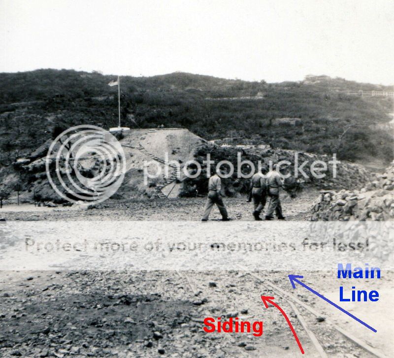 Main line and siding line junction 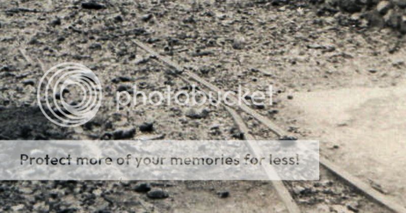 Unlabeled crop of the tracks |
|
|
|
Post by EXO on Feb 24, 2019 18:29:17 GMT 8
Great images, John. They mark the death knell of the "one line through Malinta" heresy.
I was unaware that a flag pole had been erected on the hill prior to the construction of the offices and guest house. Learning new stuff every day!
|
|
|
|
Post by chuckmorford on Apr 8, 2020 2:45:46 GMT 8
Great thread. There is as planned, as built and as modified. Unfortunately I can not find such changes on any maps.
Did the trolley follow the road to the airfield? When was the road to Malinta added from San Jose?
There is a b&w photo from Malinta looking toward the hotel. If you look carefully at the curve you will find that
only one rail line is present as the two lines appear in other photos. Anyone got a photo of the water tank and rock crusher
at the entrance when the construction was taking place?
|
|
|
|
Post by fots2 on Apr 8, 2020 10:56:38 GMT 8
Chuck,
When people mention the “Kindley” trolley station I think they assume the line went all the way to Kindley Airfield. This is incorrect and evidence of this is shown in the US Army Corps of Engineer’s RCW (Report of Completed Works). The “Kindley” station is the eastern terminus of the trolley line and is located on the ridge above the 92nd garage area. (See Karl’s map above) “When was the road to Malinta added from San Jose?” The 1917 Corregidor map does not show a rail line to the Malinta Hill quarry however the 1919 map does show it. Tunnel construction will not be started for another 13 years. “There is a b&w photo from Malinta looking toward the hotel. If you look carefully at the curve you will find that only one rail line is present as the two lines appear in other photos”. I assume you are referring to the labeled photo above taken near the West entrance of the tunnel looking towards Skipper Hill. Both rails heading away from the siding cannot be seen clearly. Is it hidden under the gravel or has it been scrapped by then, I don’t know.
The important point of that photo is that it shows the South-side siding (left-side rails) merging into the North-side main line (right-side rails).
“Anyone got a photo of the water tank and rock crusher at the entrance when the construction was taking place?” The only western entrance tunnel construction photo I have is Ze033 shown above. |
|


