|
|
Post by beirutvet on Apr 2, 2021 20:59:16 GMT 8
Hi Karl
I am curious about that fishing line that someone had put there and it helped you find what you are looking for. I wonder if that may have been placed there by scrappers as an easy way to get to where they need to go at night while no one can see what they are doing.
Also there at Battery Ramsey doesn't it look like a good portion of the barrel of that gun has been removed? More evidence of scrapping in that area?
|
|
|
|
Post by fots2 on Apr 2, 2021 23:34:52 GMT 8
Hi Beirutvet,
The fishing line was put there by one of the guides as the vegetation was so thick that some people had trouble to find the battery even though it is not far from the road.
Yes the barrels have been cut shorter by scrappers but that was many years ago.
|
|
|
|
Post by Karl Welteke on Apr 9, 2021 10:22:20 GMT 8
|
|
|
|
Post by xray on May 2, 2021 11:44:33 GMT 8
Wow amazing report, more than I can digest in 1 sitting - I still say that my life will not be complete without stepping foot on the Rock !
I take it the status of Drum is still pretty bleak ?
|
|
|
|
Post by Karl Welteke on Dec 11, 2021 17:45:36 GMT 8
First day on Corregidor 2021, Feb. 15th, First Seg. When I starting posting these pictures I only posted 12 images of the first day into this forum page. So, I am reposting the pictures of the first day of this Feb. 2021 visit to Corregidor. It will be done in segments and this is the first one. This first segment covers the boat trip to Corregidor from Bataan. Left home by car, 6am arrived at Villa Carmen, about 0745 Hours. The husband of Imelda was waiting for me, told me where to park. I drove down to the beach and offloaded my stuff which included 21 liters of water. During the Virus from Red China Crisis, I had to get permission to travel and get documents from my Barrio Barretto Barangay Captain, his Medical Department and then from the Police Headquarters of Olongapo City. Since it is conveniently located at Barrio Barretto, which was easy. It went smoothly, done that drill now three times, although for other purposes. I had to communicate with the Corregidor Foundation Inc. (CFI) Coordinator, Madam Melody, to get that office’s permission and submit a signed age waiver form. That also went very smoothly plus Madam Melody had to communicate with the Villa Carmen boat people that I was cleared to visit Corregidor. The waters of the North Channel were very calm; it seemed the ship traffic was busier now. At the north shore, Bottomside, a lonely Coast Guard man checked my arrival. He asked me, "where from?" I said from Olongapo and that I was coming home to Corregidor. Then he checked the passenger list, I was the only one and said: ”Oh, Sir Karl, welcome back!" By the way, my boat fee was 3000 peso for this trip and I had to pay that again when I left on Friday, the 19th of Feb. (When I did leave on the 19th, I had to pay 300 peso more for parking.) 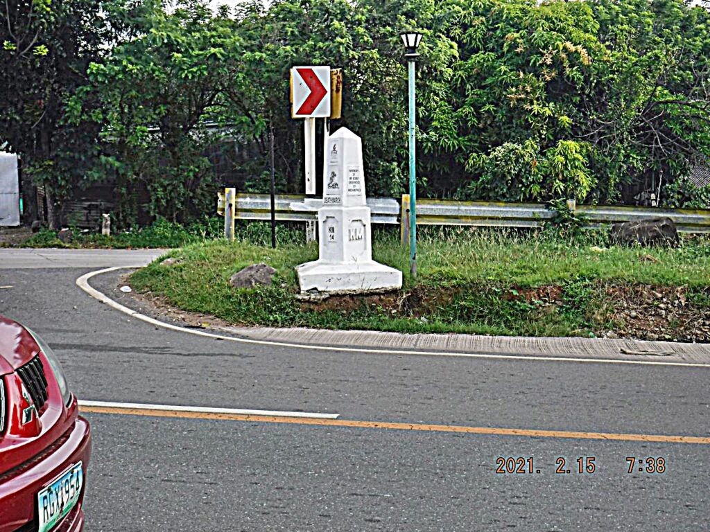 Zf224; that is where I make my left turn coming from the right on from the Roman Bataan Express way and enter the old National Road. Villa Carmen is to the right, about 1 km from here, just before Death March Marker Km Stone 15. It seems to be threatened by road construction/widening. 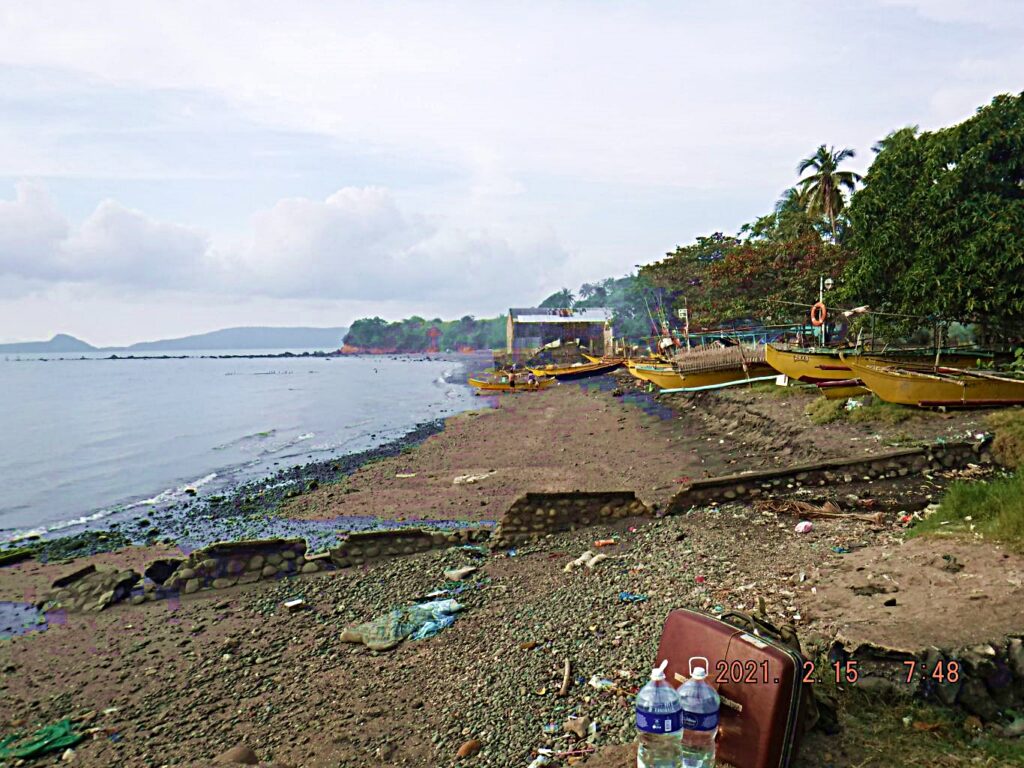 Zf226. This is the location of the Villa Carmen boats; we are looking west, towards Mariveles. Left is the North Channel between Bataan and Corregidor. 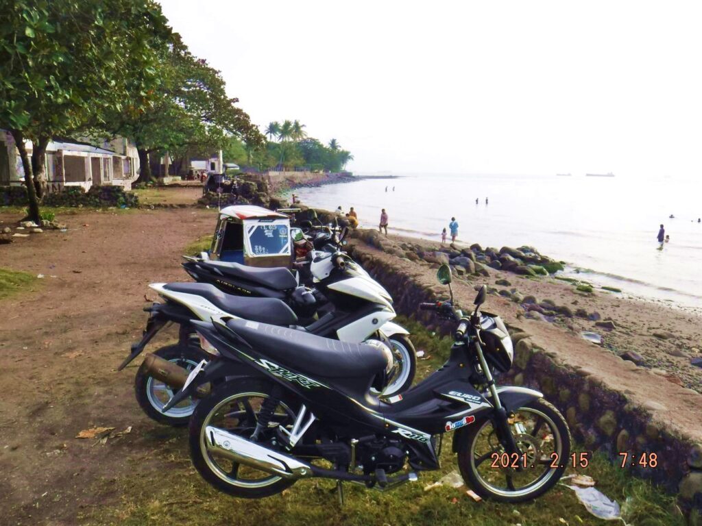 Zf227. This is the location of the Villa Carmen boats; we are looking east, towards Manila across the Manila Bay. Left are some Villa Carmen Resort bungalows, which are completely wrecked now. Local people come here and swim or bath. 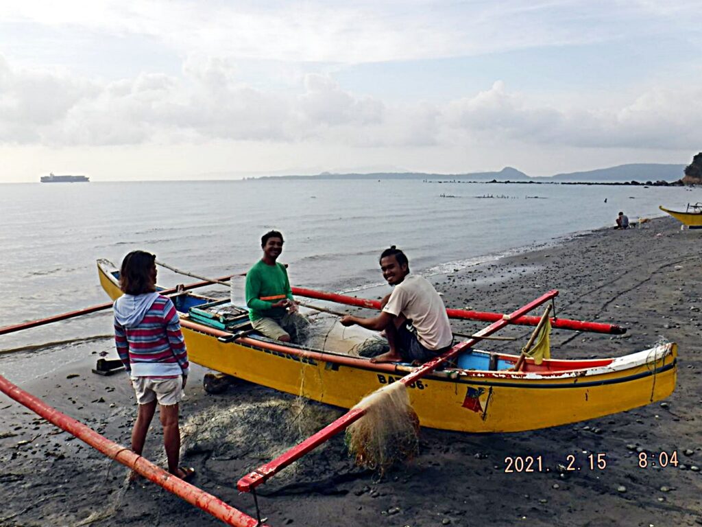 Zf228. This is the location of the Villa Carmen boats; we are looking west, towards Mariveles. Left is the North Channel between Bataan and Corregidor; a large container ship is coming into Manila Bay thru the North Channel. I added this picture because of those smiling fishermen. 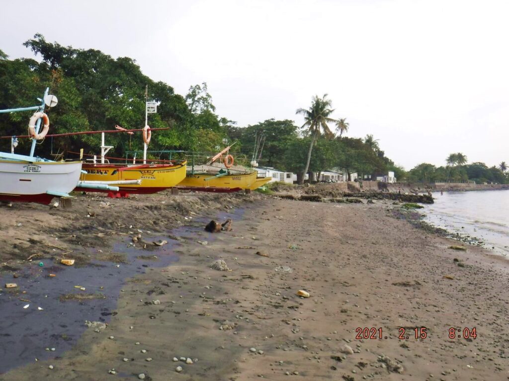 Zf229. This is the location of the Villa Carmen boats; we are looking east, towards Manila across the Manila Bay. Left are some Villa Carmen Resort bungalows, which are completely wrecked now. Local people come here and swim or bath. To that first building I drive to and unload of pick up my baggage. 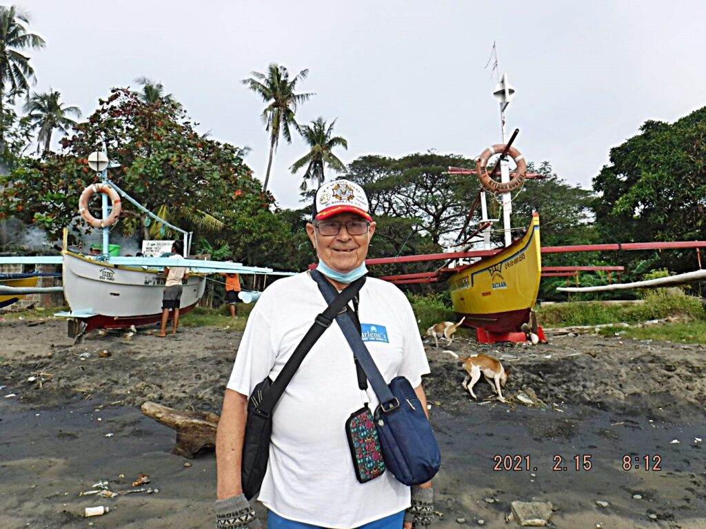 Zf230. This is the location of the Villa Carmen boats and yours truly. In this picture, I am short one month before being 79 years young. 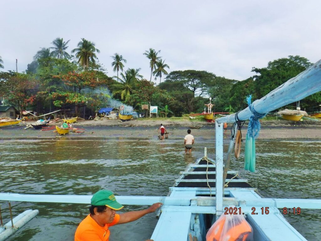 Zf231. This is the location of the Villa Carmen boats, the water is shallow here and rocks are nearby. So, it takes some doing to use the boats from this location and bring them back safely to here. I have used these boats now over 50 times and I have confidence that they run the boats in a safe manner. 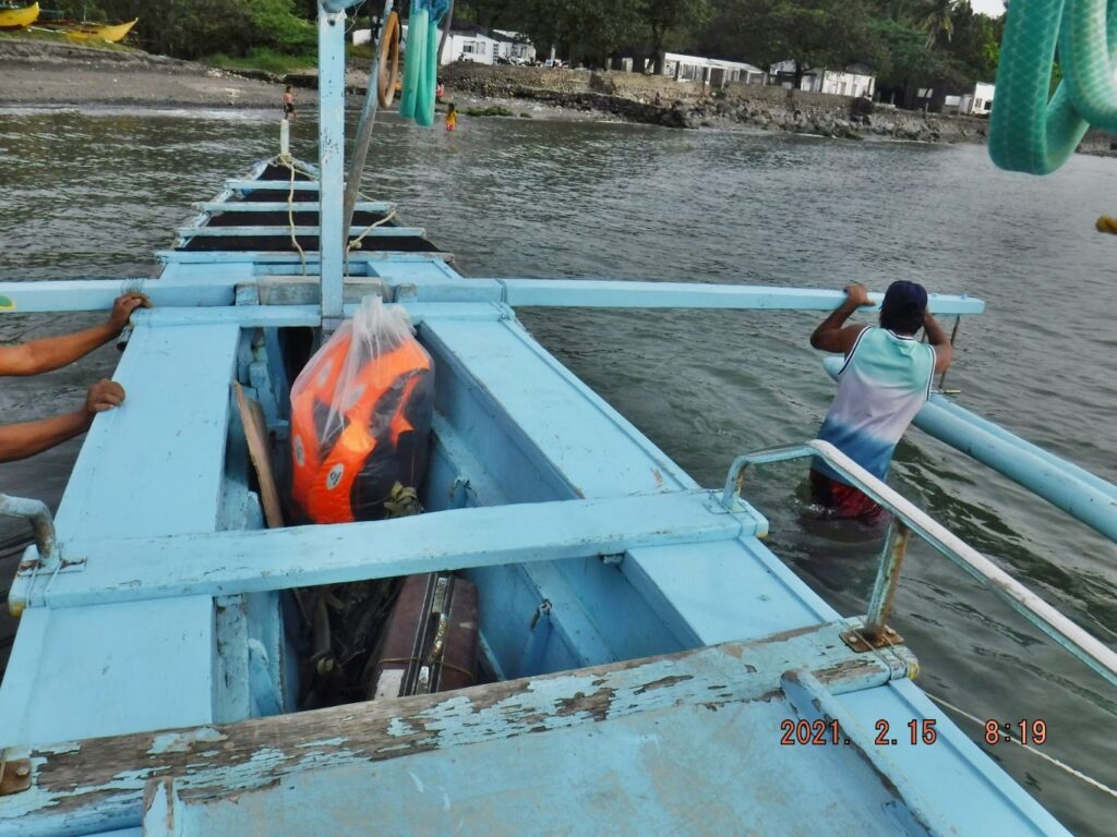 Zf232. This is the location of the Villa Carmen boats, the water is shallow here and rocks are nearby. So, it takes some doing to use the boats from this location and bring them back safely to here. I have used these boats now over 50 times and I have confidence that they run the boats in a safe manner. 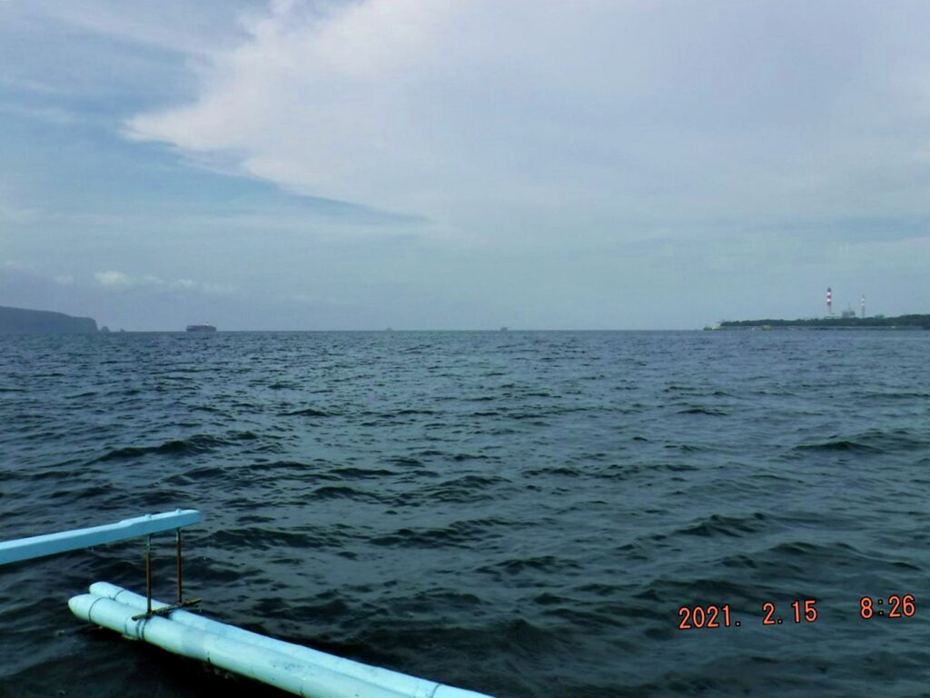 Zf233. We are crossing the North Channel to Corregidor on a Villa Carmen outrigger boat; Villa Carmen is on the SE corner of Bataan and is part of the Barangay Cabcaben. Cabcaben is where the Japanese used their Siege Artillery against Corregidor and started their boat assaults from here. In the middle of this picture we see Monja Island and right we see the new coal powered and solar power plant next and east of Sisiman Bay where the PT boats stayed before they took Gen. MacArthur on his breakthrough trip thru the Japanese Lines. 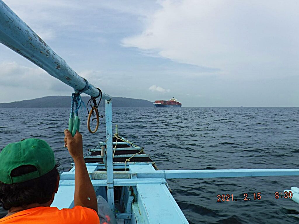 Zf234. We are crossing the North Channel to Corregidor on a Villa Carmen outrigger boat; Villa Carmen is on the SE corner of Bataan and is part of the Barangay Cabcaben. Cabcaben is where the Japanese used their Siege Artillery against Corregidor and started their boat assaults from here. A large container ship is coming into Manila Bay thru the North Channel now. 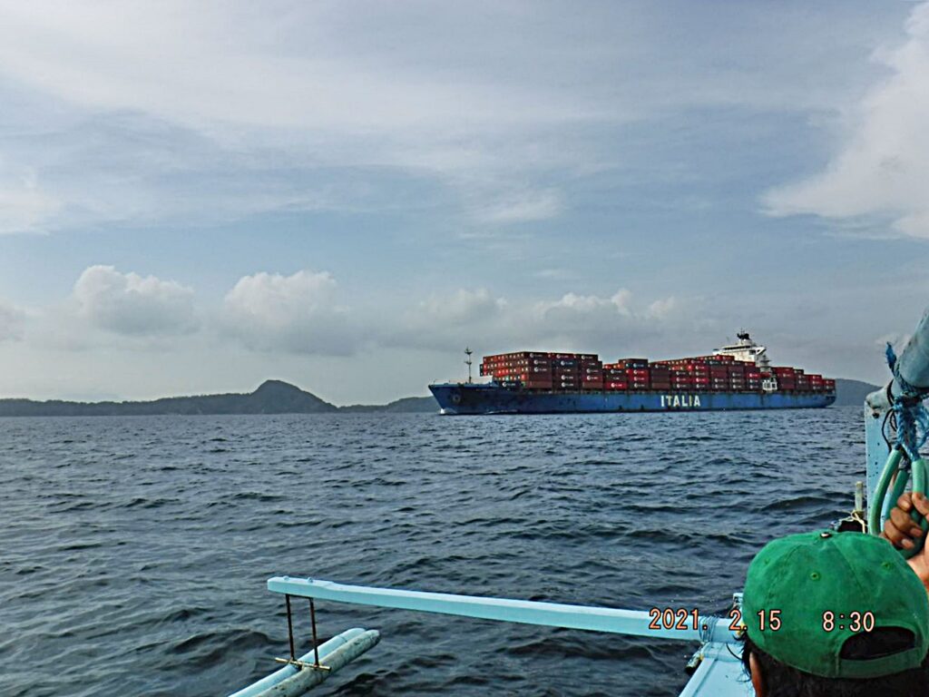 Zf235. We are crossing the North Channel to Corregidor on a Villa Carmen outrigger boat; Villa Carmen is on the SE corner of Bataan and is part of the Barangay Cabcaben. Cabcaben is where the Japanese used their Siege Artillery against Corregidor and started their boat assaults from here. A large container ship is coming into Manila Bay thru the North Channel now. |
|
|
|
Post by Karl Welteke on Dec 12, 2021 17:06:51 GMT 8
First day on Corregidor 2021, Feb. 15th, Second Segment. Then I checked in at the CFI Admin, paid the 300 peso entrance fee and 4000 peso for 4 nights stay at the rooms of the former Gen. MacArthur Café. A surprise was that the previous café manager is now a CFI employee and I will pay my food and drinking bill at the CFI Admin. A light beer is 80 peso; a Red Horse Grande Bottle (1 liter) is 135 peso. (Other charges: Carlos meal, 2 eggs, rice, small pork & beans can 220 peso; rice with fried chicken or pork shop 250 peso; 2 slices of toasted bread, butter, 2 eggs 150 peso). After I checked in into the room I met the CFI on-island manager, Fidel. He briefed me that the flagpole at the First Flag Memorial/Marker is ready and he would meet me there at 1pm after his men prepared the grounds for visitors. He and the CFI Office informed me earlier, that tomorrow, the 16th of Feb, the tourist traffic will start again. During the day I had other indications that things were picking up. A group of men arrived from Bataan and said that they were the trolley drivers for tomorrow. Plus the former Gen. MacArthur Café said she had an order to prepare 14 lunch plates. Apparently, the visitors have that option to order that or bring their own. I learned the Café specially ordered Pork and Beans for me, so I had to order the “Carlos Meal” 2 eggs, rice and the pork and beans. After that famous meal I was ready to march. No transportation is available. Then I marched off and walked 1.5 km, up the road to Middleside, the Pacific War Memorial Zone Gate is still in good shape, but no more guards. I also noticed that the South Road that starts there is completely grown over with grass, but that has been the case for many years now. From the on-island manager I learned that is no longer a security contract. He also said that there is a maintenance contractor to run the power generator (power on from 6pm to 6am) and the water pump at James Ravine. (In the morning, I saw about 4 or 5 sweepers though and during the walks, I saw single sweepers, sweeping here or there). --------------------------------------------- 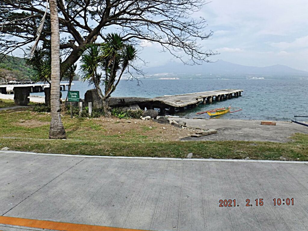 Zf236. Lorcha Dock is still in place. It is famous because Gen MacArthur and his companions left here with the PT boats and broke thru the Japanese lines. A stature is here of the Gen, not on this picture. This is one of 5 images shot from right to left at this location. 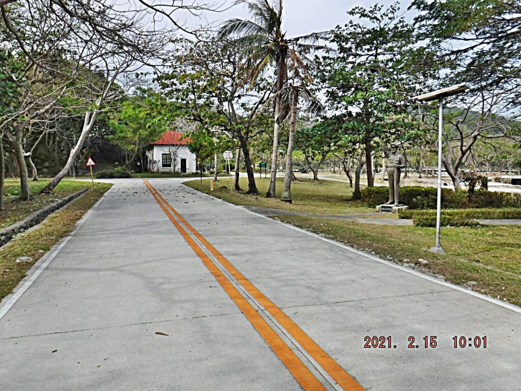 Zf237. One of 5 images shot from right to left at the shore end of the Lorcha Dock on Corregidor, where Gen MacArthur and his companions left here with the PT boats and broke thru the Japanese lines. Here, we are looking at the present Corregidor Foundation Administration buildings. They were apparently built in the Spanish Style, very similar of the Spanish buildings that stood here during the time of the Spanish American War. 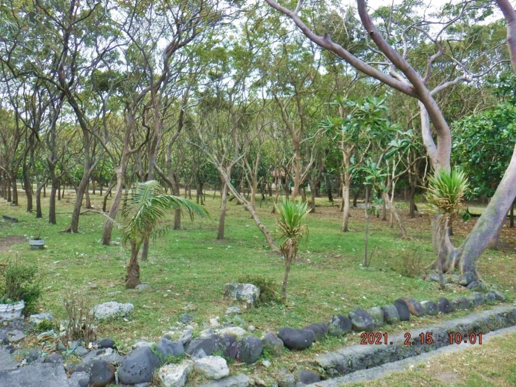 Zf238. One of 5 images shot from right to left at the shore end of the Lorcha Dock on Corregidor. These trees are located between a rise/ small ridge and what is now the only eating and sleeping place on Corregidor, the Gen MacArthur Café. These trees were planted over 20 years ago and each of these trees has a metal plate at the foot of the tree with the name of person who donated some money for a sponsor ship of one of these trees. 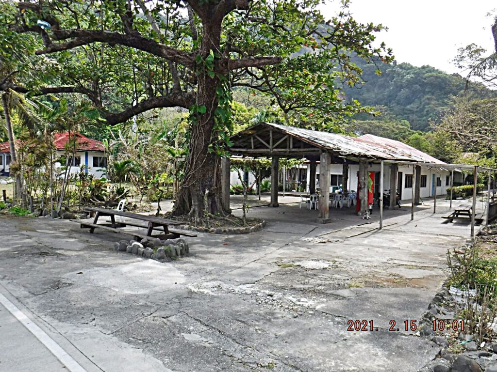 Zf239. One of 5 images shot from right to left at the shore end of the Lorcha Dock on Corregidor. This is the Gen. MacArthur Café, now the only eating and slleping Inn on the island. All the other places are closed because of lack of business and the virus from Red China. Read my comments above for details of staying here. 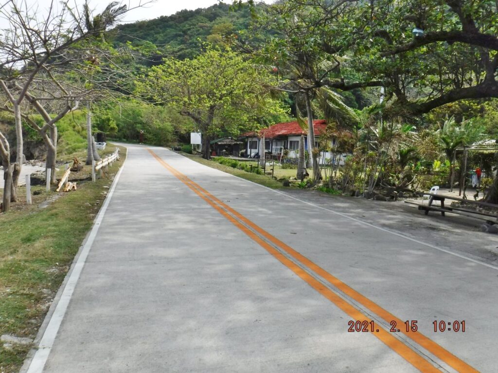 Zf240. One of 5 images shot from right to left at the shore end of the Lorcha Dock on Corregidor. This road leads to the Tailend of Corregidor Island and goes around the north side of Malinta Hill. The building at right with the red roof is the Philippine Coast Guard Station on the island.  Zf341. The west end of Corregidor is considered the War Memorial Zone, this gate is located where the road leaves Corregidor Bottomside and runs up to Middleside and Topside of Corregidor and goes past the former Stackade Level. 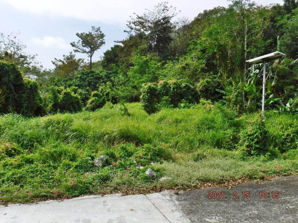 Zf342. This is right next to the War memorial Gate, left side and is the beginning of the Corregidor South Road but as you can see it is now completely grown over. In the past it was kept clear of this entire weed and it was nice walk to go this way. 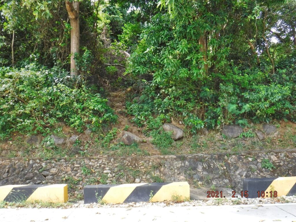 Zf343. This is a shortcut to the Stockade level, the Stockade level was the first plateau of the west end of Corregidor, it is located left or south of the road going to Middleside and Topside. This is where the Spanish Fort is located. Before the war it housed Filipino prisoners of the Philippine penal system and these prisoners did much of the work on Corregidor, then home of the Army Fort Mills. During the war it got destroyed and it houses now, the post war elementary school, barracks for the Corregidor Foundation staff personnel. I visited the area and can report nothing has changed. 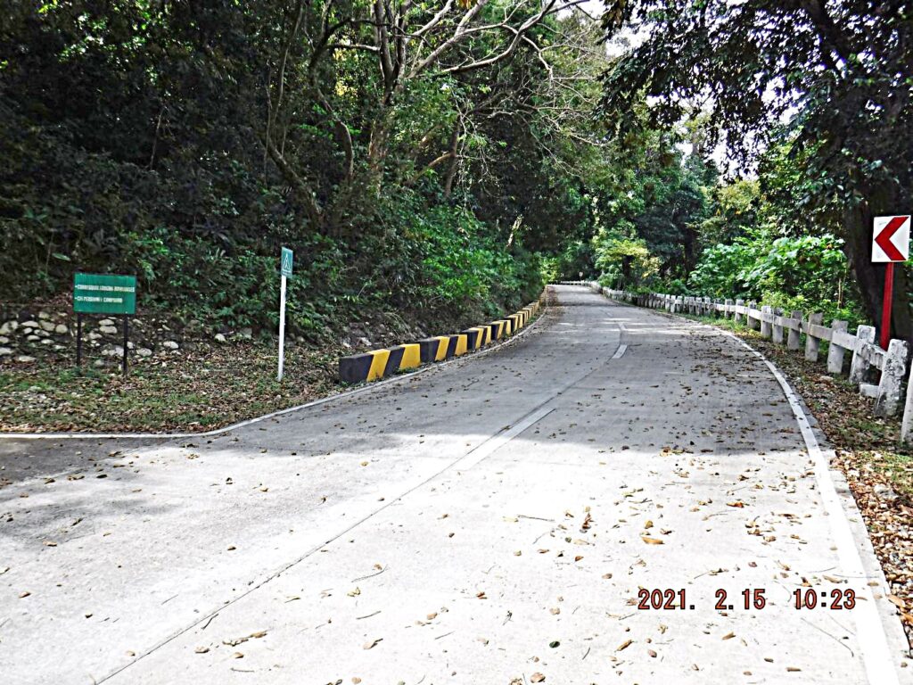 Zf344. I just walked past the entrance of the road leading to the Stockade level on Corregidor Island. 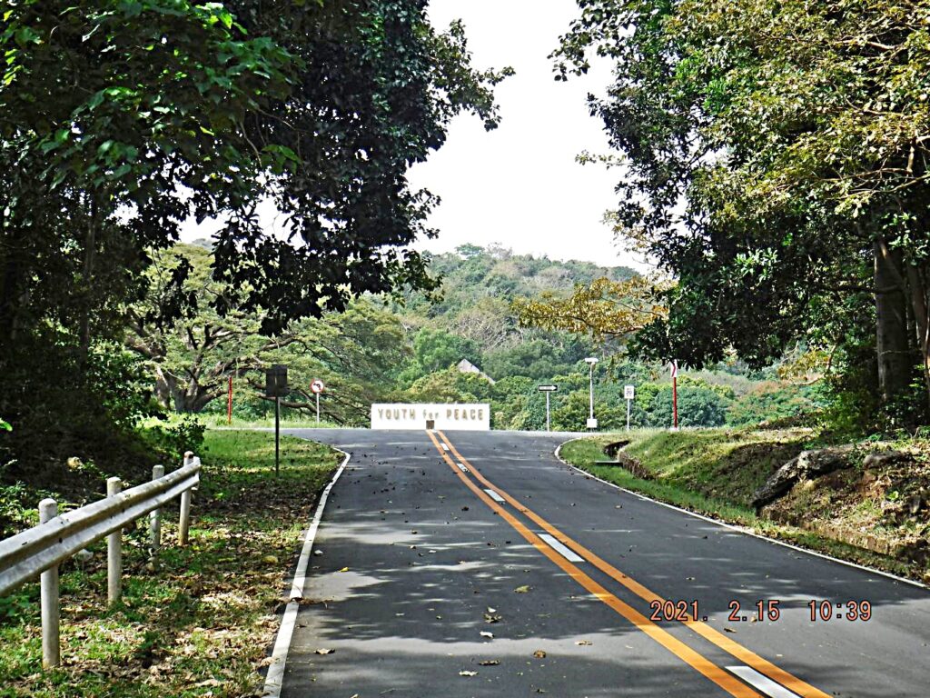 Zf345. We have reached the Middleside plateau; I consider this area a parade and exercise place. Before the war it certainly was used for the horses, they were in stalls south and next to this field. In 1998 this place was used for a Youth for Pease Camp in connection of the Philippine Centennial Celebration. This picture also shows one of the gables of the Fort Mills YMCA. 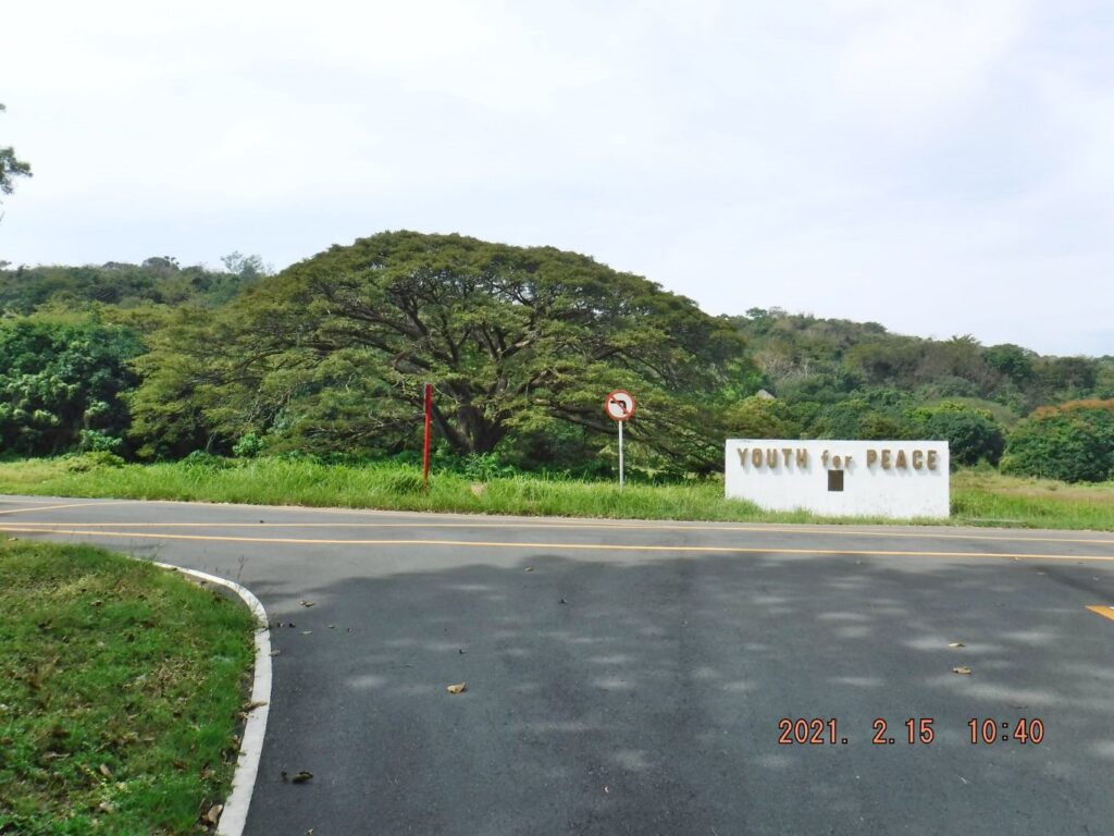 Zf346. We have reached the Middleside plateau; it has at least big tree now in the field and the trees on the west end of the field also have become big. Corregidor Foundation is now unable to cut the grass in the Middleside Parade Ground, before they did but now it looks wild.  Zf347. The Youth for Pease Camp has the memorial wall, shown in the two previous images and this is the lower portion of the plaque on that wall. The plaque is now very hard to read and so I got an older copy from my files. And this is only the lower half; I cropped it so you can read this zoomed portion. Then, in 1998, there must have been many, many young people who participated in this event. 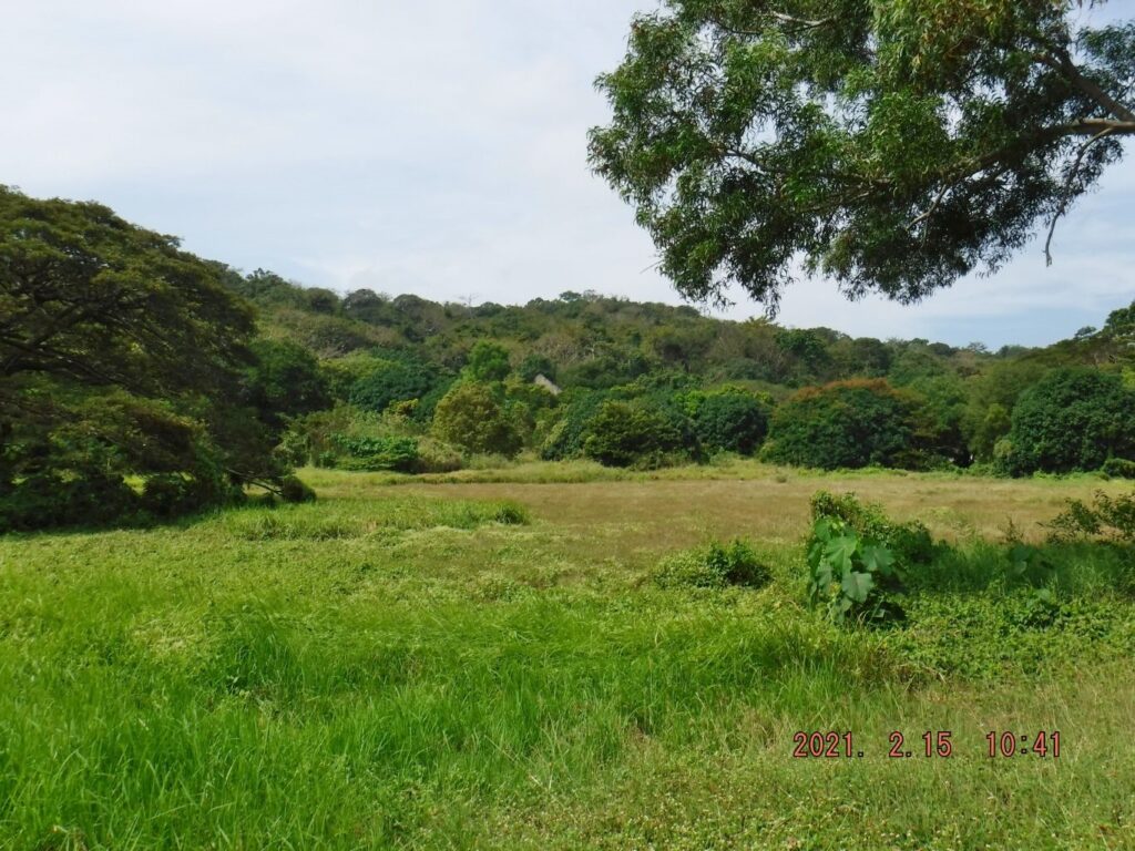 Zf348. We have reached the Middleside plateau; it has at least big tree now in the field and the trees on the west end of the field also have become big. Corregidor Foundation is now unable to cut the grass in this Middleside Parade Ground, before they did but now it looks wild. In this picture, we again see one of the gables of the former Fort Mills YMCA. 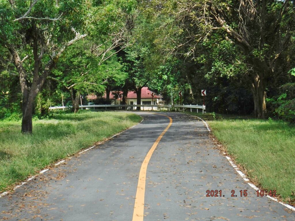 Zf349. I made a ride turn and look now north at the east edge of the Middleside Parade Ground. Ahead is the office and residence of the former Aviary. The Aviary on Corregidor was big and nice but died for economic reasons. Then, that building was used for other purposes. 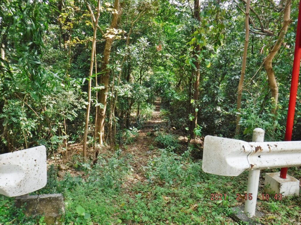 Zf350. Just before one reaches the former Aviary building is this, what we call now a shortcut down from Middleside. On this visit it was still usable. I used it a couple of times on this visit. It is concreted that means it was already a walking path during the Army Fort Mills period. |
|
|
|
Post by Karl Welteke on Dec 17, 2021 18:15:44 GMT 8
First day on Corregidor 2021, Feb. 15th, Third Segment. This 3rd segment (12 images) is mainly about the former Aviary. I included 3 older pictures of the Aviary. I had a close look at the former Aviary Park residence, once occupied by the Kwiecinski couple for 7 years plus and now sometime is used by the CFI Executive Staff or as a VIP lodge. Took a number of shots of the Middleside Barracks, they are beginning to lose the fight against vegetation overgrowth. Battery Way looks ok. The “Mile Long Barracks” looks good for the most part. But at the east end, it is also beginning to lose the fight against vegetation overgrowth, so is the Telephone exchange. We are on Middleside, in the former Fort Mills on Corregidor Island. Middleside is the starting point to see many interesting places in the former Fort Mills on Corregidor, like Battery James,-Morrison and Battery Ramsey. We start here to go down to James Ravine and Government Ravine. In the Government Ravine was the vault with the Philippine Gold. (The gold got out per submarine at the last minute). Many other things can be seen here, three Native villages were up here, then the large structure of the YMCA is here etc. From here one also goes up to Morrison Hill to look at the AAA Battery Denver etc. ------------------------------------------------------------------------- 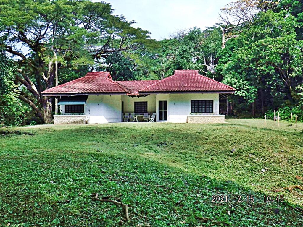 Zf255. This the former Aviary Administration Residence, then for 7 years it was the residence of the Kwiecinski couple, doing research work and were Corregidor history advisors, now it serves as a VIP visitor lodge. 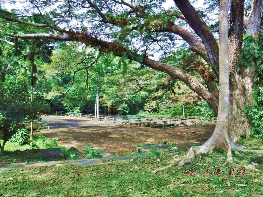 Zf356. This is one of the 2 Fort Mills Rain Water Reservoirs; they were camouflaged as tennis courts. This one apparently suffered from the scrappers and much of the deck is scrapped but the scrappers did knock down the rebar end you can’t get speared by them. It is located at the post war Aviary on Middleside. 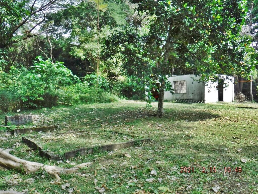 Zf357. A leftover building from the Aviary, it is located behind the former Aviary Administration Residence building. On the rise behind it and all around that rise were the native village/barrio San Isidro and one can find foundations today of those village houses there. 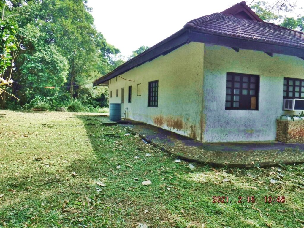 Zf358. This is the rear of the former Aviary Administration Residence building on Corregidor. The Kwiecinski couple had a water tower standing here. In the woods, in back, was part of the Native San Isidro Village (Barrio). 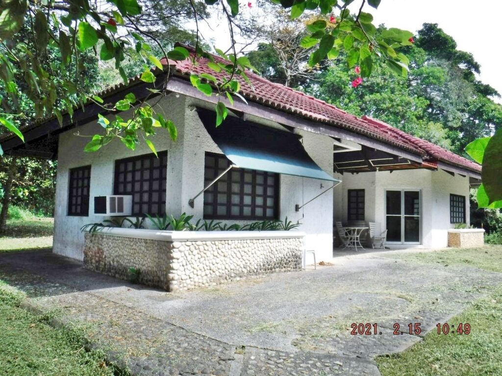 Zf359. This is the front view of the former Aviary Administration Residence building on Corregidor, for 7 years it was the residence of the Kwiecinski couple, doing research work and was Corregidor history advisors, now it serves as a VIP visitor lodge. 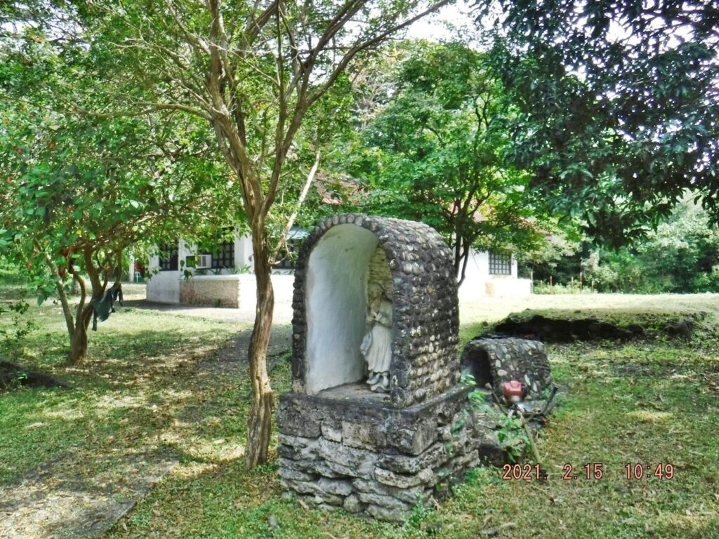 Zf360. The grotto at the former Aviary Administration Residence building on Corregidor is still in fine shape and notice the grass in this area is cut. 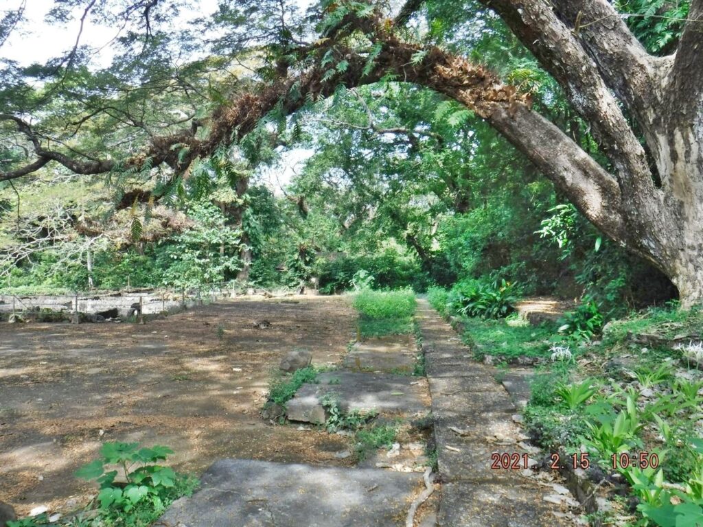 Zf361. This is the area between the Fort Mills 3 Million Gallon Rain Water Reservoir, at left and the former Aviary Administration Residence building on Corregidor, at right and not on this image. That concrete walkway led to the huge Aviary cage. 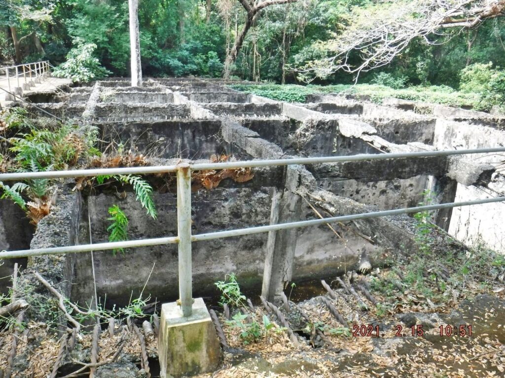 Zf362. A close up shot of the Fort Mills 3 Million Gallon Rain Water Reservoir at Middleside on Corregidor; the other one is Topside. I really don’t know what happened to this reservoir. But to me it looks like scrapper work but I don’t know when or by whom it was done. One nice thing though, the rebar is hammered down so one cannot get speared. 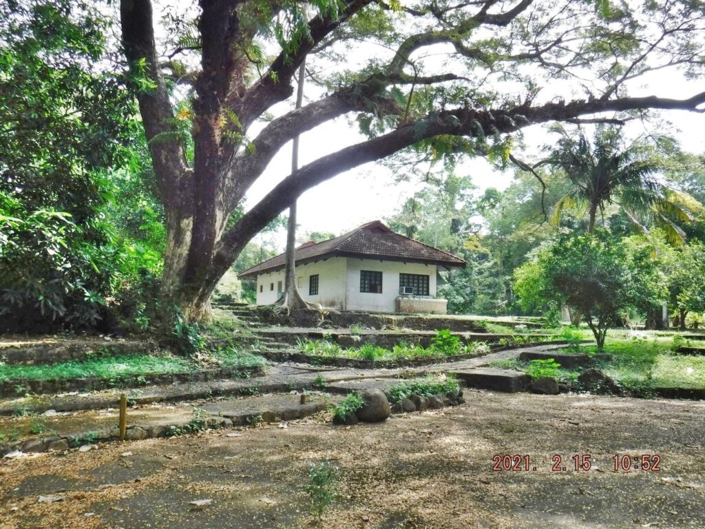 Zf363. This is a shot of the former Aviary Administration Residence building on Corregidor from about the location where the last shot of the reservoir was taken. 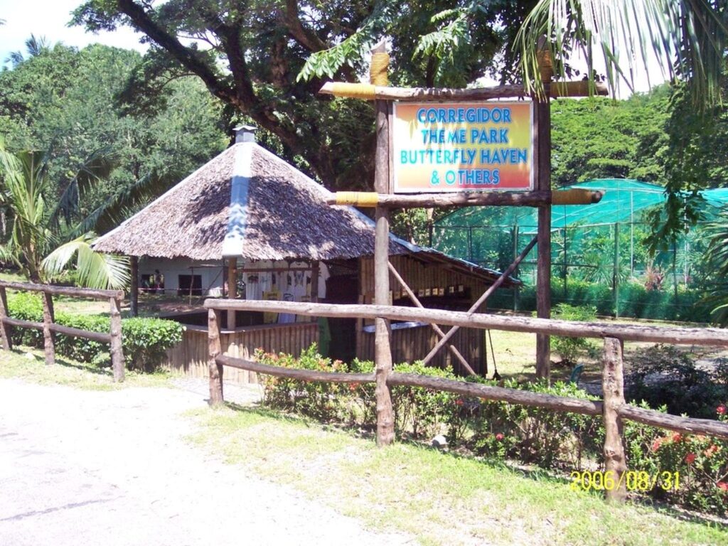 Zf364. This is a 2006 image of the Butterfly concession at the former Aviary at Middleside on Corregidor. The Fort Mills 3 Million Gallon Rain Water Reservoir is behind the Butterfly net. Both the native hooch and the Butterfly net are no longer there. 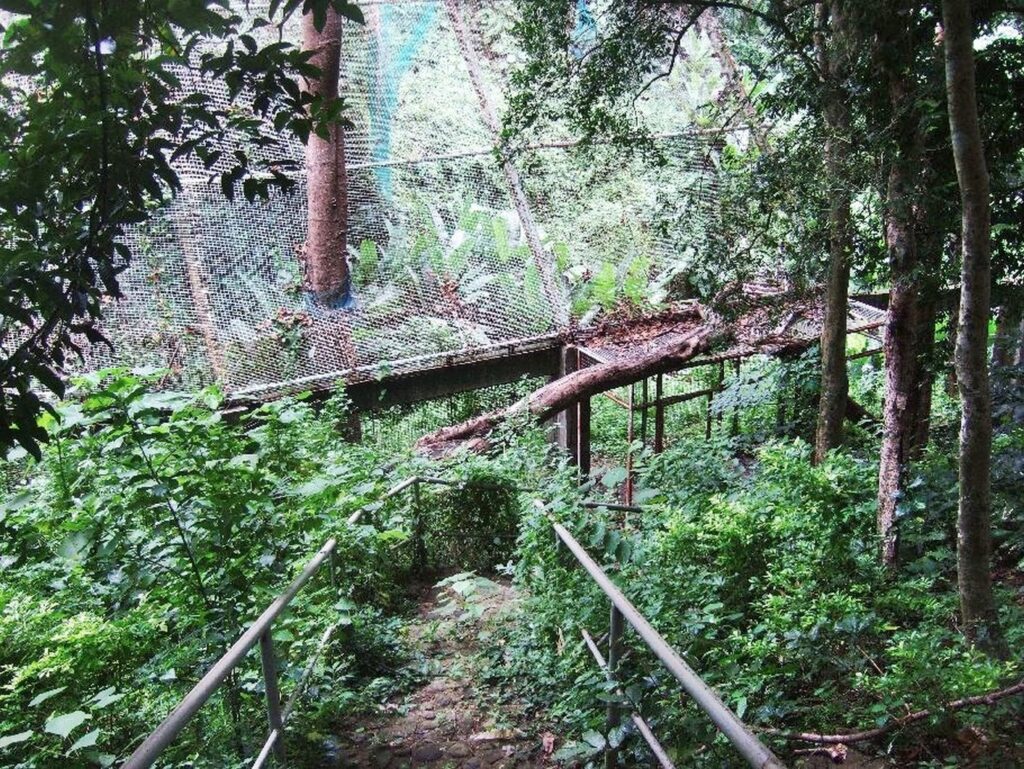 Zf365. The concrete walkway shown in image Zf361 would take you the Aviary Bird Cage entrance on this side. There was another entrance like this on the other side of this large bird cage which spread over the Corregidor Engineering Ravine. The concrete foundation posts are still in place but the netting and the bird cage metal framing is gone. The entrance was a double door set up, thru the 1st door; close it, then thru the 2nd door for obvious reasons. This is a 2008 picture. 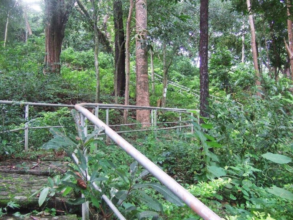 Zf366. This is a 2008 image of the railed pathway to the huge bird cage of the Corregidor Aviary on Corregidor. It started near the concrete pathway next to the former Fort Mills 3 Million Gallon Rain Water Reservoir at Middleside on Corregidor, shown in image Zf361. |
|
|
|
Post by Karl Welteke on Dec 18, 2021 19:31:15 GMT 8
First day on Corregidor 2021, Feb. 15th, Fourth Segment. This 4th segment (19 images) is mainly about the Middleside Barracks. Took a number of shots of the Middleside Barracks, they are beginning to lose the fight against vegetation overgrowth. The situation is that the grass outside, around the barracks is not being cut anymore and the trees are starting to grow inside and in close proximity of the wall are not prevented from growing. Corregidor Foundation Inc. (CFI) does not have the resources anymore to keep up the former maintenance standard of this historic Island and all the WWII buildings on it. The WWII buildings will suffer more now from the uncontrolled vegetations in and around them. 3 old images are attached that show that that problem existed before, was attended to and now it will happen again as in the past. From the area of the Middleside Barracks on Corregidor, we could look for the water tanks, Officer Quarters wrecked and the YMCA building at left. Above the road I’m walking now we could also inspect the trolley line and even enter the very Large Fort Mills Middleside Tunnel. All these wrecked structures still can be found and can be viewed today. But one has to go thru the bushes. 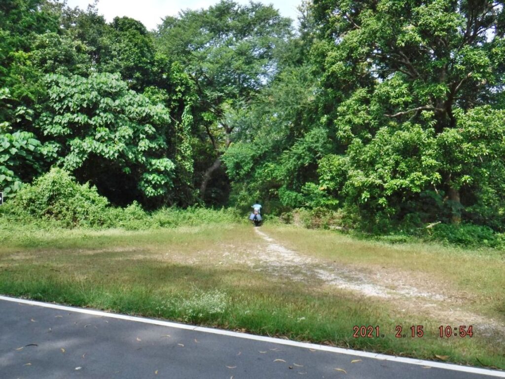 Zf367. This is the road to James Ravine and Morrison Hill etc, notice, right now you only see one vehicle track. It seems 4 wheeled vehicles use this road very seldom or not at all. This motorbike was heading to the water pump in James Ravine. 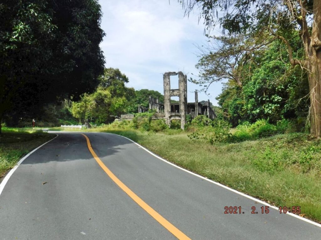 Zf368. This is one of 9 images of the South-East Middleside Barracks, the first one at right when one goes up to Corregidor Topside passed these barracks. You can see that CFI is now unable to keep the grass cut or unable to prevent trees and scrub to grow inside the barracks or next to the barracks walls. 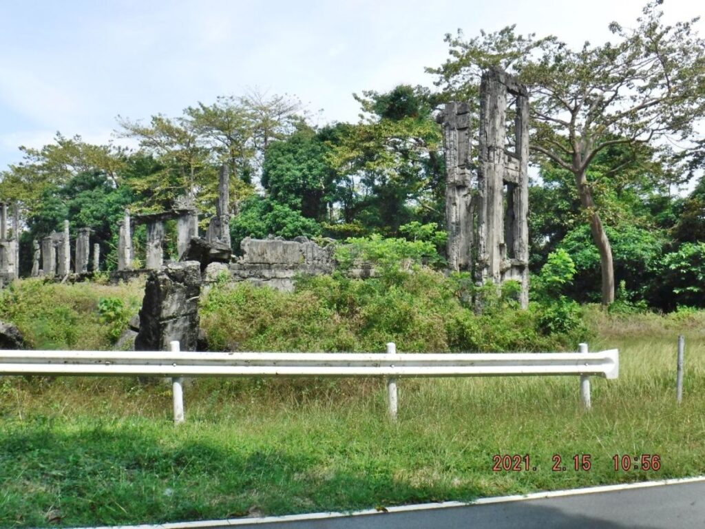 Zf369. This is one of 9 images of the South-East Middleside Barracks, the first one at right when one goes up to Corregidor Topside passed these barracks. You can see that CFI is now unable to keep the grass cut or unable to prevent trees and scrub to grow inside the barracks or next to the barracks walls. 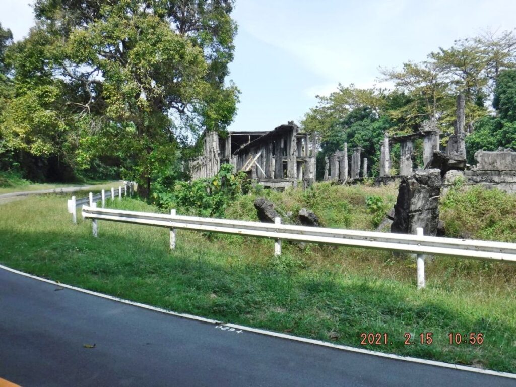 Zf370. This is one of 9 images of the Corregidor South-East Middleside Barracks, the first one at right when one goes up to Corregidor Topside passed these barracks. You can see that CFI is now unable to keep the grass cut or unable to prevent trees and scrub to grow inside the barracks or next to the barracks walls. 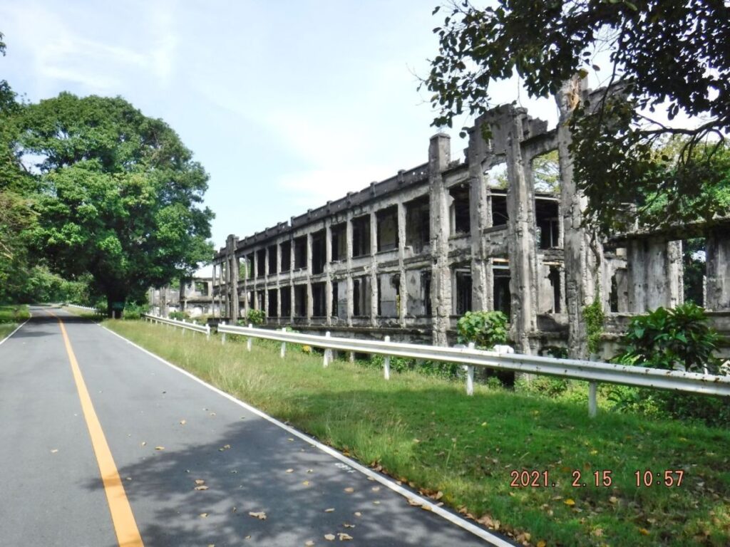 Zf371. This is one of 9 images of the South-East Middleside Barracks, the first one at right when one goes up to Corregidor Topside passed these barracks. You can see that CFI is now unable to keep the grass cut or unable to prevent trees and scrub to grow inside the barracks or next to the barracks walls. 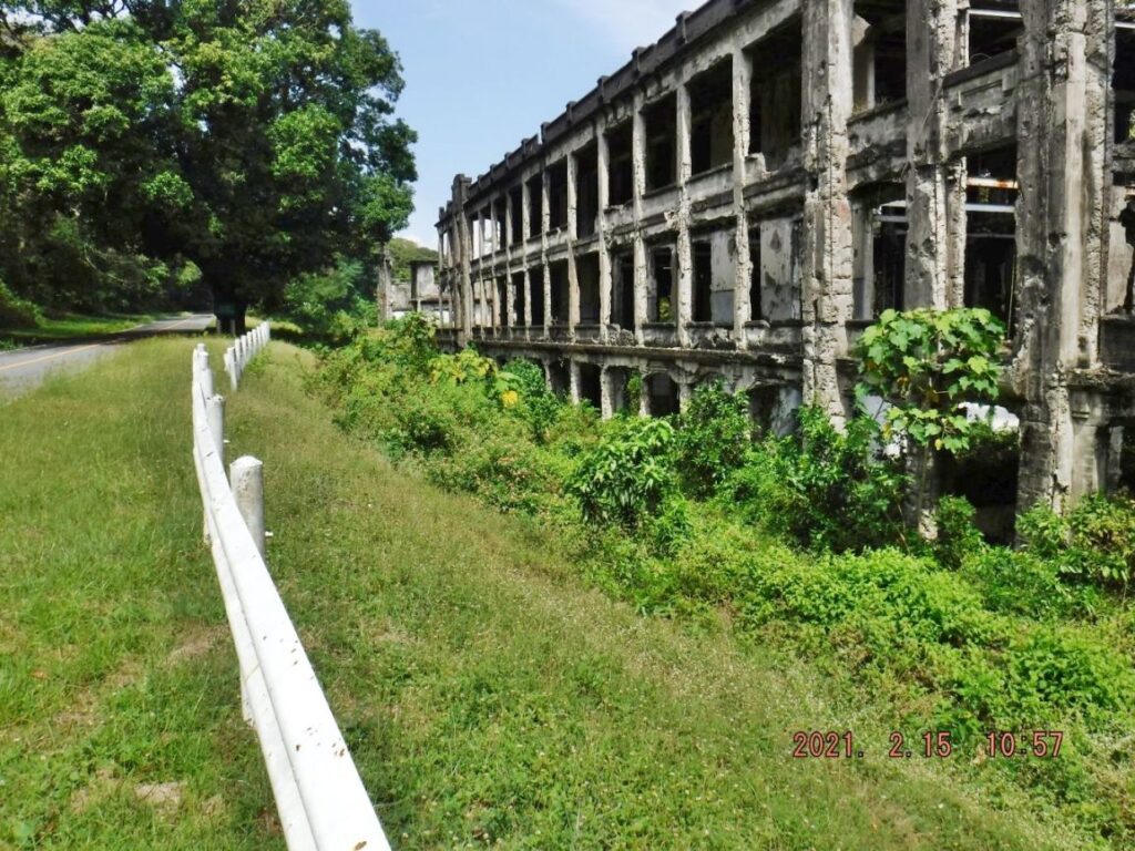 Zf372. This is one of 9 images of the South-East Middleside Barracks, the first one at right when one goes up to Corregidor Topside passed these barracks. You can see that CFI is now unable to keep the grass cut or unable to prevent trees and scrub to grow inside the barracks or next to the barracks walls. 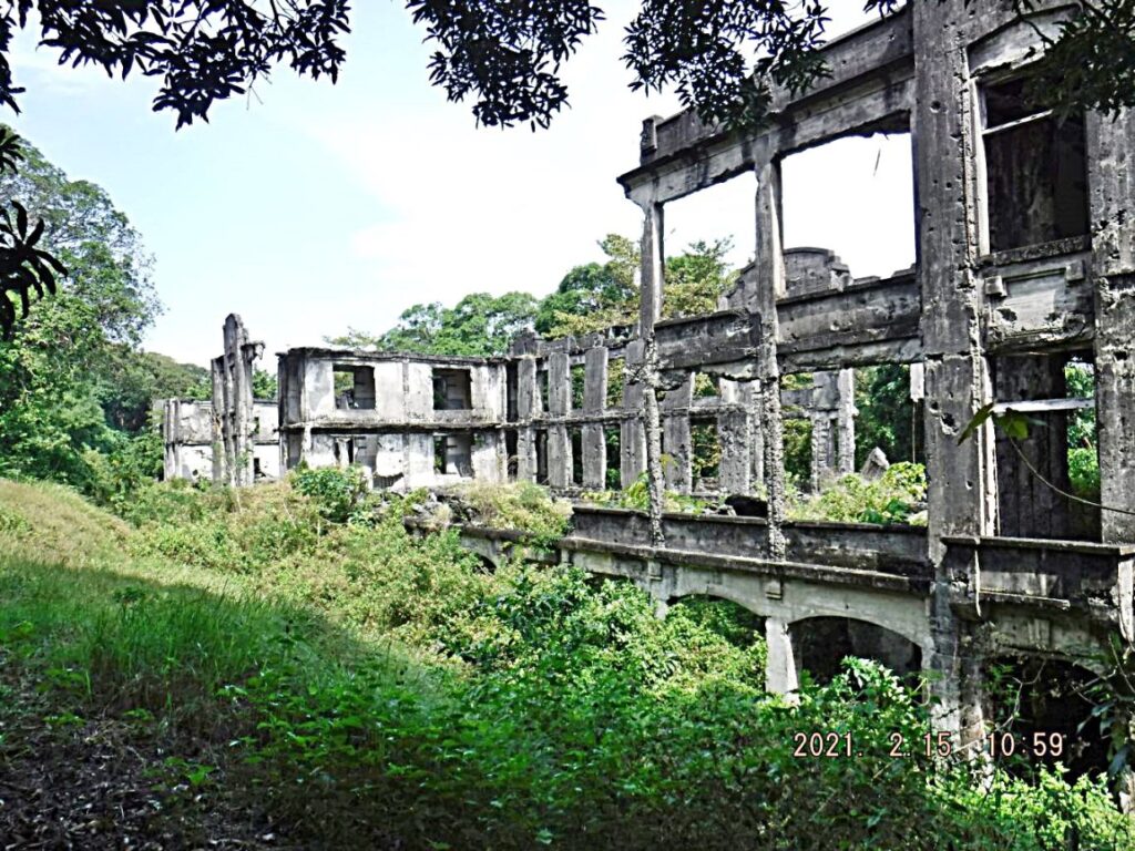 Zf373. This is one of 9 images of the South-East Middleside Barracks, the first one at right when one goes up to Corregidor Topside passed these barracks. You can see that CFI is now unable to keep the grass cut or unable to prevent trees and scrub to grow inside the barracks or next to the barracks walls. 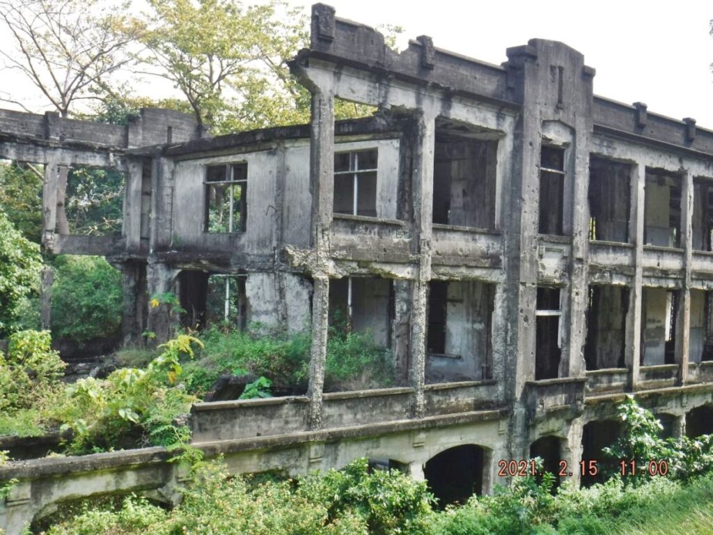 Zf374. This is one of 9 images of the South-East Middleside Barracks, the first one at right when one goes up to Corregidor Topside passed these barracks. You can see that CFI is now unable to keep the grass cut or unable to prevent trees and scrub to grow inside the barracks or next to the barracks walls. 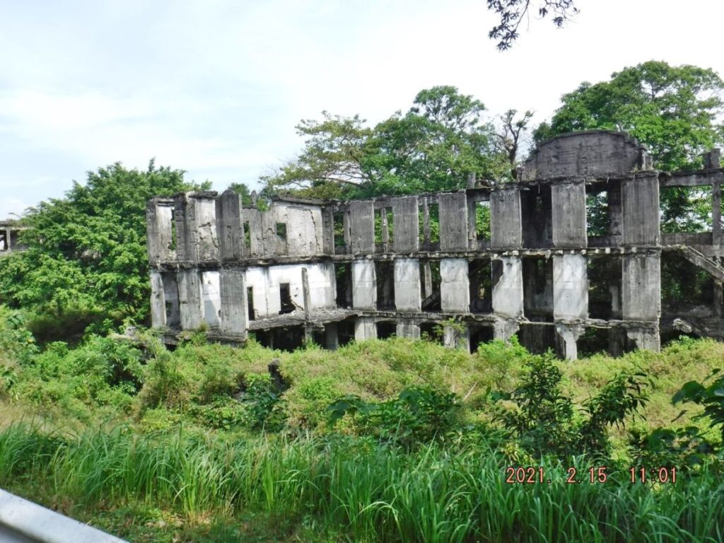 Zf375. This is one of 9 images of the South-East Middleside Barracks, the first one at right when one goes up to Corregidor Topside passed these barracks. You can see that CFI is now unable to keep the grass cut or unable to prevent trees and scrub to grow inside the barracks or next to the barracks walls. 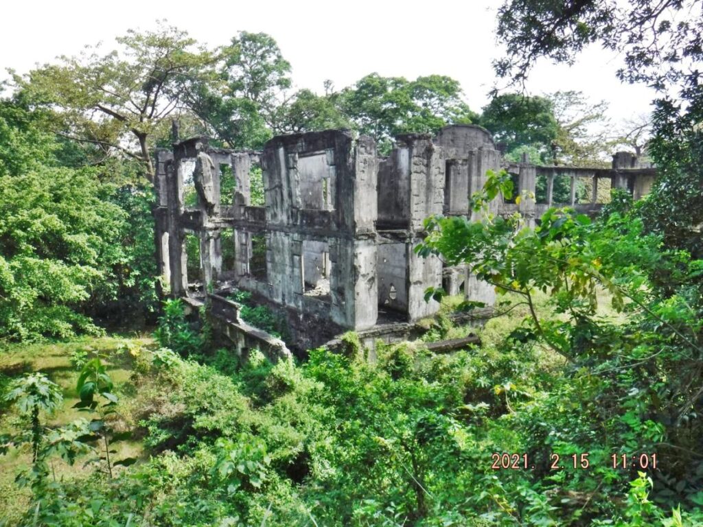 Zf376. This is one of 9 images of the South-East Middleside Barracks, the first one at right when one goes up to Corregidor Topside passed these barracks. You can see that CFI is now unable to keep the grass cut or unable to prevent trees and scrub to grow inside the barracks or next to the barracks walls. 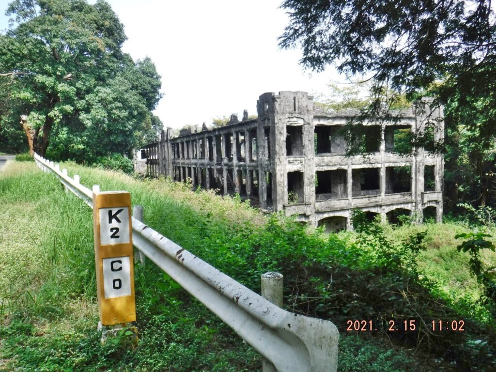 Zf381. This is one of 6 images of the Corregidor North-West Middleside Barracks, the second of two at right when one goes up to Corregidor Topside passed these barracks. You can see that CFI is now unable to keep the grass cut or unable to prevent trees and scrub to grow inside the barracks or next to the barracks walls. 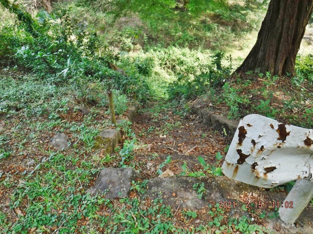 Zf382. This is one of 6 images of the Corregidor North-West Middleside Barracks, the second of two at right when one goes up to Corregidor Topside passed these barracks. You can see that CFI is now unable to keep the grass cut or unable to prevent trees and scrub to grow inside the barracks or next to the barracks walls. There are concrete steps to the barracks from the road, between the two barracks. 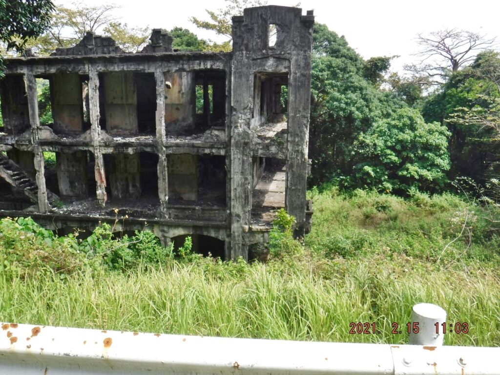 Zf383. This is one of 6 images of the Corregidor North-West Middleside Barracks, the second of two at right when one goes up to Corregidor Topside passed these barracks. You can see that CFI is now unable to keep the grass cut or unable to prevent trees and scrub to grow inside the barracks or next to the barracks walls. 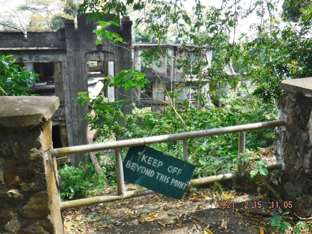 Zf384. This is one of 6 images of the Corregidor North-West Middleside Barracks, the second of two at right when one goes up to Corregidor Topside passed these barracks. You can see that CFI is now unable to keep the grass cut or unable to prevent trees and scrub to grow inside the barracks or next to the barracks walls. This used to be a metal walkway from this road to that barracks. We know of a WWII Corregidor veteran that that veteran slept on that metal path because it was cooler there. 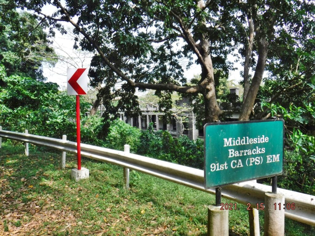 Zf385. This is one of 6 images of the Corregidor North-West Middleside Barracks, the second of two at right when one goes up to Corregidor Topside passed these barracks. You can see that CFI is now unable to keep the grass cut or unable to prevent trees and scrub to grow inside the barracks or next to the barracks walls. 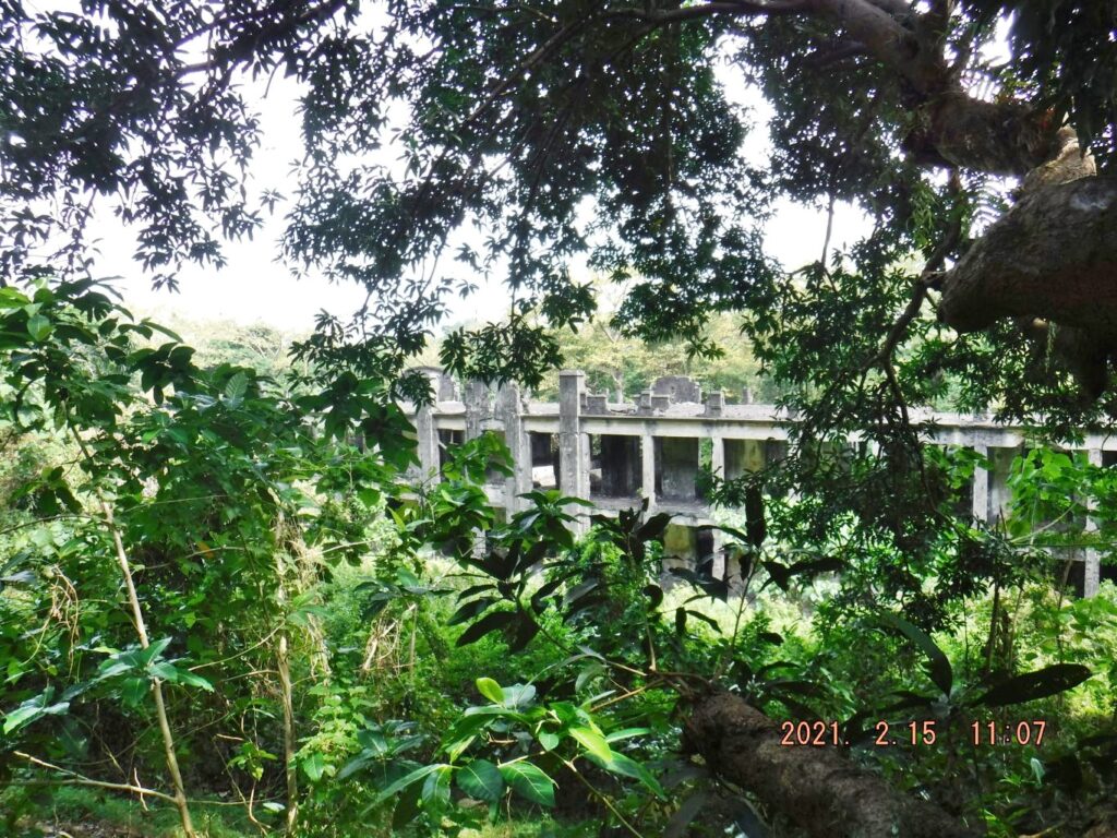 Zf386. This is one of 6 images of the Corregidor North-West Middleside Barracks, the second of two at right when one goes up to Corregidor Topside passed these barracks. You can see that CFI is now unable to keep the grass cut or unable to prevent trees and scrub to grow inside the barracks or next to the barracks walls. 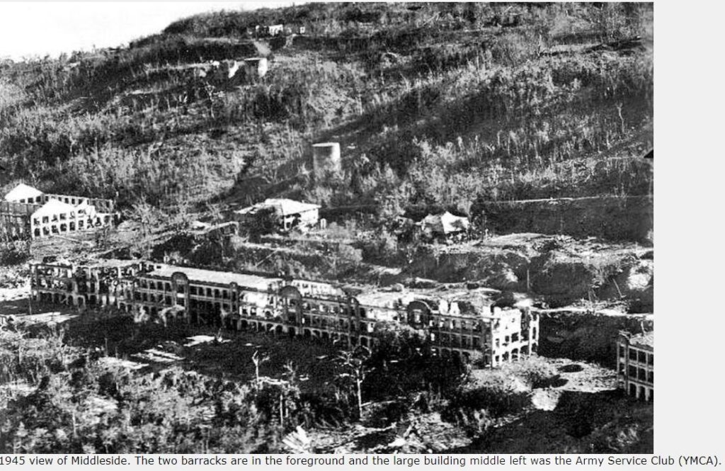 Zf387. A WWII image of the Middleside Barracks on Corregidor, we see also water tanks, Officer Quarters wrecked and the YMCA building at left; all these wrecked structures still can be found and can be viewed today. But one has to go thru the bushes. 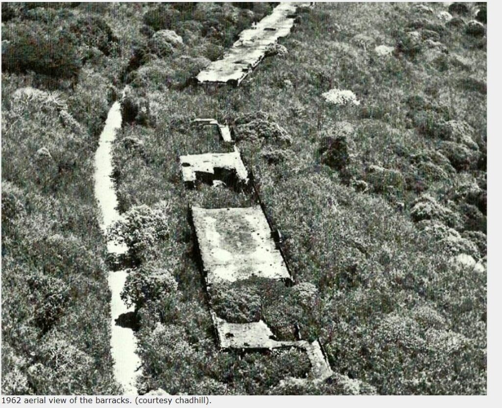 Zf388. This is a 1962 images of the Corregidor Barracks and at that time the barracks were completely covered in woods and vegetation which caused further damage the barracks. 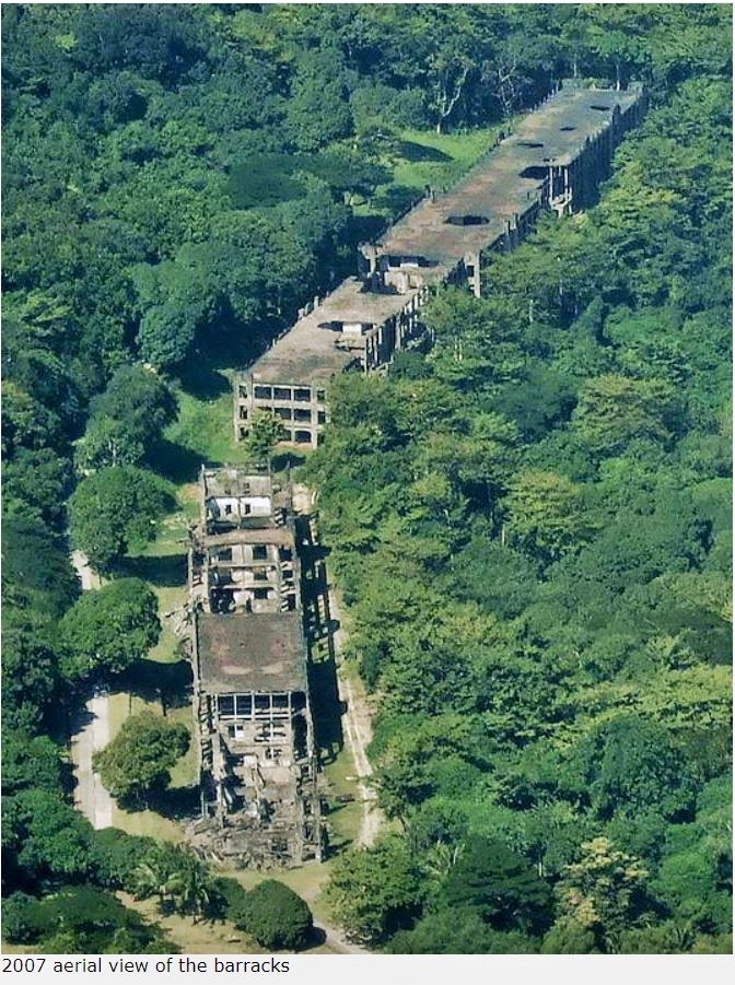 Zf389. After Corregidor became a war memorial zone, CFI got a handle on the vegetation overgrowth problem. This is a 2007 image and I and many others were able to walk around the barracks when the grass was kept cut and trees were kept in bay and we were able to look inside the barracks. That is no longer possible today. |
|
|
|
Post by Karl Welteke on Dec 19, 2021 18:42:45 GMT 8
First day on Corregidor 2021, Feb. 15th, Fifth Segment. This presentation has 12 images about Battery Way including 4 images of historical plaques. From the Middleside Barracks, I followed the road to Battery Way on Corregidor. This is really a magnificent stretch of road with majestic trees on both sides; the trees have grown to maturity after all the fighting in 1942 and 1945. This stretch of road looks like one is walking in a great tropical forest; nothing can be seen from the war devastation now. One thing I noticed is that CFI is unable to sweep the streets everyday like before, but that does not look like a big problem. To the right one is looking at one of two heads of the James Ravine and there used to be Quarters, or rather NCO Barracks. They were out of wood and are gone except the foundations. To the left, if you were to climb up the slope, you would see the Fort Mills Trolley line and stations. And above the trolley were officer quarters, wrecked now and there are concrete walkways between those quarters. Above the Officer Quarters is the famous Fort Mills Hospital on Corregidor Island. That is not on the guided tour places to be seen. It would be too much to include it in a one day tour! Opposite of Battery Way, which is at the right side, on the left side of the road you could follow trails and roads to the Fort Mills Hospital. Battery Way, with the four 12 inch Howitzers is one of the prime sites where guided tours take Corregidor visitors. It was clean and presentable as before. It has a magnificent history and 4 plaques mounted there tell the story, I added earlier pictures of those 4 plaques to this presentation. 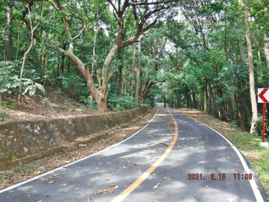 Zf425. One of 2 images of the stretch of road from the Middleside Barracks to Battery Way. This view is looking up-hill towards Battery Way. 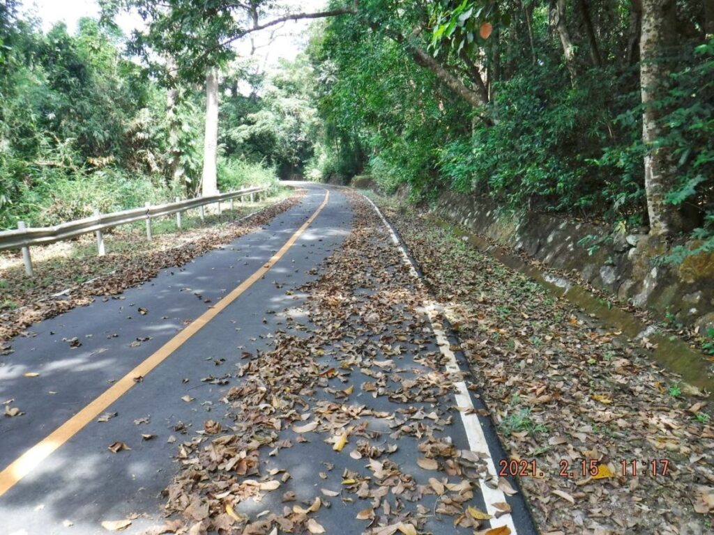 Zf426. One of 2 images of the stretch of road from the Middleside Barracks to Battery Way. This view is looking back, down-hill towards Middleside Barracks. 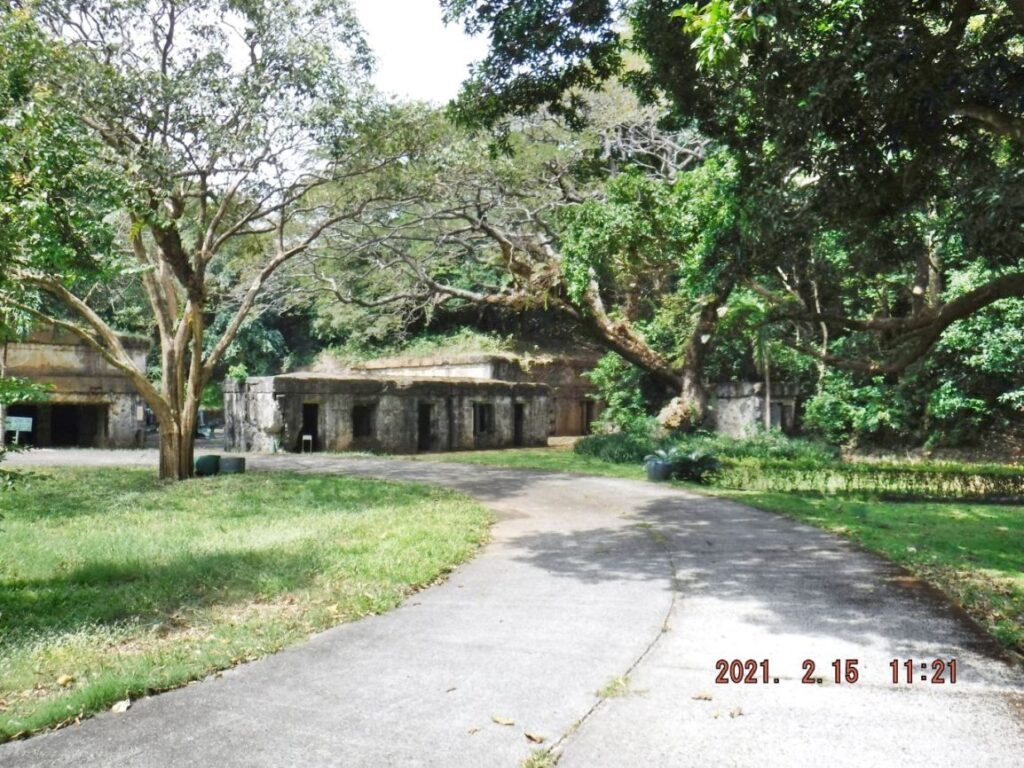 Zf427. This is one of 6 images of the Fort Mills Battery Way on Corregidor Island; the battery has four 12 Inch howitzers. The battery has a very noteworthy history and 4 plaques commemorating it are mounted in the battery. Images of the 4 plaques are at the end of this presentation. 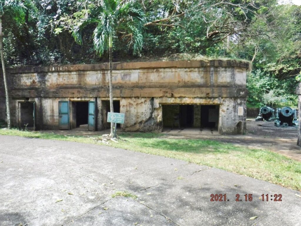 Zf428. This is one of 6 images of the Fort Mills Battery Way on Corregidor Island; the battery has four 12 Inch howitzers. The battery has a very noteworthy history and 4 plaques commemorating it are mounted in the battery. Images of the 4 plaques are at the end of this presentation. 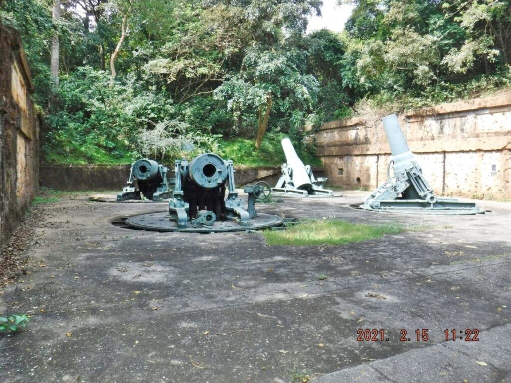 Zf429. This is one of 6 images of the Fort Mills Battery Way on Corregidor Island; the battery has four 12 Inch howitzers. The battery has a very noteworthy history and 4 plaques commemorating it are mounted in the battery. Images of the 4 plaques are at the end of this presentation. 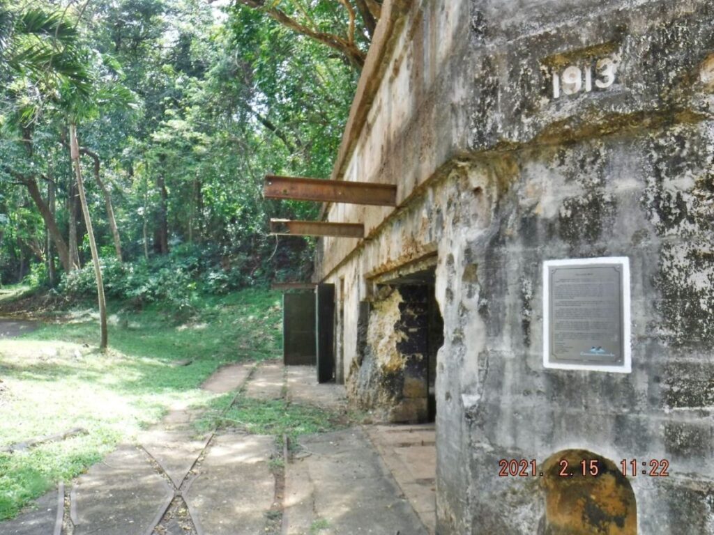 Zf430. This is one of 6 images of the Fort Mills Battery Way on Corregidor Island; the battery has four 12 Inch howitzers. The battery has a very noteworthy history and 4 plaques commemorating it are mounted in the battery. Images of the 4 plaques are at the end of this presentation. 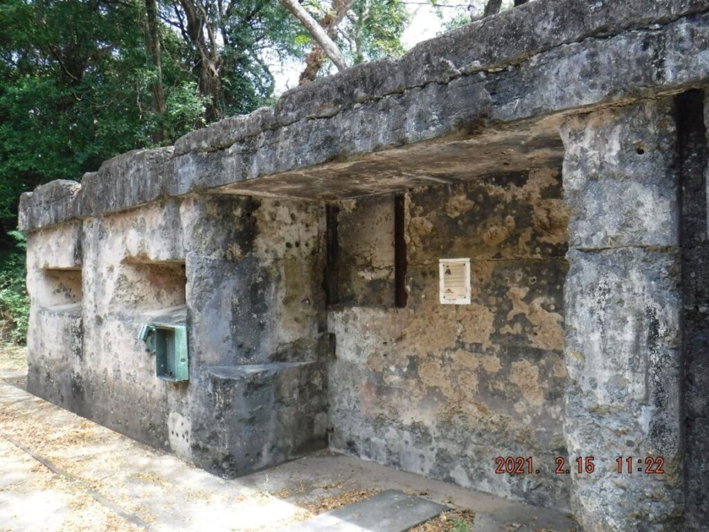 Zf431. This is one of 6 images of the Fort Mills Battery Way on Corregidor Island; the battery has four 12 Inch howitzers. The battery has a very noteworthy history and 4 plaques commemorating it are mounted in the battery. Images of the 4 plaques are at the end of this presentation. 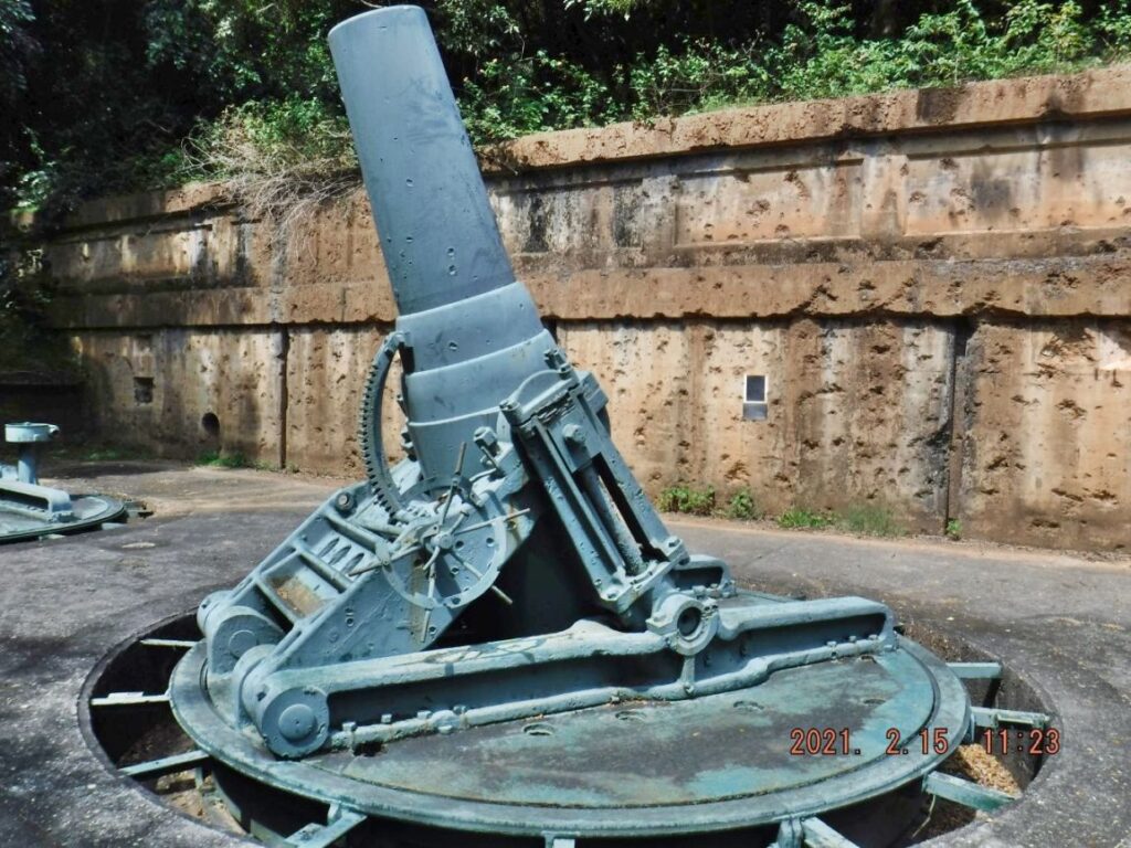 Zf432. This is one of 6 images of the Fort Mills Battery Way on Corregidor Island; the battery has four 12 Inch howitzers. The battery has a very noteworthy history and 4 plaques commemorating it are mounted in the battery. Images of the 4 plaques are at the end of this presentation. 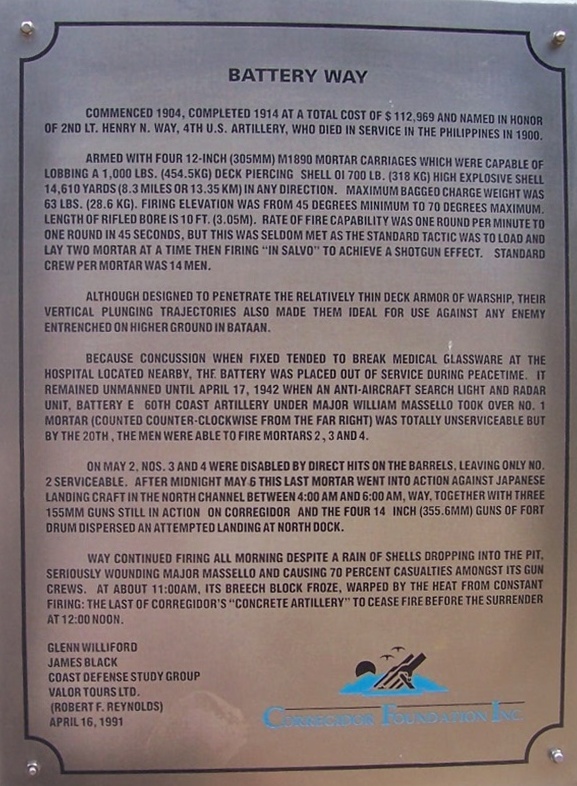 Zf433. This is the history plaque of Battery Way on Corregidor. 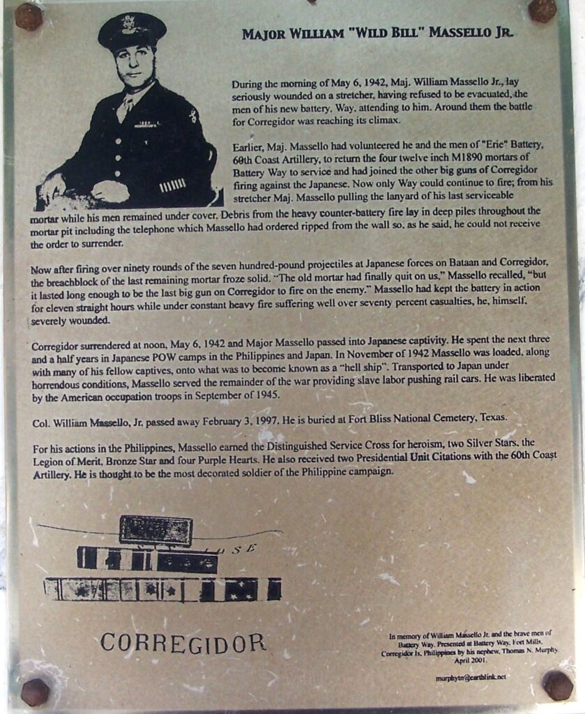 Zf434. This is the commemoration plaque to Major William “Wild Bill” Massello Jr. and his men serving this battery in the defense of Fort Mills during the Corregidor Siege to last minute. 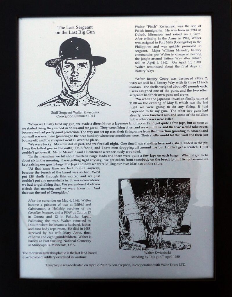 Zf435. This is the commemoration plaque to Sergeant Walter Kwiecinski who operated this howitzer, at this Battery Way, with his men as the last gun firing before the surrender of Corregidor. This plaque is mounted on the wall of the magazine next to the last gun that was able to fire. 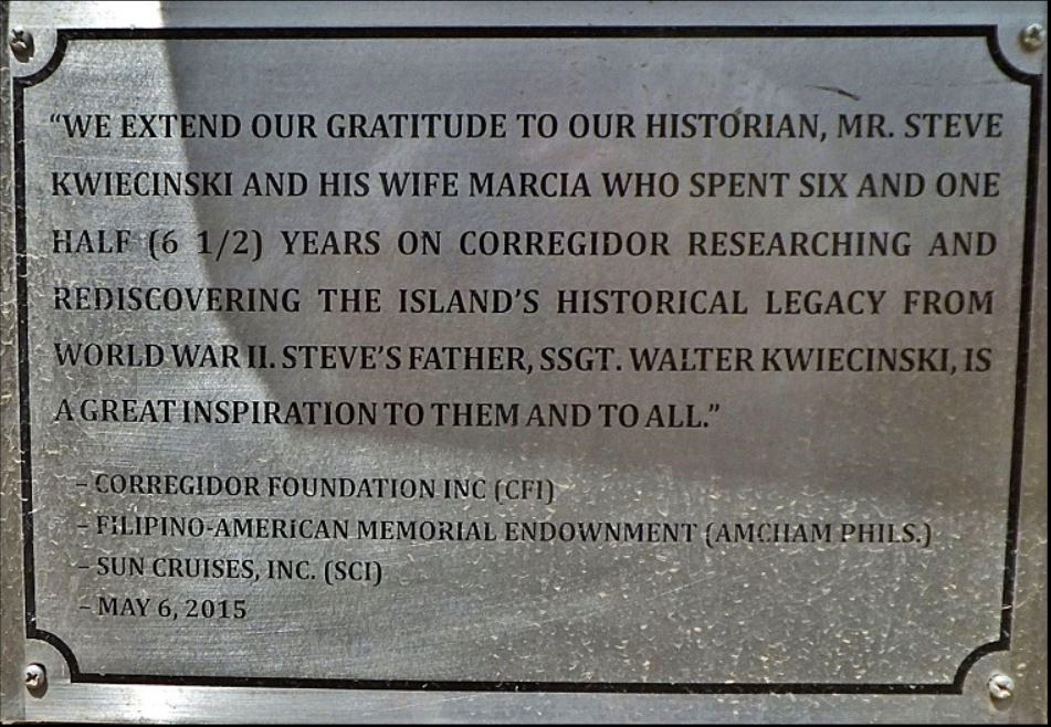 Zf436. This is the recognition and thank you plaque to the descendents of Sergeant Walter Kwiecinski, they are my friends! This is the commemoration plaque to Major. This plaque is mounted on the wall of the magazine next to the last gun that was able to fire. If interested: -We have a forum webpage about Battery Way, click here: corregidor.proboards.com/thread/722/battery-We have a forum web page for the Kwiecinski couple, click here corregidor.proboards.com/thread/1985/kwiecinski-couple-corregidor |
|
|
|
Post by Karl Welteke on Dec 21, 2021 14:51:38 GMT 8
First Day on Corregidor 2021 Feb. 15th, Sixth Segment. This presentation has 19 images including 4 images from 2007 and 1 image from 2017. I continued my walk to Topside and was awarded with 2 great views, one of the so-called “Mile Long Barracks” (MLB) and the Parade Ground in the former Fort mills on the Corregidor Island. The south side of the barracks is presentable. The east end of the so called “Mile Long Barracks” is beginning to suffer the invasion of vegetation and even trees are beginning to grow inside at the east end of the MLB. 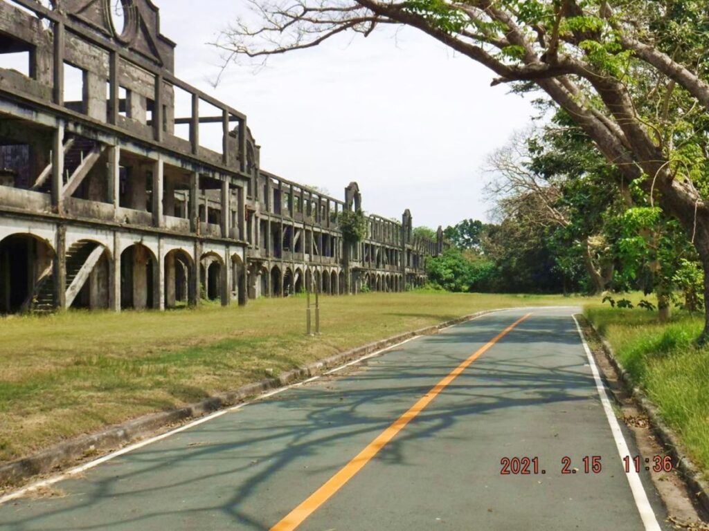 Zf437. This is one of 3 images of the Southside of the so called Fort Mills Mile Long Barracks (MLB) as to what the guided tour visitors see, when they drive by here or get to have a closer look by stepping of the trolley. Even in the middle section vegetation is encroaching but the east end of the MLB is getting bad; it is not cleared like it was even as late as 2017 as my 2017 pictures show. 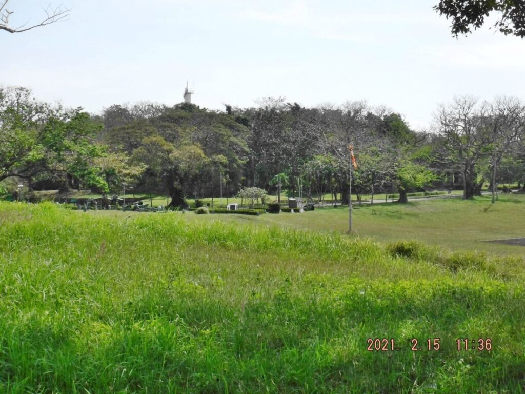 Zf438. This is a view of the east end of the former Fort Mills on Corregidor Island Parade Ground. We are looking in the direction of the lighthouse but only see the tall Manila Harbor Control Radar Tower. The area is home to 2 Memorials and many WWII type weapons. We also see a wind sock in case a Helicopter lands. 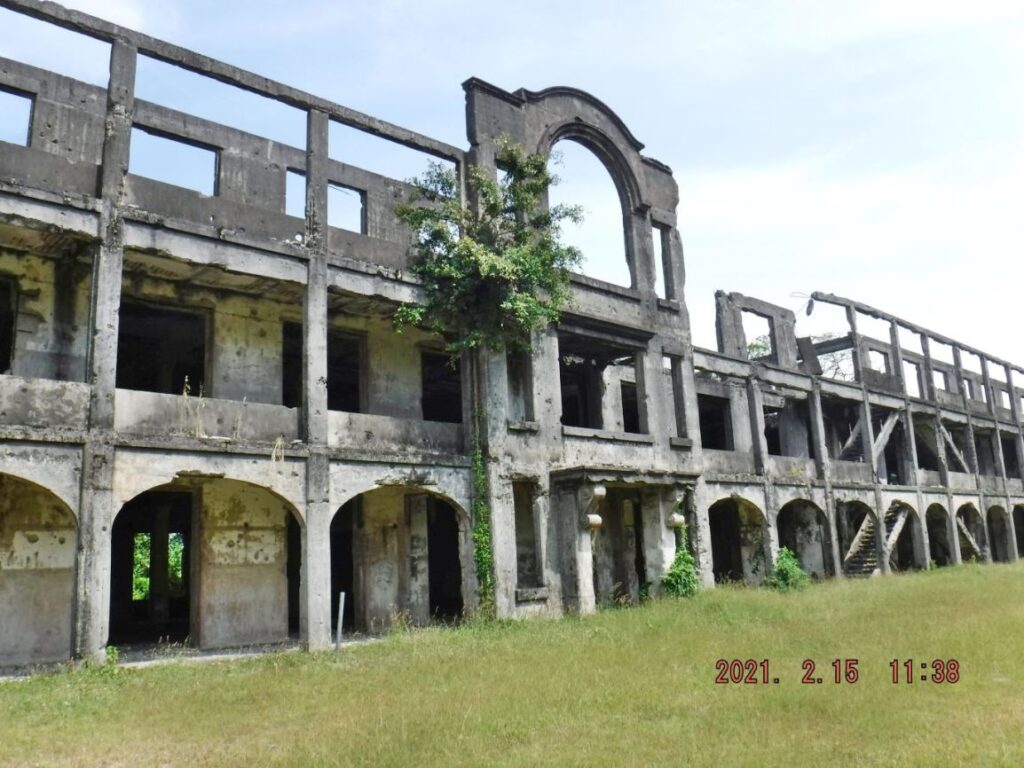 Zf439. This is one of 3 images of the Southside of the so called Fort Mills Mile Long Barracks (MLB) as to what the guided tour visitors see, when they drive by here or get to have a closer look by stepping of the trolley. Even in the middle section vegetation is encroaching but the east end of the MLB is getting bad; it is not cleared like it was even as late as 2017 as my 2017 pictures show. 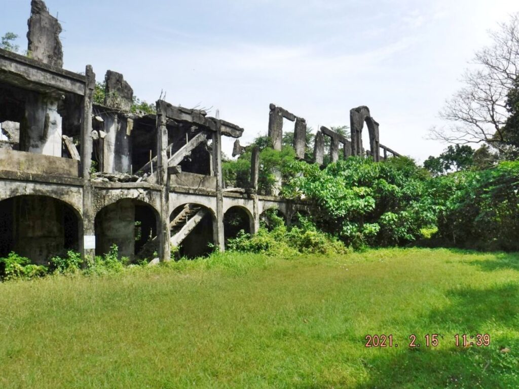 Zf440. This is one of 3 images of the Southside of the so called Fort Mills Mile Long Barracks (MLB) as to what the guided tour visitors see, when they drive by here or get to have a closer look by stepping of the trolley. Even in the middle section vegetation is encroaching but the east end of the MLB is getting bad; it is not cleared like it was even as late as 2017 as my 2017 pictures show. 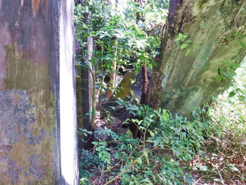 Zf441. This is one of 8 images from the east end of the so called Fort Mills Mile Long Barracks (MLB). The vegetation encroachment and the growth of trees inside the barracks are getting bad and it will cause damage to this part of the MLB. After these images you can compare them to 2007 and 2017 images. This is on the north side of the MLB. 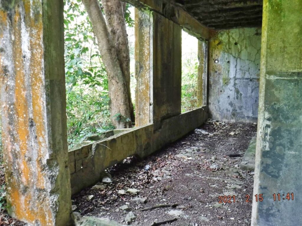 Zf442. This is one of 8 images from the east end of the so called Fort Mills Mile Long Barracks (MLB). The vegetation encroachment and the growth of trees inside the barracks are getting bad and it will cause damage to this part of the MLB. After these images you can compare them to 2007 and 2017 images. This is the north side of the MLB. 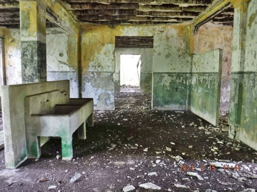 Zf443. This is one of 8 images from the east end of the so called Fort Mills Mile Long Barracks (MLB). The vegetation encroachment and the growth of trees inside the barracks are getting bad and it will cause damage to this part of the MLB. After these images you can compare them to 2007 and 2017 images. Pieces of the ceiling could fall on your head, this is the reason one should not go inside of structures with ceilings still in place. 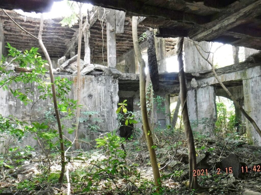 Zf444. This is one of 8 images from the east end of the so called Fort Mills Mile Long Barracks (MLB). The vegetation encroachment and the growth of trees inside the barracks are getting bad and it will cause damage to this part of the MLB. After these images you can compare them to 2007 and 2017 images. Where the bombs or artillery destroyed the ceilings, trees are starting to grow inside the MLB. 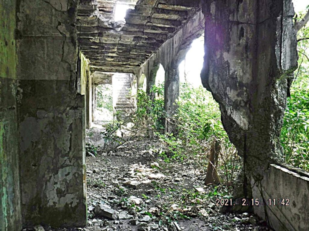 Zf445. This is one of 8 images from the east end of the so called Fort Mills Mile Long Barracks (MLB). The vegetation encroachment and the growth of trees inside the barracks are getting bad and it will cause damage to this part of the MLB. After these images you can compare them to 2007 and 2017 images. 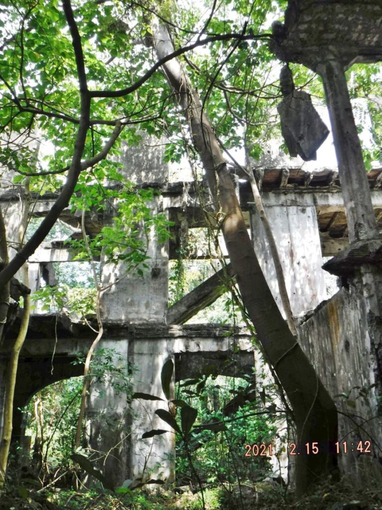 Zf446. This is one of 8 images from the east end of the so called Fort Mills Mile Long Barracks (MLB). The vegetation encroachment and the growth of trees inside the barracks are getting bad and it will cause damage to this part of the MLB. After these images you can compare them to 2007 and 2017 images. Where the bombs or artillery destroyed the ceilings, trees are starting to grow inside the MLB. 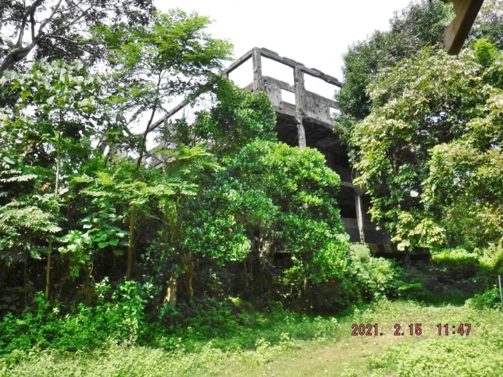 Zf447. This is one of 8 images from the east end of the so called Fort Mills Mile Long Barracks (MLB). The vegetation encroachment and the growth of trees inside the barracks are getting bad and it will cause damage to this part of the MLB. After these images you can compare them to 2007 and 2017 images. This is the very east end of the MLB. 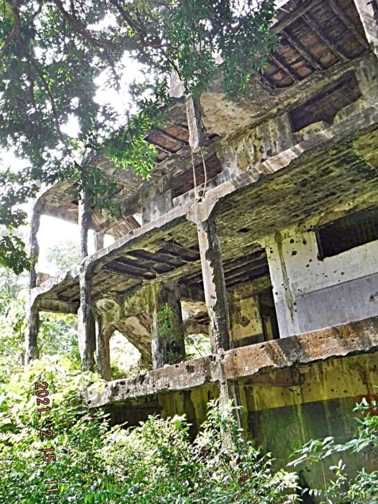 Zf448. This is one of 8 images from the east end of the so called Fort Mills Mile Long Barracks (MLB). The vegetation encroachment and the growth of trees inside the barracks are getting bad and it will cause damage to this part of the MLB. After these images you can compare them to 2007 and 2017 images. This is the very east end of the MLB. 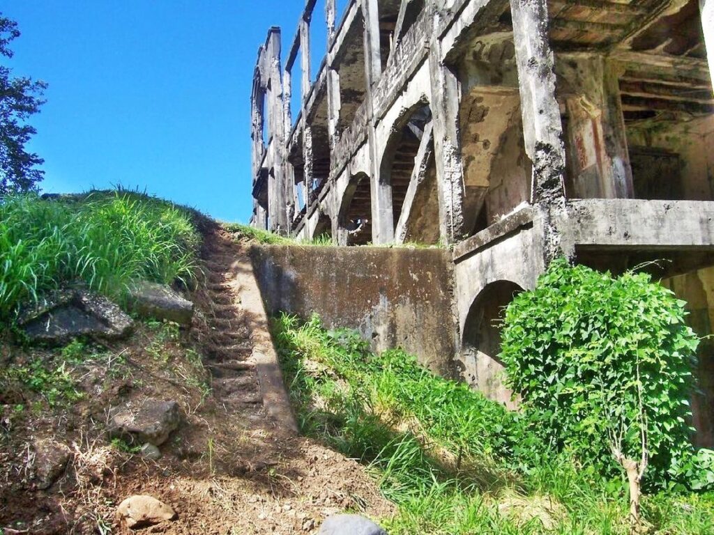 Zf449. This is one of 4 images of the so-called Fort Mills Mile long Barracks (MLB) on Corregidor from 2007. These 4 images show the east end of the MLB, which we could walk around the end without scrub vegetation hindering our walk. Scrub vegetation was also cleared from the complete north side of the MLB and it could be walked easily. 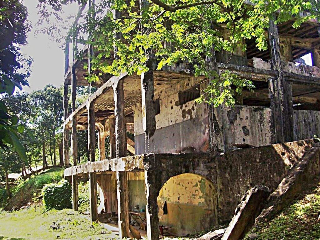 Zf450. This is one of 4 images of the so-called Fort Mills Mile long Barracks (MLB) on Corregidor from 2007. These 4 images show the east end of the MLB, which we could walk around the end without scrub vegetation hindering our walk. Scrub vegetation was also cleared from the complete north side of the MLB and it could be walked easily. 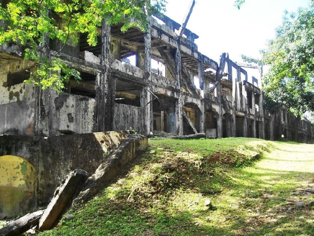 Zf451. This is one of 4 images of the so-called Fort Mills Mile long Barracks (MLB) on Corregidor from 2007. These 4 images show the east end of the MLB, which we could walk around the end without scrub vegetation hindering our walk. Scrub vegetation was also cleared from the complete north side of the MLB and it could be walked easily.  Zf452. This is one of 4 images of the so-called Fort Mills Mile long Barracks (MLB) on Corregidor from 2007. These 4 images show the east end of the MLB, which we could walk around the end without scrub vegetation hindering our walk. Scrub vegetation was also cleared from the complete north side of the MLB and it could be walked easily. 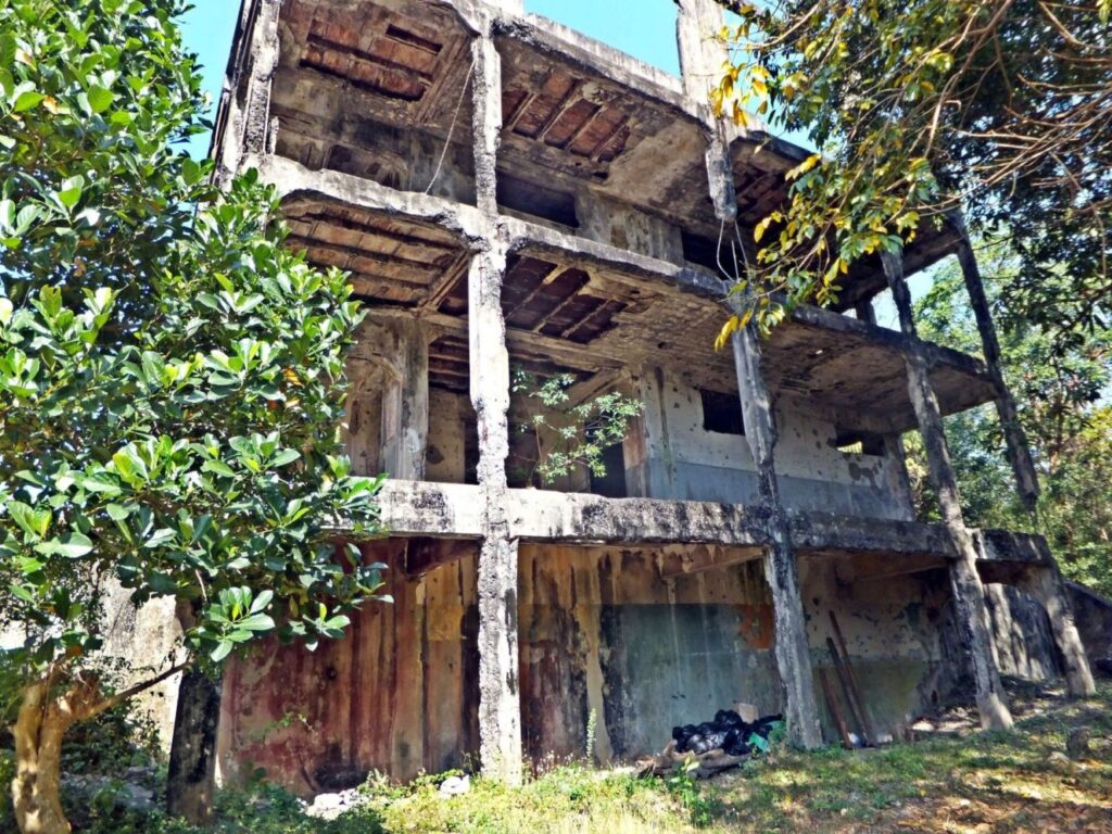 Zf454. This is one image of the so-called Fort Mills Mile long Barracks (MLB) on Corregidor from 2017. This images shows the east end of the MLB, which we could walk around the end without scrub vegetation hindering our walk. If you are interested, we have 5 page long webpage on the Mile Long Barracks on Corregidor in this forum: corregidor.proboards.com/thread/543/mile-long-barracks-pacific-memorial |
|


