Post by fots2 on May 12, 2009 13:25:15 GMT 8
Thanks to batteryboy, I learned that there are some remnants of Battery RJ43 on the east side of Malinta Hill. The gun platform and some bolts still exist. The gun barrel from this position, the only 8 inch one on Corregidor, is now on display at the North Dock.
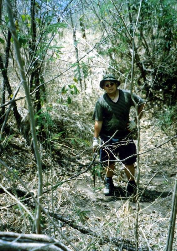
Although the area is not large, it is relatively open so vegetation was thick in places. After wandering around for quite some time, I found nothing except what I assume was a small cable vault at the top of a ridge.
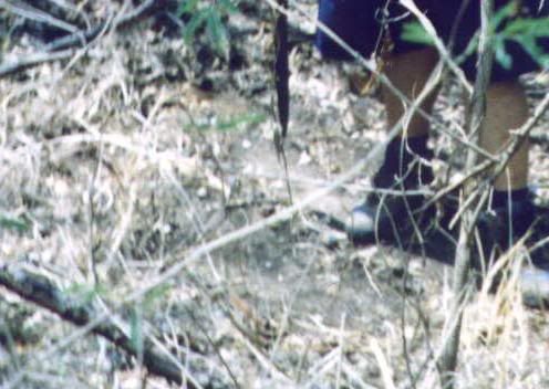
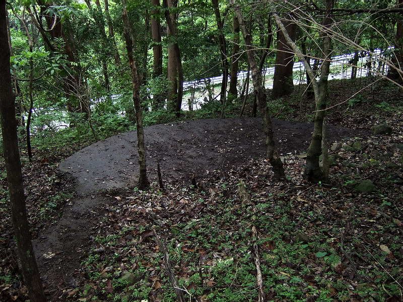
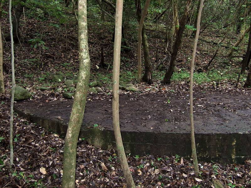
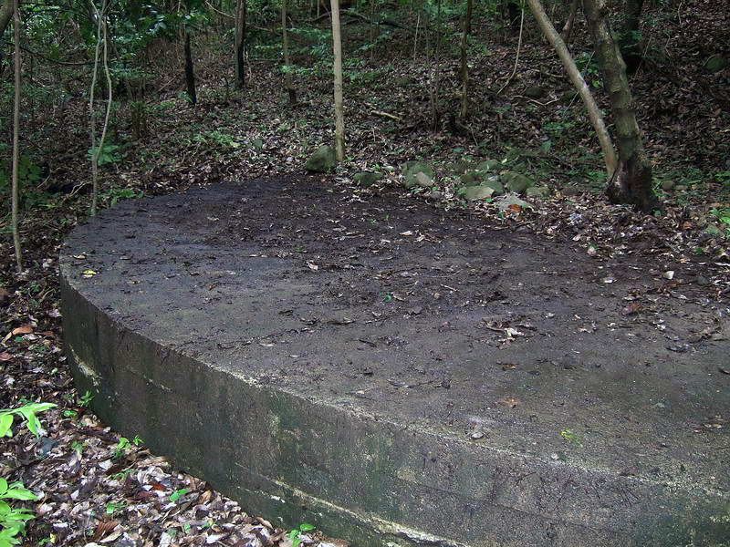
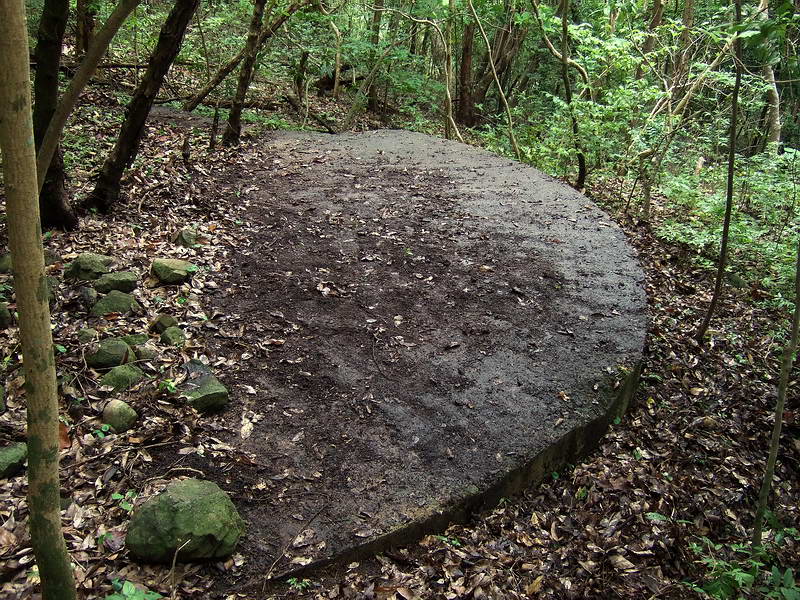
Before deciding to leave this for a later time and move on to Denver Ridge, I made one wider pass around the hill. Down the north slope of the hill I came upon what appears to be a circular gun mount. It is approximately 8 meters (24 ft) wide. There is some damage to one side but it is mostly in very good shape. It is very close to the North Shore road just below it.
I cleared leaves, branches and roots from about 1/3 of the pedestal with my feet. There may be a circular hole in the centre but I cannot say for sure although two big trees are growing out of the center of the platform. I was guessing their roots go down through that hole.
For rough directions to the pedestal, start on the North Shore road at RJ43 and walk west down the hill. At the sharp corner before you come to the Malinta Tunnel North entrance, look left (uphill). It can even be seen through the tree from the road if you look at the right spot.
The GPS position is 51 P 240315 1592204 so maybe mapmaster can place it more accurately on a map.
If this actually is a gun position, the location seems very poor to me. The open field of fire is very limited and even the higher ridge just inland from Engineer Point is in the way. South, east and most of the west direction is totally blocked.
Does anyone know exactly what this pedestal was for?
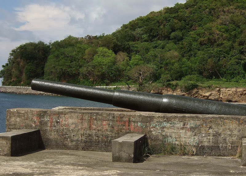
my goal had been to find the mount of this 8 inch gun barrel of Battery RJ43

the cable vault found on the top of the ridge. There are two conduit holes in all four sides of it.

Road Junction 43 (RJ43) is to the right side of the map. Red is the North Shore road around Malinta Hill. Yellow is today’s walking path to the top of Malinta Hill, Green is the South Shore road around Malinta Hill. Blue dot is the approximate location of the circular platform.
note how close this pedestal is to the North Shore road

![]() i307.photobucket.com/albums/nn299/fots2pix/Misc/9.jpg
i307.photobucket.com/albums/nn299/fots2pix/Misc/9.jpg
[/img]
Although the area is not large, it is relatively open so vegetation was thick in places. After wandering around for quite some time, I found nothing except what I assume was a small cable vault at the top of a ridge.
Before deciding to leave this for a later time and move on to Denver Ridge, I made one wider pass around the hill. Down the north slope of the hill I came upon what appears to be a circular gun mount. It is approximately 8 meters (24 ft) wide. There is some damage to one side but it is mostly in very good shape. It is very close to the North Shore road just below it.
I cleared leaves, branches and roots from about 1/3 of the pedestal with my feet. There may be a circular hole in the centre but I cannot say for sure although two big trees are growing out of the center of the platform. I was guessing their roots go down through that hole.
For rough directions to the pedestal, start on the North Shore road at RJ43 and walk west down the hill. At the sharp corner before you come to the Malinta Tunnel North entrance, look left (uphill). It can even be seen through the tree from the road if you look at the right spot.
The GPS position is 51 P 240315 1592204 so maybe mapmaster can place it more accurately on a map.
If this actually is a gun position, the location seems very poor to me. The open field of fire is very limited and even the higher ridge just inland from Engineer Point is in the way. South, east and most of the west direction is totally blocked.
Does anyone know exactly what this pedestal was for?
my goal had been to find the mount of this 8 inch gun barrel of Battery RJ43
the cable vault found on the top of the ridge. There are two conduit holes in all four sides of it.
Road Junction 43 (RJ43) is to the right side of the map. Red is the North Shore road around Malinta Hill. Yellow is today’s walking path to the top of Malinta Hill, Green is the South Shore road around Malinta Hill. Blue dot is the approximate location of the circular platform.
note how close this pedestal is to the North Shore road
[/img]