|
|
Post by fots2 on May 17, 2009 13:20:00 GMT 8
I started writing a simple response to mapmaster’s thread about ‘Inside Malinta Storage System’. corregidor.proboards.com/index.cgi?board=cartography&action=display&thread=377 It kind of grew a life of its own so I decided to post a mini trip report here. It is interesting what we take for granted. All the times I have walked past those laterals and never realized that one of them was ‘missing’ until our surveys. It is like a haunted house with a secret room. As mapmaster says, it is not actually missing; it is just not visible from the main east-west tunnel. The day tourists and the overnighters who take the ‘Malinta laterals night tour’ do NOT get to visit this area of the underground complex. Here are a few photos of what the ‘Gasoline Tunnel’ area of the Malinta Tunnel looks like. (By the way, many people refer to it by that name but I have never seen any official name for it. Also, I have been told it probably stored diesel fuel and not gasoline. Anyone know for sure? 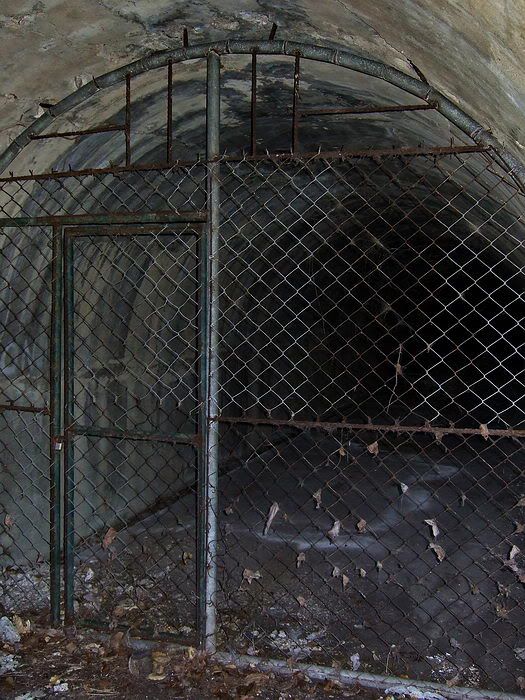 A - on the western side of Malinta Hill, the Gasoline Tunnel has its own entrance 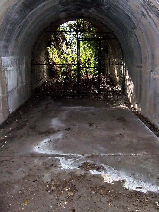 B - looking back out the Gasoline Tunnel entrance 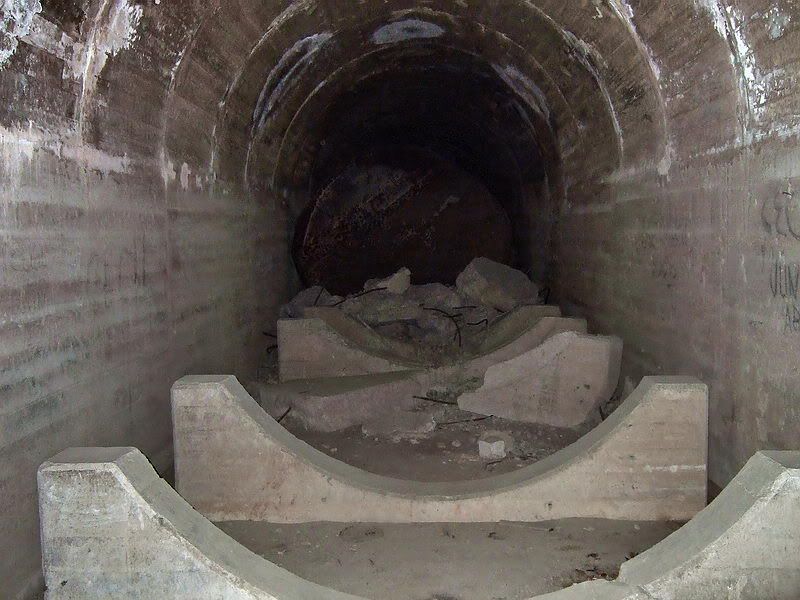 C - here is a view of the mounts and one tank at the end of a lateral. The size of these tanks is only a little smaller than the lateral in which they were installed. There is a walkway down each side of a tank but it is quite narrow. This one is flattened by a roof cave-in above it. 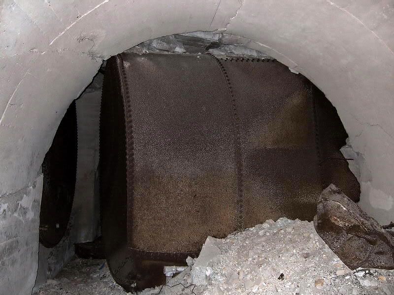 D - this tank has been pushed (from right to left) across the main tunnel by the force of an explosion. 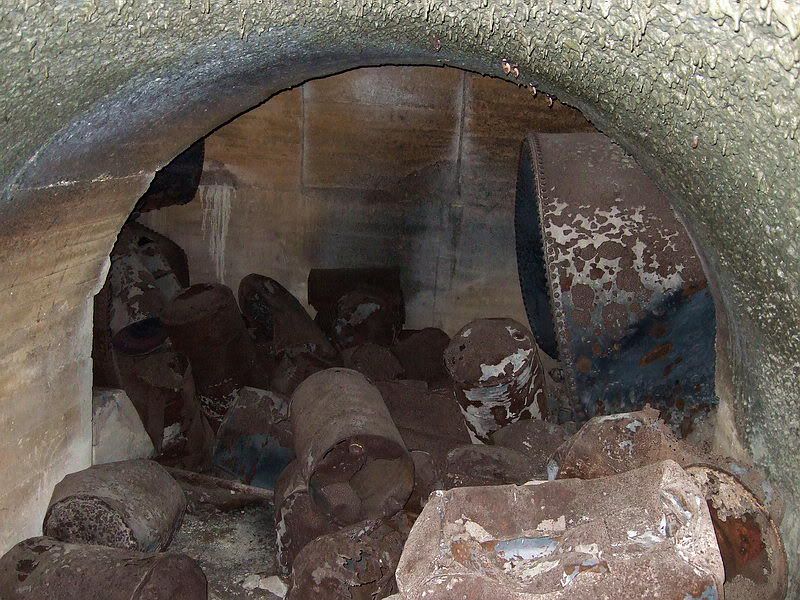 E - the end of the main tunnel with north and south laterals ahead. Here is another dislodged tank with the end bowed out. Fuel drums are scattered everywhere. This is amazing, note the ceiling which was so hot from the fires that it melted and was dripping. 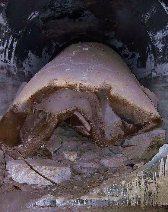 F – imagine the force required to crush/melt these huge tanks like beer cans. 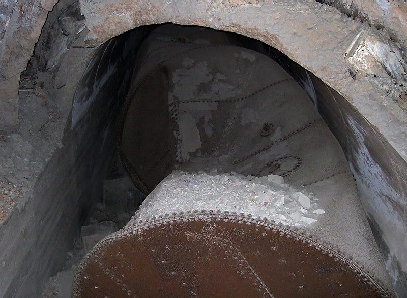 G – another ‘beer can’. 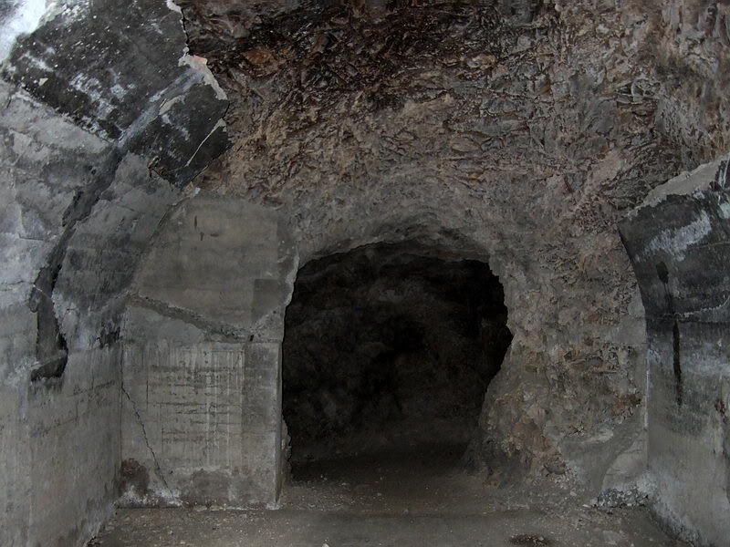 H – time to get back out of there. Make your way north up one of two accessible laterals to reach the small ventilation tunnel running east-west. In this photo, it starts at the end on the right (this is the north-western corner of Malinta Tunnel). 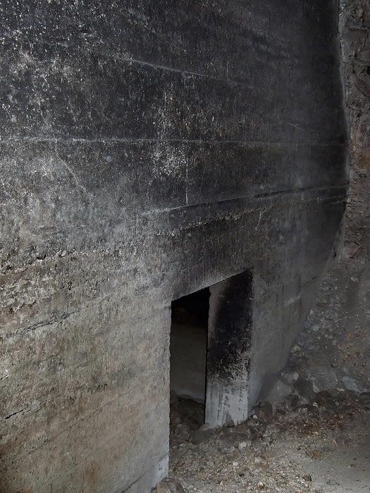 I - walking east along the rough ventilation tunnel, here is what the small doorway into north-west lateral #2 looks like.  J – continuing east, here is the doorway to north-west lateral #3. Note the ventilation tunnel continuing straight ahead. To exit Malinta go straight ahead to the next lateral and turn right. When you reach the main Malinta east-west tunnel, turn right to exit via the west entrance. 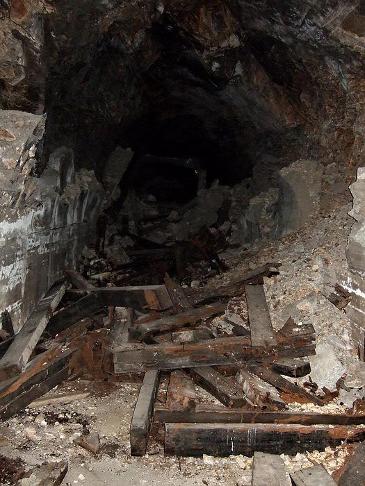 K – finally, if you think all of Malinta Tunnel has been cleaned-up and resurfaced over the years, look at this. There are still original wooden beams and metal brackets lying around this north-side lateral. All of Malinta Tunnel must have been a real mess after the war and before clean-up work began. |
|
|
|
Post by mapmaster on May 17, 2009 21:55:29 GMT 8
Hi fots2
Excellent follow up on my "snippet". I only took a few photos, in January, of the gasoline storage entrance and laterals; and not one of the original Malinta lining at the end of the not really "missing" tunnel. So I don't have a complete record of some of what we saw.
Visible in your photos, of the storage entrance tunnel, is the 4" x 4" gutter in the floor along the edge of the tunnel wall. These gutters were also present in the gasoline laterals, although I did not notice them during our visit. They were probably full of rubble. They purpose may have been for drainage of fuel spills as well as moisture.
As to the name of this portion of the Malinta Storage System, the Office of the Department Engineer, Harbor Defenses of Manila & Subic Bays used the notation Gasoline Storage for each of the subject laterals on their 1934 map of the Malinta Storage System. The gasoline entrance and laterals were complete by then.
These laterals may have stored a mixture of fuels including diesel, petrol and lubricating oil. I'm guessing the storage may have been for all the machinery and powered equipment on Corregidor. This may have included tractors, trucks and cars as well as the power station, other generators and maybe even the US Army Mine Planter Harrison.
Again, excellent follow up.
Regards
mapmaster
|
|
|
|
Post by okla on May 17, 2009 23:10:50 GMT 8
hey fots....sitting here in tulsa, oklahoma on a beautiful sunday morning, i have just finished a most interesting visit to the corregidor fuel storage tunnels courtesy of "fots corregidor tours". i didnt even have to leave my computer chair. you have no idea how i enjoy these jaunts that you make possible. those fuel storage areas in malinta hill, i believe, go largely unnoticed by most folks, even by those people interested in the corregidor story. i have known they existed only by seeing their location shown on maps of the rock. never, ever, thought i would be fortunate enough to view the interiors. again, thanks to "fots tours, inc".
|
|
|
|
Post by fots2 on May 18, 2009 15:33:13 GMT 8
mapmaster, thanks for the comments and additional information. The more we know about areas and structures, the better understanding we have of what they originally looked like and their purpose. Many times I come across a big piece of twisted metal and wonder what it was. You, EXO and batteryboy etc seem to be able to distinguish exactly what it was. An example is the Japanese twin AA gun mount near Battery Way. It always looked like scrap to me until you posted a photo of an intact one. Now it makes sense. Now, how you and EXO can get some sort of tracked vehicle made in Canada out of a rusted chunk of metal is beyond me (near the YMCA on Middleside). It still looks like a rusted chunk of metal…  |
|
|
|
Post by fots2 on May 18, 2009 15:41:28 GMT 8
okla, I am glad you enjoyed the tour. Most people do not even know this area exists. These laterals are off limits to the general public but visits can be arranged. Out of the way places such as this are a great experience to explore. It took me a few trips to Corregidor to realize there is much more to the island than just the ‘big guns’. Here are a few Monday morning photos for you. The first three are other rarely seen areas of un-restored Malinta Tunnel. The forth one is a Malinta tunnel entrance rarely seen. It is looking into the small Hospital tunnel entrance on the north side. Number five is the Malinta west entrance as you would see it today (light from the east entrance can be seen in the distance). Have a good day. 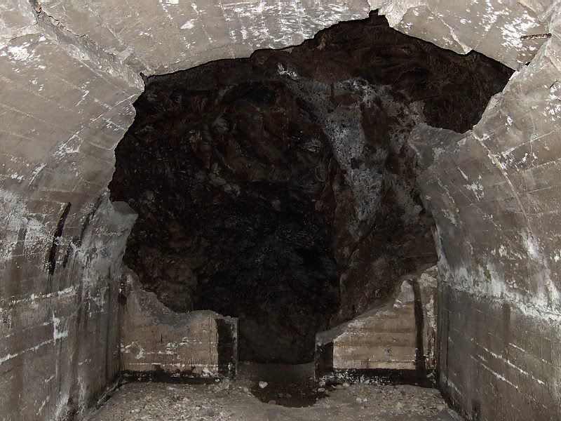 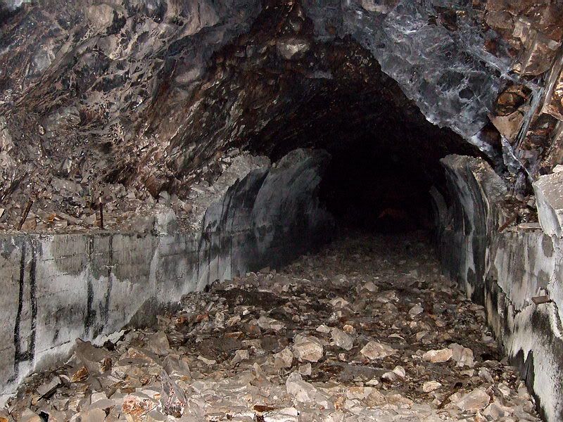 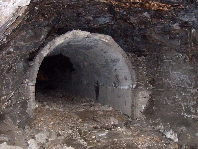 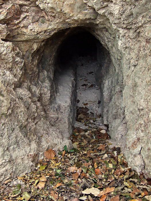 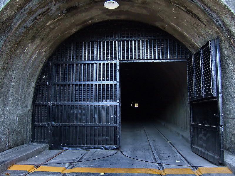 |
|
|
|
Post by fots2 on May 19, 2009 0:10:27 GMT 8
Hi mapmaster, I hope these few photos complete your collection of the Gasoline Storage laterals. They are a little larger than usual so you can keep them for your records. Photo #1 is at the end of the first southern lateral when you enter from the Gasoline Tunnel entrance walking east (i.e. first lateral on the right). On the other side of the wall is the main Malinta east-west tunnel. The tank supports (no tanks) and all the soft bat crap we walked over can be seen on the floor. At the left, note the small rectangular tunnel connected to the second lateral. This is at the rear base of the wall between these laterals and the main Malinta east-west tunnel. Another similar tunnel also connects laterals two and three. Photo #2 is the same end wall with a close-up of the concrete patch. It was a very rough patch job using plywood and concrete stuffed into cracks. Photo #3 is a close-up of the small tunnel (approx 3ft high) which interconnects the three southern laterals mentioned above. Photo #4 is just one more ‘bent beer can’. Fuel drums have been thrown into the end of the tank. Coming from the east, it is at the southern end of northern lateral #3. 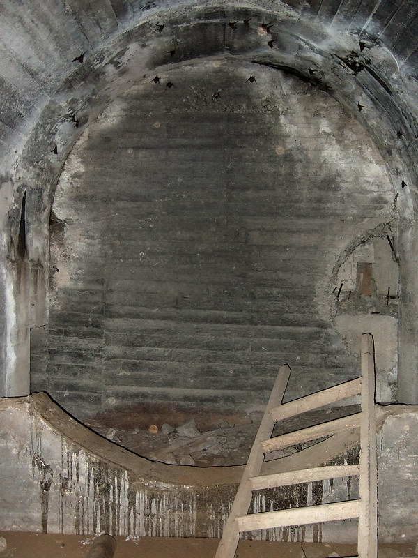 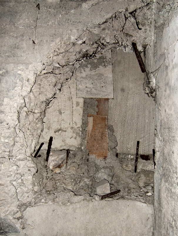 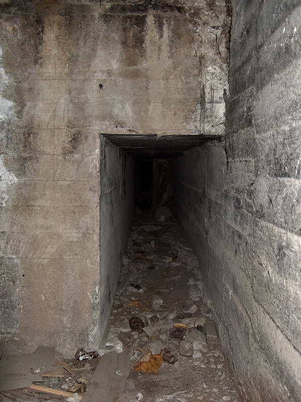 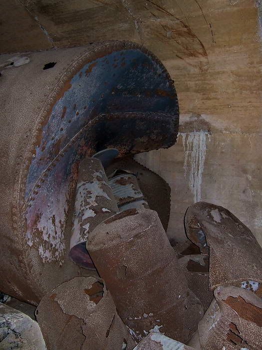 |
|
|
|
Post by okla on May 19, 2009 0:23:04 GMT 8
hey fots...my good day is that much better with these latest photos. any pics of areas off "the beaten" path in the malinta complex (or other areas for that matter) always intrigue me. i gotta believe there are para-normal beings flitting around those tunnels. concerning the little known north entry to the hospital area. i read somewhere that several personnel were taking a smoke break,etc one evening when a japanese shell from bataan scored a direct hit near this entrance and many were killed and wounded. to my knowledge no american nurses were casualties since the late book "band of angels" lists none. evidently all were male medical corpsmen/doctors,etc, but no nurses. maybe there were some filipina nurses, but i have never read or heard of any. when i toured the little big horn (custer) battlefield in montana back in 1969 the park brochure stated that the area was a place "where ghosts literally walk at mid-day". i would say the same would hold true for the "rock". keep the good stuff coming. it is so appreciated.
|
|
|
|
Post by okla on May 21, 2009 7:18:40 GMT 8
hey fots....before my senile old mind forgets, i have another "place" for you to add to your corregidor "to do list". how about prowling around the "philippine treasury vaults" area. i dont know the exact name of this particular location. it was discussed on some posts sometime last year and one poster contributed a map of the rock with an exact location. it is usually referred to as "government ravine". you might even have been that poster. whatever, i betcha there are folks who follow this board who would appreciate another "fots tour". all i remember about the exact location was that it is loacated in a ravine between battery ramsey and crockett on the southeastern side of topside. i also betcha that you already know exactly where this place is situated. i await in nervous anticipation.
|
|
|
|
Post by fots2 on May 21, 2009 14:44:54 GMT 8
Good Day okla, Yes, the Treasury Vault is in Government Ravine and it is located where you say it is. On the 1932 map the ravine area is called ‘Insular Government Reservation’. I have not explored it in detail but I will do that. Thanks okla, that is a good addition to my list. Farther down the ravine from the vault, there are many old defenses and structures just up from the rocky beach. Karl tells me walking can be quite difficult close to the water but that is nothing new. In the upper part of this ravine and closer to Battery Crockett than Battery Ramsay is what people call the ‘Wall of Caves’. This is a series of small interconnected tunnels along the upper side of the road. Many entrances are partially or fully collapsed but others can be entered. I have been told they were dug by US Marines. I get there by walking past Battery Ramsay and following an old road which winds across the ridge and eventually passes below Battery Crockett (above the South Shore road). You might wonder how I find these places. Here is my secret which is available to everyone. I use very detailed digital maps of Corregidor. Forget those old yellow hard to read original scraps of paper. These maps can be zoomed 600% to show amazing detail. I am sure they are available at the Corregidor.org PX if anyone is interested. Here are a few ‘Wall of Caves’ photos taken a couple years ago for you. 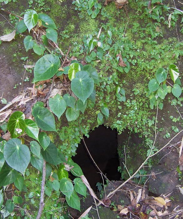 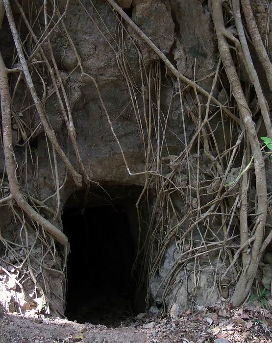 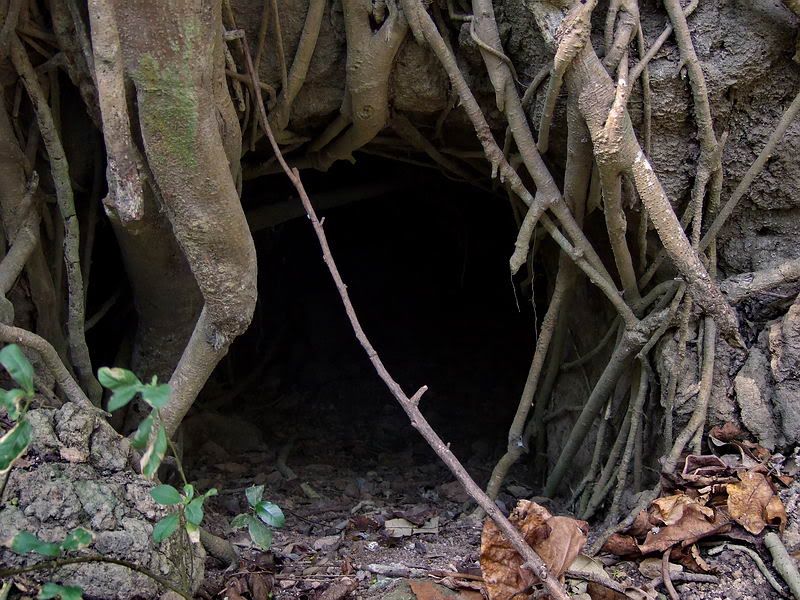 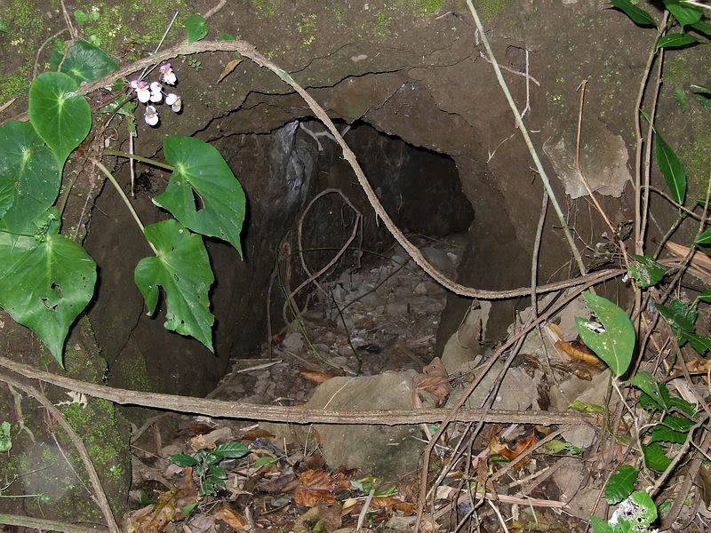 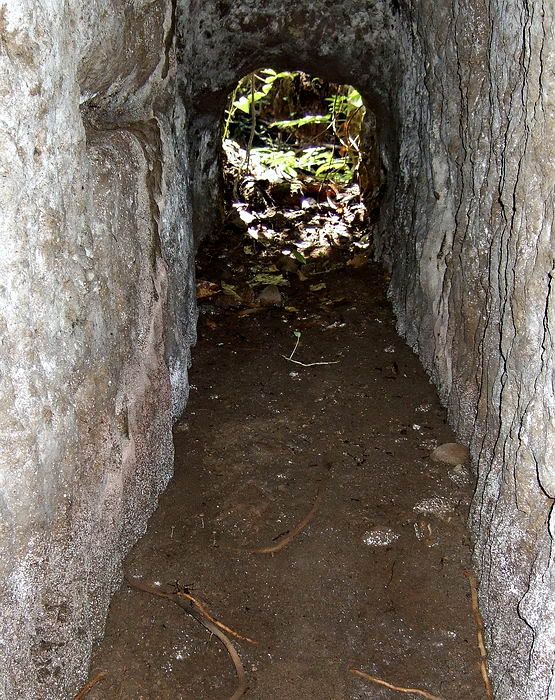  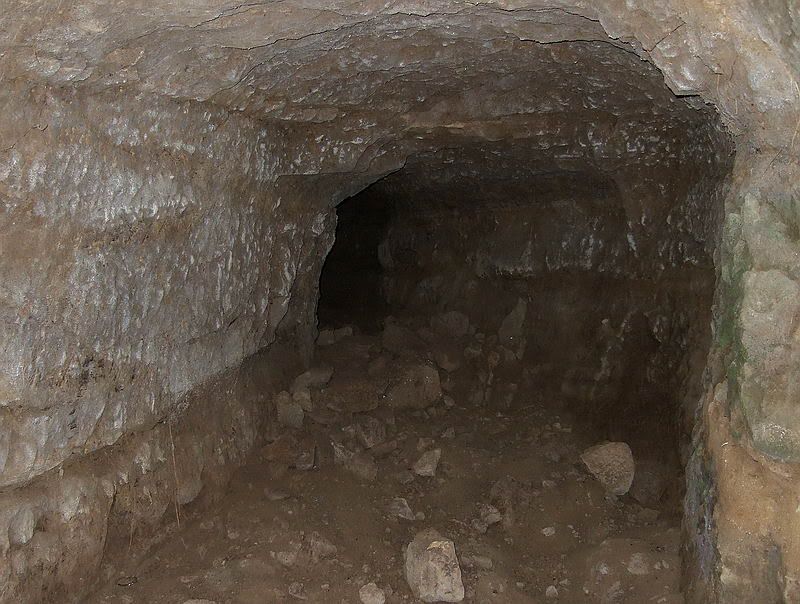 |
|
|
|
Post by batteryboy on May 21, 2009 23:11:45 GMT 8
hey fots....before my senile old mind forgets, i have another "place" for you to add to your corregidor "to do list". how about prowling around the "philippine treasury vaults" area. i dont know the exact name of this particular location. it was discussed on some posts sometime last year and one poster contributed a map of the rock with an exact location. it is usually referred to as "government ravine". you might even have been that poster. whatever, i betcha there are folks who follow this board who would appreciate another "fots tour". all i remember about the exact location was that it is loacated in a ravine between battery ramsey and crockett on the southeastern side of topside. i also betcha that you already know exactly where this place is situated. i await in nervous anticipation. Okla, The area you are referring to is the Insular Governement Reservation and as you put it known locally as"government ravine". In 2005 we went down there and surveyed the area and found the remains of the government treasury vault, the guards quarters and the bridge that leads to the treasury vault area. The place was hit by bombs during the retaking in 1945 as most of the structures in the area were destroyed. Below are some pics: 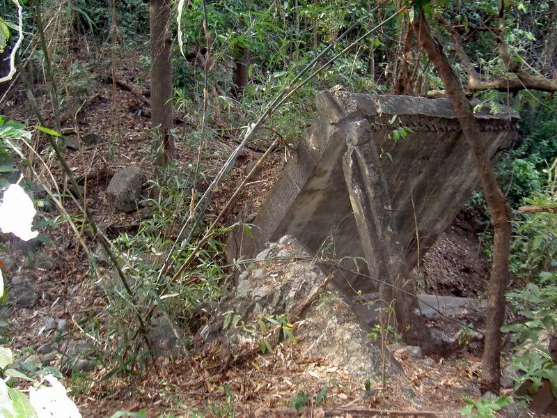 Remains of the bridge below government ravine leading to the Treasury Vault building 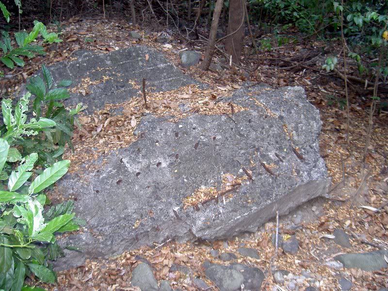 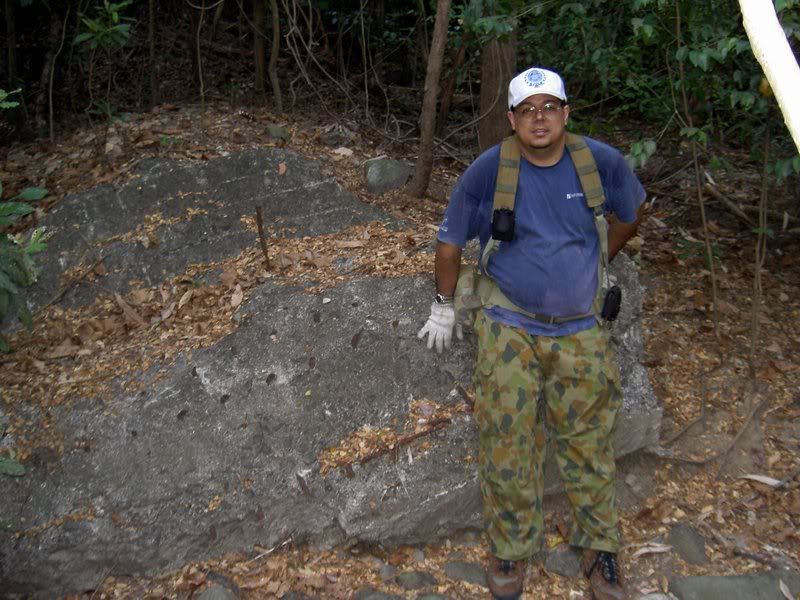 Remains of the Treaury Vault building wall (and me for scale) ...and how it looks like before the war.. 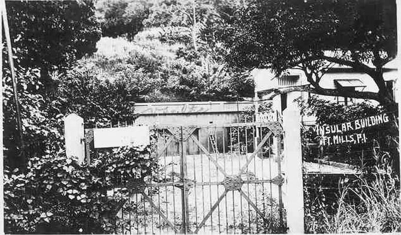 FWIW, |
|


