


Post by fots2 on Jul 9, 2009 14:12:51 GMT 8
During discussions between the Corregidor.org mapping team, it became obvious that more detailed information on the remaining Navy Tunnels was necessary for mapmaster to accurately create his detailed maps. He let me know what he required and provided the incentive to get my hands dirty again on my next trip to Corregidor Island
In the past I had heard that you cannot travel very far inside these tunnels and I had never challenged that view. A few days ago I climbed steep hills of loose rock to measure exact distances at the ends of both tunnels where the loose rock meets the solid rock walls. I was amazed that in both Queen and Roger, even though the passages are small or low, the tunnels continue past this point. This cannot be seen without climbing the rock piles where most people think the tunnels end.
I decided to create a “Navy Tunnels Part 2” trip report to reveal some new information and to correct statements from “Part 1” that says “you cannot go any further”. We certainly can go further in both tunnels before collapsed rock seals them completely.
I’ll attach some photos that are in addition to the photos in Part 1.
- - - - - - - - - - - - - - - - - - - - - - - - - - - - - - - - - - - - - - - - - - - - - - - - - - - - - - - - - - - - - - - - - - -
This time of the year in the Philippines is the rainy season. The first real indication of this is when you are standing on the South Shore road where you next walk in toward the steep Malinta hillside. Mid March this area had bare soil and scattered dead plants to walk by. Now the vegetation was well over my head and thick. I used a stick and beat the bushes as I slowly made my way towards the tree line through this two metre high snake pit. On reaching the tree line the walking is easy and looks the same year round.
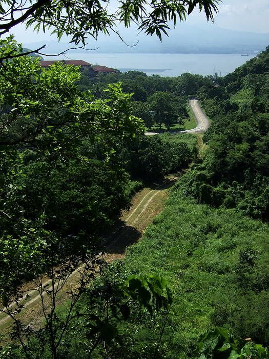
View from the cliff at the south-west corner of Malinta Hill looking north. Below is the vegetation you must pass through to get to the Navy tunnels towards the right. Grasses and bushes are well over my head in this snake pit. The grassy road is the South Shore Road around Malinta Hill. The concrete road comes from the Malinta Tunnel west entrance. Bataan is in the background.
A short ways up the hillside from the snake pit is the entrance to Queen
Queen was first. I set my GPS above the entrance to record an accurate location while I was inside taking measurements. Only the top half metre of the entrance is open but it is easy to navigate. After entering, walk down the debris slope to the concrete tunnel floor. Come to a 35 degree turn north and continue to where the tunnel opens up into a 4.4m wide shaft with a circular roof.
This tunnel may have been part of Malinta Tunnel’s power generation and/or blower motors for air ventilation. Many concrete pads line the tunnel sides and you see pipes, drains, electrical boxes, dozens of metal hangars on the walls and two vertical pipes going up through the tunnel ceiling.
Unlike the dry tunnels encountered earlier in the year, the Navy Tunnels now have dripping water and high humidity. The fallen rocks, walls, ceilings and floor (where there is one) are wet and slippery. Along with sweat, my glasses would often fog up inside the tunnels. The daytime temperature this time of the year is around +32C (90F) with a heat index of +40C. On later exiting the tunnels it felt noticeably cooler outside.
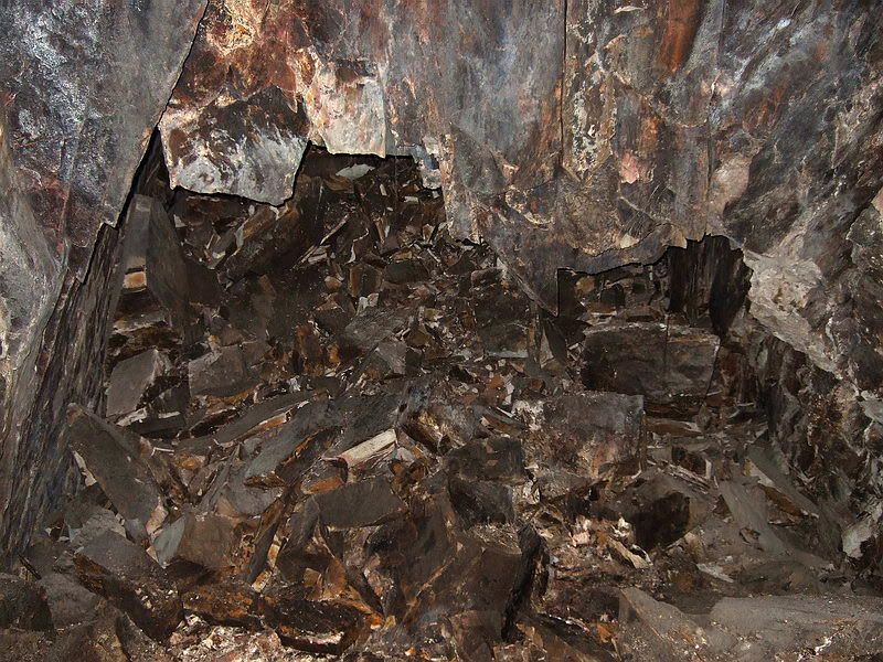
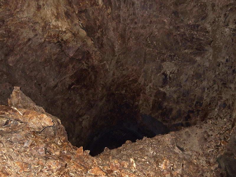
As you walk further into the tunnel you quickly notice damage to the concrete ceiling and walls increasing to the point that neither exists anymore. A large steep pile of loose rocks is like a mountain in front of you. Above that there is a huge high open chamber at the ceiling. A very large explosion occurred at this location in 1945. The ‘mountain’ is actually rock debris that has fallen from the original tunnel ceiling creating the huge 21 metre wide chamber.
This is the location in which people thought that the tunnel ended as you see a full collapse from here. Climbing up the steep and loose rock slope seems pointless.
Actually the first half of the little mountain is not too bad and those who have gone up there will see gaps in large fallen rocks along the north wall. Many people including me thought this may possibly have been a collapsed side tunnel. You are quite a ways above the original tunnel floor so it is impossible to know for sure.
Now the fun part. I needed to get to the top with my tape to get the exact length measurement I required. This was not fun at all. It was slippery, there was loose rock everywhere and not a lot of solid foot holds. I took my time and made it up ok.
Now I was ready to measure the tunnel end where the mountain met the solid ceiling rock. I took out my tape, pointed my light to the dip in the mountain and….it did NOT touch!!!
I shone the light through the gap and I could see a rough passable shaft. I decided to follow is as far as it went. Navigating this semi-collapsed tunnel was slow going. Remember that I am walking on collapsed tunnel roof with the original concrete floor many metres of rock below me. At no time did I ever see any concrete.
Large rocks meant a left and right, up and down path of travel. Most times I could stand up but a few areas required bending over or 'on your knees through the holes' sections. The ceiling was multiple small chambers of jagged rock.
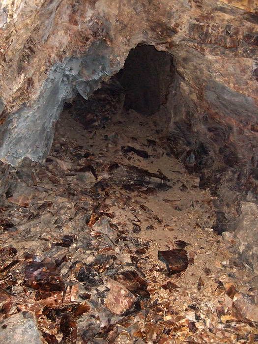
This photo gives you an example of what traveling along a collapsed tunnel roof looks like. This was taken a short distance away in the semi-collapsed portions of tunnel south of the Quartermaster laterals. Since they all basically look the same, I did not take any new photos of this. Typically you encounter a series of chambers where you can walk followed by an area of crouching or crawling into the next chamber.
The second largest chamber in the whole tunnel was at the final collapsed area. There must have been a big explosion here too. Now I can say that I was finally at the tunnel end. I thought that considering the terrain, there is no way I can get an accurate distance measurement in this semi-collapsed section. To give mapmaster a ballpark figure I counted off every metre of travel on the way back. I counted 82 metres from the end back to the gap at the big chamber. Due to my path not being linear, I told him to reduce that 82 metre figure by one quarter to one third. My total Queen tunnel length measurement is 155 metres (uncorrected).
I headed back towards the entrance and made it down the first mountain without breaking anything important. Time to grab the GPS and move on. As a side note, four days later I went up there again as it was important to see at what angle that semi-collapsed area took w.r.t. the original concrete tunnel. It was even more difficult this time and I have decided that I will not go up there again.
Nine metres to the north of Queen and at the same level is Roger. I placed the GPS high above the entrance and entered the tunnel. Similar slide in as before but severe damage to the concrete tunnel is already visible. The first mini-mountain is easily walked over.

Looking back out the Roger Tunnel entrance where I just crawled in
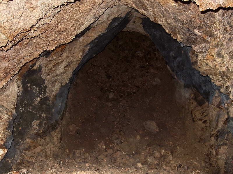
At the entrance looking deeper into the tunnel you see part of the first little mountain of collapsed rock. The largest chamber starts here.
View over the mountain peak looking back towards the main tunnel entrance. A portion of the concrete domed roof at the entrance is barely visible. The largest chamber is directly overhead.
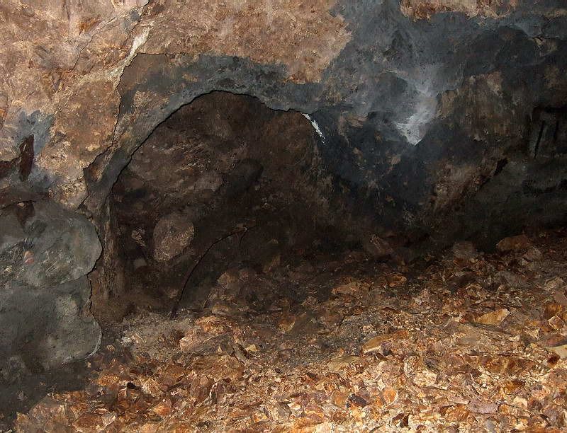
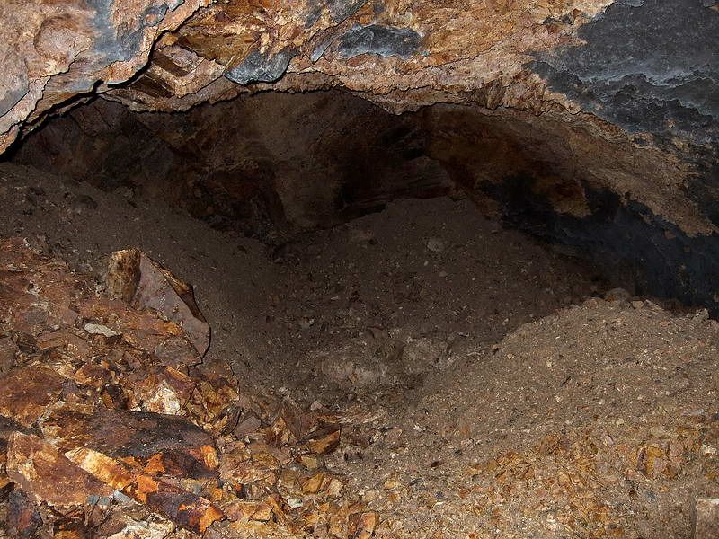
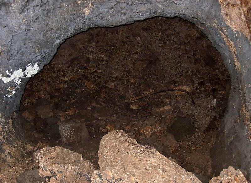
Immediately you notice is a 7.5 metre long side tunnel on the north side. I took a photo of this tunnel years ago but forgot about it until I saw it a couple weeks ago. What really surprised me was that when I went in to measure it, I saw second side tunnel heading west. The loose rocks and gravel are high here and you cannot see the second tunnel from the main shaft. By crawling on my stomach I entered that tunnel which was collapsed after 15 metres.
View of the mouth of the first side tunnel taken from the mountain of rock below the big chamber
Inside the first side tunnel a full collapse is ahead (mount slightly to the right of centre)
What the first side tunnel full collapse looks like. Solid rock walls and roof with loose rubble straight ahead.

At the end of the first side tunnel and towards the left over a mound of dirt, the entrance to the second side
tunnel can just be seen
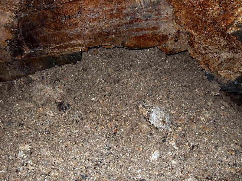
Collapsed end of the second side tunnel
View inside the first side tunnel looking back towards the main tunnel
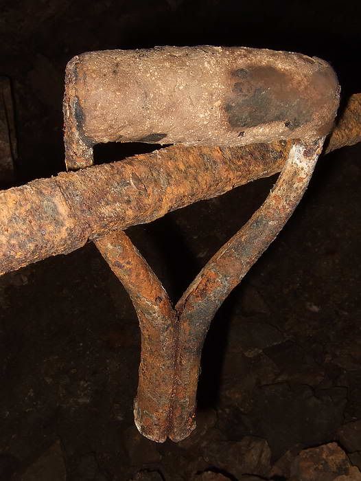
Old shovel handle on a piece of rebar. If it could only talk…
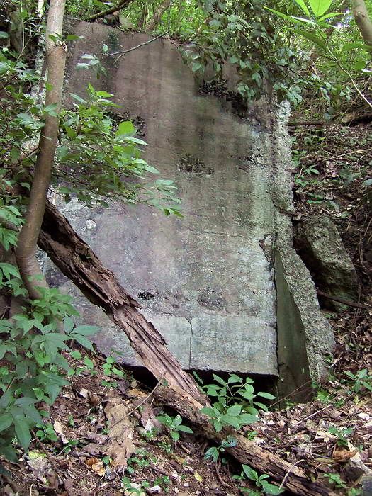
Back to the main tunnel, follow an original concrete wall and you will come to a 4 metre section of concrete floor. Now I could answer my question that this tunnel did not have a rail line.

Original concrete wall. Notice the white paint still clearly visible

This is the only section of concrete floor that can still be seen in the tunnel
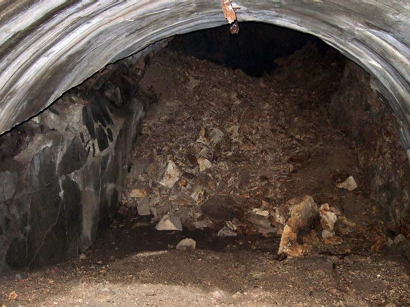
Another large chamber starts here with a mountain of fallen rock at a 45 degree angle. The rock is a little loose but climbing it is not a problem. Just over the mountain is the final collapse and as far as you can go. The total distance inside Roger is approximately 50 metres.

The last section of original concrete wall. You can see the start of a rock mountain as the second largest chamber is soon overhead
Looking up a 45 degree incline of loose slippery rock. The final collapsed section of this tunnel is just over the peak 17 metres from this location
The rest of the day and a half at the Navy Tunnels was completing length and angle measurements plus taking photos. Also I did a little search outside along the hillside but found nothing significant.
I created two sketches of the tunnels containing all the measurements. They were sent to mapmaster for input to his latest maps so we can get a good idea of how this all looks drawn to scale.
The only thing that was unusual happened when I went to get my GPS from above Roger’s entrance. Above it I noticed something round and brown. On closer look I believe it is an unexploded artillery shell sticking out of the ground. Just another day on Corregidor…
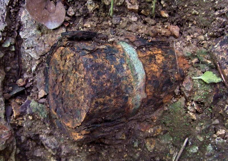
This shell embedded in Malinta hillside is approximately 4 inches across. The outer layer is rusting away. Near the end a light colored ring can be seen. There are no fins so I assume it is a dud artillery shell
Since you have to slide/crouch at times or crawl on your stomach, you get very muddy in those tunnels this time of the year. On returning to the hotel I got some strange looks from a few overnight guests when I walked by. They had no idea that they were so close to the little bit of history I had been exploring. Tonight they will take a tour to see the sunset at Battery Grubbs and then the flock will be guided around some of Malinta’s laterals. Tomorrow they will leave the island having “seen it all”.
They probably couldn’t see the smile on my face under that layer of mud.
fots2
Bataan after sunset (taken from the Corregidor Inn last week)
In the past I had heard that you cannot travel very far inside these tunnels and I had never challenged that view. A few days ago I climbed steep hills of loose rock to measure exact distances at the ends of both tunnels where the loose rock meets the solid rock walls. I was amazed that in both Queen and Roger, even though the passages are small or low, the tunnels continue past this point. This cannot be seen without climbing the rock piles where most people think the tunnels end.
I decided to create a “Navy Tunnels Part 2” trip report to reveal some new information and to correct statements from “Part 1” that says “you cannot go any further”. We certainly can go further in both tunnels before collapsed rock seals them completely.
I’ll attach some photos that are in addition to the photos in Part 1.
- - - - - - - - - - - - - - - - - - - - - - - - - - - - - - - - - - - - - - - - - - - - - - - - - - - - - - - - - - - - - - - - - - -
This time of the year in the Philippines is the rainy season. The first real indication of this is when you are standing on the South Shore road where you next walk in toward the steep Malinta hillside. Mid March this area had bare soil and scattered dead plants to walk by. Now the vegetation was well over my head and thick. I used a stick and beat the bushes as I slowly made my way towards the tree line through this two metre high snake pit. On reaching the tree line the walking is easy and looks the same year round.
View from the cliff at the south-west corner of Malinta Hill looking north. Below is the vegetation you must pass through to get to the Navy tunnels towards the right. Grasses and bushes are well over my head in this snake pit. The grassy road is the South Shore Road around Malinta Hill. The concrete road comes from the Malinta Tunnel west entrance. Bataan is in the background.
A short ways up the hillside from the snake pit is the entrance to Queen
Queen was first. I set my GPS above the entrance to record an accurate location while I was inside taking measurements. Only the top half metre of the entrance is open but it is easy to navigate. After entering, walk down the debris slope to the concrete tunnel floor. Come to a 35 degree turn north and continue to where the tunnel opens up into a 4.4m wide shaft with a circular roof.
This tunnel may have been part of Malinta Tunnel’s power generation and/or blower motors for air ventilation. Many concrete pads line the tunnel sides and you see pipes, drains, electrical boxes, dozens of metal hangars on the walls and two vertical pipes going up through the tunnel ceiling.
Unlike the dry tunnels encountered earlier in the year, the Navy Tunnels now have dripping water and high humidity. The fallen rocks, walls, ceilings and floor (where there is one) are wet and slippery. Along with sweat, my glasses would often fog up inside the tunnels. The daytime temperature this time of the year is around +32C (90F) with a heat index of +40C. On later exiting the tunnels it felt noticeably cooler outside.
As you walk further into the tunnel you quickly notice damage to the concrete ceiling and walls increasing to the point that neither exists anymore. A large steep pile of loose rocks is like a mountain in front of you. Above that there is a huge high open chamber at the ceiling. A very large explosion occurred at this location in 1945. The ‘mountain’ is actually rock debris that has fallen from the original tunnel ceiling creating the huge 21 metre wide chamber.
This is the location in which people thought that the tunnel ended as you see a full collapse from here. Climbing up the steep and loose rock slope seems pointless.
Actually the first half of the little mountain is not too bad and those who have gone up there will see gaps in large fallen rocks along the north wall. Many people including me thought this may possibly have been a collapsed side tunnel. You are quite a ways above the original tunnel floor so it is impossible to know for sure.
Now the fun part. I needed to get to the top with my tape to get the exact length measurement I required. This was not fun at all. It was slippery, there was loose rock everywhere and not a lot of solid foot holds. I took my time and made it up ok.
Now I was ready to measure the tunnel end where the mountain met the solid ceiling rock. I took out my tape, pointed my light to the dip in the mountain and….it did NOT touch!!!
I shone the light through the gap and I could see a rough passable shaft. I decided to follow is as far as it went. Navigating this semi-collapsed tunnel was slow going. Remember that I am walking on collapsed tunnel roof with the original concrete floor many metres of rock below me. At no time did I ever see any concrete.
Large rocks meant a left and right, up and down path of travel. Most times I could stand up but a few areas required bending over or 'on your knees through the holes' sections. The ceiling was multiple small chambers of jagged rock.
This photo gives you an example of what traveling along a collapsed tunnel roof looks like. This was taken a short distance away in the semi-collapsed portions of tunnel south of the Quartermaster laterals. Since they all basically look the same, I did not take any new photos of this. Typically you encounter a series of chambers where you can walk followed by an area of crouching or crawling into the next chamber.
The second largest chamber in the whole tunnel was at the final collapsed area. There must have been a big explosion here too. Now I can say that I was finally at the tunnel end. I thought that considering the terrain, there is no way I can get an accurate distance measurement in this semi-collapsed section. To give mapmaster a ballpark figure I counted off every metre of travel on the way back. I counted 82 metres from the end back to the gap at the big chamber. Due to my path not being linear, I told him to reduce that 82 metre figure by one quarter to one third. My total Queen tunnel length measurement is 155 metres (uncorrected).
I headed back towards the entrance and made it down the first mountain without breaking anything important. Time to grab the GPS and move on. As a side note, four days later I went up there again as it was important to see at what angle that semi-collapsed area took w.r.t. the original concrete tunnel. It was even more difficult this time and I have decided that I will not go up there again.
Nine metres to the north of Queen and at the same level is Roger. I placed the GPS high above the entrance and entered the tunnel. Similar slide in as before but severe damage to the concrete tunnel is already visible. The first mini-mountain is easily walked over.
Looking back out the Roger Tunnel entrance where I just crawled in
At the entrance looking deeper into the tunnel you see part of the first little mountain of collapsed rock. The largest chamber starts here.
View over the mountain peak looking back towards the main tunnel entrance. A portion of the concrete domed roof at the entrance is barely visible. The largest chamber is directly overhead.
Immediately you notice is a 7.5 metre long side tunnel on the north side. I took a photo of this tunnel years ago but forgot about it until I saw it a couple weeks ago. What really surprised me was that when I went in to measure it, I saw second side tunnel heading west. The loose rocks and gravel are high here and you cannot see the second tunnel from the main shaft. By crawling on my stomach I entered that tunnel which was collapsed after 15 metres.
View of the mouth of the first side tunnel taken from the mountain of rock below the big chamber
Inside the first side tunnel a full collapse is ahead (mount slightly to the right of centre)
What the first side tunnel full collapse looks like. Solid rock walls and roof with loose rubble straight ahead.
At the end of the first side tunnel and towards the left over a mound of dirt, the entrance to the second side
tunnel can just be seen
Collapsed end of the second side tunnel
View inside the first side tunnel looking back towards the main tunnel
Old shovel handle on a piece of rebar. If it could only talk…
Back to the main tunnel, follow an original concrete wall and you will come to a 4 metre section of concrete floor. Now I could answer my question that this tunnel did not have a rail line.
Original concrete wall. Notice the white paint still clearly visible
This is the only section of concrete floor that can still be seen in the tunnel
Another large chamber starts here with a mountain of fallen rock at a 45 degree angle. The rock is a little loose but climbing it is not a problem. Just over the mountain is the final collapse and as far as you can go. The total distance inside Roger is approximately 50 metres.
The last section of original concrete wall. You can see the start of a rock mountain as the second largest chamber is soon overhead
Looking up a 45 degree incline of loose slippery rock. The final collapsed section of this tunnel is just over the peak 17 metres from this location
The rest of the day and a half at the Navy Tunnels was completing length and angle measurements plus taking photos. Also I did a little search outside along the hillside but found nothing significant.
I created two sketches of the tunnels containing all the measurements. They were sent to mapmaster for input to his latest maps so we can get a good idea of how this all looks drawn to scale.
The only thing that was unusual happened when I went to get my GPS from above Roger’s entrance. Above it I noticed something round and brown. On closer look I believe it is an unexploded artillery shell sticking out of the ground. Just another day on Corregidor…
This shell embedded in Malinta hillside is approximately 4 inches across. The outer layer is rusting away. Near the end a light colored ring can be seen. There are no fins so I assume it is a dud artillery shell
Since you have to slide/crouch at times or crawl on your stomach, you get very muddy in those tunnels this time of the year. On returning to the hotel I got some strange looks from a few overnight guests when I walked by. They had no idea that they were so close to the little bit of history I had been exploring. Tonight they will take a tour to see the sunset at Battery Grubbs and then the flock will be guided around some of Malinta’s laterals. Tomorrow they will leave the island having “seen it all”.
They probably couldn’t see the smile on my face under that layer of mud.
fots2
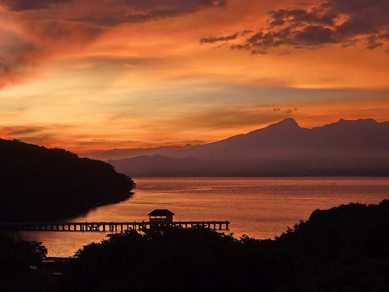
Bataan after sunset (taken from the Corregidor Inn last week)


